3.7Km
3.7Km


Note
 4.8Km
4.8Km
4.8Km
4.8Km
7Km
7Km
7.5Km
4.8Km
4.8Km
4.8Km
4.8Km
7Km
7Km
7.5Km
Sentiero di discesa dal rif. Elena quasi interamente non ciclabile con guadi assai pericolosi. Salita al rif. Bonatti ciclabile solo nel tratto finale per poche decine di metri!
Avvicinamento
.
Descrizione
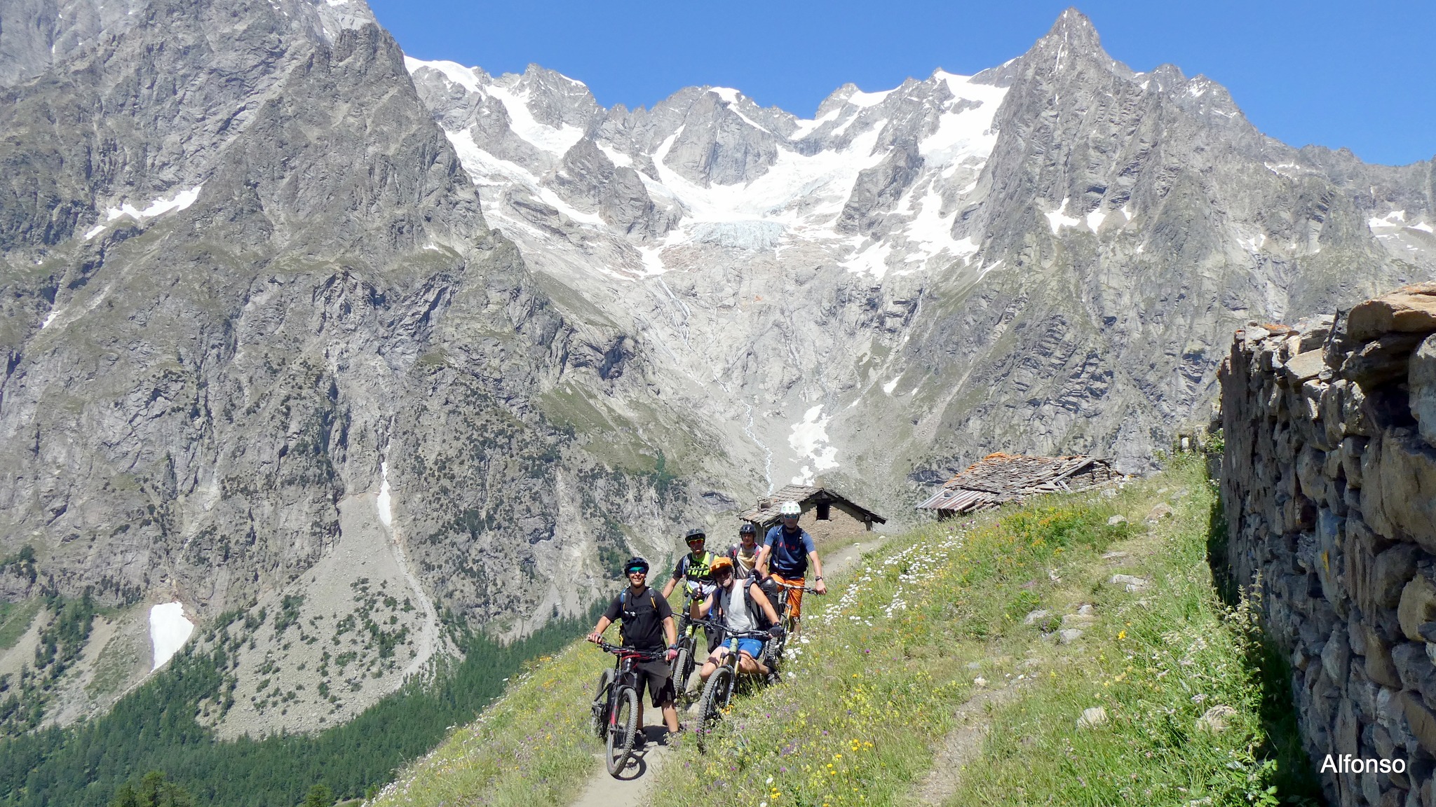
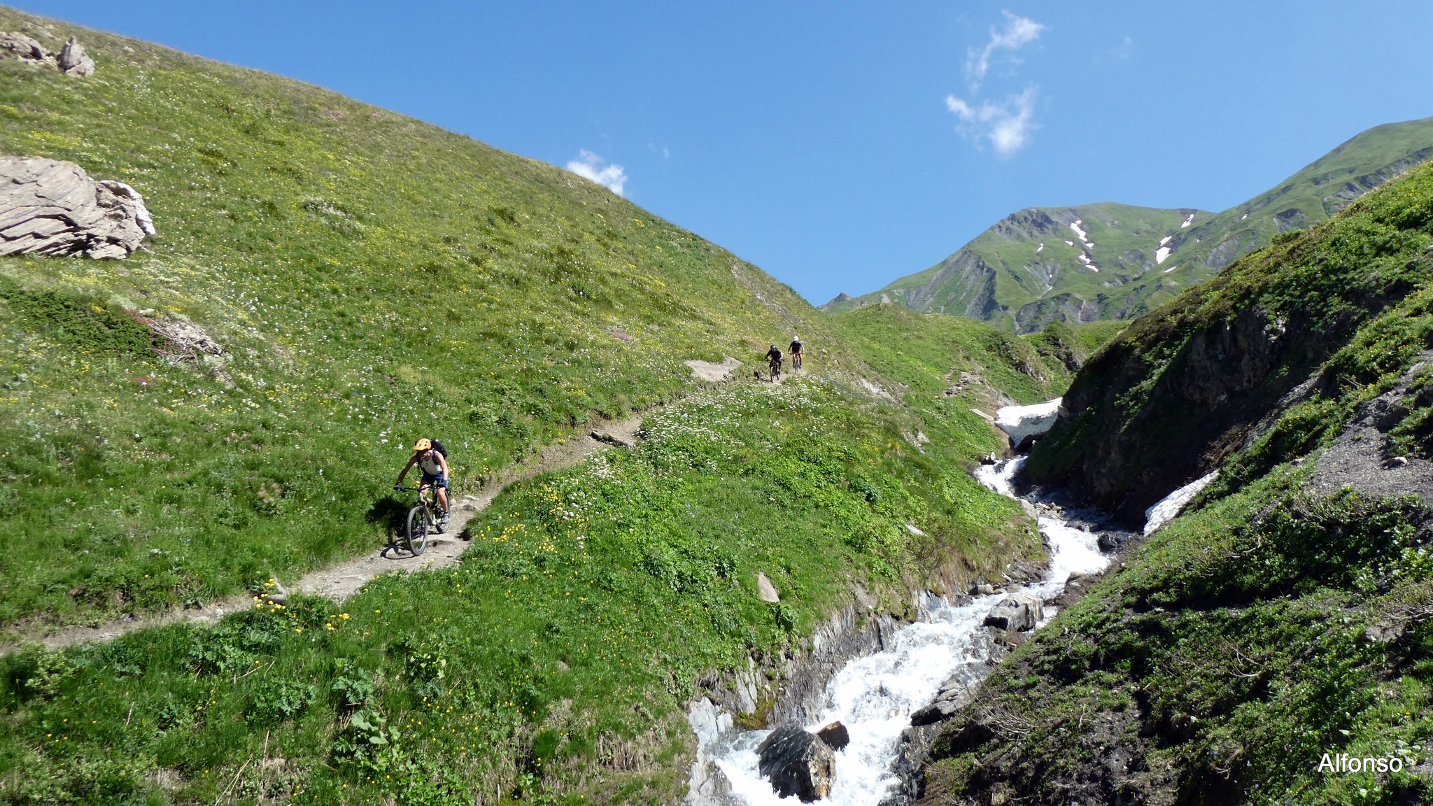
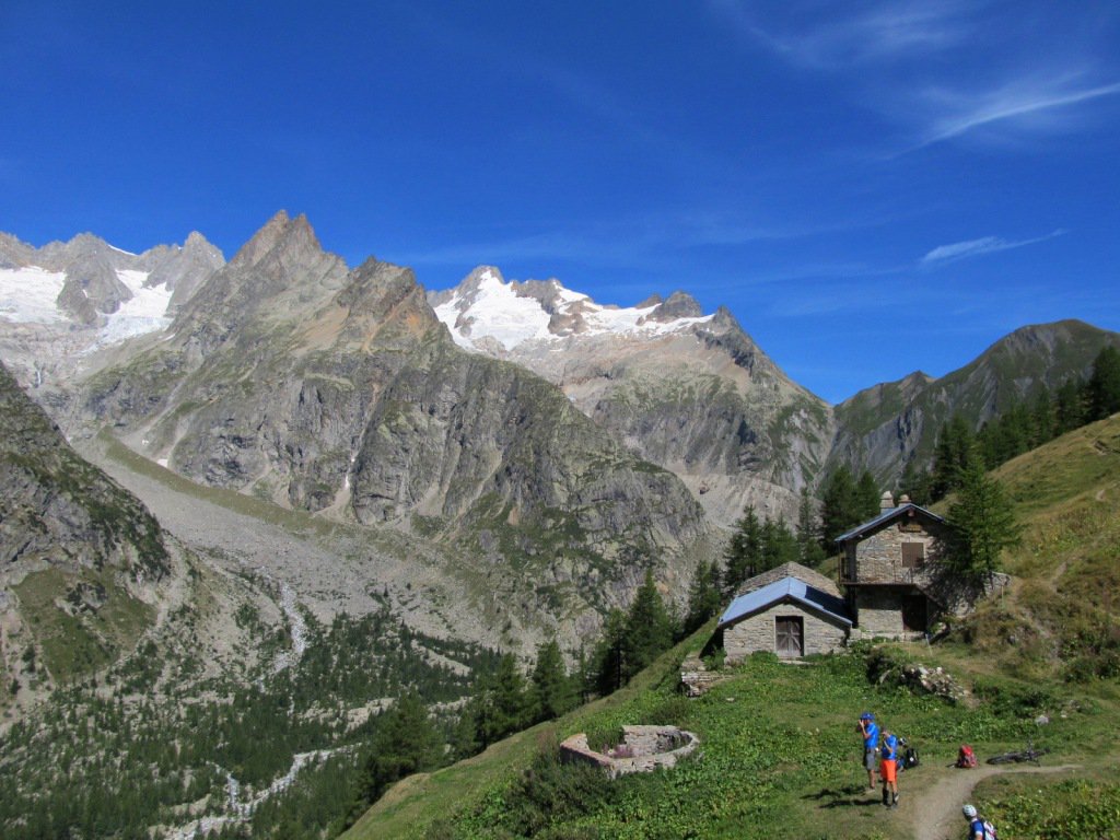
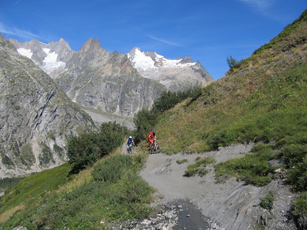
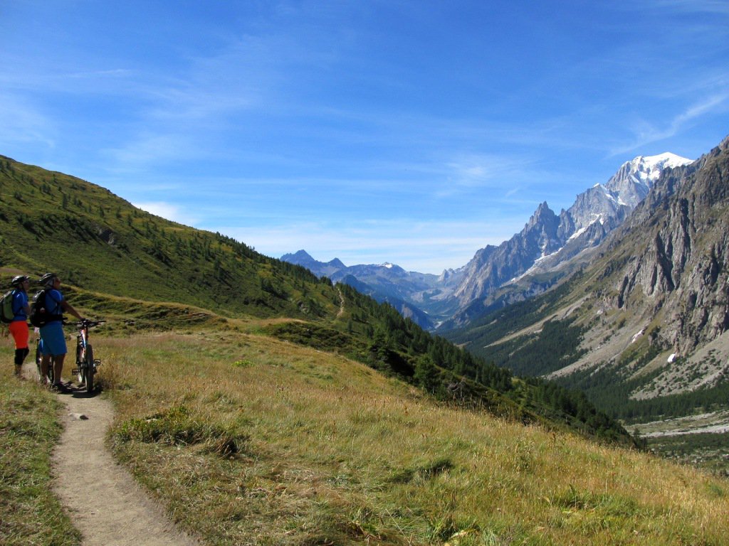
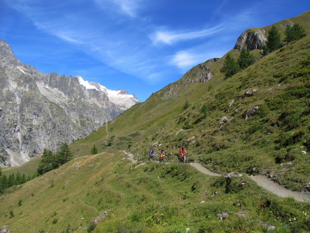
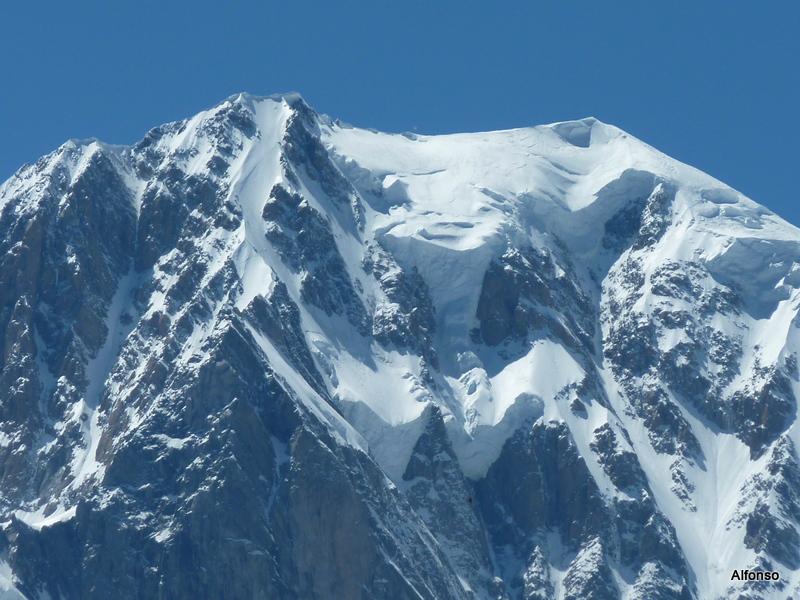
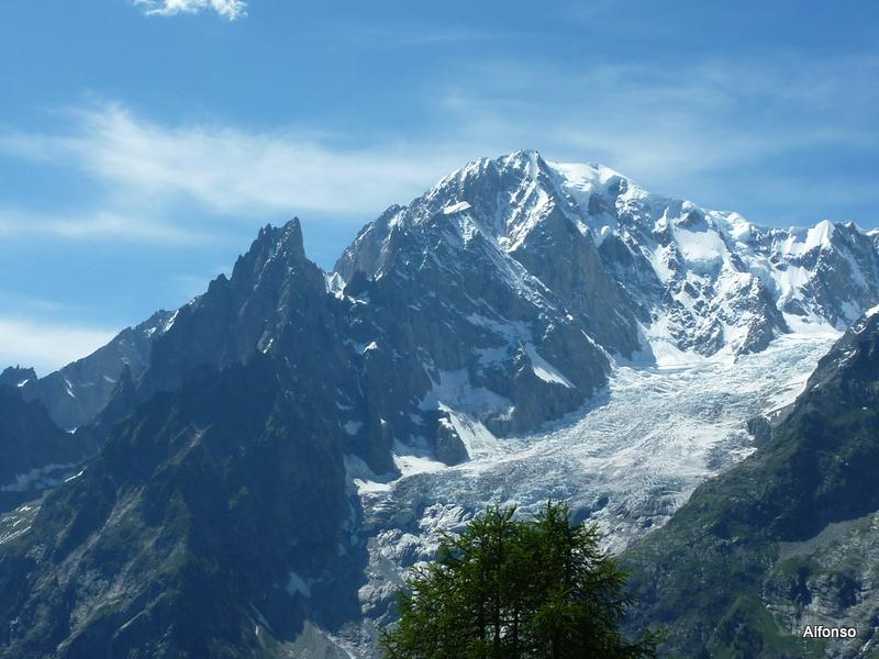
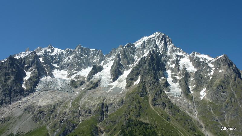
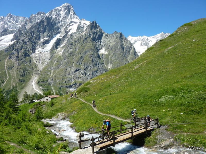
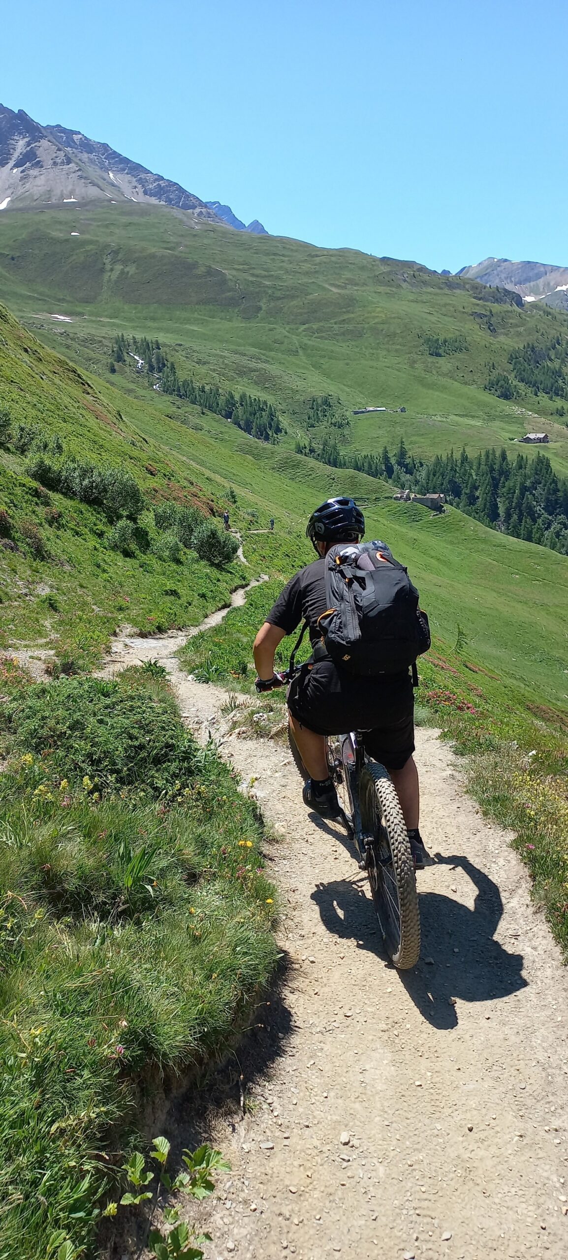
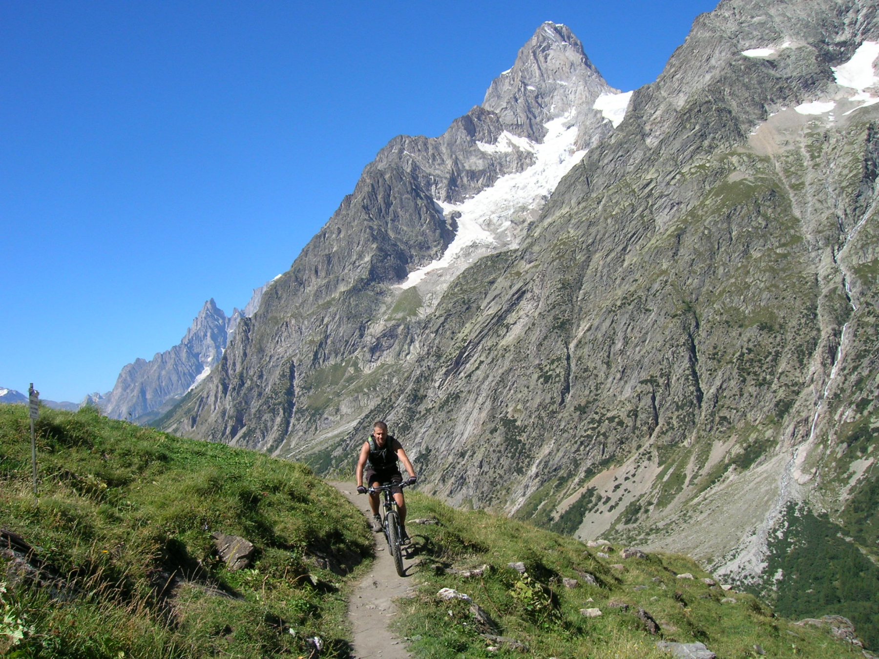
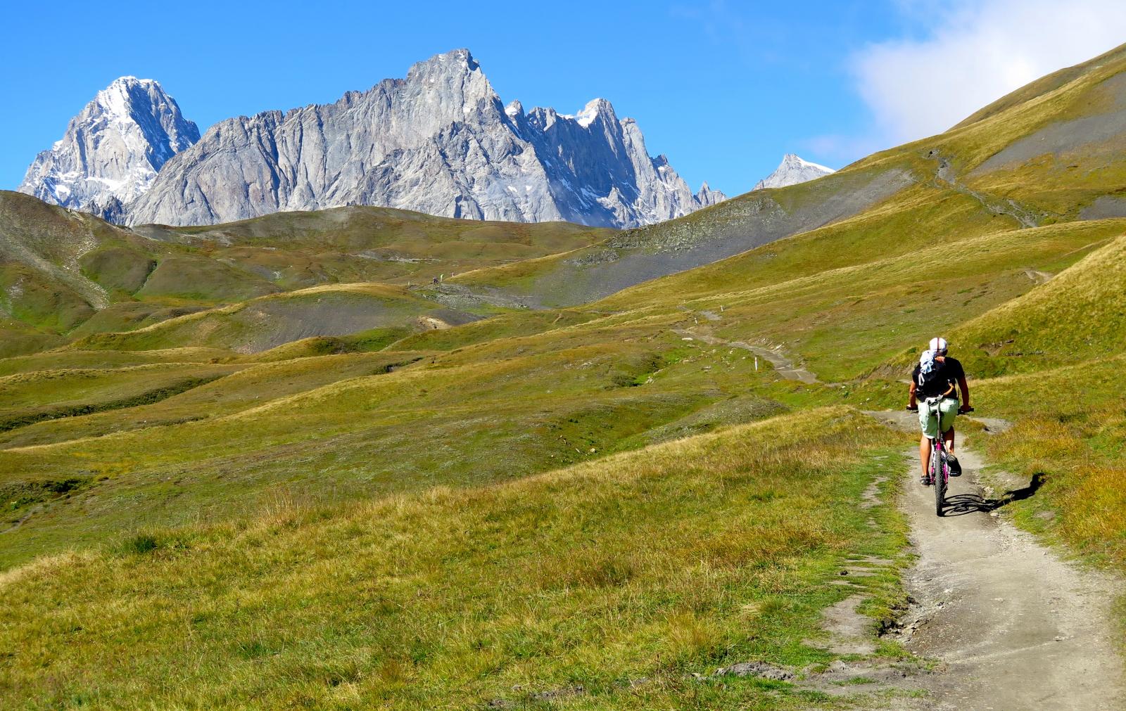
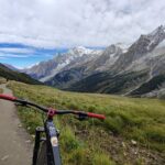
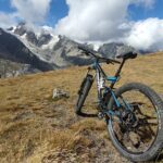
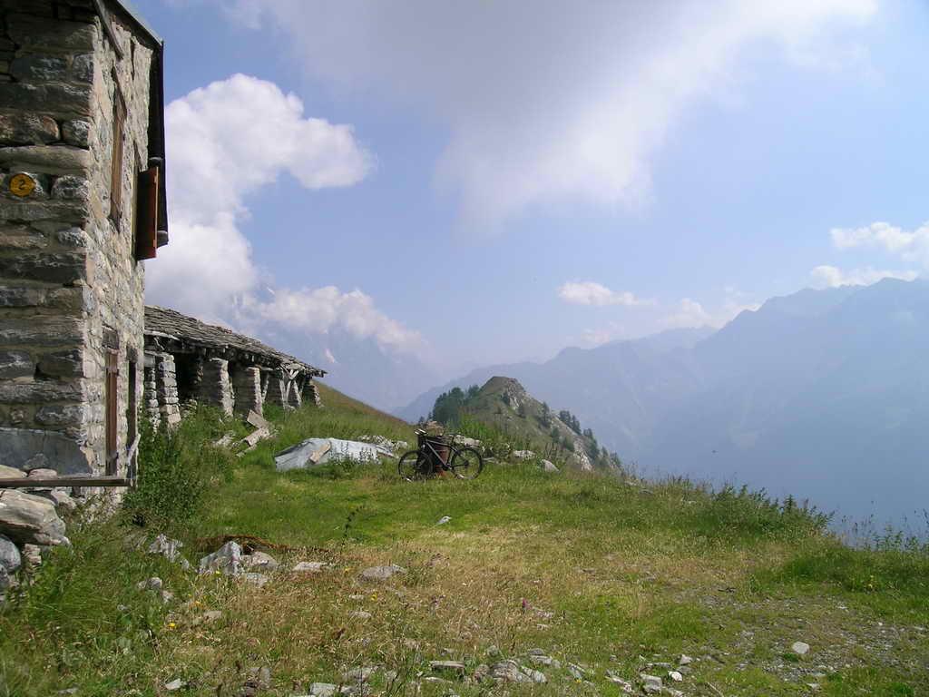
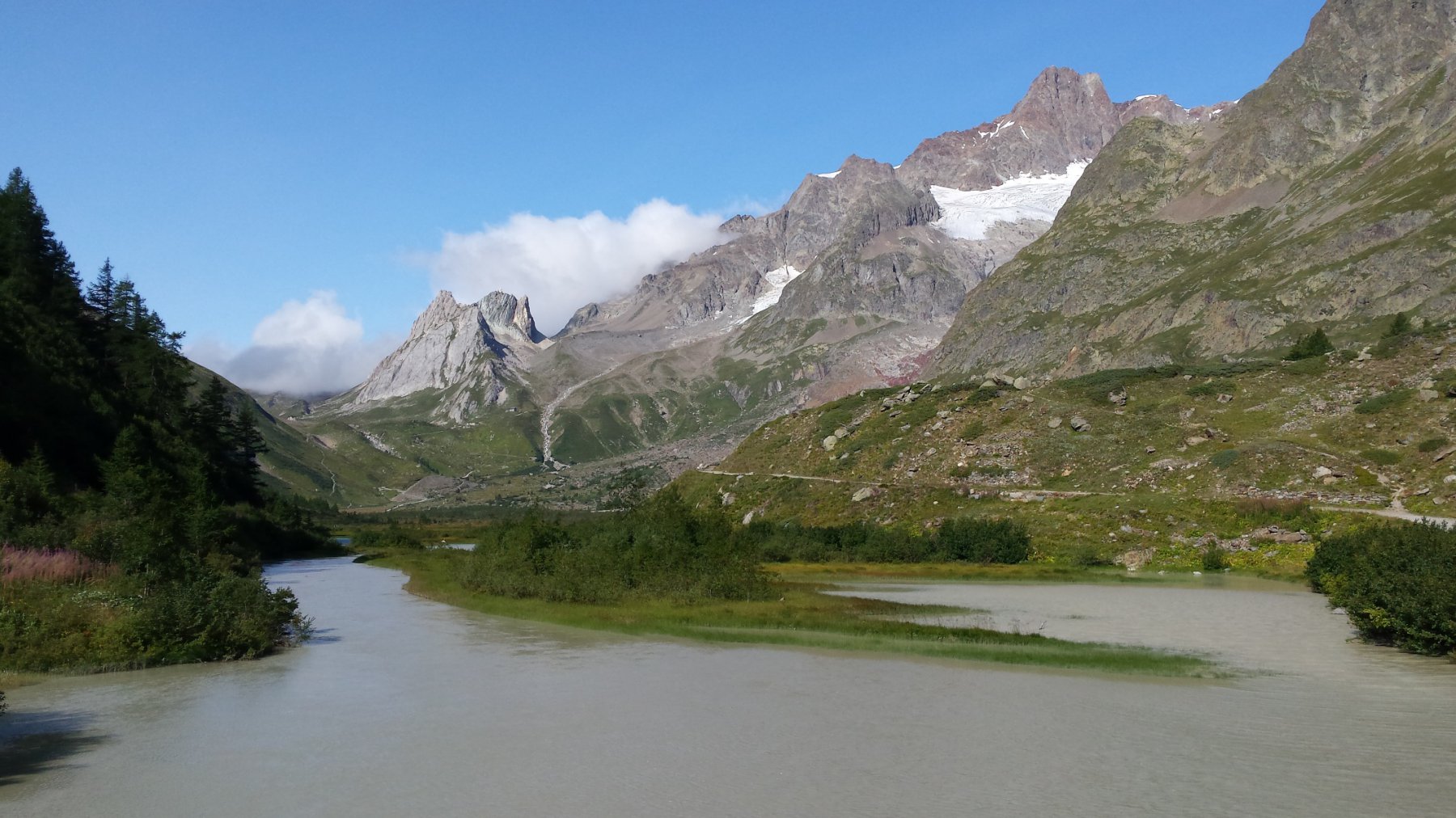
Dal piazzale di Planpinceux risalire tutta la Val Ferret sulla strada asfaltata riscaldandosi e godendo del panorama lungo il torrente. Ai casolari di Arnouva la strada si impenna e diventa sterrata fino al Rif. Elena (mt. 2062). Discesa dal rif. Elena con alcuni passaggi difficili e altri non ciclabili. ad Arnouva reperire dietro le case il sentiero per l’alpe Bellecombe; si tratta di portare la bici in spalla per 200 mt. circa di dislivello poi spingerla a mano per altri 150 (un’oretta circa, fermandosi a gustarsi la vista sul Triolet e le Jorasses dietro di noi. Da qui (acqua) inizia uno splendido sentiero balcone che rimane a quota 2000 (TMB Tour du Mont Blanc) nonostante vari sali scendi attraverso pendii di rododendri. Giunti al rif. Bonatti scendere leggermente sempre sul sentiero TMB (difficile) e al primo bivio tralasciare il ramo che scende alla strada della Val Ferret, ma rimanere in quota e in salita SPESSO difficoltosa da pedalare avvicinarsi al vallone di Armina il cui torrente si attraversa a piedi ad inizio stagione o su un ponte di legno quando gli alpeggi sono popolati. Giunti all’alpe Lachey (o Leche su alcune carte) continuare sul sentiero che si stringe e si impenna; attraversiamo gli ampi pratoni in fiore del Mont de la Saxe; da qui la vista sul Bianco, la cresta di Peuterey e le Jorasses è qualcosa di eccezionale. Un ultimo tratto faticoso in salita con alcuni tornantini e un lungo diagonale in falsopiano ci portano in prossimità del rif. Bertone dove è collocata una tavola panoramica, collocata per il Bicentenario della conquista del Monte Bianco. La discesa avviene sul sentiero molto divertente fino all’Alpe Lachey, da dove si imbocca la larga ma ripida mulattiera che con discesa breve e molto veloce porta sulla strada di fondovalle in prossimità di un ponte sulla Dora, poche centinaia di metri a monte di Planpinceux.
- Cartografia:
- IGC 1:25000 n.107.Monte Bianco
Nelle vicinanze Mappa
Itinerari
26/08/2007 AO, Courmayeur D+ 1250 m BC+, OC, S3 Tutte
Tronche (Testa della) da Planpincieux, giro per i Monts de la Saxe
50m
23/08/2004 AO, Courmayeur D+ 1600 m BC, BC, S1 Varie
Fortin (Mont) da Courmayeur, giro
4.8Km
25/08/2016 AO, Courmayeur D+ 1940 m BC, BC+, S2 Varie
Entre Deux Sauts (Tète) da Courmayeur, giro
 4.8Km
4.8Km
15/07/2015 AO, Courmayeur D+ 1700 m BC, BC, S0 Tutte
Tour del Monte Bianco (CCW) Tappa 1: Courmayeur – Champex
 4.8Km
4.8Km
08/09/2024 AO, Courmayeur D+ 10000 m OC+, OC+, S5 Tutte
Tor des Geants in MTB
 4.8Km
4.8Km
15/09/2019 AO, Courmayeur D+ 1040 m BC, BC, S2 Est
Seigne (Col de la) e Rifugio Elisabetta Soldini da Courmayeur per il lac Combal
 4.8Km
4.8Km
19/08/2023 AO, Pré-Saint-Didier D+ 2800 m BC, OC, S3 Tutte
Arp e Chavannes (Colli) da Pré Saint Didier, giro
 7Km
7Km
01/08/2009 AO, Pré-Saint-Didier D+ 1100 m MC, MC, S0 Est
Arp (Alpe) da Pre Saint Didier
 7Km
7Km
18/07/2025 AO, Pré-Saint-Didier D+ 1650 m BC, BC+, S1 Tutte
Chavannes (Col de) da Prè Saint Didier, discesa in Val Veny
7.5Km
04/08/2018 AO, Pré-Saint-Didier D+ 2900 m MC, TC, S1 Tutte
Seigne (Col de la) da Pré Saint Didier, giro per Bourg Saint Maurice e Colle del Piccolo San Bernardo
 7.5Km
7.5Km