 6.5Km
6.5Km
Avvicinamento
 0m
850m
850m
3.5Km
3.5Km
3.5Km
3.5Km
0m
850m
850m
3.5Km
3.5Km
3.5Km
3.5Km
Possibilità di parcheggiare auto nel parcheggio della piscina di Prè Saint Didier.
Descrizione
Da Pre Saint Didier si segue la strada statale del Piccolo San Bernardo, che sale dolcemente verso La Thuile con ampi tornanti. Il traffico e’ continuo anche alle prime ora della mattina e le gallerie sono pestilenziali.
Una volta a La Thuile si prosegue verso il Piccolo San Bernardo per circa 3 km e poco prima di Pont Serrand si imbocca sulla destra la strada , ancora asfaltata, con le indicazioni escursionistiche per il Col Chavannes .
La pendenza diventa impegnativa e continua per circa 3,5 km. Dopo l’agriturismo la strada diventa sterrata e dopo una leggera discesa si inoltra nel vallone con una pendenza sempre ciclabile senza grosso impegno . Dall’Alpe Chavannes di mezzo 2150 m, inizia una serie di tornanti con pendenza più impegnativa e fondo sconnesso .
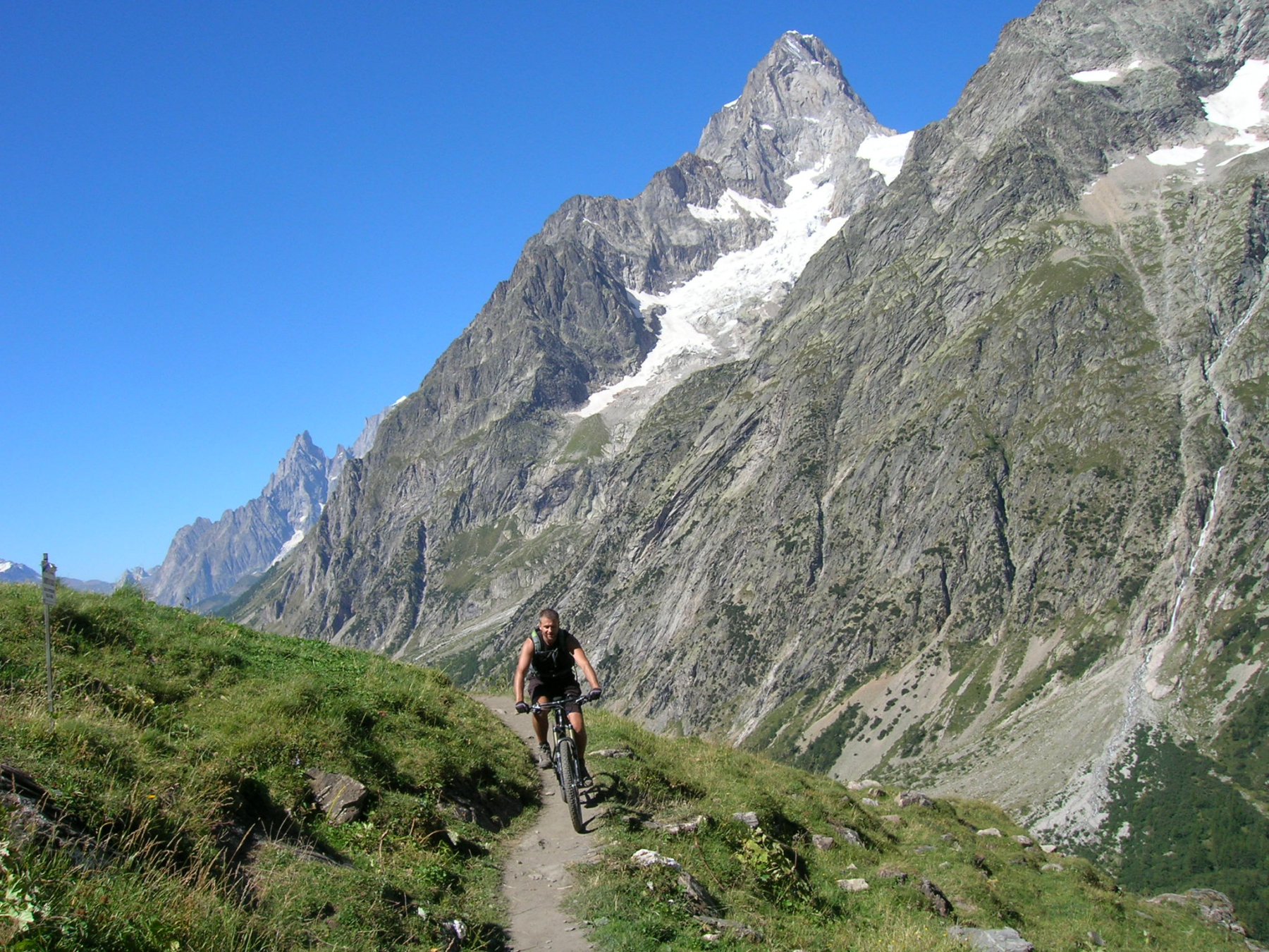
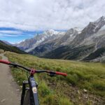
Si giunge quindi all’Alpe Chavannes superiore , la strada diventa un single track sempre pedalabile con lieve pendenza.che porta fino al colle.
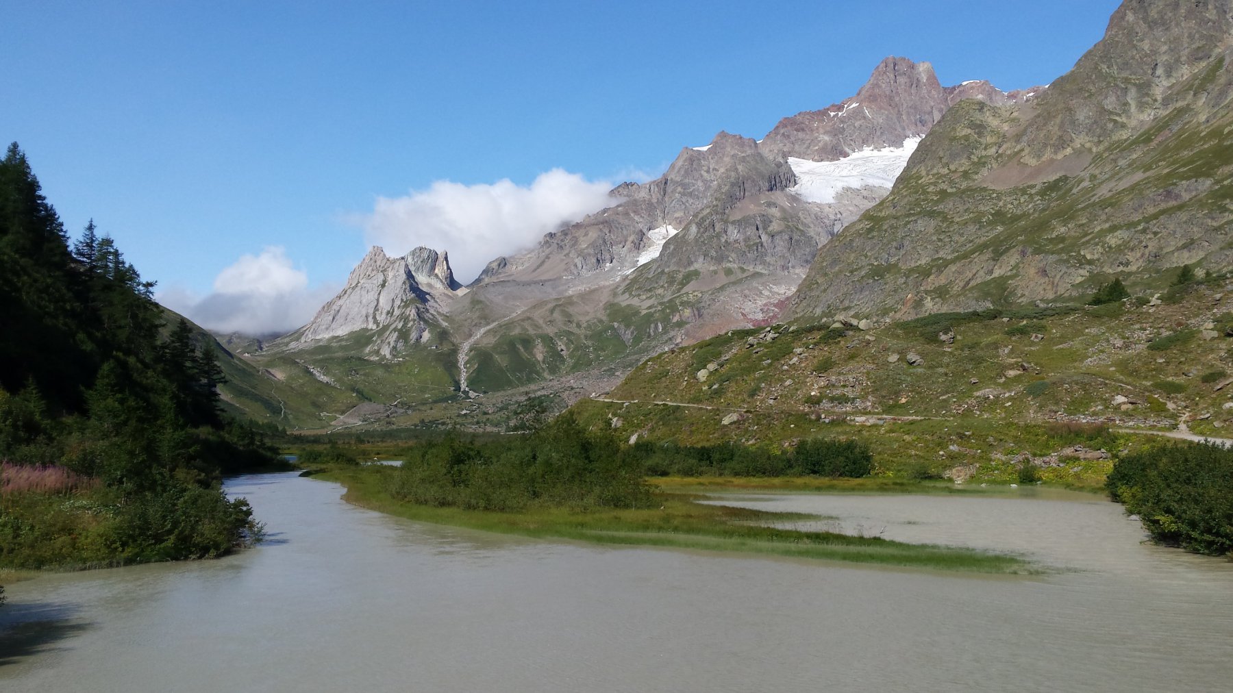
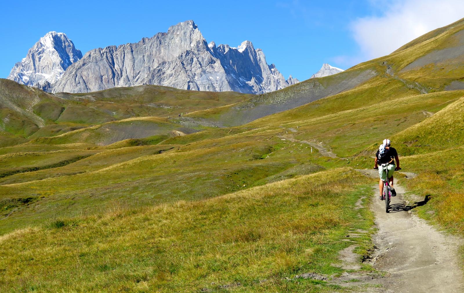
Dal colle lo spettacolo e’ eccezionale sul massiccio del Bianco e sul fondo dellA val Veny.
Discesa –
Dal colle si imbocca il sentiero della Alta via 2 , con bici al fianco perlomeno per 150/200 m di dislivello. Sono tornantini esposti su sfasciumi .
Il senteiro diventa ciclabile a tratti più in basso e infine si giunge nella piana della Val Veny che si percorre costeggiando il torrente. Si può risalire fino al Rifugio Elisabetta e quindi ritornare verso il fondo valle sulla strada sterrata affollata da turisti .
Dopo il lago Combal la strada ritorna asfaltata ed è’ necessario fare attenzione ai gitanti e al traffico. Per evitare parte del traffico è possibile lasciare la strada asfaltata seguendo le indicazioni per rifugio Monte Bianco , per poi ritornarci poco prima di Notre Dame de la Guerison .
Ritorno a Pre Saint Didier su statale.
- Cartografia:
- carta igc 1 :50.000 n° 4 Monte Bianco
Nelle vicinanze Mappa
Itinerari
04/08/2018 AO, Pré-Saint-Didier D+ 2900 m MC, TC, S1 Tutte
Seigne (Col de la) da Pré Saint Didier, giro per Bourg Saint Maurice e Colle del Piccolo San Bernardo
 0m
0m
03/08/2018 AO, Pré-Saint-Didier D+ 3500 m OC, BC+, S3 Varie
Bard, Citrin, Malatrà (Colli) da Prè Saint Didier, giro della Valdigne
0m
19/08/2018 AO, Pré-Saint-Didier D+ 2000 m OC, OC, S3 Tutte
Liconi (Testa di) da Prè Saint Didier, giro
0m
19/08/2023 AO, Pré-Saint-Didier D+ 2800 m BC, OC, S3 Tutte
Arp e Chavannes (Colli) da Pré Saint Didier, giro
 850m
850m
01/08/2009 AO, Pré-Saint-Didier D+ 1100 m MC, MC, S0 Est
Arp (Alpe) da Pre Saint Didier
 850m
850m
27/08/2017 AO, La Thuile D+ 1200 m EC, BC+, S3 Varie
Colmet (Mont) dal Colle San Carlo
2.4Km
25/08/2016 AO, Courmayeur D+ 1940 m BC, BC+, S2 Varie
Entre Deux Sauts (Tète) da Courmayeur, giro
 3.5Km
3.5Km
15/07/2015 AO, Courmayeur D+ 1700 m BC, BC, S0 Tutte
Tour del Monte Bianco (CCW) Tappa 1: Courmayeur – Champex
 3.5Km
3.5Km
15/09/2019 AO, Courmayeur D+ 1040 m BC, BC, S2 Est
Seigne (Col de la) e Rifugio Elisabetta Soldini da Courmayeur per il lac Combal
 3.5Km
3.5Km
08/09/2024 AO, Courmayeur D+ 10000 m OC+, OC+, S5 Tutte
Tor des Geants in MTB
 3.5Km
3.5Km