2.8Km
2.8Km
Note
 50m
50m
50m
50m
50m
50m
50m
50m
50m
50m
50m
50m
50m
50m
50m
50m
50m
50m
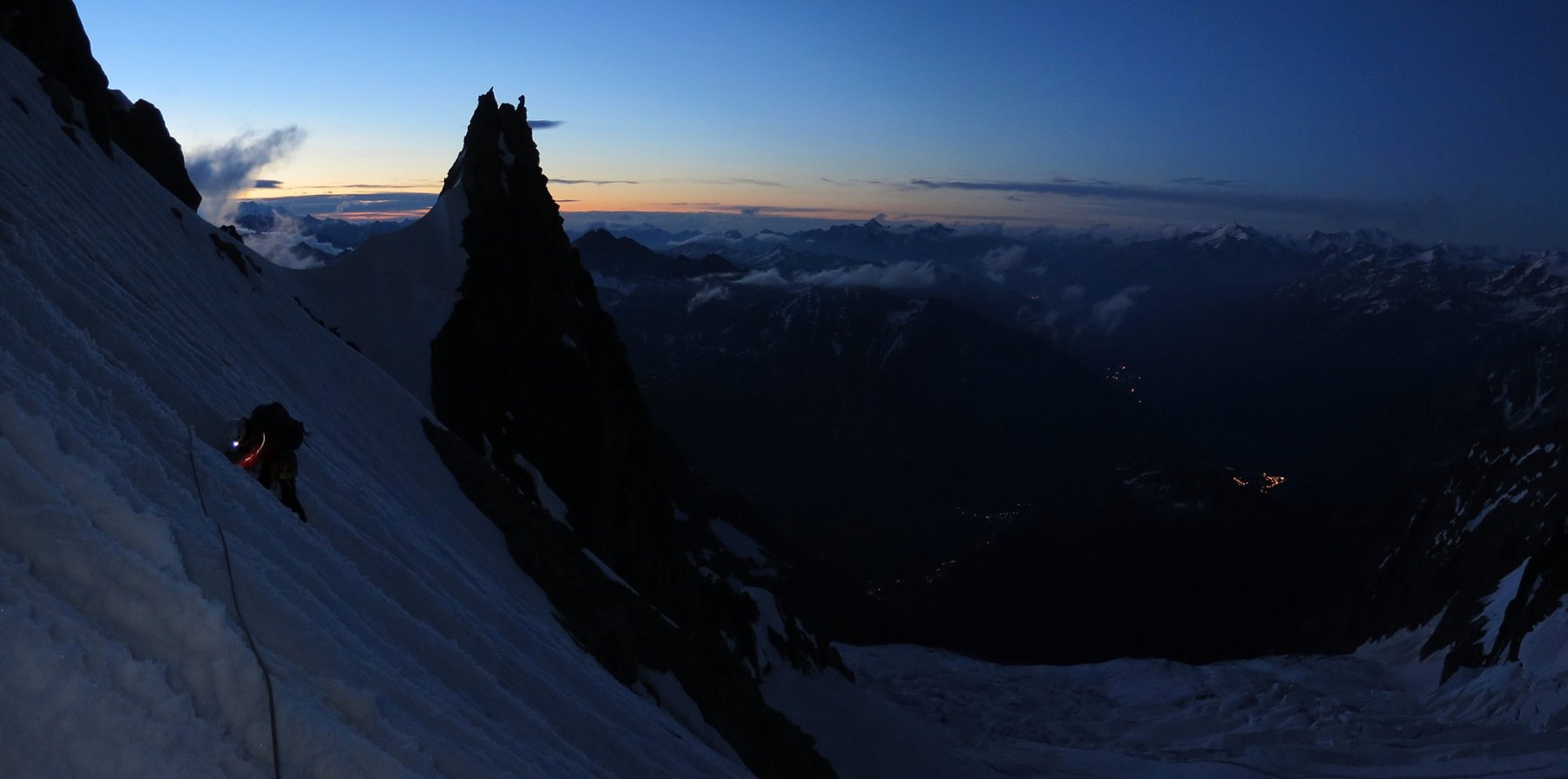
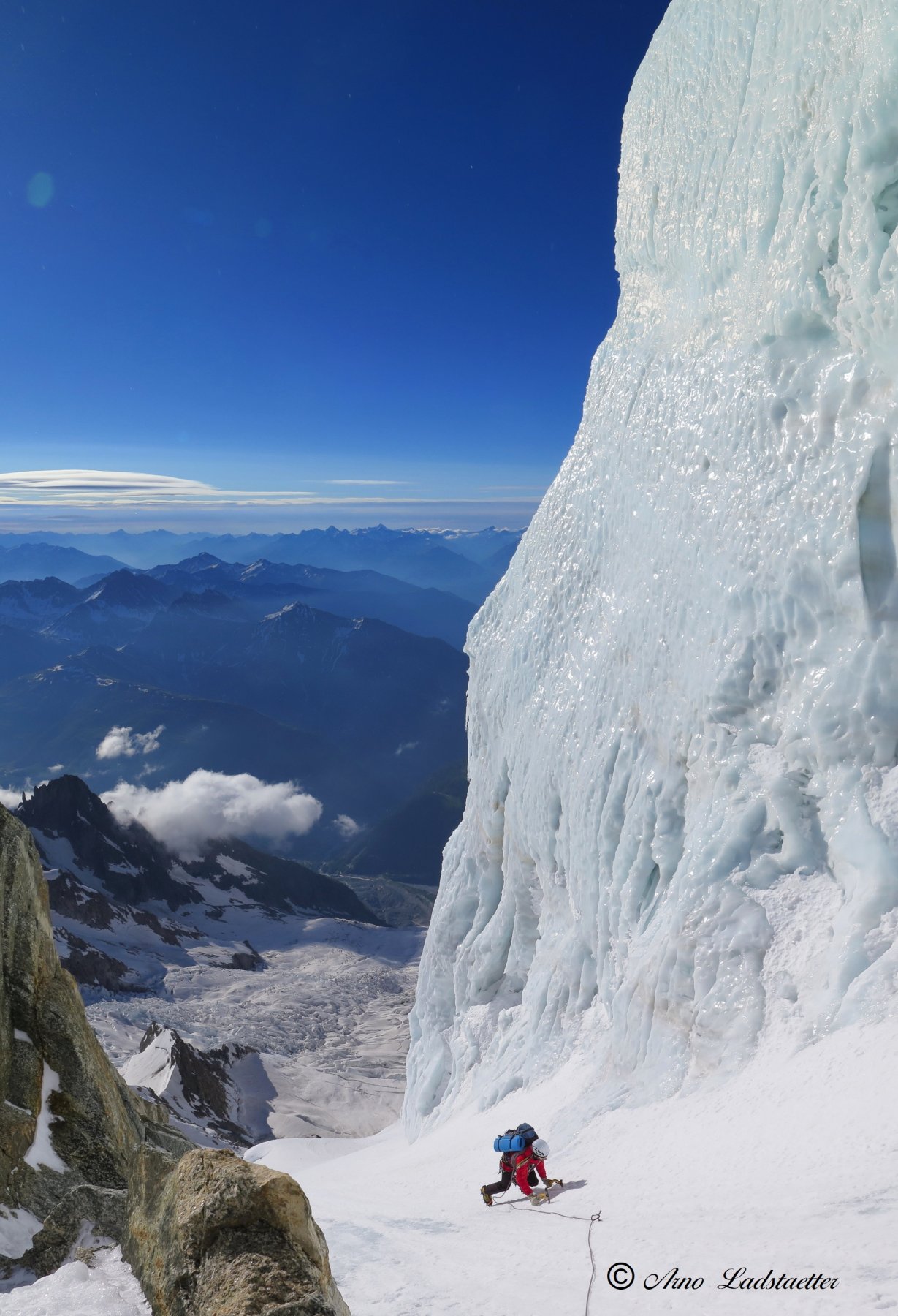
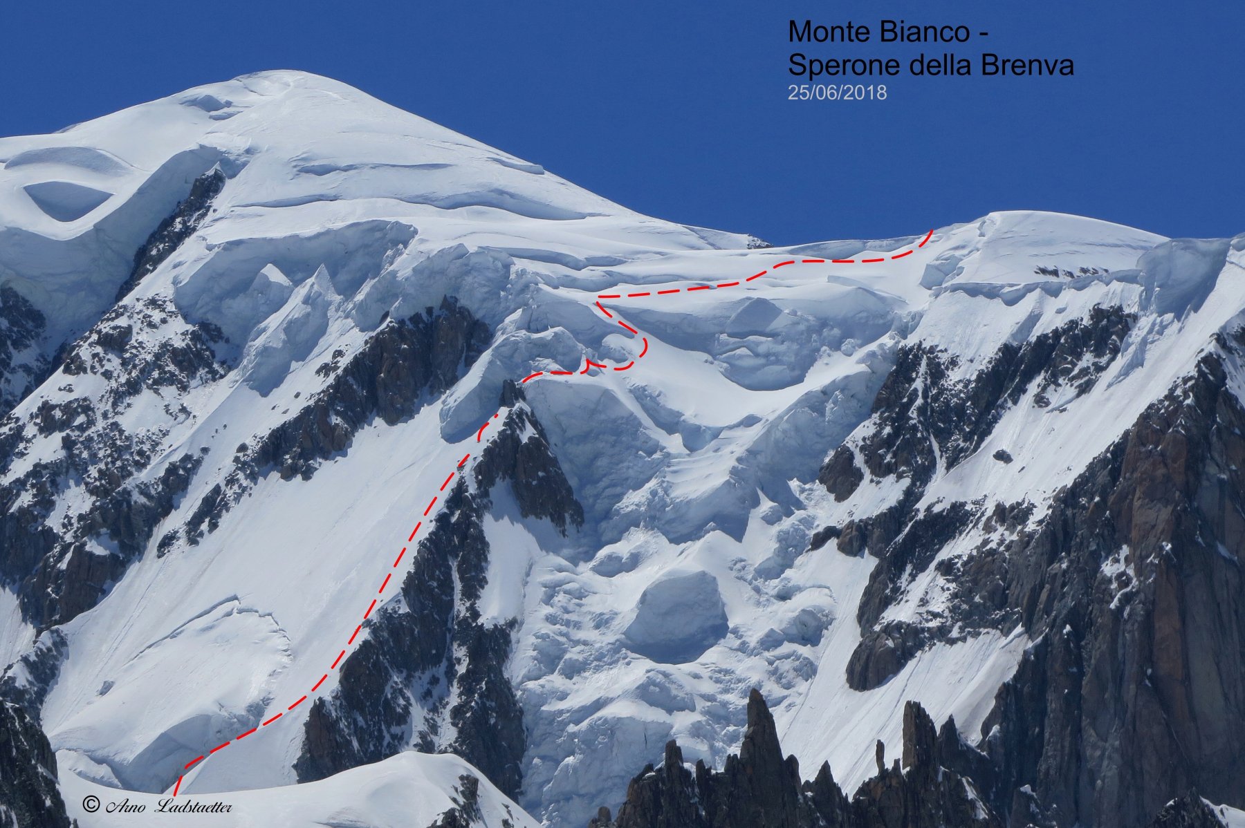
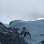
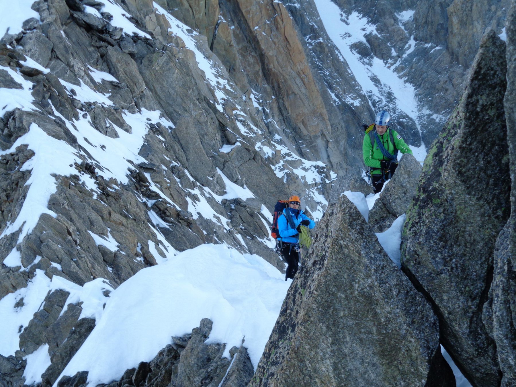
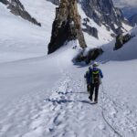
Itinerario lungo ed ingaggiato con possibilità di rientro davvero scarse per esposizione e complessità. Richiede un'ottima dimestichezza su terreno nevoso e misto di alta montagna e un'ottima conoscenza del territorio.
Avvicinamento
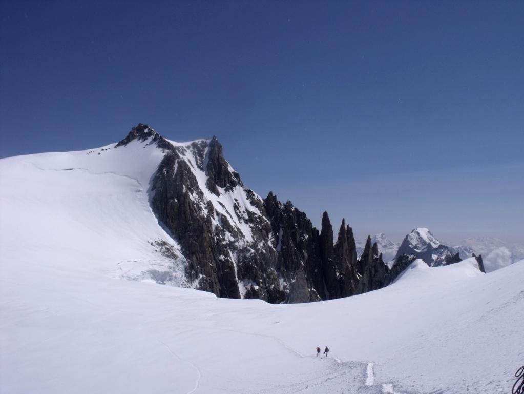
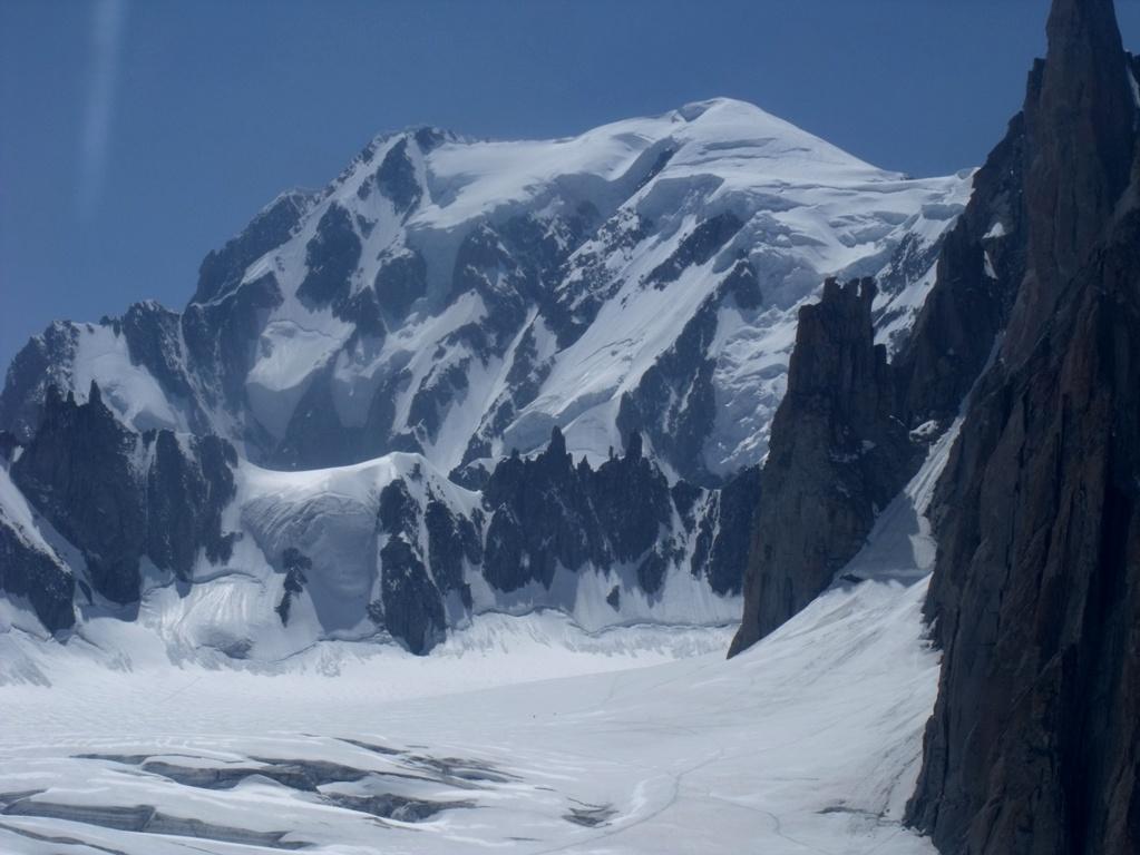
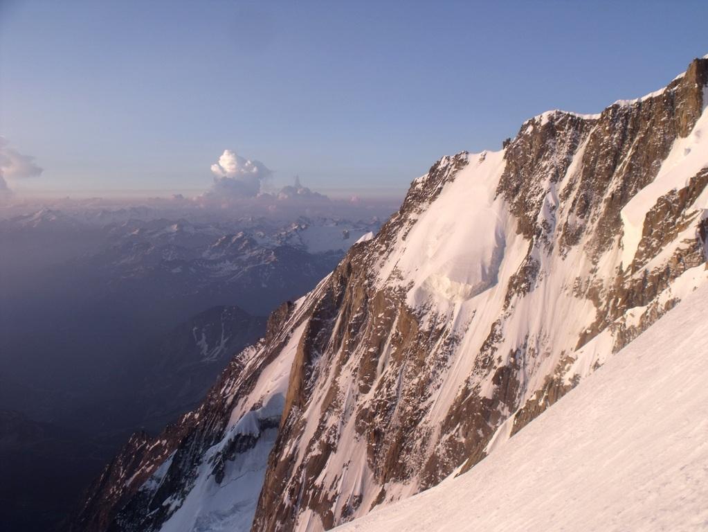
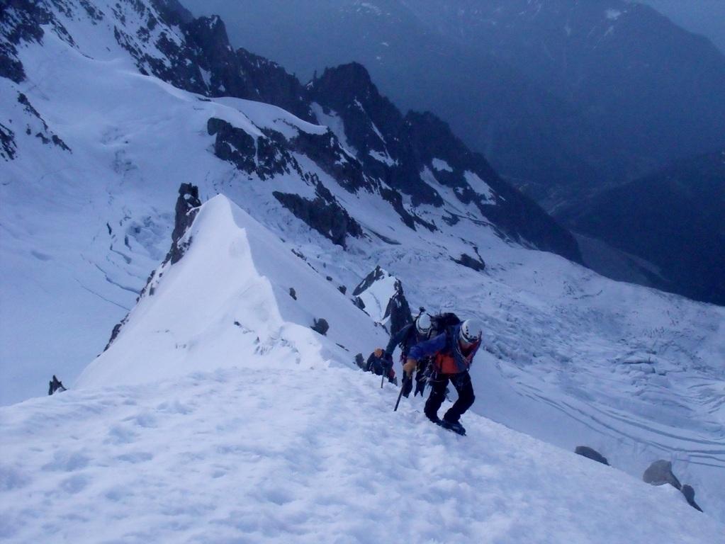
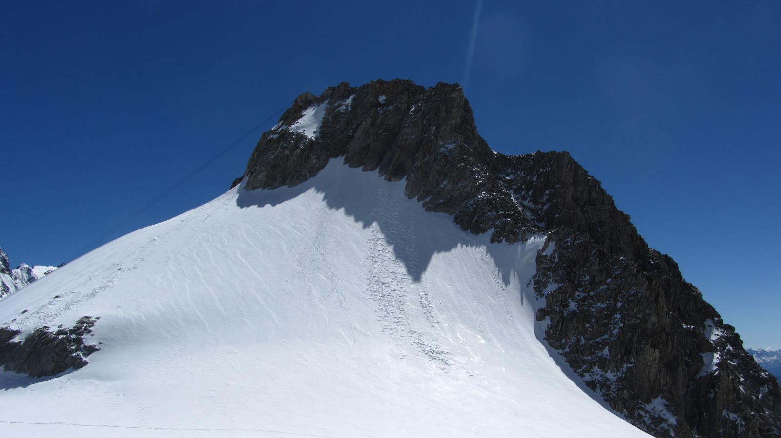
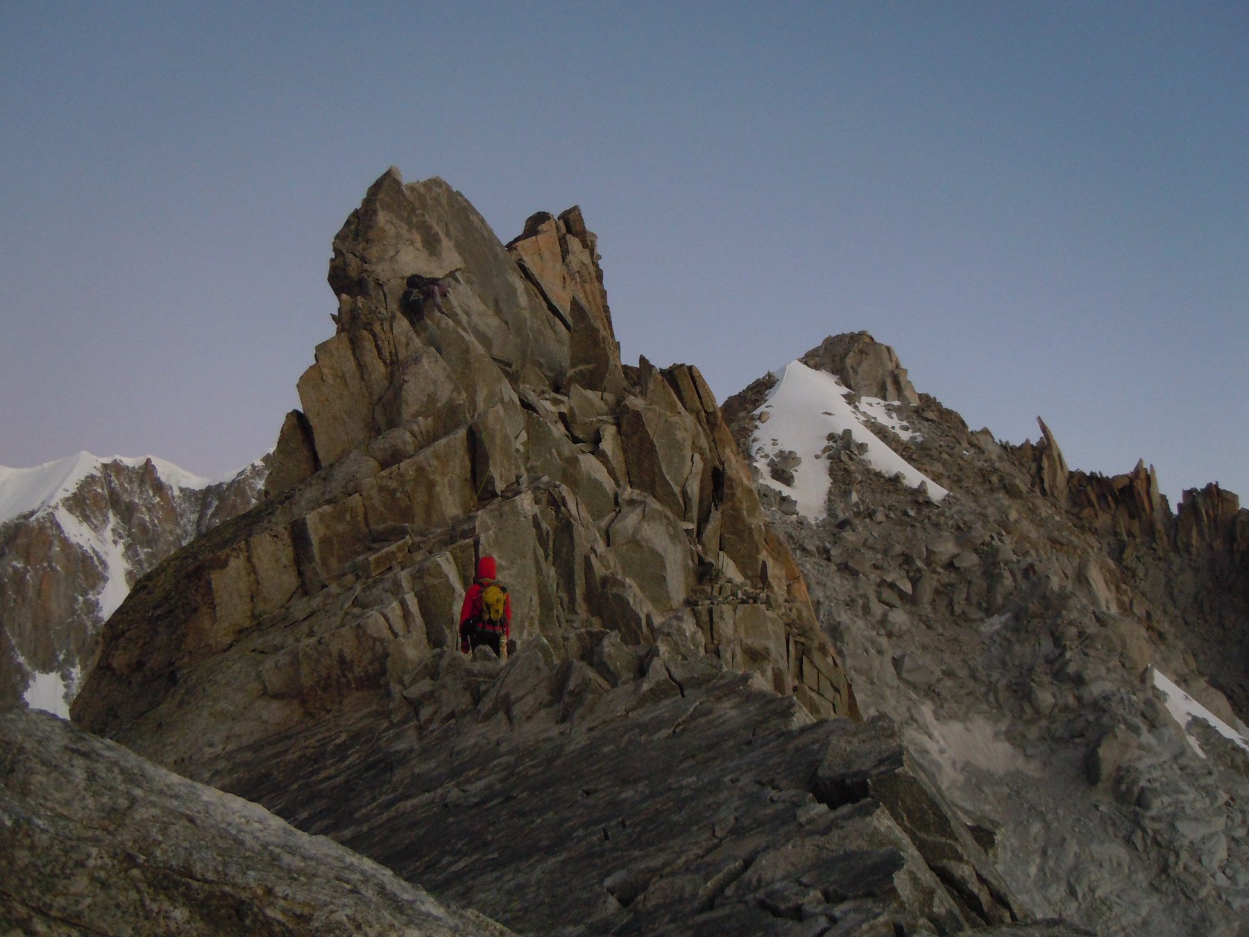
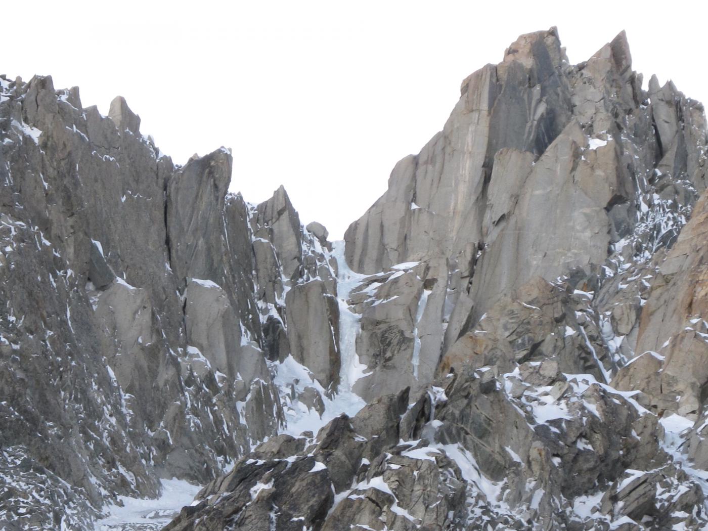
per la A5 fino al villaggio di La Palud e alla funivia del Monte Bianco. Pernotto al Rifugio Torino. Per ghiacciaio, passato il Col Flambeaux dirigersi in direzione della parete N della Tour Ronde, costeggiarla sul pianoro in direzione della cresta spartiacque tra la combe Maudite e il versante E del Mont Maudit. Individuare i grossi pinnacoli sulla cresta e salire il pendio alla loro destra fino in cresta. Poco dietro si trova il bivacco della Fourche (altro punto di partenza possibile). Dalla balaustra del bivacco, effettuare due corde doppie da 30 metri partendo dall'estrema sinistra di questa (faccia allo sperone. tardi in stagione possono essere indispensabili piu doppie e di maggior lunghezza a seconda della quantità di neve presente nel canale). Una volta sul ghiacciaio puntare al col Moore.
Descrizione
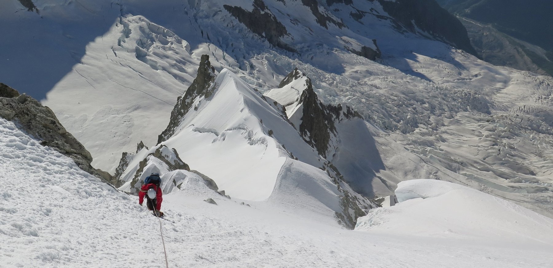
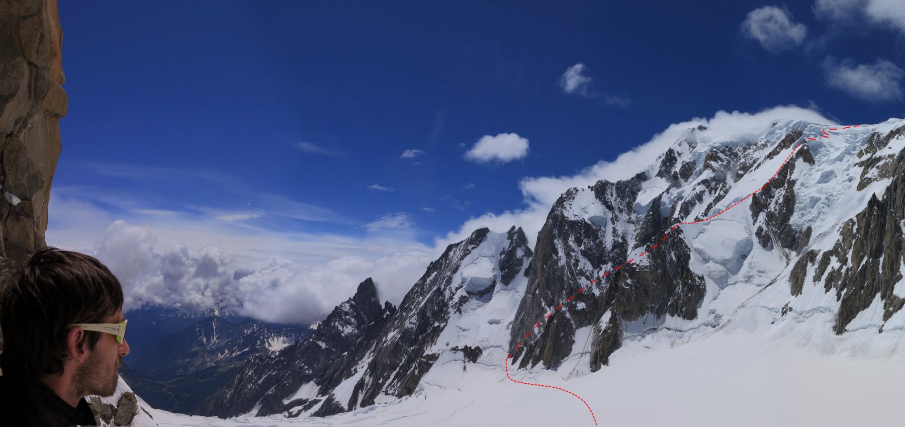
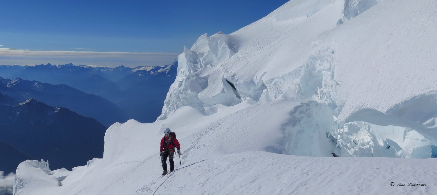
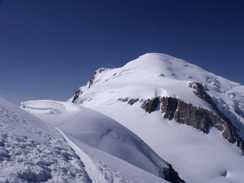
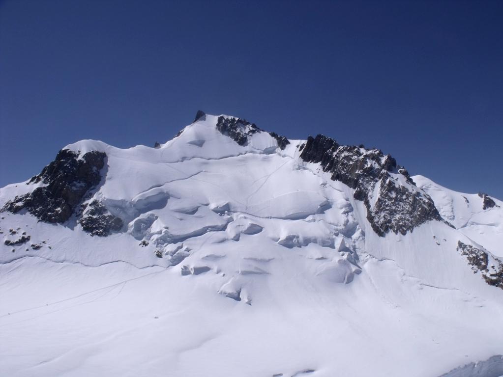
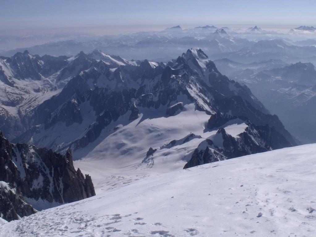
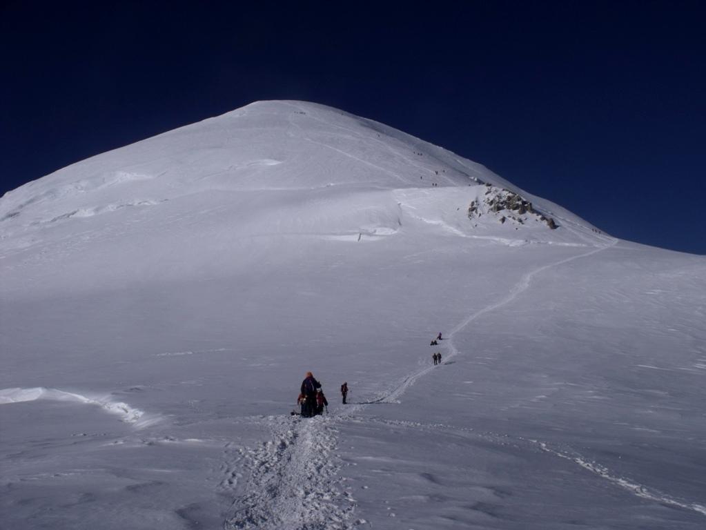
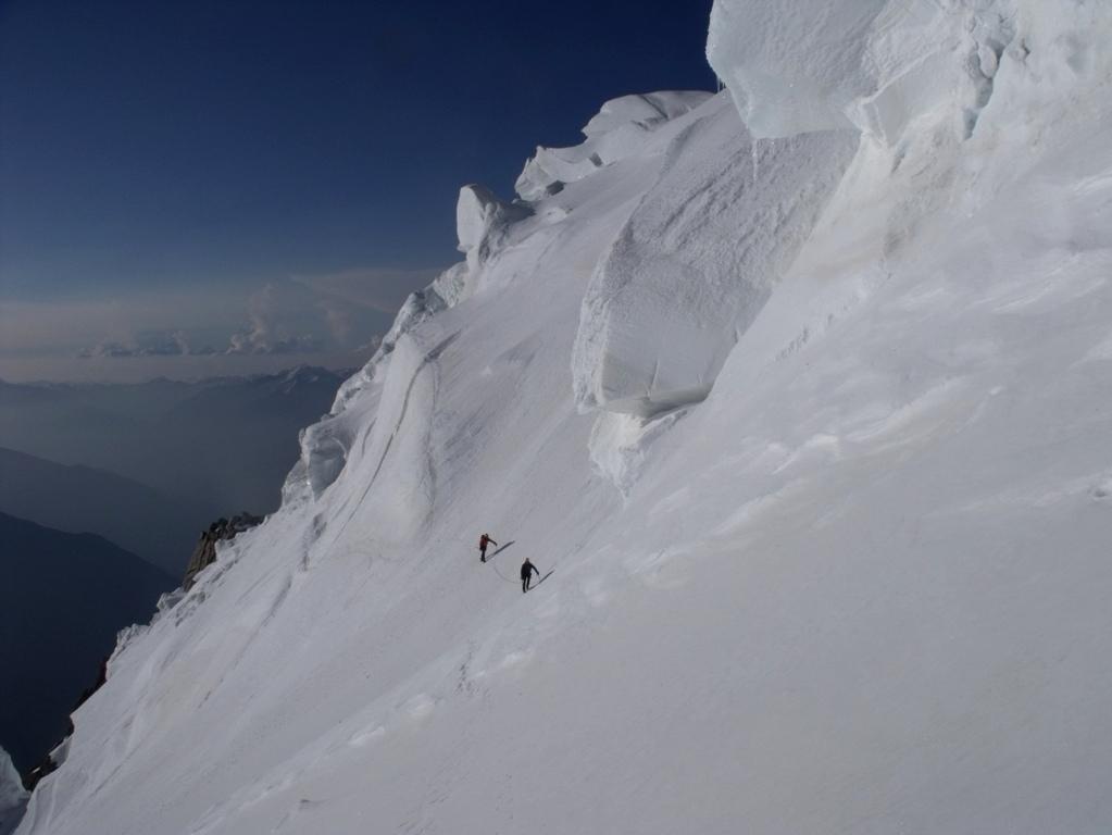
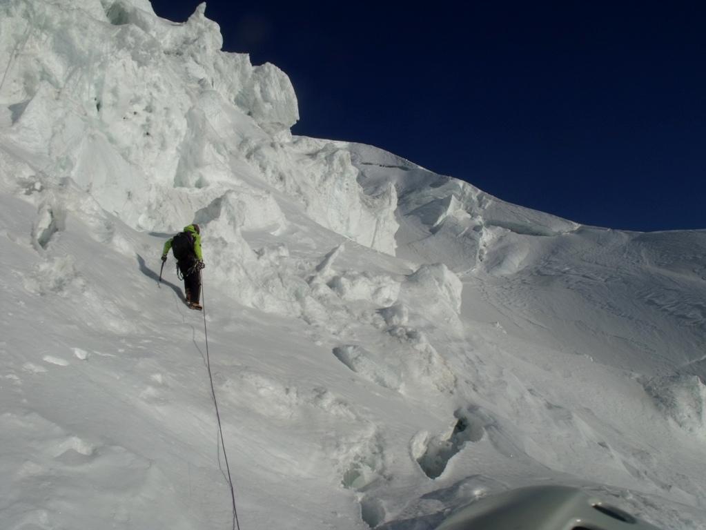
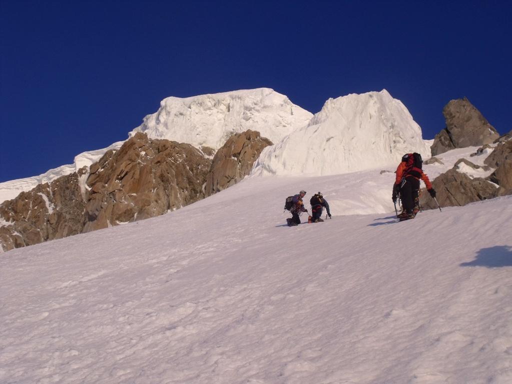
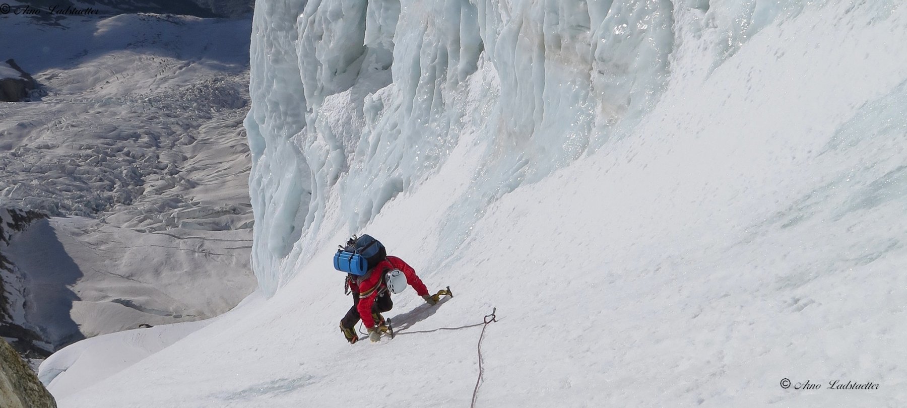
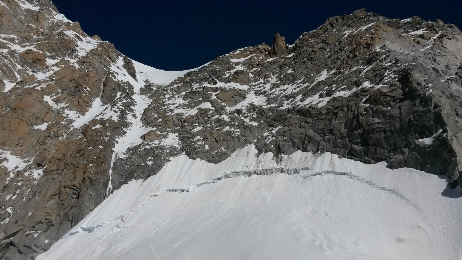
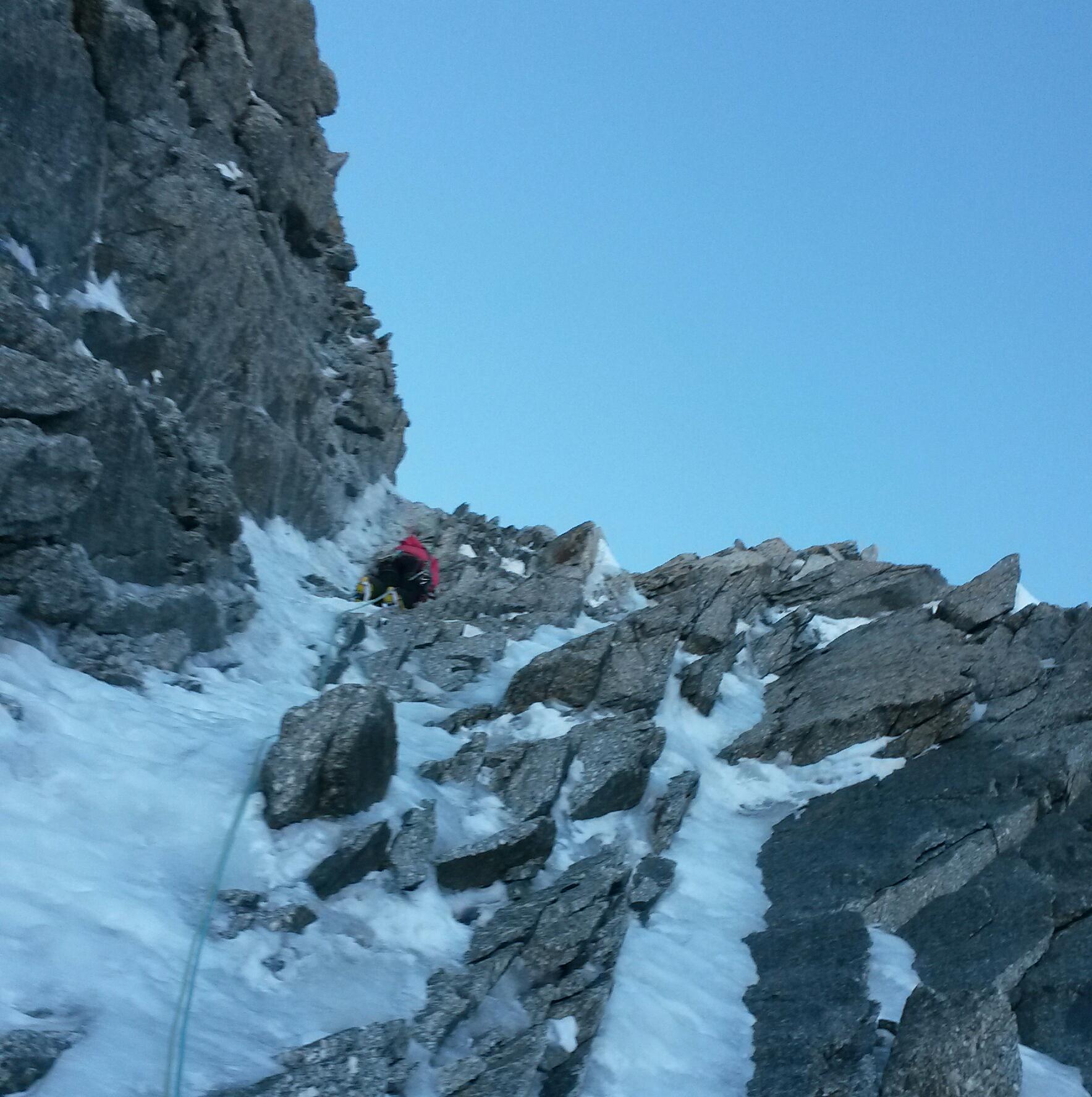
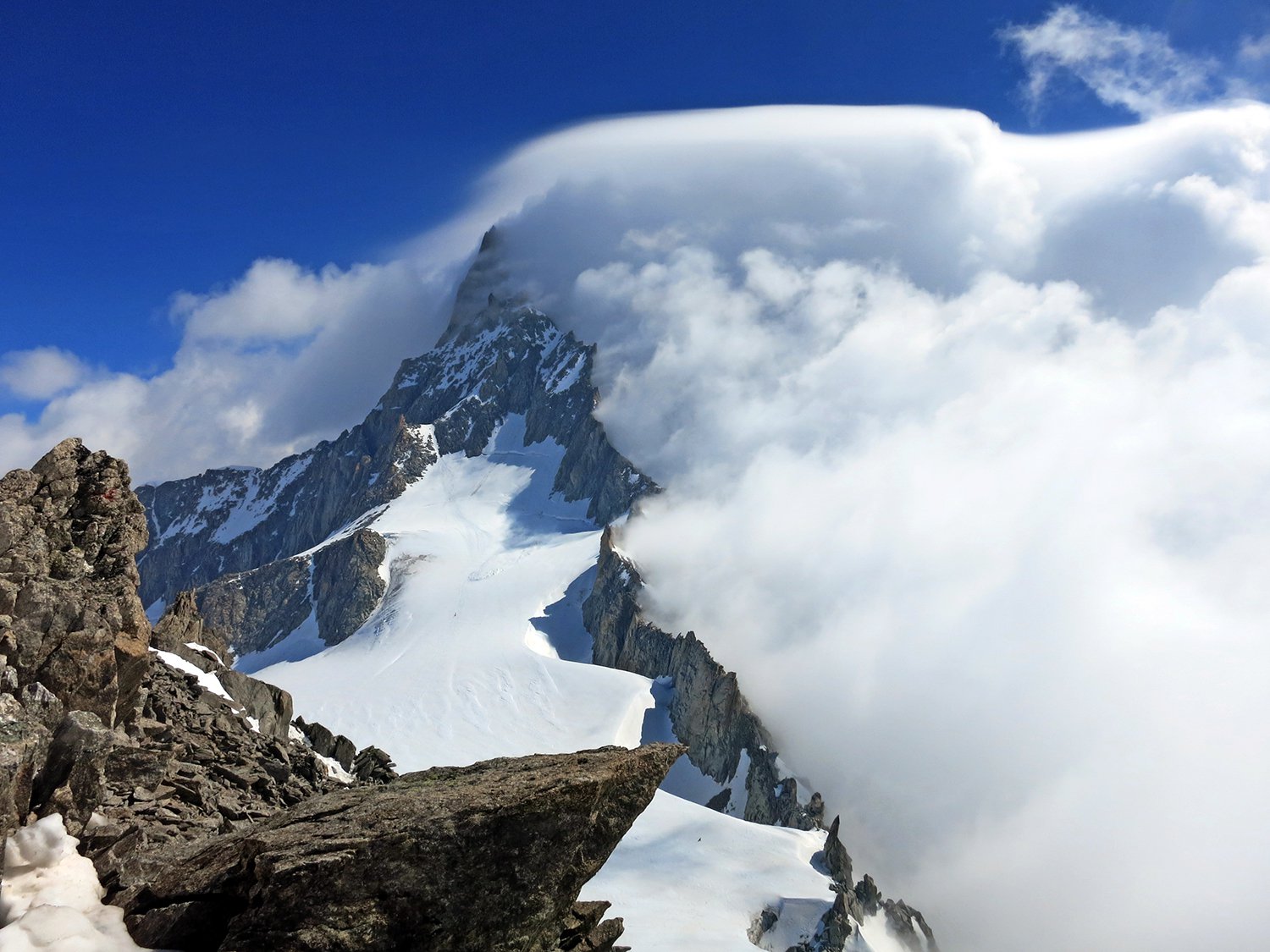
Superare il col Moore e scendere in diagonale discendente versante Brenva fino a reperire i pendii di neve che salgono. Tutto l’anfiteatro è chiuso da barre rocciose. Traversare lungamente in modo ascendente e talvolta orizzontale verso sinistra (salendo) fino ad arrivare ad un colletto evidente. Da qui seguire il filo dello sperone nevoso (con qualche passaggio di roccia facile) risalendo in direzione del filo di cresta dello sperone principale della Brenva. Una volta sul filo di cresta l’itinerario è evidente fino all’ultimo isolotto roccioso contro i seracchi. Al momento lo stato dei seracchi stessi permette di procedere in questo modo: aggirare il grosso isolotto a sinistra e salirvi a monte. Traversare in piano per circa 250 m verso destra per uscire al colle della Brenva.
- Bibliografia:
- Buscaini o Neige Glace Mixt
Nelle vicinanze Mappa
Itinerari
03/03/2026 AO, Courmayeur D+ 140 m D Sud-Ovest
Rognon Vaudano – Veloce Veloce 2.0
 50m
50m
05/12/2016 AO, Courmayeur D+ 244 m PD+ Nord-Ovest
Grand Flambeau cresta nord e versante ovest
 50m
50m
07/03/2025 AO, Courmayeur D+ 150 m D+ Est
Tacul (Mont Blanc du) Goulotte Silvia
50m
13/09/2014 AO, Courmayeur D+ 1600 m D Varie
Bianco (Monte) Parete Nord dell’Aiguille Blanche e Cresta di Peuterey
 50m
50m
27/12/2015 AO, Courmayeur D+ 251 m AD Nord
Fourche (Col de la) da Punta Helbronner
 50m
50m
17/06/2024 AO, Courmayeur D+ 750 m PD+ Sud-Est
Tour Ronde via Normale per la Cresta SE
 50m
50m
10/05/2015 AO, Courmayeur D+ 600 m ED- Nord-Est
Maudit (Mont) A l’est Rien de Nouveau
 50m
50m
26/03/2022 AO, Courmayeur D+ 600 m TD Nord
Maudit (Mont) diretta Roger-Baxter-Jones
 50m
50m
12/07/2026 AO, Courmayeur D+ 322 m PD+ Nord-Est
Marbrées (Aiguilles, Punta Nord) Cresta NE
 50m
50m
02/06/2023 AO, Courmayeur D+ 250 m PD+ Varie
Vierge (la) da Punta Helbronner
 50m
50m