1.8Km
1.8Km

Note
Storico
 950m
1.1Km
1.3Km
1.4Km
1.5Km
1.7Km
1.7Km
1.7Km
1.7Km
1.7Km
950m
1.1Km
1.3Km
1.4Km
1.5Km
1.7Km
1.7Km
1.7Km
1.7Km
1.7Km
1.8Km
3.6Km
8.6Km
9Km
9Km
9.2Km
9.2Km
9.4Km
9.4Km
9.4Km
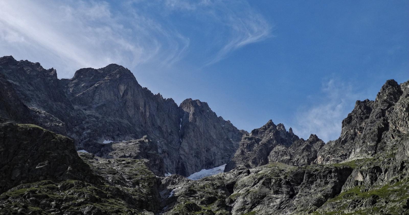
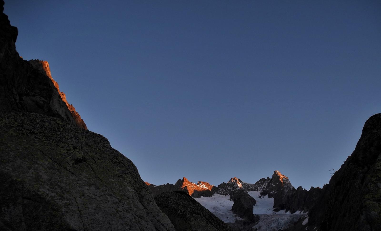
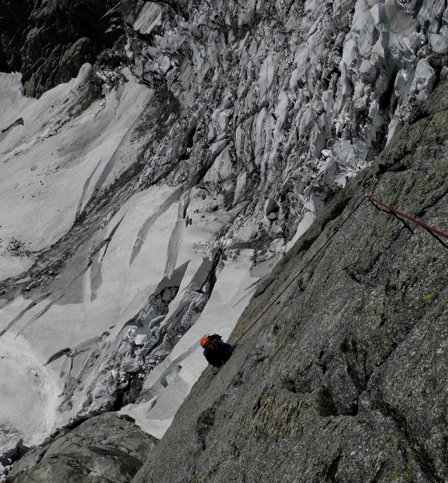
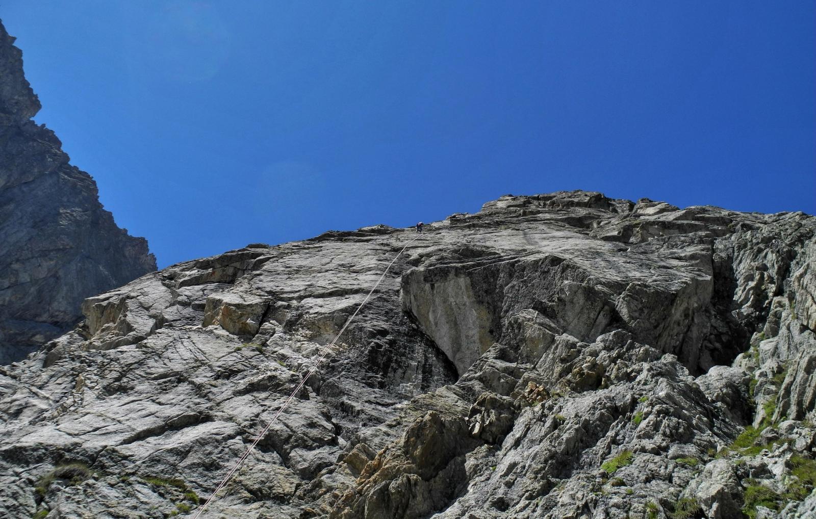
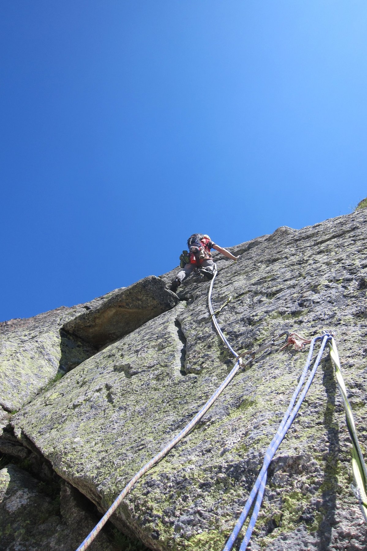
Posto decisamente selvaggio e senza possibilità di utilizzo del cellulare.
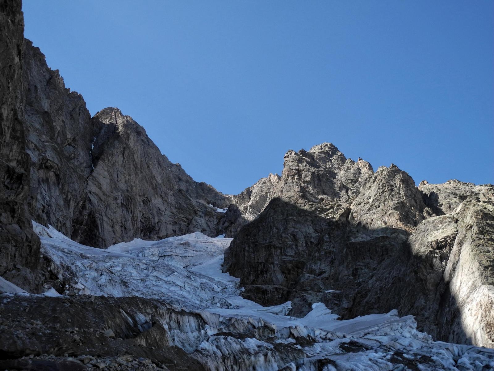
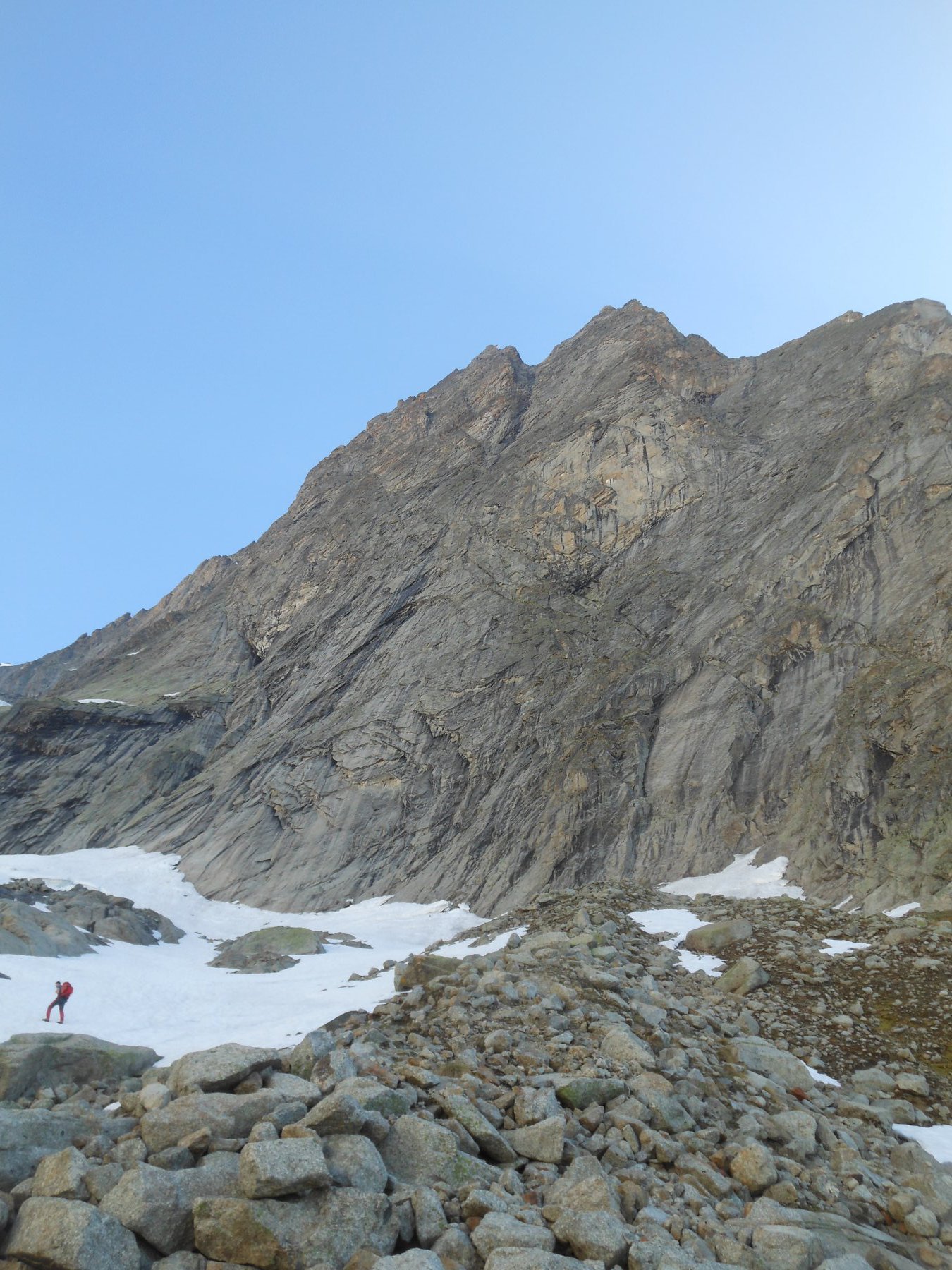
Le caratteristiche dell'avvicinamento e del ghiacciaio da percorrere la inseriscono in un contesto decisamente alpinistico.
Ramponi e piccozza.
Attenzione: gli spit di "progressione" citati nella fonte dei primi salitori indicano gli unici ed effettivi spit presenti sul tiro!!
2 corde da 60m, 1 set completo di friends fino al nr. 3
Avvicinamento
Le caratteristiche dell'avvicinamento e del ghiacciaio da percorrere la inseriscono in un contesto decisamente alpinistico.
Ramponi e piccozza.
Attenzione: gli spit di "progressione" citati nella fonte dei primi salitori indicano gli unici ed effettivi spit presenti sul tiro!!
2 corde da 60m, 1 set completo di friends fino al nr. 3
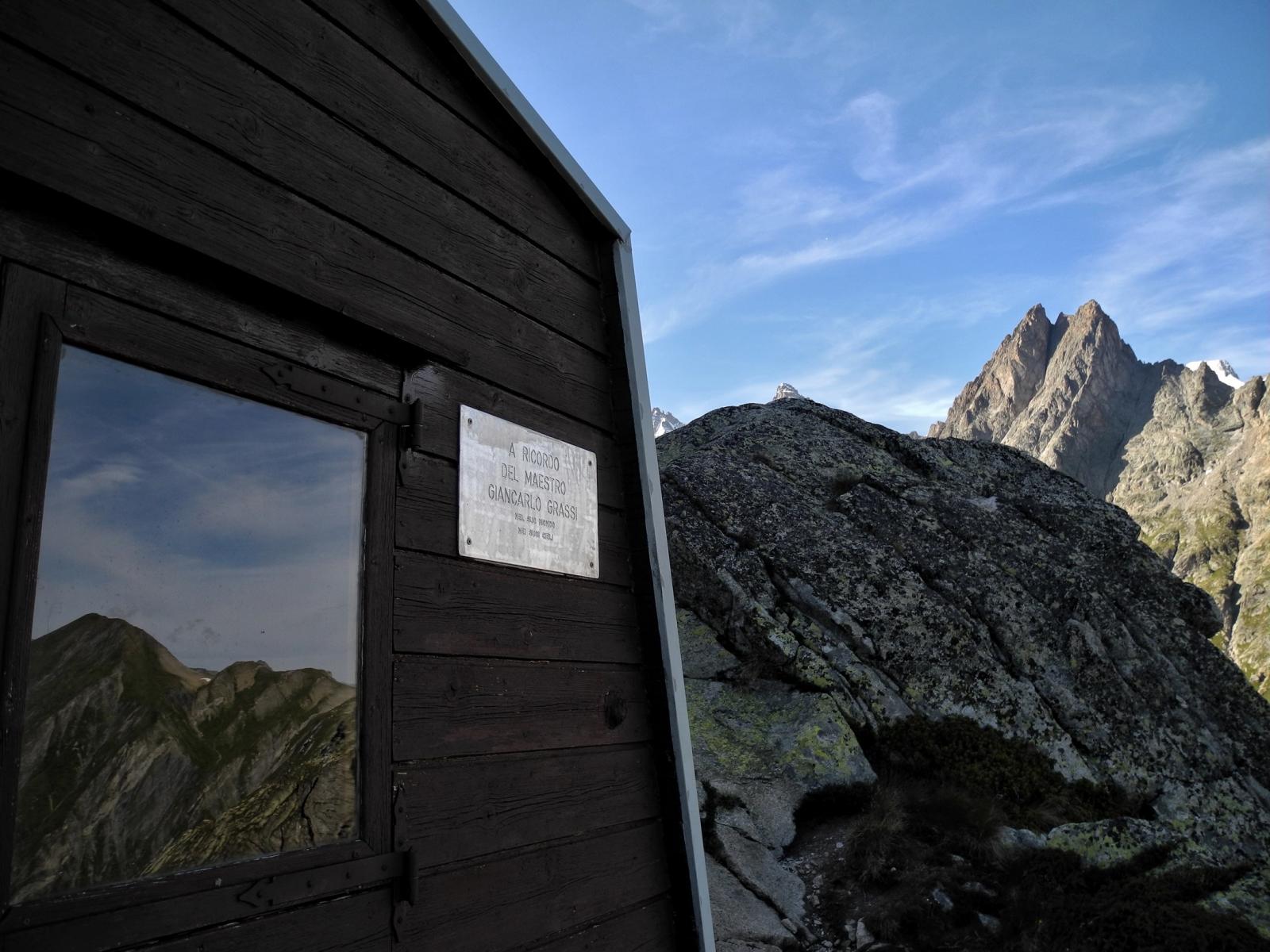
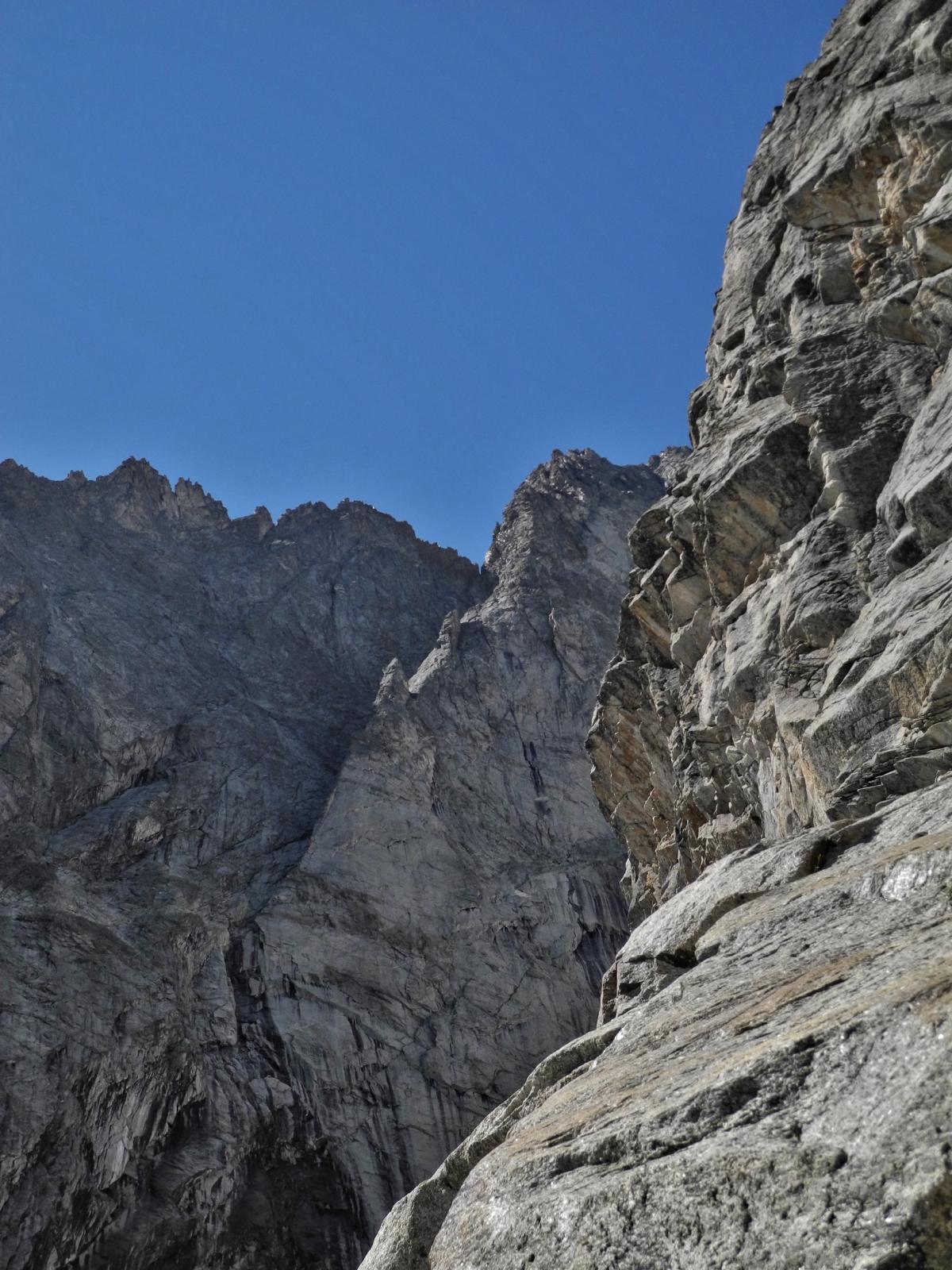
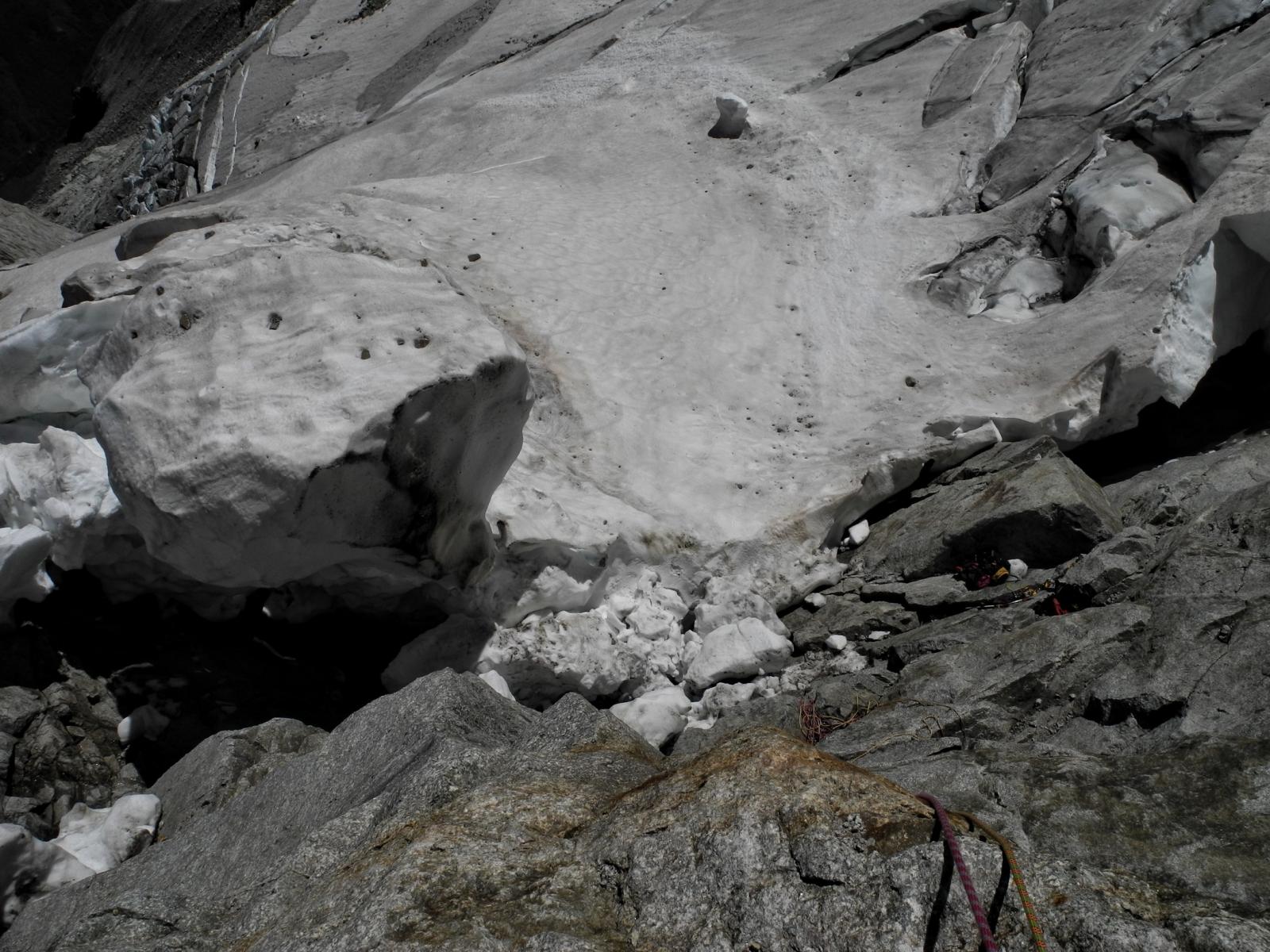
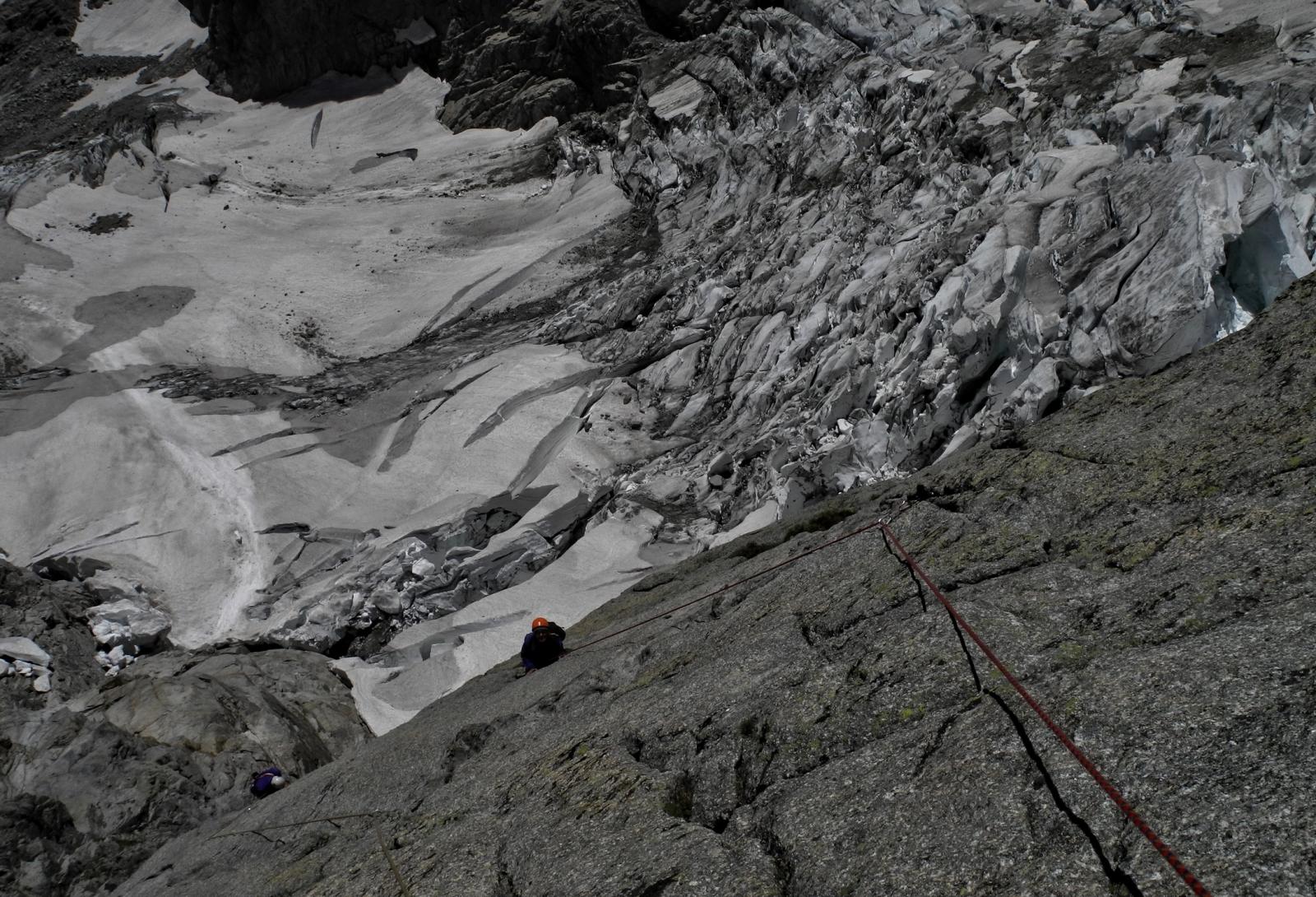
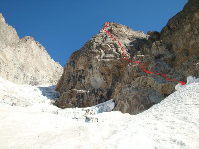
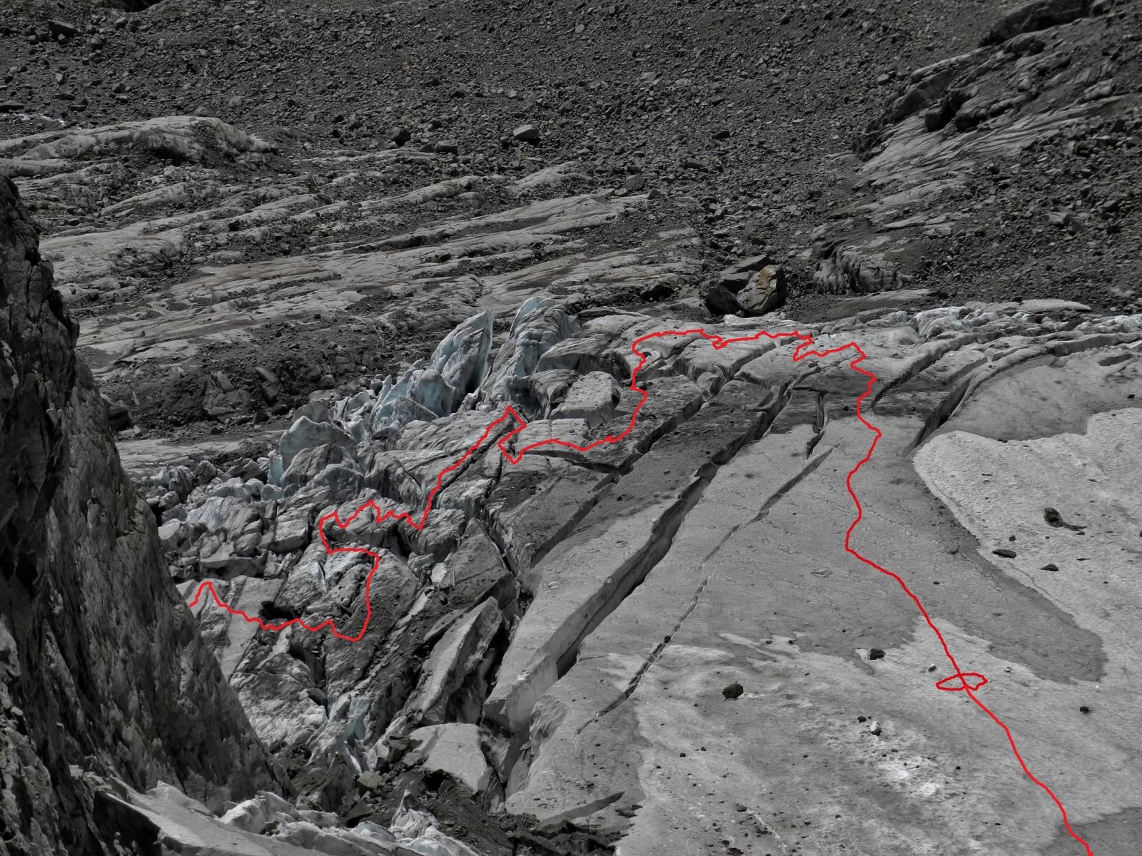
dal Bivacco in 40 minuti (descrizione Michel Piola) si raggiunge l'unico approvvigionamento possibile acqua, costeggiando sulla sinistra la parete sovrastante.Si prosegue sempre verso nord su ripidi pendii erbosi montonati fino a raggiungere la morena che si sale faticosamente quasi fino al suo termine, sulla sinistra si nota un masso con bollo rosso che indica l'unico posto dove poter scendere e raggiungere il ghiacciaio; lo si sale sulla destra cercando il passaggio migliore sino ai piedi di una placca color arancio ove alla sua destra è solitamente presente un caratteristico e gigantesco obelisco di ghiaccio alquanto inquietante (resti valanghe primaverili) 1h30- 3h secondo le condizioni del ghiacciaio; l'attacco è a sx. di questo menhir di ghiaccio.
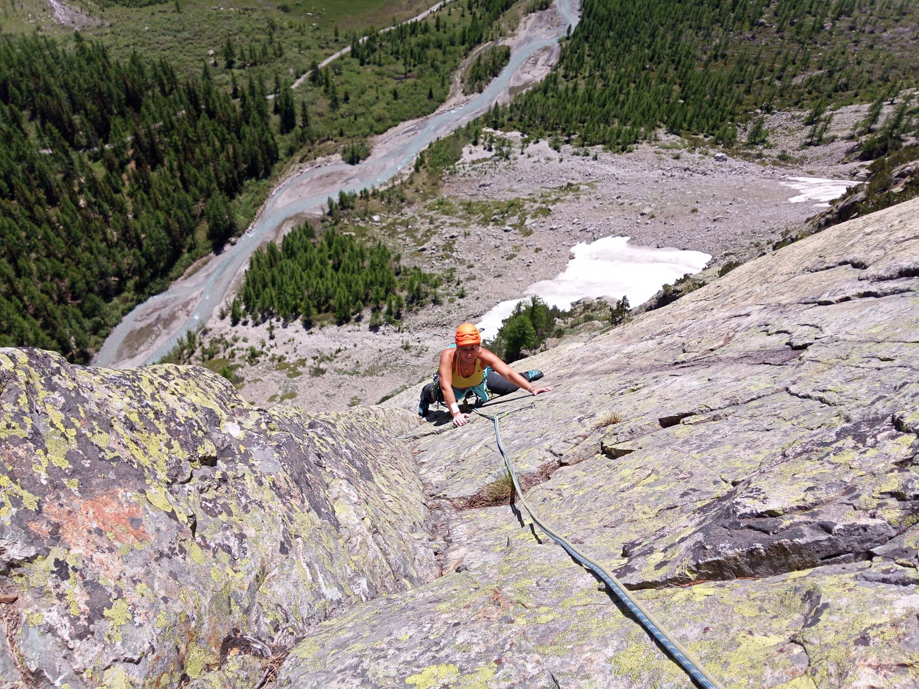
Descrizione
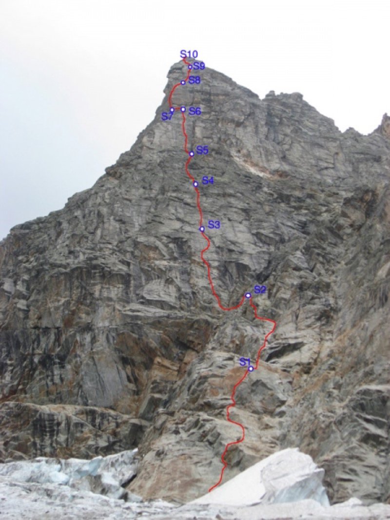
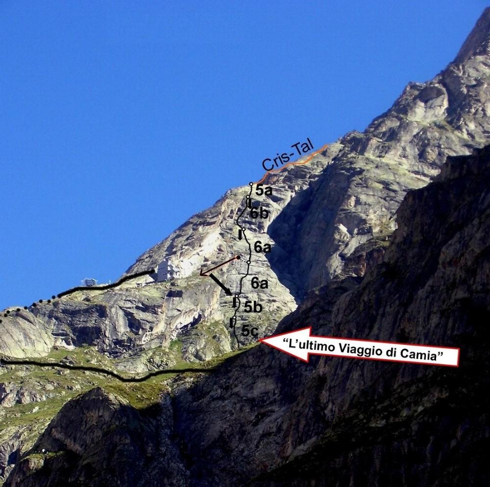
L1: 6a, 55 m 1ch. + sosta doppia
L2: 5c, 55 m 1 spit + sosta doppia
L3: 6a+,60m 2 spit + sosta doppia
L4: 5c, 55m nessuna protezione + sosta doppia
L5: 6a+, 60m 2 spit + sosta doppia
L6: 10m verso sx, sosta su uno spit in alto (spostamento) + sosta doppia
L7: 6b+,55 m + sosta
L8: 6a, 50m 2 spit, sosta su 1 spit + sosta
L9: 6a, 50m 2 spit + sosta doppia
Doppie sulla via attrezzate.
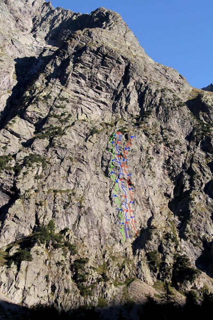
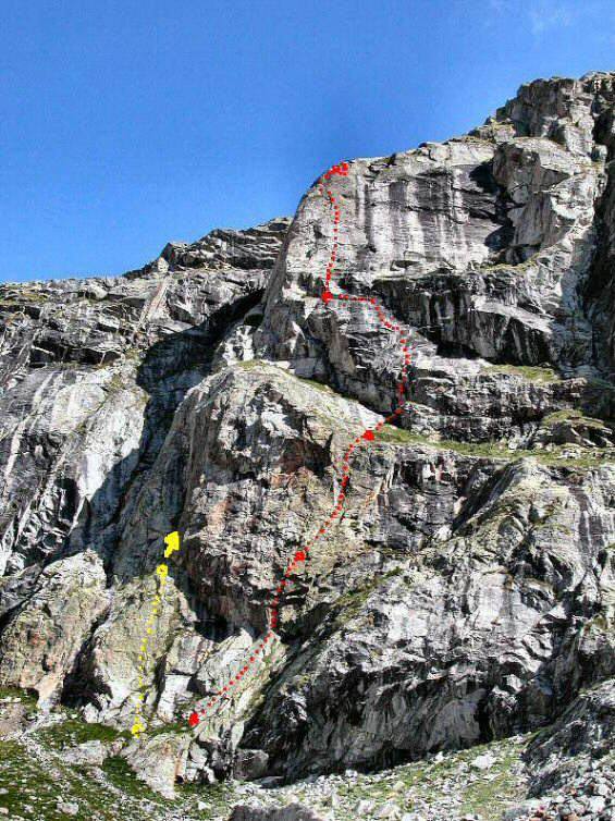
L1: 6a 55m 1 Chiodo con cordino di progressione (sosta 2 spit + maillon)
L2: 5c 55m (sosta 2 spit + maillon)
L3: 6a+ 55m 2 spit di progressione (sosta 2 spit + maillon)
L4: 5c 55m (sosta 2 spit + maillon)
L6: 6a+ 55m 1spit di progressione (sosta 2 spit + maillon)
L7: 4a 10m (sosta 1spit)
L8: 6b+ 55m (sosta 2 spit + maillon)
L9: 6a 50mt 2 spit di progressione (sosta 1 spit)
L10: 6a 50m 2 spit di progressione (sosta 2 spit + maillon)
Via aperta nell'agosto 2011 da Marco Farina, Francesco Canale ed Elia Andreola
Nelle vicinanze Mappa
Itinerari
19/08/2021 AO, Courmayeur 6c+, 6b obbl. Sud-Est
Greuvetta (Mont), Parete Est – Tempest
 950m
950m
11/08/2023 AO, Courmayeur 6a+, 6a obbl., a0 Sud-Ovest
Madeleine (Pointe) Parete Ovest – Où Va Tu Basile
 1.1Km
1.1Km
03/06/2017 AO, Courmayeur 5b, 5b obbl. Sud-Ovest
Greuvetta (Petit Mont) – Via Grassi-Meneghin
 1.3Km
1.3Km
14/07/2023 AO, Courmayeur 6b, 5c obbl. Sud
Greuvetta (Mont), avancorpo – Father&Son
 1.4Km
1.4Km
15/09/2013 AO, Courmayeur 6b+, 6a obbl. Sud
Greuvetta (Mont), avancorpo – Game Over
 1.5Km
1.5Km
24/06/2023 AO, Courmayeur 6b+, 6a obbl. Sud
Greuvetta (Mont), avancorpo – Padri Curiosi
 1.7Km
1.7Km
07/09/2024 AO, Courmayeur 6b+, 6b obbl. Sud
Greuvetta (Mont), avancorpo – Voglio Vederti Danzare
 1.7Km
1.7Km
20/08/2024 AO, Courmayeur 6b, 5c obbl. Sud
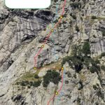
Triolet (Monts Rouges de), Punta Est – L’Ultimo Viaggio di Camia
 1.7Km
1.7Km
21/08/2024 AO, Courmayeur 6a, 5b obbl. Sud
Triolet (Monts Rouges de), Punta Est – Cris-Tal
 1.7Km
1.7Km
09/07/2011 AO, Courmayeur 6b, 6a obbl. Sud
Triolet (Monts Rouges de), Contrafforti del Rifugio Dalmazzi – Quelli che la Montagna
 1.7Km
1.7Km
Servizi
1.8Km
3.6Km
Lavachey Albergo
Courmayeur
8.6Km
Cabane de l’A Neuve Rifugio
La Fouly 9Km
9Km
Chalet le Dolent B&B
La Fouly 9Km
9Km
Hôtel du Col de Fenêtre Albergo
La Fouly 9.2Km
9.2Km
Majya-Joie Ristorante
La Fouly 9.2Km
9.2Km
Auberge de Maya Joie Albergo
La Fouly 9.4Km
9.4Km
Zanskar Sport Servizi
La Fouly 9.4Km
9.4Km
Auberge des Glaciers Albergo
La Fouly 9.4Km
9.4Km