3.3Km
3.3Km

Note
Storico
 2.3Km
2.3Km
3.3Km
3.3Km
4.3Km
4.5Km
8.6Km
8.6Km
8.8Km
8.9Km
2.3Km
2.3Km
3.3Km
3.3Km
4.3Km
4.5Km
8.6Km
8.6Km
8.8Km
8.9Km
3.3Km
4.5Km
4.5Km
4.5Km
7.9Km
8.1Km
8.3Km
8.3Km
8.6Km
9Km
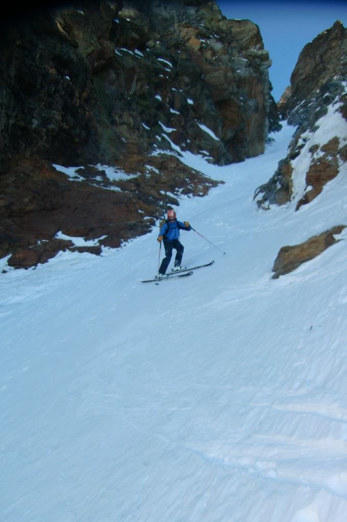
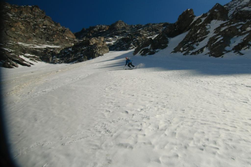
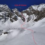
ATTENZIONE itinerario da percorrere con condizioni di neve sicurissime e in generale con condizioni "secche", poichè le pareti laterali possono scaricare.
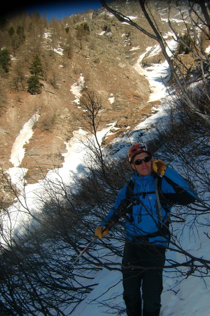
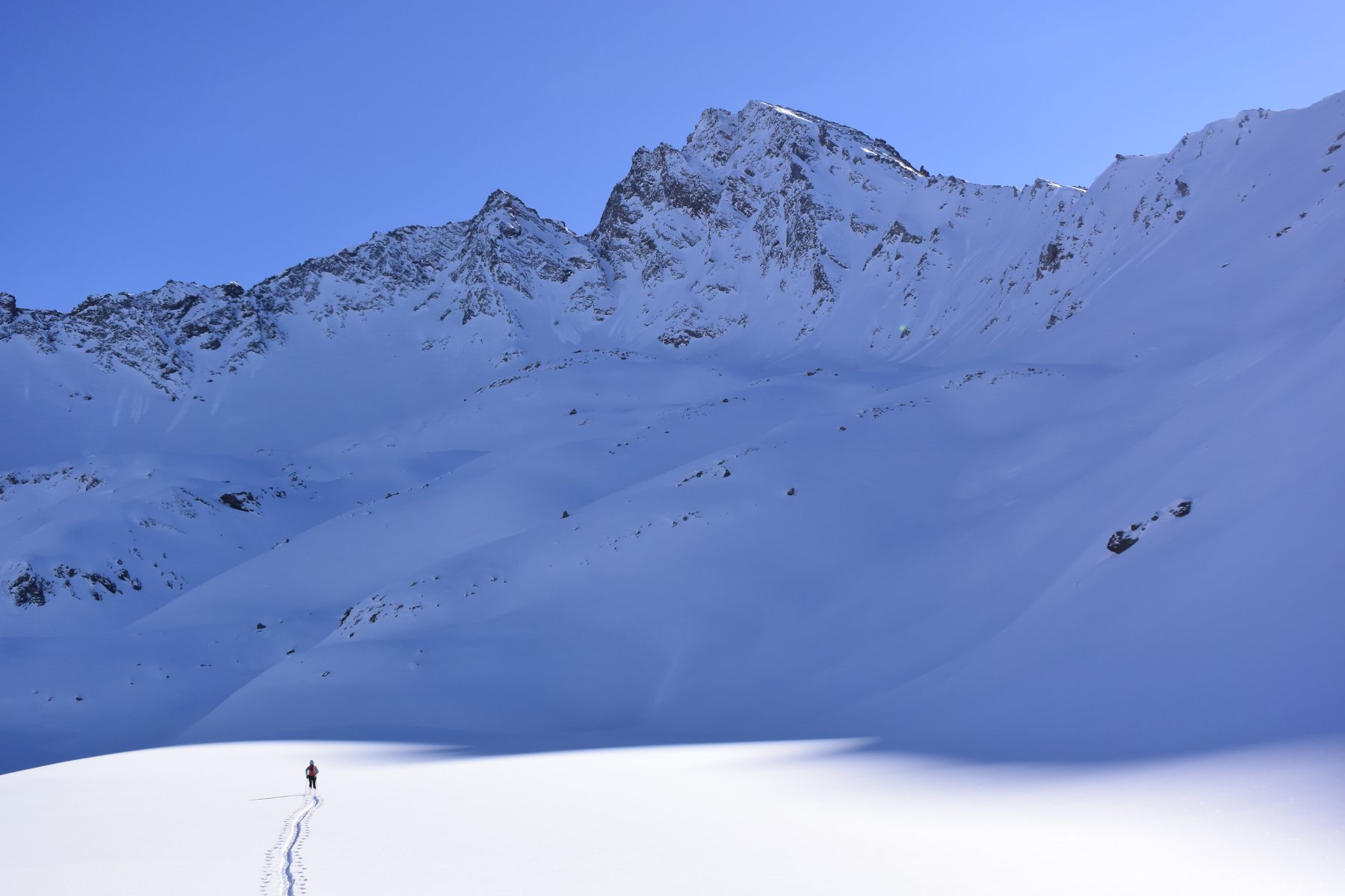
Avvicinamento
.
Descrizione
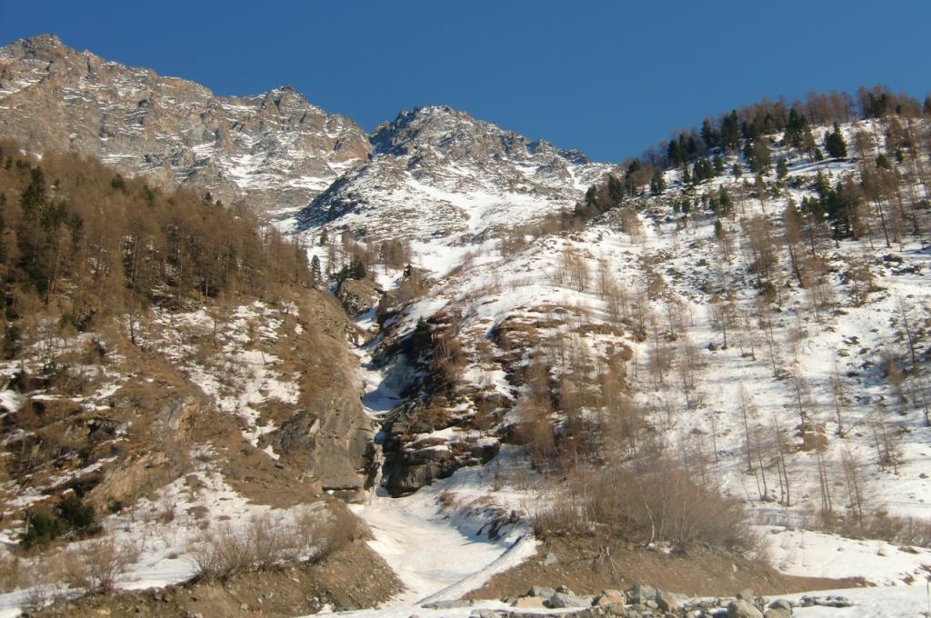
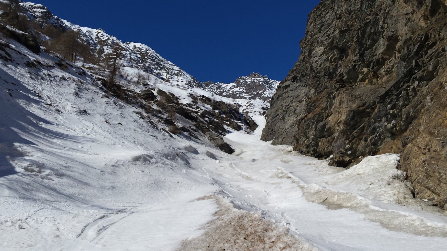
Dopo la frazione di Melignon giungere ad un rettilineo ed entrare in un lungo paravalanghe quasi interrato, parcheggiare all’uscita di esso, piccolo spiazzetto sulla destra.
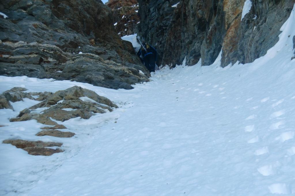
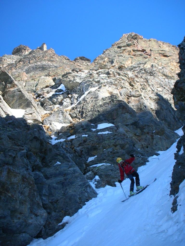
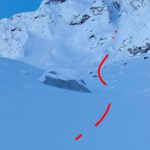
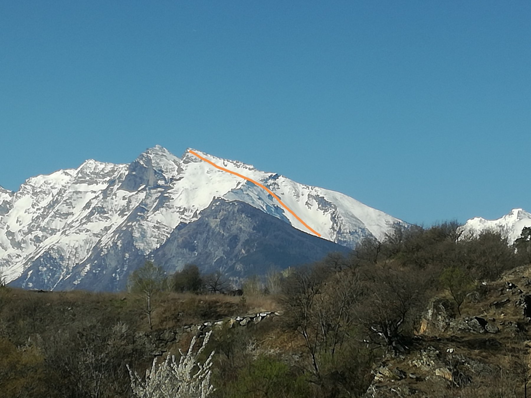
Il canale si può intuire già dalla strada sul versante destro orografico della valle.
Attraversare la strada e iniziare a salire in direzione ovest a destra (faccia a monte) della briglia del paravalanghe.
Dal suo termine risalire per bosco rado e appena possibile immettersi nel fondo del canale che si trova sopra il primo salto della cascata.
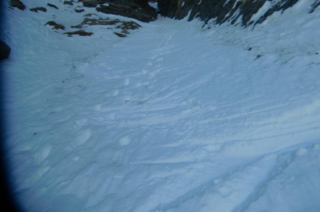
Percorrere il canale e al suo termine uscire sulla destra per una ripida rampa.
A questo punto con percorso meno obbligato spostarsi progressivamente a sinistra fino in prossimità del grande conoide che scende dal canale.
Da qui entrare nel canale e percorrerlo fino al suo termine.
Si incontra solo un bivio in cui bisogna tenere la sinistra anche se a prima vista sembra il passaggio meno comodo poichè più stretto.
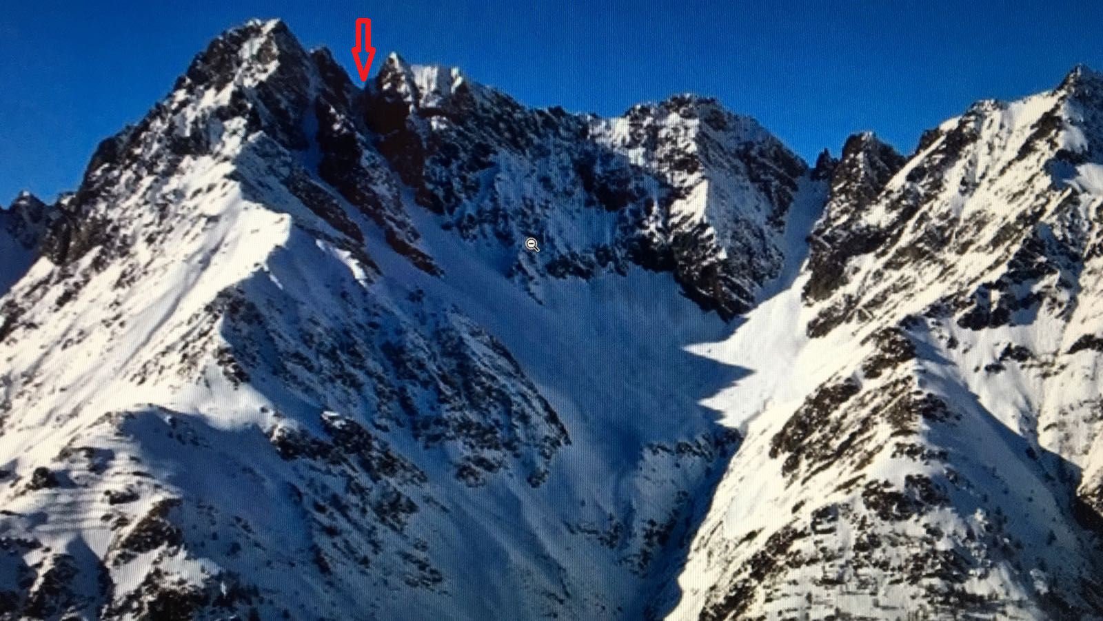
Dal colletto (3.383 mt), se innevato possibilità di uscire in punta.
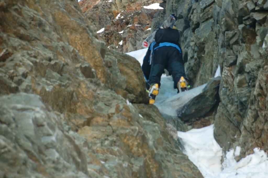
Attenzione, a circa 70 metri dal colletto dove muore il canale c’è una piccola goulotte di circa dieci metri con una prima parte su neve a cui succede una strettoia prima di misto e poi di ghiaccio.
Se pur non difficile, conviene avere con se un paio di ramponi abbastanza seri e almeno una picca buona.
Per la discesa l’ideale sarebbe attrezzare una doppia per comodità e sicurezza.
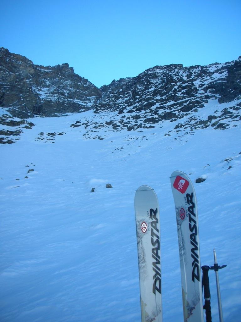
Canale di 700 metri scovato dall'inesauribile curiosità di Andrea Bormida, scrupoloso esploratore "intervallivo", meticoloso organizzatore e caparbio condottiero quando dal pensiero si passa all'azione.
- Cartografia:
- I.G.C. 3
Nelle vicinanze Mappa
Itinerari
13/03/2026 AO, Rhemes-Saint-Georges D+ 1330 m I, 4.2, E2 Nord-Est
Feluma (Col de) Couloir NE
 2.3Km
2.3Km
15/02/2025 AO, Rhemes-Saint-Georges D+ 1270 m I, 4.1, E2 Est
Tsaboc (Punta di) cresta Est spalla 2950 m – Il Budello del Courthoud
 2.3Km
2.3Km
03/02/2024 AO, Rhêmes-Notre-Dame D+ 1193 m I, 4.2, E1 Sud-Est
Cussunaz o Cussuna (Colle di) Canali SE
 3.3Km
3.3Km
25/02/2017 AO, Rhêmes-Notre-Dame D+ 1361 m I, 4.2, E1 Est
Tey o Tei (Becca), brèche 3053 m Couloir Est
 3.3Km
3.3Km
05/04/2026 AO, Rhêmes-Notre-Dame D+ 1120 m II, 3.3, E1 Est
Fenetre (Col) da Rhemes Notre Dame
 4.3Km
4.3Km
05/03/2026 AO, Rhêmes-Notre-Dame D+ 1350 m III, 4.2, E3 Nord-Ovest
Tsambeina (Becca) Canale Nord
 4.5Km
4.5Km
18/12/2025 AO, Valgrisenche D+ 1400 m II, 3.3, E2 Varie
Tey o Tei (Becca), brèche 3053 m da Mondanges
 8.6Km
8.6Km
03/02/2018 AO, Valgrisenche D+ 1500 m II, 4.2, E2 Nord-Ovest
Tey o Tei (Becca) Canale NO
 8.6Km
8.6Km
21/04/2024 AO, Valsavarenche D+ 1784 m III, 4.2, E2 Est
Rolettaz (Monte) da Creton
 8.8Km
8.8Km
14/05/2019 AO, Introd D+ 1180 m I, 4.1, E1 Nord-Est
Merlo (Becca del) o di Chamin Pendio NE
 8.9Km
8.9Km
Servizi
3.3Km
4.5Km
Galisia Albergo
Rhemes-Notre-Dame
4.5Km
Tanini Ristorante
Rhemes-Notre-Dame
4.5Km
Lo Sabot Albergo
Rhemes-Notre-Dame
7.9Km
Benevolo Rifugio
Rhêmes-Notre-Dame
8.1Km
Chalet de L’Epée Rifugio
Valgrisenche
8.3Km
Lo Fourquin Bar
Valsavarenche
8.3Km
Abro de la Leunna Ristorante
Valsavarenche
8.6Km
La Tana delle Volpi Ristorante
Valgrisenche
9Km