3.8Km
3.8Km

Note
 450m
1.8Km
1.9Km
1.9Km
2.6Km
3.4Km
3.6Km
3.7Km
3.7Km
450m
1.8Km
1.9Km
1.9Km
2.6Km
3.4Km
3.6Km
3.7Km
3.7Km
3.8Km
4.3Km
4.9Km
5.5Km
5.5Km
5.7Km
6.6Km
7Km
7.4Km
7.7Km
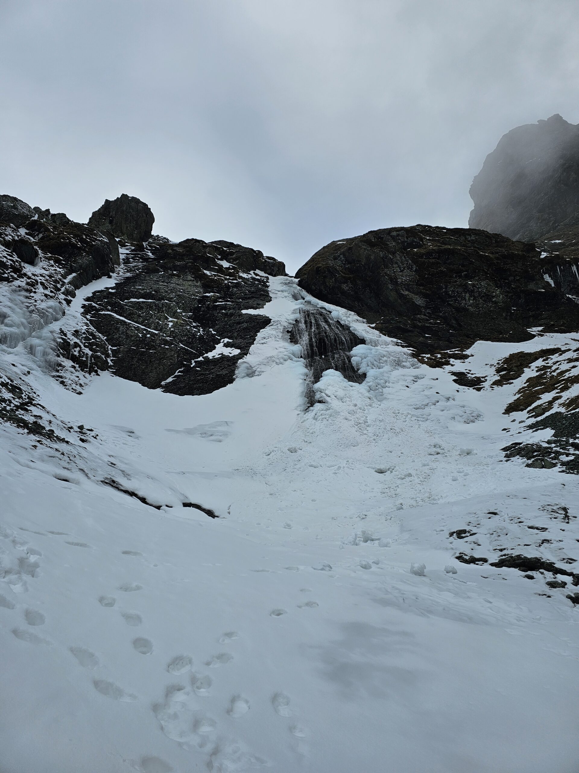
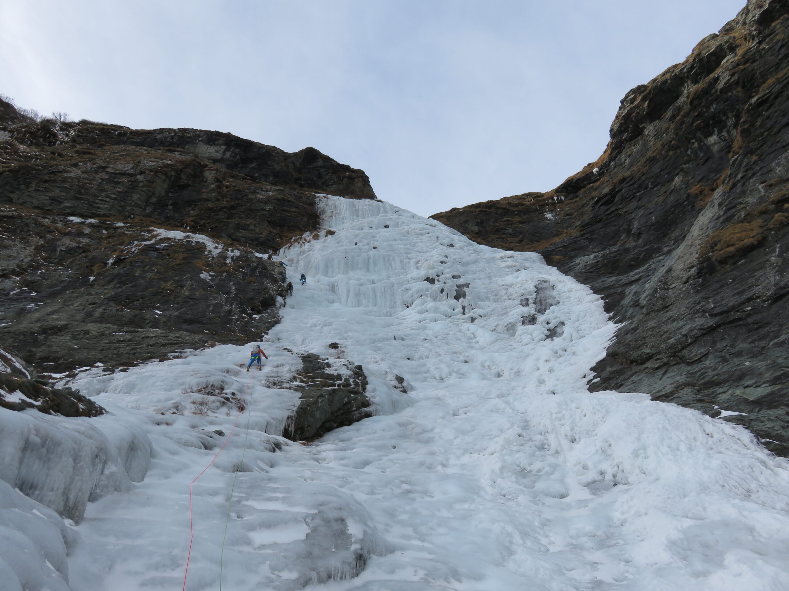
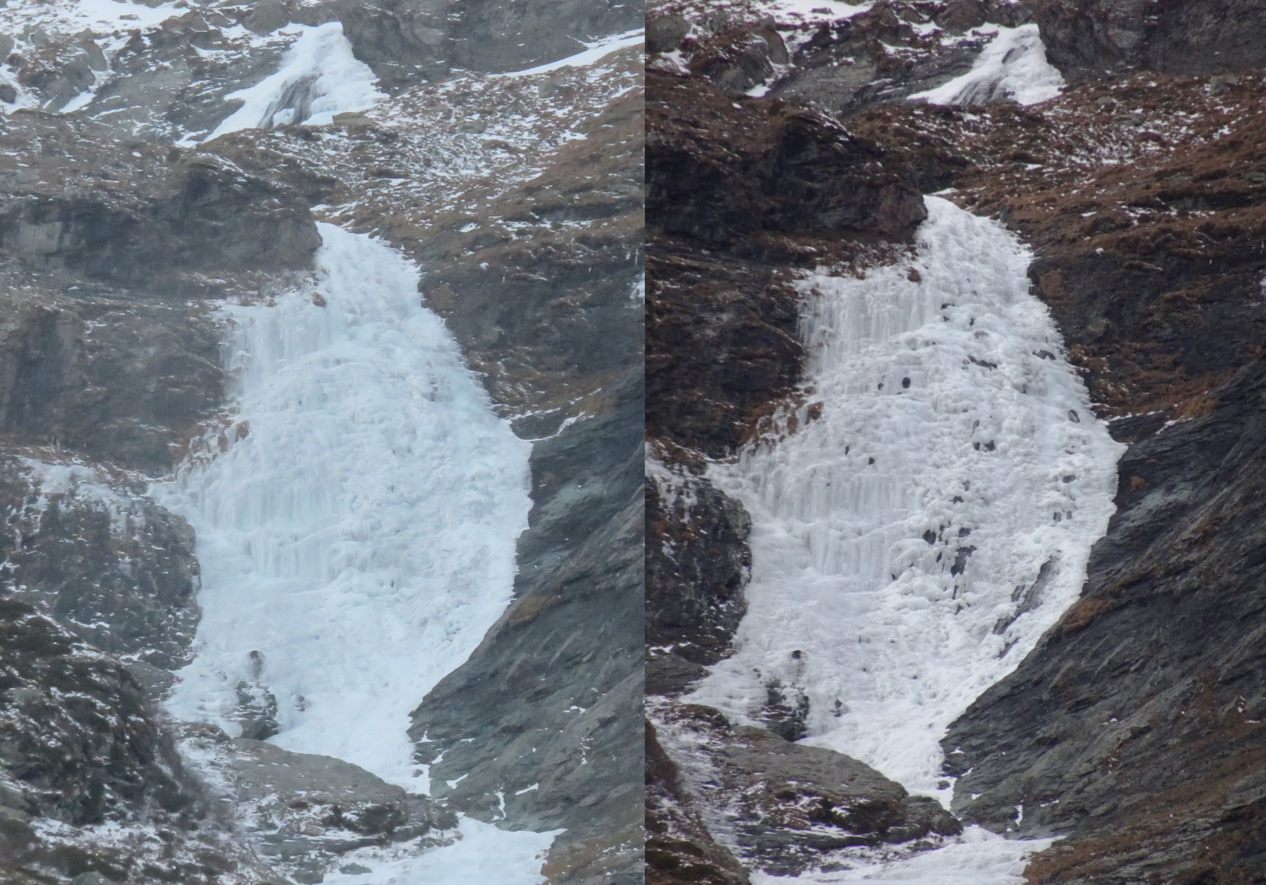
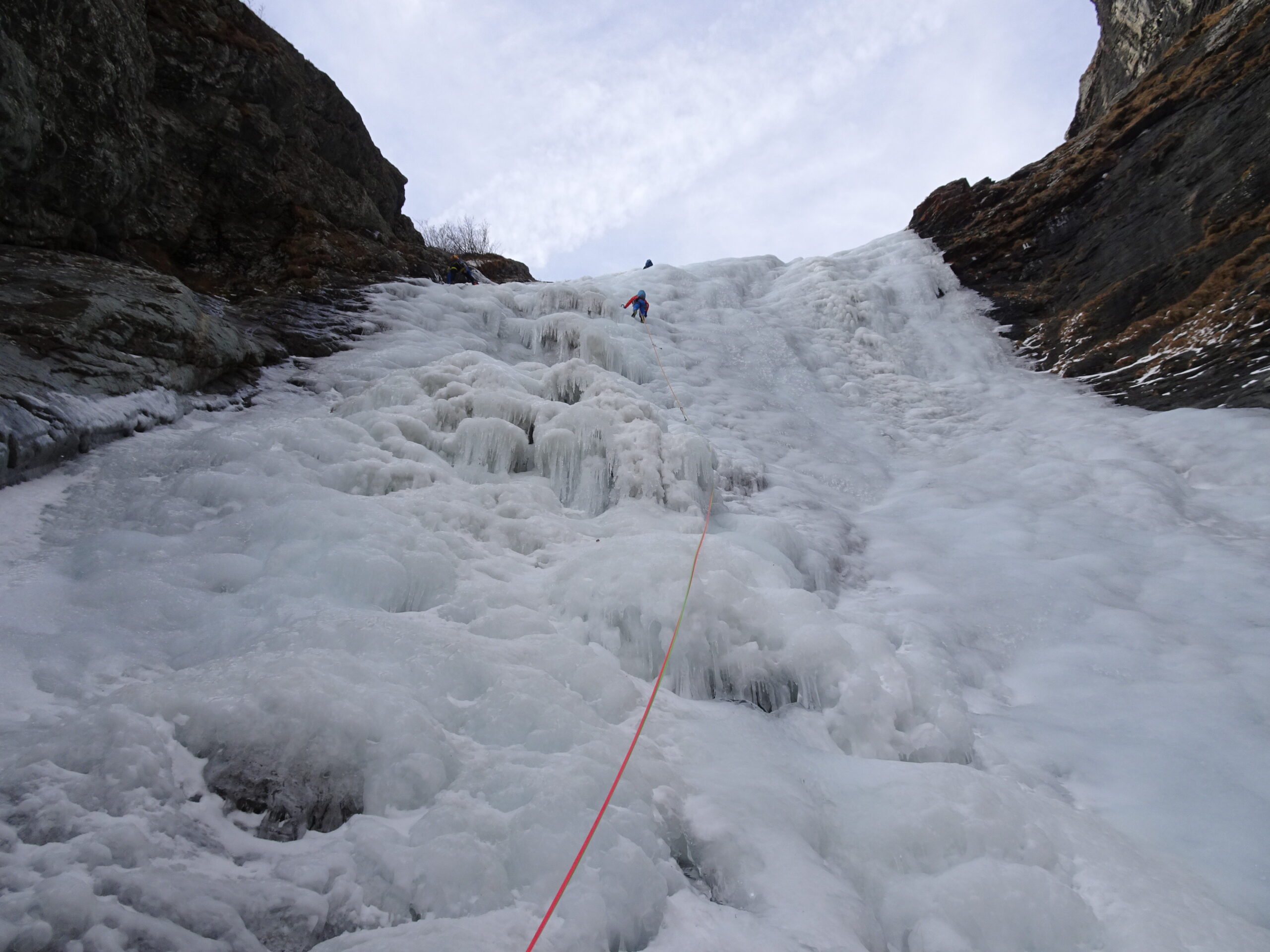
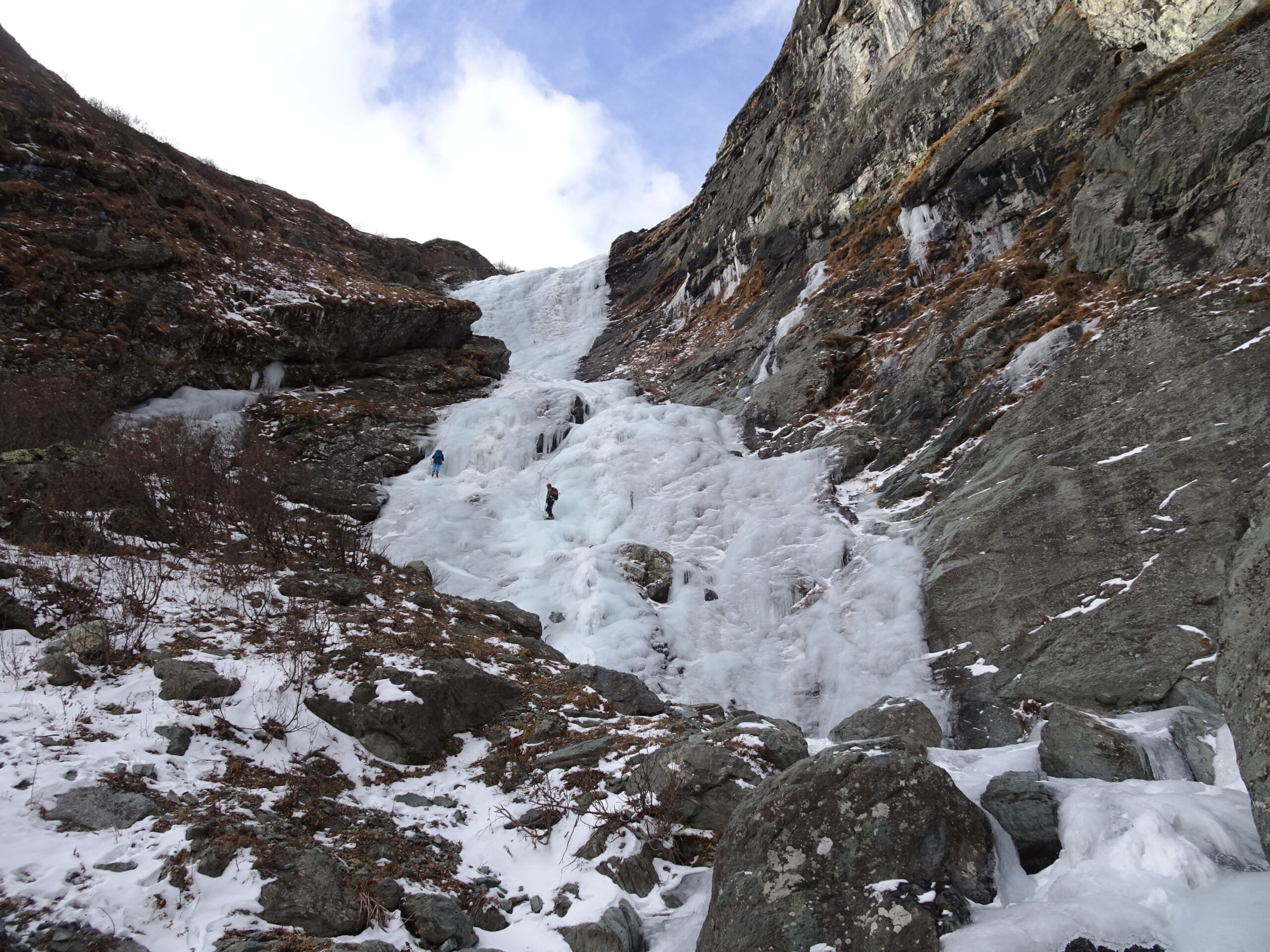
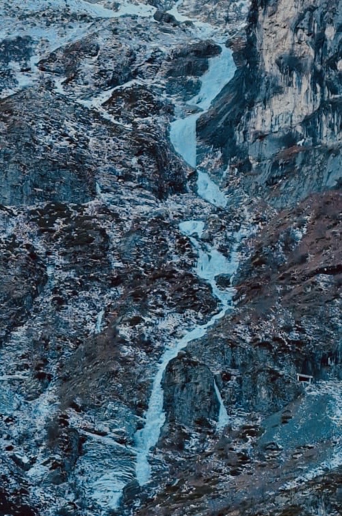
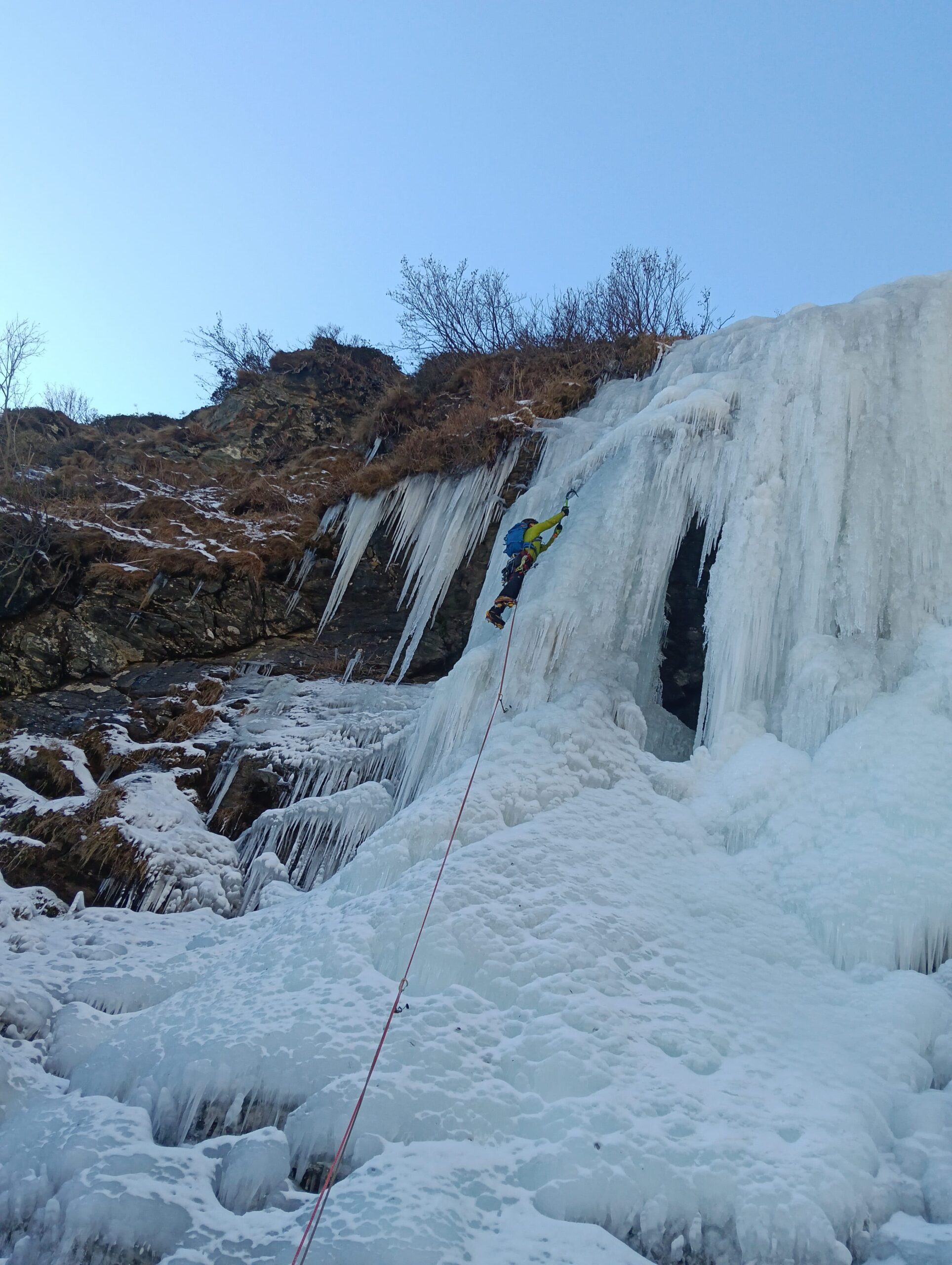
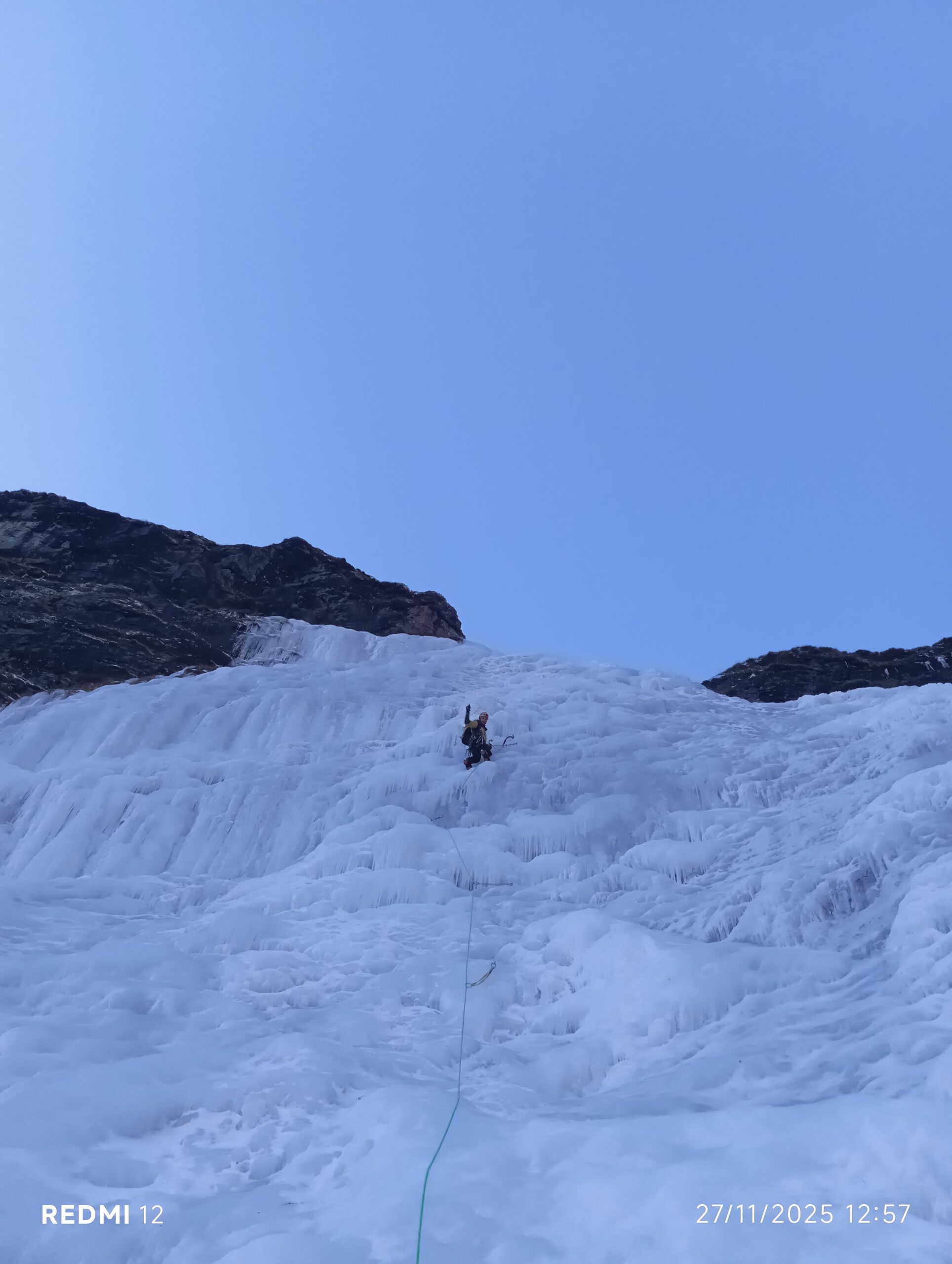
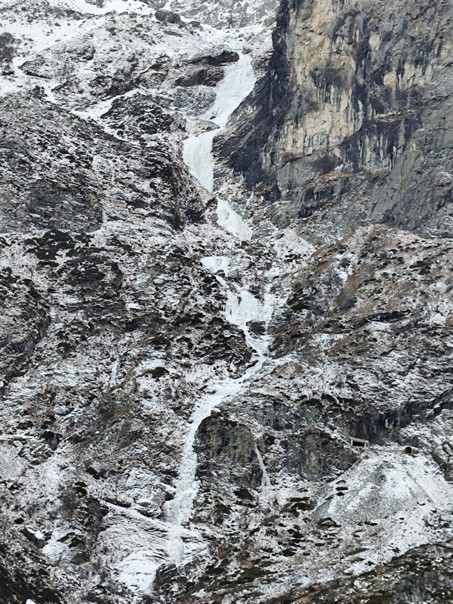
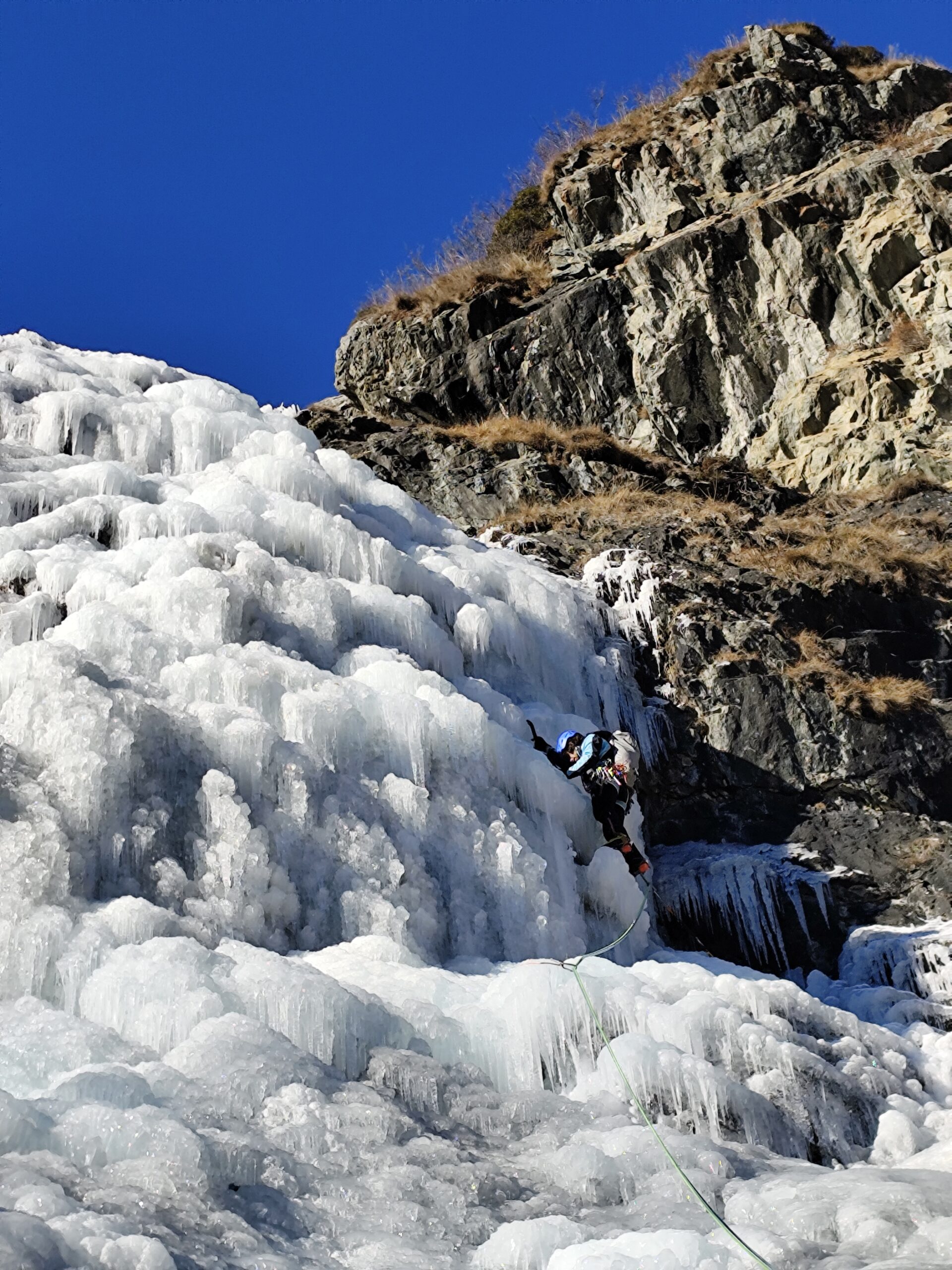
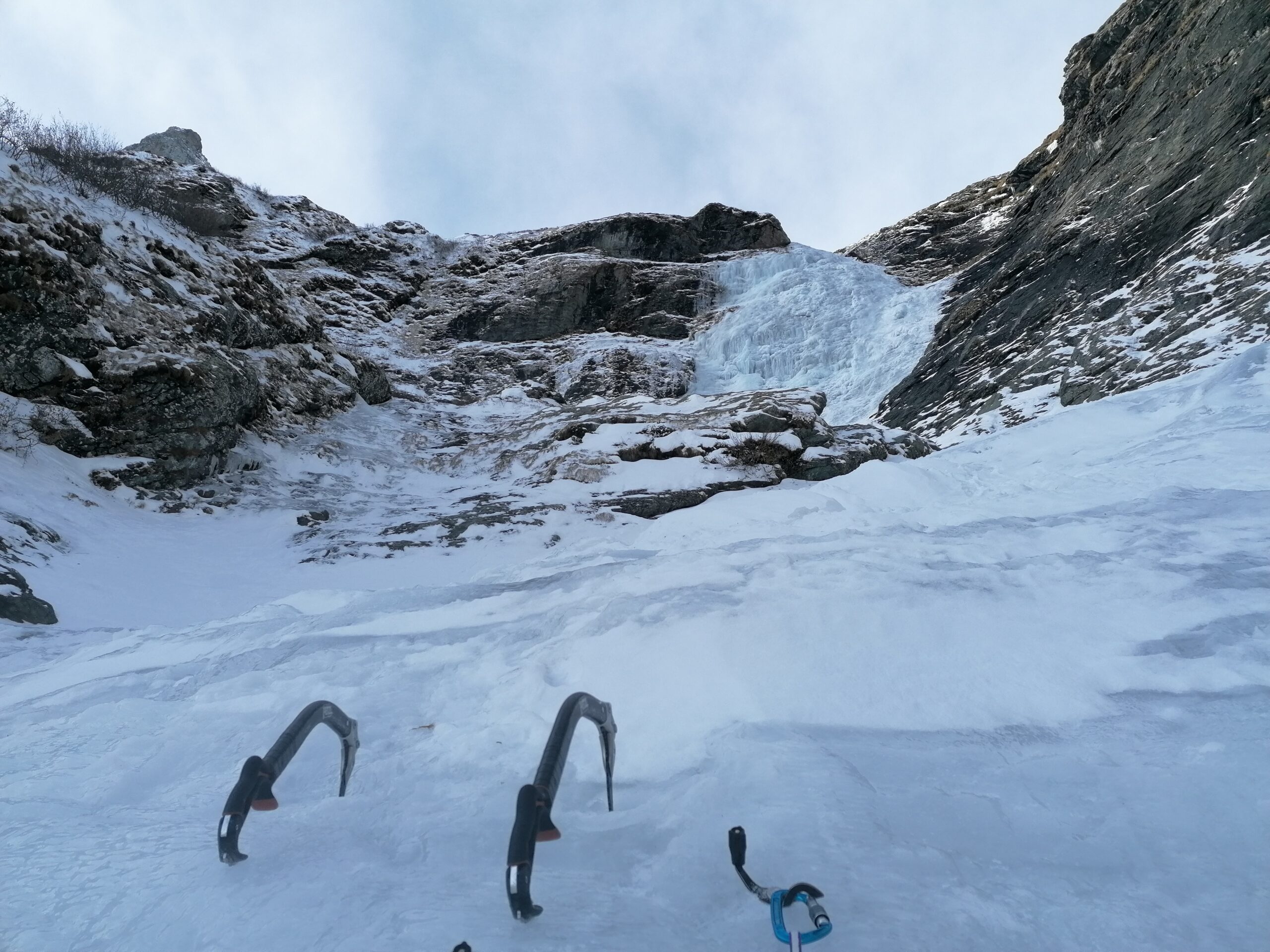
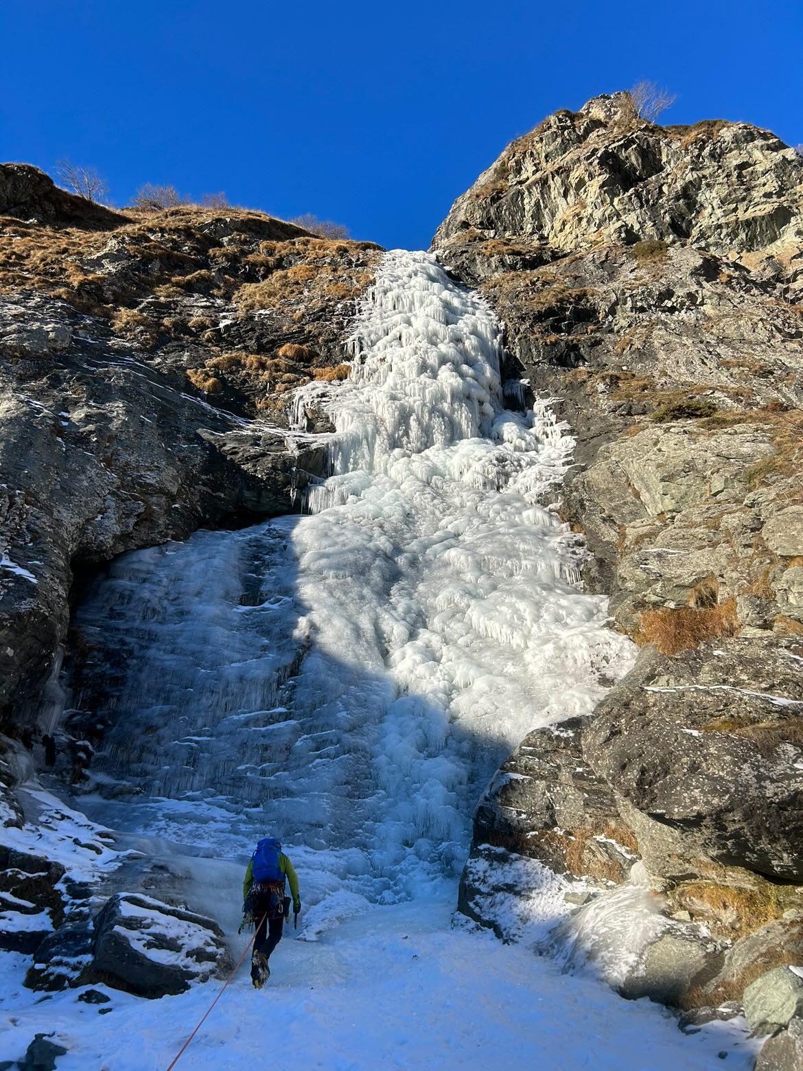
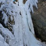
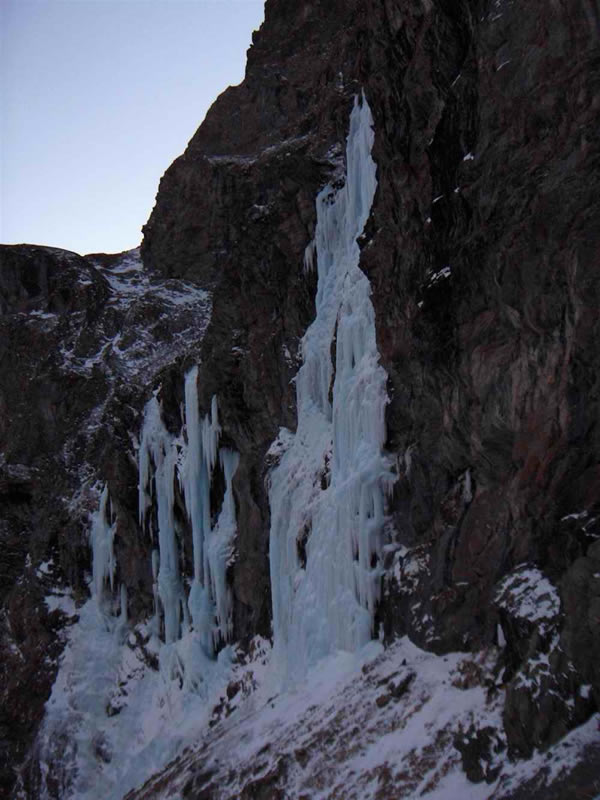
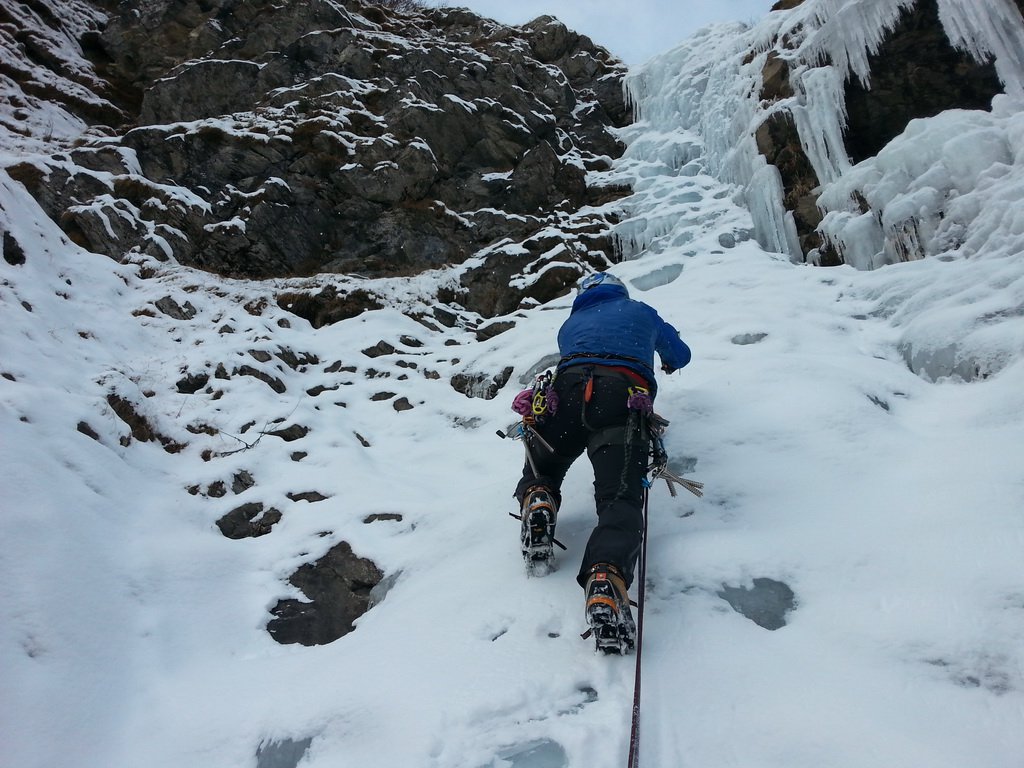
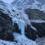
Cascata imponente, necessita di ottime condizioni per formarsi e per essere percorsa. Necessario scarso innevamento e temperature fredde, nonostante ciò il flusso d’acqua sotto è sempre presente e voluminoso.
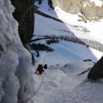
3 grossi muri con notevoli quantità di ghiaccio, difficoltà variabili dal 3 al 4, si alternano a brevi risalti e trasferimenti.
Avvicinamento
3 grossi muri con notevoli quantità di ghiaccio, difficoltà variabili dal 3 al 4, si alternano a brevi risalti e trasferimenti.
SP32 fino a Usseglio, in frazione Villaretto prendere la strada che sale verso destra dietro il ristorante "La Furnasa" , risalire il vallone d'Arnas fino a quota 1600 m (Pian Sulé) dove c'è il bivio per il lago della Torre e la sbarra (verso destra). A questo bivio mantenere la sinistra in direzione di un vecchio chalet di legno (Alpe Sulè, 1690m) ; parcheggiare la macchina. Da qui dirigersi verso il fiume "Gurie", attraversarlo e risalire un sentiero verso la cascata ben visibile.
Nel caso la sbarra sia chiusa a Castello, contare 1h di avvicinamento partendo da 1350m.
Descrizione
Nel caso la sbarra sia chiusa a Castello, contare 1h di avvicinamento partendo da 1350m.
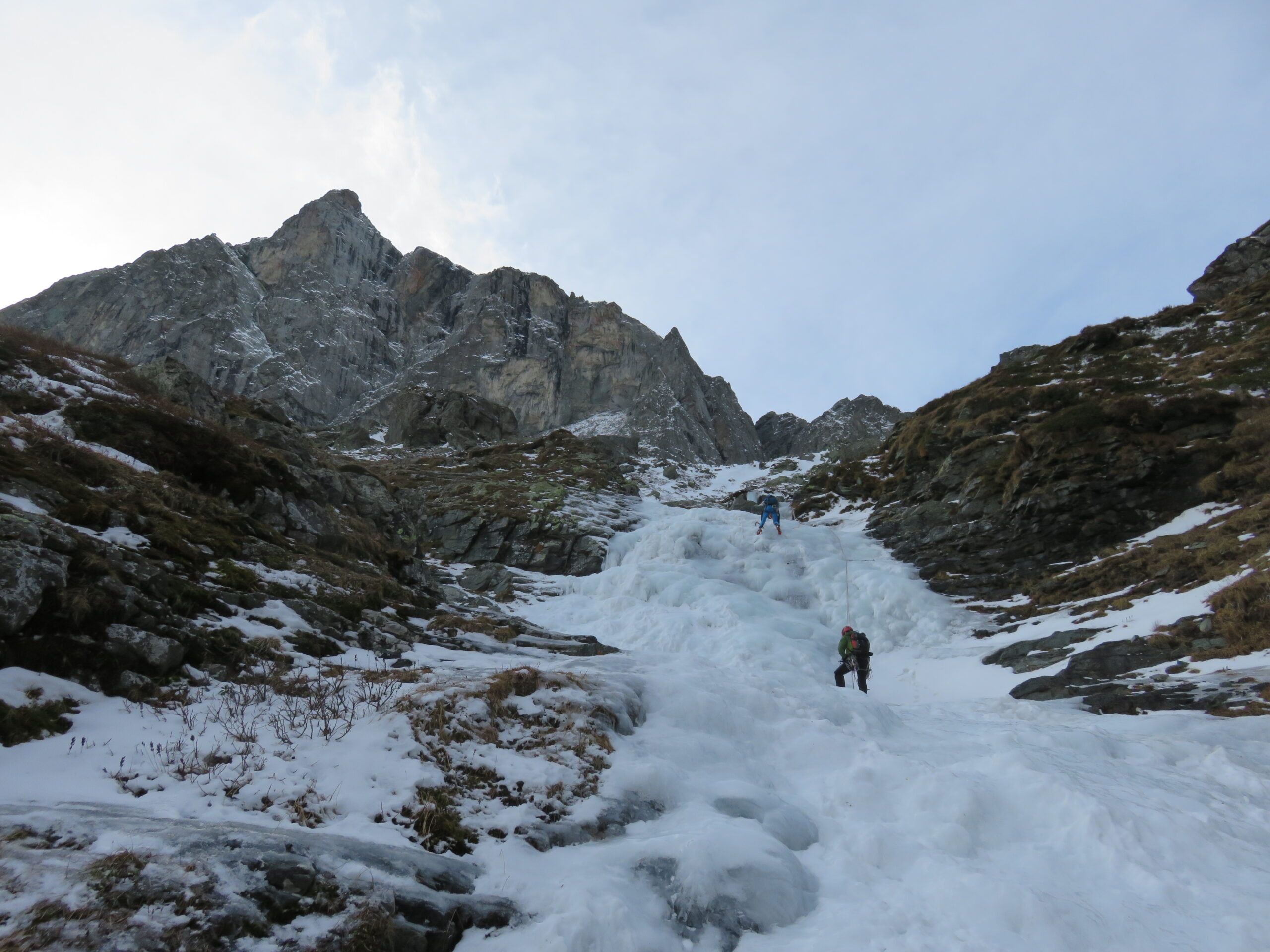
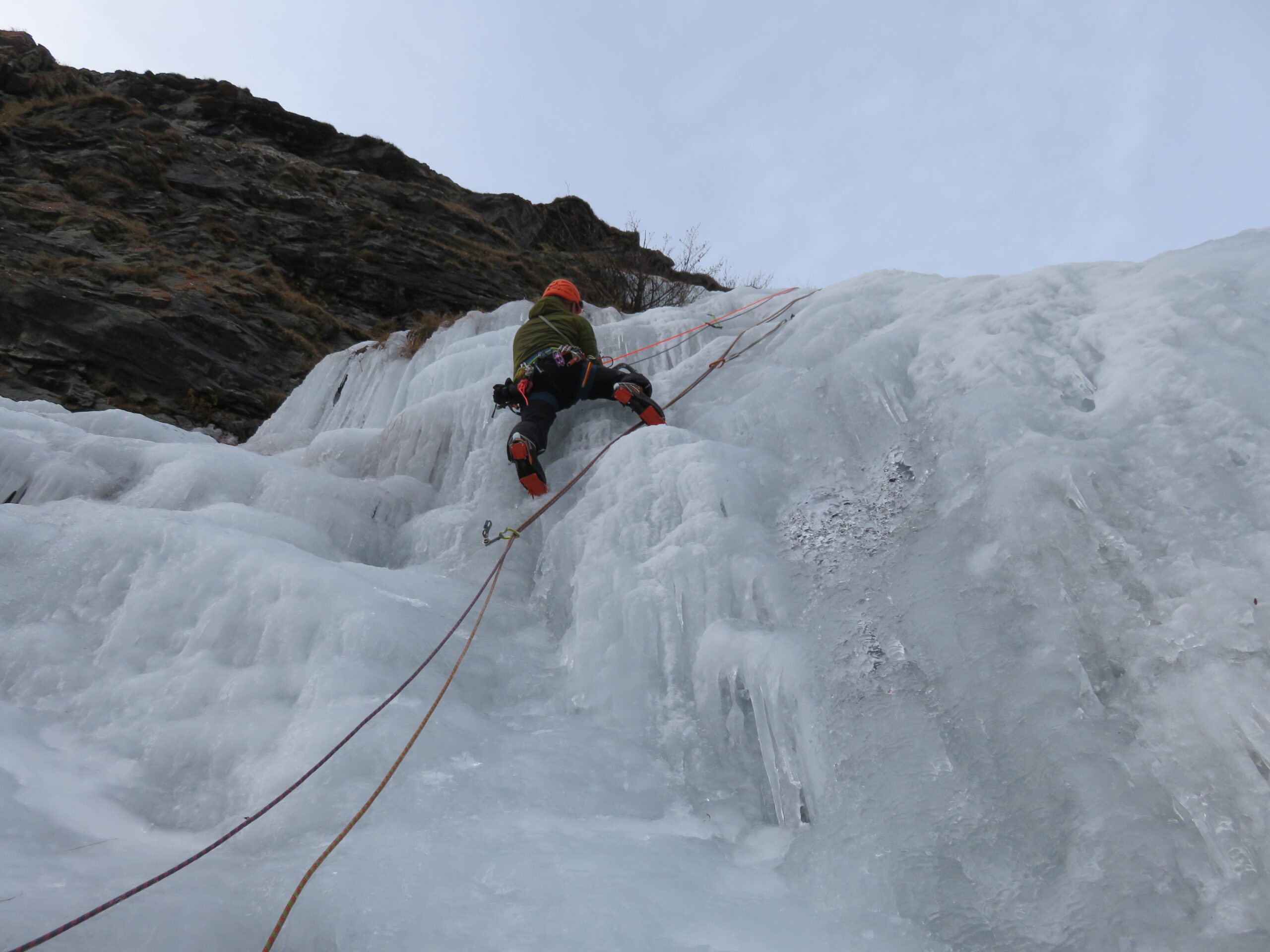
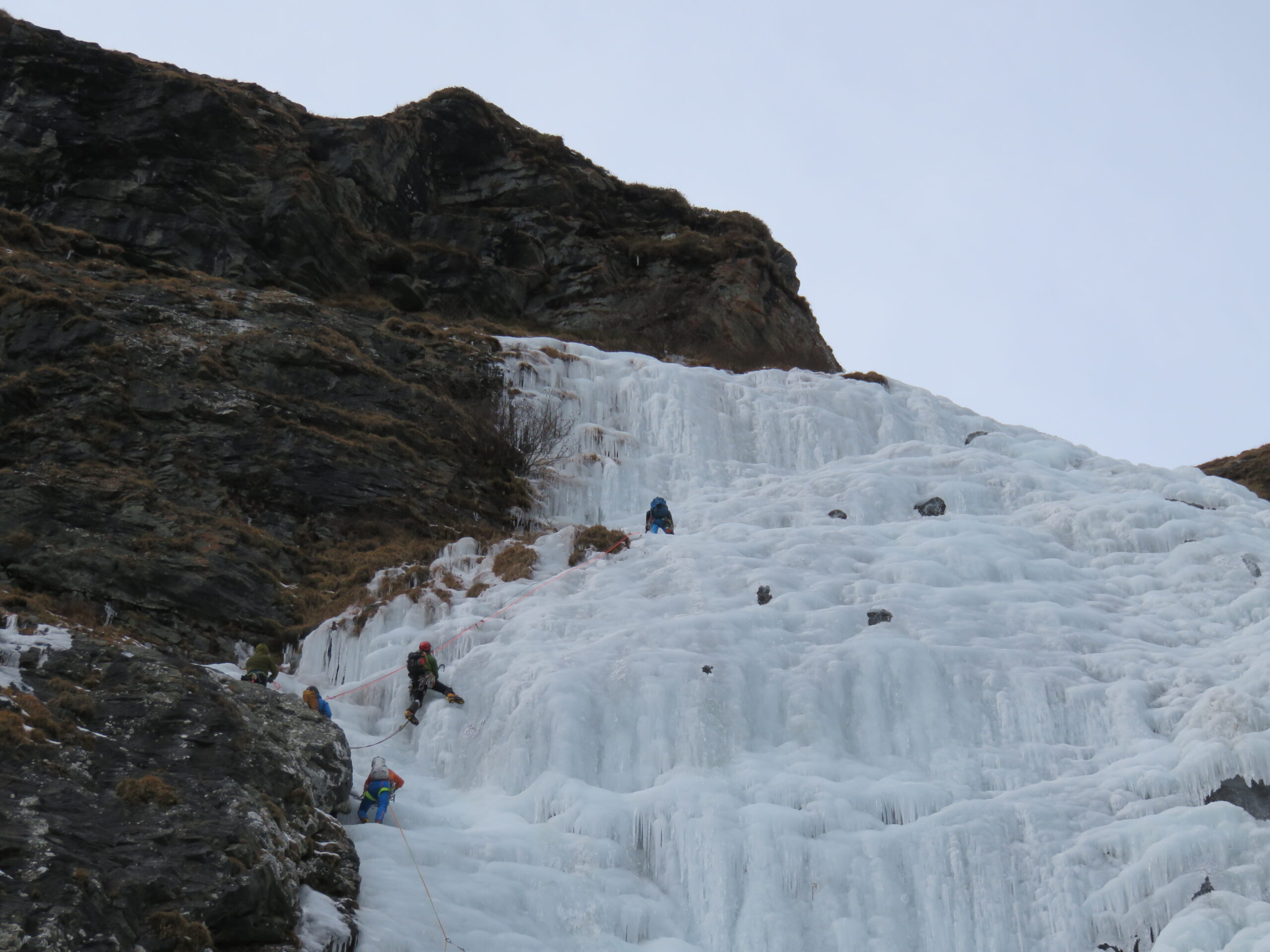
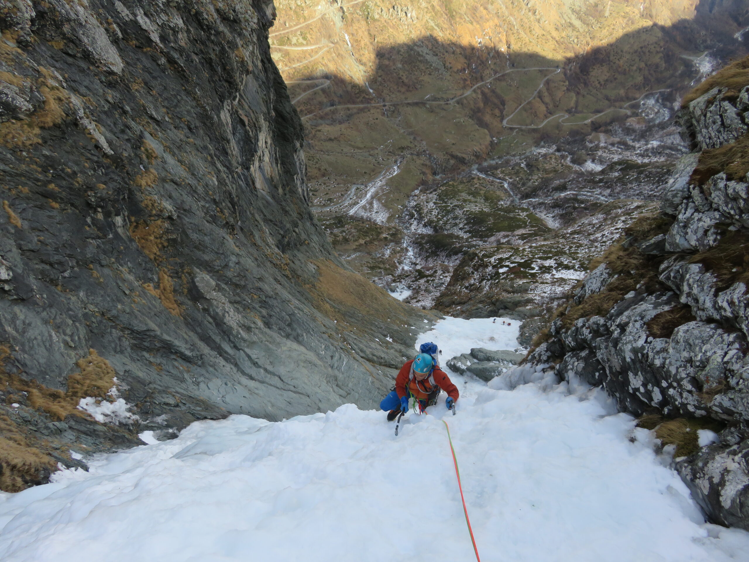
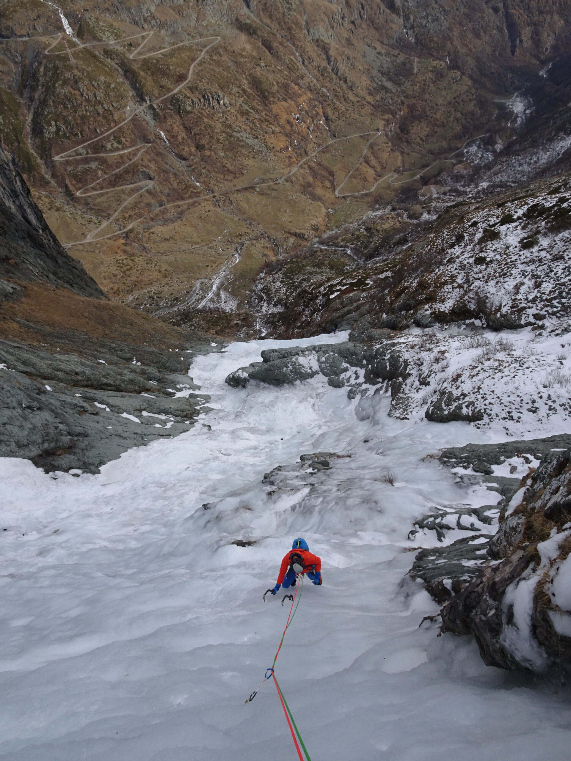
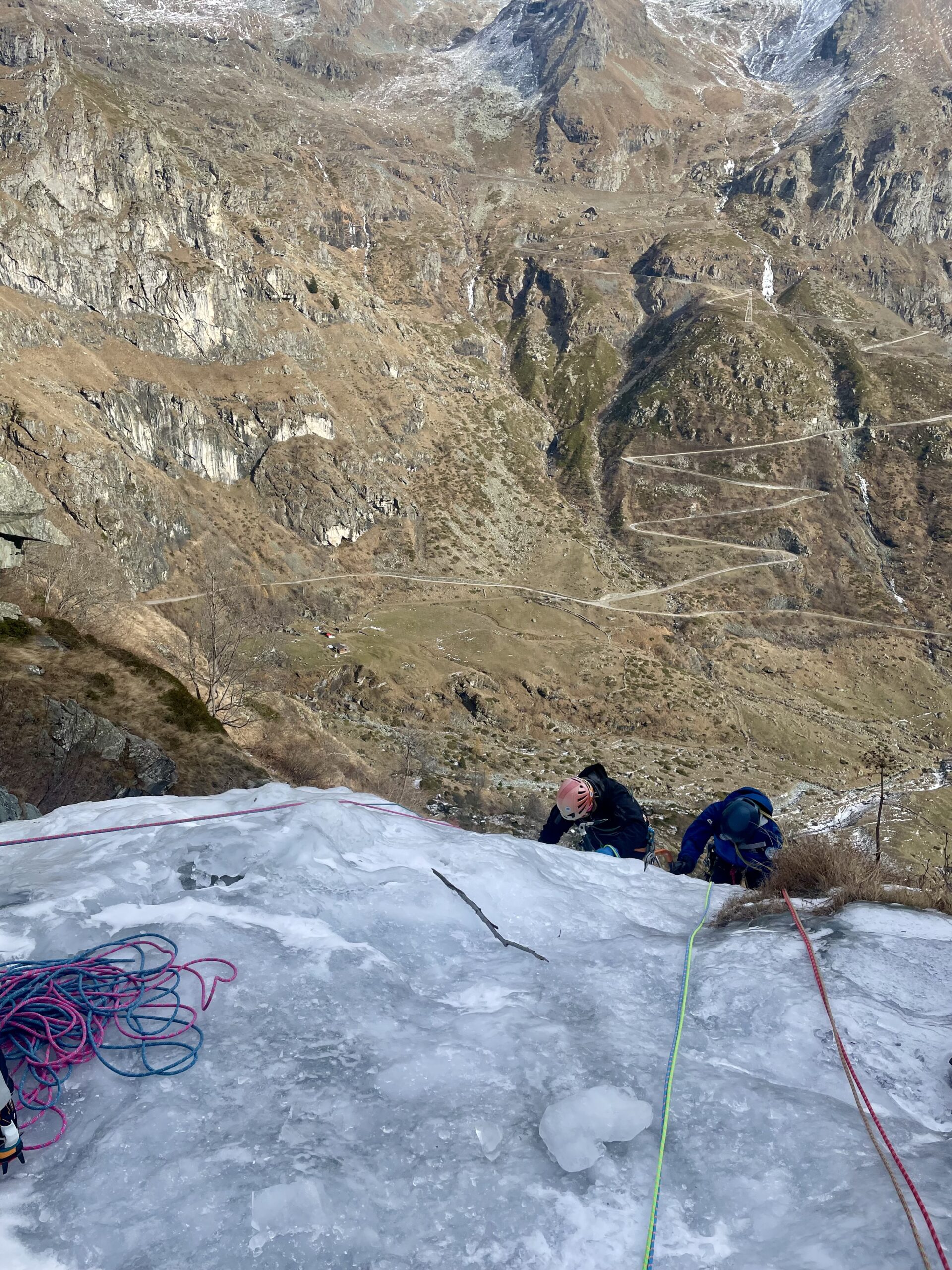
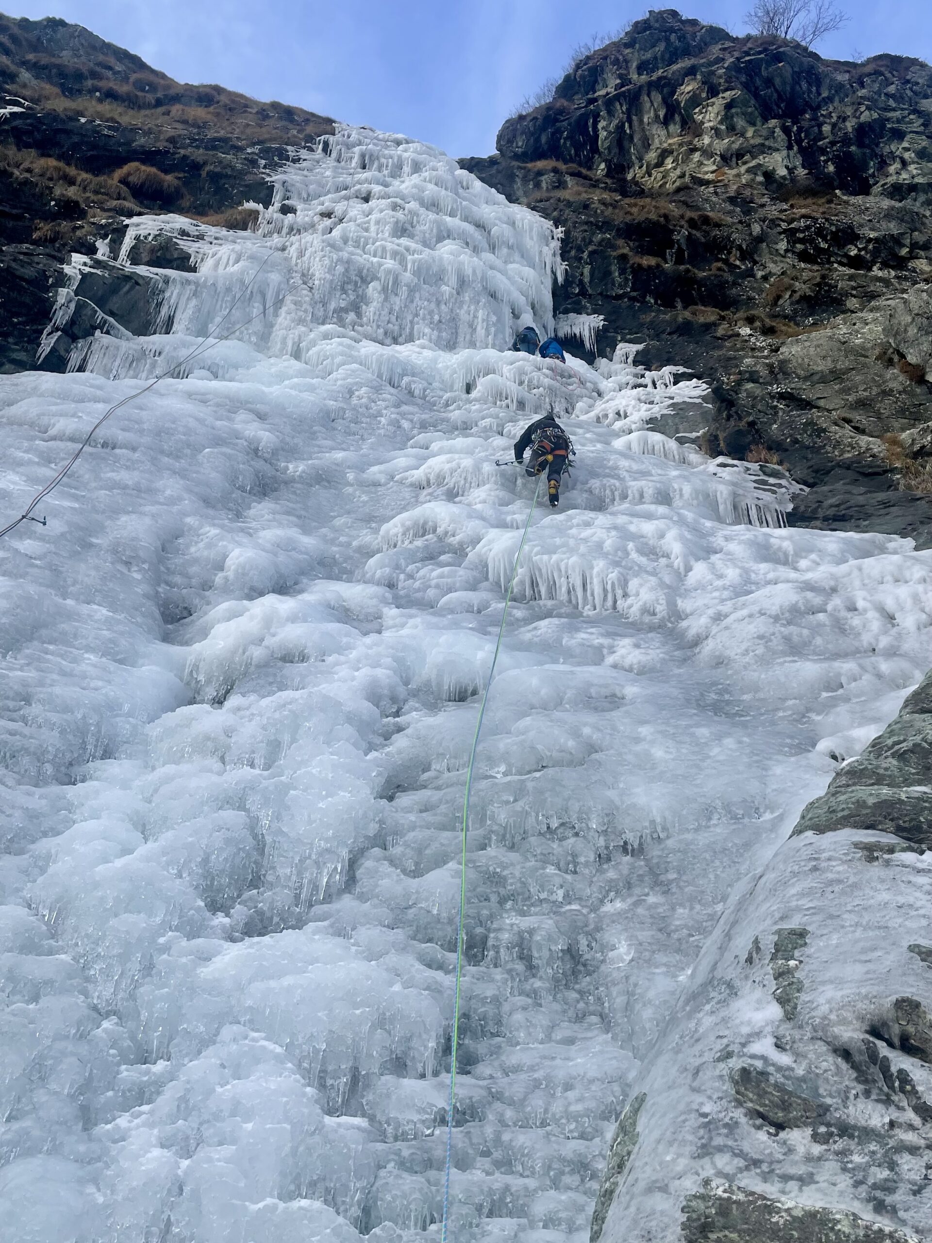
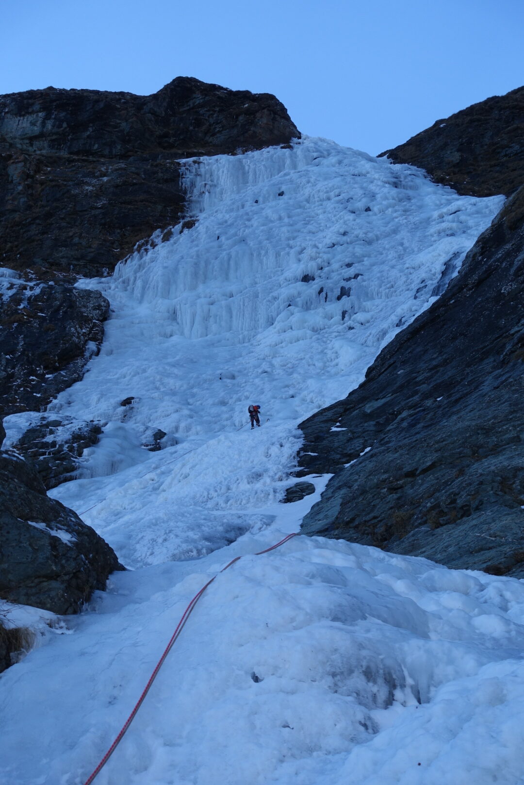
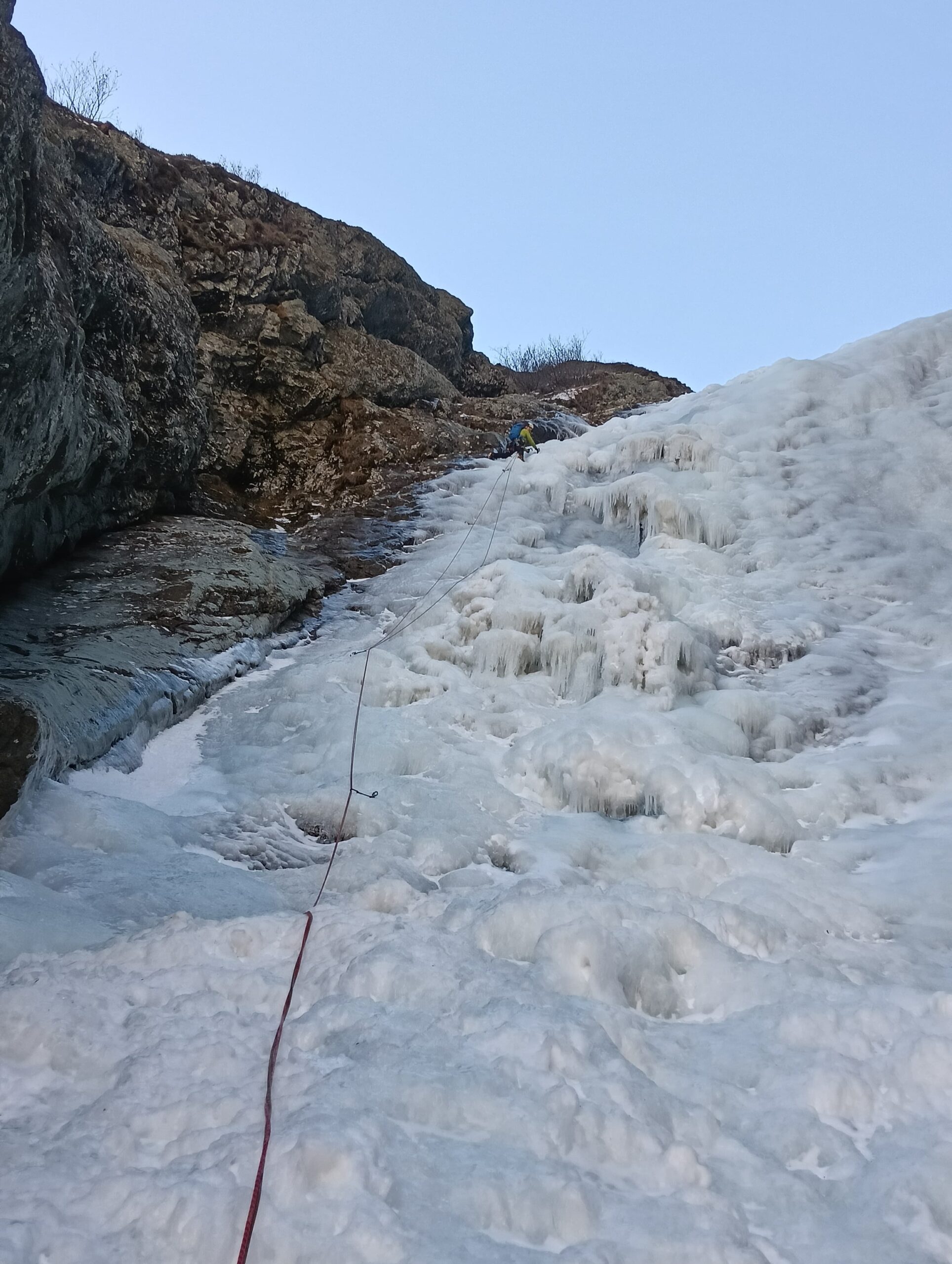
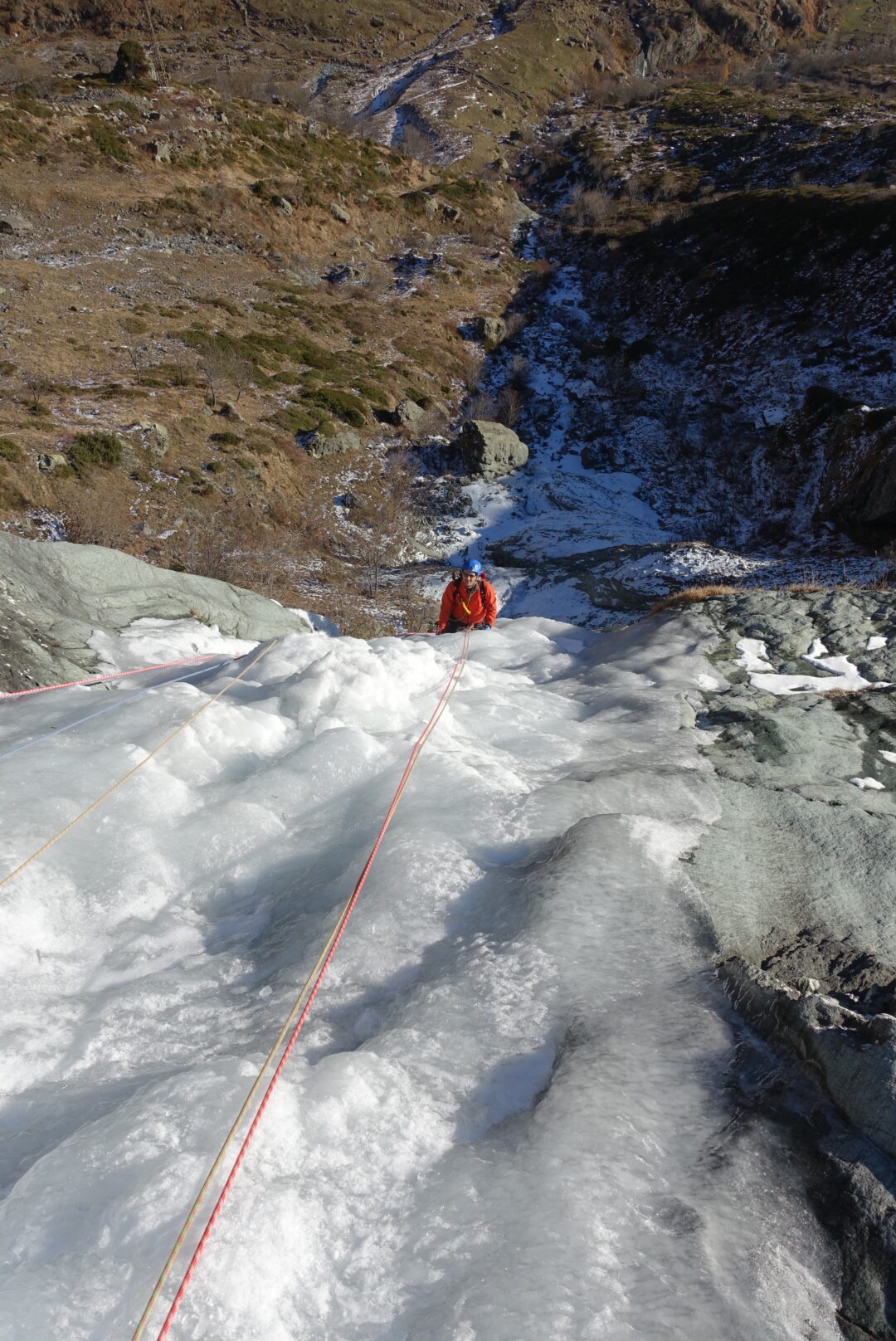
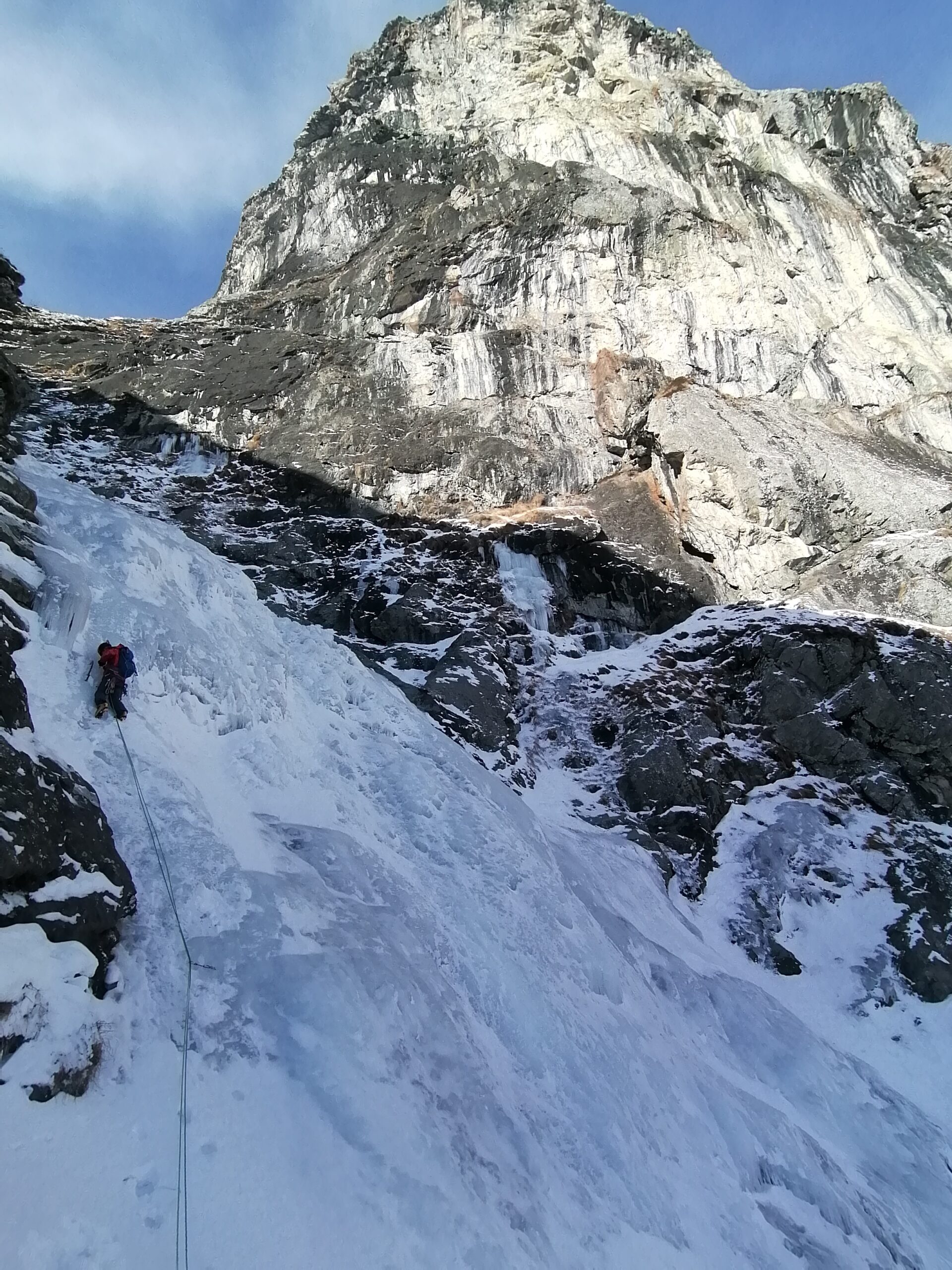
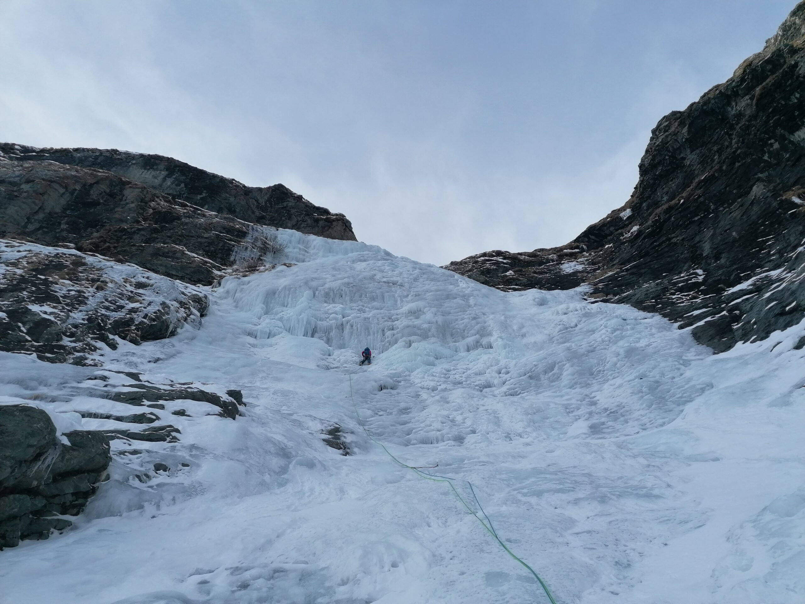
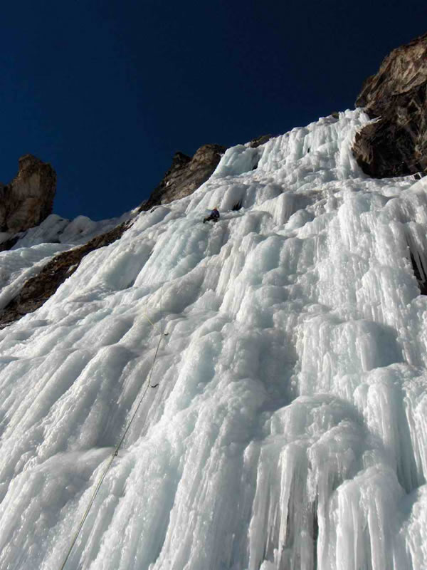
Due brevi salti facili (eventualmente evitabili) portano alla base del primo imponente salto, salibile frontalmente (non sempre formato, 3+/4, 80m) o tramite la variante di dx (3/3+, 70m). In entrambi i casi si esce nei pressi del tracciolino. Si prosegue con un lungo trasferimento costituito dal torrente appoggiato alternato a facili e brevi risalti fino nei pressi di un salto, caratterizzato sulla sx da una colonnina. Salire al centro (80°) uscendo in una stretta goulotte (65-70m). Proseguire facilmente lungo il torrente ghiacciato fino al primo grosso muro, che si supera generalmente sulla sx (60m, tratti a 75-80°). Si sosta generalmente sulla sx, alla base del secondo grande muro, che si supera anch’esso frontalmente (70m, 80°). Si prosegue su terreno più facile in direzione dell’ultimo grande muro. Questo, se ben formato, si può salire in tutta la sua larghezza con difficoltà variabili, altrimenti conviene salirlo sulla sx dove prende meno sole (da 75° a 90° in base alla linea, 2 tiri da 60-70m). Si esce in un pianetto, si prosegue per 60m e si esce nei pressi di un piccolo anfiteatro alla base di un ultimo salto, spesso non formato, che termina proprio nei pressi della staccionata del sentiero (q.2320m).
Discesa: dal sentiero che scende dal rifugio Cibrario (attraversando dei canaloni ripidi) fino alla Decauville, che si segue verso sinistra, si attraversa la prima galleria e poi all’altezza della seconda galleria (con il portone chiuso) scendere per prati e rododendri fino ad arrivare alla partenza della cascata, da lì alla macchina.
- Bibliografia:
- Ghiaccio dell'Ovest - G.C.Grassi
Nelle vicinanze Mappa
Itinerari
08/12/2025 TO, Usseglio 45 m II, 4+ Nord
Vallone d’Arnas – Cattedrale di Cristallo (Cascata)
 450m
450m
22/12/2005 TO, Usseglio 120 m II, 4 Est
Vallone d’Arnas, Bastionata della Torre – La Magia del Sogno (Cascata)
800m
19/01/2006 TO, Usseglio 120 m IV, 6 Sud-Est
Vallone d’Arnas, Bastionata della Torre – L’Altra Faccia dell’Amore (Cascata)
 1.8Km
1.8Km
14/01/2006 TO, Usseglio 120 m II, 4+ Est
Vallone d’Arnas, Bastionata della Torre – The Commitment (Cascata)
 1.9Km
1.9Km
08/01/2006 TO, Usseglio 155 m III, 6 Est
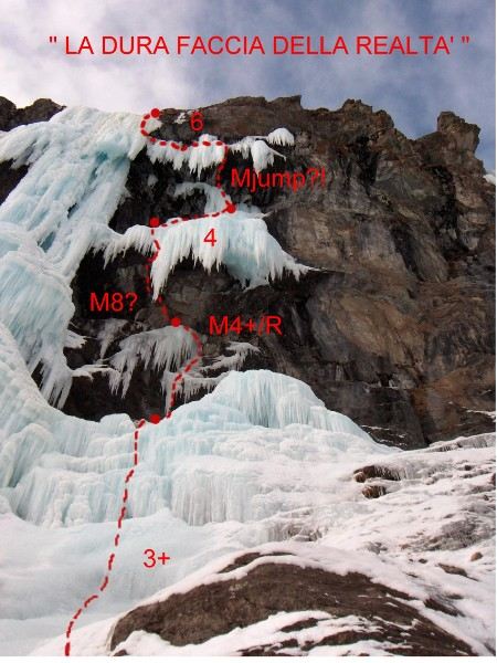
Vallone d’Arnas, Bastionata della Torre – La Dura Faccia della Realtà (Cascata)
 1.9Km
1.9Km
03/01/2016 TO, Usseglio 60 m II, 3+ Sud-Ovest
Margone – Trapette (Cascata di)
 2.6Km
2.6Km
01/02/2015 TO, Usseglio 300 m III, 4+ Ovest
Vallone d’Arnas – Salto delle Streghe (Cascata)
 3.4Km
3.4Km
29/12/2024 TO, Usseglio 50 m II, 4+ Sud
Margone, settore Gastik – Chandelle Gastik (Cascata)
 3.6Km
3.6Km
21/12/2025 TO, Usseglio 100 m II, 4 Nord
Margone – Lassù l’Ultimo (Cascata)
 3.7Km
3.7Km
21/02/2023 TO, Usseglio 450 m III, 4 Nord
Vallone d’Arnas – Bertà (Couloir della)
 3.7Km
3.7Km
Servizi
3.8Km
4.3Km
Furnasa Albergo
Usseglio
4.9Km
Vulpot Rifugio
Usseglio
5.5Km
Luigi Cibrario Rifugio
Usseglio
5.5Km
Grand’Usselio Albergo
Usseglio
5.7Km
Il bivacco Ristorante
Usseglio
6.6Km
Gastaldi Rifugio
Balme
7Km
Ciriè Rifugio
Balme
7.4Km
Nej e Solei Ristorante
Usseglio
7.7Km