 1.2Km
1.2Km

Note
Storico
 450m
800m
850m
950m
1Km
1.1Km
2.2Km
2.6Km
450m
800m
850m
950m
1Km
1.1Km
2.2Km
2.6Km
1.2Km
2.2Km
2.2Km
2.4Km
2.9Km
4.1Km
7Km
7.1Km
7.3Km
7.3Km
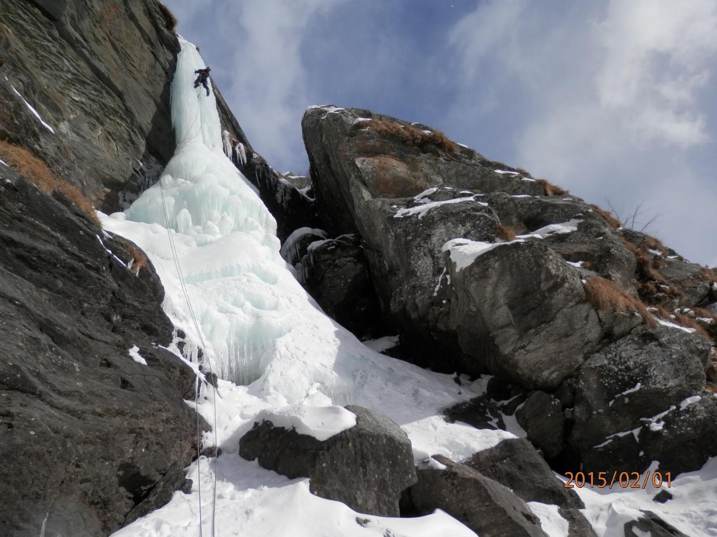
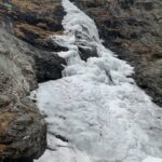
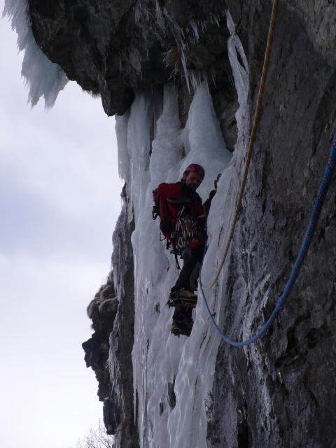
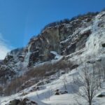
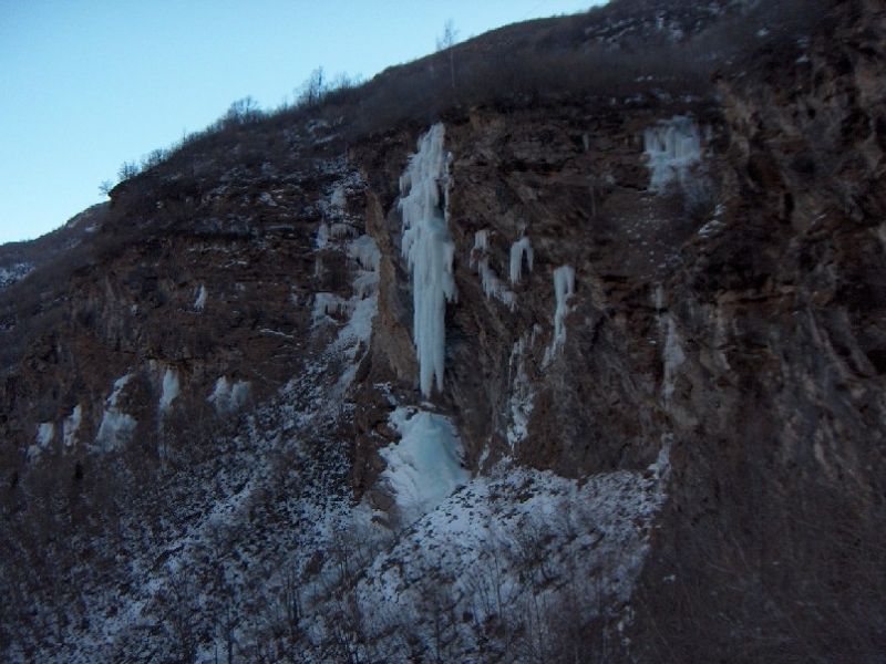
Cascata dalle caratteristiche molto varie che si svolge in un ambiente roccioso. L'esposizione la rende percorribile solo dopo periodi molto freddi. La colta prende sole dalle 11 in poi (più o meno).
Avvicinamento
Percorrere la val di Viù fino all'uscita del paese di Usseglio.
Prendere la strada a destra che imbocca il vallone di Arnas (lo stesso delle cascate Mantello di Madonna, Peraciaval, etc...). Raggiungere in breve i casolari di Castello. Se strada aperta e con poca neve proseguire per circa 1,5 km e parcheggiare nei pressi della chiesetta di Santana (struttura con piccolo portico bianco).
A piedi:
se la strada è chiusa ai casolari di Castello proseguire sulla strada per circa 1,5 km; 100 metri dopo la chiesetta di Santana la cascata è nell'evidente canale a destra (prima che la strada volga a sx.). Lasciare la strada e raggiungere il ruscello che esce dalla cascata. Contare 20-25 minuti dai casolari di Castello.
Descrizione
Prendere la strada a destra che imbocca il vallone di Arnas (lo stesso delle cascate Mantello di Madonna, Peraciaval, etc...). Raggiungere in breve i casolari di Castello. Se strada aperta e con poca neve proseguire per circa 1,5 km e parcheggiare nei pressi della chiesetta di Santana (struttura con piccolo portico bianco).
A piedi:
se la strada è chiusa ai casolari di Castello proseguire sulla strada per circa 1,5 km; 100 metri dopo la chiesetta di Santana la cascata è nell'evidente canale a destra (prima che la strada volga a sx.). Lasciare la strada e raggiungere il ruscello che esce dalla cascata. Contare 20-25 minuti dai casolari di Castello.
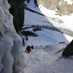
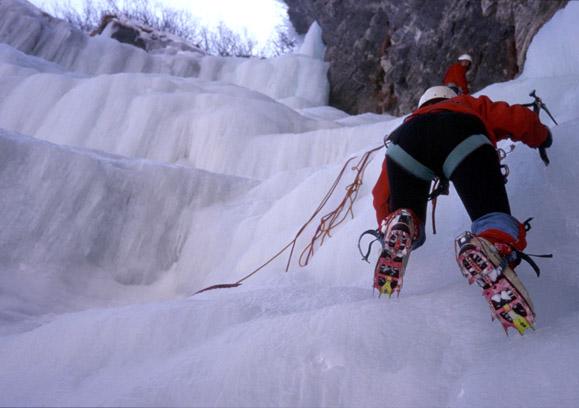
L1: salto a 50-60° circa 30 metri. Sosta su ghiaccio o roccia da attrezzare.
L2: salto a circa 60° mediamente; al termine, dopo un brevissimo risalto verticale, la lunghezza termina in una caratteristica goulottina di circa 10 metri. 50 metri totali, sosta su arbusti.
L3: breve trasferimento nel corso del torrente (circa 50 metri).
L4: bel tiro vario e tecnico, da 60 a 85°. Muro, diedro ghiacciato a destra e uscita verticale di 3 metri. 45 metri totali, sosta su friend e chiodi da attrezzare.
L5: salto a circa 60° all’inizio, poi muro stalattico di circa 10 metri a 85/90 con uscita delicata. Sosta su piante.
L6: trasferimento di circa 200/250 metri lungo il torrente. A piedi e con un breve risalto di ghiaccio da scalare in conserva.
L7: lunghezza chiave. Scalare il basamento della colonna per circa 15 metri. Attaccare al centro la colonna e scalarla direttamente per circa 15 metri in verticale. 45 metri, sosta su ghiaccio.
L8: tiro finale di circa 40 metri, dai 70 agli 80°.
DISCESA: sulla sinistra idrografica della colata. A piedi e con una doppia. Dall’uscita traversare a destra circa 30 metri. Poi scendere sulla petraia (disagevole, ma tenere i ramponi) lungo circa la linea di massima pendenza. Al termine della pietraia scendere leggermente a destra (verso la colata) e poi di nuovo lungo la linea di massima pendenza su erba secca e tra bassa vegetazione. Dopo circa 100 metri di dislivello raggiungere un boschetto di betulle sul bordo di una bastionata. Attrezzare una doppia su una delle due betulle più grandi (caratteristiche, cresciute accoppiate). Calarsi per 40 metri (molto verticale, a tratti nel vuoto). Dopo la doppia , proseguire facilmente in discesa a piedi per raggiungere il pianoro tra la colata e la strada.
Prima salita: Claudio Balagna
- Cartografia:
- Fraternali 1:25000 n 8 - Valle di Lanzo
Nelle vicinanze Mappa
Itinerari
21/02/2023 TO, Usseglio 450 m III, 4 Nord
Vallone d’Arnas – Bertà (Couloir della)
 450m
450m
12/02/2022 TO, Usseglio 180 m III, 2+, M1 Nord-Est
Vallone d’Arnas – Nuovi Orizzonti (Cascata)
 800m
800m
05/02/2006 TO, Usseglio 80 m II, 5 Sud
Vallone d’Arnas – Un Giorno di Ordinaria Follia (Cascata)
 850m
850m
20/01/2002 TO, Usseglio 60 m I, 1 Nord
Vallone d’Arnas – Perline di Arnas sx (Cascata)
 950m
950m
24/12/2005 TO, Usseglio 40 m I, 4+ Nord-Est
Vallone d’Arnas – New Age (Cascata)
950m
29/12/2005 TO, Usseglio 80 m I, 2 Sud
Vallone d’Arnas – Castello (Cascata di)
950m
05/02/2017 TO, Usseglio 100 m II, 5 Nord-Est
Vallone d’Arnas – Mantello di Madonna (Cascata) colata sx
 1Km
1Km
31/01/2021 TO, Usseglio 130 m III, 4 Nord-Est
Vallone d’Arnas – Mantello di Madonna (Cascata)
 1.1Km
1.1Km
13/01/2006 TO, Usseglio 90 m IV, 5+ Est
Usseglio – Quinto Elemento (Cascata)
 2.2Km
2.2Km
29/12/2024 TO, Usseglio 50 m II, 4+ Sud
Margone, settore Gastik – Chandelle Gastik (Cascata)
 2.6Km
2.6Km
Servizi
1.2Km
2.2Km
Luigi Cibrario Rifugio
Usseglio
2.2Km
Grand’Usselio Albergo
Usseglio
2.4Km
Il bivacco Ristorante
Usseglio
2.9Km
Il Caminetto Ristorante
Usseglio
4.1Km
Nej e Solei Ristorante
Usseglio
7Km
Vulpot Rifugio
Usseglio
7.1Km
Val Servin Ristorante
Balme
7.3Km
Les Montagnards Albergo
Balme
7.3Km
