3.3Km
3.3Km


Note
 50m
50m
50m
550m
1.8Km
1.8Km
1.8Km
1.8Km
2.3Km
50m
50m
50m
550m
1.8Km
1.8Km
1.8Km
1.8Km
2.3Km
Un ulteriore itinerario ad anello e percorso della famosa gara Arrancabirra
Avvicinamento
.
Descrizione
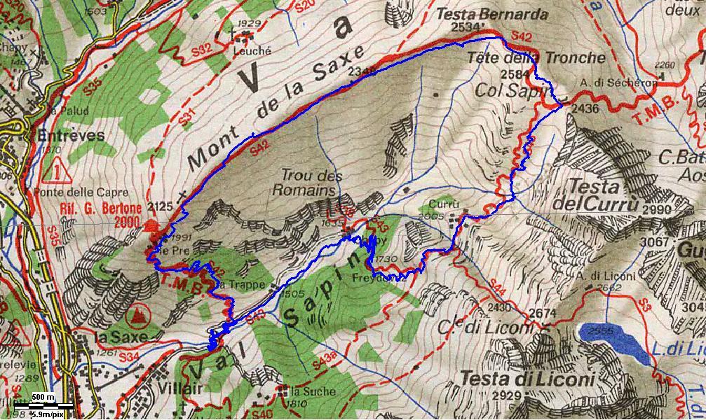
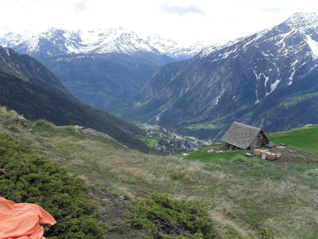
Dalla sbarra seguire la poderale e il segnavia n.43 in direzione del col Sapin,lasciare lo sterrato all’abitato Chapy mt.1614 e seguire il sentiero che attraversa il torrente ed inizia a salire, lasciato sulla propria dx il sentiero che conduce al col Liconi seguire sempre il segnavia n.43 fino a raggiungere il col Sapin mt.2435,
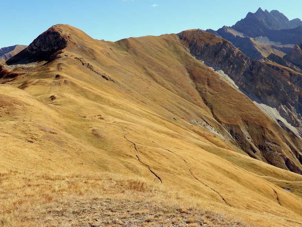
Proseguire sulla sx e raggiungere prima Tete de la Tronche mt.2581 e in seguito Tete Bernarde mt.2533, scendere lungo il Mon de la Saxe, segnavia n. 42 fino al rif. Bertone e giù seguendo la mulattiera fino a riprendere la strada poderale poco sopra a dove si è lasciata l’auto
Nelle vicinanze Mappa
Itinerari
20/07/2025 AO, Courmayeur D+ 1355 m E Sud
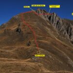
Tronche (Testa della) e Testa Bernarda da Villair, anello per i Monts de la Saxe e Col Sapin
 50m
50m
06/10/2025 AO, Courmayeur D+ 671 m E Sud
Bertone Giorgio (Rifugio) da Villair
 50m
50m
08/11/2024 AO, Courmayeur D+ 1530 m EE Ovest
Liconi (Testa di) da Villair per la Val Sapin
 50m
50m
27/09/2015 AO, Courmayeur D+ 500 m E Ovest
Tirecorne (Baite) da Courmayeur, anello per la Suche
 550m
550m
29/06/2025 AO, Courmayeur D+ 2382 m E Varie
Giro del Monte Bianco da Courmayeur a La Fouly
 1.8Km
1.8Km
10/07/2019 AO, Courmayeur D+ 1652 m E Nord-Ovest
Liconi (Testa di) da Courmayeur per la Val Sapin
 1.8Km
1.8Km
12/07/2025 AO, Courmayeur D+ 9300 m E Tutte
Monte Bianco (Giro del) da Courmayeur, giro antiorario (4 gg)
 1.8Km
1.8Km
13/08/2023 AO, Courmayeur D+ 1515 m EE/F Varie
Cormet (Mont) da Courmayeur, traversata a Morgex
 1.8Km
1.8Km
01/07/2026 AO, Courmayeur D+ 3750 m EE Varie
Tor des Geants/Giro dei Giganti Tappa 1: Courmayeur – Valgrisenche
1.8Km
12/08/2025 AO, Courmayeur D+ 1200 m EEA Sud-Est
Chetif (Mont) da Courmayeur per il sentiero attrezzato del Bicentenario CHIUSO PER MANUTENZIONE agosto 2025
 2.3Km
2.3Km