600m
600m
Note
 50m
50m
1.5Km
1.5Km
1.5Km
1.5Km
3.4Km
3.4Km
3.5Km
3.5Km
50m
50m
1.5Km
1.5Km
1.5Km
1.5Km
3.4Km
3.4Km
3.5Km
3.5Km
600m
3.7Km
3.9Km
3.9Km
5Km
5.5Km
5.5Km
5.5Km
6.1Km
7.7Km
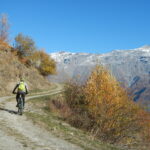
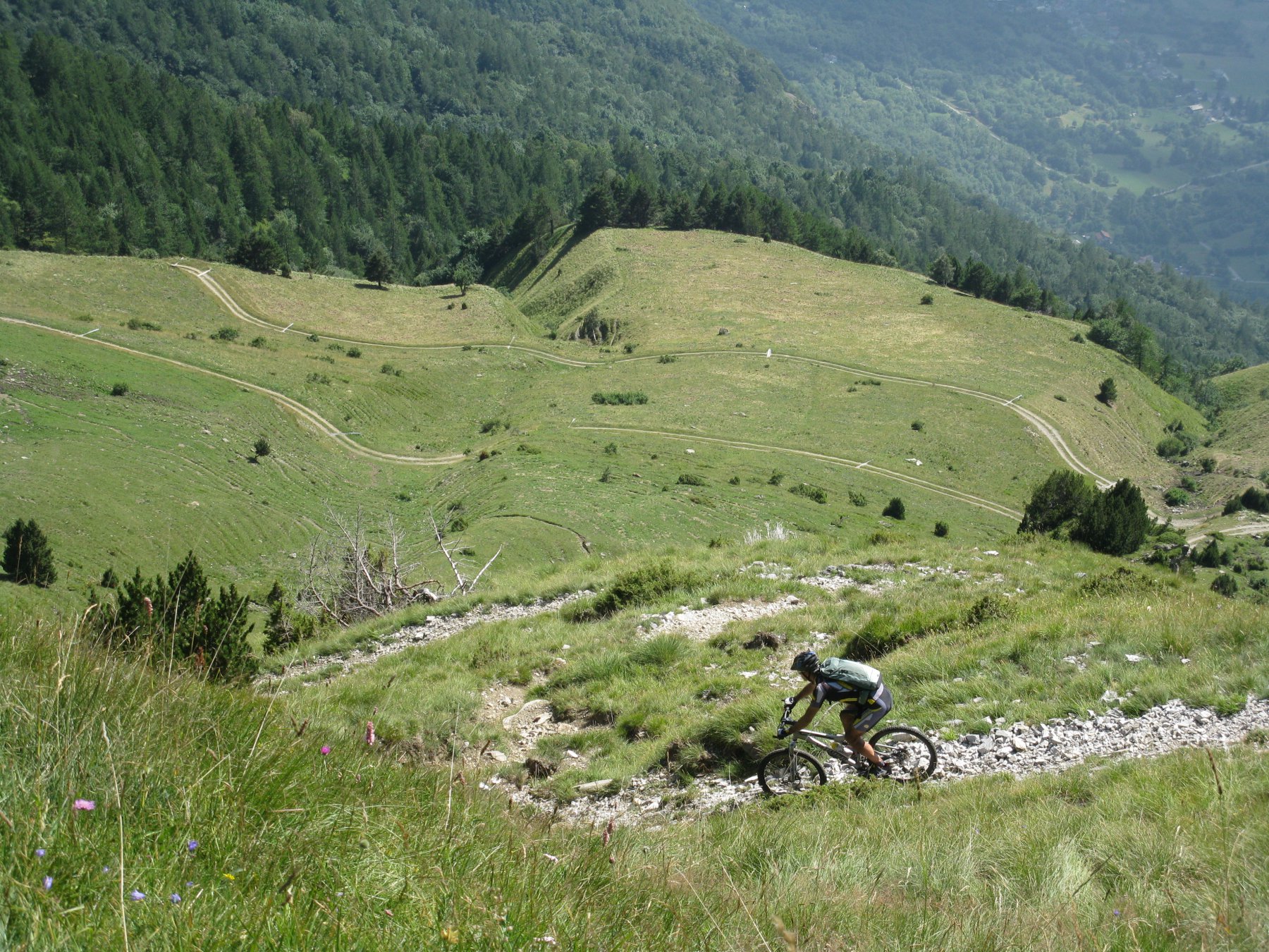
Gita molto complessa ed impegnativa, sia per il dislivello che per l’impegno psicofisico. Riservata a bikers molto allenati dato anche il notevole sviluppo chilometrico, sono 45 km di salita quasi sempre molto dura! In totale i km sono 65 circa. Da intraprendersi con tempo assolutamente bello e stabile! Vale però la pena perché la discesa dal Col Clapier è semplicemente fantastica, molto difficile ma fantastica!!
Avvicinamento
.
Descrizione
Si parte da sopra Susa, al bivio per Venaus-Novalesa, metri 550-600 circa, e si prosegue alla volta di Novalesa.
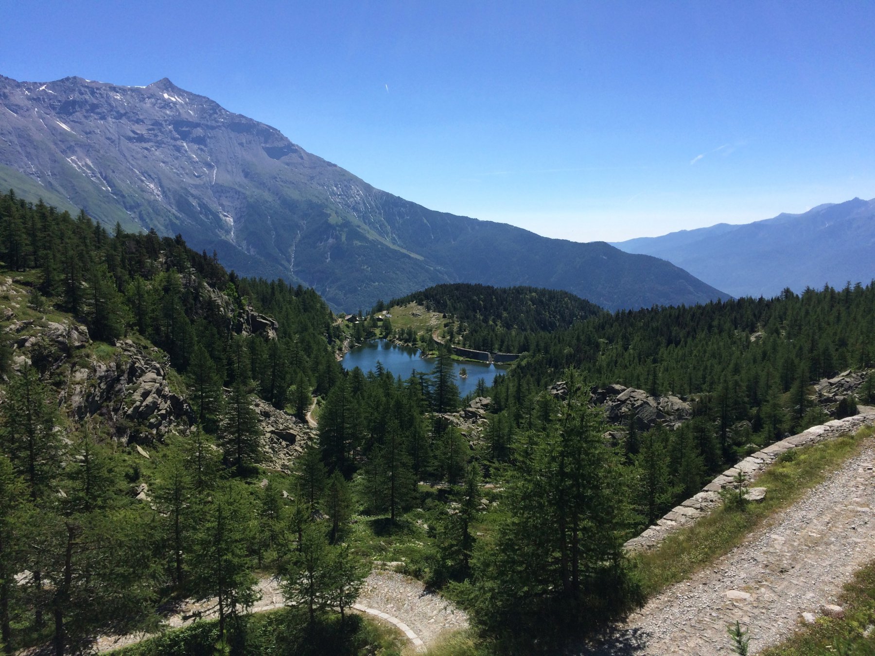
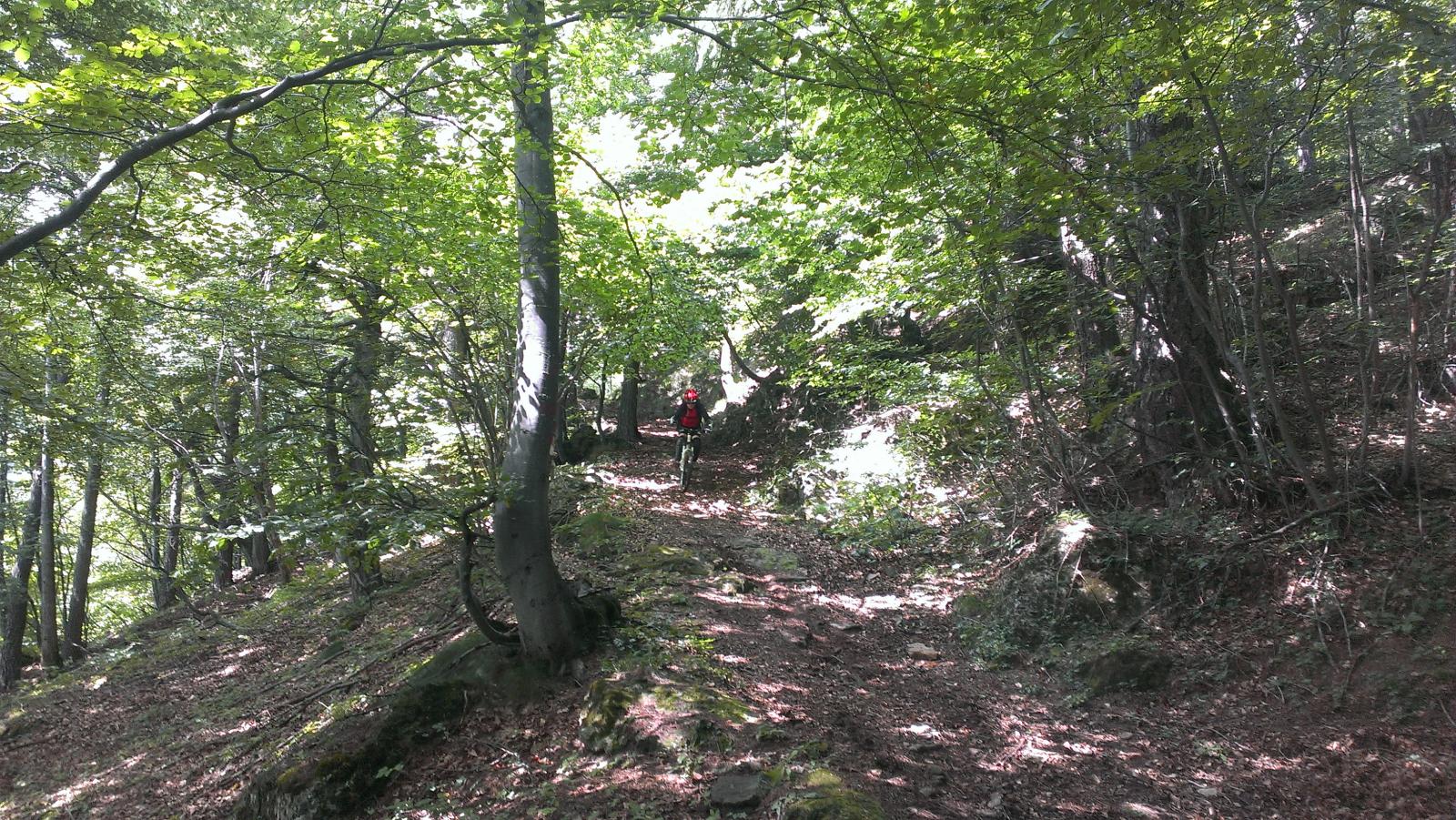
Da Novalesa s’imbocca una strada inizialmente asfaltata con indicazione Rif. Stellina (meta di un grande trofeo di corsa in montagna) che sale con un paio di tornanti ripidissimi, ma dopo pochi chilometri la pendenza diminuisce e con salita stupenda tra boschi e prati, si arriva alle Grange Prapiano a metri 1900 circa. Qui la strada torna decisamente indietro e finisce in un caseggiato con sul muro l’indicazione del Sentiero 2000.
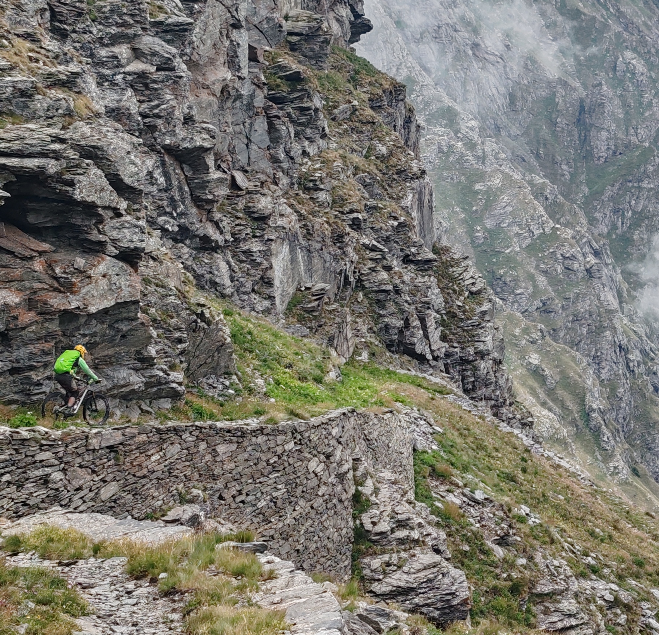
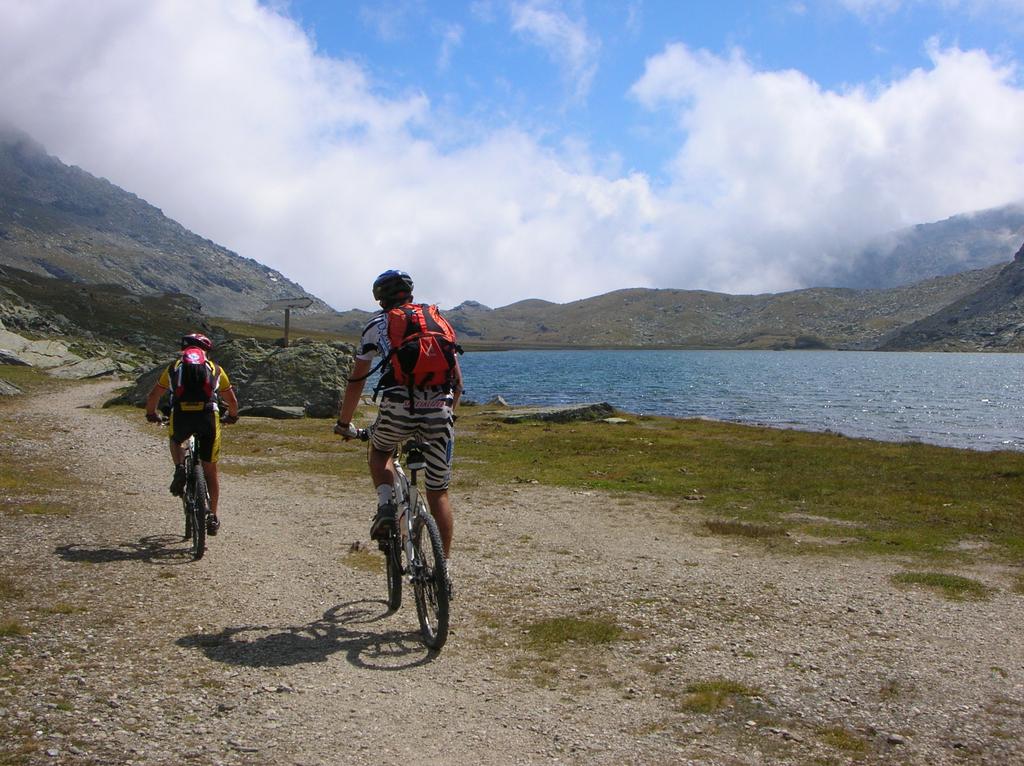
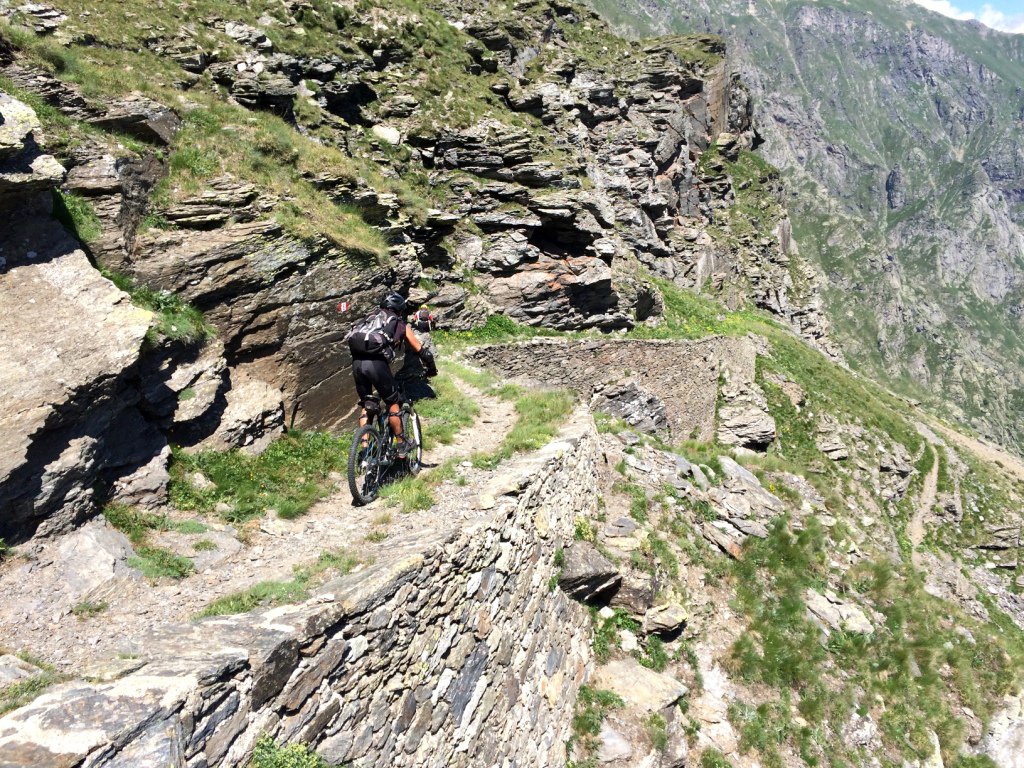
Si imbocca il sentiero che abbastanza ciclabile e tutto ben segnalato con tacche bianco rosse del GTA ci porta ad attraversare un paio di valloni molto impervi e selvaggi arrivando in circa 30 minuti ad una presa d’acqua dell’ENEL dove troviamo una strada che molto ripida ci porta all’ Alpe Tour a metri 2124.
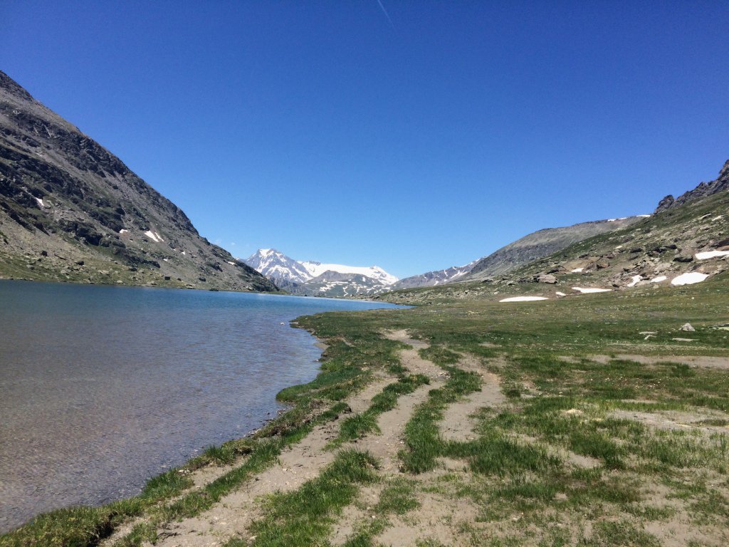
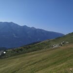
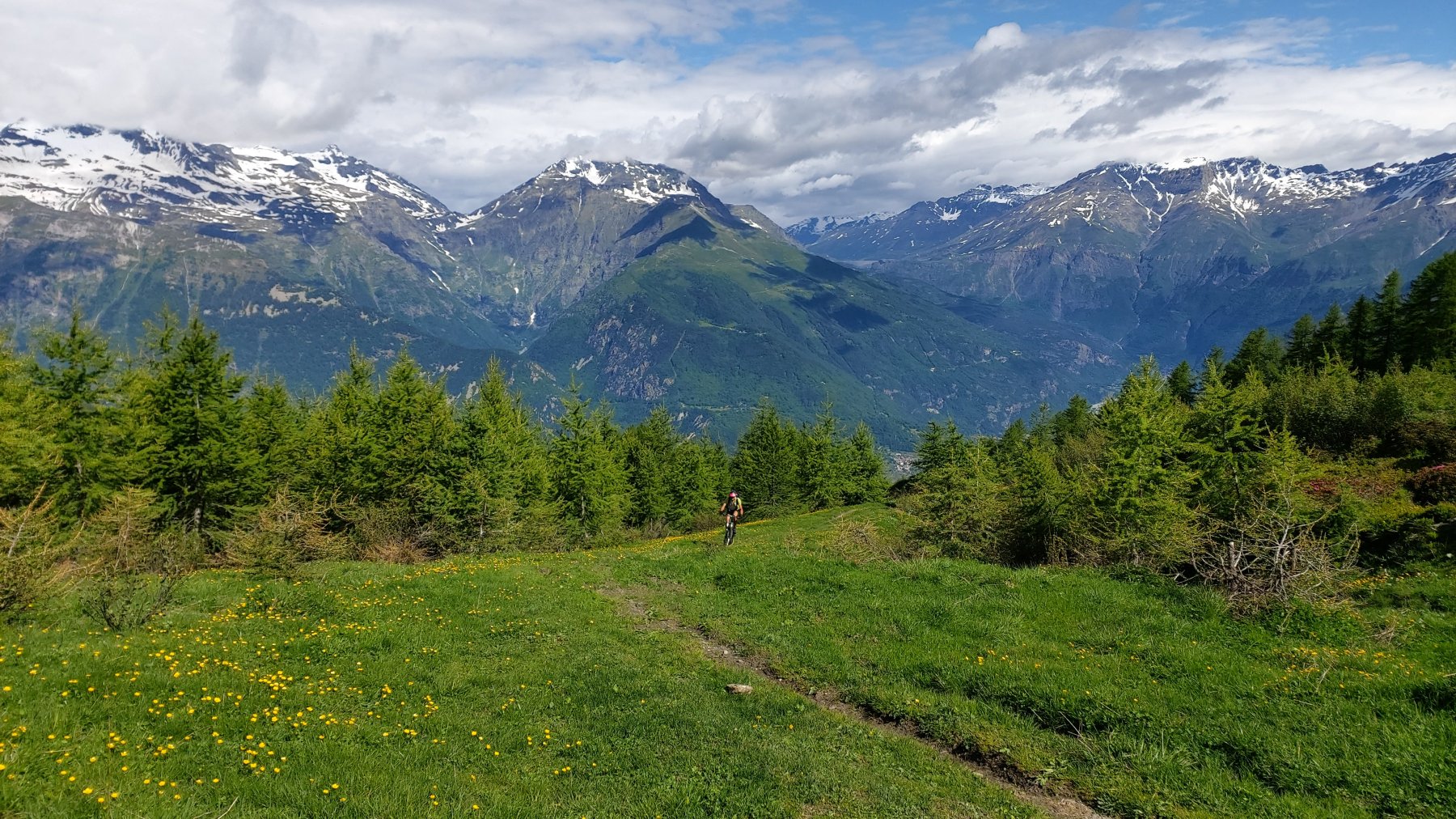
Qui proseguiamo su questa stupenda strada sterrata con percorso in sali e scendi e molto panoramico che, tagliando i versanti sud della Chamois-Lamet, ci porta in vista del Lago del Moncenisio che, con breve discesa si raggiunge all’altezza della ex dogana a metri 1900.
A questo punto, chi già ha speso tutto, può scendere tramite la “Strada Reale” a Ferrere Cenisio Novalesa e quindi alle macchine. Quelli che invece hanno ancora energie da spendere (restano ancora 600 metri di dislivello), imboccano una sterrata sulla sinistra del pianoro antistante lo sbarramento del lago (oppure direttamente sulla diga) che, passando nei pressi del Forte Varisello e, costeggiando poi sulla sinistra il Lago del Moncenisio, ci porta con salita più dolce al Colle del Piccolo Moncenisio 2182 m.
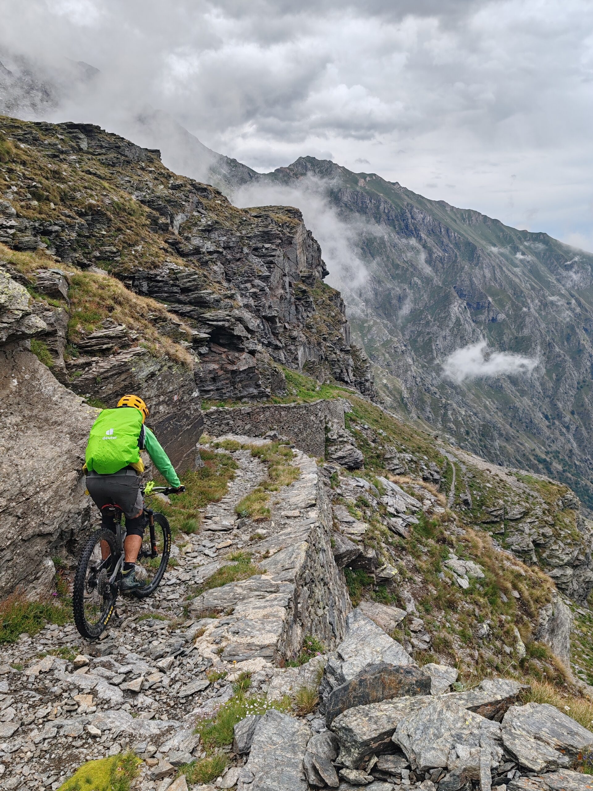
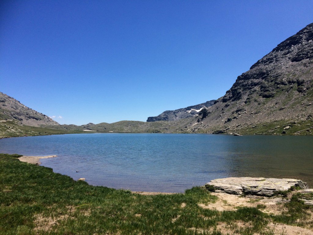
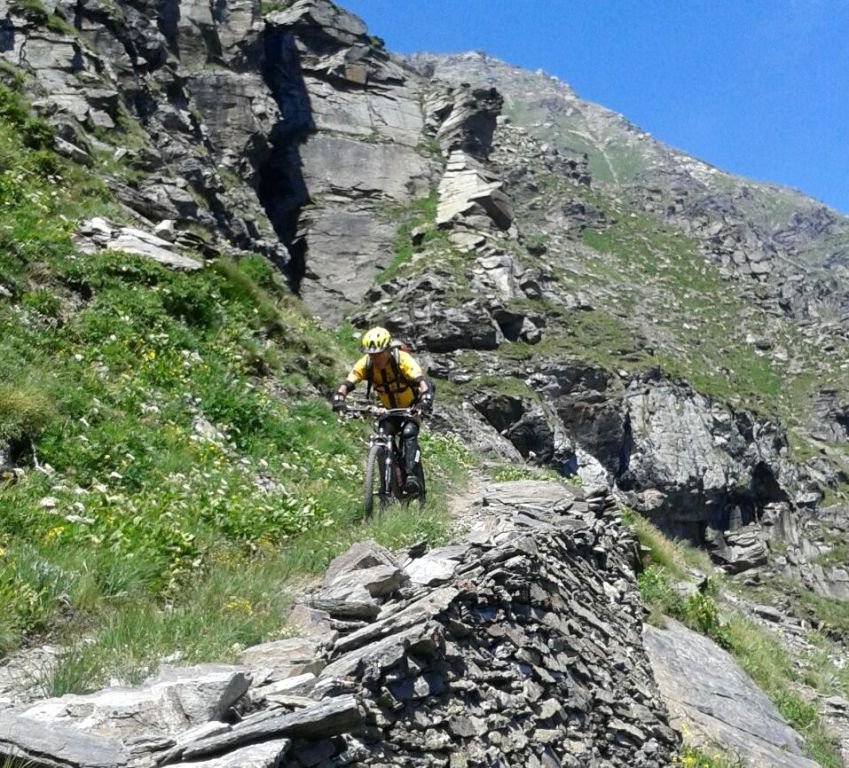
Dal Colle si prende a sinistra (sud) una sterrata che diventa ben presto una mulattiera ed entra nello stupendo Vallone delle Savine e con salita alquanto impegnativa si raggiunge il lago omonimo a metri 2449, e, con poche pedalate più facili, si giunge al culmine della nostra salita, il Col Clapier metri 2477.
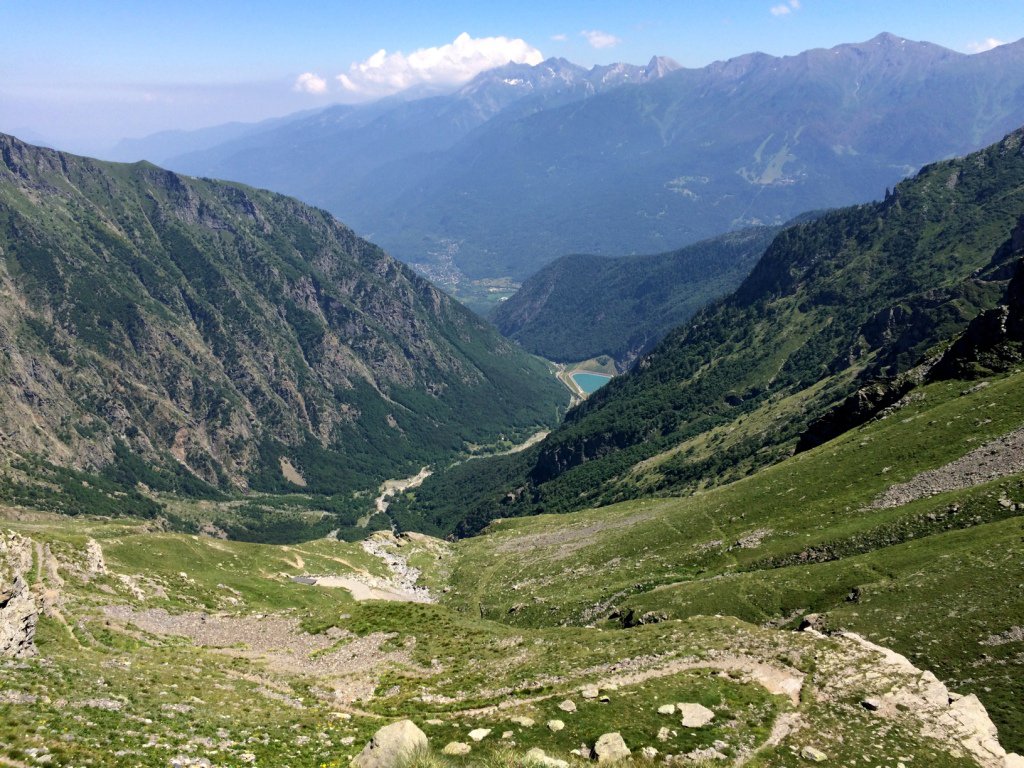
Qui necessariamente bisogna riposarsi perché, ci aspetta una discesa stupenda ma, interminabile e senza un’attimo di distrazione, che ci fa scendere nella Val Clarea fino all’altezza delle grange S.Giacomo e Buttigliera.
Qui prestare attenzione ad imboccare il canale di Maria Bona che ci porta splendidamente a S.Chiara e poi sempre con stupenda mulattiera a Giaglione chiudendo così l’anello.
Variante di salita: sempre con partenza da Venaus, arrivati a Novalesa prendere a sx per Moncenisio dove si arriva dopo 6 km. di asfalto con alcune ripide rampe, in leggera discesa arrivare poi sulla SS 25 e percorrerla per circa 2 km. fino poco oltre Bar Cenisio. Prendere una sterrata sulla sx che porta al lago d’ Arpon, proseguire poi per altri 5 km., superato il bivio per il Malamot seguire indicazioni Piccolo Moncenisio per ricollegarsi al percorso originale. La variante proposta é completamente ciclabile fino ad incontrare la mulattiera per il Colle Clapier che richiede alcuni tratti di bici al fianco. Il giro così proposto è di 60 km. e 2200 mt. D+
- Cartografia:
- Fraternali 1:25000 n.3 Val di Susa Val Cenischia Rocciamelone Val Chisone
Nelle vicinanze Mappa
Itinerari
09/11/2025 TO, Venaus D+ 1500 m MC, BC, S1 Varie
Marzo (Grange) da Venaus, giro per Santa Chiara, Bar Cenisio e Novalesa
 50m
50m
11/06/2023 TO, Venaus D+ 802 m MC, BC, S1 Varie
Tiraculo (Borgata) e Canale di Maria Bona da Venaus, giro
 50m
50m
22/09/2018 TO, Giaglione D+ 1800 m BC+, BC+, S1 Varie
Avanzà (Rifugio) da Giaglione per le Bergerie Martina
 1.5Km
1.5Km
08/11/2025 TO, Giaglione D+ 1214 m MC, BC+, S1 Sud-Est
Marzo (Grange) da Giaglione, discesa su Bar Cenisio
 1.5Km
1.5Km
01/08/2020 TO, Giaglione D+ 2500 m BC+, BC+, S3 Tutte
Clapier (Col) da Giaglione, giro del Monte Giusalet per il Rifugio Avanzà
 1.5Km
1.5Km
30/01/2025 TO, Giaglione D+ 1100 m BC, BC+, S2 Sud-Ovest
Martina (Bergerie) da Giaglione
 1.5Km
1.5Km
06/06/2020 TO, Gravere D+ 1800 m BC+, BC, S1 Nord
Pintas (Monte) da Gravere per Pian Gelassa
 3.4Km
3.4Km
05/08/2023 TO, Gravere D+ 850 m BC, BC+ Nord
Gelassa (Pian) da Gravere, giro per Frais e Madonna della Losa
 3.4Km
3.4Km
24/09/2023 TO, Novalesa D+ 1900 m MC+, OC, S2 Sud
Stellina (Rifugio) alla Punta Carolei da Novalesa per l’Alpe Tour, discesa per Alpe Carolei e Grange Pra Piano
 3.5Km
3.5Km
23/02/2022 TO, Novalesa D+ 1372 m MC+, OC, S3 Nord-Est
Tour (Alpe) da Novalesa, discesa per Grange Prapiano
 3.5Km
3.5Km
Servizi
600m
3.7Km
C’era una volta Ristorante
Novalesa
3.9Km
La posta Ristorante
Novalesa
3.9Km
Delle Alpi Ristorante
Novalesa
5Km
La Cantina delle Arti Ristorante
Chiomonte
5.5Km
1880 Ristorante
Venaus
5.5Km
Jamais sans tois Ristorante
Chiomonte
5.5Km
Ramats Ristorante
Chiomonte
6.1Km
Bellavista Rifugio
Meana di Susa
7.7Km