250m
250m
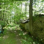
Avvicinamento
 50m
50m
3.5Km
3.5Km
3.5Km
3.8Km
4.2Km
4.2Km
4.9Km
4.9Km
50m
50m
3.5Km
3.5Km
3.5Km
3.8Km
4.2Km
4.2Km
4.9Km
4.9Km
250m
450m
450m
3.2Km
4.1Km
4.9Km
7.6Km
8.1Km
8.4Km
8.4Km
.
Descrizione
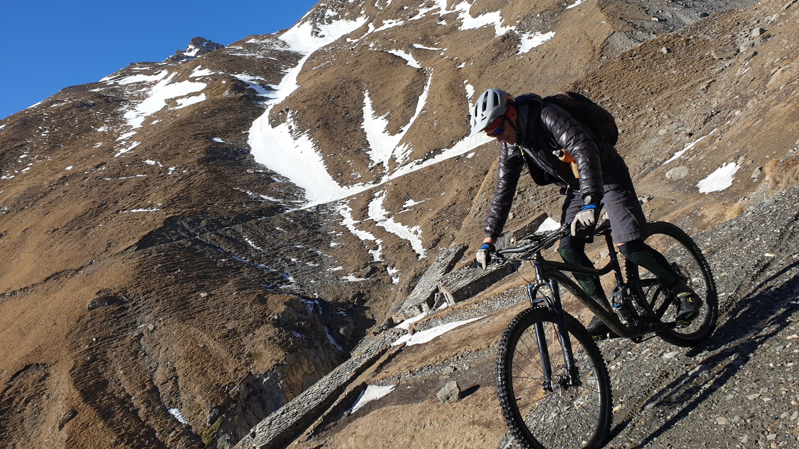
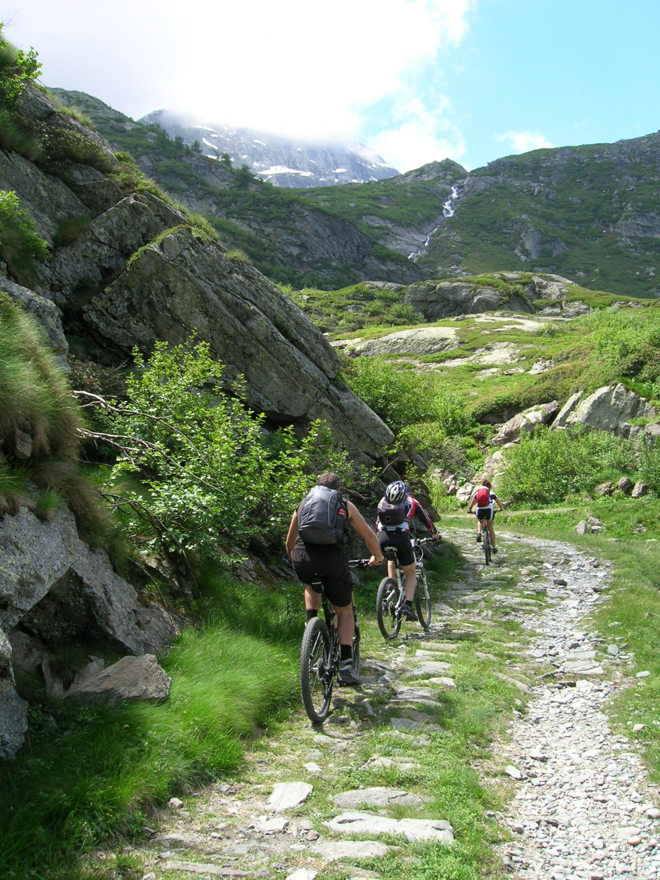
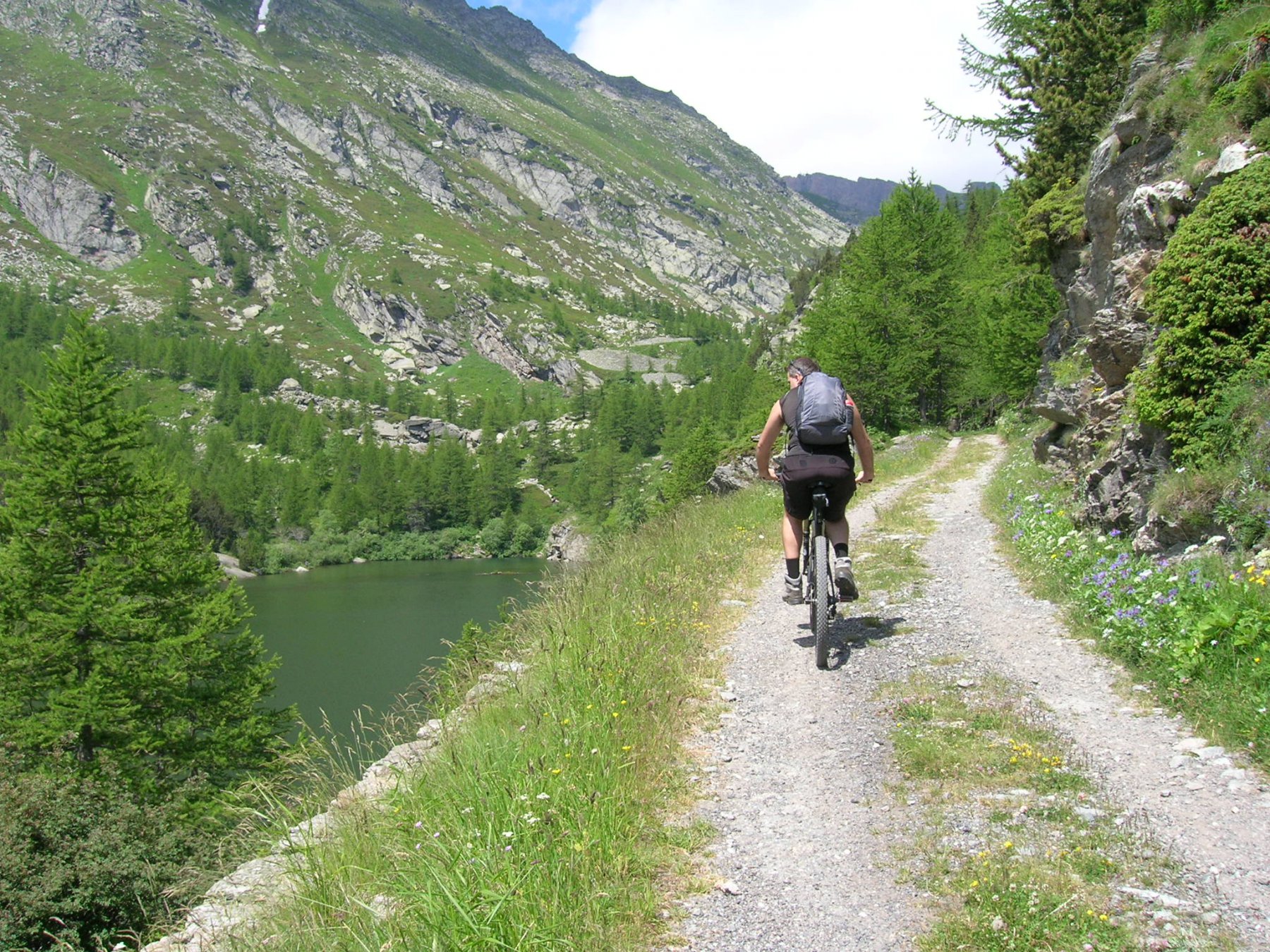
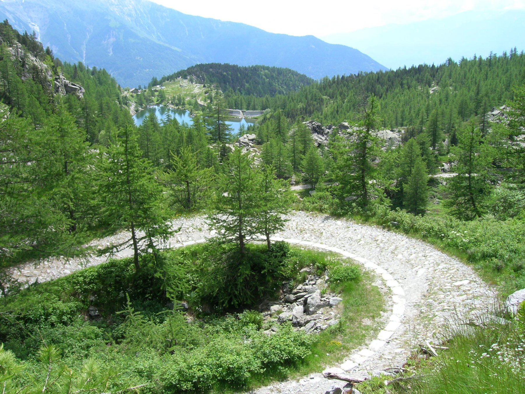
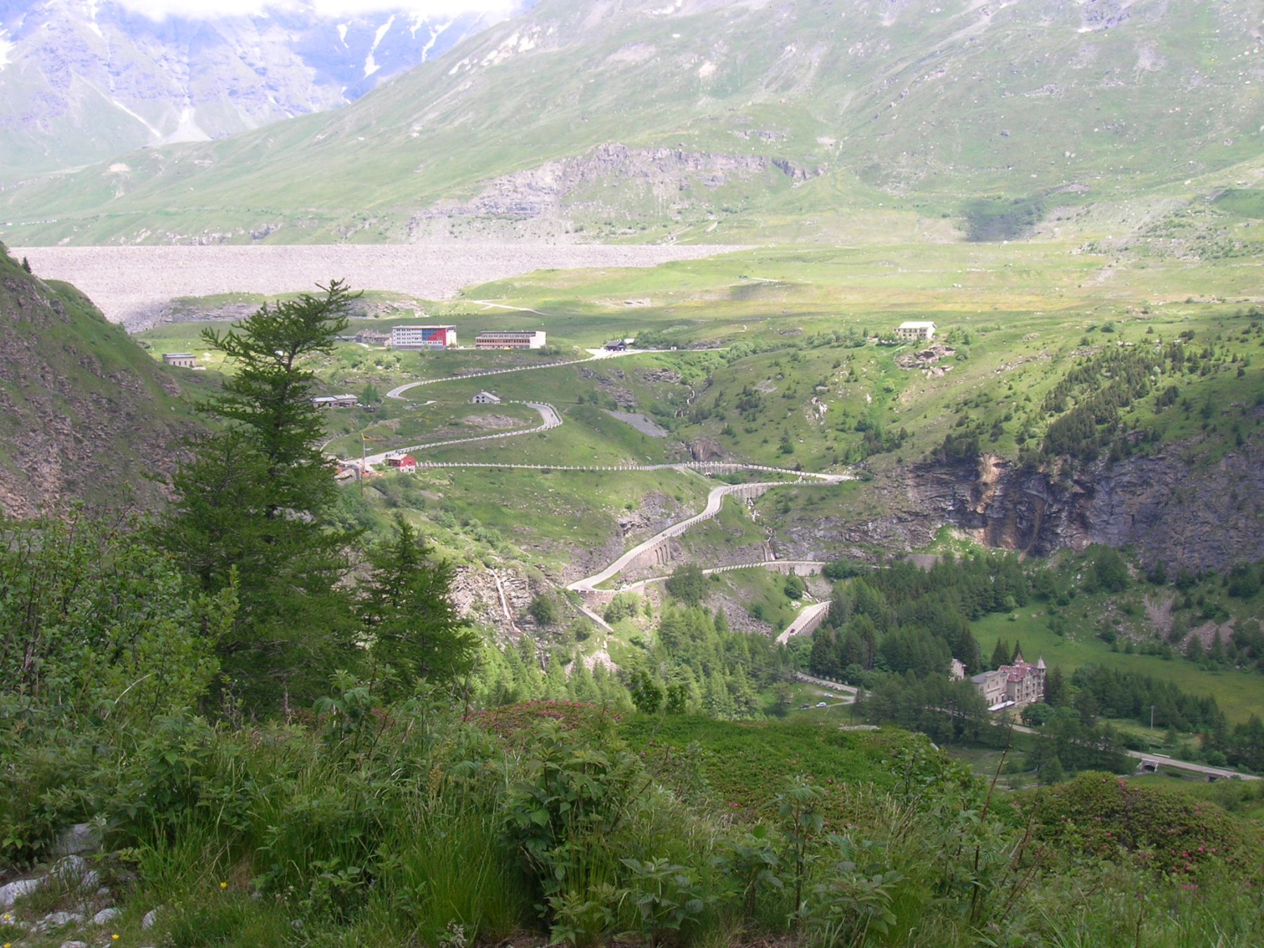
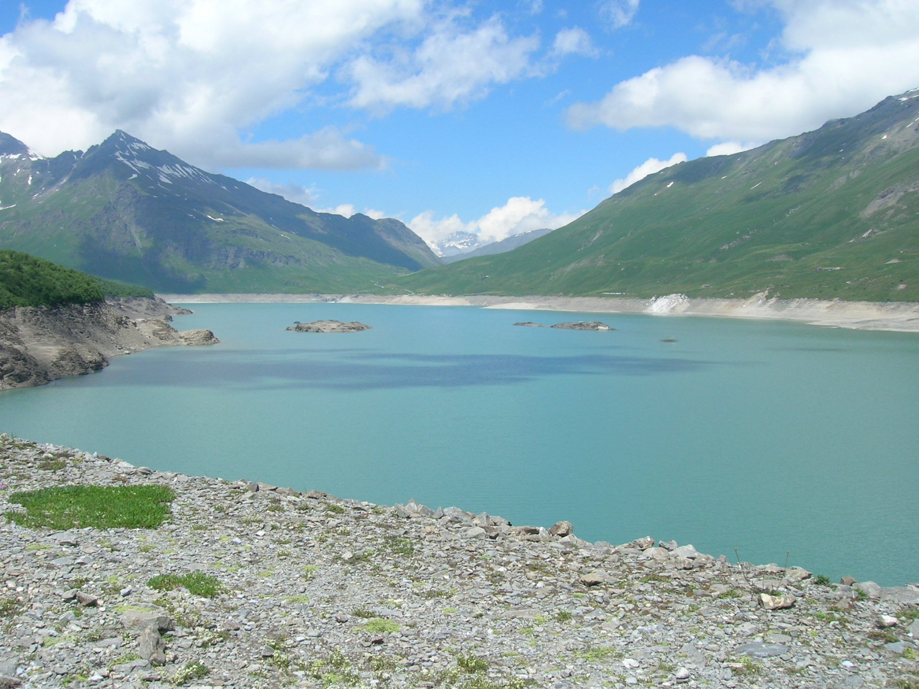
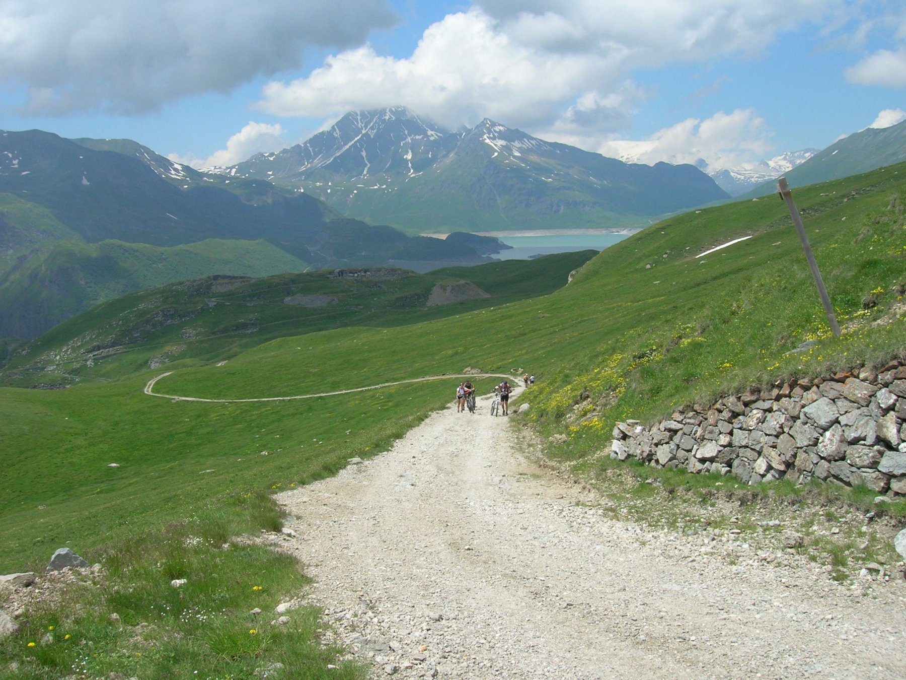
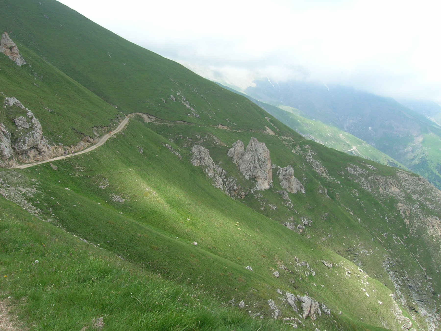
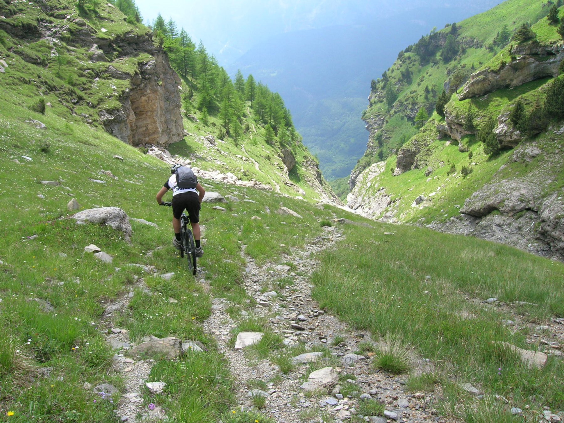
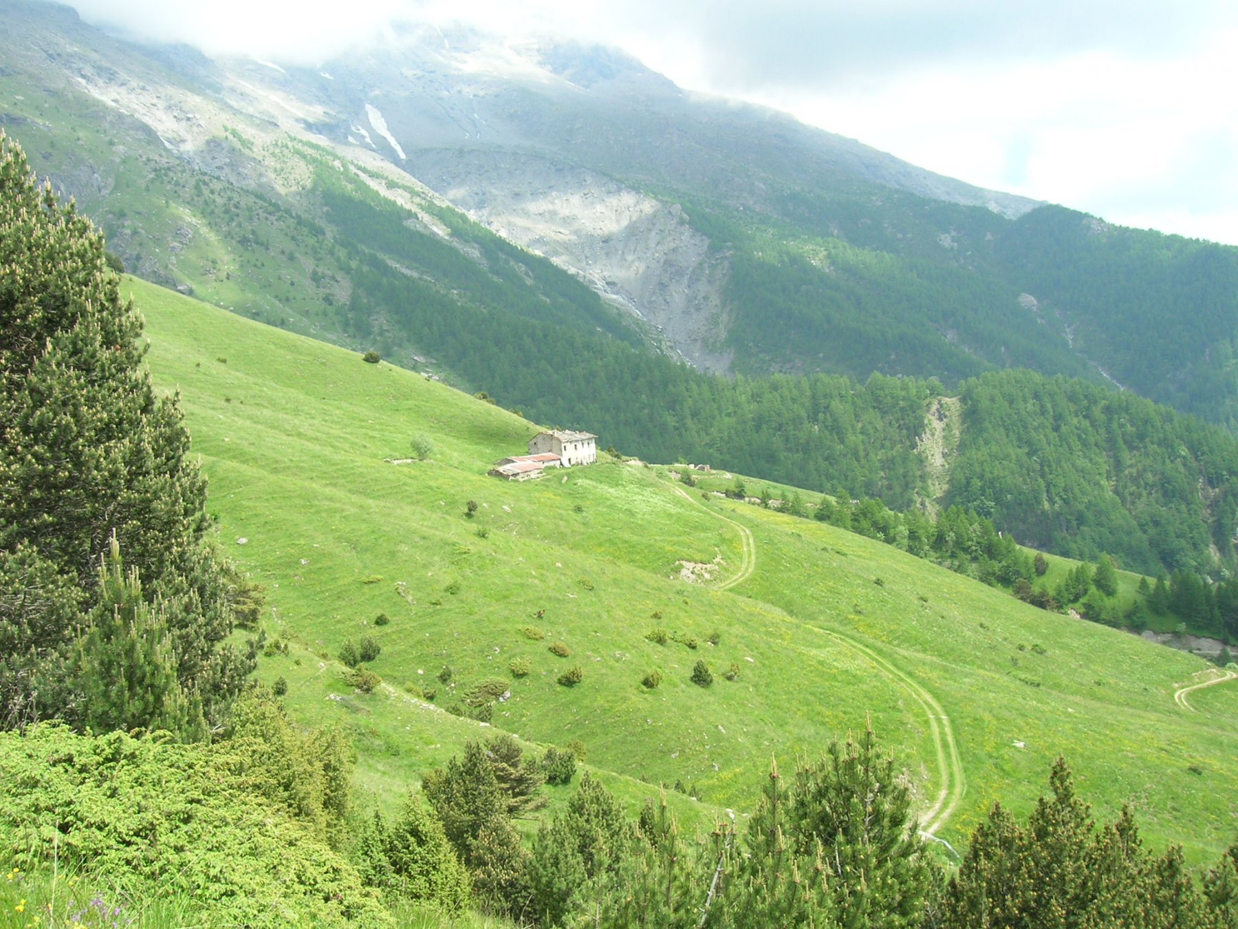
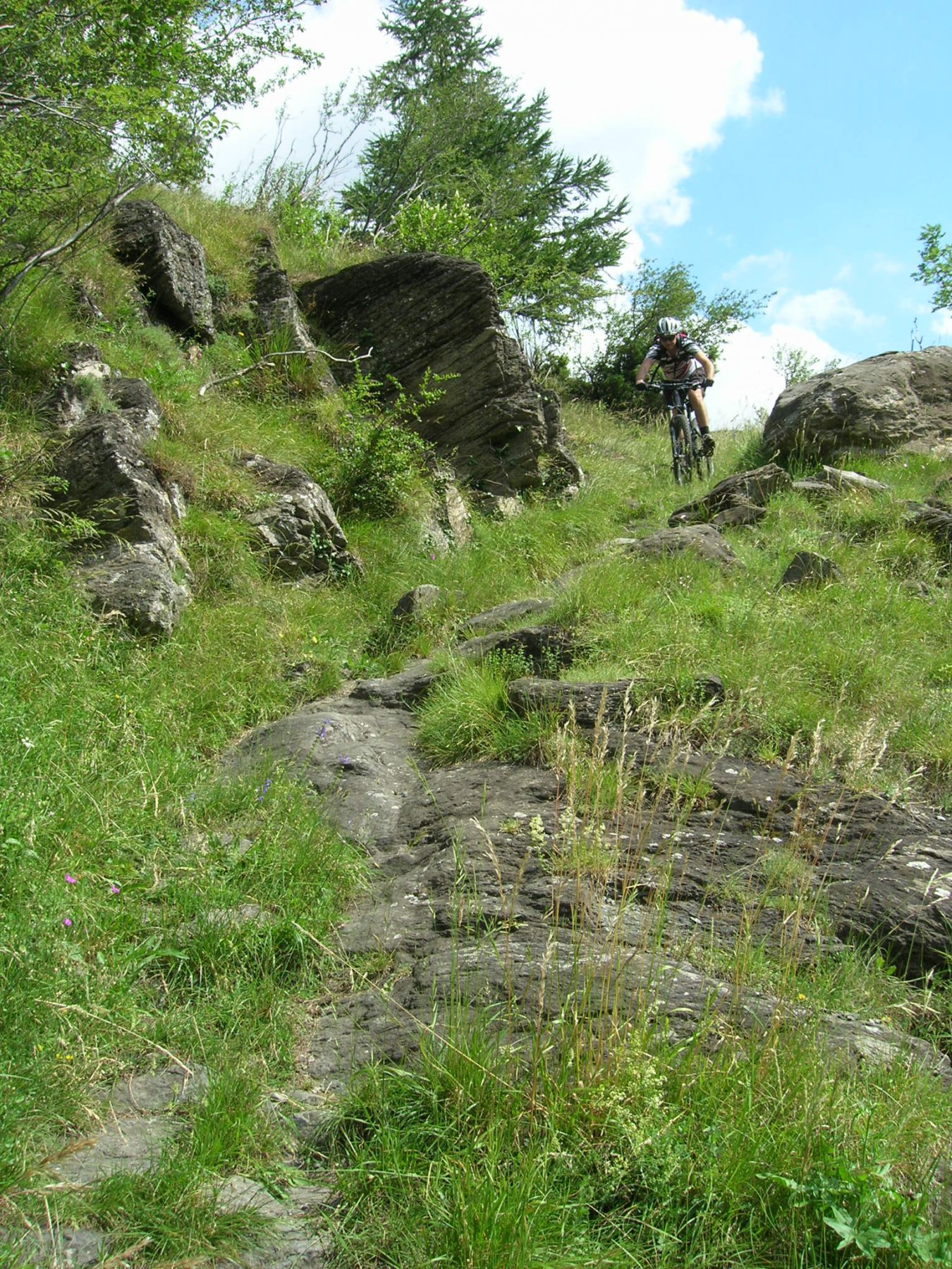
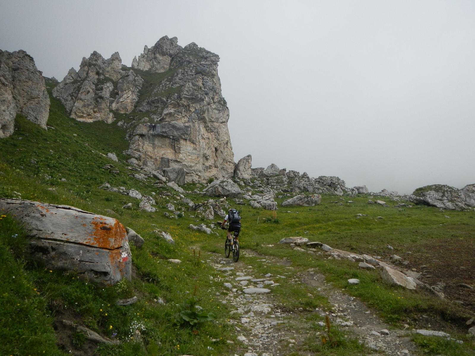
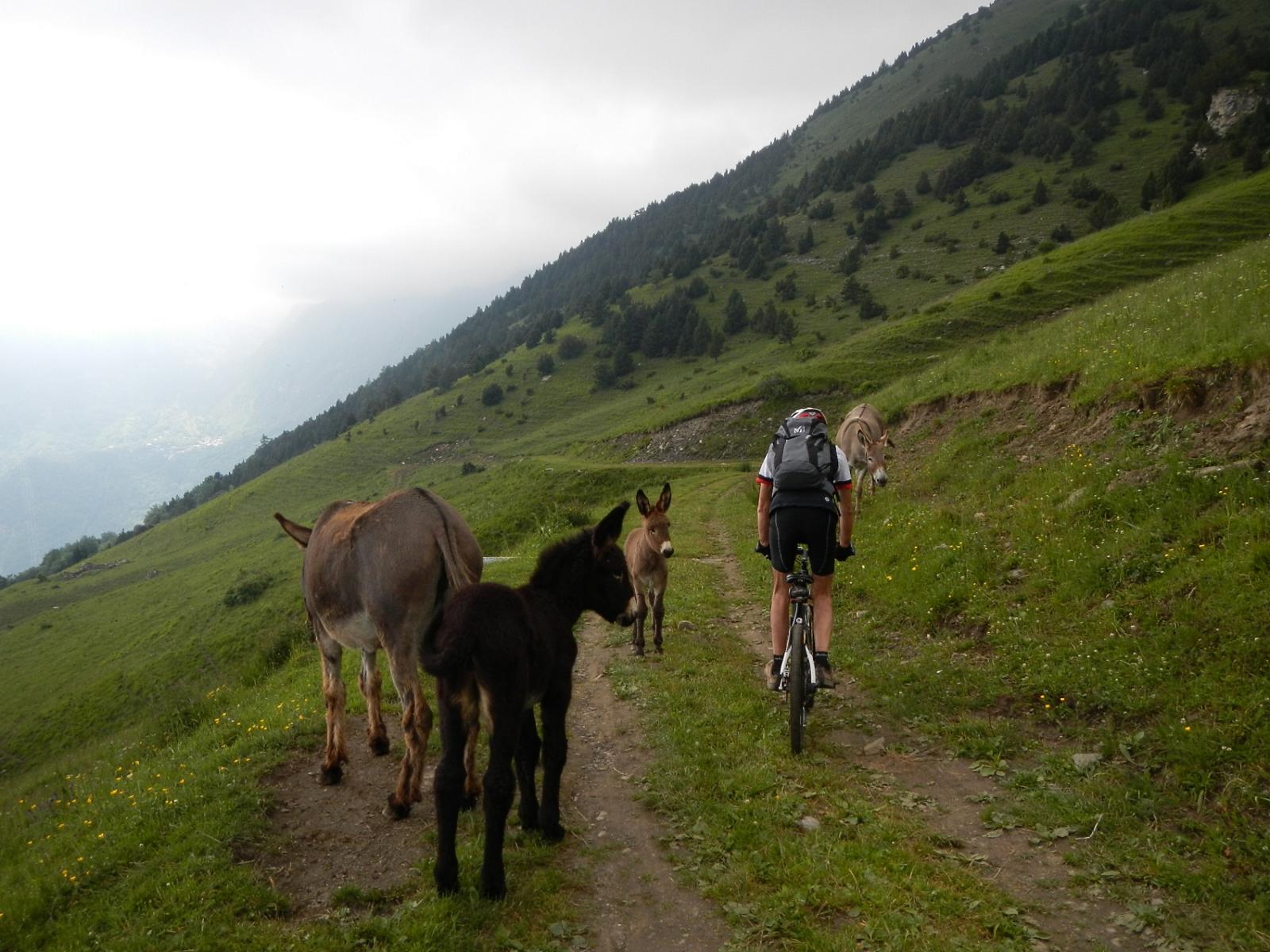
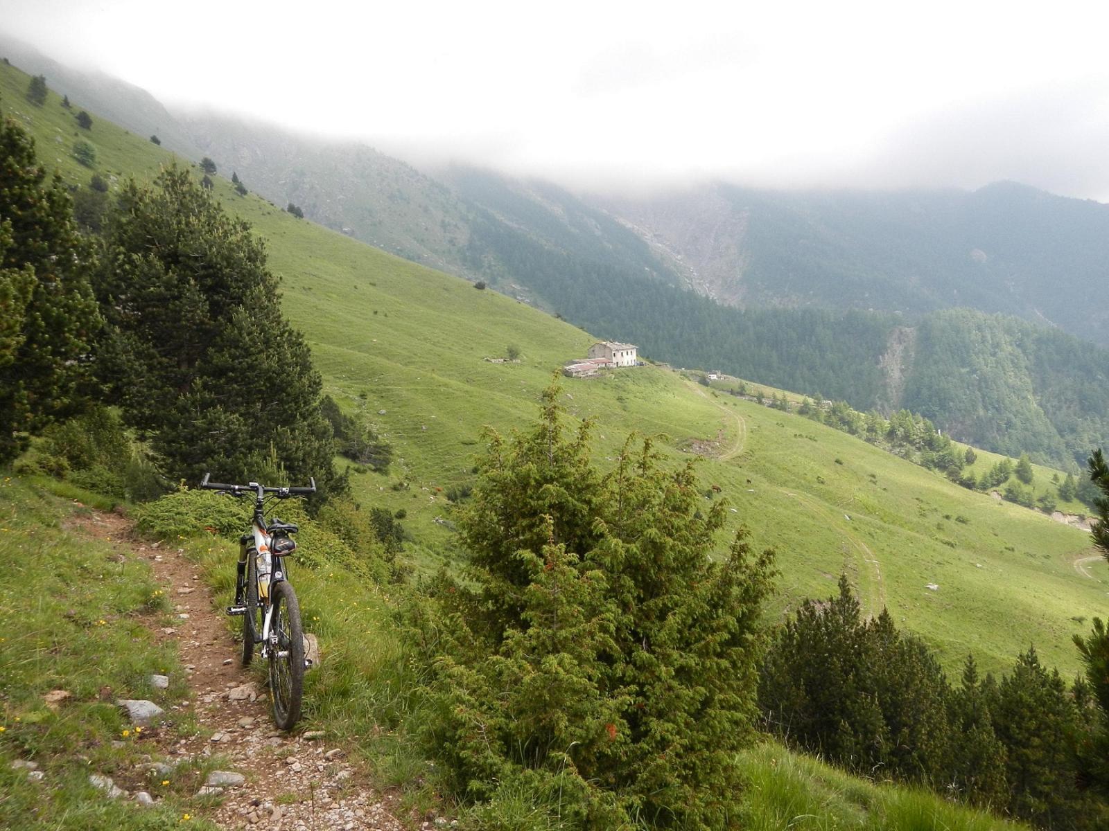
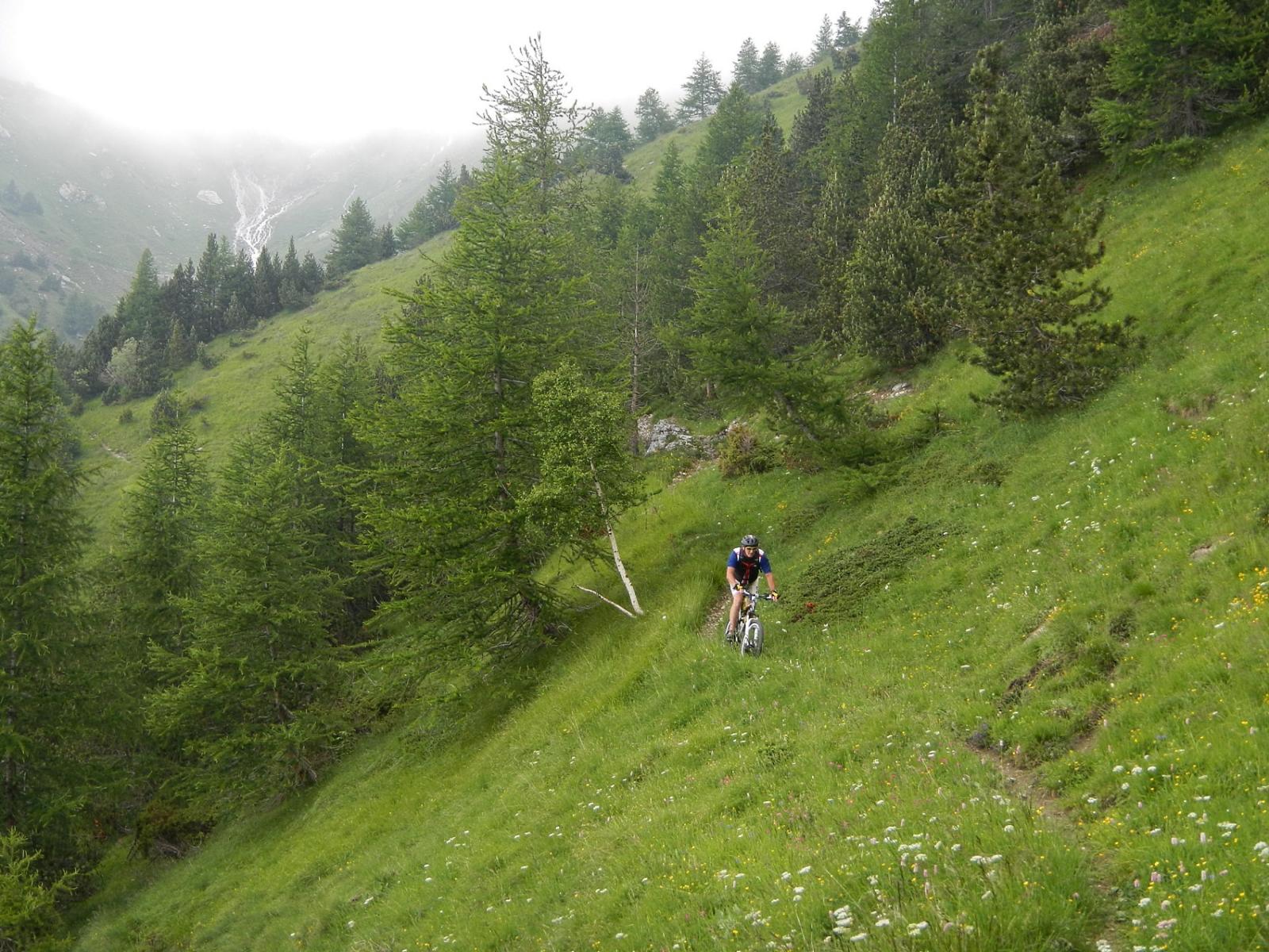
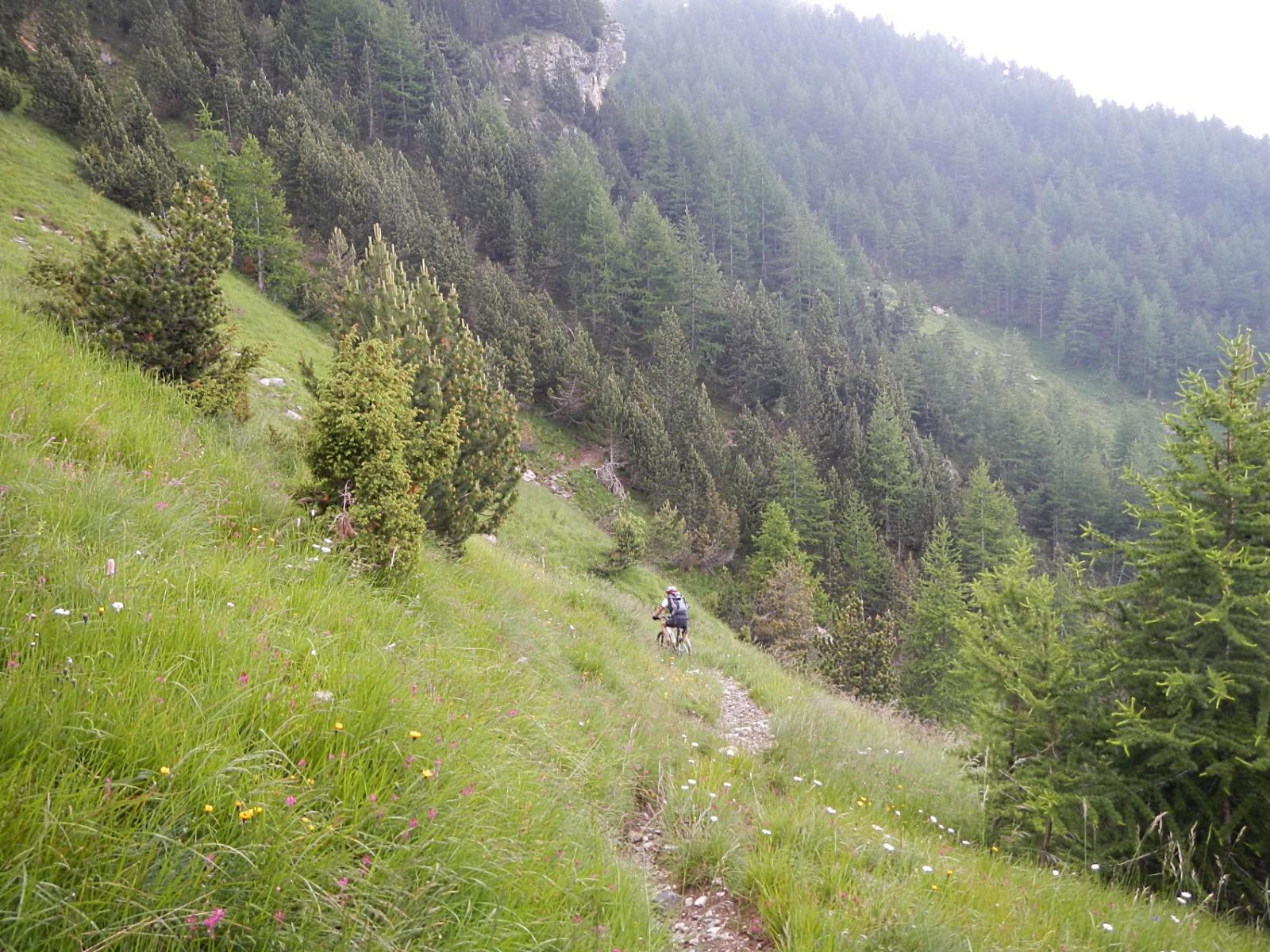
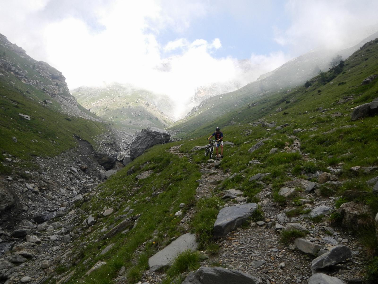
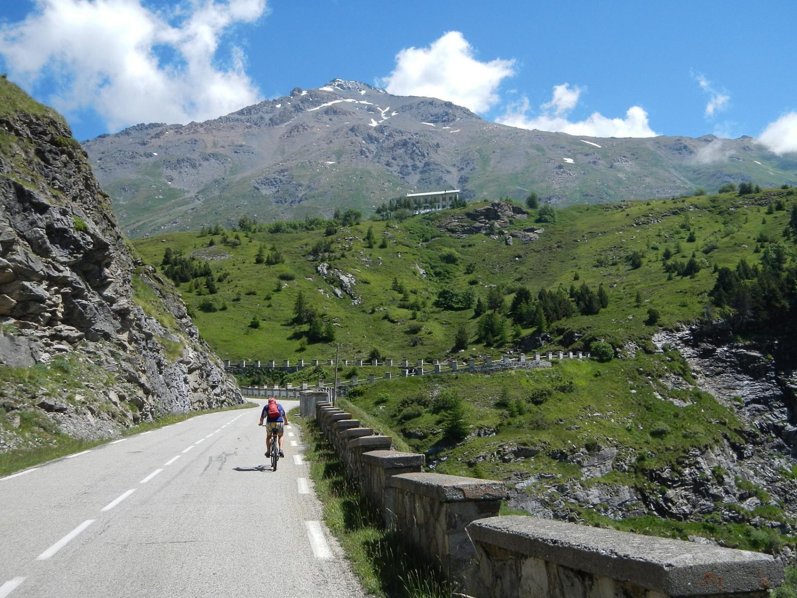
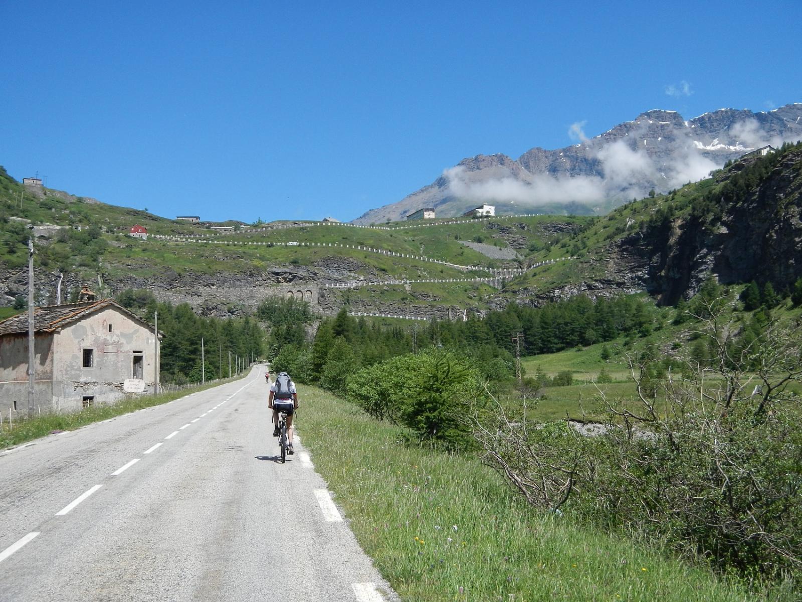
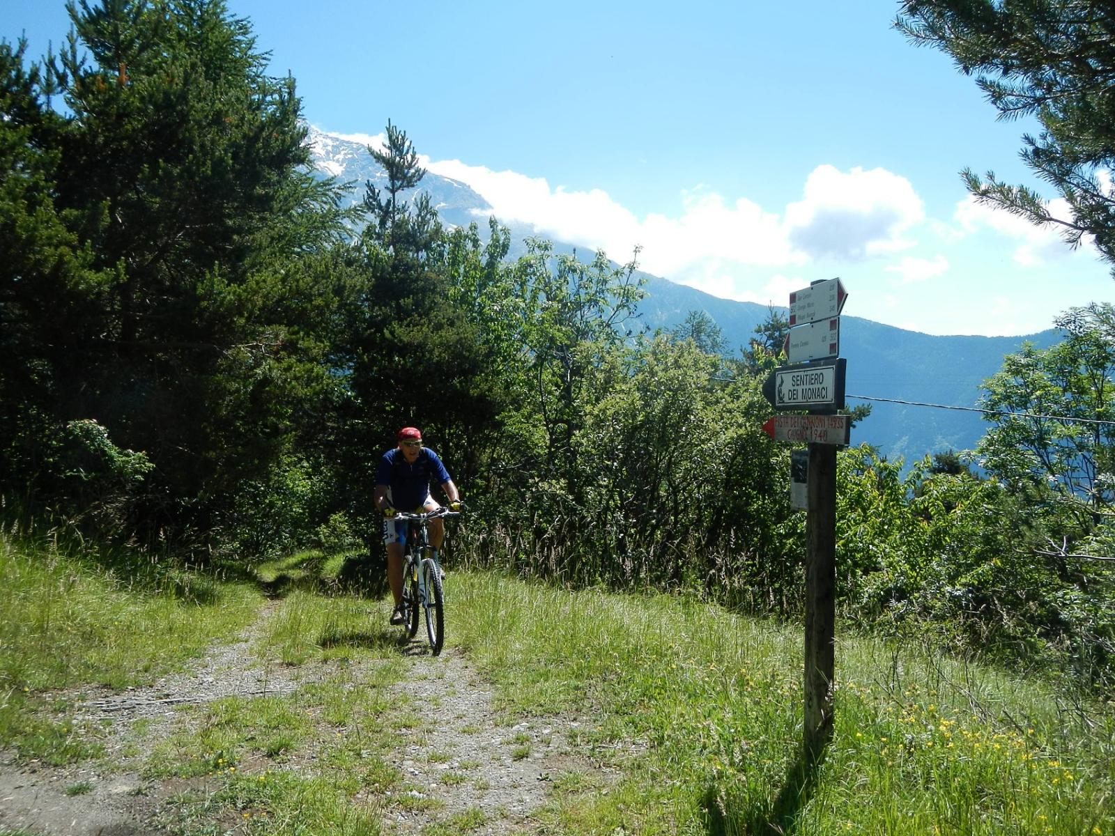
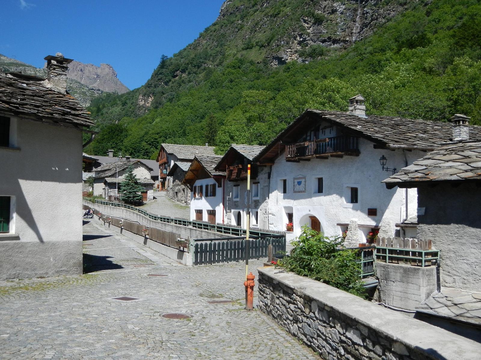
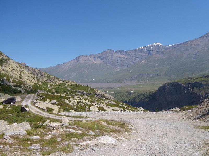
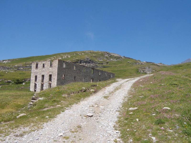
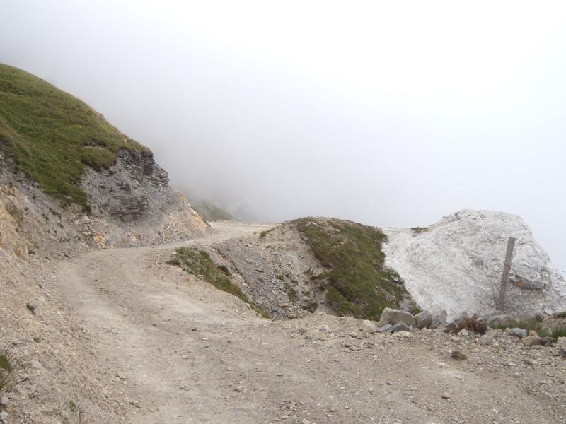
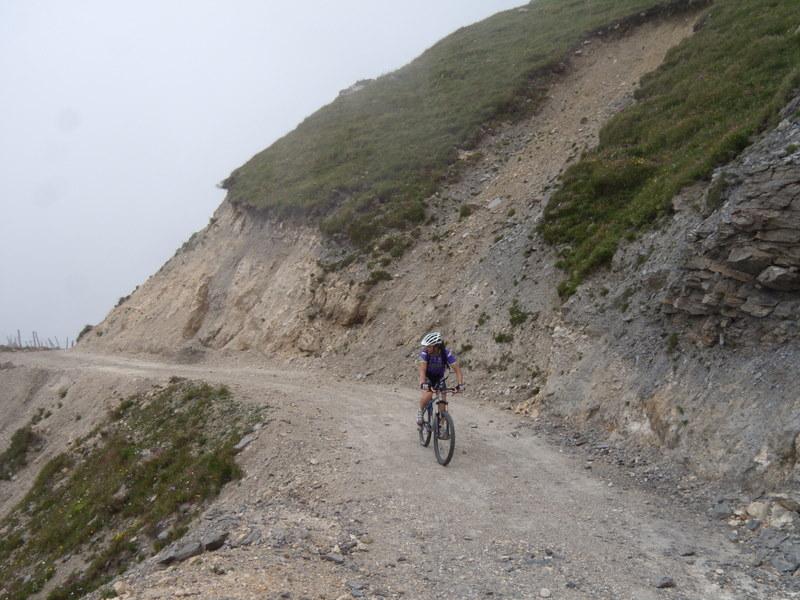
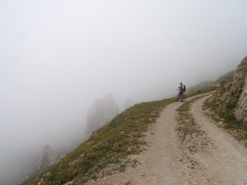
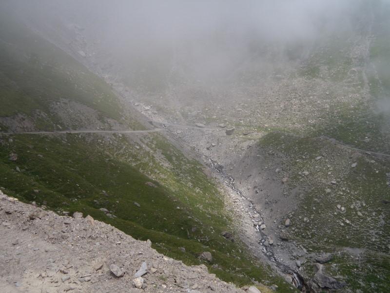
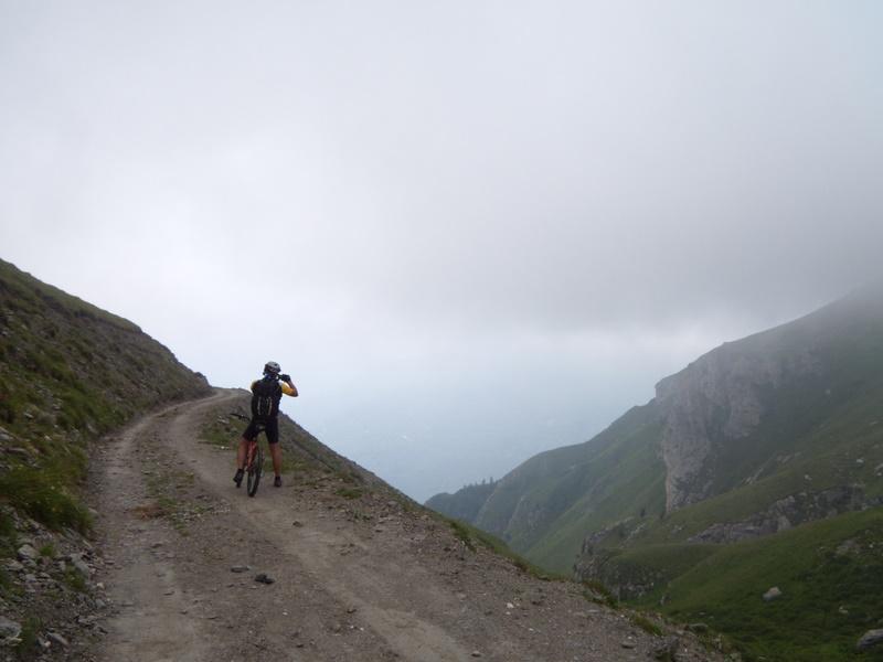
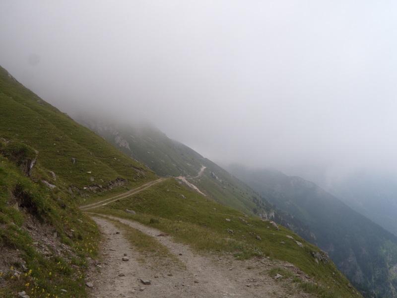
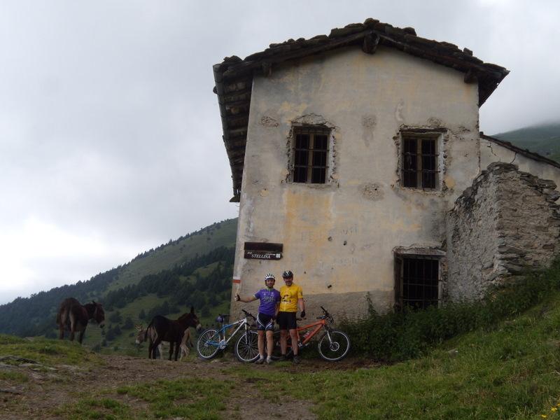
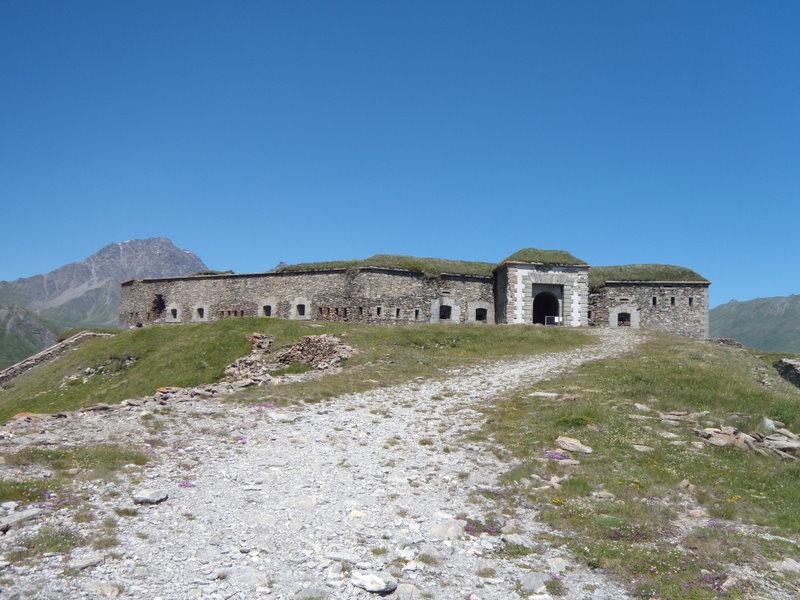
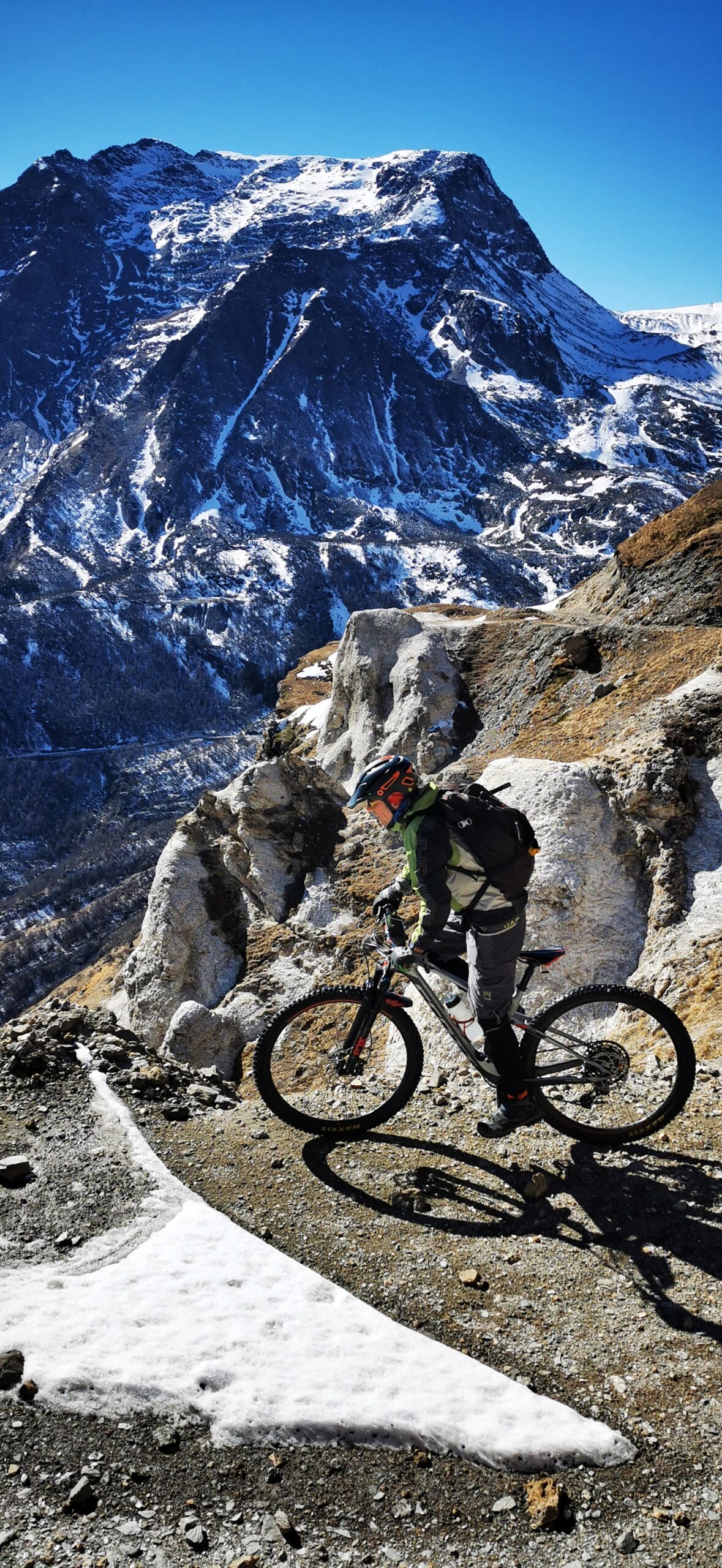
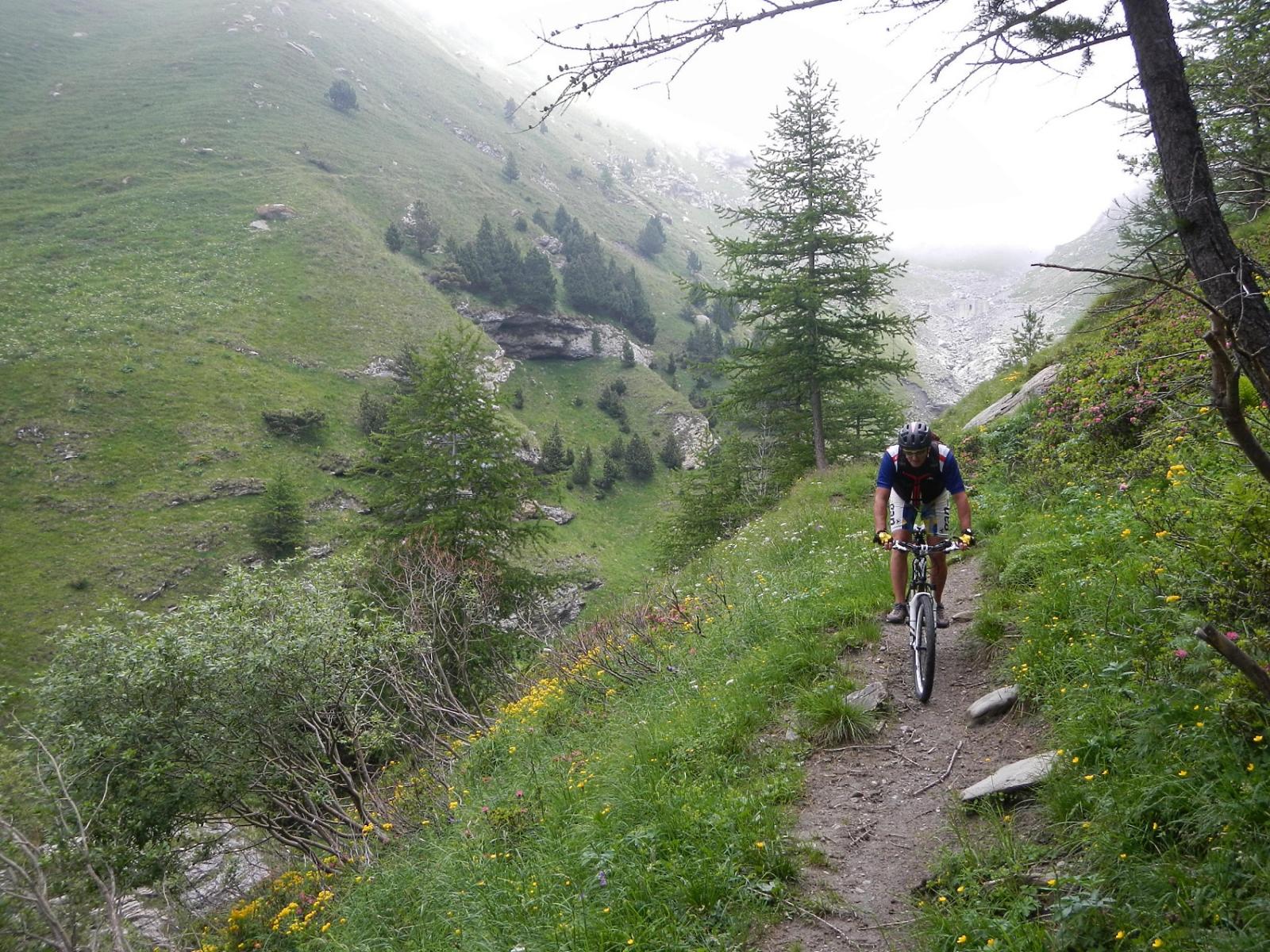
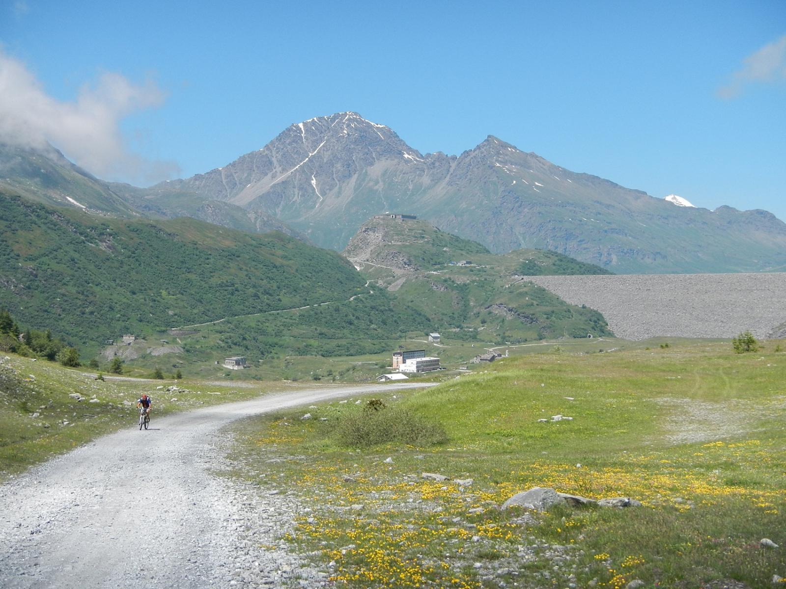
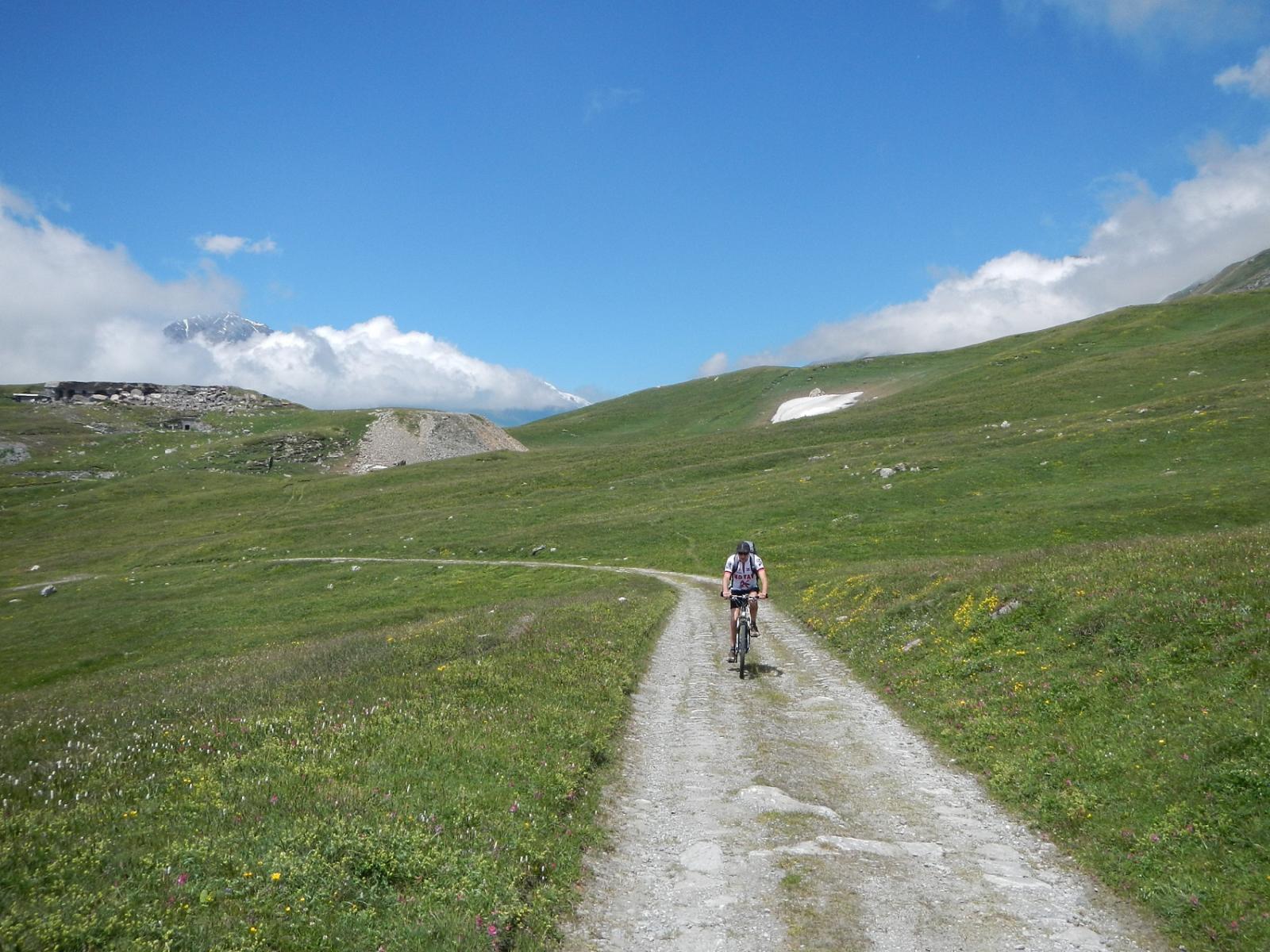
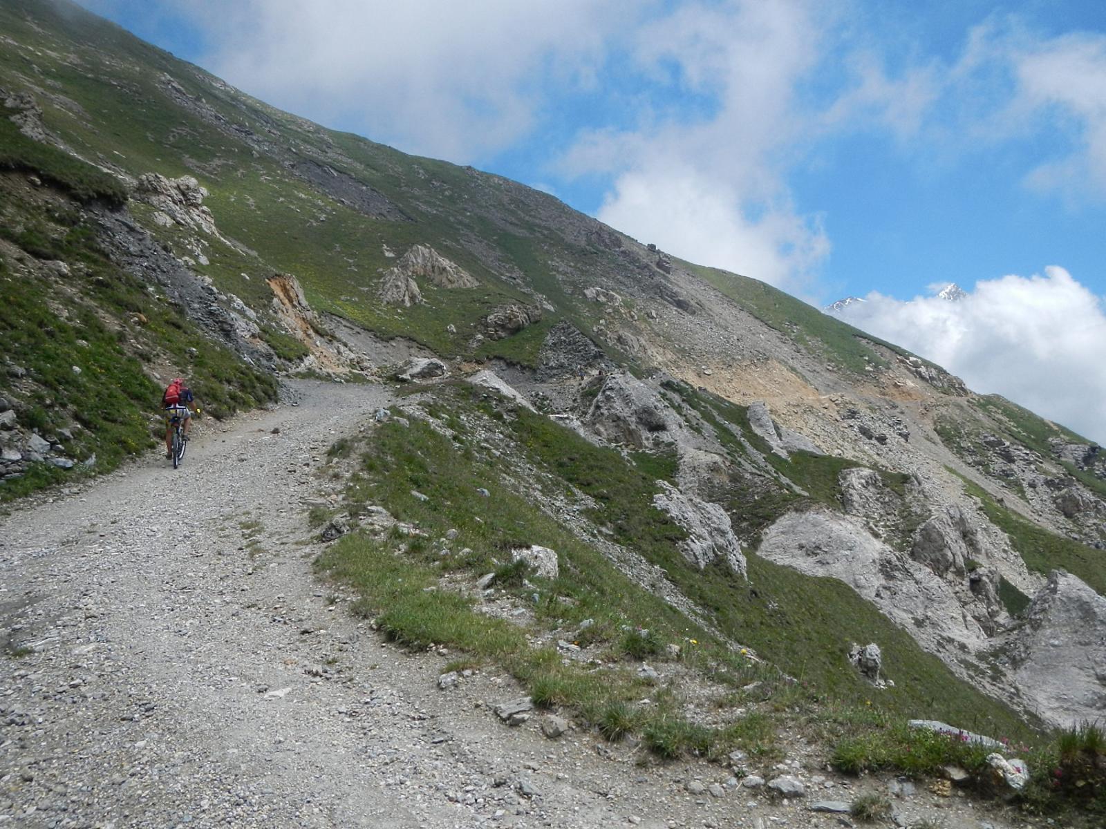
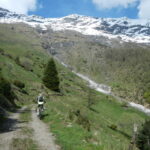
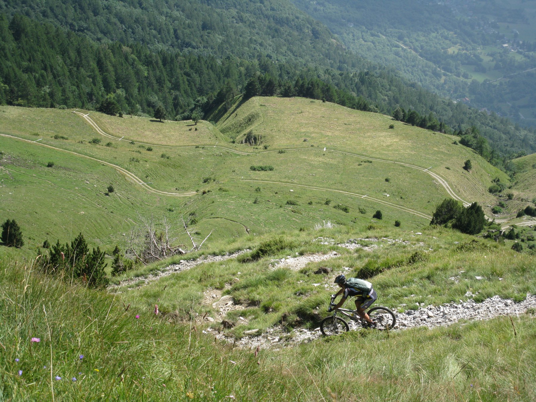
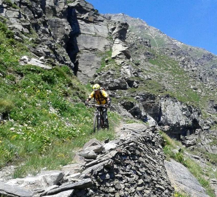
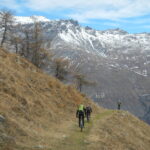
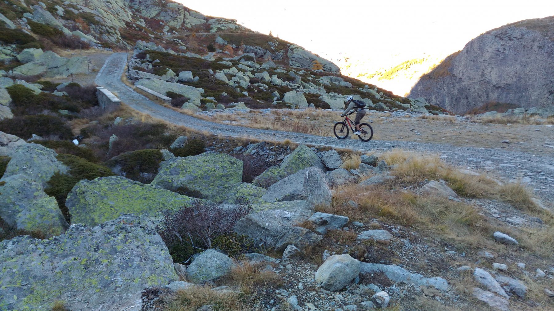
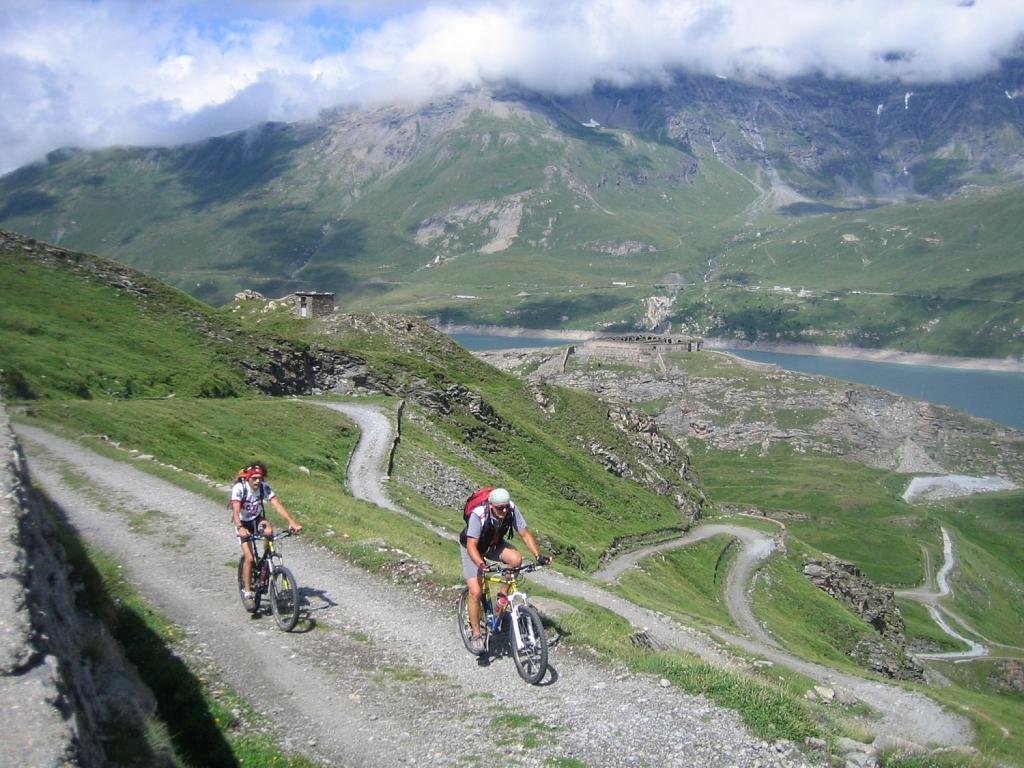
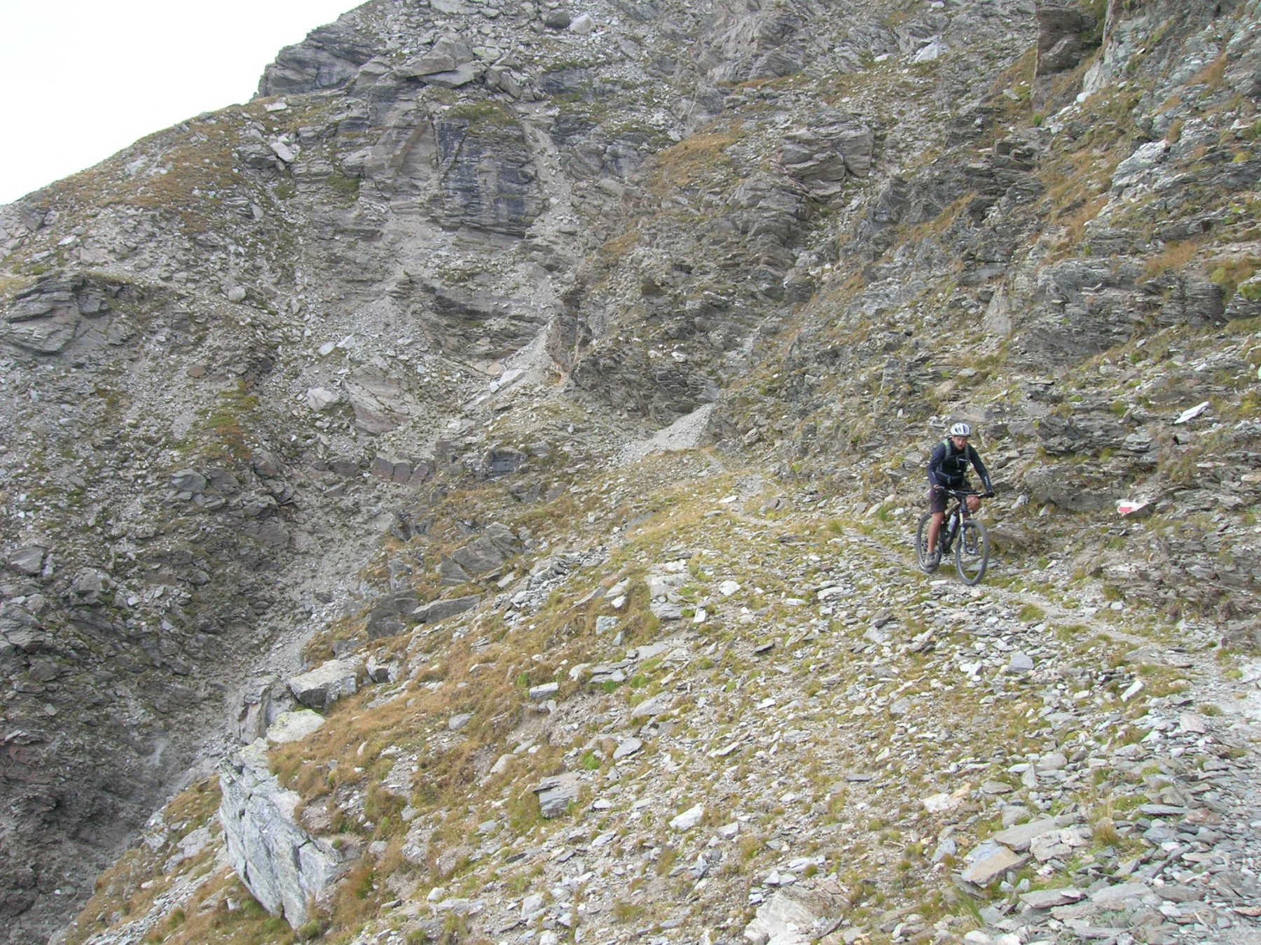
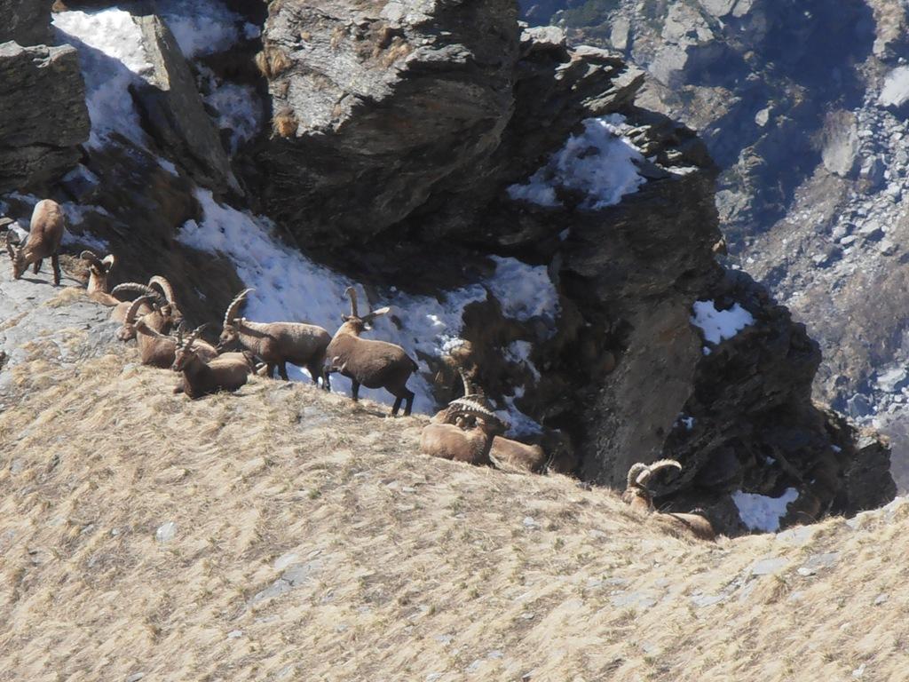
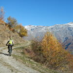
Partenza da Novalesa, lasciando la macchina all’altezza del Ristorante delle Alpi. Prendere la strada asfaltata a sinistra che sale verso Ferrera-Moncenisio, dopo il ponte. Inizia subito una salita di circa 7 km con pendenze impegnative. E’ una strada piacevolissima perchè praticamente non ci passano nè autoveicoli nè motociclette e quindi si può godere appieno della natura e del paesaggio. I primi 3 km sono fuori bosco, poi attraversato un ponte in pietra, iniziano una serie di tornanti ripidi (pendenza media 9-10%)al fresco del bosco. Una volta a Ferrera-Moncenisio si gira a sinistra in direzione SS25-Francia. Quiinizia un falsopiano in discesa che costeggia il Lago Ferrera. Dopo circa 5 km ci si immette sulla SS25 che sale al Passo del Moncenisio. La salita è facile ma dimenticate la tranquillità precedente: moto e auto sfrecciano allegramente. Al Km70 della SS25 la salita finisce e si arriva alla Pian di San Nicolao, in territorio francese, dominata dall’ imponente diga del lago del Moncenisio. Il pianoro consente di recuperare un pò le energie per poter poi affrontare i tornanti impegnativi che salgono fino alla Dogana Francese. Dalla Dogana si continua a salire lasciando sulla destra l’Hotel Gran Scala e poi giungendo dopo 6 km circa al Plan de Fontainette appena sotto il Fort de Ronce. Una volta giunti qui consiglio vivamente una sosta per godersi lo spettacolo del Lac du Moncenis e delle vette circostanti. Si torna poi indietro per circa 1 km e qui sulla sinistra inizia la strada sterrata. E inizia con una ripida salita che porta ad un primo bivio. Al bivio tenere la strada a destra (non ci sono indicazioni) prendendo come riferimento 2 ripide rampe della mulattiera che si vedono in lontananza in direzione del Rocciamelone (est). Si attraversa in discesa un pianoro (casa delle marmotte!! ne ho viste almeno 10!!) e si arriva rapidamente ai resti del fronte di gola della batteria la Court. Qui dopo un paio di tornanti in discesa ci si immette sulla mulattiera che caratterizza il “Sentiero dei 2000”, virando a sinistra e arrivando alle 2 ripide rampe di cui sopra. La strada è sdrucciolevole e ripida e porta al punto più alto del percorso che vi sto descrivendo. Terminata la seconda rampa inizia un lungo e bellissimo traverso caratterizzato da facili saliscendi ma soprattutto da cui si può godere del panorama di tutta la Val Cenischia, da Novalesa, a Ferrera-Cenisio, alle vasche di compensazione di Venaus in lontananza, al Rocciamelone e al Monte Malamot. Dopo circa 4 km si arriva all’Alpe Tour, a quota 2100 m circa. Qui inizia la difficile discesa verso il Grange Pra Plan. La prima parte è caratterizzata da un fondo pietroso e sabbioso e bisogna prestare molta attenzione anche ai fili di recinzione per gli animali che tagliano in due la discesa. Superato un piccolo rio, la discesa diventa molto ripida ed è davvero complicato rimanere in sella. Dopo 200mt circa si arriva ad un vallone investito da una frana. Qui bisogna prendersi in spalla la bici e scendere verso un sentiero che si scorge in lontanza al limite del bosco. Imboccato il sentiero si può risalire in sella ma bisogna prestare moltissima attenzione. Si tratta di un single-track molto tecnico, con pochissimi centrimetri di spazio, intervallato da ripidi salti su roccia, e non proprio in piano. Qui è possibile incrociare escursionisti, per cui il mio consiglio, viste anche le difficoltà tecniche, è di affrontarlo con estrema cautela e al più di percorrerlo a piedi. La parte di single track termina con l’arrivo alle baite del Grange Pra Plan.
Alla baita bisogna seguire l’indicazione per Novalesa, da cui diparte in discesa una mulattiera larga e molto impegnativa, caratterizzata da un fondoprima compatto, poi sdrucciolevole, poi leggermente sassoso, per poi tornare compatto. La difficoltà aumenta perchè si scende abbastanza veloci e ci sono molti tornanti. Superate un paio di cascate si arriva poi sull’ultimo tratto della discesa, ora in asfalto, appena oltrepassata una barra. Da qui poche centinaia di metri e si è nuovamente nel centro di Novalesa.
Nelle vicinanze Mappa
Itinerari
15/05/2025 TO, Novalesa D+ 1063 m MC, OC, S2 Sud-Est
Prapiano (Grange) da Novalesa, discesa per il Sentiero dei Monaci
 50m
50m
24/09/2023 TO, Novalesa D+ 1900 m MC+, OC, S2 Sud
Stellina (Rifugio) alla Punta Carolei da Novalesa per l’Alpe Tour, discesa per Alpe Carolei e Grange Pra Piano
 50m
50m
19/07/2025 TO, Venaus D+ 2250 m OC, OC, S3 Tutte
Clapier (Col) da Venaus, giro per Prapiano, Alpe Tour, Lac Savine, discesa Val Clarea
 3.5Km
3.5Km
09/11/2025 TO, Venaus D+ 1500 m MC, BC, S1 Varie
Marzo (Grange) da Venaus, giro per Santa Chiara, Bar Cenisio e Novalesa
 3.5Km
3.5Km
11/06/2023 TO, Venaus D+ 802 m MC, BC, S1 Varie
Tiraculo (Borgata) e Canale di Maria Bona da Venaus, giro
 3.5Km
3.5Km
21/07/2023 TO, Moncenisio D+ 727 m MC, MC, S1 Varie
Arpone, Roterel (Laghi) da Moncenisio
 3.8Km
3.8Km
22/09/2013 TO, Venaus D+ 1350 m BC, OC+, S3 Varie
Bianco (Lago) da Bar Cenisio per il Lago d’Arpone e Forte Varisello
 4.2Km
4.2Km
11/08/2021 TO, Venaus D+ 1635 m BC+, OC, S3 Varie
Trinceramenti (Passo dei) da Bar Cenisio, giro del Giusalet per Col Clapier e Rifugio Avanzà
 4.2Km
4.2Km
22/09/2018 TO, Giaglione D+ 1800 m BC+, BC+, S1 Varie
Avanzà (Rifugio) da Giaglione per le Bergerie Martina
 4.9Km
4.9Km
08/11/2025 TO, Giaglione D+ 1214 m MC, BC+, S1 Sud-Est
Marzo (Grange) da Giaglione, discesa su Bar Cenisio
 4.9Km
4.9Km
Servizi
250m
450m
La posta Ristorante
Novalesa
450m
Delle Alpi Ristorante
Novalesa
3.2Km
Da Candida Ristorante
Venaus
4.1Km
1880 Ristorante
Venaus
4.9Km
Stellina Rifugio
Novalesa
7.6Km
La riposa Rifugio
Mompantero
8.1Km
La Cantina delle Arti Ristorante
Chiomonte
8.4Km
Jamais sans tois Ristorante
Chiomonte
8.4Km