1.6Km
1.6Km

Note
 1.6Km
2.2Km
4.1Km
4.1Km
4.1Km
4.1Km
10.5Km
10.5Km
10.5Km
10.5Km
1.6Km
2.2Km
4.1Km
4.1Km
4.1Km
4.1Km
10.5Km
10.5Km
10.5Km
10.5Km
1.6Km
4.1Km
4.6Km
6Km
6Km
6.2Km
6.7Km
6.7Km
6.9Km
7.6Km
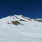
Itinerario complesso e stupendo. Tutto il versante è molto assolato e soggetto ad un elevato pericolo valanghe.
Avvicinamento
Dalla strada statale 24 seguire l'indicazione Grange della Valle. 500 metri dopo l'abitato di Eclause svoltare a sinistra verso le Grange Hubert (strada sterrata) dove si lascia la macchina negli spiazzi che precedono l'alpeggio.
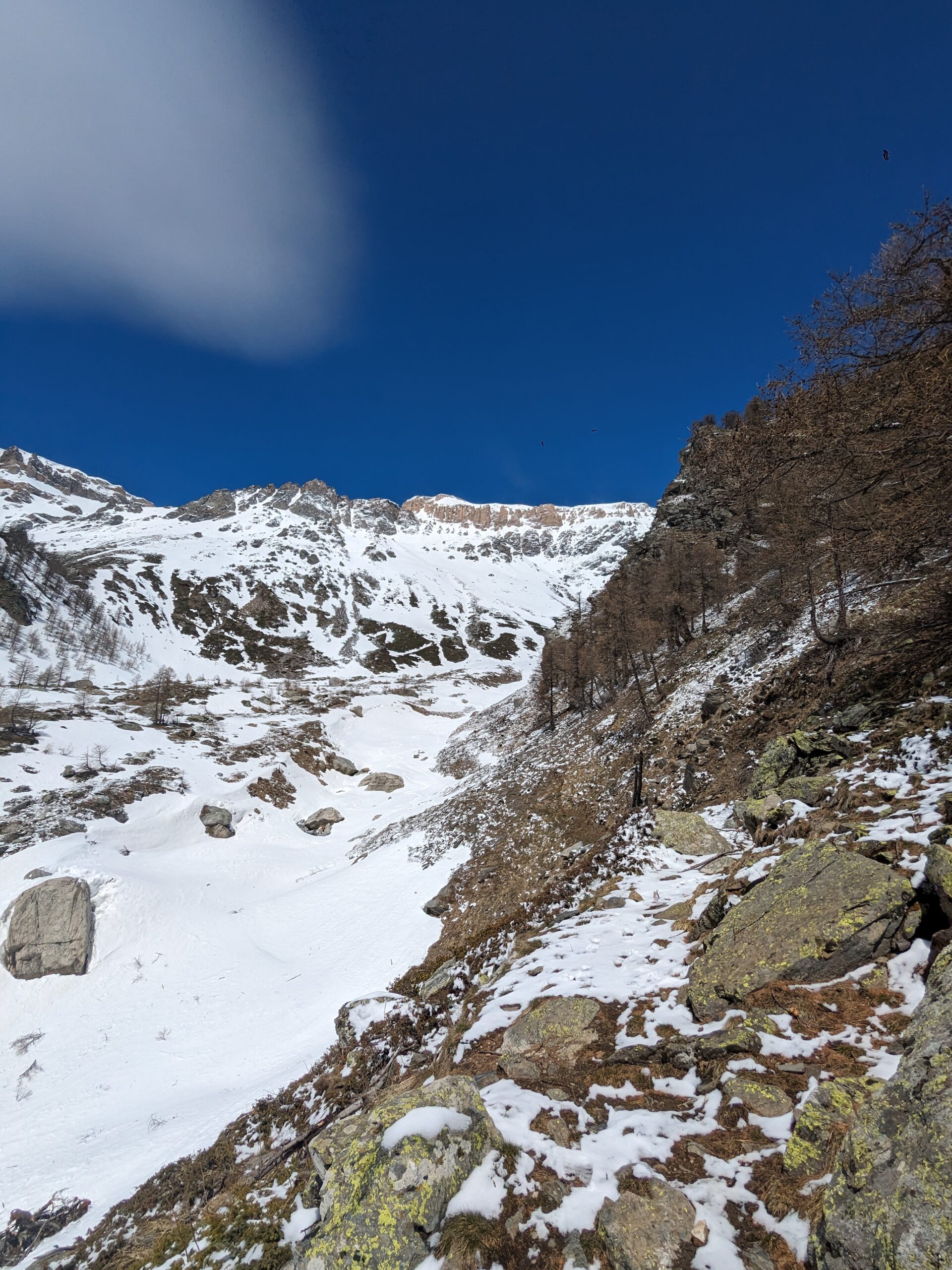
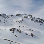
Dalle Grange Hubert si segue il sentiero a tornanti verso Nord che porta nel vallone del Rio Geronda, che si raggiunge ad una quota di circa 2070m. Anche con abbondante innevamento, questo tratto risulta difficilmente sciabile.
Descrizione
Dalle Grange Hubert si segue il sentiero a tornanti verso Nord che porta nel vallone del Rio Geronda, che si raggiunge ad una quota di circa 2070m. Anche con abbondante innevamento, questo tratto risulta difficilmente sciabile.
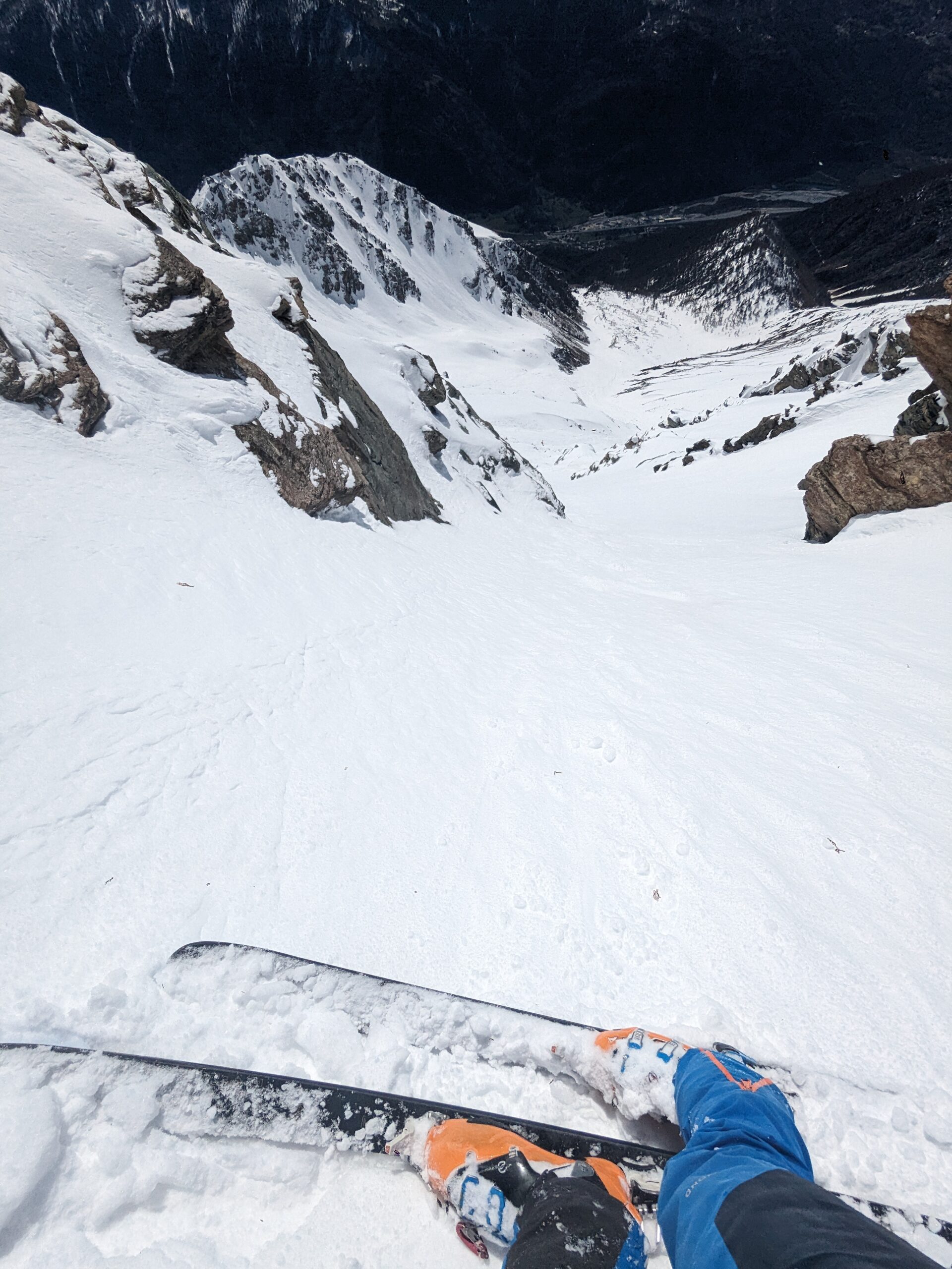
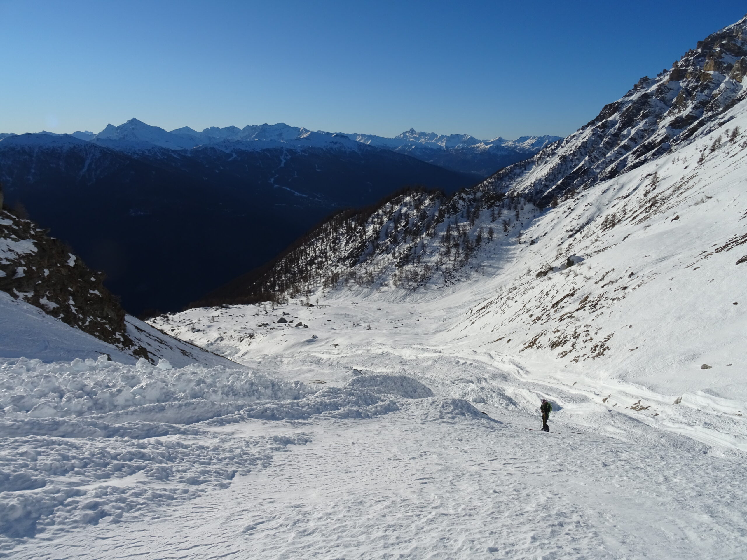
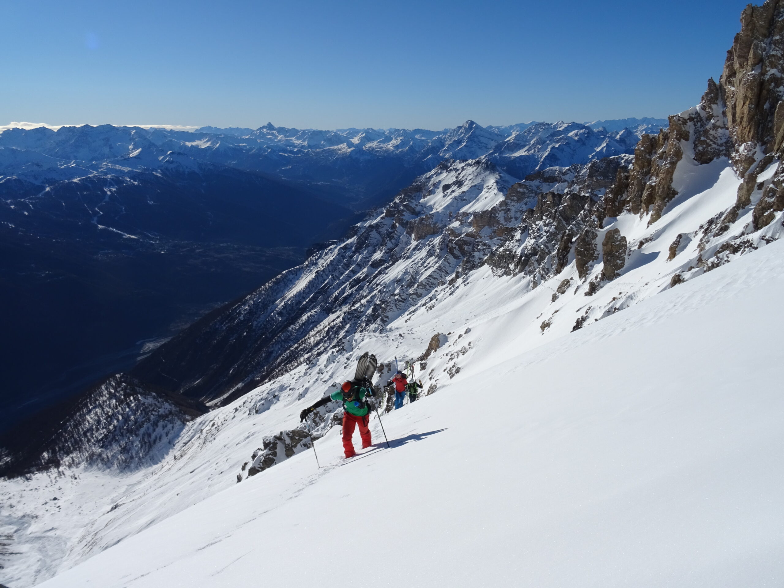
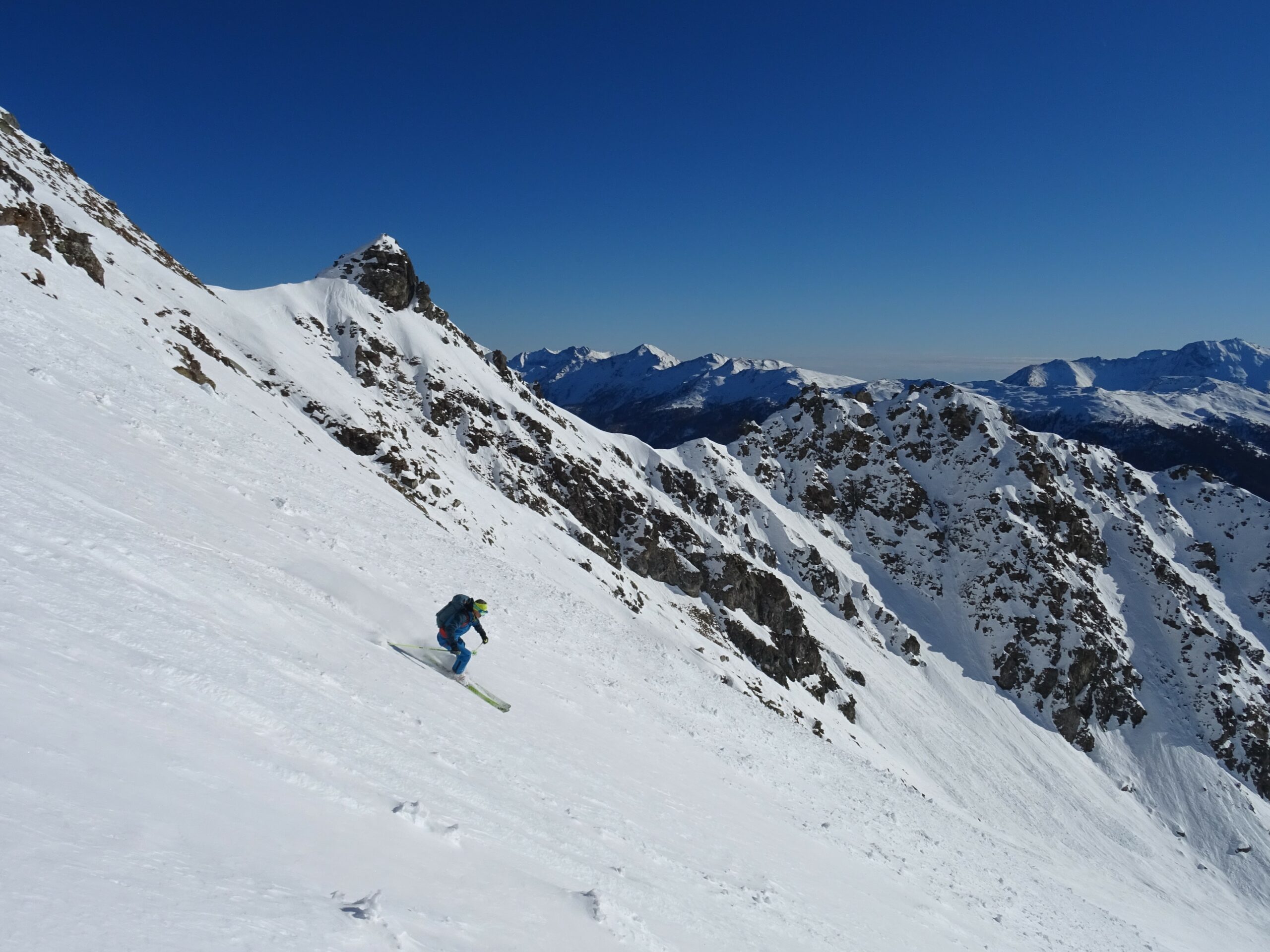
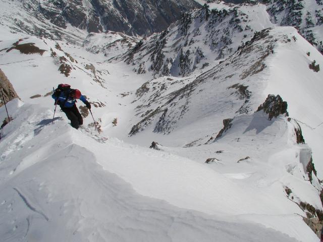
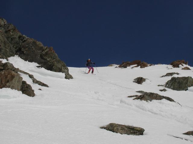
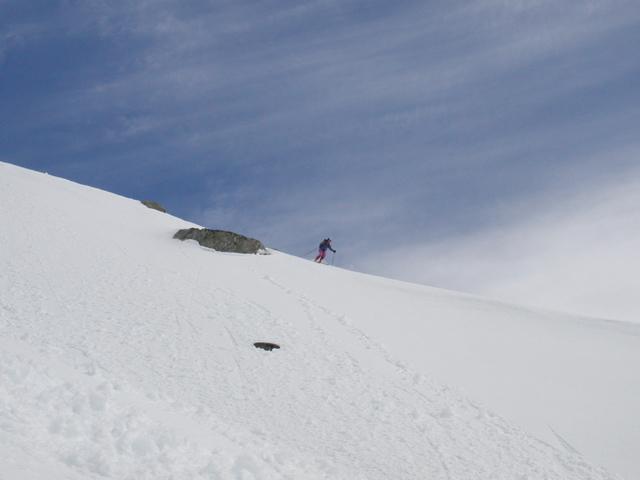
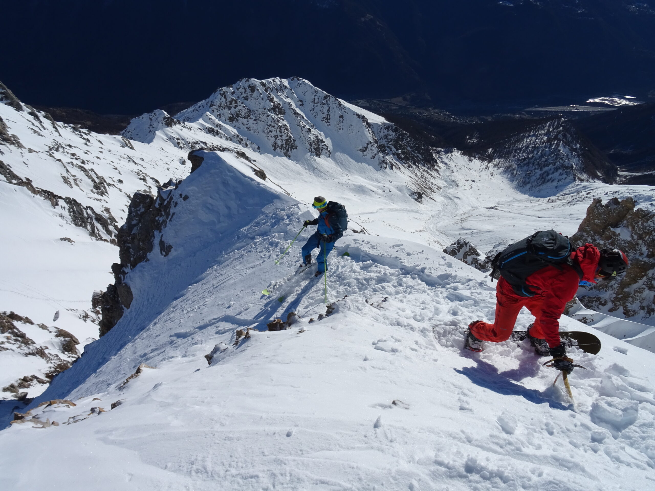
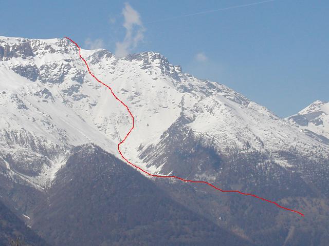
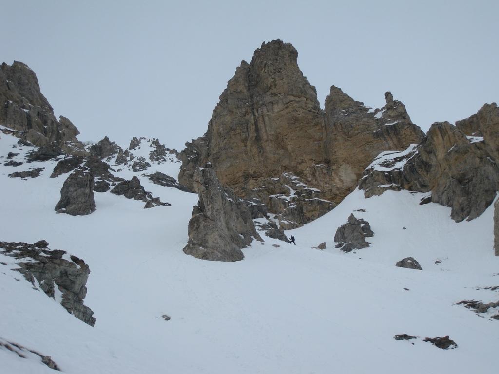
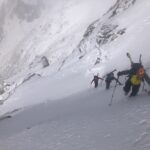
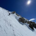
Seguire il fondo del vallone, generalmente occupato da una grande valanga. Intorno a q. 2300-2400m ci si sposta gradualmente verso destra, sotto le pendici della Casses Blanches, si super un ripido risalto (noto come Clot Vallon, 35°) e quindi generalmente dai 2750m si prosegue sci a spalle tagliando gradualmente verso sinistra in un evidente pendio-canale (40°, qualche tratto a 45° nelle strettoie). Quando il canale si apre spostarsi a dx e raggiungere il colletto ad Est della cima (q. 3036m). Svoltare quindi a sinistra (Ovest), aggirando uno sperone roccioso e salendo il canale esposto ad Est che in breve porta in cima al Truc Peyron (esposto l’ultimo tratto, 40-45°).
Discesa lungo l’itinerario di salita.
- Cartografia:
- IGC Valli di Susa Chisone e Germanasca
Nelle vicinanze Mappa
Itinerari
07/04/2010 TO, Salbertrand D+ 1300 m 4.2, E3 Sud-Est
Seguret (Monte) Canale Est
 1.6Km
1.6Km
04/04/2026 TO, Salbertrand D+ 1572 m I, 3.3, E1 Sud
Vallonetto (Cima del) dal Rio Secco
 2.2Km
2.2Km
05/04/2025 TO, Exilles D+ 1600 m II, 4.1, E3 Sud-Est
Niblè (Monte) Lenzuolo Sud-Est
 4.1Km
4.1Km
13/04/2023 TO, Exilles D+ 1600 m III, 4.3, E2 Sud
Niblè (Monte) Canale Sud-Ovest e lenzuolo Sud-Est
 4.1Km
4.1Km
05/04/2026 TO, Exilles D+ 1260 m II, 4.2, E2 Tutte
Gros Beuri da Grange della Valle, canale centrale
 4.1Km
4.1Km
25/04/2025 TO, Exilles D+ 1600 m III, 5.1, E4 Sud-Ovest
Niblè (Monte) Versante SO
 4.1Km
4.1Km
29/05/2014 TO, Bardonecchia D+ 1105 m I, 5.1, E3 Ovest
Rognosa d’Etiache Torre Maria Celeste – Parete Ovest
 10.5Km
25/03/2025 TO, Pragelato D+ 1000 m I, 3.3, E1 Est
Fraiteve (Monte) Canalino Est
 10.5Km
26/04/2026 TO, Bardonecchia D+ 1300 m II, 4.2, E2 Nord-Ovest
Rognosa d’Etiache, cima NE
 10.5Km
26/04/2026 TO, Bardonecchia D+ 1200 m II, 4.2, E2 Nord
Vallonetto (Cima del) Parete Nord
 10.5Km
Servizi
1.6Km
4.1Km
Levi Molinari Rifugio
Exilles
4.6Km
Arlaud Rifugio
Salbertrand
6Km
La Quadriglia Ristorante
Exilles
6Km
L’ultima stisa Ristorante
Exilles
6.2Km
Touplan Ristorante
Exilles
6.7Km
orto del frate Ristorante
Sauze d'Oulx
6.7Km
paddy mc ginty Ristorante
Sauze d'Oulx
6.9Km
L’Cantun B&B
Sauze D'oulx
7.6Km