1.9Km
1.9Km

Note
 50m
50m
100m
1.3Km
9.2Km
9.4Km
9.9Km
12.3Km
50m
50m
100m
1.3Km
9.2Km
9.4Km
9.9Km
12.3Km
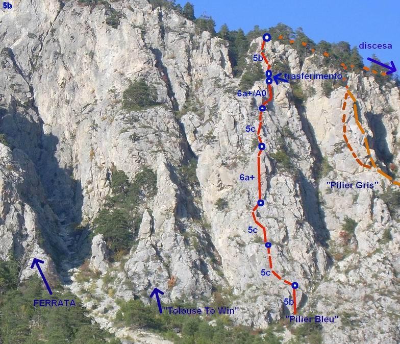
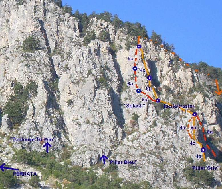
via più lunga del vicino Pilier Gris, su roccia a tratti molto bella.
Uscita in comune con "Toulouse To Win", si puo anche proseguire con una nuova via (Super-Toulouse o qualcosa del genere) che richiede un po di ricerca e 2 calate in doppia "verdoniane", per un totale di 14 tiri! Via interamente spittata con fix da 10.
Avvicinamento
Uscita in comune con "Toulouse To Win", si puo anche proseguire con una nuova via (Super-Toulouse o qualcosa del genere) che richiede un po di ricerca e 2 calate in doppia "verdoniane", per un totale di 14 tiri! Via interamente spittata con fix da 10.
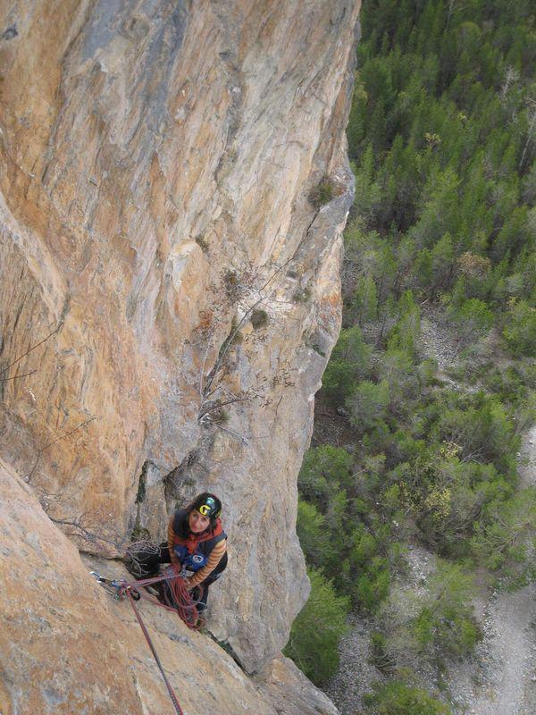
Briançon, Champ de Mars
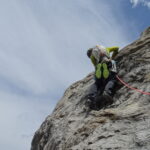
Descrizione
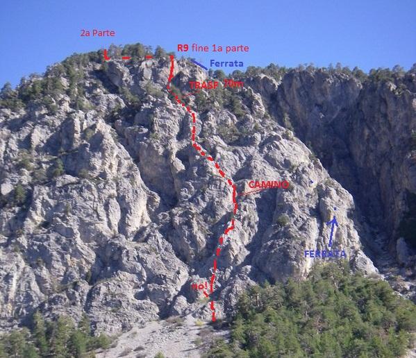
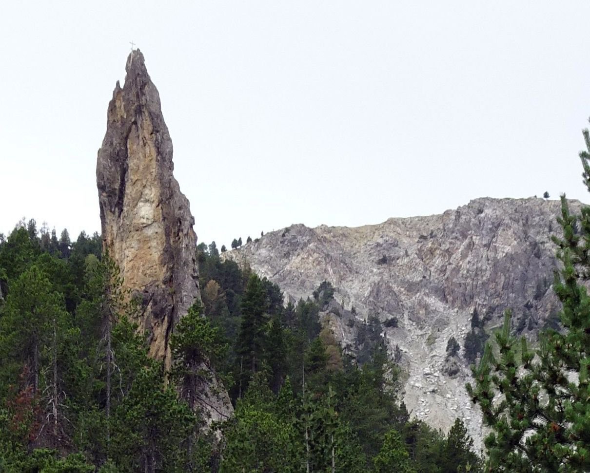
come per il Pilier Gris, ma anziché prendere il primo canale a dx, continuare a salire sulla ripida pietraia per 100m, cercando la via alla base dello sperone più largo. (vedi schizzo).
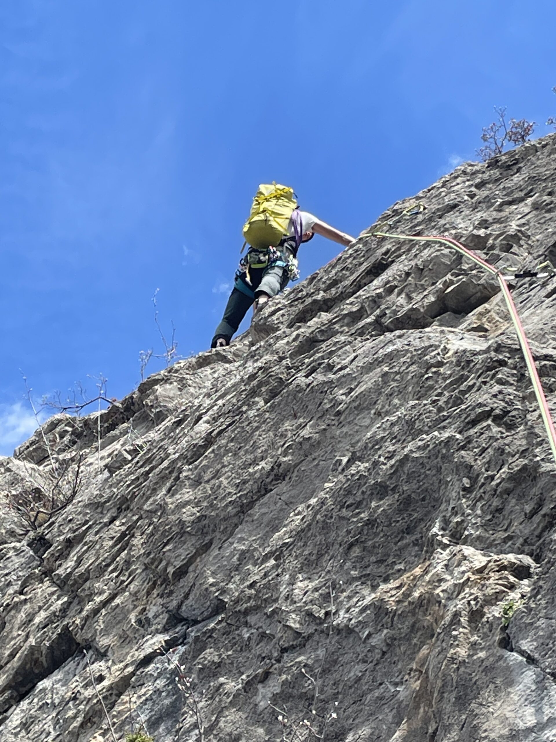
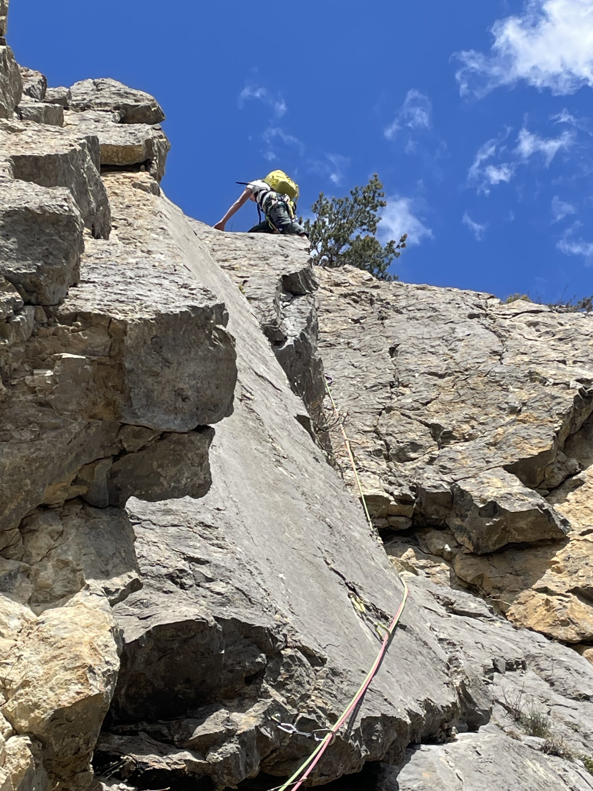
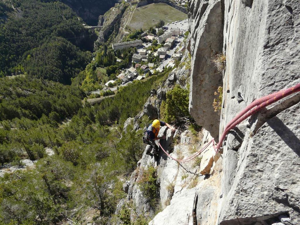
Cinque lunghezze: 5b, 5c, 6a+ (bellissimo), 5c (marciotto, delicato), 6a+/Ao, 5b (dopo un breve trasferimento).
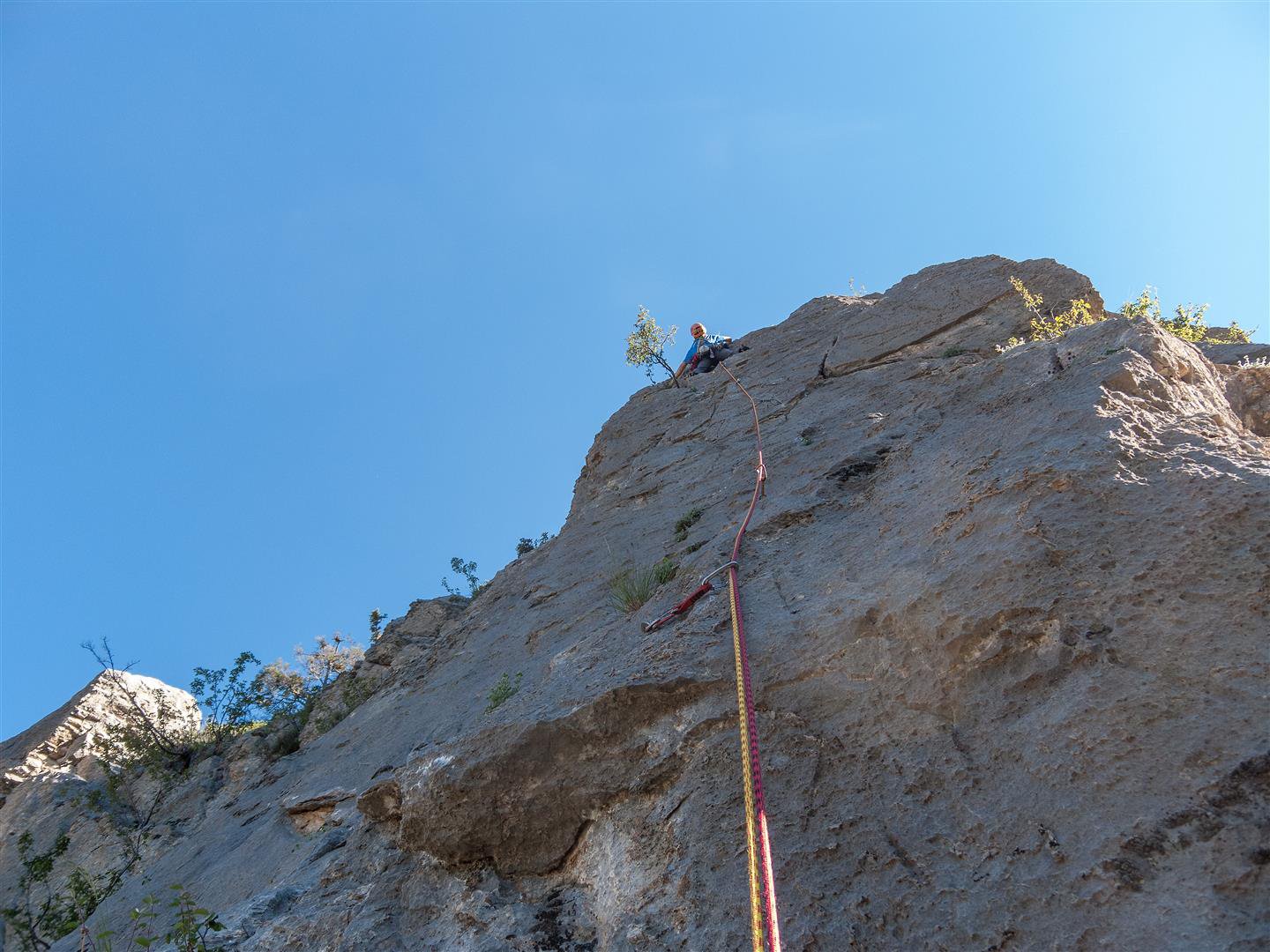
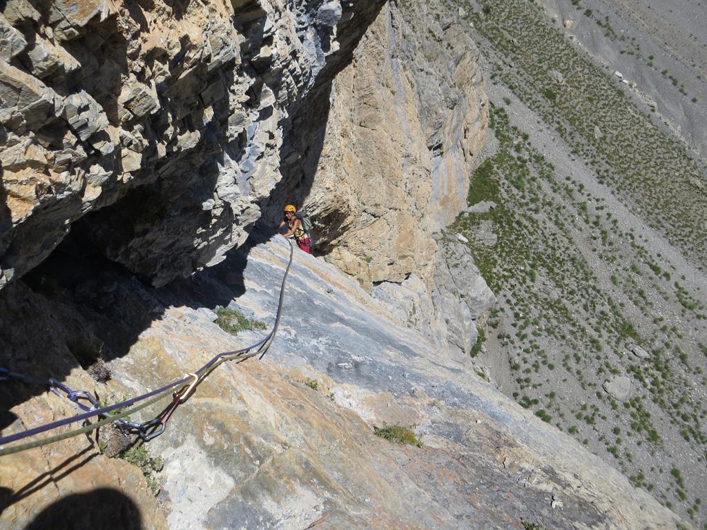
Dalla cima del Pilier, si puo’ scendere verso destra per raggiungere la discesa del “Plier Gris”. Oppure scendere a sinistra per prendere lo spigolo spittato che con 2 lunghezze porta di nuovo fuori dalle rocce, di li traversare lungamente a destra o andare a sinistra a cercare le calate per il misterioso concatenamento “verdoniano” di cui si parlava nelle note.
- Bibliografia:
- Giornalino CAF Briancon
Nelle vicinanze Mappa
Itinerari
01/06/2026 Hautes-Alpes, Briançon 5b, 5b obbl. Sud
Toulouse (Croix de) – Eperon des Salettes
 50m
50m
05/09/2023 Hautes-Alpes, Briançon 6a, 5b obbl. Sud
Toulouse (Croix de) – Pilier Gris
 50m
50m
02/06/2016 Hautes-Alpes, Briançon 6a, 5c obbl. Sud
Toulouse (Croix de) – Toulouse To Win
 100m
100m
12/08/2020 Hautes-Alpes, Briançon 6a+, 5c obbl. Sud
Toulouse (Croix de) – Splash
100m
11/05/2013 Hautes-Alpes, Briançon 6b, 5a obbl. Sud
Toulouse (Croix de) – GV
 1.3Km
1.3Km
26/07/2025 Hautes-Alpes, Puy-Saint-André 6a, 5c obbl. Nord-Ovest
Jaune (Rocher) – Meursault Pilami
 9.2Km
9.2Km
20/08/2024 Hautes-Alpes, Névache 6b, 6a obbl. Sud
Val de la Clarée, Paroi des 50 Anes – Diedre Jaune + Viree en Claree
 9.4Km
9.4Km
01/11/2009 Hautes-Alpes, Névache 6a, 5c obbl. Sud
Val de la Clarée, Paroi des 50 Anes – Pilier Gris
9.7Km
02/08/2019 Hautes-Alpes, Arvieux 6a, 6a obbl. Est
le Laus (Aiguillette de) – Carpatoux
 9.9Km
9.9Km
04/09/2013 Hautes-Alpes, Arvieux 6b, 6a obbl., a0 Sud-Est
Beaudouis (Pic de) – Crete de l’Alpalier Adios Pèpè
 12.3Km