2.9Km
2.9Km

Note
Storico
 100m
100m
200m
300m
2.9Km
3.1Km
10.4Km
10.4Km
10.5Km
100m
100m
200m
300m
2.9Km
3.1Km
10.4Km
10.4Km
10.5Km
2.9Km
2.9Km
3Km
3.5Km
3.8Km
4.7Km
8.5Km
8.5Km
8.5Km
8.5Km
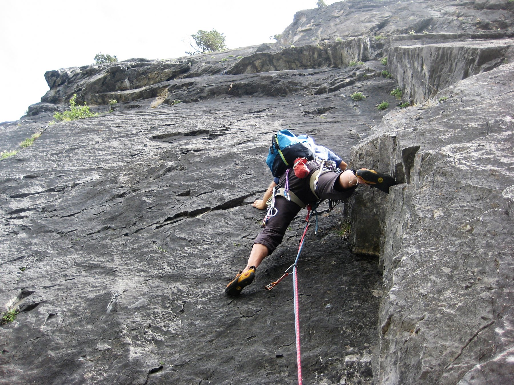
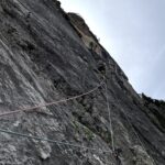
L’ ultimo itinerario aperto sul Monte Furgon, ed il secondo in stile moderno, molto bello e logico su roccia nel complesso buona con alcune sezioni più delicate, si sviluppa nella zona sinistra, pressa poco lungo l’ enorme colata nera, la via è interamente attrezzata a fix con soste per le calate, utili qualche friend piccolo e medio.
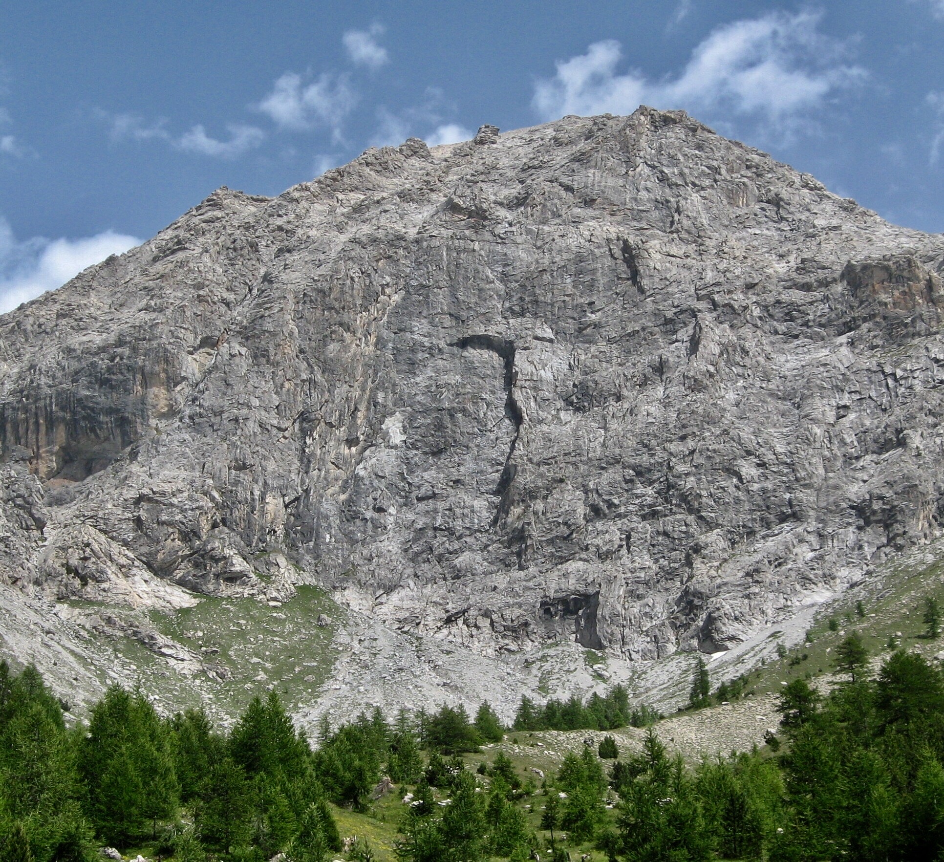
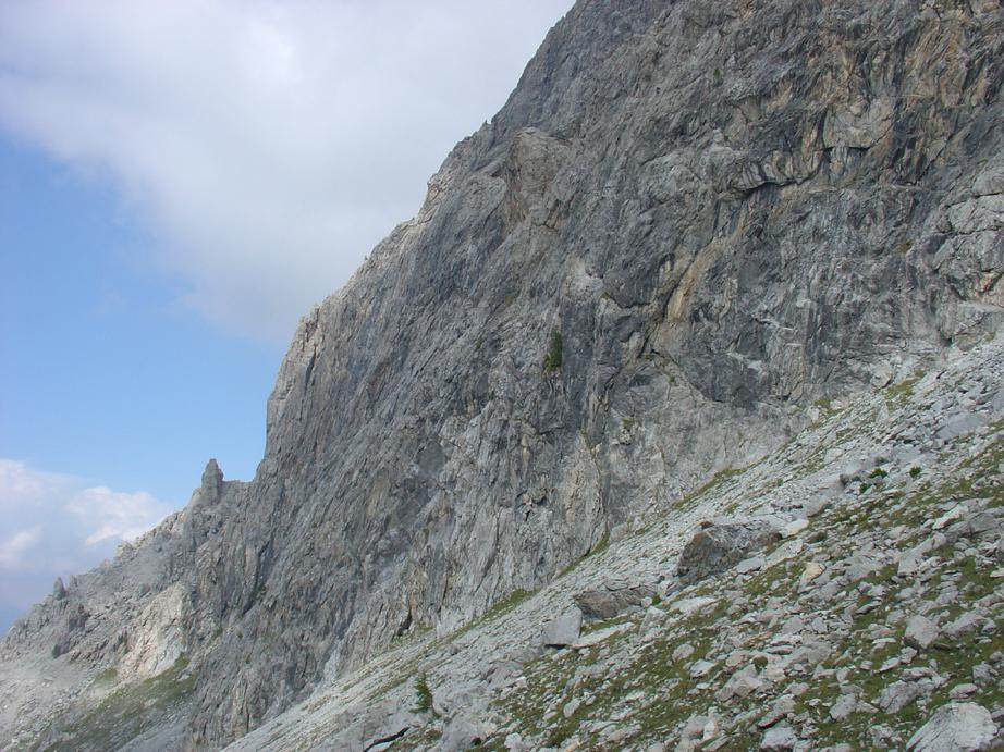
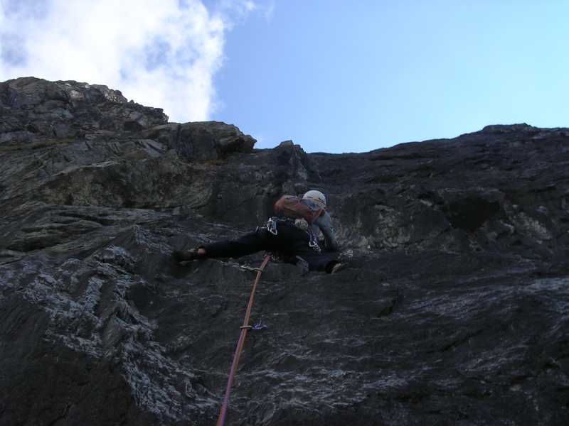
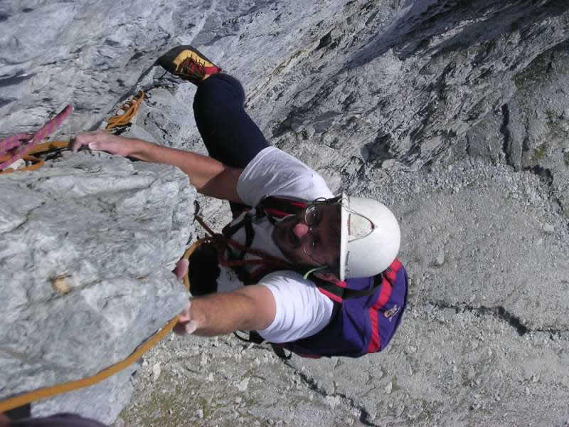
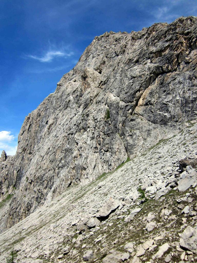
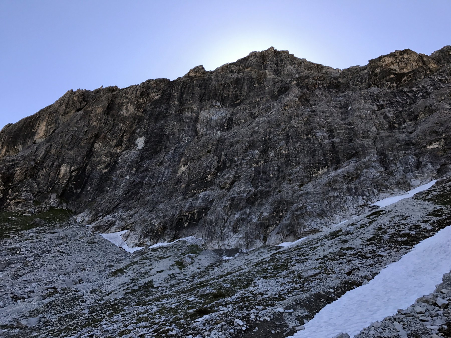
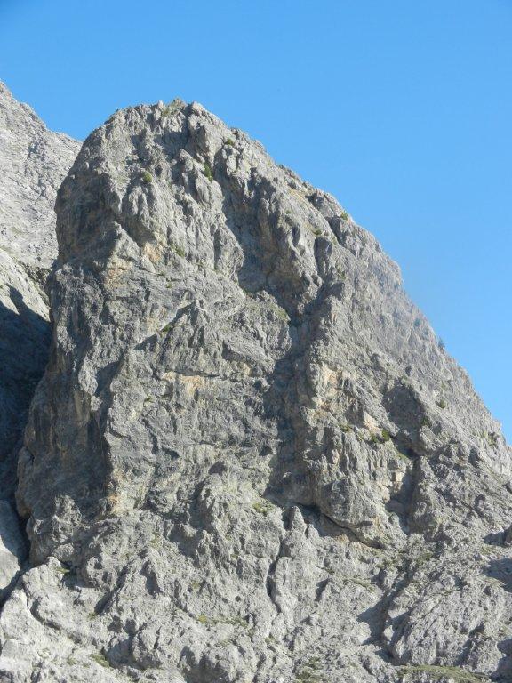
II Monte Furgon m. 2815 è la prima vetta rocciosa posta sullo spartiacque Valle Ripa - Valle Thuras, essa si trova a sud della Cima del Bosco e si presenta sul versante Nord-ovest con un imponente parete di roccia calcarea alta circa 400 metri, che inizia a pochi metri dal sentiero che dal Colle Chalvet, porta nella conca di “ La Coppa ”. La roccia è un bel calcare grigio e nero con alcune zone più rossicce, in alcuni punti, pur non essendo assolutamente friabile, è comunque un pò delicata.
La parete per via della sua esposizione a Nord Ovest riceve poco sole anche nel pieno dell’estate, pertanto vista la quota non indifferente di 2800 metri è ideale per l’ arrampicata solo nella bella stagione. Le vie attaccano ad una quota di circa 2400 m. ed il sole raggiunge i piedi della parete mai prima delle ore 13/14
Avvicinamento
II Monte Furgon m. 2815 è la prima vetta rocciosa posta sullo spartiacque Valle Ripa - Valle Thuras, essa si trova a sud della Cima del Bosco e si presenta sul versante Nord-ovest con un imponente parete di roccia calcarea alta circa 400 metri, che inizia a pochi metri dal sentiero che dal Colle Chalvet, porta nella conca di “ La Coppa ”. La roccia è un bel calcare grigio e nero con alcune zone più rossicce, in alcuni punti, pur non essendo assolutamente friabile, è comunque un pò delicata.
La parete per via della sua esposizione a Nord Ovest riceve poco sole anche nel pieno dell’estate, pertanto vista la quota non indifferente di 2800 metri è ideale per l’ arrampicata solo nella bella stagione. Le vie attaccano ad una quota di circa 2400 m. ed il sole raggiunge i piedi della parete mai prima delle ore 13/14
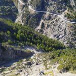
Da Oulx, raggiungibile tramite la A32 del Frejus, dirigersi verso il valico del Monginevro fino al paese di Cesana, raggiunto il quale non svoltare per il valico, ma proseguire diritti oltrepassandone l’ abitato per dirigersi verso Bousson.
Arrivati in prossimità della Caserma degli Alpini nel piccolo villaggio di Bousson, svoltare a destra e per strada asfaltata raggiungere la frazione di Thures, dal tornate prima di immettersi nelle case, parte una sterrata in direzione opposta alla frazione, seguirla passando a monte delle costruzioni e raggiungere un altro piccolo villaggio Gorlier 1760 m. cui parcheggiare.
Descrizione
Arrivati in prossimità della Caserma degli Alpini nel piccolo villaggio di Bousson, svoltare a destra e per strada asfaltata raggiungere la frazione di Thures, dal tornate prima di immettersi nelle case, parte una sterrata in direzione opposta alla frazione, seguirla passando a monte delle costruzioni e raggiungere un altro piccolo villaggio Gorlier 1760 m. cui parcheggiare.
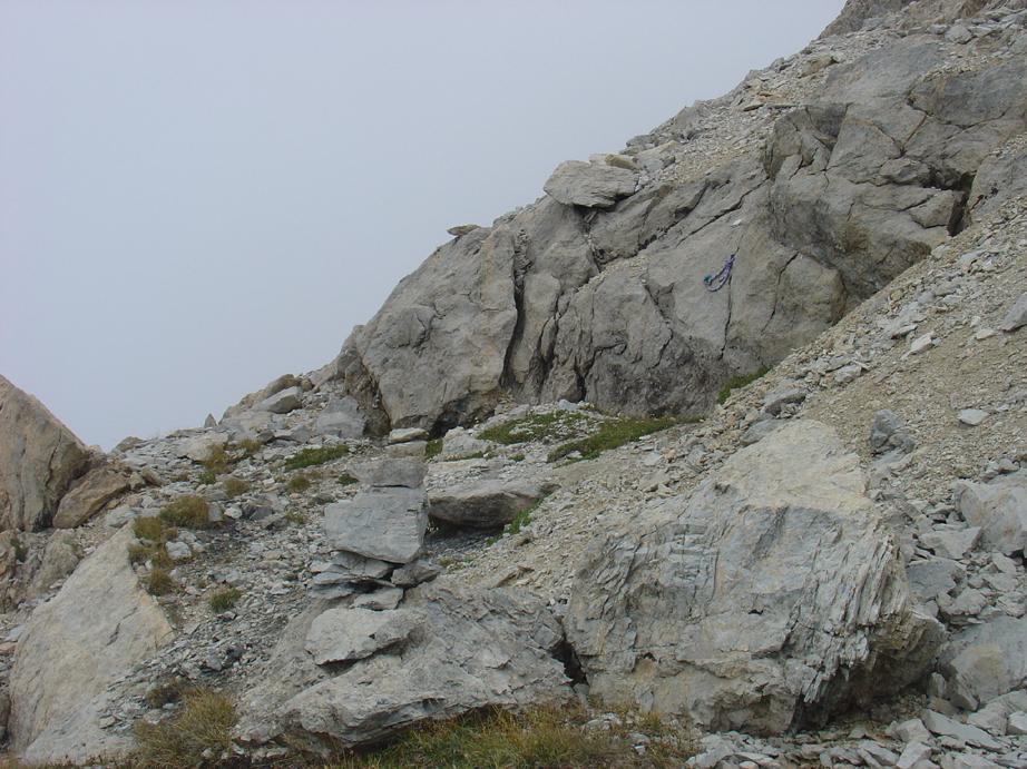
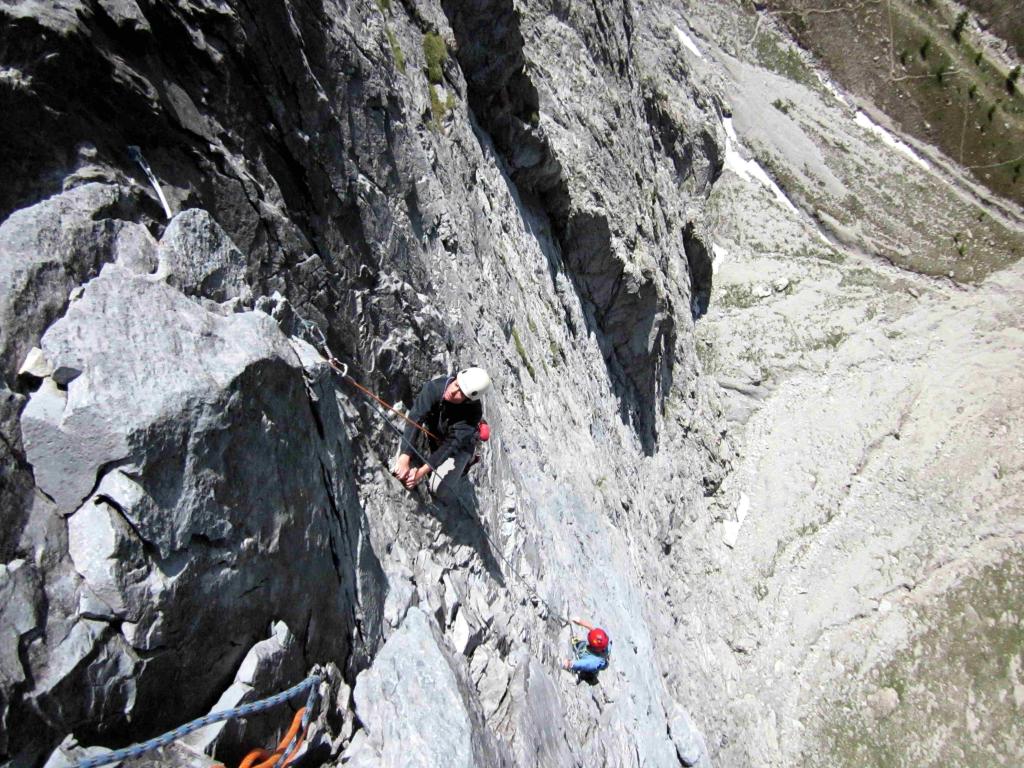
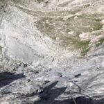
Salire per sentiero e prati in direzione del col Chalvet ( nord-est) dopo qualche centinaio di metri di dislivello si vede la parete, seguire ancora il sentiero fin che questo tende a sinistra, quindi salire in direzione della base parete che si raggiunge per ghiaione a quota m. 2400. 1.30 h.
Discesa (possibilità di scariche di pietre): dalla sosta 9 dove terminano le difficoltà possibilità di calata in corda doppia ( 2 corde da 50 m. )
Oppure (consigliato) : dalla sosta 9, traversare verso sinistra, fino ad un facile canale roccioso, risalirlo o aggiralo per circa 80 metri, quindi a dx (sud, piccoli segni blu ) per una cengia detritica fino ad incrociare la via normale, dal quale si raggiunge la conca “ Della Coppa “, e il sentiero che riporta alla base. ( 45 min.)
prima salita: - F. Michelin - C. Bocco luglio 1995
- Bibliografia:
- Roccia d'Autore - Fiorenzo Michelin
Nelle vicinanze Mappa
Itinerari
19/07/2026 TO, Cesana Torinese 6b+, 6a+ obbl. Nord-Ovest
Furgon (Monte) – Super Furgon
 100m
100m
05/09/2022 TO, Cesana Torinese 6c+, 6a+ obbl. Nord-Ovest
Furgon (Monte) – Polvere di Stelle
 100m
100m
07/09/2024 TO, Cesana Torinese 6c, 5a obbl. Nord-Ovest
Furgon (Monte) – Via del Pilastro
 200m
200m
21/07/2022 TO, Cesana Torinese 6a, 5c obbl. Nord-Ovest
Furgon (Monte) Parete NO – Furgon Plaisir
 300m
300m
05/07/2026 TO, Cesana Torinese 5b, 5a obbl. Nord
Alberon (Cima) – Voie de l’Amitiè
 2.9Km
2.9Km
18/08/2012 TO, Cesana Torinese 5a, 5a obbl. Est
Rossa di Thuras (Guglia) – Via Normale
 3.1Km
3.1Km
28/06/2026 TO, Cesana Torinese 7a, 6a+ obbl. Ovest
Clarì (Punta) – Un Pas Vers le Ciel
 10.4Km
19/07/2026 TO, Cesana Torinese 6a+, 6a obbl. Nord-Ovest
Clarì (Rocca) – Super Calcaire
 10.4Km
20/08/2024 TO, Cesana Torinese 6c+, 6c obbl., a0 Nord-Ovest
Clarì (Rocca), torre est – Calimero nella Grotta dei Ricordi
 10.5Km
20/07/2013 TO, Cesana Torinese 6a+, 5c obbl., a0 Nord-Ovest
Clarì (Rocca) – Placche Nere
10.5Km
Servizi
2.9Km
2.9Km
La Tana degli Orsi B&B
Cesana Torinese
3Km
La Crota B&B
Cesana Torinese
3.5Km
Misun La Font Ristorante
Sauze di Cesana
3.8Km
La Fontana del Thures Rifugio
Cesana Torinese
4.7Km
Centro Ristorante
Cesana Torinese
8.5Km
L’Ibarus Rifugio
Cesana Torinese
8.5Km
Piergiorgio Frassati B&B
Cesana Torinese
8.5Km
Casa Cesana Bar
Cesana Torinese
8.5Km