2.8Km
2.8Km
Note
Storico
 50m
100m
100m
200m
2.8Km
3Km
10.3Km
10.4Km
10.4Km
50m
100m
100m
200m
2.8Km
3Km
10.3Km
10.4Km
10.4Km
2.8Km
2.8Km
2.9Km
3.5Km
3.7Km
4.6Km
8.5Km
8.5Km
8.5Km
8.5Km
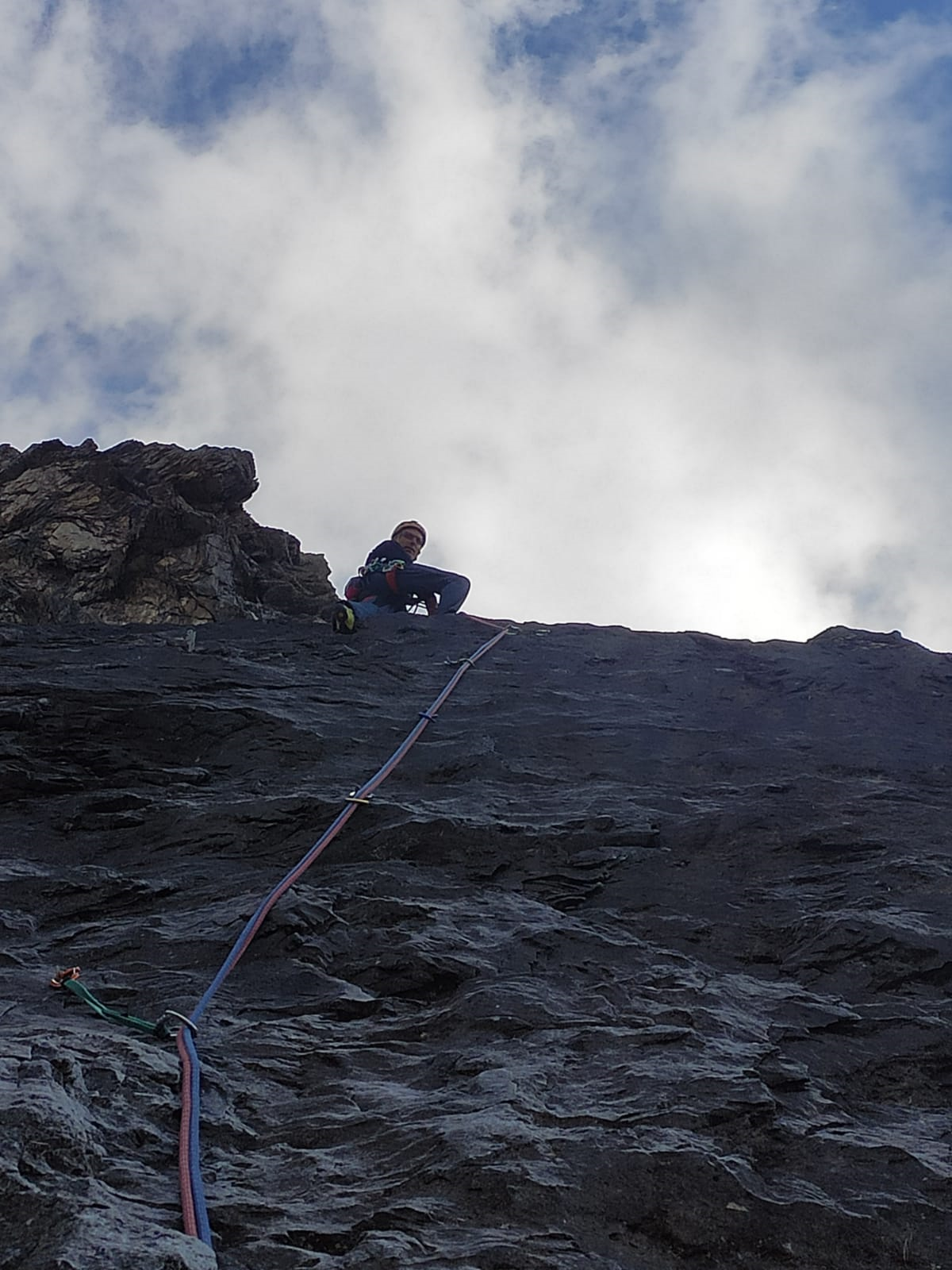
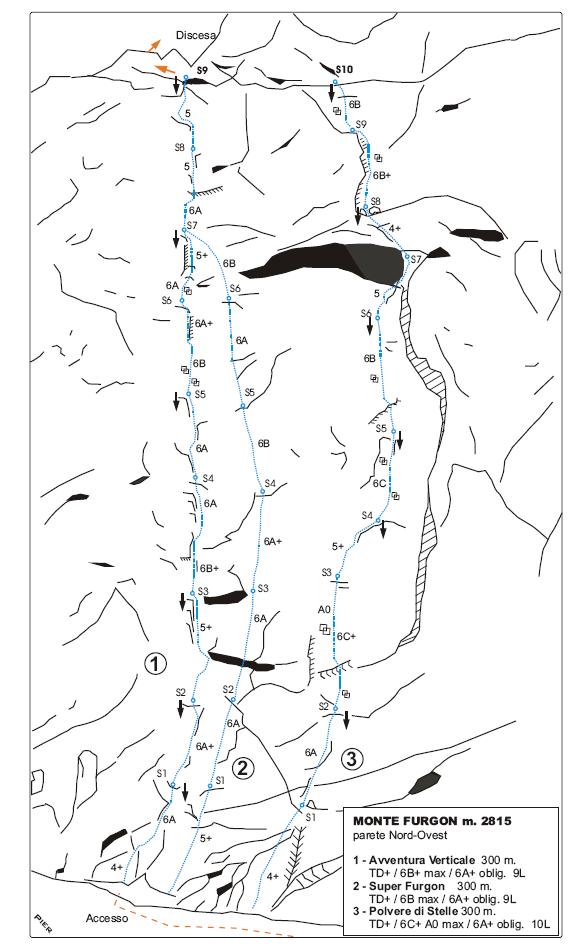
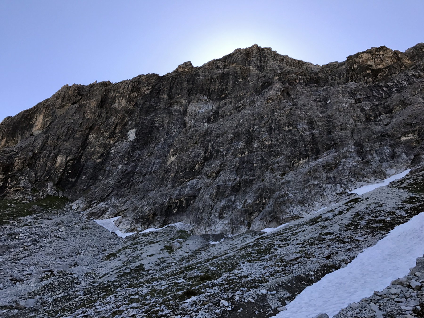
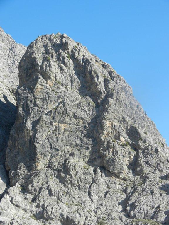
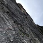
II Monte Furgon m. 2815 è la prima vetta rocciosa posta sullo spartiacque Valle Ripa - Valle Thuras, essa si trova a sud della Cima del Bosco e si presenta sul versante Nord-ovest con un imponente parete di roccia calcarea alta circa 400 metri, che inizia a pochi metri dal sentiero che dal Colle Chalvet, porta nella conca di “ La Coppa ”.
La roccia è un bel calcare grigio e nero con alcune zone più rossicce, in alcuni punti, pur non essendo assolutamente friabile, è comunque un pò delicata. La parete per via della sua esposizione riceve poco sole anche nel pieno dell’estate, pertanto vista la quota non indifferente di 2800 metri è ideale per l’ arrampicata solo nella bella stagione. Le vie attaccano ad una quota di circa 2400 m. ed il sole raggiunge i piedi della parete mai prima delle ore 13/14.
Avvicinamento
La roccia è un bel calcare grigio e nero con alcune zone più rossicce, in alcuni punti, pur non essendo assolutamente friabile, è comunque un pò delicata. La parete per via della sua esposizione riceve poco sole anche nel pieno dell’estate, pertanto vista la quota non indifferente di 2800 metri è ideale per l’ arrampicata solo nella bella stagione. Le vie attaccano ad una quota di circa 2400 m. ed il sole raggiunge i piedi della parete mai prima delle ore 13/14.
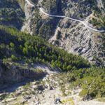
Da Oulx, raggiungibile tramite la A32 del Frejus, dirigersi verso il valico del Monginevro fino al paese di Cesana, raggiunto il quale non svoltare per il valico, ma proseguire diritti oltrepassandone l’abitato per dirigersi verso Bousson. Arrivati in prossimità della Caserma degli Alpini nel piccolo villaggio di Bousson, svoltare a destra e per strada asfaltata raggiungere la frazione di Thures, dal tornante prima di immettersi nelle case, parte una sterrata in direzione opposta alla frazione, seguirla passando a monte delle costruzioni e raggiungere un altro piccolo villaggio Gorlier 1760 m. cui parcheggiare.
Descrizione
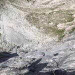
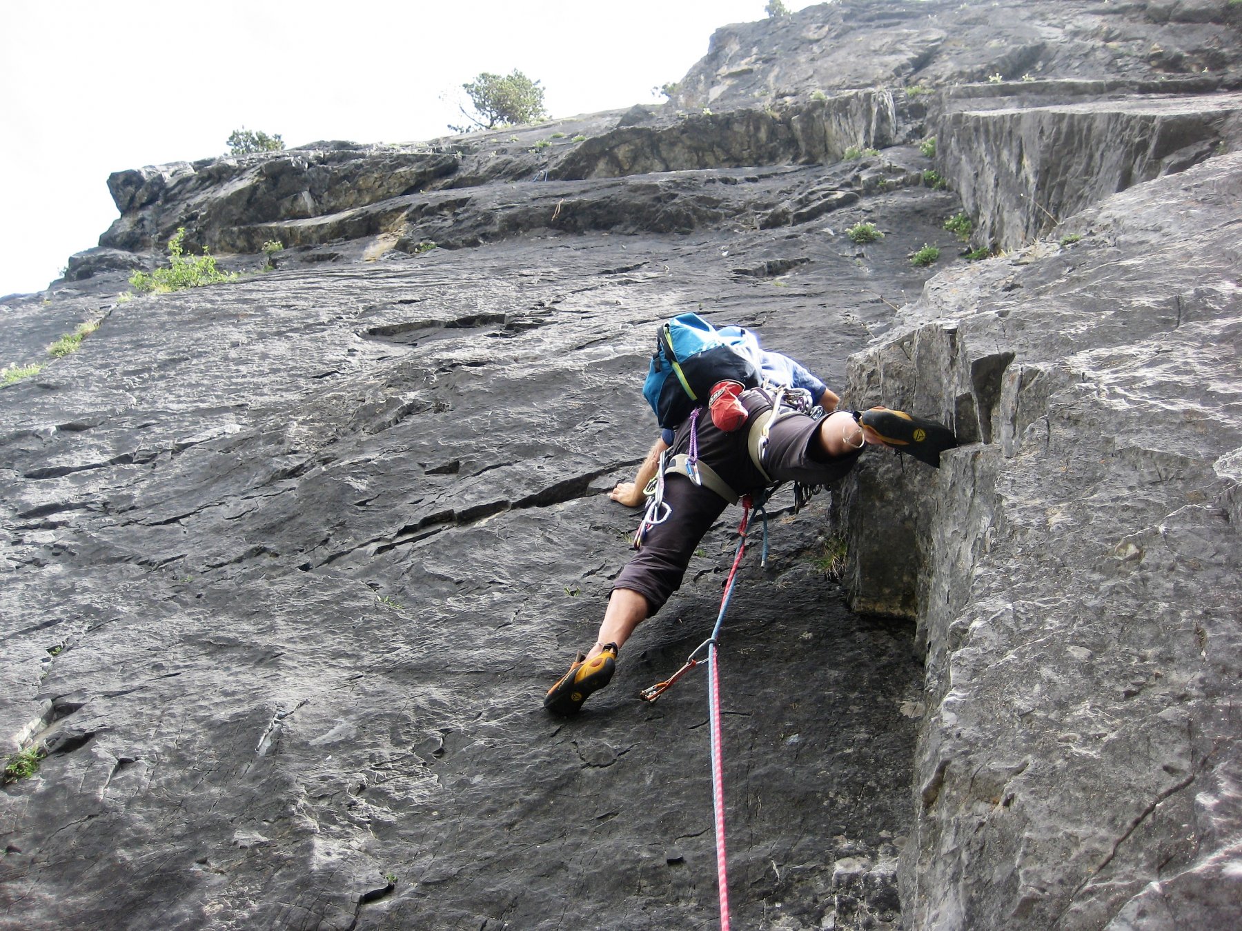
Salire per sentiero e prati in direzione del col Chalvet ( nord-est) dopo qualche centinaio di metri di dislivello si vede la parete, seguire ancora il sentiero fin che questo tende a sinistra, quindi salire in direzione della base parete che si raggiunge per ghiaione a quota m. 2400. 1.30 h
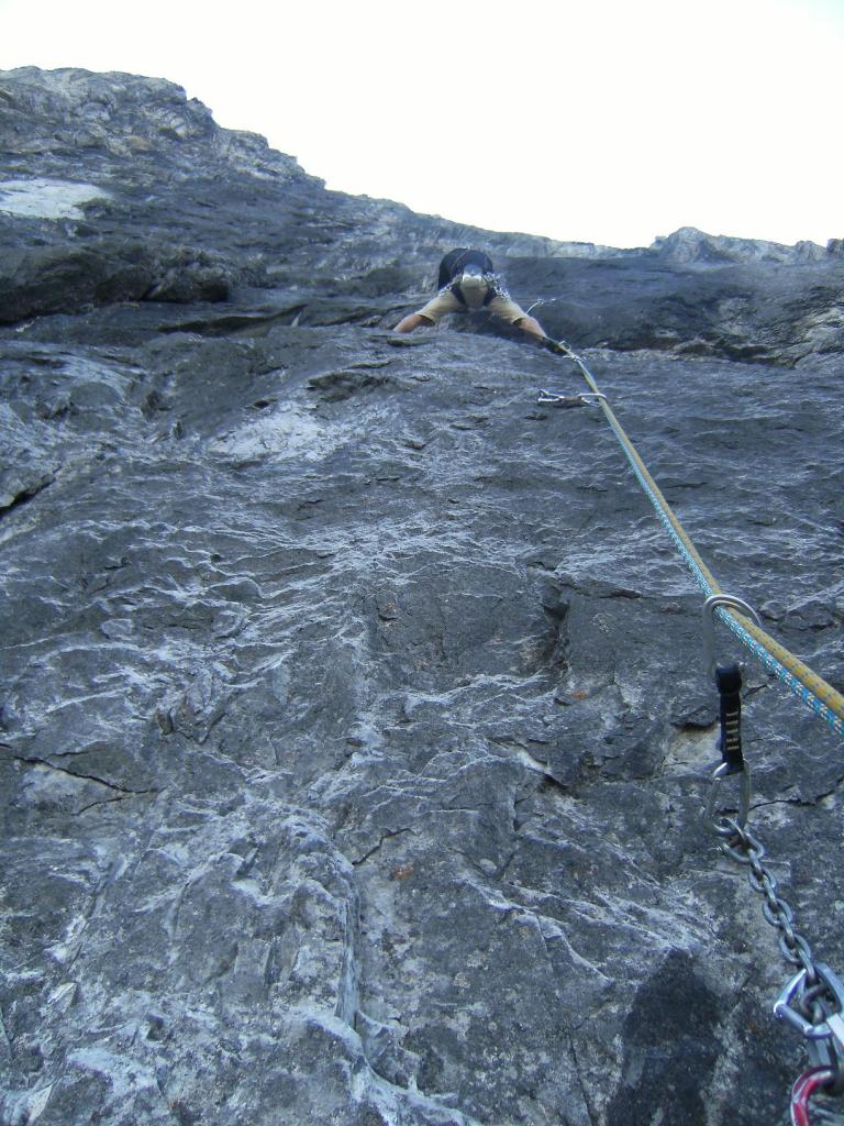
la via supera con bella arrampicata le placconate a sinistra del grande diedro dentrale.
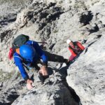
1) Superare lo zoccolo e portarsi su una cengia alla base della placconata (4+).
2)-3)-4)-5)-6) Superare le placche a sinistra del diedro seguendo una fila di spit (6a, 6b, 6c+/A0).
7) Attraversare a destra sotto al sovrastante tetto e portarsi a destra del diedro (5).
8) Salire facilmente fino alla base di un camino (4+).
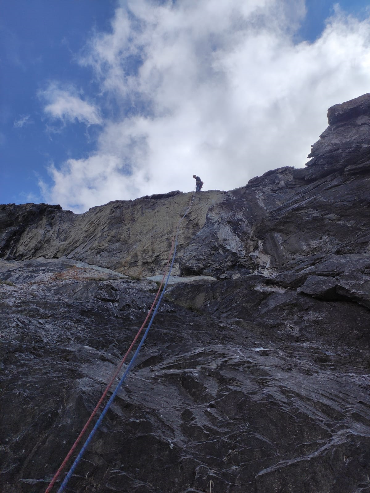
9)-10) Superare la placca alla destra del camino (6b+), spostarsi a sinistra e proseguire fino ad una cengia al termine della via (6b).
DISCESA: 6 doppie da 50 mt sulle soste della via
prima salita : L. Gally - M. Dalla Chiesa estate 88 - 90. La via é stata aperta quando la parete era ancora inviolata, in vari gg. e interamente dal basso, gli ultimi due tiri sono stati aperti grazie all'aiuto di Cozzumbo.
- Bibliografia:
- www.altox.it
Nelle vicinanze Mappa
Itinerari
14/06/2025 TO, Cesana Torinese 6b+, 6a+ obbl. Nord-Ovest
Furgon (Monte) – Super Furgon
 50m
50m
07/09/2024 TO, Cesana Torinese 6c, 5a obbl. Nord-Ovest
Furgon (Monte) – Via del Pilastro
 100m
100m
24/06/2012 TO, Cesana Torinese 6b+, 6a+ obbl. Nord-Ovest
Furgon (Monte) – Avventura Verticale
 100m
100m
21/07/2022 TO, Cesana Torinese 6a, 5c obbl. Nord-Ovest
Furgon (Monte) Parete NO – Furgon Plaisir
 200m
200m
05/07/2026 TO, Cesana Torinese 5b, 5a obbl. Nord
Alberon (Cima) – Voie de l’Amitiè
 2.8Km
2.8Km
18/08/2012 TO, Cesana Torinese 5a, 5a obbl. Est
Rossa di Thuras (Guglia) – Via Normale
 3Km
3Km
28/06/2026 TO, Cesana Torinese 7a, 6a+ obbl. Ovest
Clarì (Punta) – Un Pas Vers le Ciel
 10.3Km
18/07/2026 TO, Cesana Torinese 6a+, 6a obbl. Nord-Ovest
Clarì (Rocca) – Super Calcaire
 10.4Km
20/08/2024 TO, Cesana Torinese 6c+, 6c obbl., a0 Nord-Ovest
Clarì (Rocca), torre est – Calimero nella Grotta dei Ricordi
 10.4Km
20/07/2013 TO, Cesana Torinese 6a+, 5c obbl., a0 Nord-Ovest
Clarì (Rocca) – Placche Nere
10.5Km
Servizi
2.8Km
2.8Km
La Tana degli Orsi B&B
Cesana Torinese
2.9Km
La Crota B&B
Cesana Torinese
3.5Km
Misun La Font Ristorante
Sauze di Cesana
3.7Km
La Fontana del Thures Rifugio
Cesana Torinese
4.6Km
Centro Ristorante
Cesana Torinese
8.5Km
L’Ibarus Rifugio
Cesana Torinese
8.5Km
Piergiorgio Frassati B&B
Cesana Torinese
8.5Km
Casa Cesana Bar
Cesana Torinese
8.5Km