 2.7Km
2.7Km
Note
Storico
 100m
100m
100m
100m
100m
100m
150m
150m
200m
200m
100m
100m
100m
100m
100m
100m
150m
150m
200m
200m
Itinerario percorso molto raramente. Discreto impegno. Lungo sviluppo. Roccia scadente.
La cresta SW della Tour Ronde, in senso stretto, inizia al colle orientale della Tour Ronde, e sarebbe anche un bell'itinerario che permetterebbe la traversata della montagna con moderate difficoltà, penso che sia poco percorsa perché l'accesso diretto al colle implica la salita di un pendio di 150m 45°-50° un po' ripido, che con cattive condizioni obbliga all'uso di 2 picche.
Avvicinamento
La cresta SW della Tour Ronde, in senso stretto, inizia al colle orientale della Tour Ronde, e sarebbe anche un bell'itinerario che permetterebbe la traversata della montagna con moderate difficoltà, penso che sia poco percorsa perché l'accesso diretto al colle implica la salita di un pendio di 150m 45°-50° un po' ripido, che con cattive condizioni obbliga all'uso di 2 picche.
Con funivia al rif. Torino
Descrizione
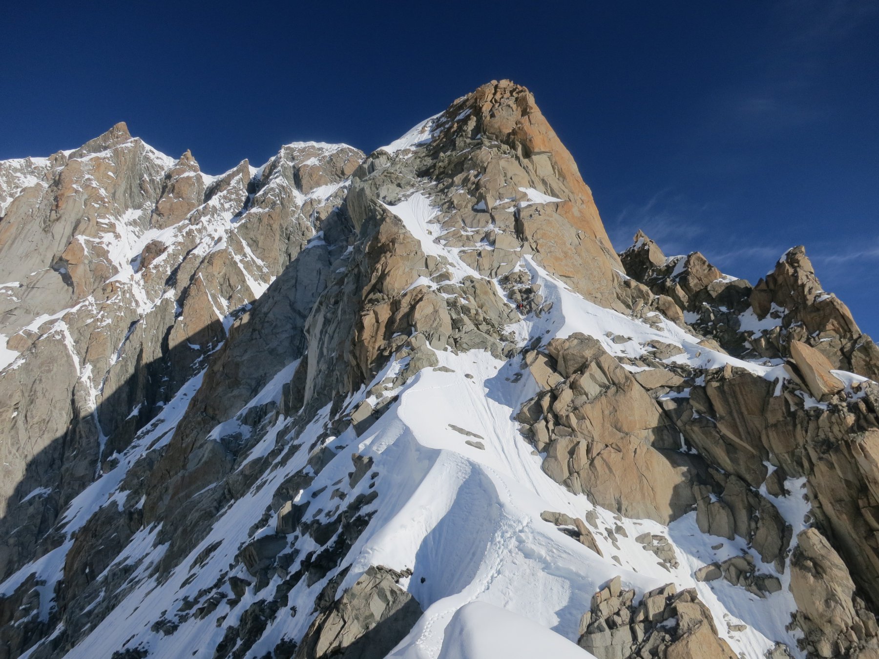
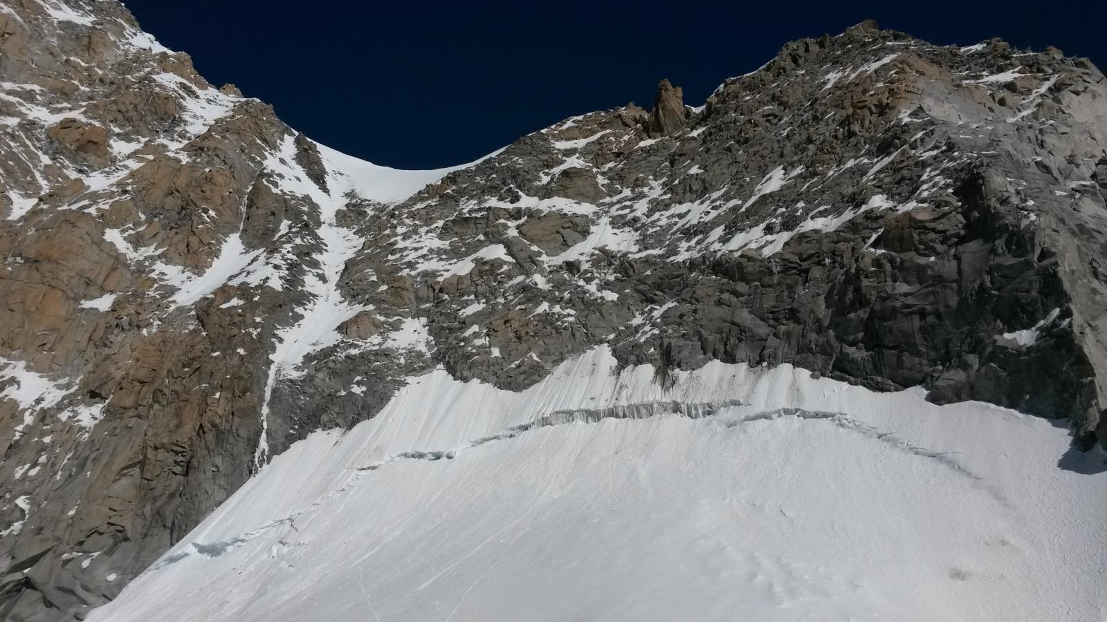
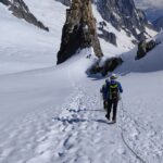
Dal rif. Torino, attraverso il glacier du Geant al col du Trident,dove è posto il rudere del vecchio rif Ghiglione, pendio di 150m 45°, alla sinistra del seracco della Calotte.
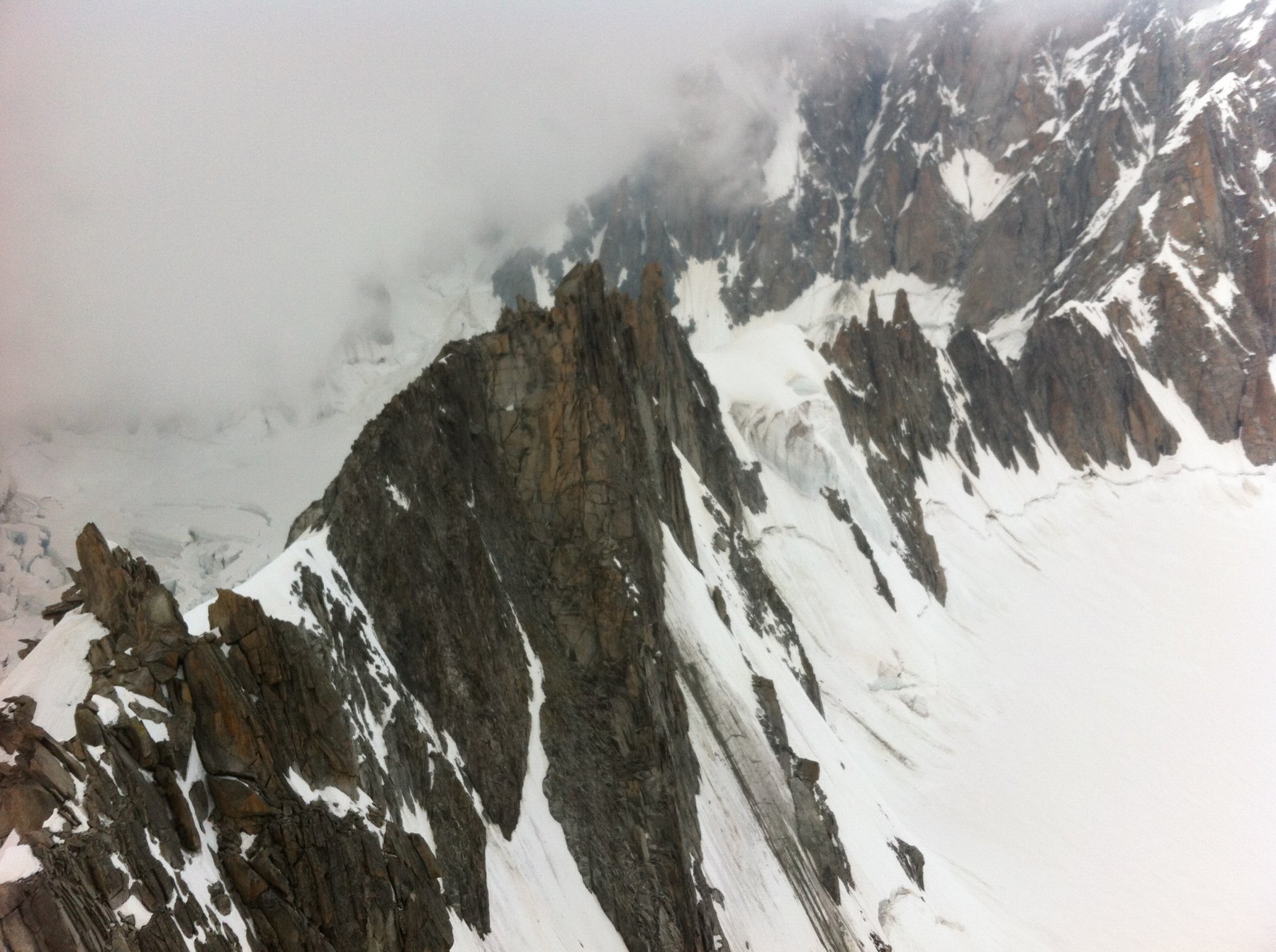
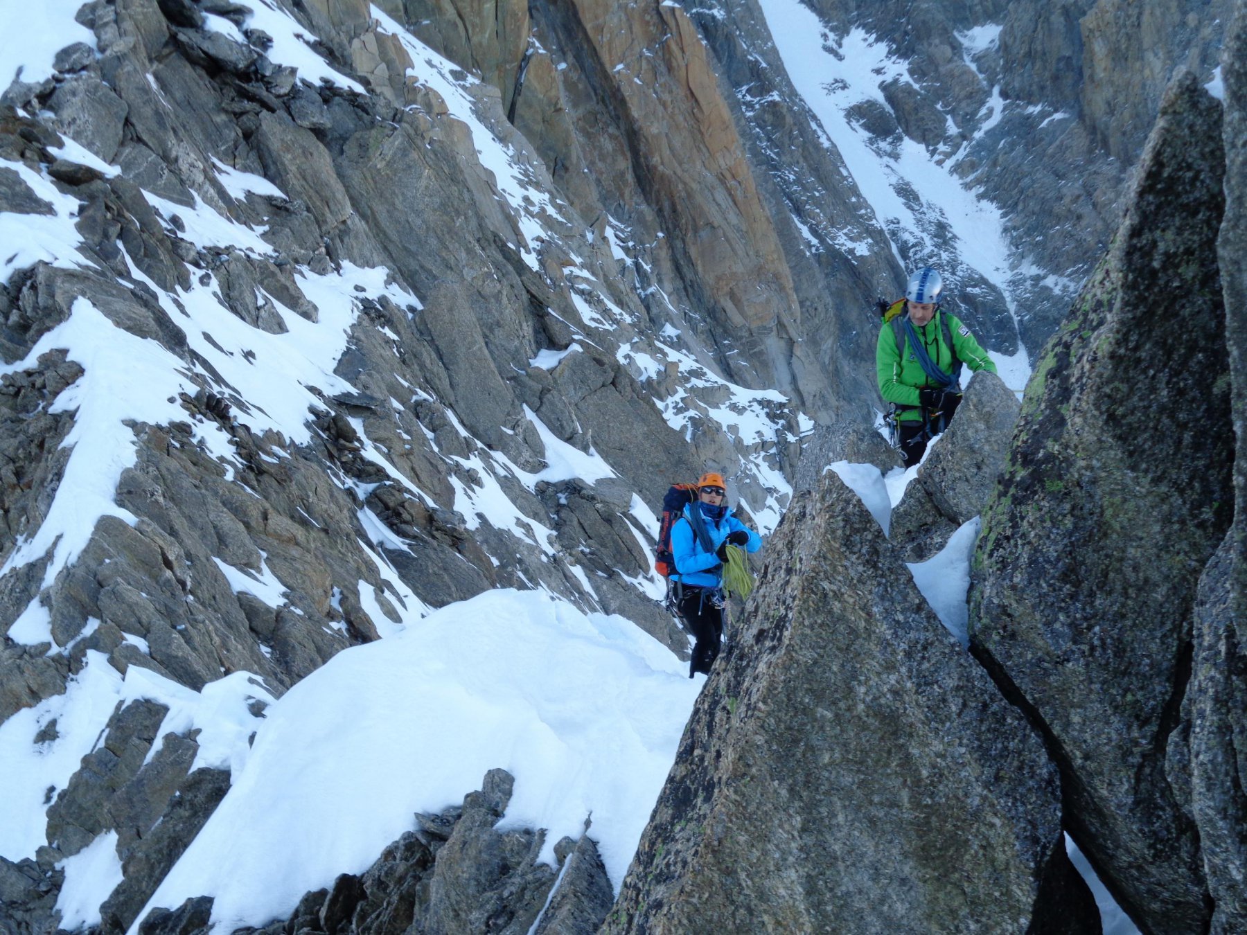
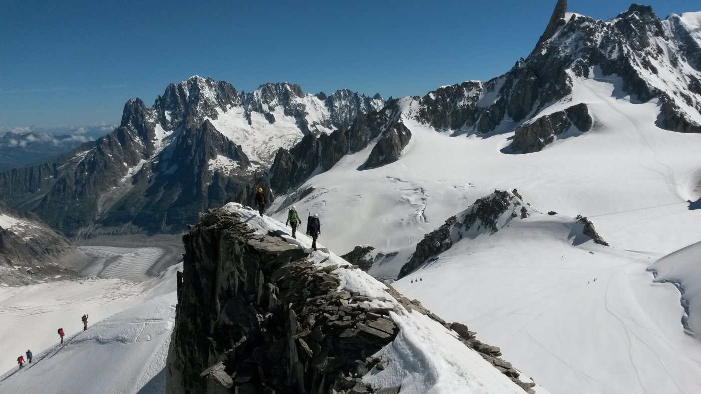
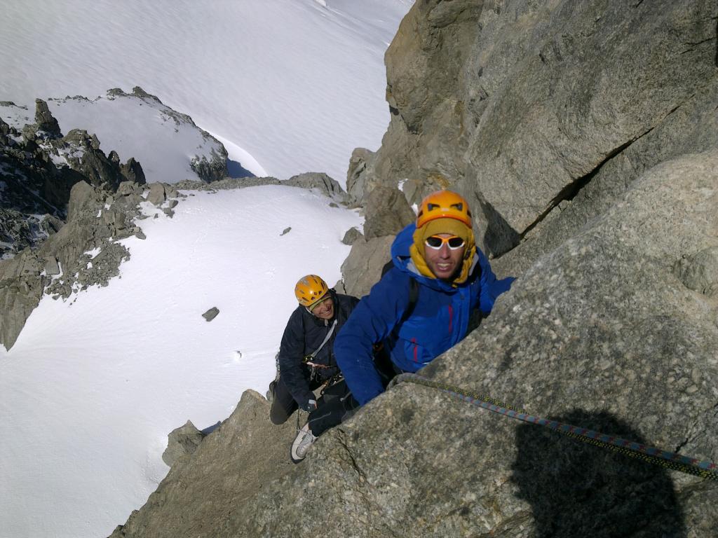
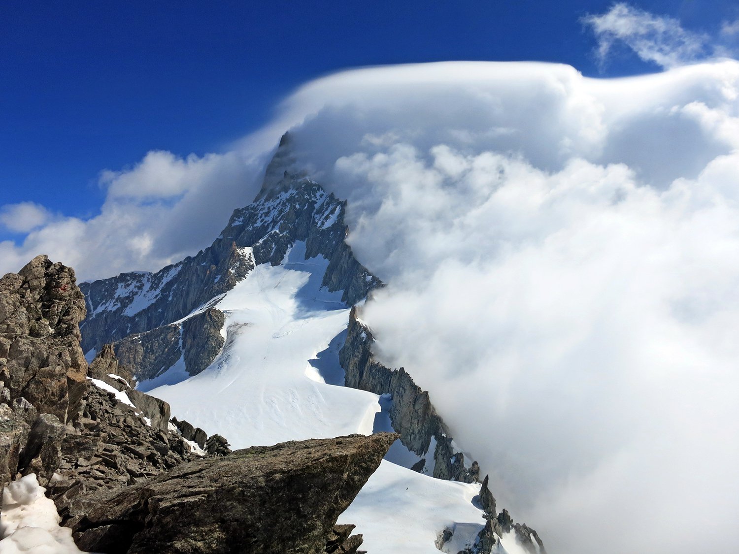
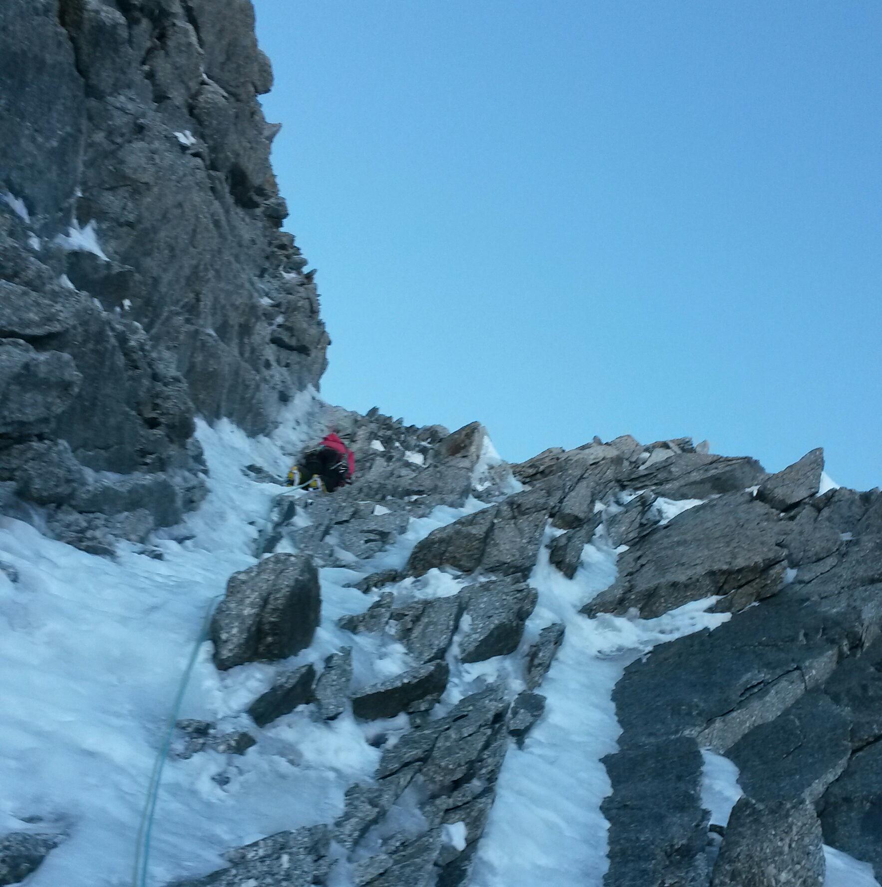
Dal col du Trident inizia la lunga cresta, ad occhio direi 1,5 Km fino alla vetta Tour Ronde . In cresta non ci si sta quasi mai, sia il Trident della Brenva sia il tratto tra i colli Occidentale e Orientale della Tour Ronde, si attraversano sul lato Brenva. Il percorso non è obbligato, si viaggia sempre in diagonale, sotto il filo di cresta, tra roccia scadente e canalini di neve, in un continuo saliscendi. Non si incontrano mai difficoltà elevate, ma si usano sempre le mani, lunghi tratti di 2° e un po’ di 3°, sempre in esposizione e con scarse possibilità di assicurazione. Noi ce la siamo cavata con una sola doppia di 20m.
Dal colle Or. della Tour Ronde,la vera cresta SW è la parte più piacevole della salita.
Considerare che per la discesa, se si segue la cresta SE, per scelta o per necessità, sono altri 700 m di cresta.
La relazione del Buscaini è molto laconica, ma ci sta coi tempi, che sono stati anche i nostri: 4 ore dal col du Trident al colle Or. della Tour Ronde, 1 ora per la cresta finale della Tour Ronde. Devo dire, nel nostro caso con molta neve sfondosa.
- Bibliografia:
- CAI-TCI Monte Bianco 1 It. 152f e 148a
Nelle vicinanze Mappa
Itinerari
27/12/2015 AO, Courmayeur D+ 251 m AD Nord
Fourche (Colle della) da Punta Helbronner
 100m
100m
06/09/2025 Haute-Savoie, Chamonix-Mont-Blanc D+ 350 m AD Varie
Entreves (Aiguille d’) Cresta SO
 100m
100m
13/07/2025 Haute-Savoie, Chamonix-Mont-Blanc D+ 1300 m D Sud-Est
Maudit (Mont) Cresta Kuffner
 100m
100m
08/06/2025 Haute-Savoie, Chamonix-Mont-Blanc D+ 400 m PD- Ovest
Toules (Aiguilles des) Versante NW e cresta NW
 100m
100m
10/06/2017 AO, Courmayeur D+ 700 m TD Sud
Dente del Gigante Via Burgasser
 100m
100m
14/07/2024 AO, Courmayeur D+ 850 m F Varie
Lachenal (Pointe) Via Normale
 100m
100m
07/09/2025 AO, Courmayeur D+ 322 m PD+ Nord-Est
Marbrées (Aiguilles, Punta Nord) Cresta NE
 150m
150m
13/09/2014 AO, Courmayeur D+ 1600 m D Varie
Bianco (Monte) Parete Nord dell’Aiguille Blanche e Cresta di Peuterey
 150m
150m
26/03/2022 AO, Courmayeur D+ 600 m TD Nord
Maudit (Mont) diretta Roger-Baxter-Jones
 200m
200m
02/06/2023 AO, Courmayeur D+ 250 m PD+ Varie
Vierge (la) da Punta Helbronner
 200m
200m