2.9Km
2.9Km
Note
 2.1Km
2.1Km
2.1Km
2.1Km
2.1Km
2.9Km
2.9Km
2.9Km
2.9Km
2.1Km
2.1Km
2.1Km
2.1Km
2.1Km
2.9Km
2.9Km
2.9Km
2.9Km
2.9Km
3.1Km
3.3Km
3.3Km
4.8Km
5.7Km
5.8Km
5.8Km
7.8Km
8.3Km
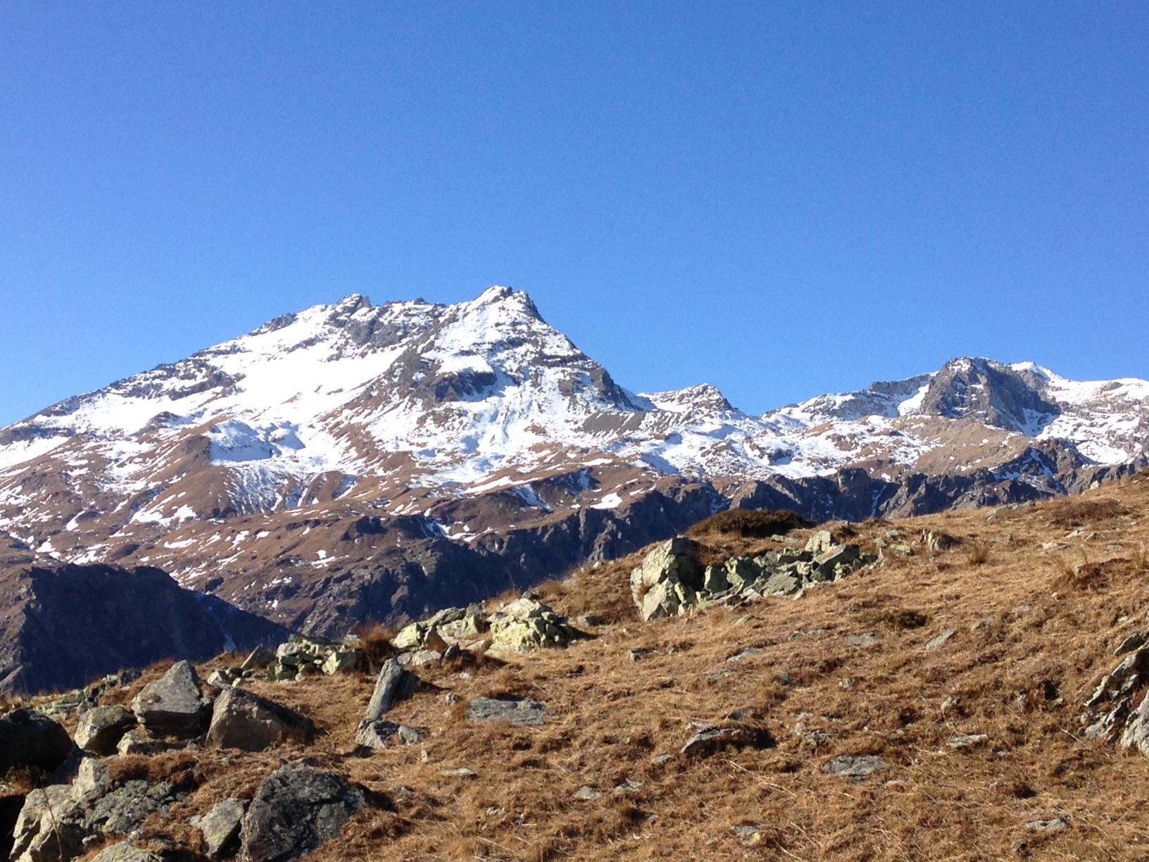
La cresta sud, di notevole sviluppo, divide la Val Cenischia dalla Val Clarea. La sua percorrenza permette di ammirare contemporaneamente i panorami che i due versanti offrono stando sempre sul filo alquanto affilato ma mai esposto.
Avvicinamento
Da Susa direzione Moncenisio fino al bivio a sx per Val Clarea e poi S. Chiara.
Descrizione
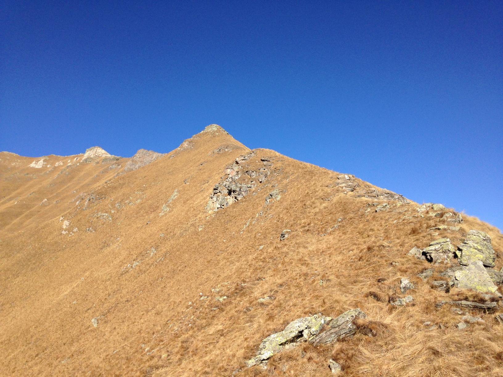
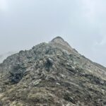
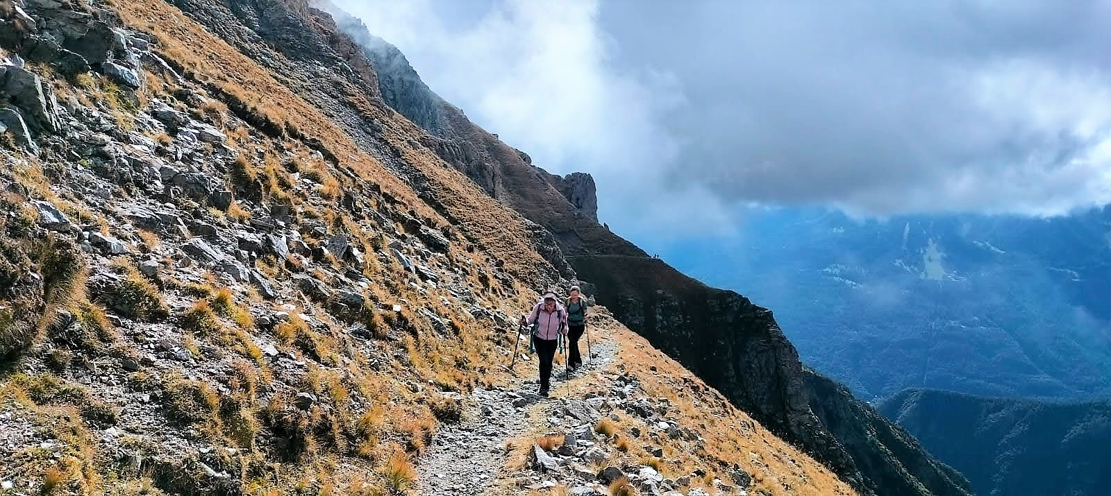
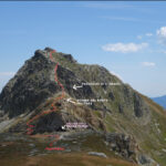
Dal Forte S. Chiara (park) seguire il sentiero subito a sx della sterrata, indicazione rif. Avanzà-h3 che, con bel percorso porta alla bergeria Martina 1960mt. Continuare sul sentiero sulla sx, sempre ben segnato bianco/rosso, fino a quando scavalca la cresta in questione portandosi sul versante Val Clarea. Qui lasciare il sentiero per cominciare a salire la cresta ben visibile fino in cima, stando costantemente sul filo molto panoramico e contraddistinto da parecchie croci metalliche lungo il suo sviluppo.
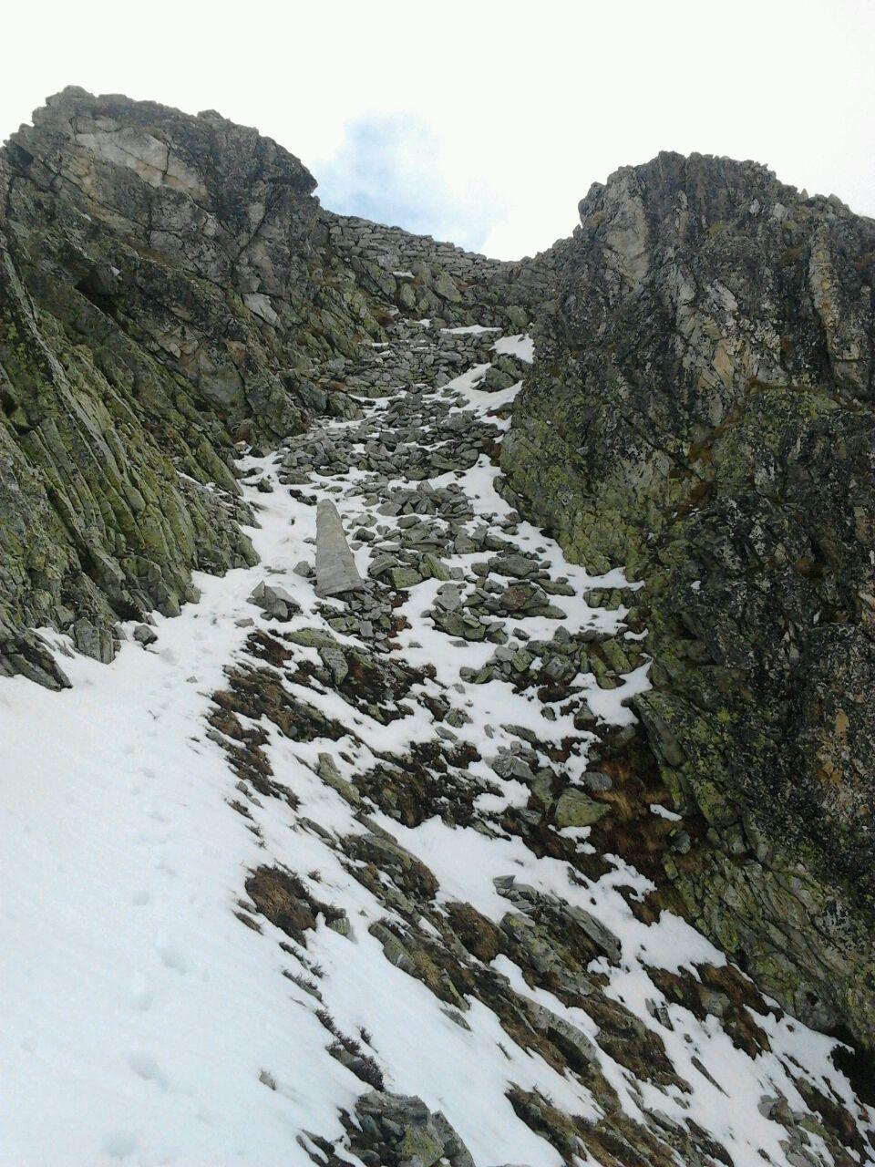
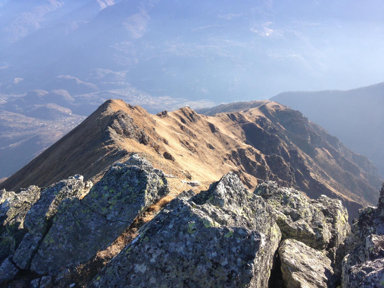
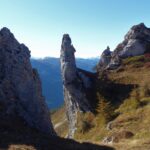
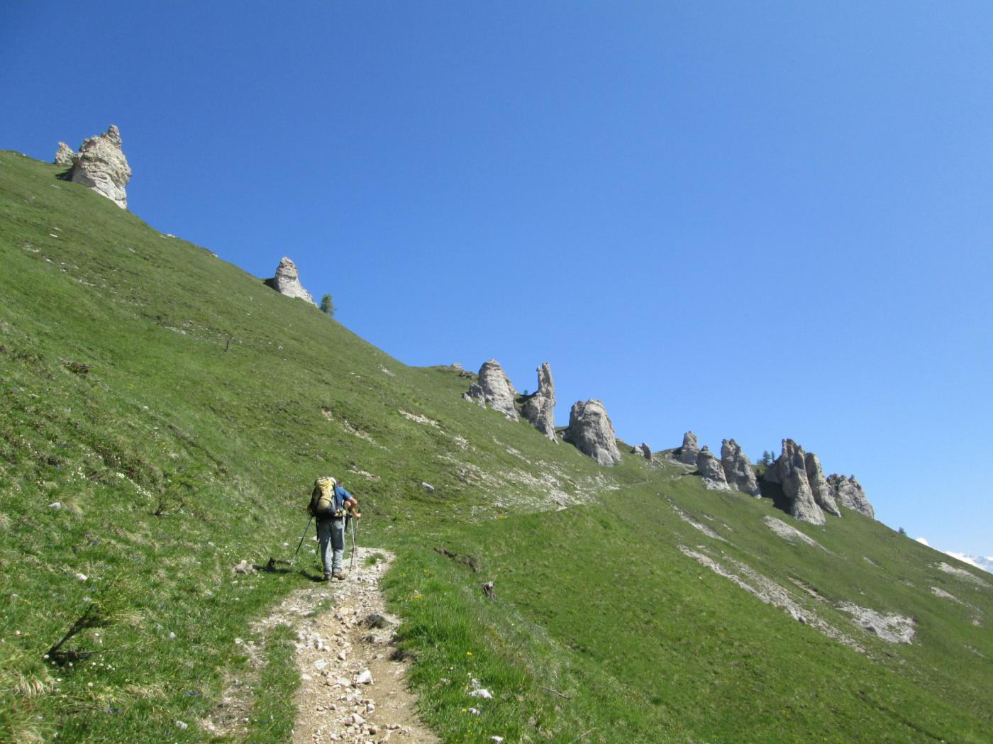
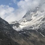
La prima gia visibile da qui, si raggiunge in breve su labile sentierino che si snoda praticamente per tutto il percorso. Evitare di stare sui ripidi fianchi erbosi per una migliore e più bella progressione sul filo a volte molto stretto ma non esposto. Si giunge così ad un testone di calcare tubolare chiaro che si supera con passi di 1° grado, oltre si scavalca la P.Ta Mulatera 2544mt. oltre la quale, vicina si vede la Toasso Bianco. Seguendo sempre la sinuosa cresta, si arriva alla base delle quarzitiche balze finali che, sempre con passi di 1° grado conducono all’ometto di vetta. Panorama spettacolare.
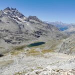
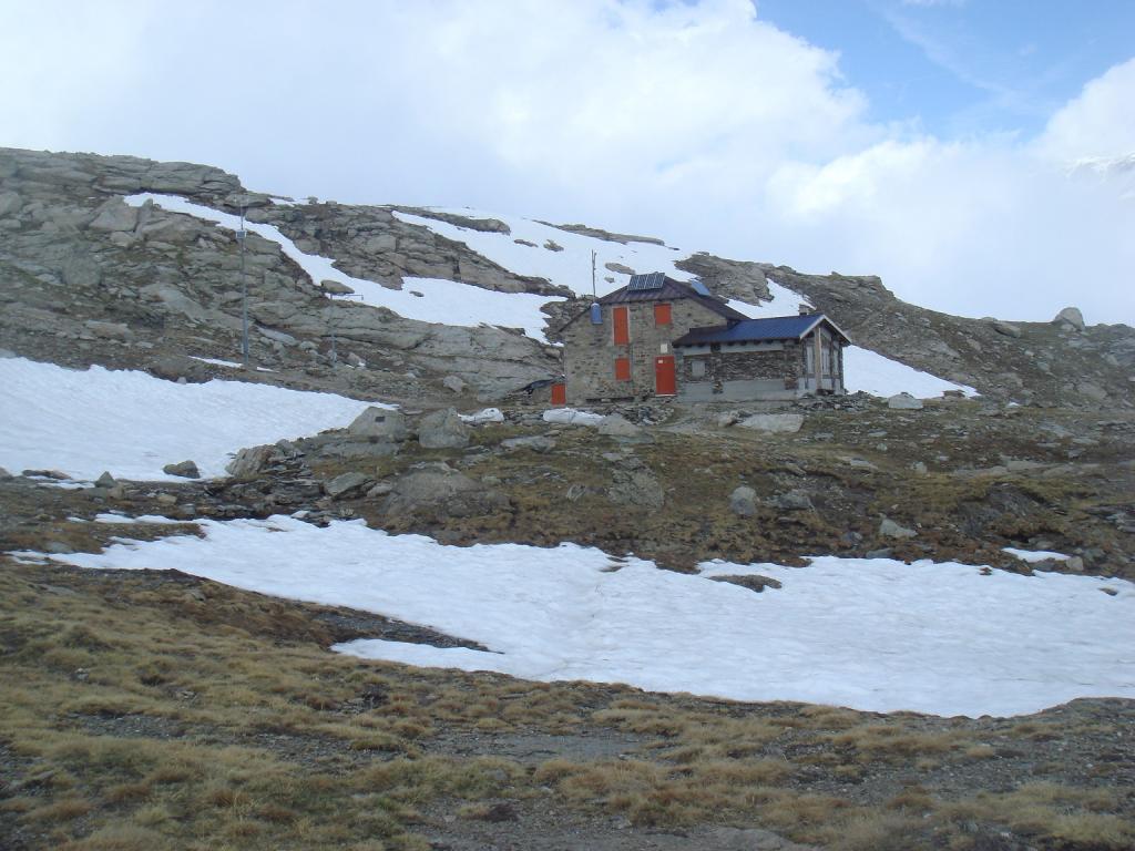
Discesa: dalla cima è ben visibile il rif. Avanzà 2574mt. Scendere in quella direzione (NO) per un sentierino militare con muretti di sostegno fino al Passo Avanzà che precede il rif. Da qui, il bel sentiero che avevamo lasciato allo scollinamento, riporterà alla partenza.
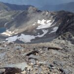
Dal punto di scollinamento è possibile scendere lungo il proseguimento naturale della cresta passando dal dosso con grande ometto ben visibile da qui, proseguendo poi costantemente sul filo di cresta, un sentierino lo percorre. Si passa poi da una croce in memoria di un caduto, arrivando infine alla dx del vasto piano erboso vicino al forte.
- Cartografia:
- Fraternali 1:25000 n.3 Val di Susa Val Cenischia Rocciamelone Val Chisone
Nelle vicinanze Mappa
Itinerari
03/05/2026 TO, Venaus D+ 900 m E Tutte
Mulatera (Punta) da Mulatera, anello per il Rifugio Avanzà
 2.1Km
2.1Km
21/06/2026 TO, Venaus D+ 804 m E Varie
Avanzà (Rifugio) e Lago della Vecchia da Mulatera, anello
 2.1Km
2.1Km
21/08/2021 TO, Venaus D+ 1123 m EE Sud-Ovest
Vecchia (Punta della) e Punta Tricuspide da Mulatera per il Rifugio Avanzà e il Passo dei Trinceramenti
 2.1Km
2.1Km
24/06/2024 TO, Venaus D+ 2300 m EE Varie
Agnello (Colle dell’) dalle Bergerie Martina per Rifugio Avanzà, Col Clapier, Rifugio Vaccarone
2.1Km
10/07/2025 TO, Venaus D+ 1470 m EE Sud-Est
Giusalet o Ciusalet (Monte) o Signal du Clery da Mulatera per il Rifugio Avanzà
 2.1Km
2.1Km
18/07/2026 TO, Venaus D+ 772 m EE Sud-Ovest
Toasso Bianco da Mulatera, anello per il Rifugio Avanzà
 2.1Km
2.1Km
17/10/2020 TO, Chiomonte D+ 1207 m EE Sud
Vallone (Cima del) da Ramats, anello per i Denti di Chiomonte la Cappella Bianca e la Cima Quattro Denti
 2.9Km
2.9Km
27/09/2025 TO, Chiomonte D+ 1070 m E Sud
Quattro Denti (Cima) o Denti di Chiomonte da Ramats, anello
 2.9Km
2.9Km
09/05/2026 TO, Giaglione D+ 1200 m E Est
Arià (Monte) dalla Val Clarea per il Vallone del Tiraculo
 2.9Km
2.9Km
09/07/2014 TO, Giaglione D+ 1643 m EE Sud-Est
Vaccarone Luigi (Rifugio) da Grange Buttigliera per il Col Clapier
 2.9Km
2.9Km
Servizi
2.9Km
3.1Km
La Cantina delle Arti Ristorante
Chiomonte
3.3Km
Jamais sans tois Ristorante
Chiomonte
3.3Km
Ramats Ristorante
Chiomonte
4.8Km
1880 Ristorante
Venaus
5.7Km
C’era una volta Ristorante
Novalesa
5.8Km
La posta Ristorante
Novalesa
5.8Km
Delle Alpi Ristorante
Novalesa
7.8Km
Vaccarone Rifugio
Giaglione
8.3Km