700m
700m
Note
 50m
50m
50m
2.7Km
2.7Km
2.7Km
2.7Km
2.7Km
2.7Km
50m
50m
50m
2.7Km
2.7Km
2.7Km
2.7Km
2.7Km
2.7Km
700m
6.1Km
6.3Km
7.1Km
7.9Km
8.9Km
9Km
9Km
9Km
9.7Km
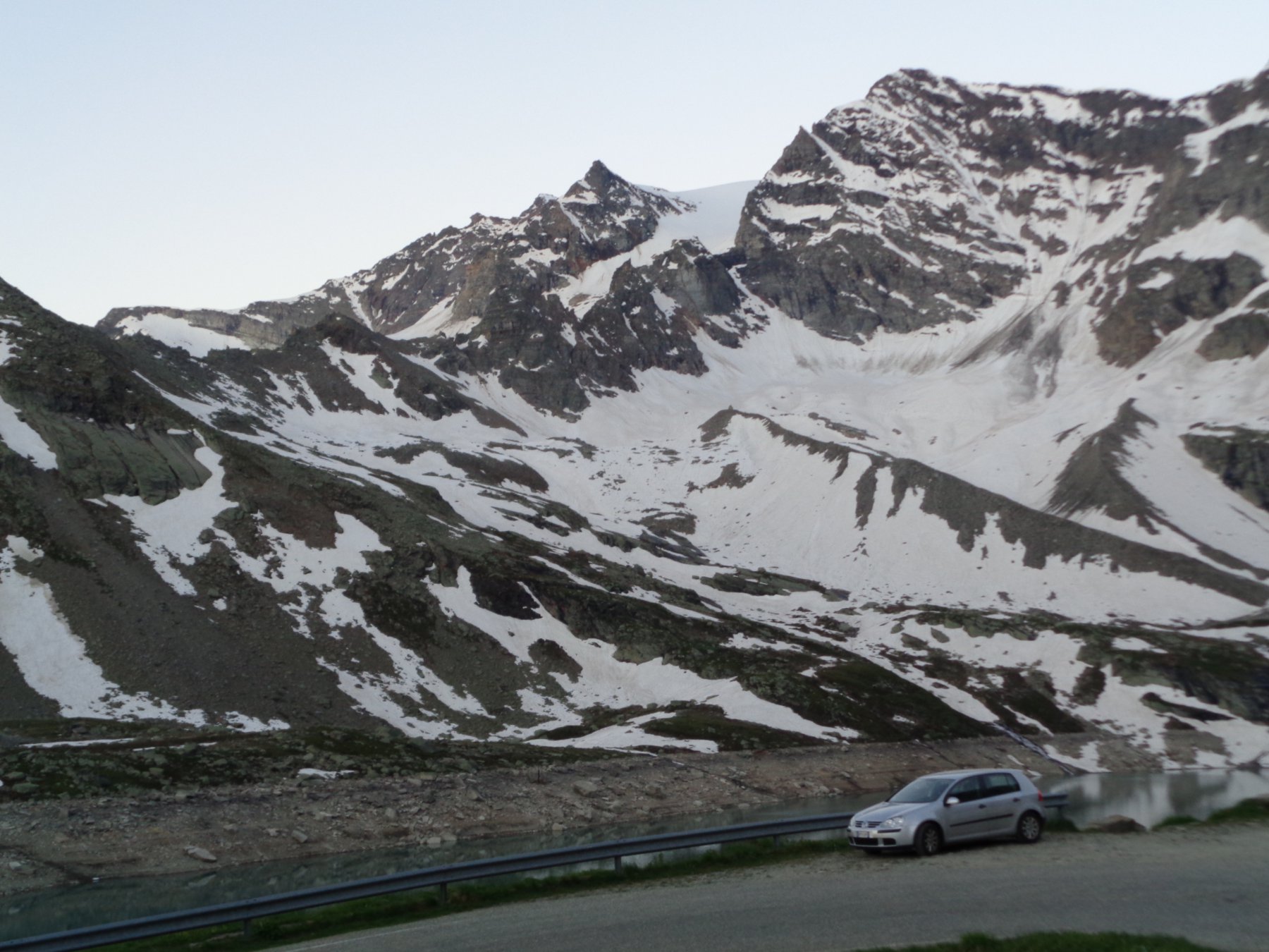
La strada è aperta fino al Colle solo in tarda primavera.
Avvicinamento
.
Descrizione
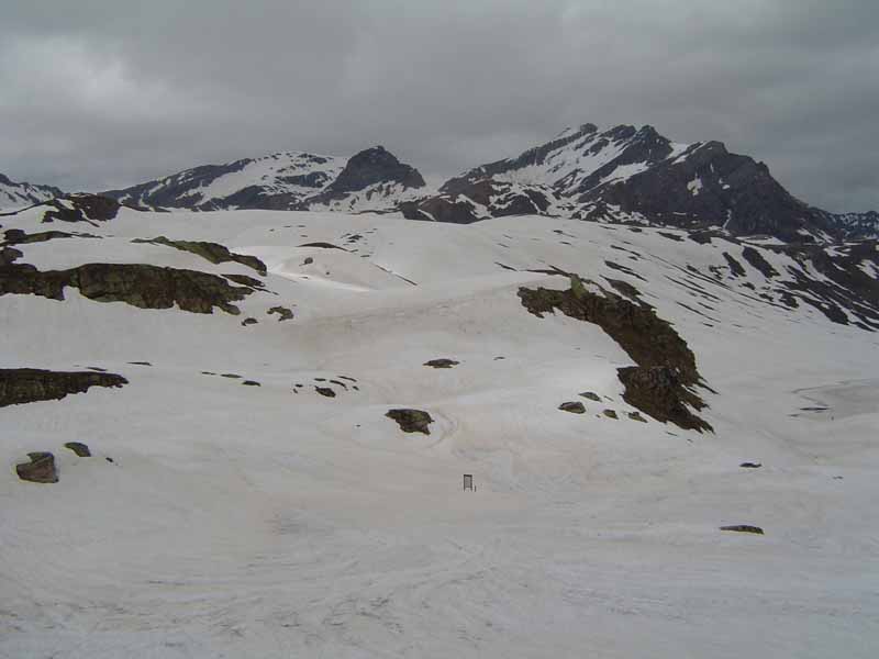
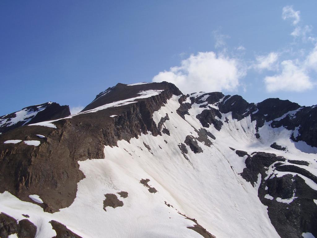
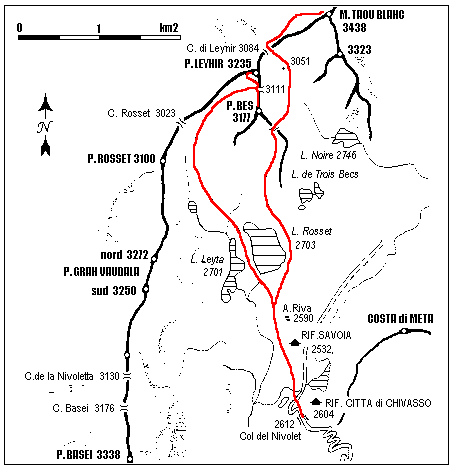
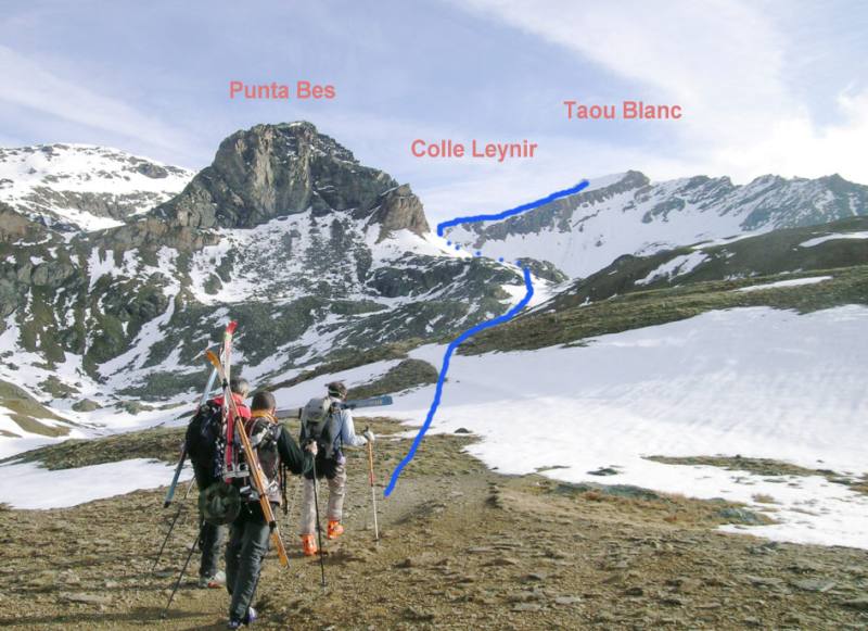
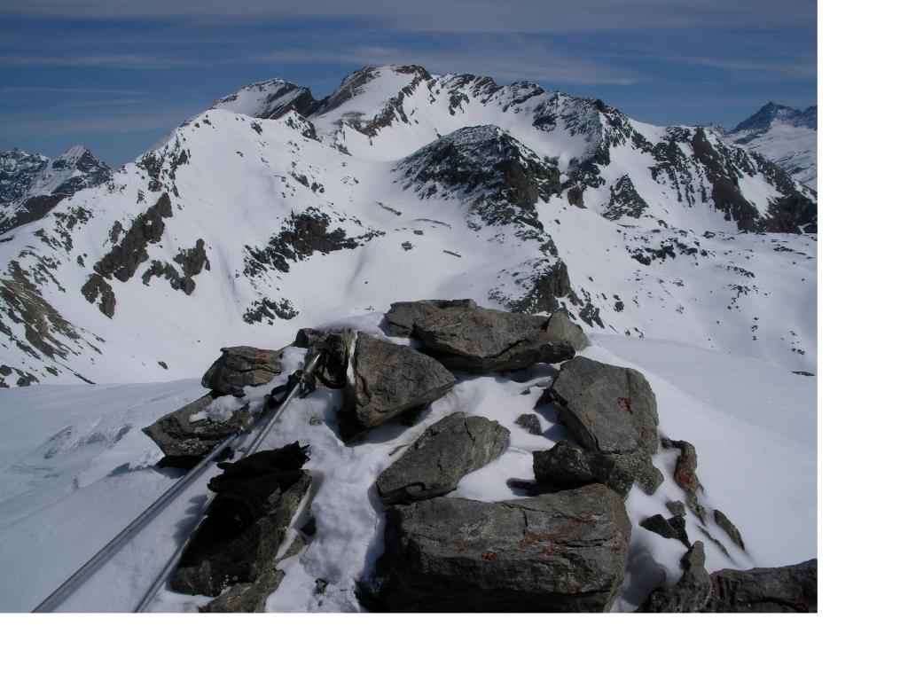
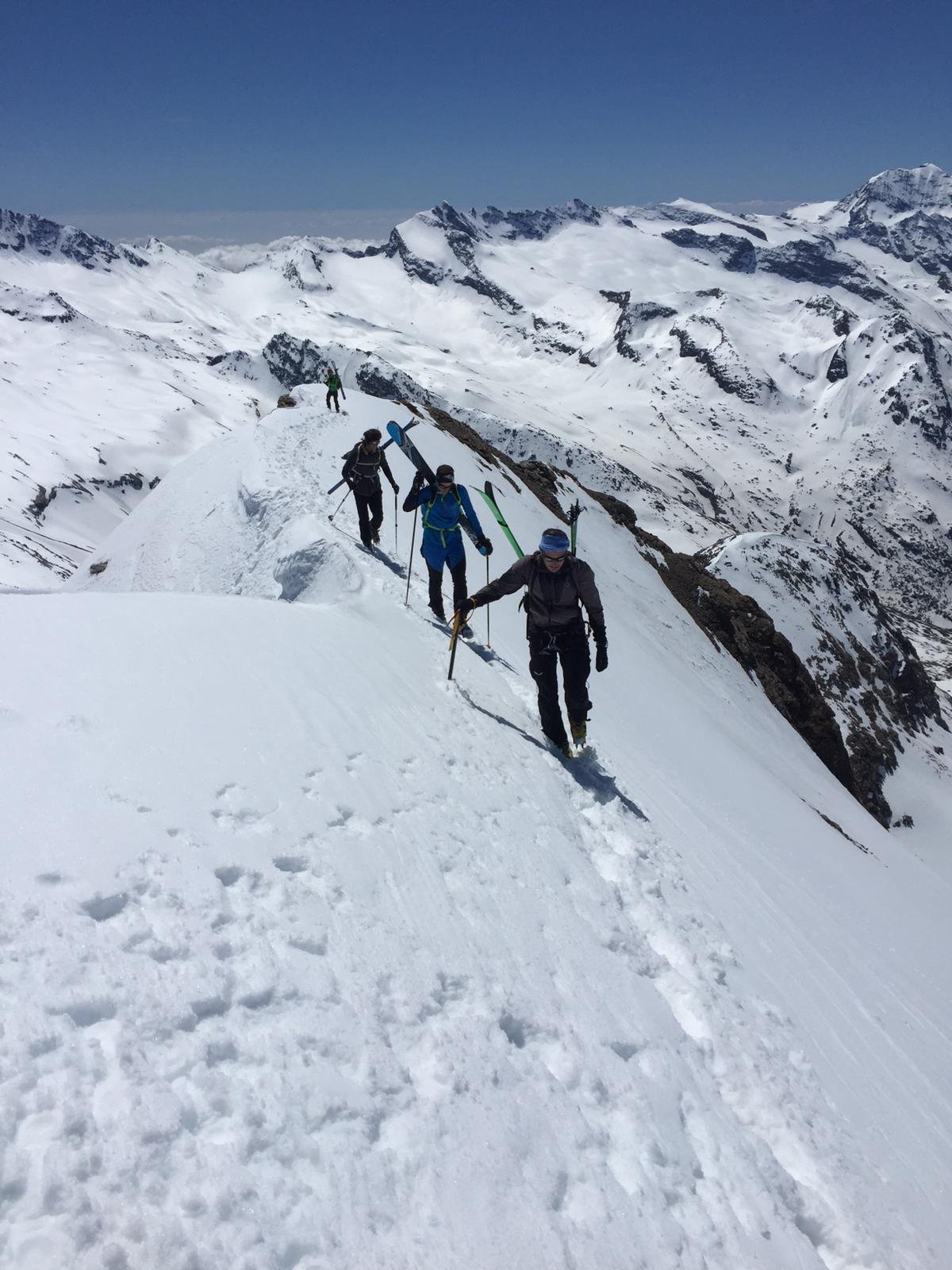
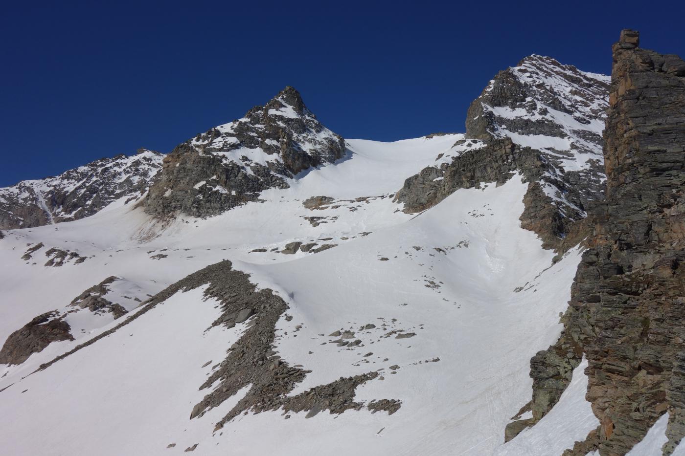
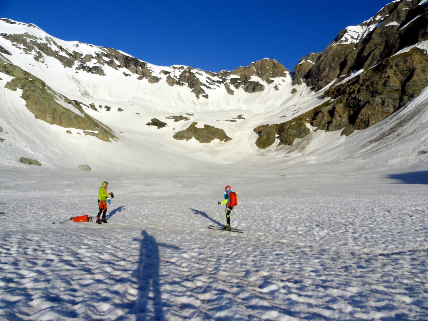
Dal Piano del Nivolet, si scende 2-300m lungo la strada oltre il rifugio Savoia; si risale diagonalmente il pendio Sud-Est che porta in breve ai piani del Rosset. Percorrere la sponda orientale del lago Rosset 2703m e continuare la salita mantenendosi a sinistra della dorsale, per raggiungere il colletto posto tra la rocciosa parete della Punta Bes a sinistra e la quota 2952m a destra (colletto Trebecchi). Scendere di poco sull’opposto vallone del Lago Nero e deviare a sinistra raggiungendo il colle Leynir 3084m. Superare, normalmente senza sci, la piccola bastionata rocciosa sopra il colle, (tratto esposto) dirigendosi prima verso sinistra (Nord) e ritornando verso destra, quasi al termine del pendio. A circa 3200m si rimettono gli sci e ci si innalza lungo il regolare pendio Ovest che conduce direttamente in vetta.
- Cartografia:
- l'Escursionista, 1/25.000, n° 14
- Bibliografia:
- D.Amateis, D.&D.Caresio. CAI-Rivarolo. Nuova Guida Sci-alp.del Canavese. N°B29
Nelle vicinanze Mappa
Itinerari
18/06/2023 TO, Ceresole Reale D+ 700 m MS Sud
Bes (Punta del) dai Piani del Nivolet
 50m
50m
22/05/2011 TO, Ceresole Reale D+ 623 m BS Sud
Leynir (Punta) dai Piani del Nivolet
 50m
50m
04/07/2024 TO, Ceresole Reale D+ 800 m BS Nord
Basei (Punta) dai Piani del Nivolet
 50m
50m
07/04/2018 TO, Ceresole Reale D+ 1100 m BSA Nord-Ovest
Fourà (Punta) dal Lago del Serrù
 2.7Km
2.7Km
13/06/2021 TO, Ceresole Reale D+ 1200 m MS Sud-Est
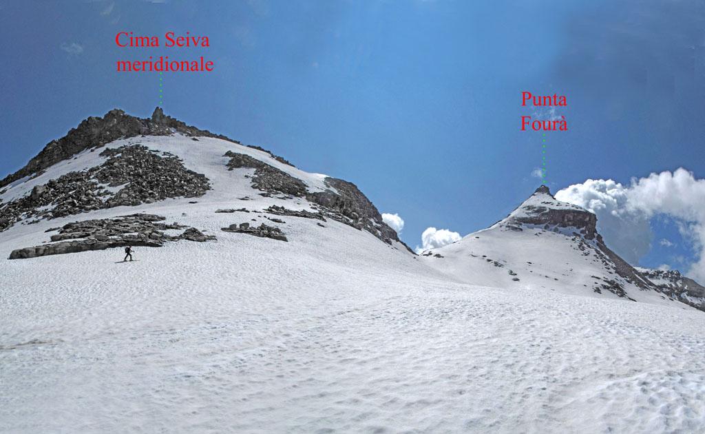
Seiva (Cima Meridionale di) dal Lago del Serrù per il Colle di Ferauda
 2.7Km
2.7Km
01/05/2026 TO, Ceresole Reale D+ 1207 m OSA Nord
Grande Aiguille Rousse da Lago del Serrù e la Parete Nord
 2.7Km
2.7Km
05/06/2026 TO, Ceresole Reale D+ 1050 m BSA Nord
Carro (Cima del) dal Lago del Serrù
 2.7Km
2.7Km
28/05/2020 TO, Ceresole Reale D+ 1700 m BSA, PD Varie
Galisia (Punta), Punta Bousson, Punta Basei dal Lago del Serrù, giro
 2.7Km
2.7Km
08/06/2003 TO, Ceresole Reale D+ 1071 m BSA Varie
Galisia (Punta) da Lago del Serrù
2.7Km
07/06/2026 TO, Ceresole Reale D+ 1800 m OSA Varie
Galisia (Punta) dalla Diga del Serrù, giro valli Orco, Rhemes e Isère per il Colle Nivolettaz e Passo della Vacca
 2.7Km
2.7Km
Servizi
700m
6.1Km
Guido Muzio Rifugio
Ceresole Reale
6.3Km
Da emilia Ristorante
Ceresole Reale
7.1Km
Benevolo Rifugio
Rhêmes-Notre-Dame
7.9Km
Gran Paradiso Bar
Valsavarenche
8.9Km
Villa Campeggio
Ceresole Reale
9Km
Massimo Mila Rifugio
Ceresole Reale
9Km
Lanterna del duca Ristorante
Ceresole Reale
9Km
Mila Rifugio
Ceresole Reale
9.7Km