1Km
1Km


Note
 50m
50m
50m
50m
50m
50m
50m
50m
50m
50m
50m
50m
50m
50m
50m
50m
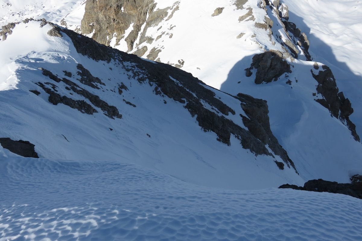
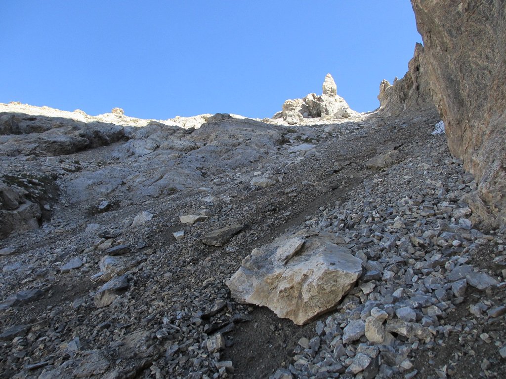
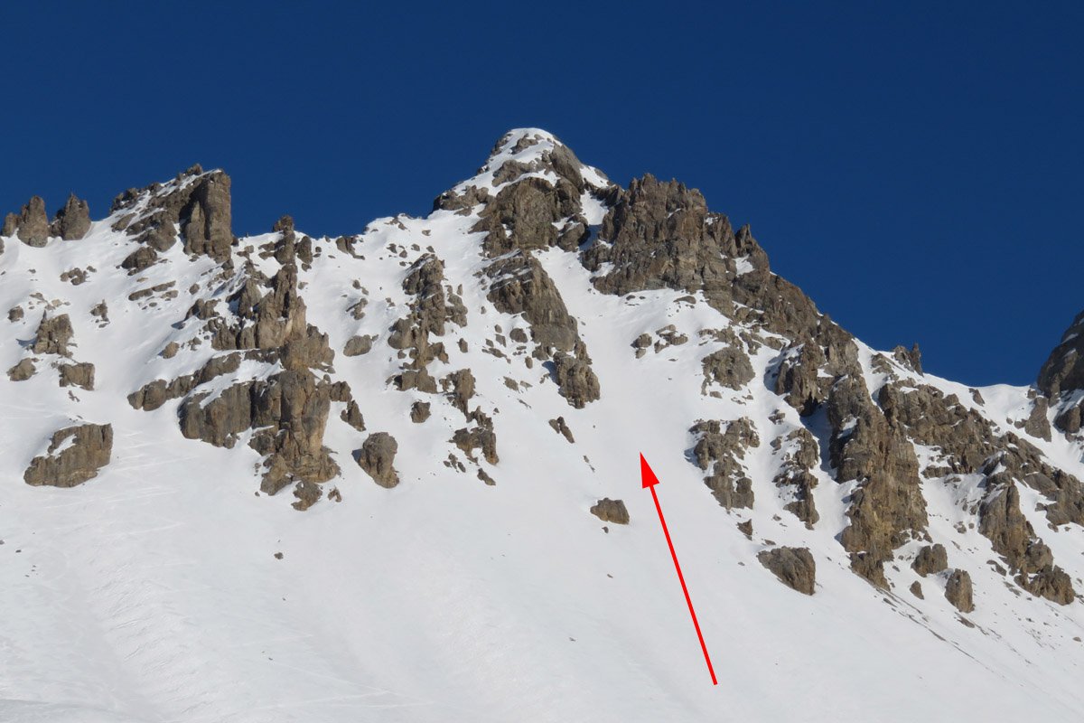
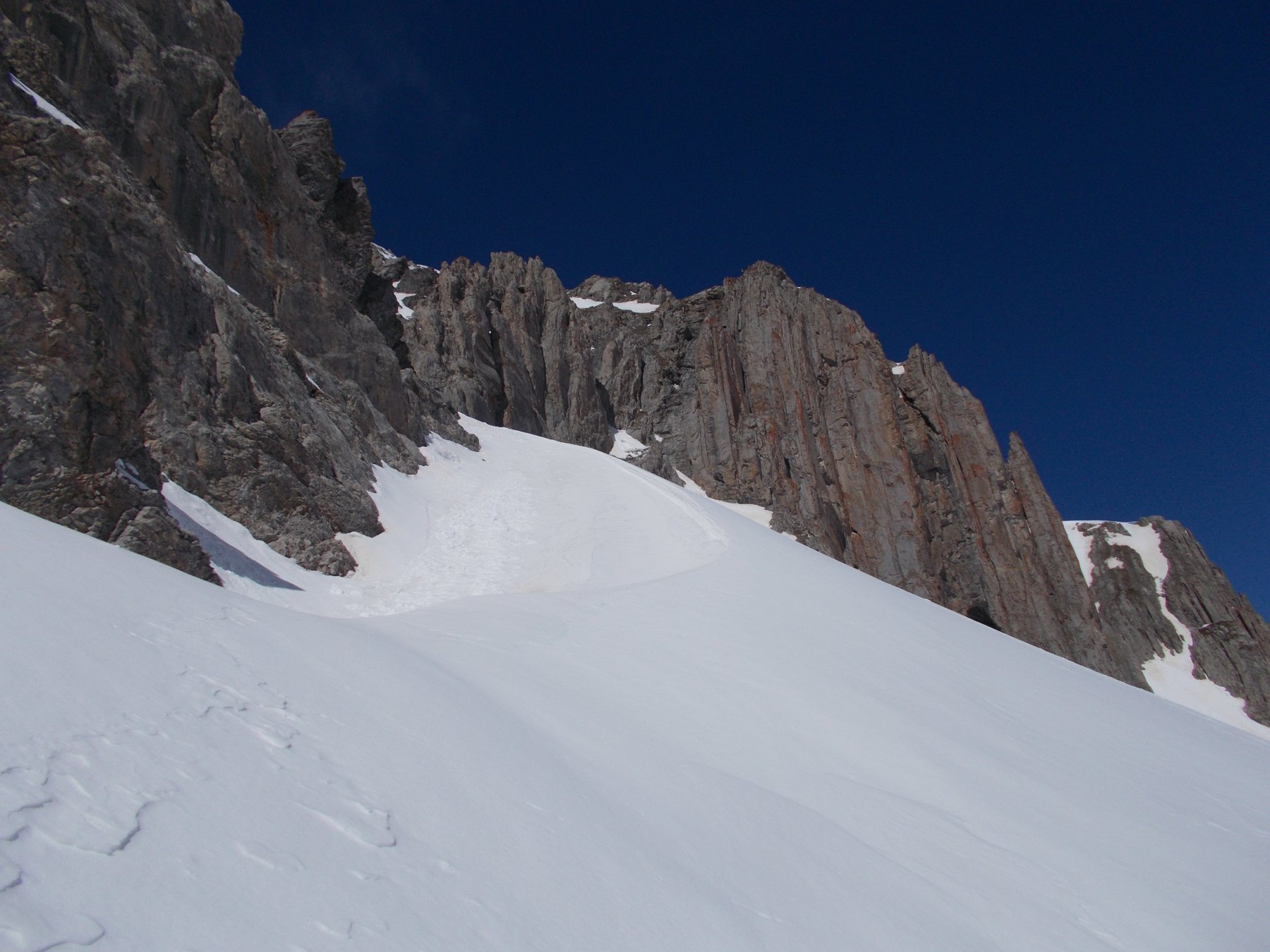
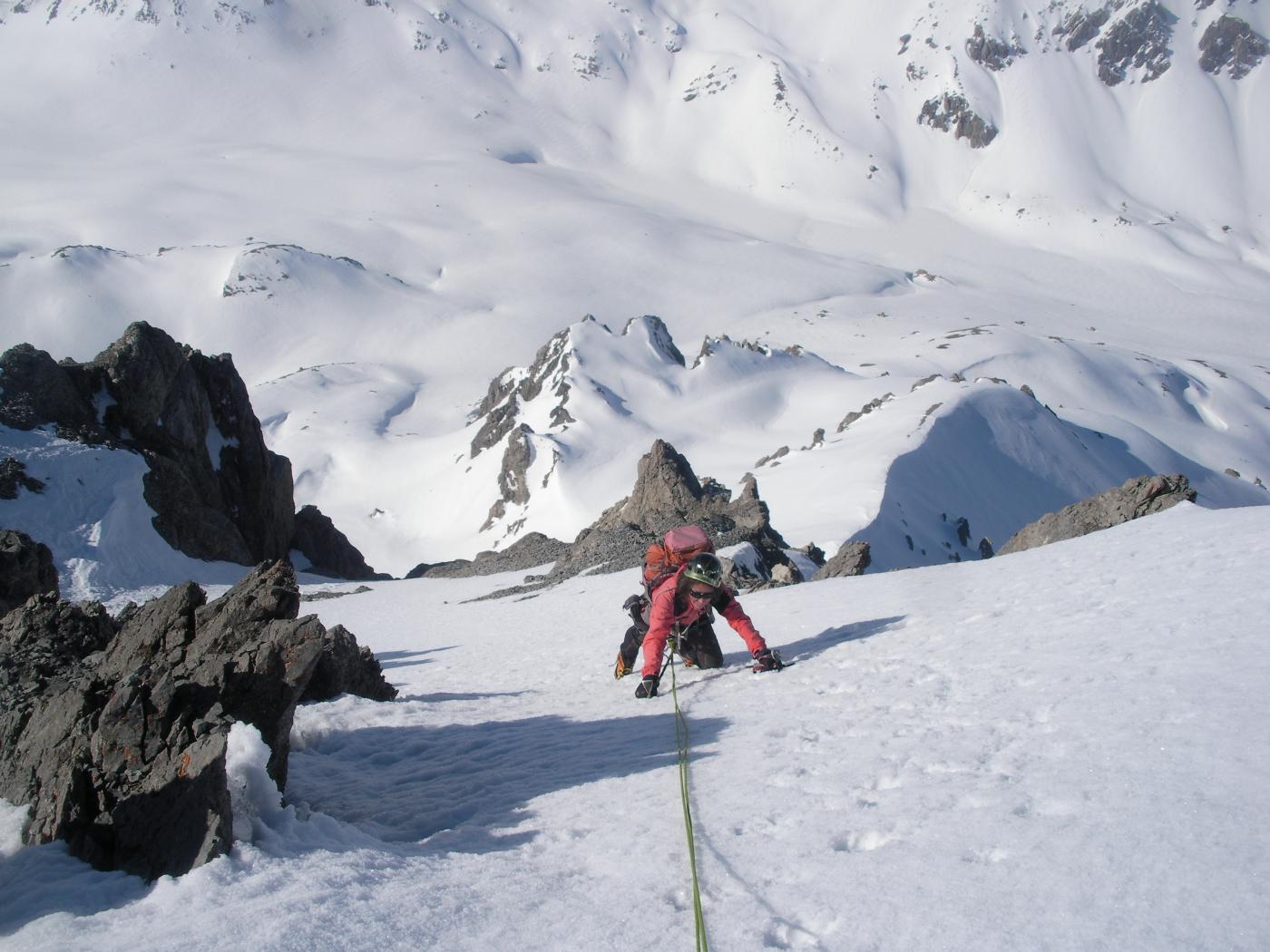
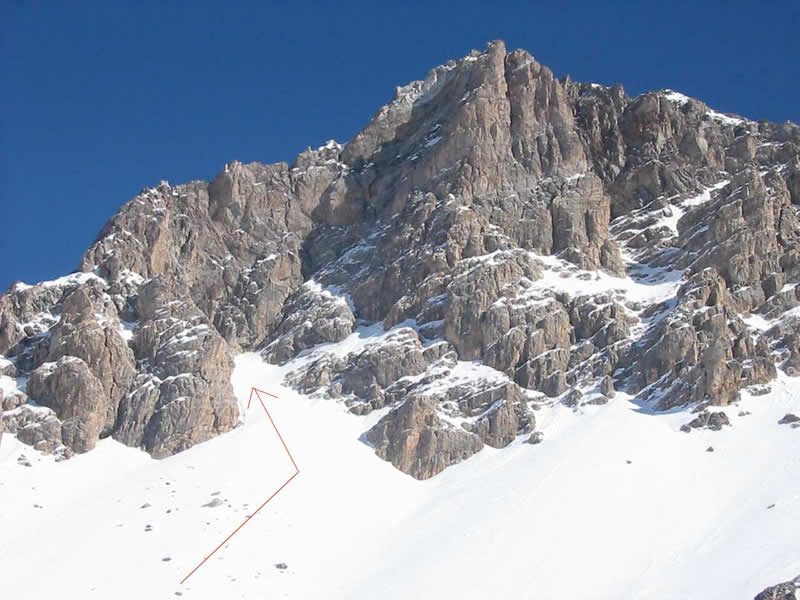
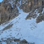
Gita in parte fuori sentiero, dopo il primo lago Oronaye il percorso diventa prativo, successivamente si sale un ghiaione instabile e mobile circa 250 metri fino al colletto non nominato in cartina, tra la parete est della Tete Platasse e la cresta che sale alla Aig.d'Oronaye, dal colletto gli ultimi 50 metri circa si possono salire su roccia oppure su neve o misto (da considerare che è la parete nord e che fino a fine giugno è possibile trovarci innevato) pendenza circa 35/40°.
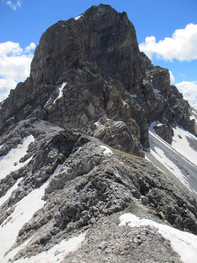
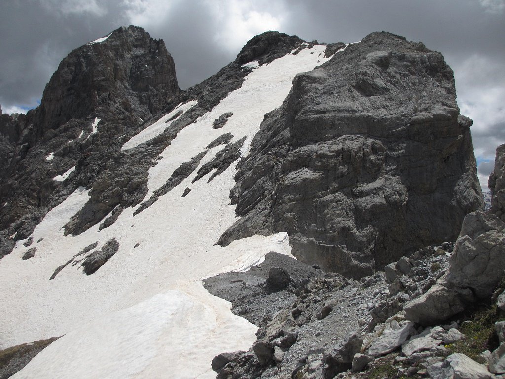
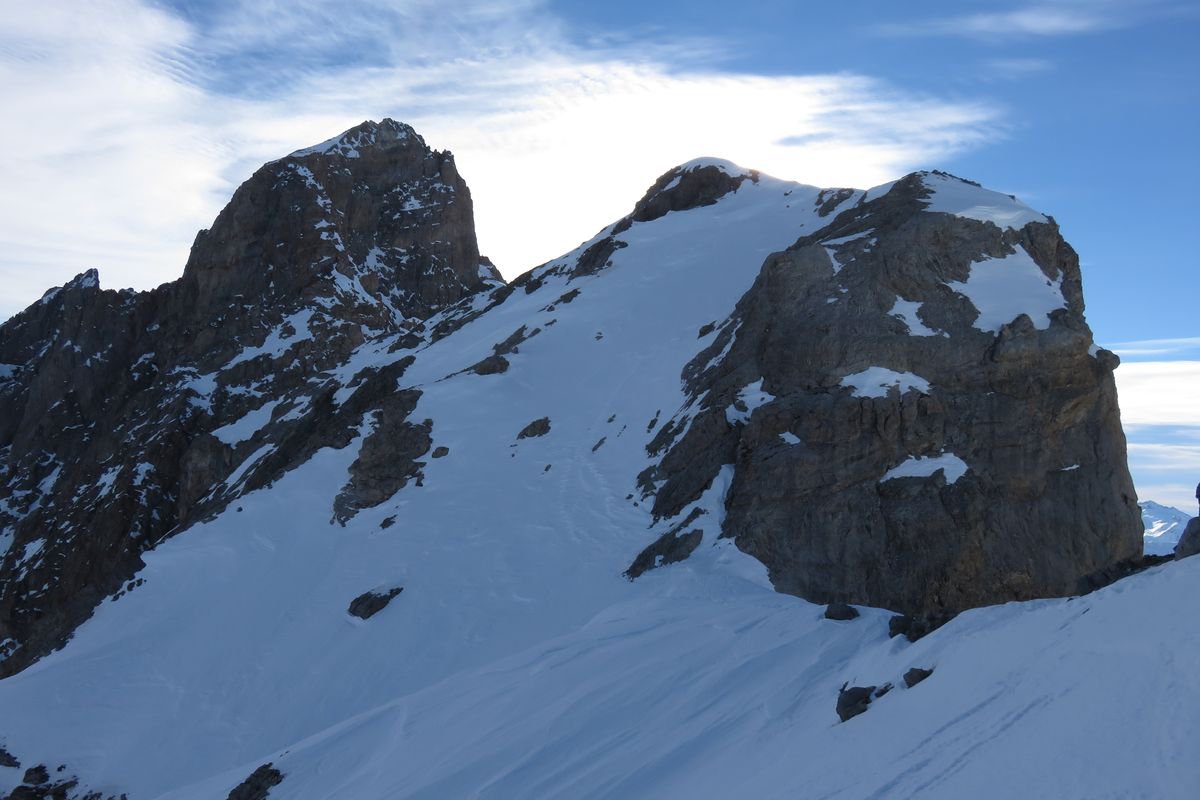
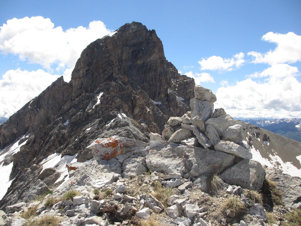
La Tete Platasse è la prima elevazione a est del M.Oronaye ed offre una bella vista sulla Valle Maira e Ubayette, è possibile in accoppiata alla Tete, ritornati al passo salire la l'Aig.d'Oronaye percorrendo la facile cresta in direzione est, circa 10 minuti e si è sulla cima.
Avvicinamento
La Tete Platasse è la prima elevazione a est del M.Oronaye ed offre una bella vista sulla Valle Maira e Ubayette, è possibile in accoppiata alla Tete, ritornati al passo salire la l'Aig.d'Oronaye percorrendo la facile cresta in direzione est, circa 10 minuti e si è sulla cima.
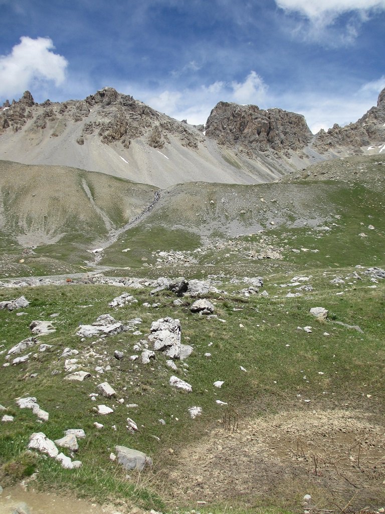
Da Cuneo seguire indicazioni per valle Stura colle della Maddalena,si supera il colle e dopo circa 1 km appena superato il torrente Oronaye sulla dx si trova uno spiazzo per posteggiare,oppure poco più avanti sempre sulla dx,stradina.
Descrizione
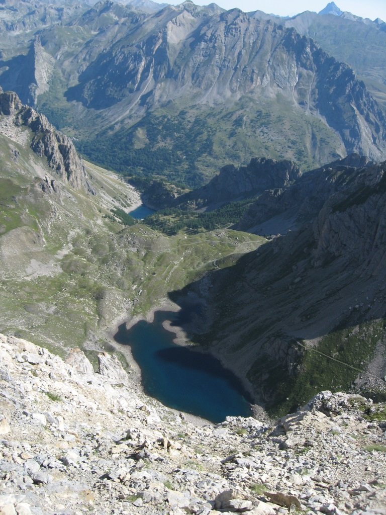
Dal posteggio parte un sentiero che sale poco distante alla sx del rio Oronaye,si supera la baracca del pastore e successivamente si perviene ad un ripiano con grossi massi dove è possibile vedere la catena che dal M.Oronaye scende fino alla Punta Villadel e il percorso da seguire. Si segue il sentiero che prosegue sulla dx e che diventa più largo fino a guadare il rio Oronaye (é possibile guadarlo anche se non ci sono passerelle,o cercando un guado migliore a monte) poco oltre troviamo un laghetto.
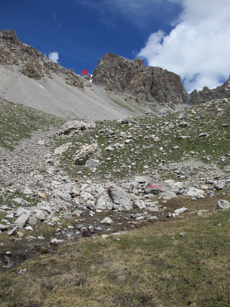
Lo superiamo in leggera salita e quando appare sulla sx in lontananza un ruscello abbandoniamo il sentiero e ci dirigiamo per prati nella sua direzione, risaliamo i pendii alla dx del rio fino ad arrivare alla sua sorgente,da dove è possibile vedere la via nel ghiaione che bisogna salire fino al colletto (posto a sx della parete est della Tete di Platasse).
Dal colletto si sale a dx per roccette sfruttando un piccolo intaglio e girando a sx fino alla cresta che conduce alla cima, oppure su terreno misto alla sx delle roccette.
- Cartografia:
- I.G.C. n°7 Valli Maira Grana e Stura
Nelle vicinanze Mappa
Itinerari
25/05/2018 Alpes-de-Haute-Provence, Val-d'Oronaye D+ 900 m PD Sud-Ovest
Oronaye (Aiguille orientale d’) direttissima versante SO
 50m
50m
12/02/2022 Alpes-de-Haute-Provence, Val-d'Oronaye D+ 850 m PD Nord-Est
Blaves (Tete de) Canale NE
 50m
50m
31/05/2020 Alpes-de-Haute-Provence, Val-d'Oronaye D+ 1152 m AD- Sud-Ovest
Oronaye (Monte) Canale Sud di destra
 50m
50m
20/07/2025 Alpes-de-Haute-Provence, Val-d'Oronaye D+ 1152 m PD- Sud-Ovest
Oronaye (Monte) Via Normale del Canale Sud di sx (classico) e la Cresta Ovest
 50m
50m
09/02/2005 Alpes-de-Haute-Provence, Val-d'Oronaye D+ 100 m D Sud-Ovest
Oronaye (Monte) Couloir SO alla Forcella della Cresta O/NO
 50m
50m
27/01/2016 Alpes-de-Haute-Provence, Val-d'Oronaye D+ 754 m F+ Sud-Ovest
Blaves (Tete de) da le Pontet per il Versante SO
50m
11/07/2021 Alpes-de-Haute-Provence, Val-d'Oronaye D+ 1400 m PD Varie
Bonnet Carrè da le Pontet
 50m
50m
11/06/2016 Alpes-de-Haute-Provence, Val-d'Oronaye D+ 826 m PD+ Varie
Signora (Monte della) Canale Nord-Est
 50m
50m
06/01/2023 Alpes-de-Haute-Provence, Val-d'Oronaye D+ 802 m PD- Nord-Ovest
Blaves (Tete des) Canale NO
 50m
50m
12/02/2022 Alpes-de-Haute-Provence, Val-d'Oronaye D+ 900 m PD Nord-Est
Signora (Monte della) Canale NE della Crete de Blaves e Cresta NO
50m