2.5Km
2.5Km
Note
 450m
1.2Km
1.2Km
1.3Km
1.8Km
1.8Km
1.8Km
1.8Km
2.5Km
2.5Km
450m
1.2Km
1.2Km
1.3Km
1.8Km
1.8Km
1.8Km
1.8Km
2.5Km
2.5Km
Bella escursione ad anello che presenta alcune difficoltà; ottimo panorama.
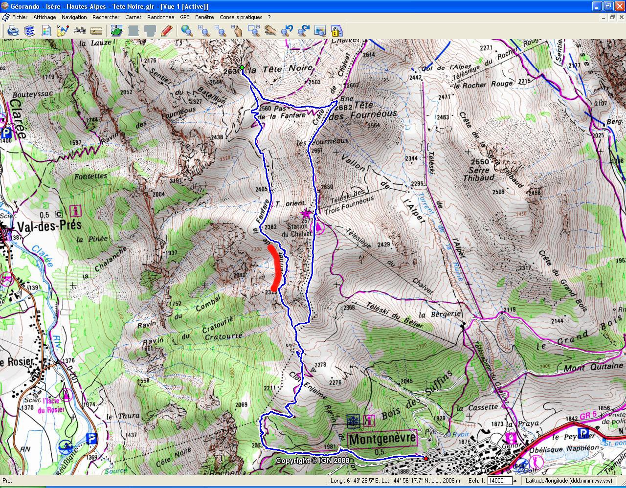
Avvicinamento
Dopo la frontiera si entra nel paese e subito dopo la piazzetta con la fontana si svolta a destra per Rue du Serre Blanc (indicazione POSTE); alla fine della salita si volta a sinistra fino ad incontrare la Rue de la Combe (destra); si entra in questa via e dopo circa 50 metri si parcheggia; oltre divieto di transito.
Descrizione
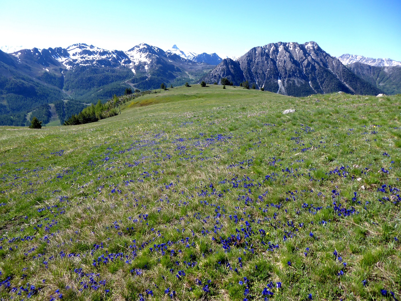
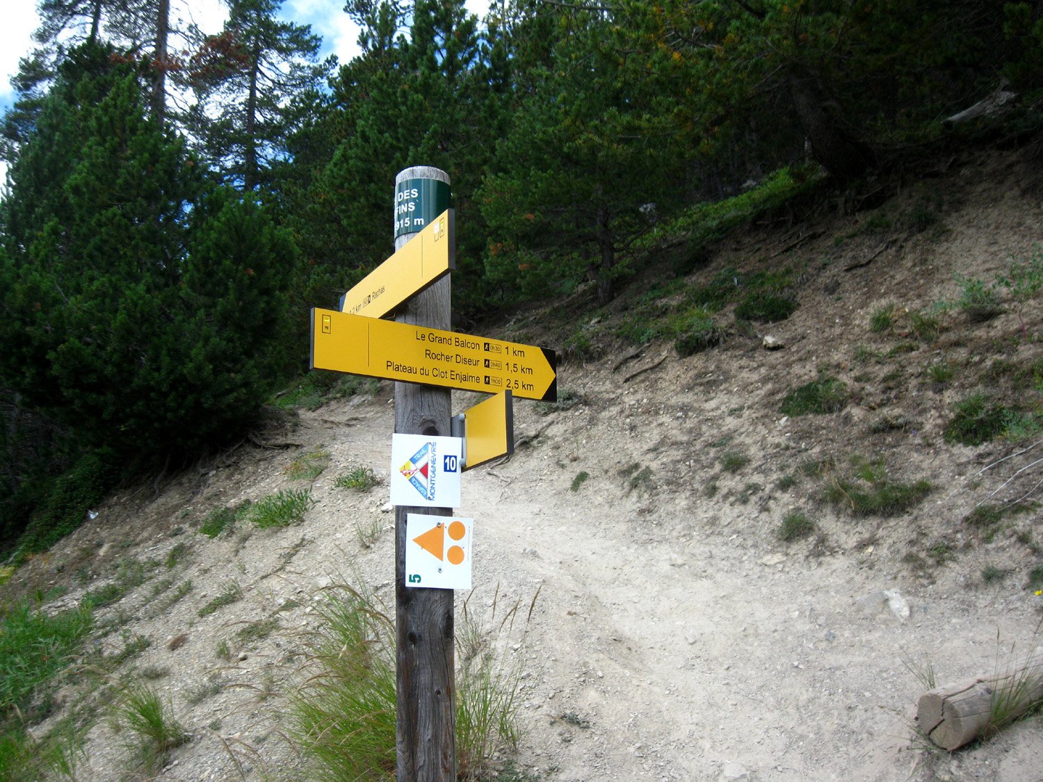
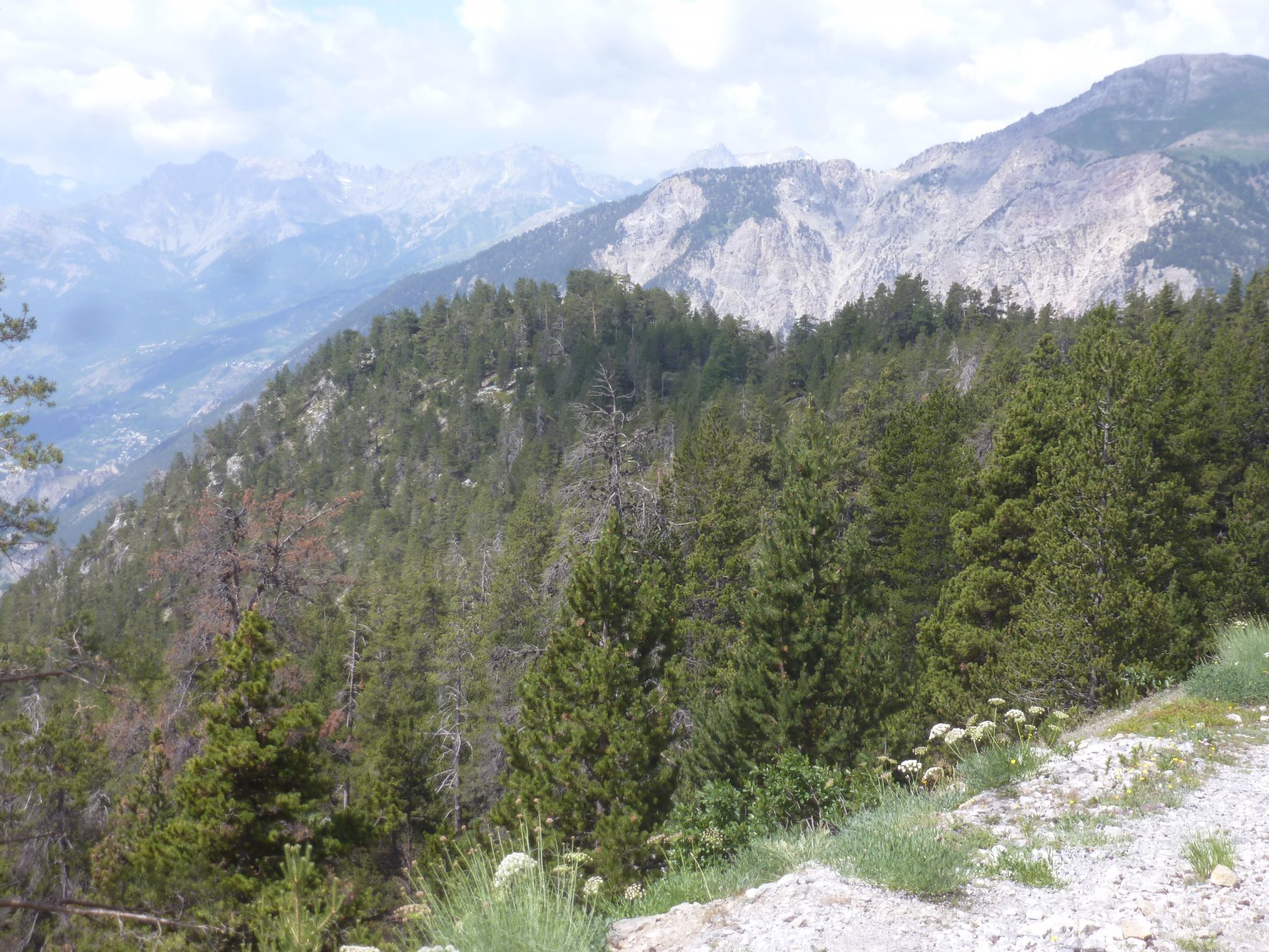
Dal parcheggio si prosegue, dritti, sulla strada asfaltata fini ad incontrare (destra) una evidente mulattiera con l’indicazione le Grand Balcon. Si incontra una pista sterrata che collega la zona del Mont Quitane alla Roche Diseur, che si può raggiungere in 5 minuti di deviazione sulla sinistra (consigliato, ottimo punto panoramico). Ritornati al bivio precedente, si segue il sentiero che ora sale in diagonale nel bosco di pini cembri varie indicazioni tra cui Pas de la Fanfare).
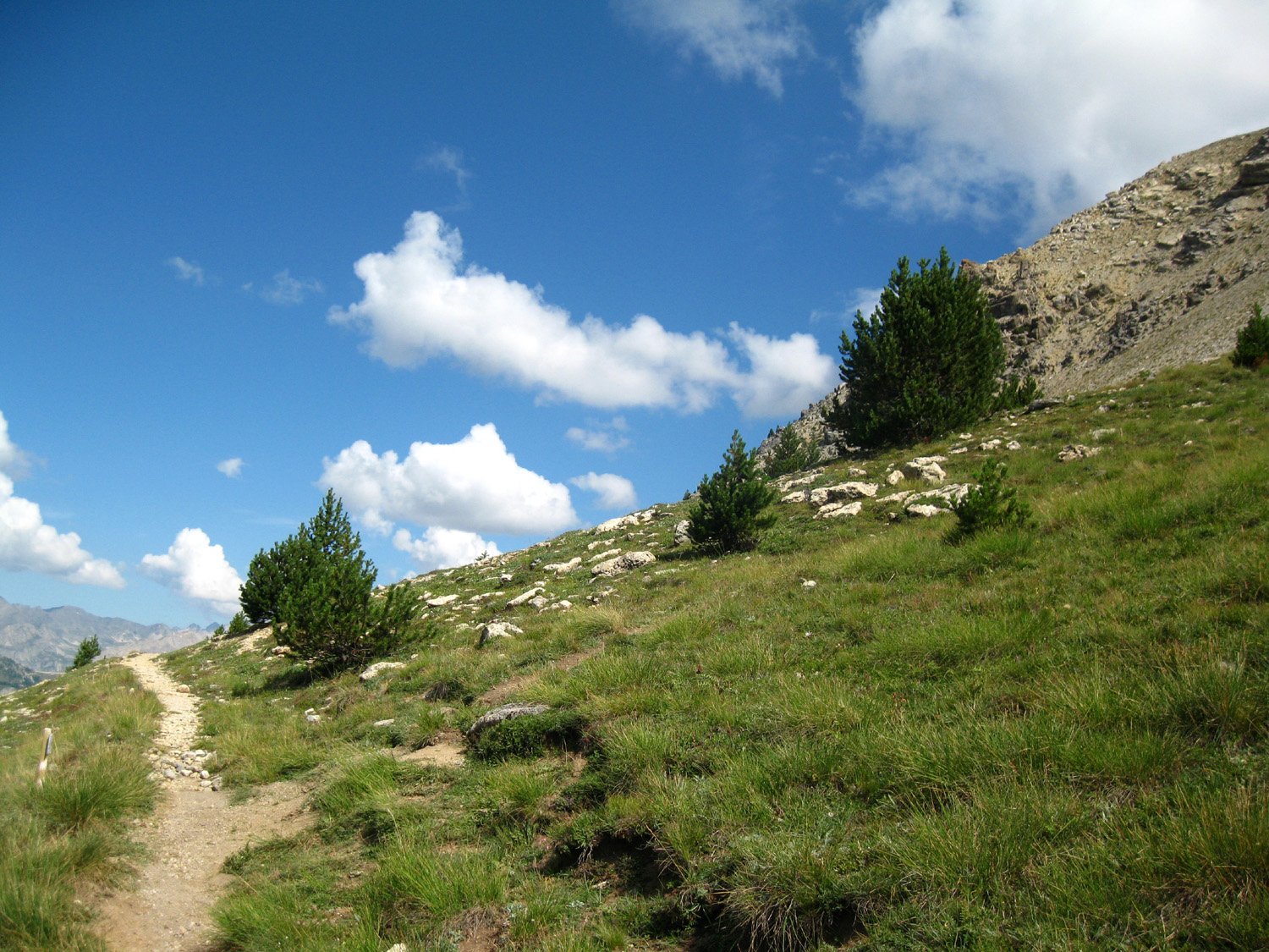
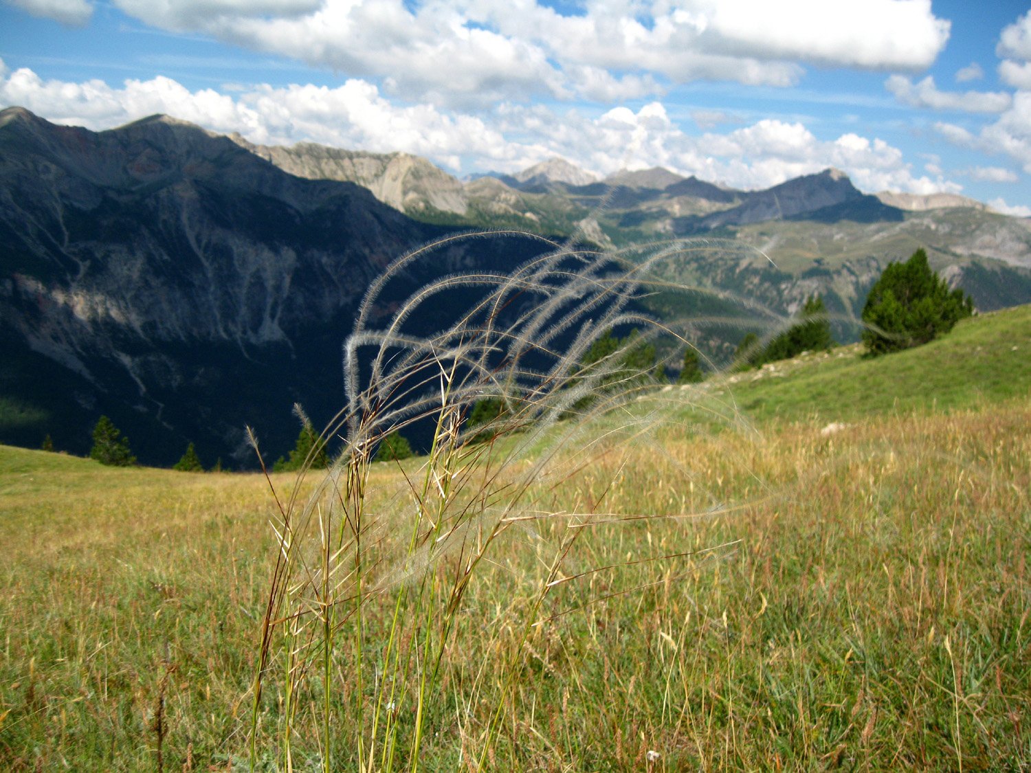
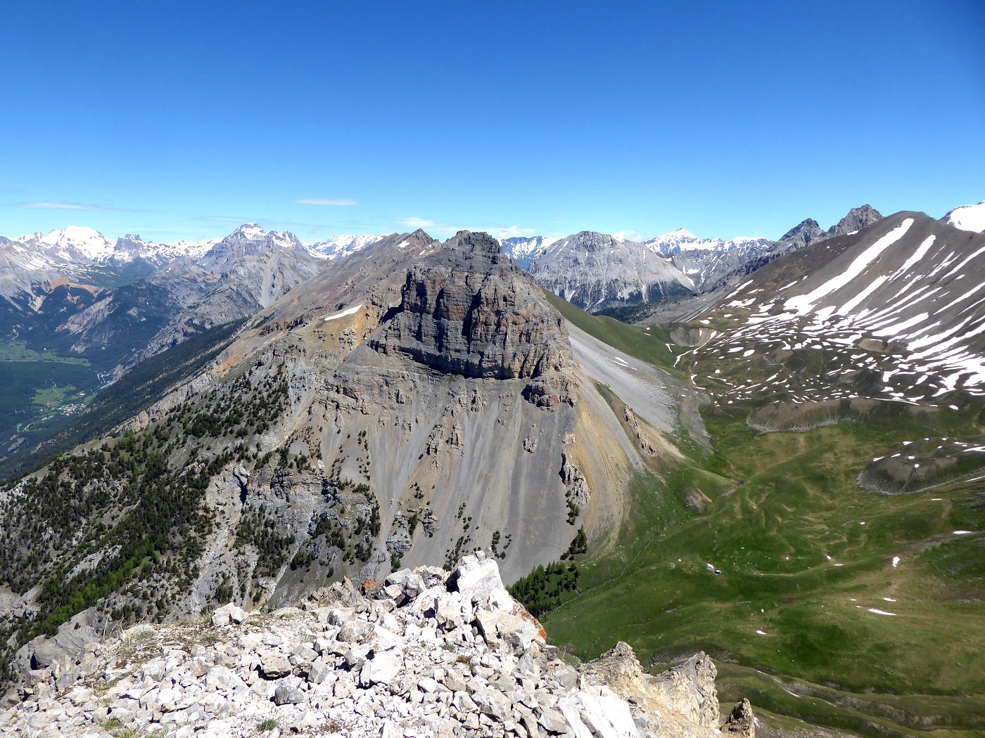
Uscendo dal bosco si raggiunge un ampio plateau erboso molto panoramico. Si sale al centro di esso finchè in corrispondenza di alcuni ruderi (antiche postazioni militari) occorre abbandonare il sentiero per il Pas de la Fanfare (dei cartelli in precedenza ne vietano la percorrenza in quanto eroso dalle recenti alluvioni che hanno interessato la Val de la Clarèe e non più percorribile).
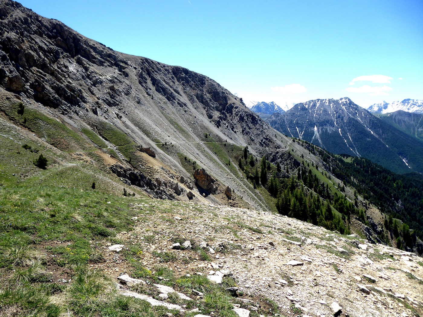
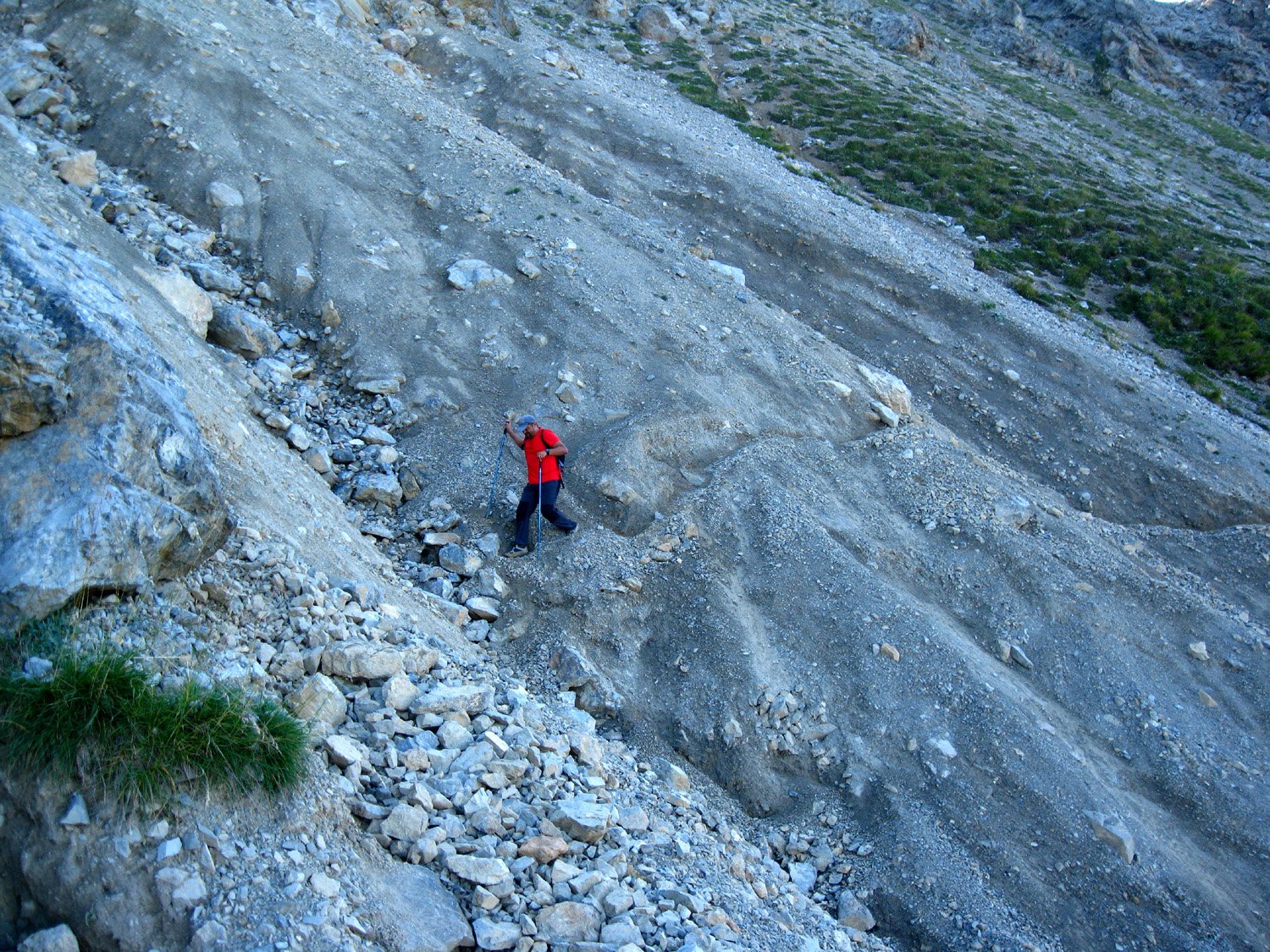
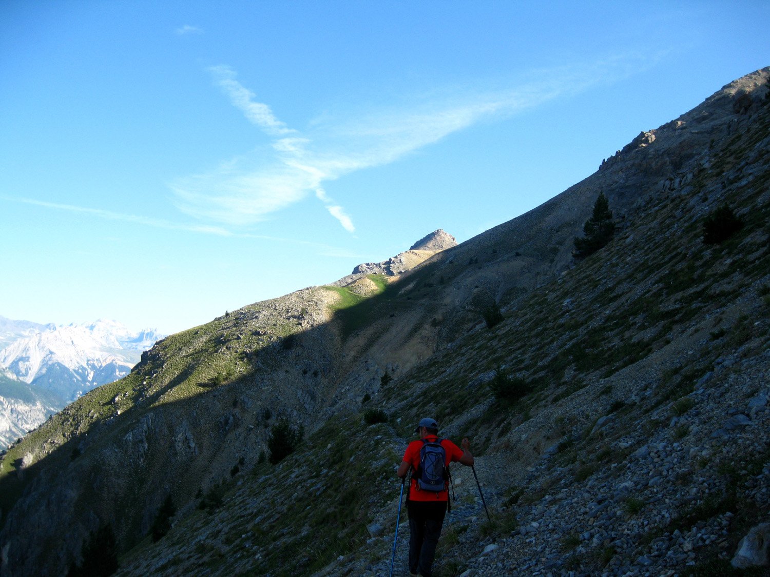
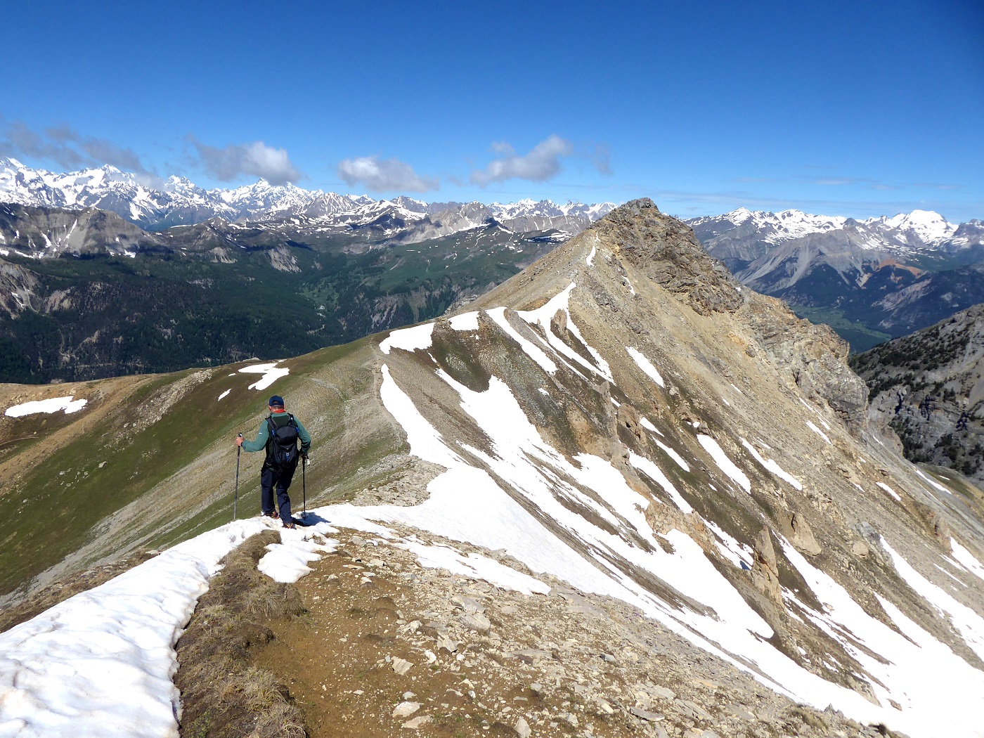
Si individua invece una traccia che sale ripida sulla destra (vernice rossa) puntando alla dorsale scistosa che ha origine dalla Tete des Fourneuos.
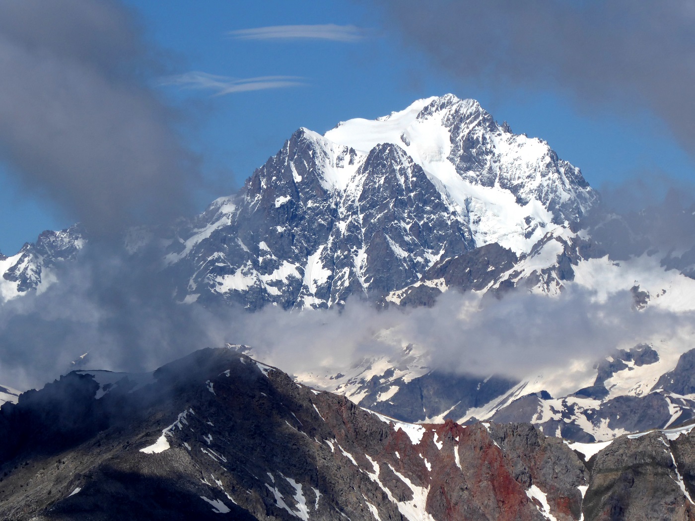
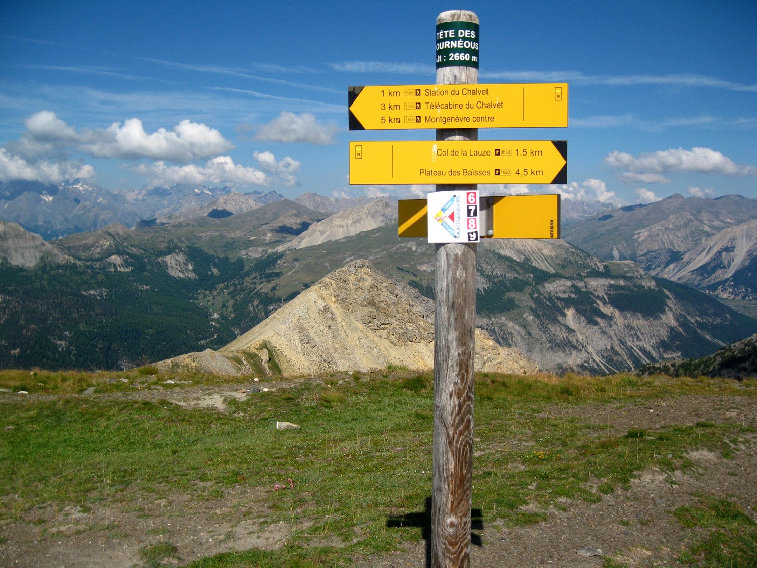
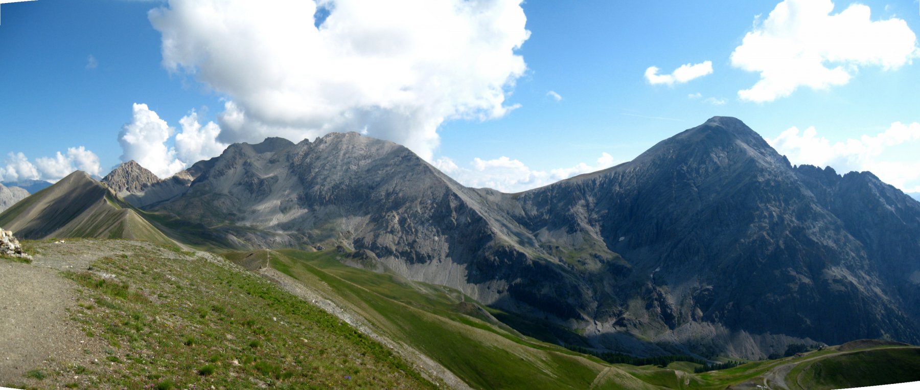
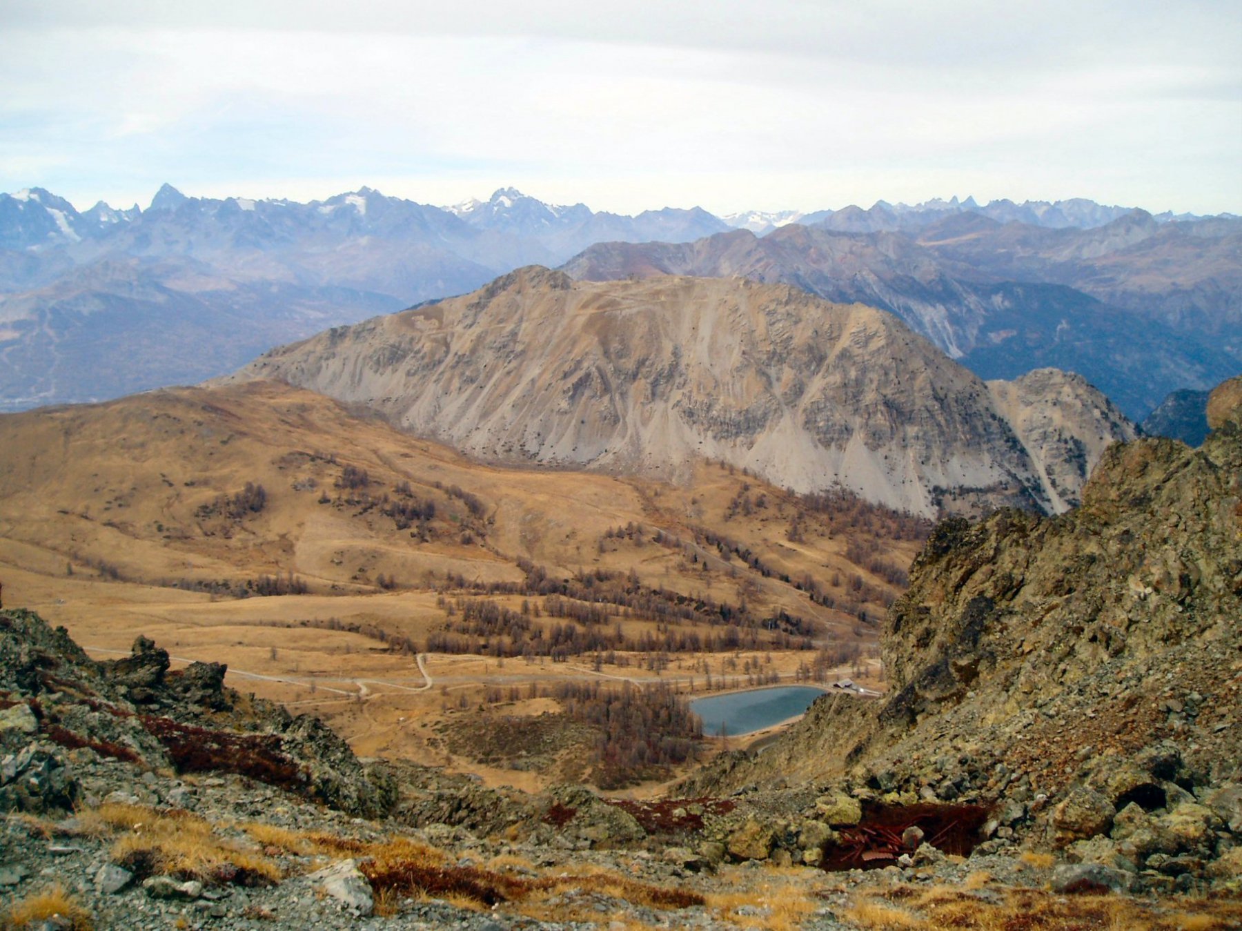
Si arriva un po’ faticosamente alla stazione di arrivo della seggiovia, e si continua a monte sempre sulla panoramica dorsale via via meno ripida finchè questa spiana e conduce alla sommità della Tete des Fourneous 2682 m (identificabile per un casotto in pietra poco sotto la cima).
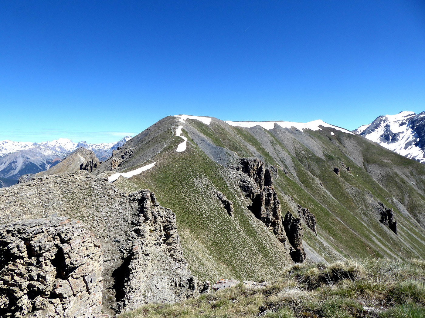
Per raggiungere la Tete Noire, si segue il sentiero inerbito che scende per 80 m il pendio in direzione del sottostante Pas de la Fanfare, dove si incontra anche l’altro sentiero proveniente dalla balconata sopra Plampinet, e come detto in precedenza non percorribile.
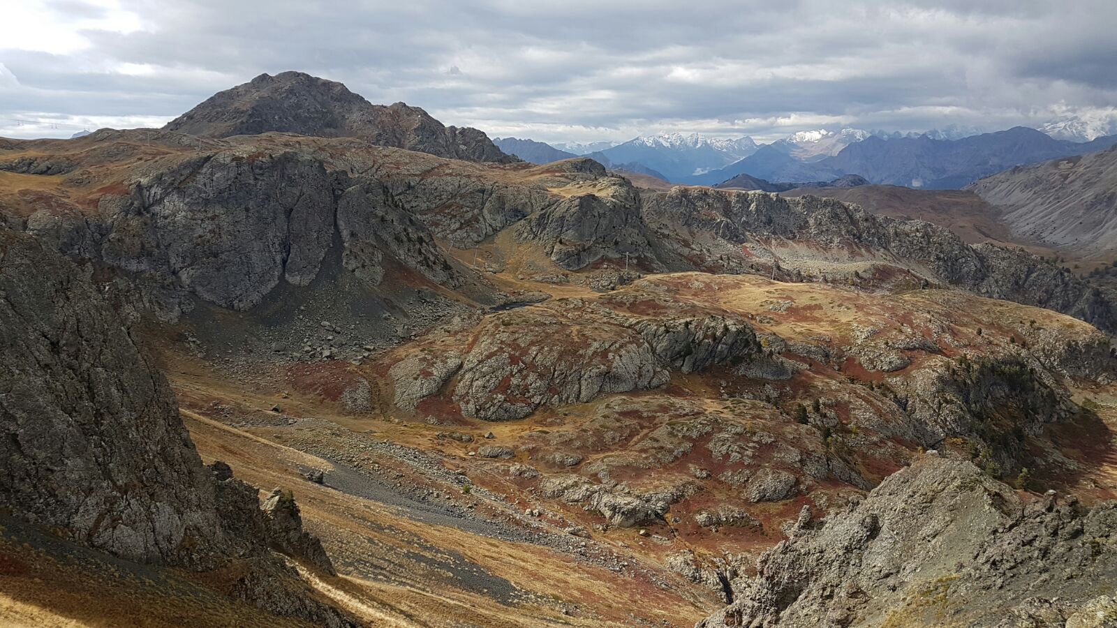
Si continua sul crinale giallastro in direzione nord-ovest, passando a fianco di un bunker di appostamento (utile come riparo in caso di maltempo improvviso).
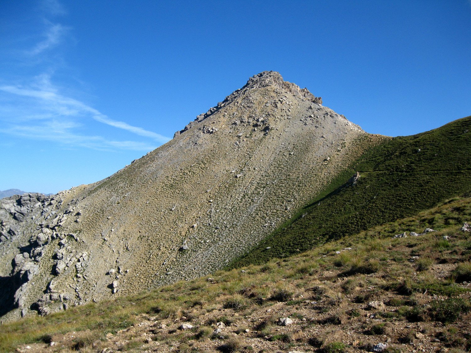
Raggiunta la base del breve castelletto roccioso della Tete Noire 2602 m, si sale senza percorso obbligato per facili roccette alternate a terreno detritico, toccando la cima senza particolari difficoltò (EE, si usano qua a là le mani).
Ritorno dal percorso di salita, oppure risaliti alla Tete des Fourneous, si può optare per un anello un po’ più lungo scendendo verso nord al Col du Lauzin, e da qui si fa ritorno a Monginevro seguendo le varie sterrate di servizio degli impianti sciistici.
Nelle vicinanze Mappa
Itinerari
07/08/2025 Hautes-Alpes, Montgenèvre D+ 750 m E Varie
Janus (le) da Montgenèvre e il Fort du Gondran
 450m
450m
21/06/2025 Hautes-Alpes, Montgenèvre D+ 1300 m E Varie
Chenaillet (le), Monte Gimont, Monte la Plane da Montgenèvre, anello dei Monti della Luna
 1.2Km
1.2Km
24/07/2025 Hautes-Alpes, Montgenèvre D+ 890 m E Sud
Forneous (Tete des) e le Grand Chalvet da Montgenèvre
 1.2Km
1.2Km
27/06/2017 Hautes-Alpes, Montgenèvre D+ 213 m T Sud
Diseur (Rocher) da Montgenèvre
 1.3Km
1.3Km
11/08/2025 Hautes-Alpes, Montgenèvre D+ 830 m E Varie
Chenaillet (le) da Montgenèvre
 1.8Km
1.8Km
20/07/2025 Hautes-Alpes, Montgenèvre D+ 750 m E Ovest
Plane (Monte la) da Montgenevre per la Valle dei Mandarini e Col Guignard
 1.8Km
1.8Km
20/06/2017 Hautes-Alpes, Montgenèvre D+ 750 m EE/F Sud-Ovest
Verde (Colletto) da Montgenèvre per il Colletto Guignard
 1.8Km
1.8Km
30/08/2025 Hautes-Alpes, Montgenèvre D+ 790 m E Nord
Gimont (Mont) o Grand Charvia da Montgenèvre per la Valle dei Mandarini e il Colletto Verde
 1.8Km
1.8Km
09/06/2026 Hautes-Alpes, Montgenèvre D+ 1251 m E Varie
Chaberton (Monte) da Montgénevre per il Colle dello Chaberton
 2.5Km
2.5Km
29/07/2025 Hautes-Alpes, Montgenèvre D+ 1400 m EE Sud-Ovest
Rochers Charniers (Pointe des) e Pointe de Chalance Ronde da Montgenèvre per il Passo dell’Asino
 2.5Km
2.5Km