 3.6Km
3.6Km
Note
 3Km
3Km
3.1Km
3.2Km
3.4Km
3.5Km
3.6Km
3.6Km
3.6Km
3Km
3Km
3.1Km
3.2Km
3.4Km
3.5Km
3.6Km
3.6Km
3.6Km
3.6Km
3.6Km
3.7Km
3.7Km
3.7Km
6Km
6Km
6.3Km
6.4Km
7.5Km
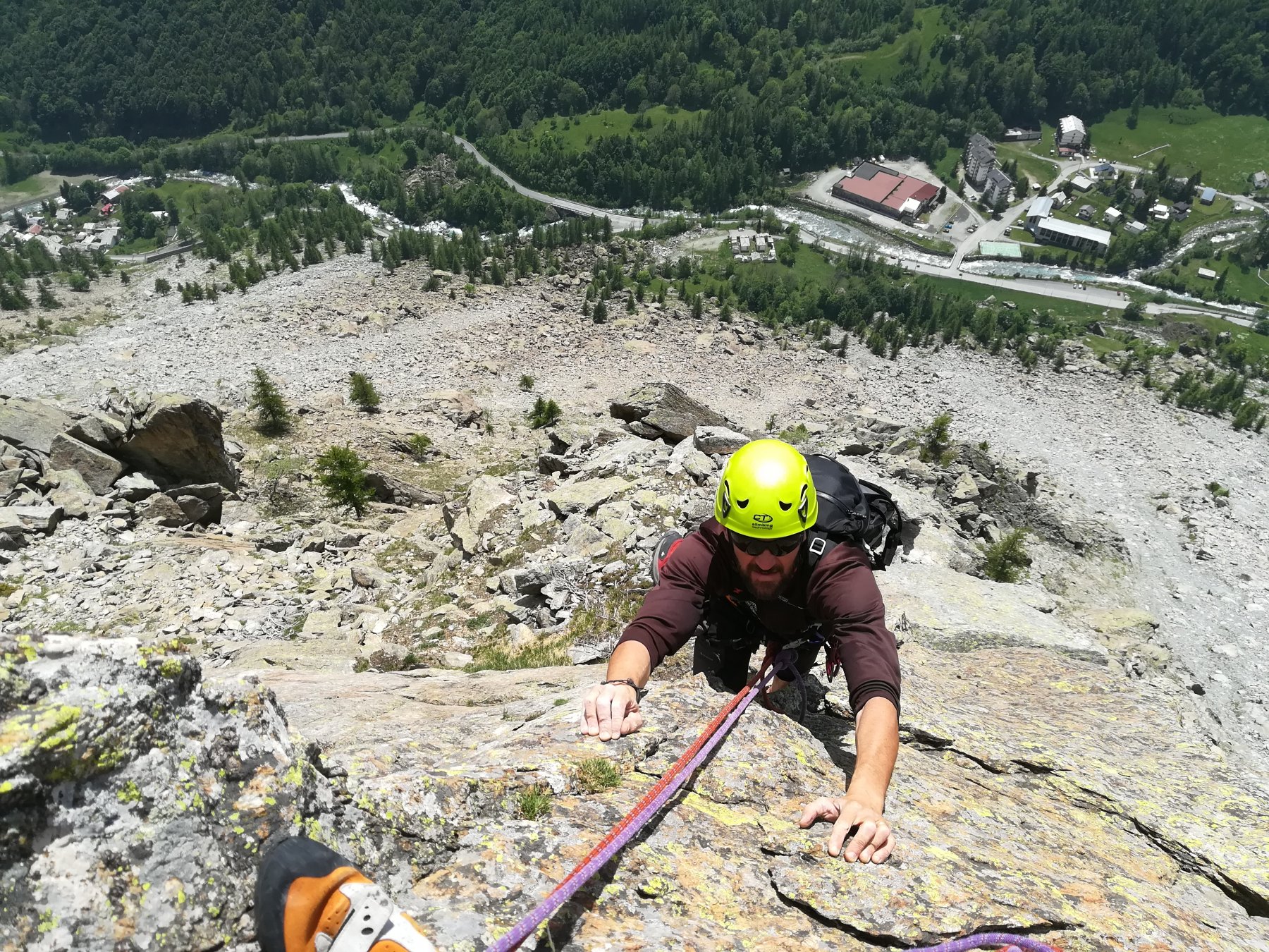
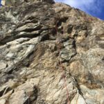
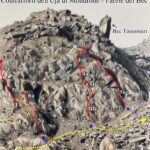
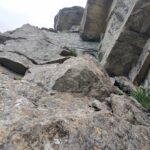
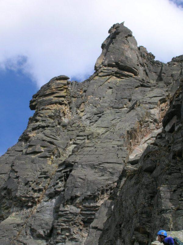
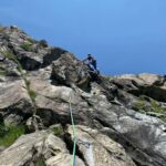
Via che si risolve in 150 m, poi degrada e su roccia molto bella, velocemente in punta. Ottimo schizzo sulla guida Monti d'Italia. La via attacca nell'ultimo diedrone nerastro della parte dx. della parete. Da non confondere con il diedro appena prima, dove passa la Grassi-Ala.
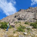
Avvicinamento
.
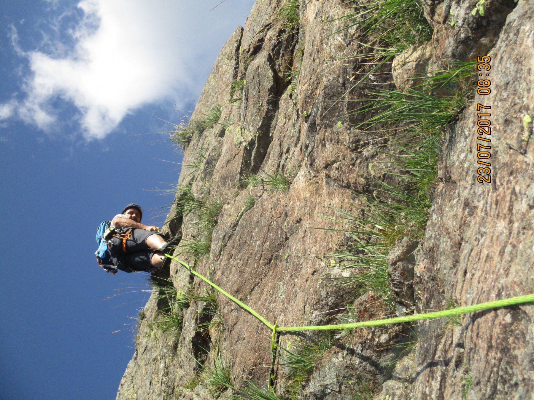
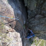
Descrizione
Dopo una lunghezza in diedro la via salta “fuori” sulla faccia dx più chiara e con un tiro stupendo di 60 m (qualche chiodo) arriva in sosta. Ancora un bel tiro e si è fuori dalle difficoltà. Da fare per capire la forza di Guido Rossa. Via riservata agli amanti di questo genere di salite e a chi vuole passare una bella giornata in montagna.
Nelle vicinanze Mappa
Itinerari
28/10/2025 TO, Balme 5a, 5a obbl. Sud
Mondrone (Uja di), contrafforti – Adriana
 3Km
3Km
27/06/2024 TO, Balme 6c+, 6b obbl., a0 Sud
Balme – Cascata (Falesia della)
 3Km
3Km
12/07/2026 TO, Balme 6a, 5c obbl. Sud
Mondrone (Uja di), Parete del Bec – Vie varie
 3.1Km
3.1Km
28/10/2025 TO, Balme 5b, 5b obbl. Sud
Mondrone (Uja di), contrafforti – Torrione Nanni
 3.2Km
3.2Km
26/08/2012 TO, Groscavallo 6b, 6b obbl. Nord-Ovest
Leitosa (Cima occidentale di) quota 2550 m – I Colori della Rabbia
3.3Km
28/06/2026 TO, Balme 5a, 4 obbl. Sud-Ovest
Ru (Torrioni del) – Fantasia
 3.4Km
3.4Km
20/09/2015 TO, Groscavallo 5c, 5a obbl. Nord-Ovest
Gallo (Torrione del) parete Nord-Ovest – Via Meneghin
 3.5Km
3.5Km
17/06/2026 TO, Balme 5c, 5b obbl. Sud
Ru (Torrioni del) – Qué Miras Bobo?
 3.6Km
3.6Km
25/07/2024 TO, Groscavallo 6b+, 5c obbl. Sud
Ru (Torrioni del) – Giubbe Rosse
 3.6Km
3.6Km
10/09/2024 TO, Balme 6b+, 5c obbl. Sud
Ru (Torrioni del) – Chiacchiere e Distintivo
 3.6Km
3.6Km
Servizi
3.6Km
3.6Km
Camussot Albergo
Balme
3.7Km
Val Servin Ristorante
Balme
3.7Km
Stella Alpina Ristorante
Balme
3.7Km
Masinà B&B
Balme
6Km
Maronero Ristorante
Ala di Stura
6Km
corbassera Ristorante
Ala di Stura
6.3Km
Il Saloon Ristorante
Groscavallo
6.4Km
Daviso Rifugio
Groscavallo
7.5Km