50m
50m
Note
 50m
50m
50m
50m
2.8Km
8.1Km
10Km
11.5Km
12.3Km
50m
50m
50m
50m
2.8Km
8.1Km
10Km
11.5Km
12.3Km
Attenzione! Alcune guide di itinerari MTB piuttosto datate non tengono conto del fatto che le alluvioni del 2000 hanno seriamente danneggiato parte del sentiero su cui si svolge l'escursione
Avvicinamento
.
Descrizione
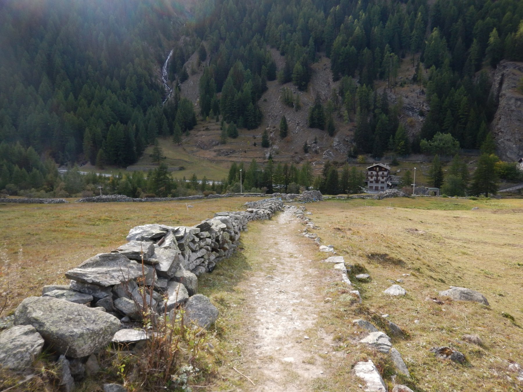
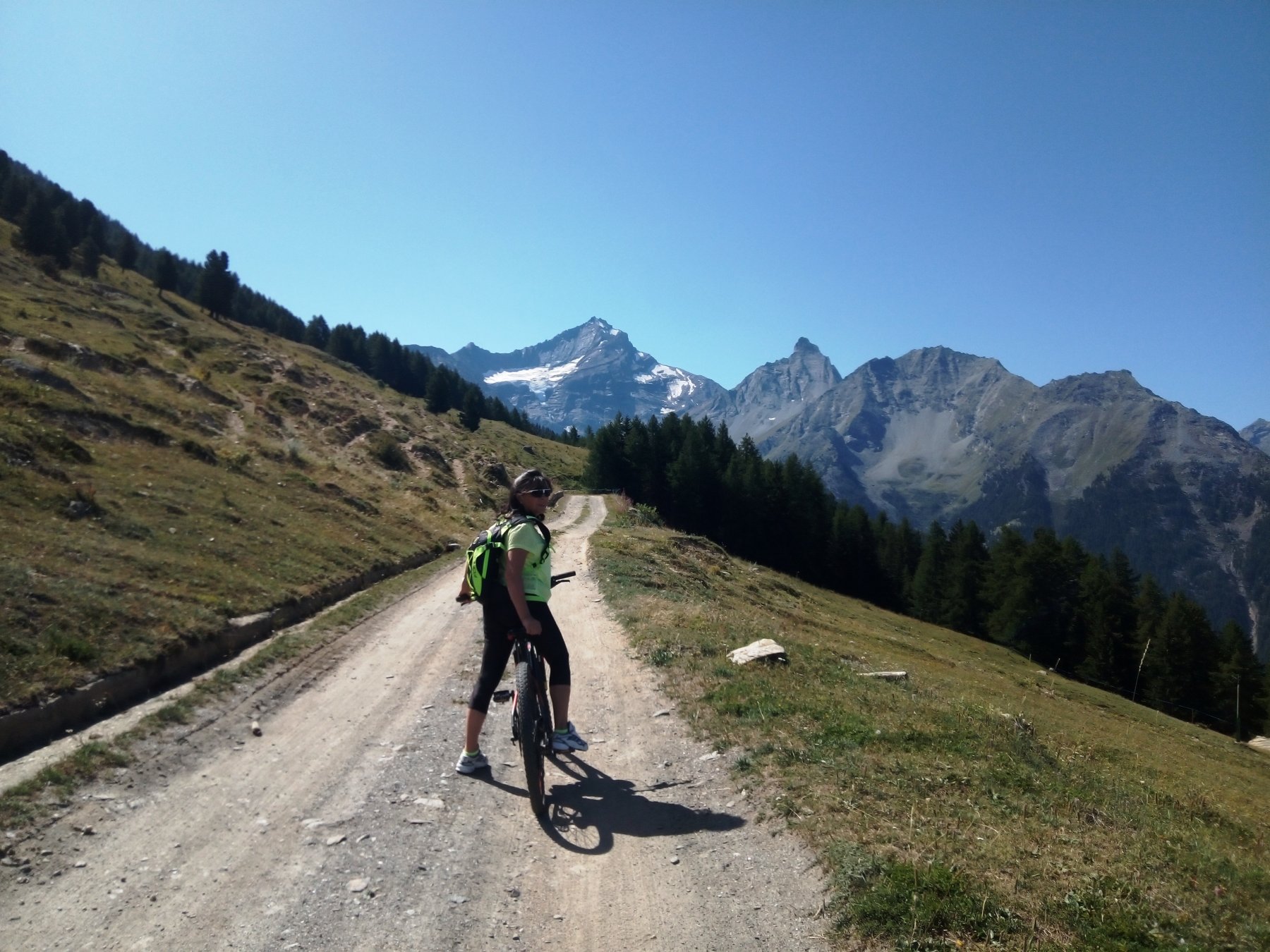
SI parte da Degioz 1540 m, centro principale della valle (parcheggio vicino al Centro Visitatori del Parco), e si risale per pochi chilometri la vallata sino alla frazione di Eaux Rousses (mt. 1666), dove si lascia l’asfalto per attraversare il torrente ed iniziare la lunga ascesa (pannelli indicatori dell’Alta via n. 2).
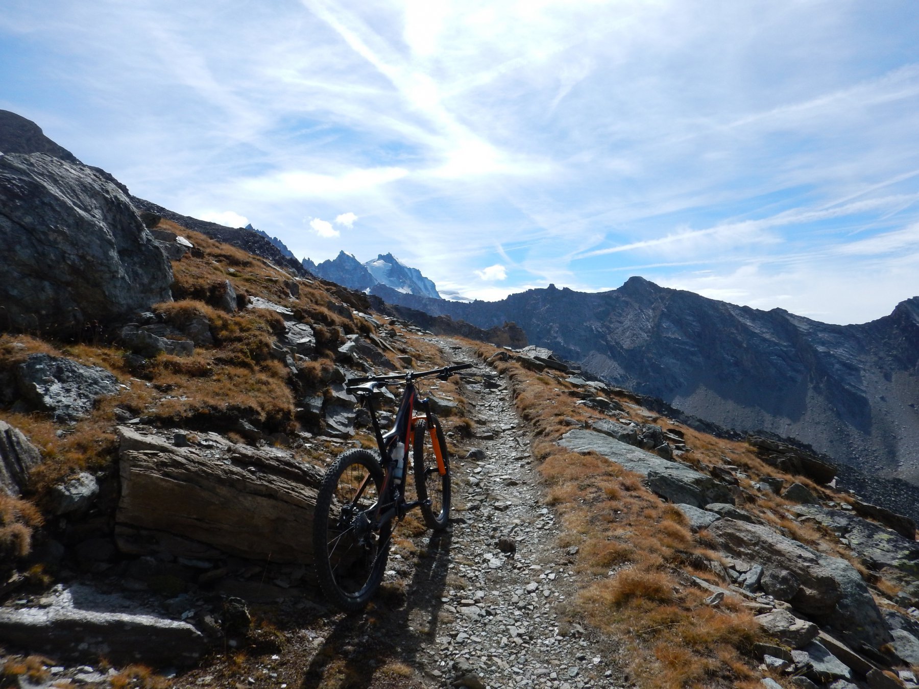
L’inizio non è dei più promettenti: infatti il sentiero si riduce ad una sassaiola informe che risale il prato. Impossibile restare in sella per più di dieci metri consecutivi.
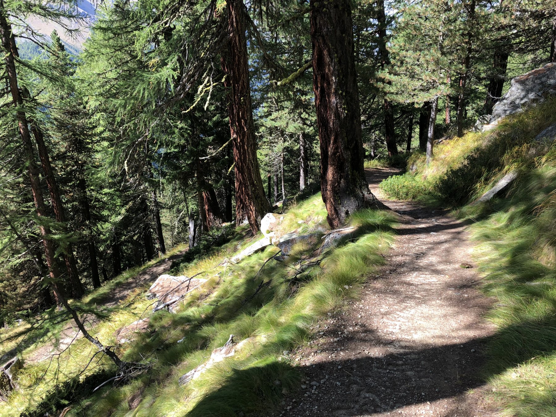
Giunti all’inizio del bosco poi le vecchie relazioni delle guide in mio possesso (Val d’Aosta in MTB- Pietro e Matteo Giglio-Musumeci Edizioni) descrivono l’itinerario come quasi interamente ciclabile. E così comincio a fregarmi le mani dalla gioia.
Peccato che di anni ne siano passati parecchi e – nel frattempo – c’è stata un’alluvione mica da ridere (quella del 2000, tutta la Val d’Aosta ne porta ancora le ferite più o meno rimarginate).
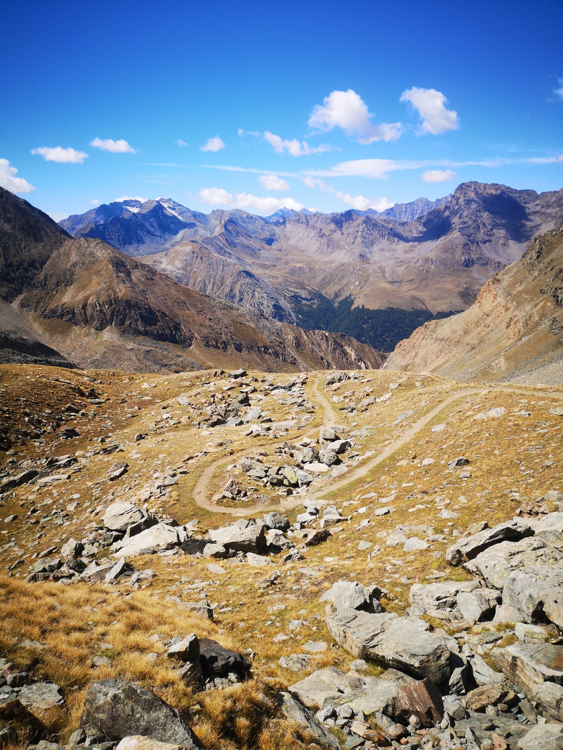
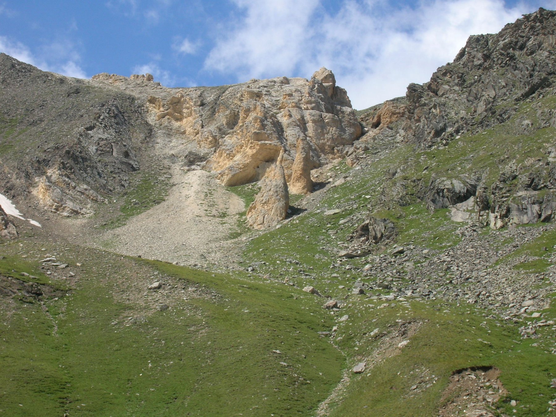
Risultato: si deve risalire a tornanti il fronte di una grandissima frana che ha sconvolto i resti della mulattiera reale: ed è un continuo salire e scendere dalla bici.
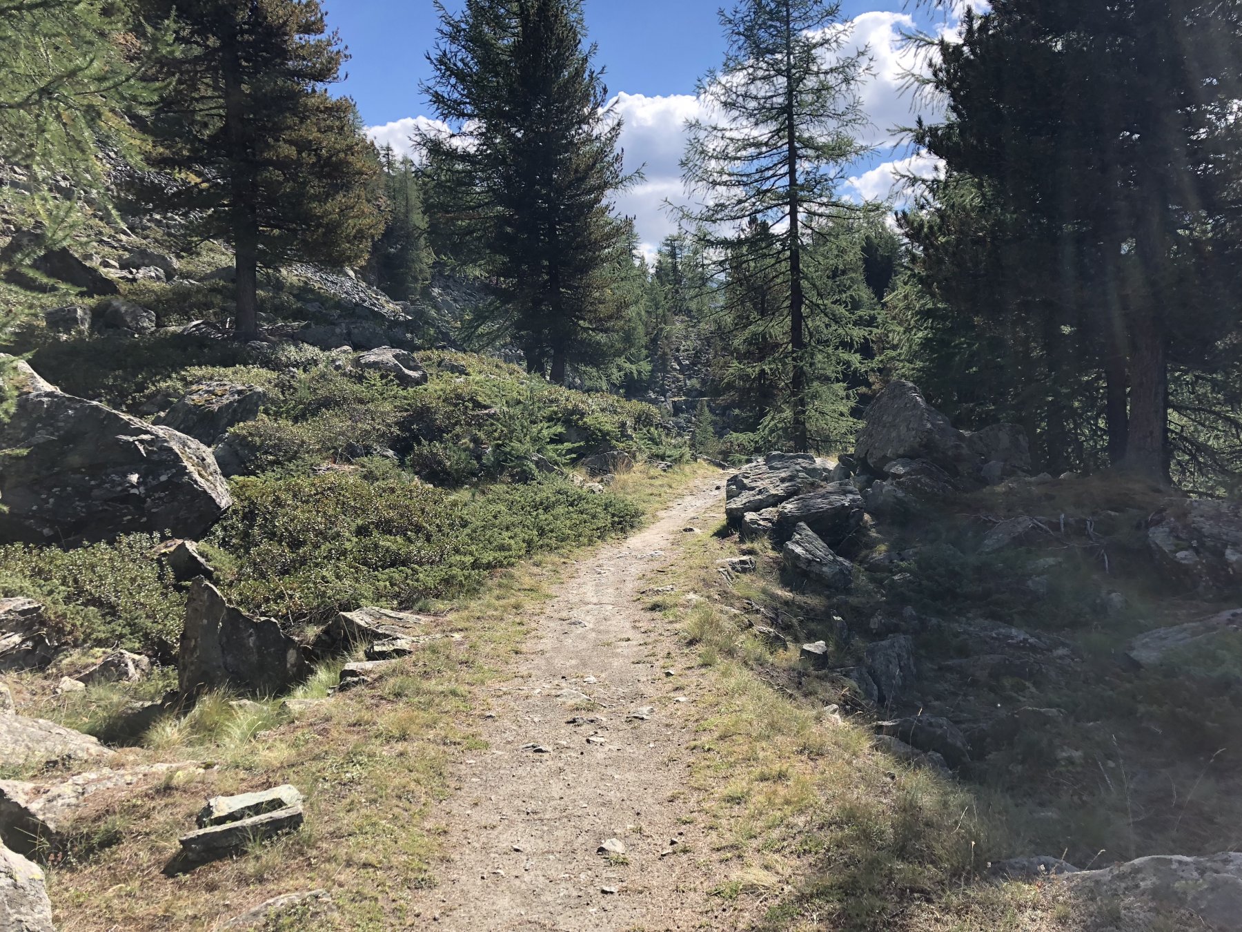
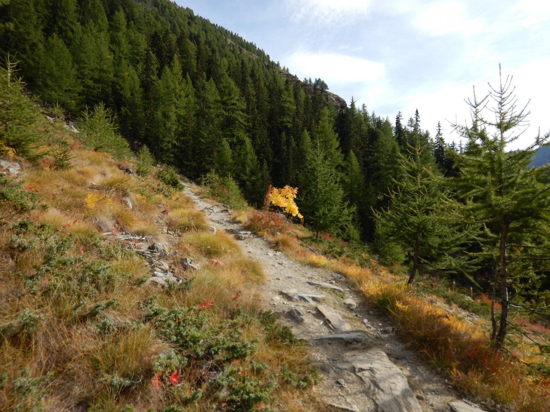
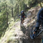
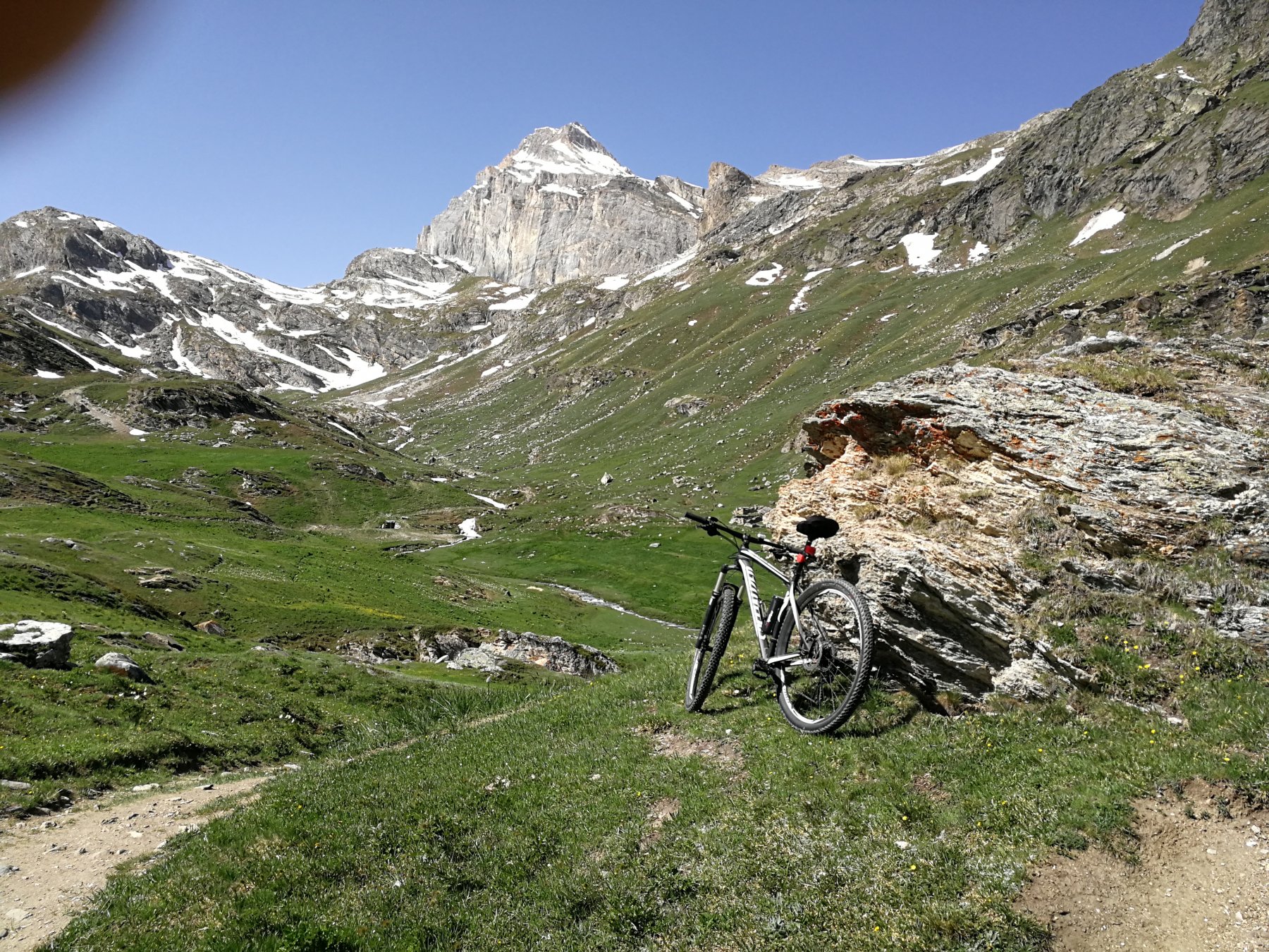
Solo dopo aver attraversato definitivamente il fronte frana il sentiero torna a farsi pedalabile, ed è un vero spettacolo affrontare questo tratto nel bosco, caratterizzato da innumerevoli tornantini ravvicinati.
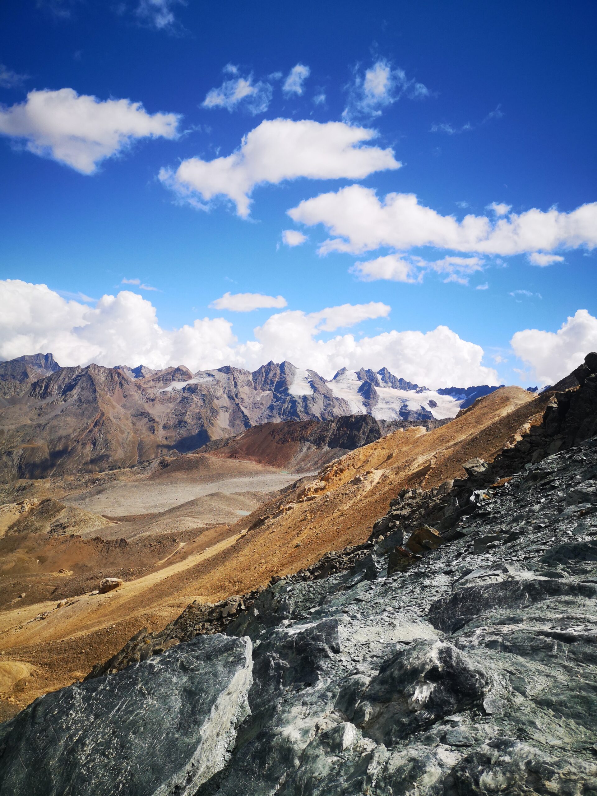
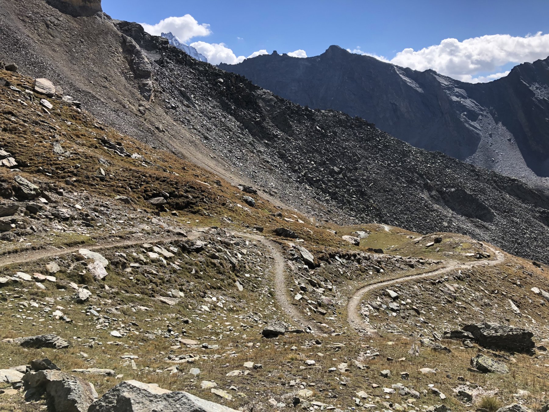
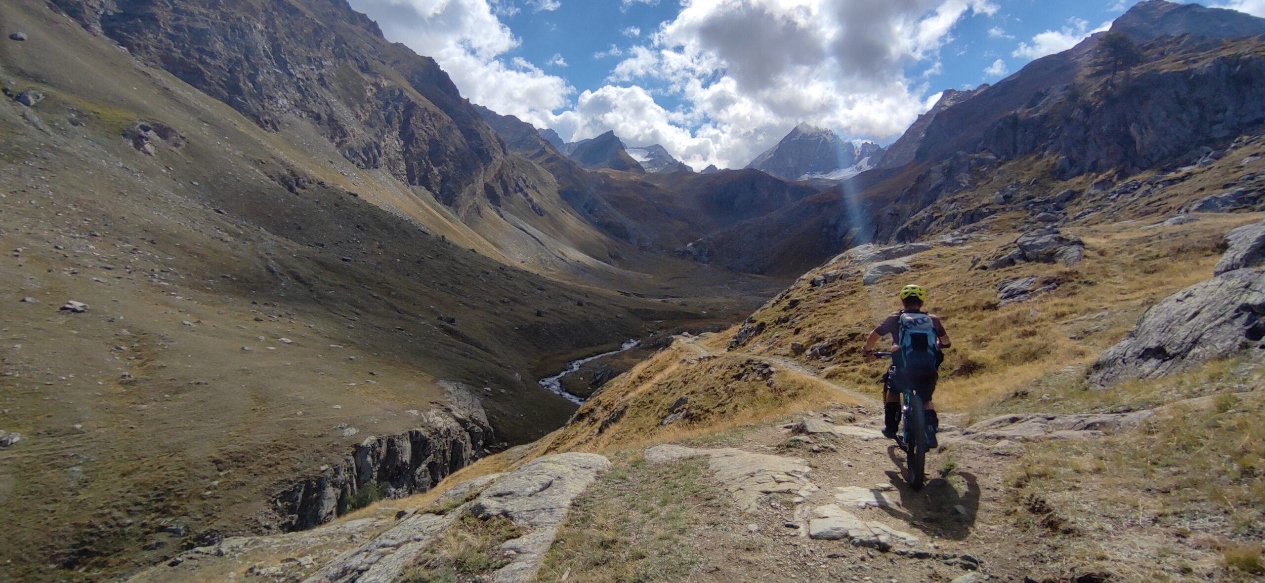
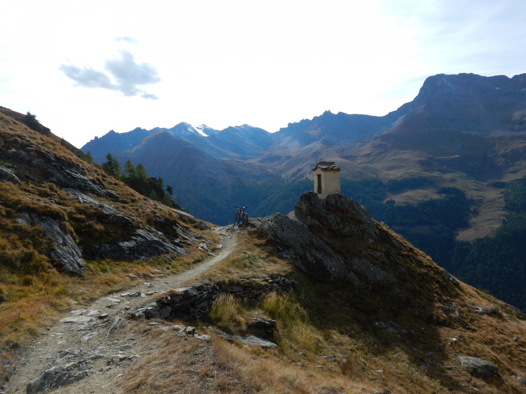
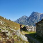
Si esce dal bosco e dopo un breve tratto non ciclabile si raggiungono la cappelletta e le baite dell’alpe Levionaz inferiore mt 2303, spettacolare panorama sull’intera valle.
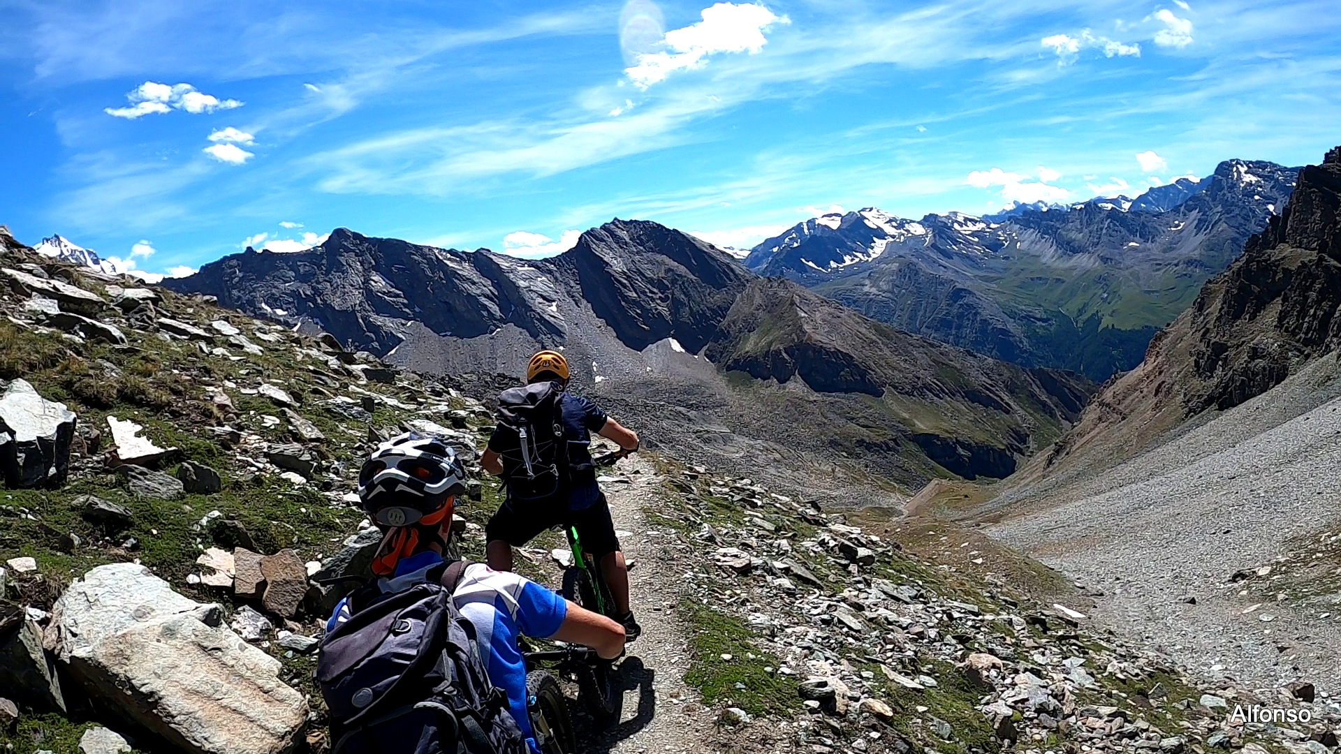
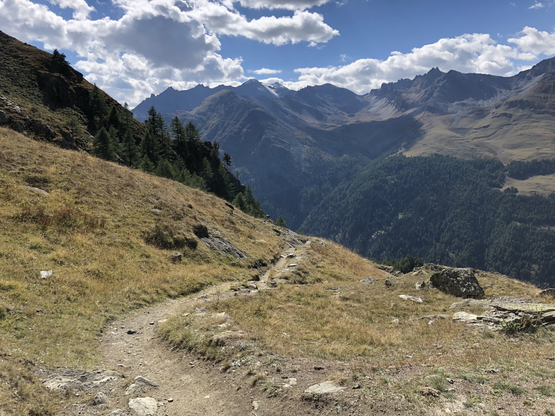
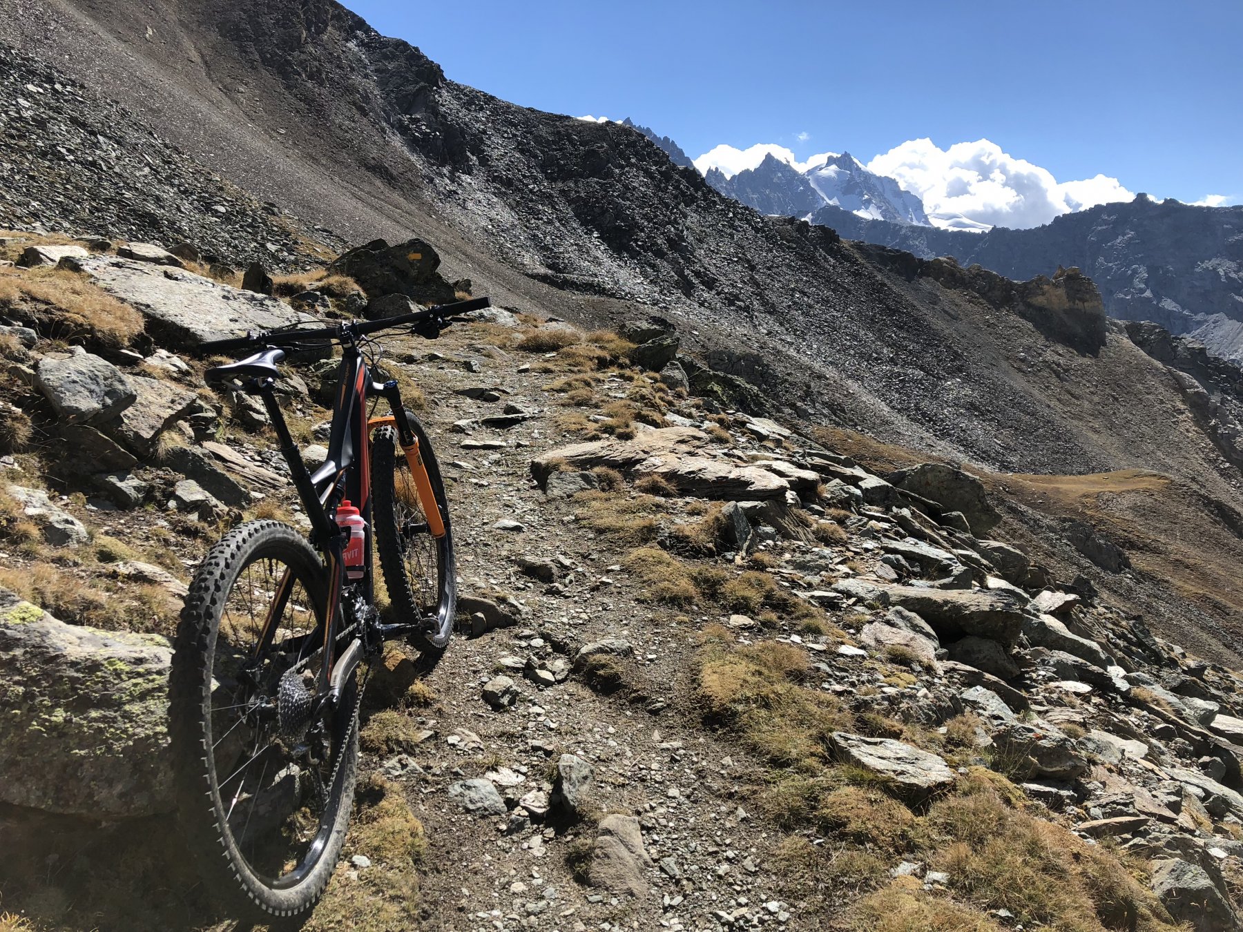
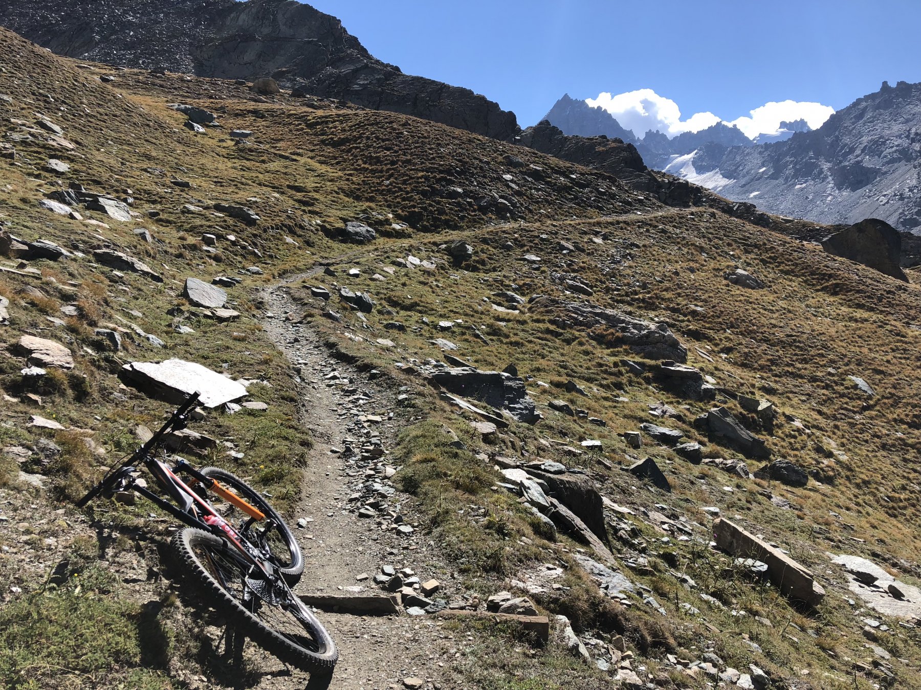
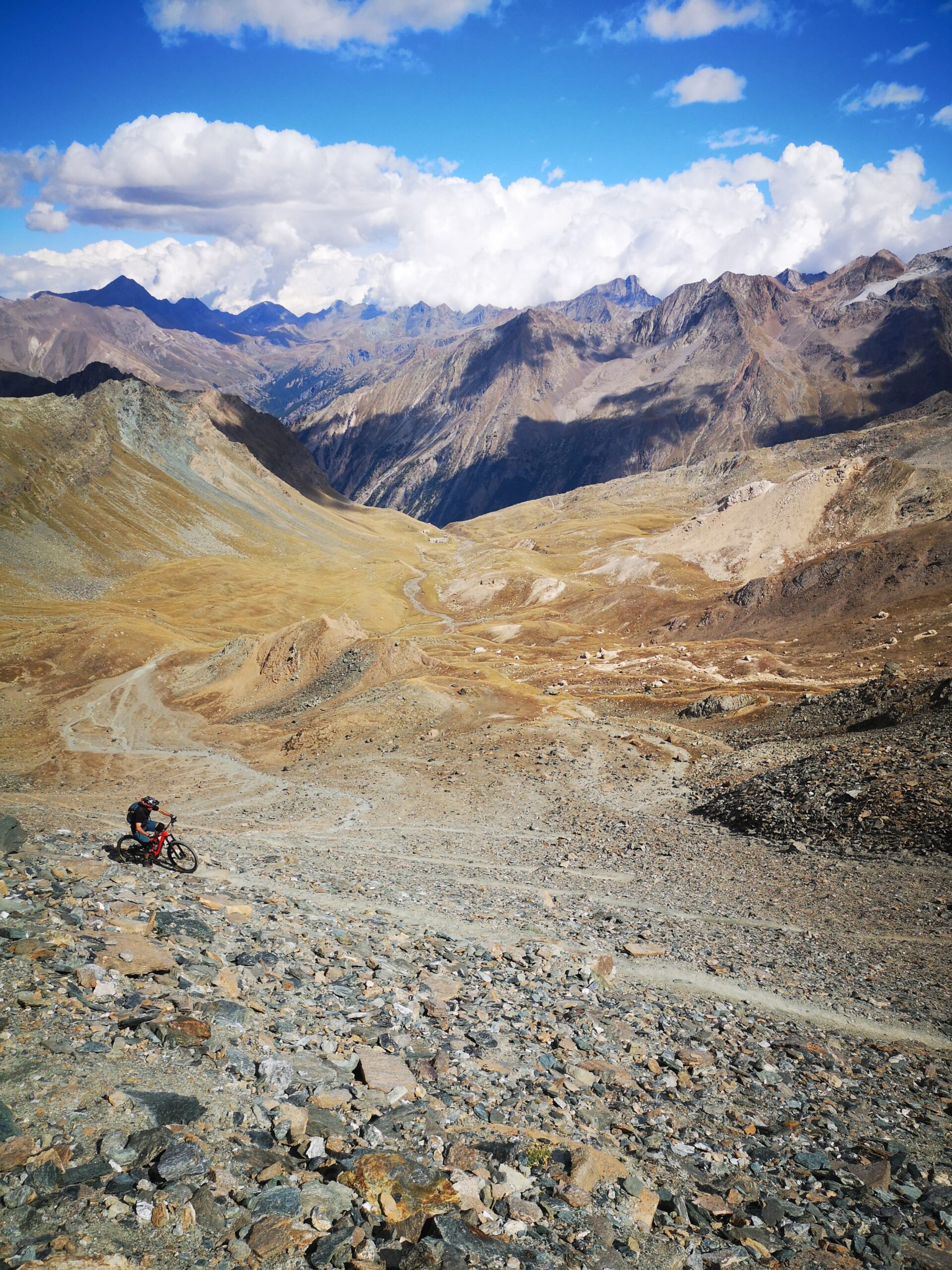
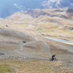
Ora il sentiero entra decisamente nel vallone di Levionaz (splendida vista sui ghiacciai del Gran Paradiso) e dopo una breve discesa corre parallelo al torrente: anche qui si notano evidenti i segni di passati sconvolgimenti alluvionali, e i successivi tornanti sono quasi tutti da farsi bici a fianco. Dopo aver passato un ponticello sul torrente la ciclabilità torna buona, anzi man mano che si procede di quota ci si stupisce di quanto si riesca a stare in sella. E’ un tratto entusiasmante: l’ambiente è quello tipico dell’alta montagna, il sentiero è molto aereo ed esposto, ma noi non desistiamo e continuiamo a procedere in sella sorpassando decine di escursionisti increduli.
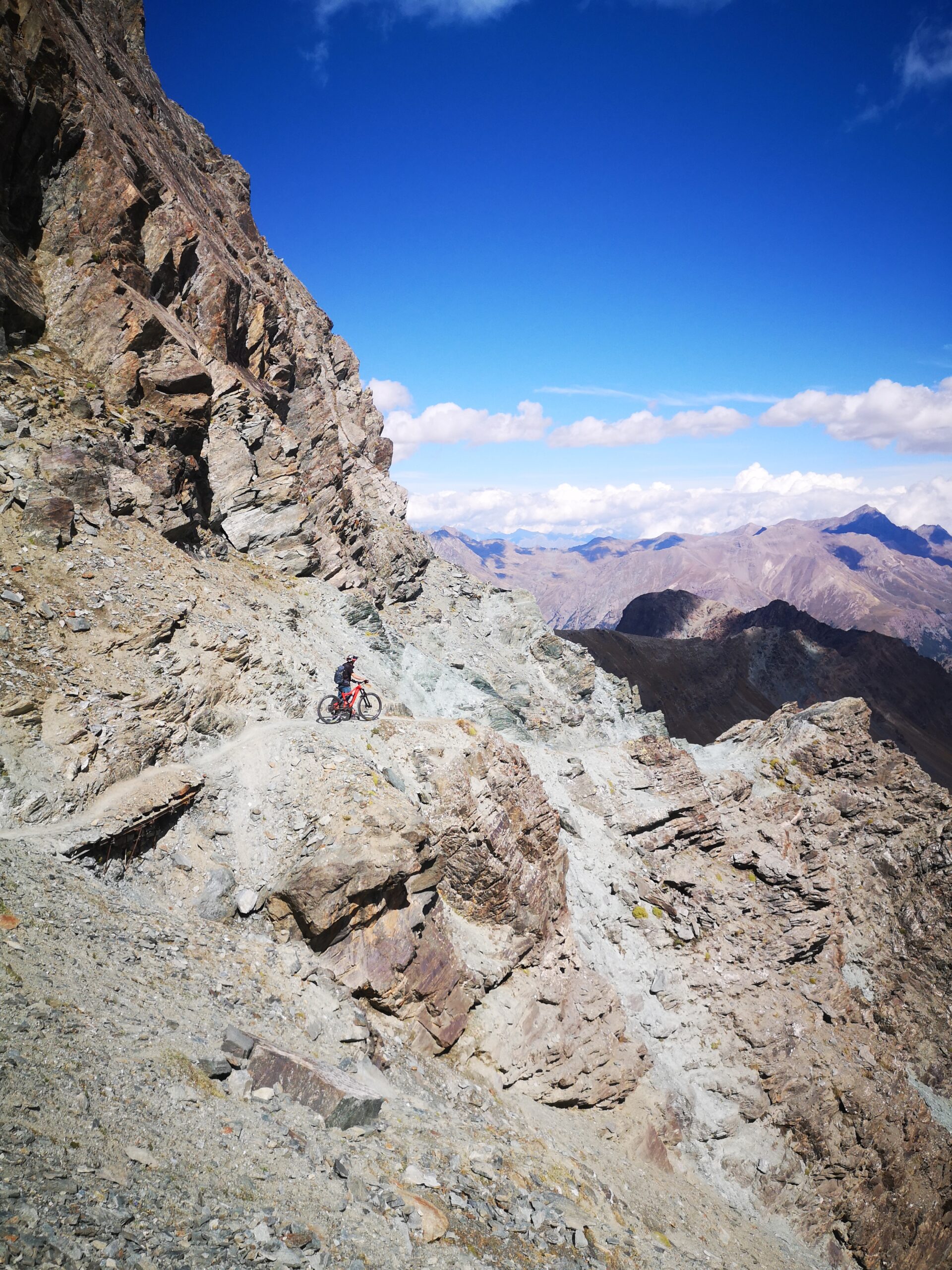
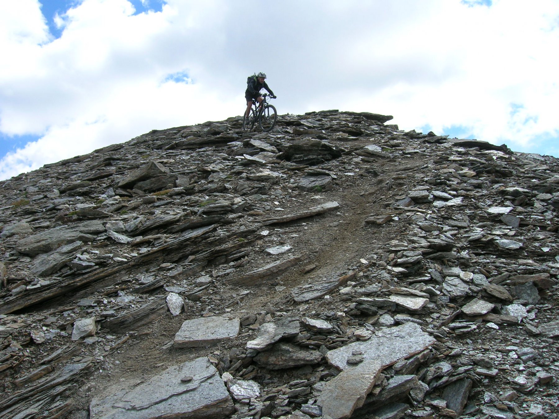
La manna termina a quota 2950 mt, dove comincia l’immensa pietraia che porta al colle: inutile proseguire oltre (o se proprio volete fatelo a piedi).
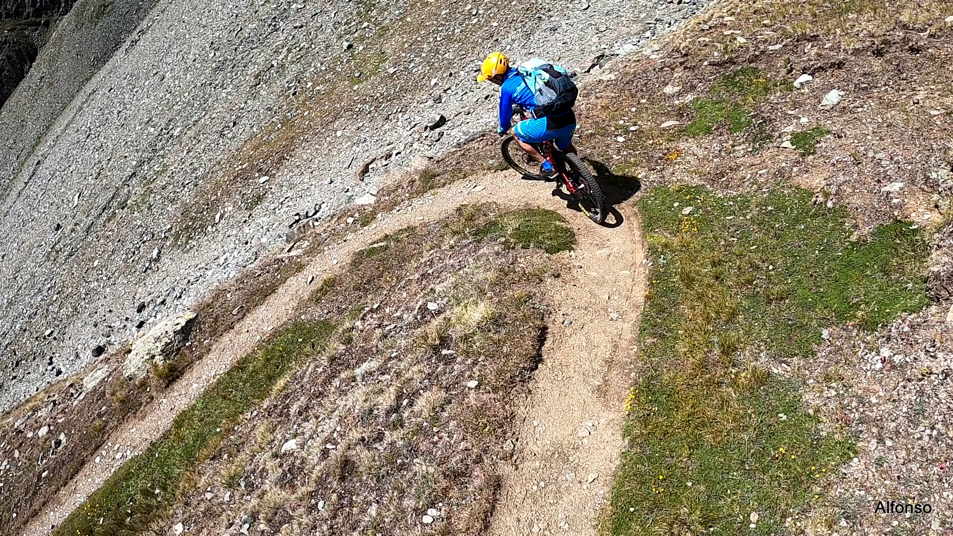
Breve sosta rigeneratrice, e poi inizia una discesa di quelle che non si dimenticano facilmente: si riesce a stare in sella molto più che in salita, soprattutto per chi dispone di buona tecnica e sana incoscienza. Io preferisco scendere nei punti più critici, ma ciononostante il divertimento è assicurato.
In conclusione: escursione stupenda, ma se mal digerite i giri poco pedalabili lasciate perdere. E soprattutto considerate che l’impegno fisico è notevole, viste le quote raggiunte.
- Cartografia:
- IGC n. 107-Valsavarenche
Nelle vicinanze Mappa
Itinerari
01/08/2020 AO, Valsavarenche D+ 1713 m BC+, OC, S3 Nord
Percià (Punta) da Degioz per il Colle di Entrelor
 50m
50m
28/09/2018 AO, Valsavarenche D+ 1900 m BC+, BC, S2 Est
Manteau (Col) da Degioz, giro per il Lago Djouan e il Piano del Nivolet
 50m
50m
25/08/2023 AO, Valsavarenche D+ 1450 m BC+, OC, S2 Varie
Entrelor (Colle di) da Degioz per il Lago Djouan
 50m
50m
08/10/2021 AO, Valsavarenche D+ 938 m BC, BC, S2 Varie
Djouan (Lago) da Degioz
 50m
50m
13/09/2020 AO, Valsavarenche D+ 1700 m BC, BC, S2 Nord
Leynir (Col) da Eaux Rousses
 2.8Km
2.8Km
23/06/2013 AO, Aymavilles D+ 1200 m MC, MC Nord
Pila da Aymavilles, giro per Ozein
7.9Km
27/07/2016 AO, Aymavilles D+ 1735 m TC, EC, S4 Varie
Trajo (Colle del) da Vieyes, traversata a Epinel
 8.1Km
8.1Km
15/08/2019 AO, Aymavilles D+ 850 m MC, TC Nord-Ovest
La Pierre (Alpeggio) da Ozein
 10Km
10Km
09/07/2025 AO, Introd D+ 1200 m MC+, BC+, S2 Tutte
Mont Blanc (Col di) da Introd, giro
 11.5Km
23/08/2020 AO, Villeneuve D+ 1700 m MC, BC, S2 Nord-Ovest
Benevolo Gian Federico (Rifugio) da Villeneuve per la Val di Rhemes
 12.3Km