1.5Km
1.5Km

Note
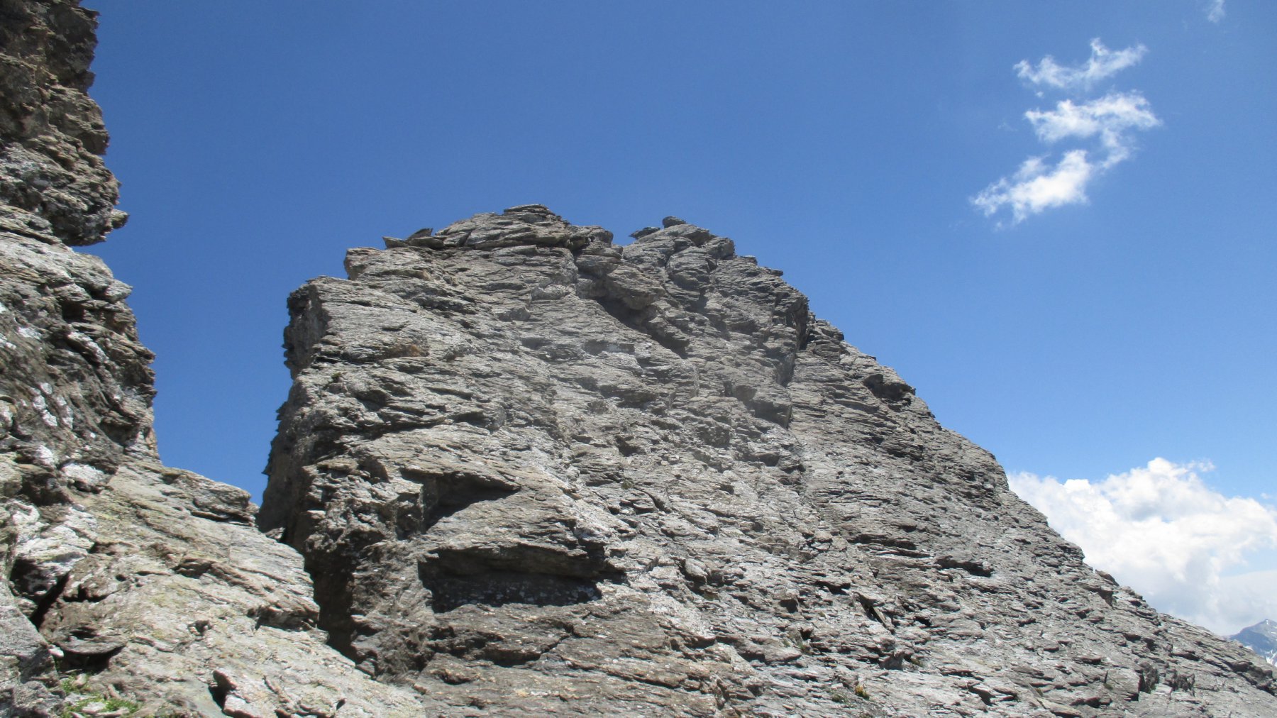
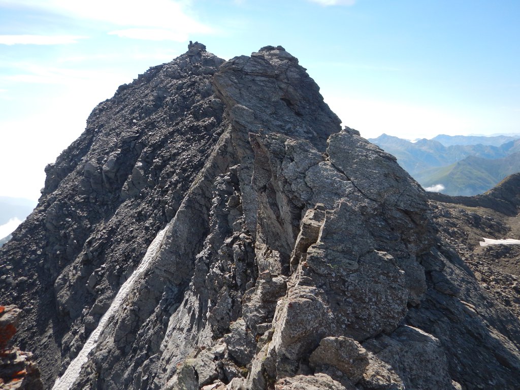
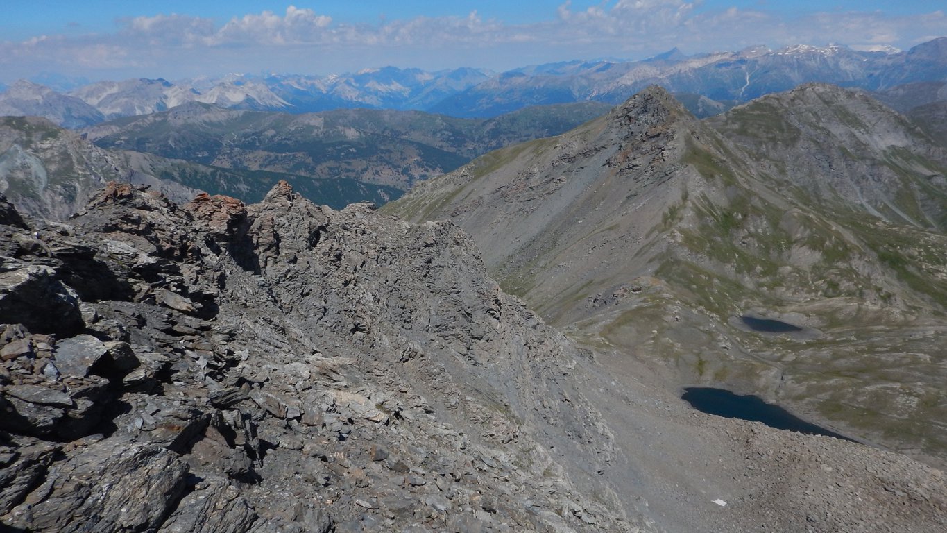
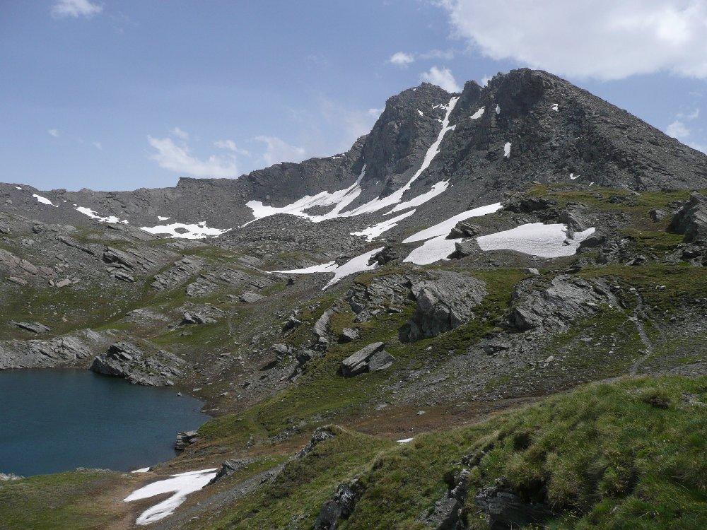
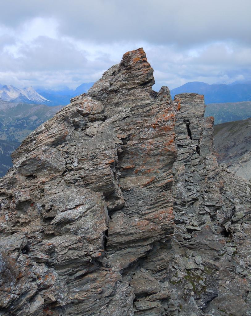
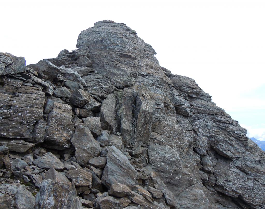
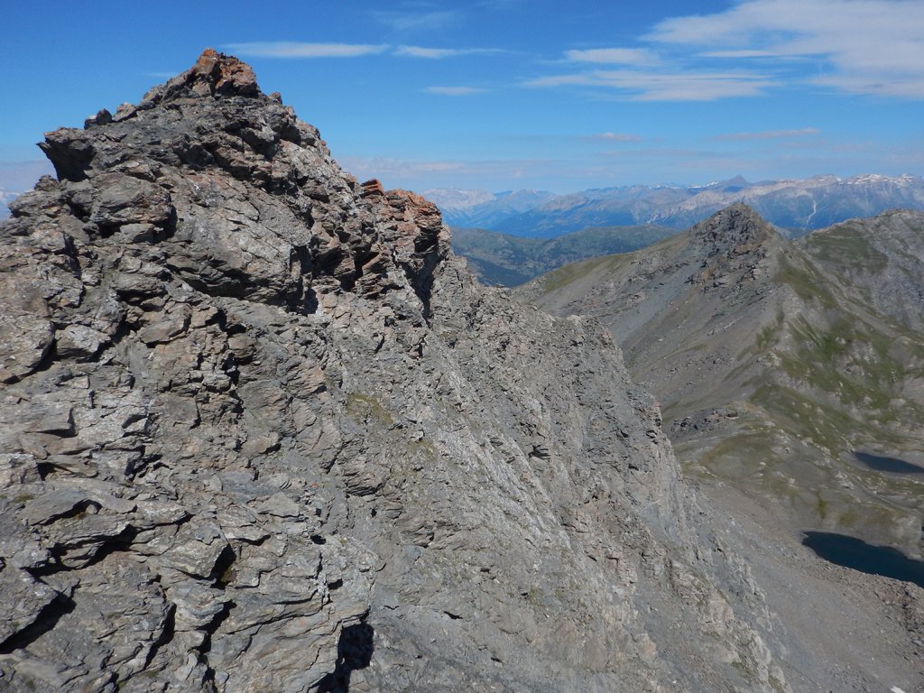
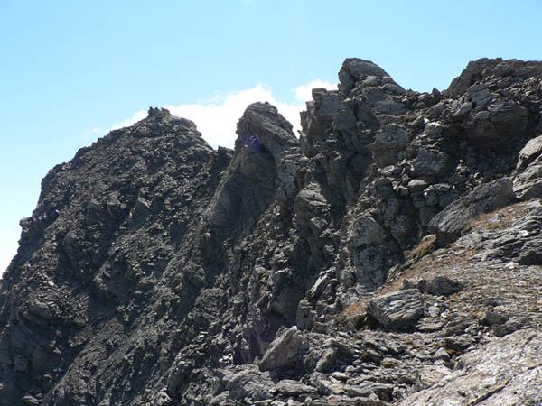
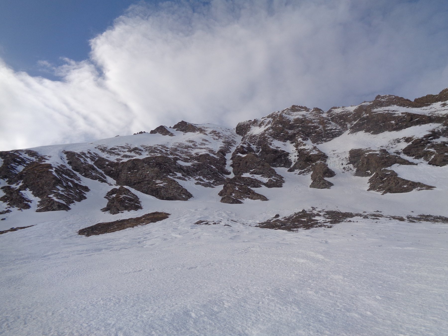
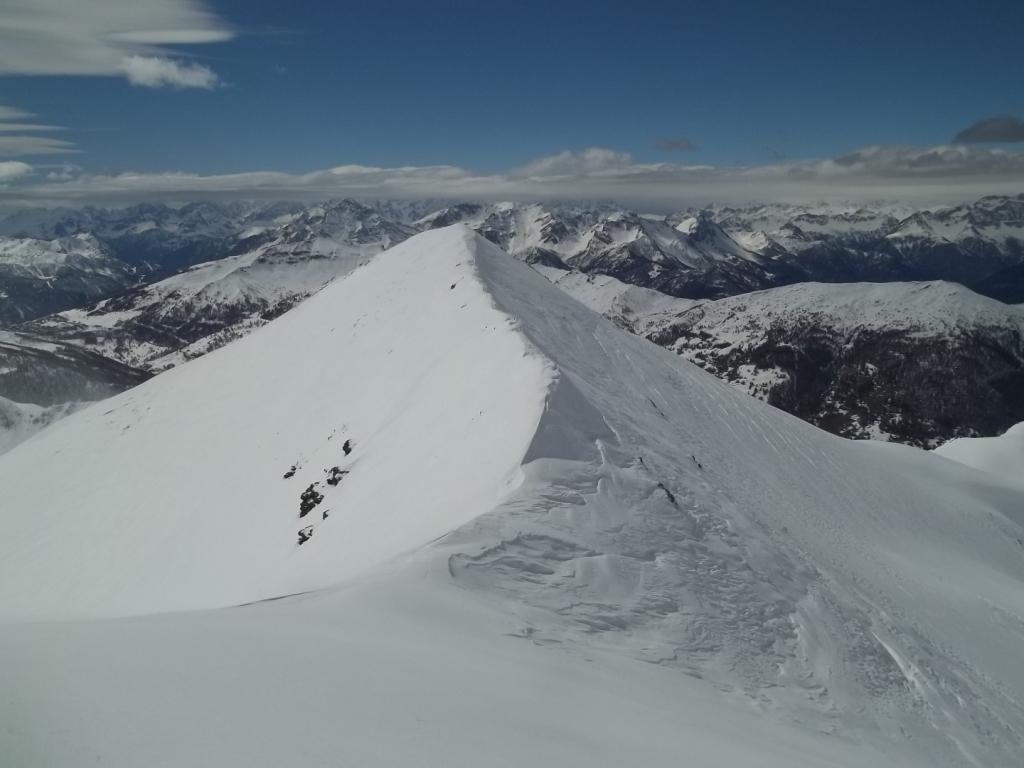
La cresta NO è quella che collega il Ghinivert al Colle del Beth. La parte passa è larga e detritica, la parte superiore è più affilata e costituita da una serie di torrioni piegati verso SE, con la parte verso il Colle del Beth composta di placche inclinate e quella verso la vetta più verticale. Questo percorso è un’alternativa alla solita via normale per il versante OSO per chi abbia una certa dimestichezza con l’arrampicata (brevi passi di I e II).
Avvicinamento
 2.1Km
4.8Km
4.8Km
4.8Km
4.8Km
4.8Km
4.8Km
5.9Km
5.9Km
7.3Km
2.1Km
4.8Km
4.8Km
4.8Km
4.8Km
4.8Km
4.8Km
5.9Km
5.9Km
7.3Km
1.5Km
2.6Km
2.9Km
3.3Km
3.3Km
5.2Km
5.3Km
5.3Km
6.8Km
7.2Km
La cresta NO è quella che collega il Ghinivert al Colle del Beth. La parte passa è larga e detritica, la parte superiore è più affilata e costituita da una serie di torrioni piegati verso SE, con la parte verso il Colle del Beth composta di placche inclinate e quella verso la vetta più verticale. Questo percorso è un’alternativa alla solita via normale per il versante OSO per chi abbia una certa dimestichezza con l’arrampicata (brevi passi di I e II).
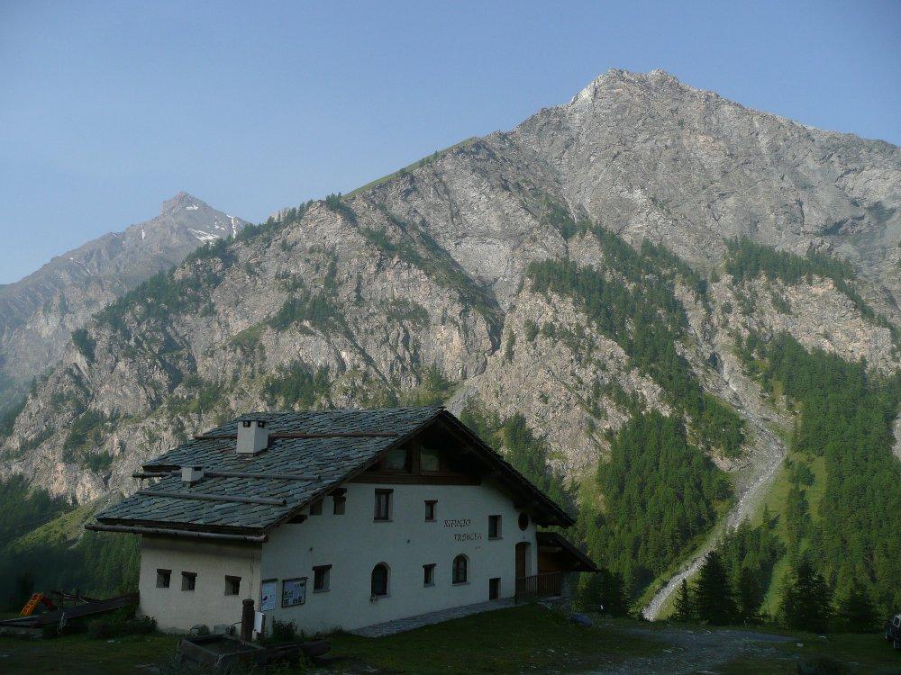
La strada della Val Troncea è chiusa al traffico privato, esiste un servizio navetta fino a Troncea. La partenza a piedi è da Pattemouche.
Descrizione
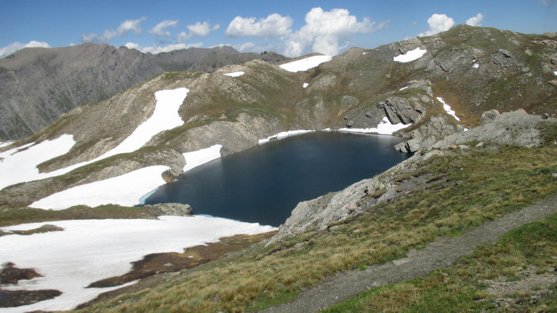
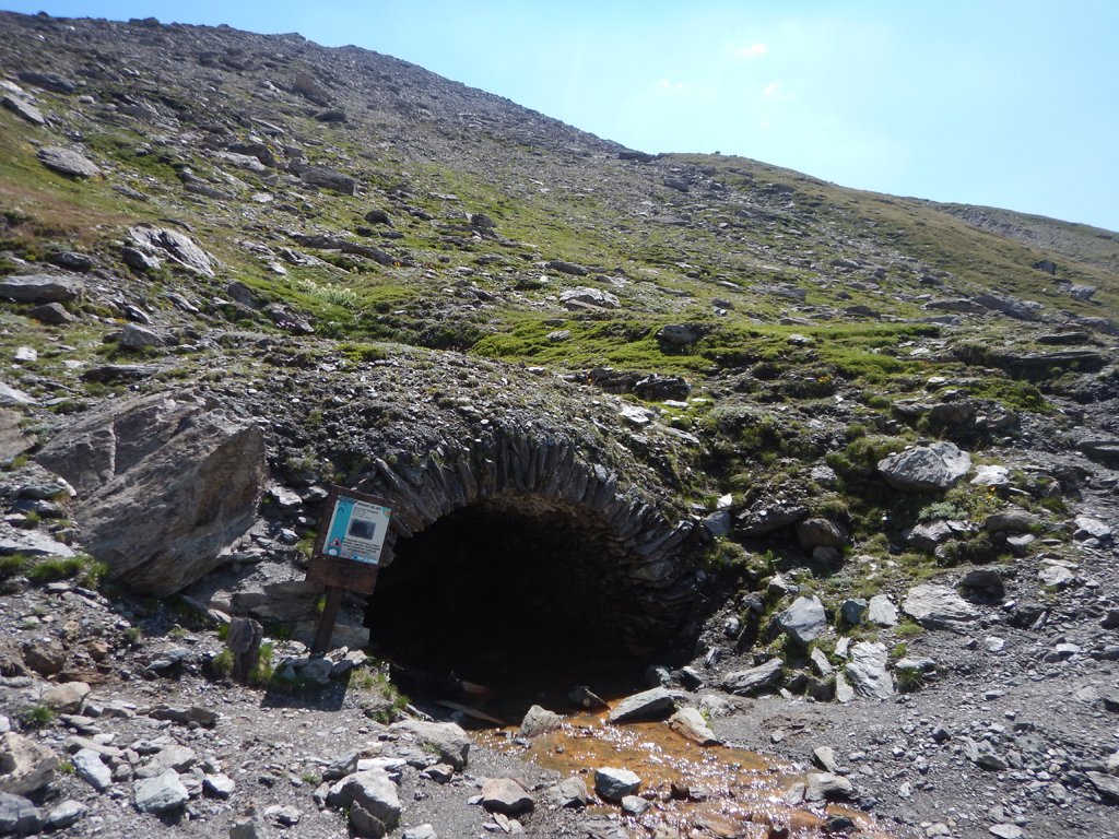
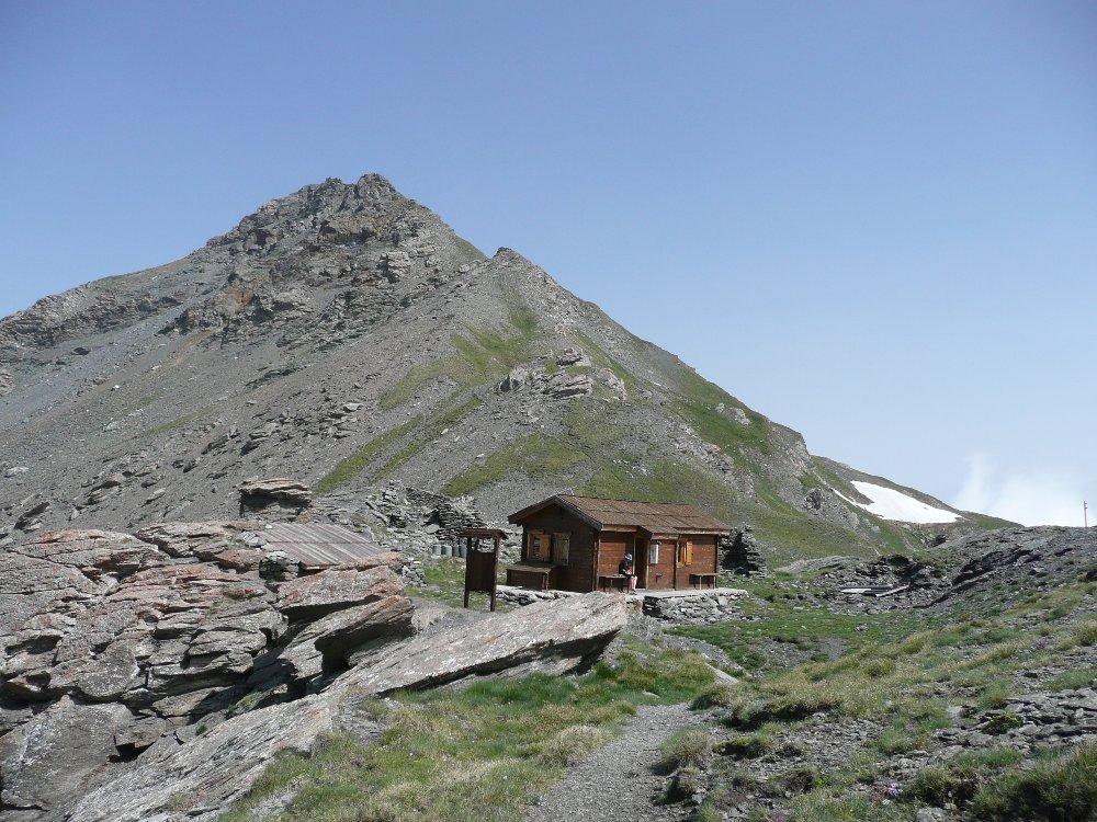
Da Troncea, raggiungibile partendo da Pattemouche seguendo la strada della Val Troncea, alpeggio al centro dell’omonimo Parco Naturale, si seguono le indicazioni per il colle del Beth (2h).
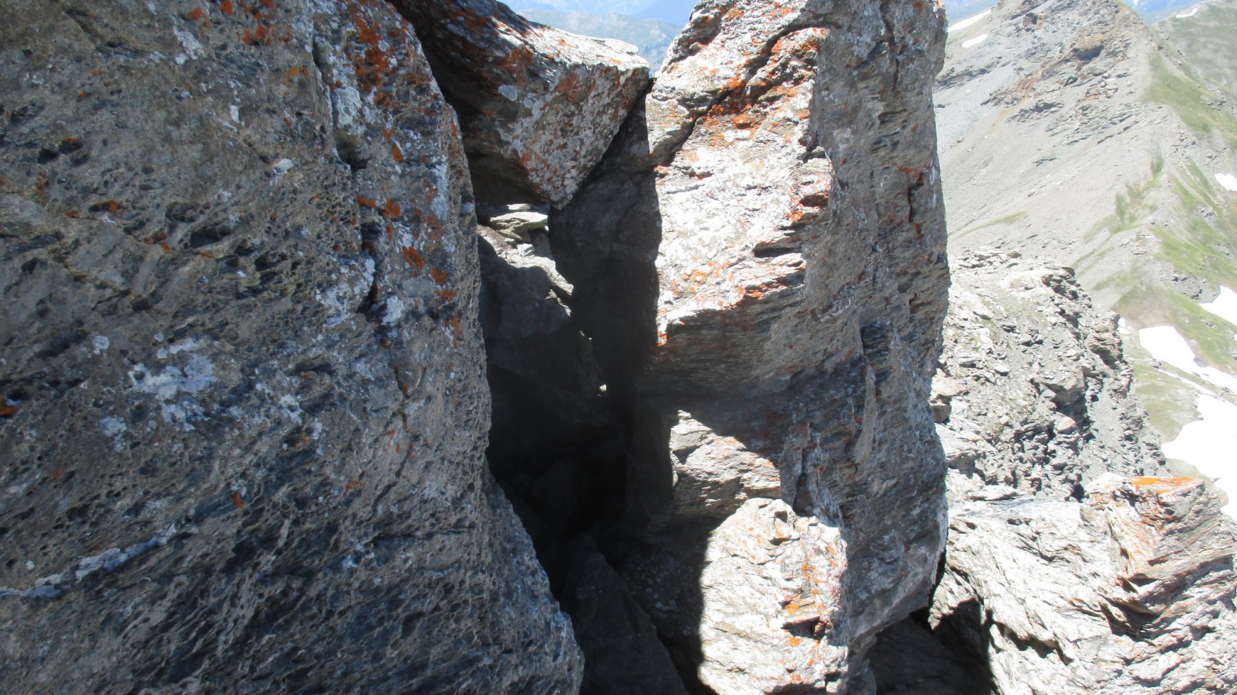
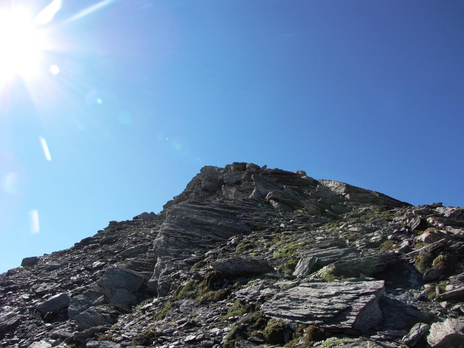
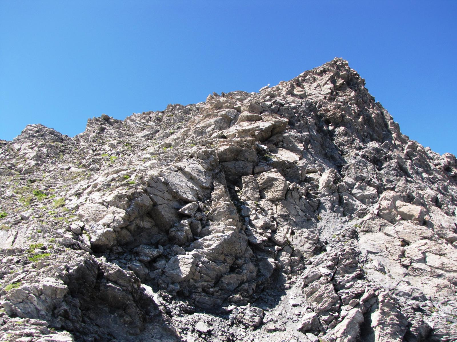
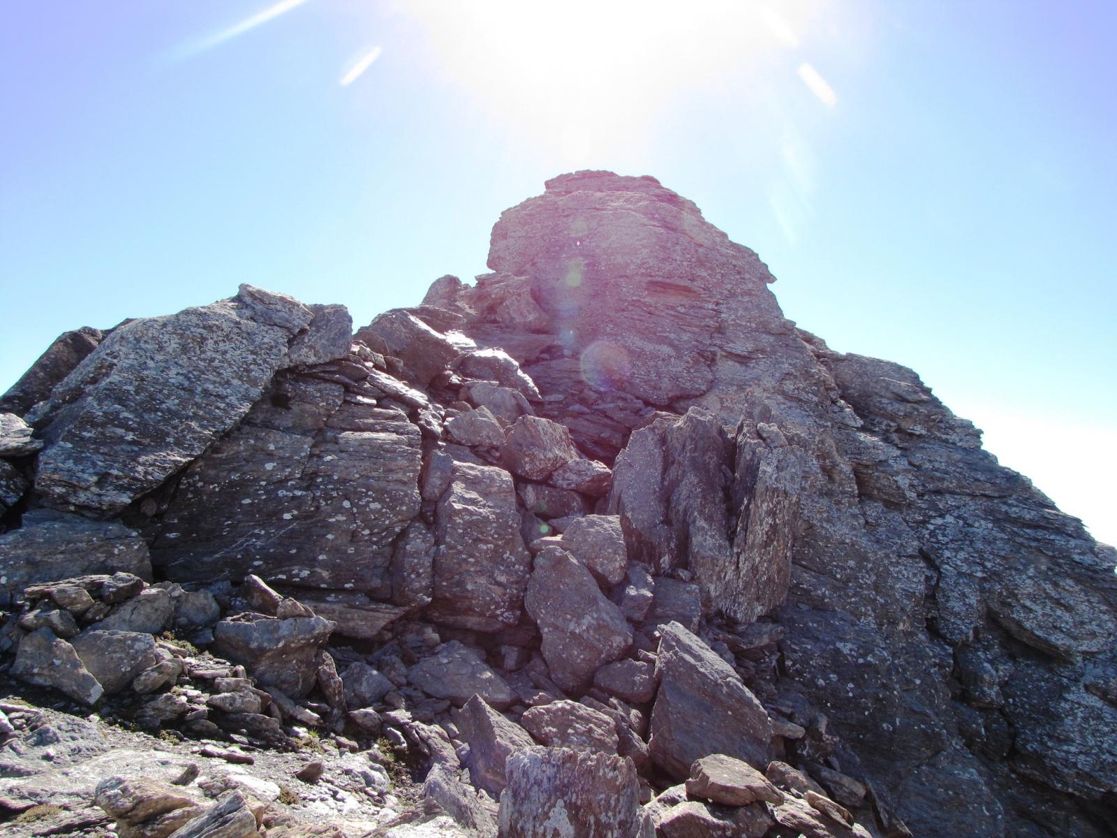
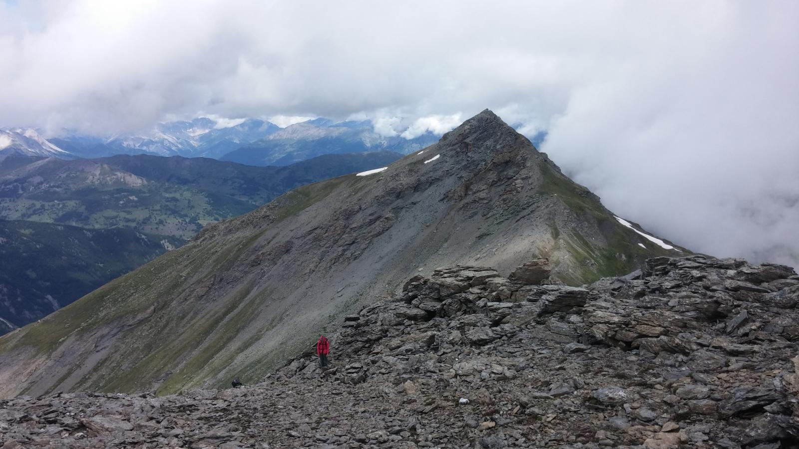
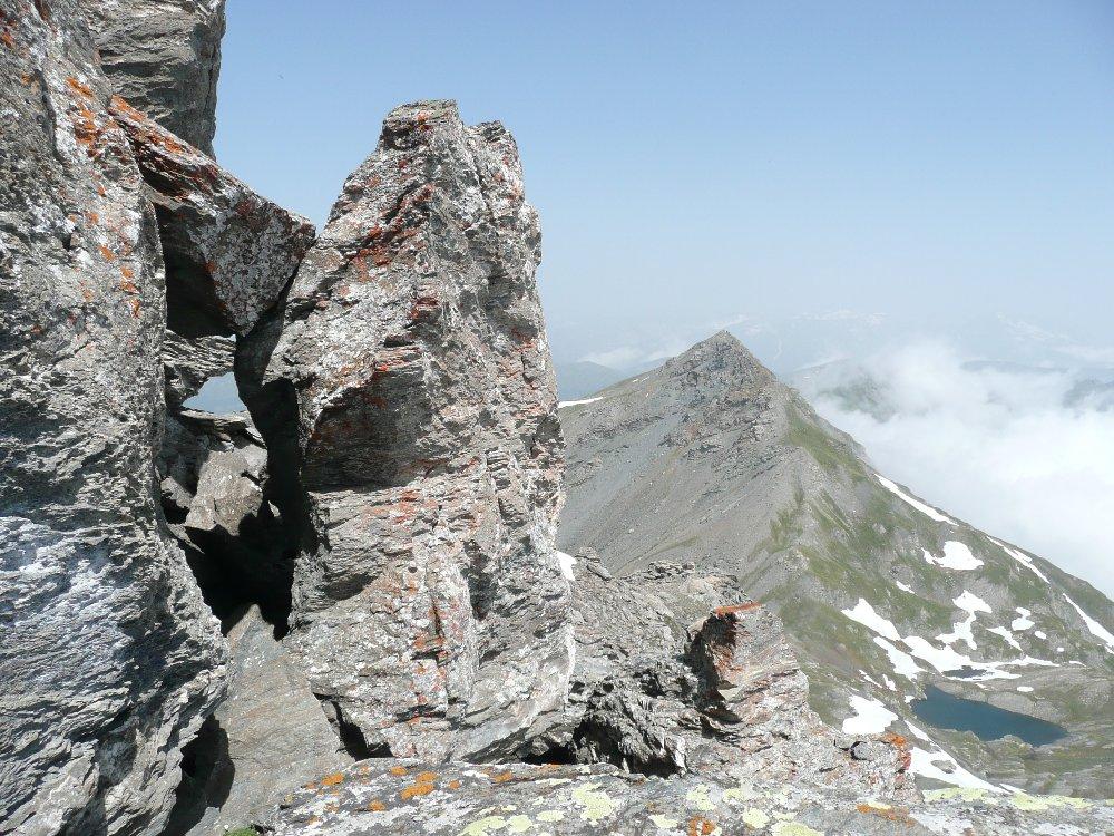
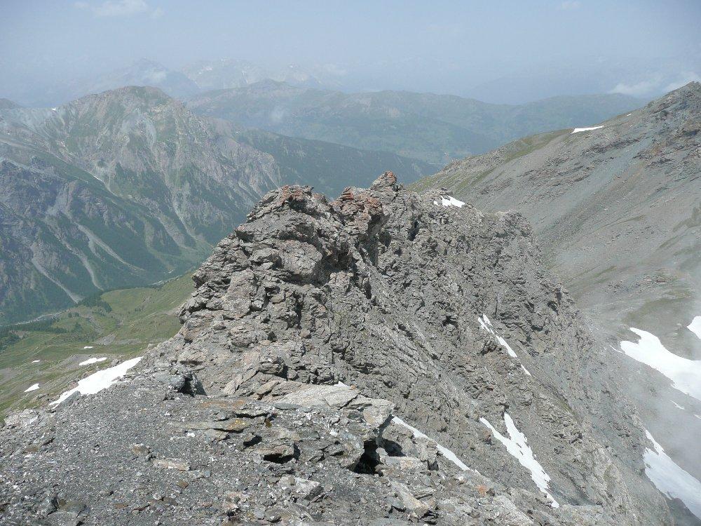
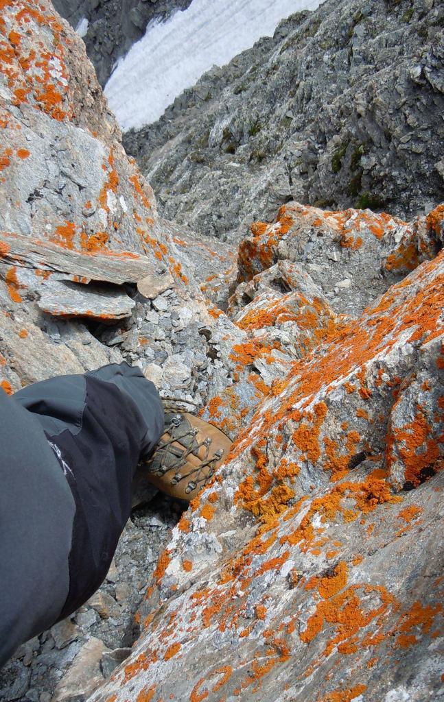
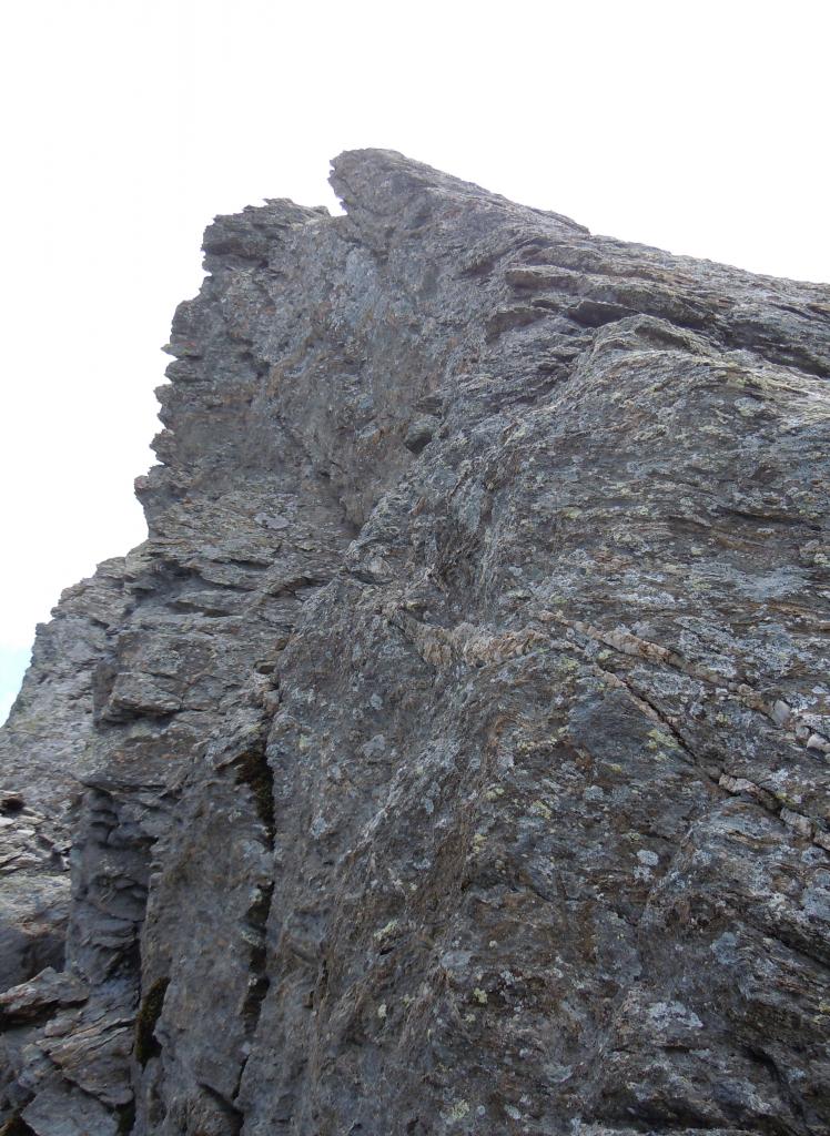
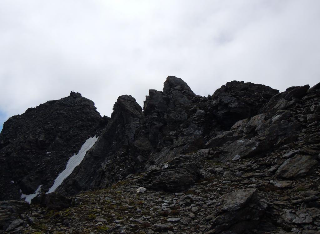
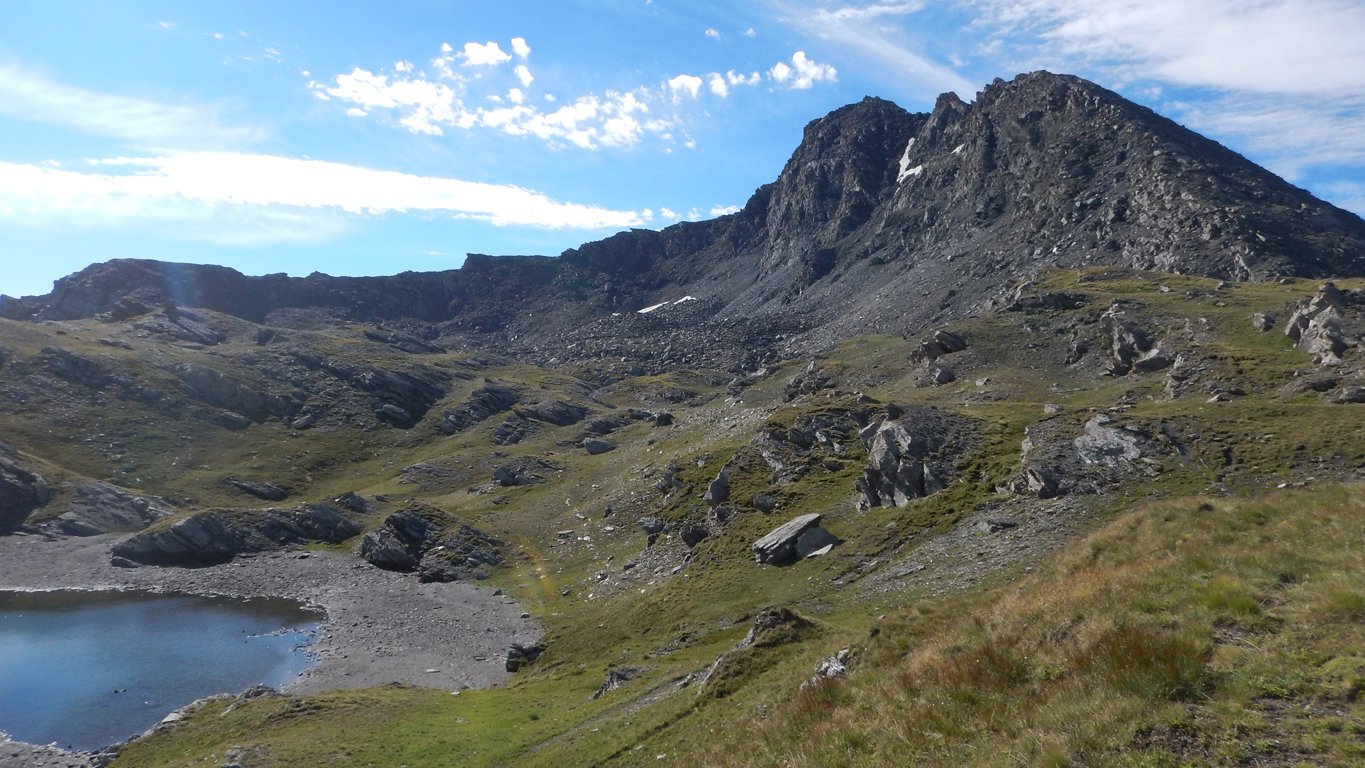
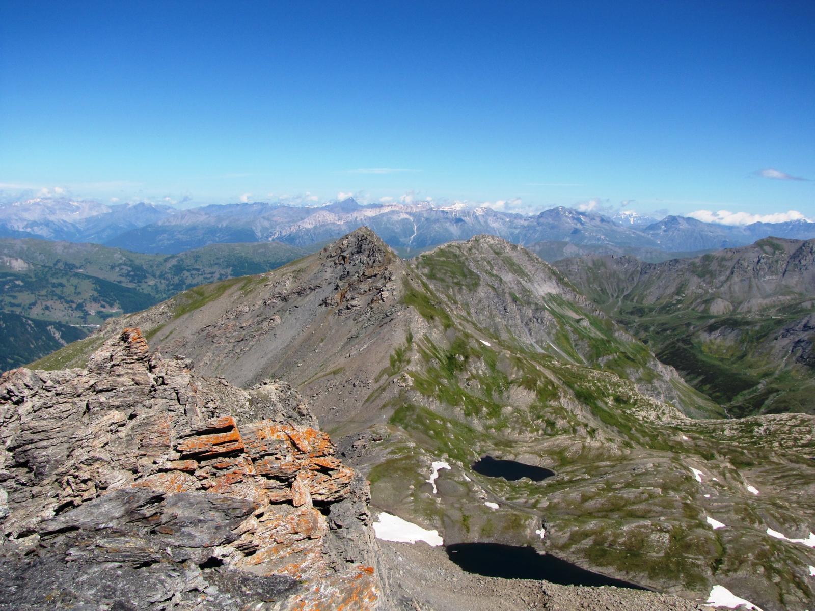
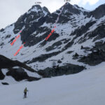
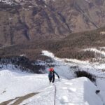
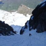
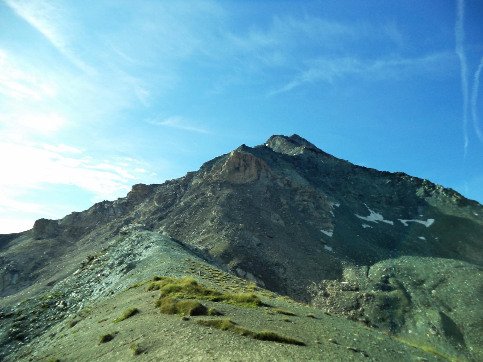
Da colle si segue la traccia che superato il bivacco del Parco, attraversa quasi in piano il versante OSO del Ghinivert (tacche bianche e rosse). Si tralascia il sentierino e si sale per sfasciumi l’ampia cresta che quanto spiana diventa rocciosa. Il primo torrione si supera sul versante NE (Val Germanasca) sfruttando un passaggio sotto un roccione inclinato, il secondo ed il terzo si evitano sul versante O (Val Troncea), quelli successivi si scavalcano direttamente. L’ultimo richiede una discesa di alcuni metri un po’ scomoda per un salto verticale comunque ben appigliato (II).
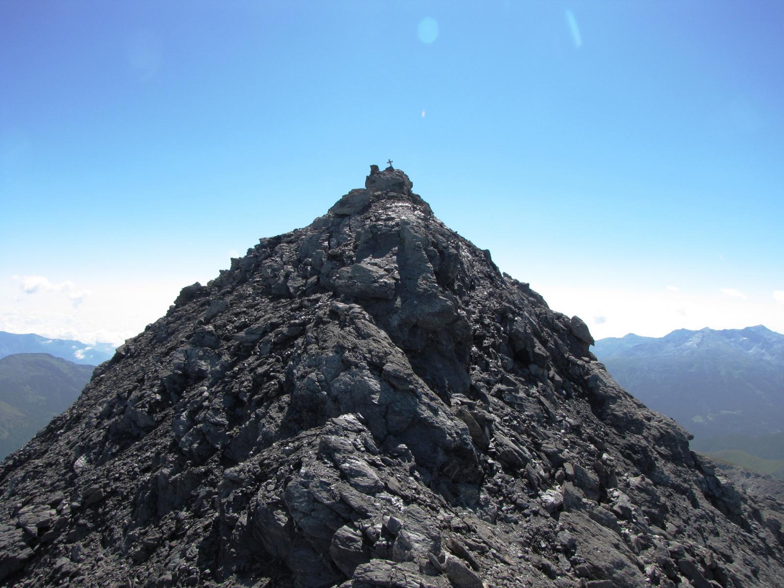
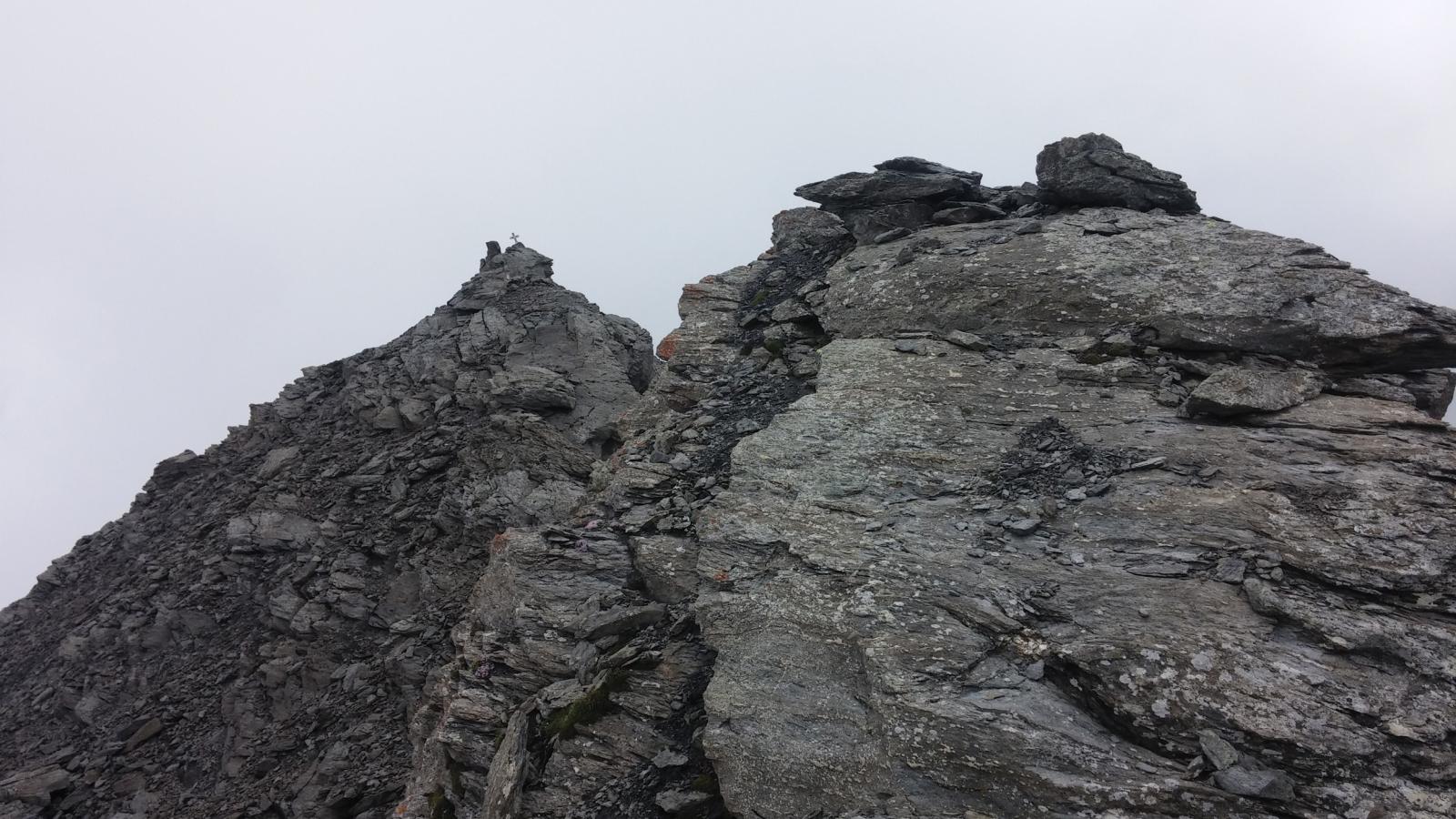
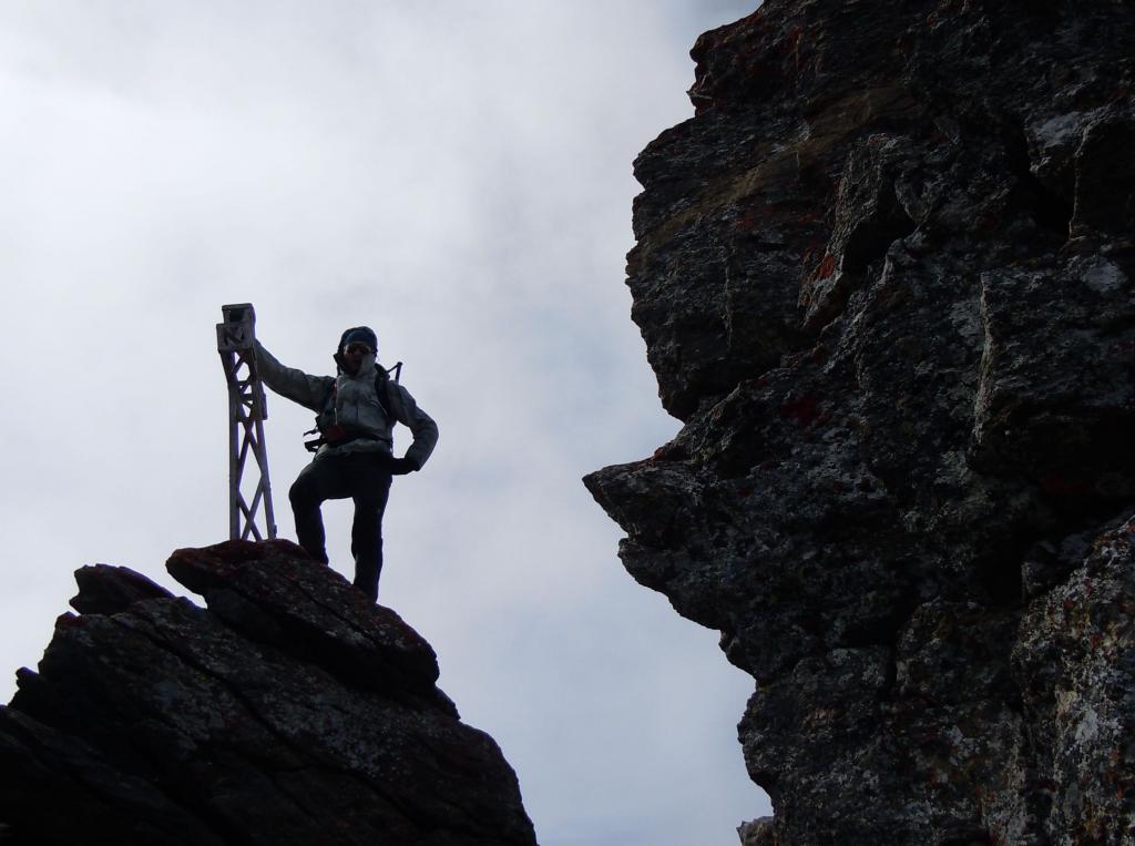
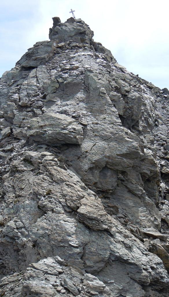
Superati gli ultimi lastroni si raggiunge il masso dove è collocata la croce, che si tocca superando l’ultimo ostacolo (II-). (0h45).
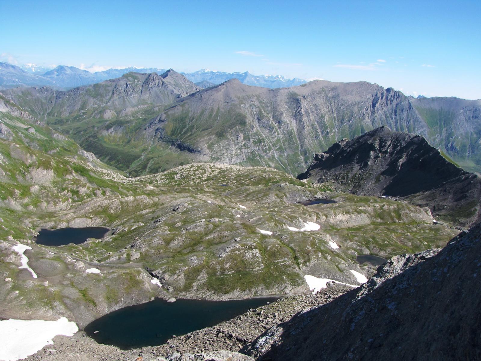
Discesa per la via normale che segue per un breve tratto la cresta S, quindi torna al colle attraversando il diagonale il versante OSO (difficoltà E)
Nelle vicinanze Mappa
Itinerari
27/03/2022 TO, Pragelato D+ 1600 m D Nord-Est
Ruetas (Monte) Couloir NE
 2.1Km
2.1Km
25/05/2025 TO, Pragelato D+ 1330 m PD+ Nord-Ovest
Gran Miuls (Monte) quota 2865 m couloir Nord-Ovest
 4.8Km
4.8Km
02/07/2023 TO, Pragelato D+ 1450 m PD+ Varie
Gran Miuls (Monte) Cresta SE dal Colle dell’Albergian
 4.8Km
4.8Km
10/02/2022 TO, Pragelato D+ 1055 m PD+ Ovest
Gran Muels (Monte) parete/canale Ovest
 4.8Km
4.8Km
01/06/2024 TO, Pragelato D+ 1400 m D Nord-Ovest
Gran Miuls (Monte) anticima NO 2940 m Couloir Barba-Truc
 4.8Km
4.8Km
06/06/2020 TO, Pragelato D+ 1434 m PD+ Nord-Ovest
Gran Miuls (Monte) Canalone NO
 4.8Km
4.8Km
25/05/2025 TO, Pragelato D+ 1400 m AD Nord-Ovest
Gran Miuls (Monte) anticima NO 2940 m Couloir Magnaut
 4.8Km
4.8Km
07/08/2014 TO, Sestriere D+ 1250 m PD Nord
Rognosa del Sestriere (Punta) cresta Nord dal Passo della Banchetta
 5.9Km
5.9Km
28/12/2023 TO, Sestriere D+ 701 m AD- Nord-Est
Querellet (Monte) canale NE o Budello
 5.9Km
5.9Km
27/07/2025 TO, Pragelato D+ 1650 m F Nord
Albergian (Monte) e Monte Ciabertas Cresta O del Ciabertas e Cresta NE dell’Albergian
 7.3Km
7.3Km
Servizi
1.5Km
2.6Km
Troncea Rifugio
Pragelato
2.9Km
Refugium – ex. Rif. Belotte Rifugio
Pragelato
3.3Km
La capanna del sole Ristorante
Pragelato
3.3Km
Al Mulino Ristorante
Pragelato
5.2Km
Casa degli Escartons Alex Berton B&B
Pragelato
5.3Km
Casa Alpina Rifugio
Pragelato
5.3Km
Passet Ristorante
Pragelato
6.8Km
L’itialette Ristorante
Pragelato
7.2Km