 0m
0m

Note
 0m
0m
0m
0m
0m
50m
50m
0m
0m
0m
0m
0m
50m
50m
0m
3.2Km
4.9Km
5.7Km
5.7Km
5.8Km
5.8Km
5.9Km
6.1Km
6.5Km
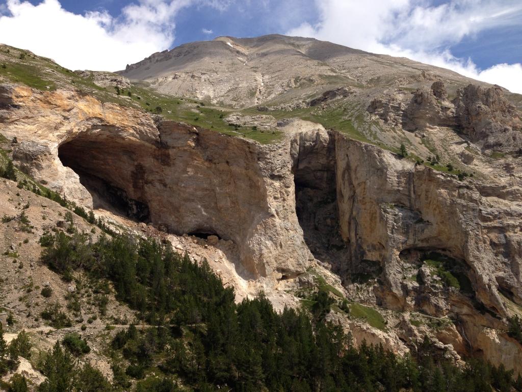
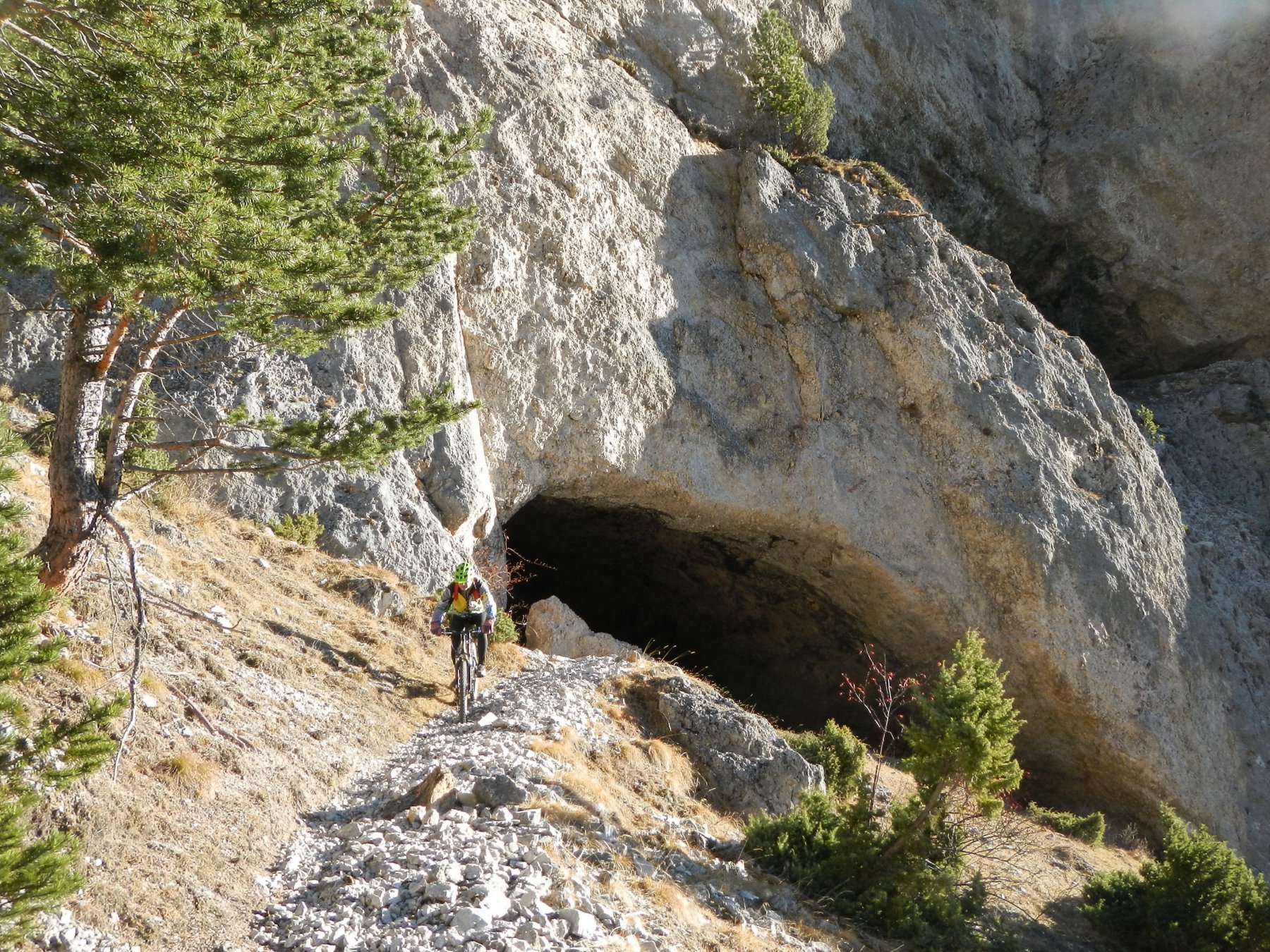
Spettacolare ed impegnativo itinerario, la cui parte superiore si svolge a ridosso delle bastionate calcaree del M. Seguret ed è sovrastata dalle Grotte dei Saraceni, molto caratteristiche e forse uniche nel loro genere in Val Di Susa e dintorni.
Descrizione
Da Salbertrand dirigersi verso Exilles sulla SS24 sino ad imboccare a sn il bivio per Pramand-Grange della Valle.
Tralasciare i bivi per Fenils e Grange della Valle e seguendo le indicazioni per Pramand giungere a Moncellier m 1321 dove la strada diventa sterrata.
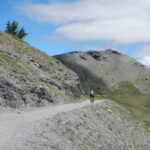
Proseguire sulla traccia principale sino al Colletto del Pramand 2088 m, affrontando, dopo il ponte sul Rio Secco tratti più impegnativi per strappi di pendenza e fondo con molti ciottoli.
Dal Colletto, svoltando a sn in breve si è al Forte di Pramand 2162 m, ritornati al Colletto si prosegue la strada fatta in salita e con un lungo mezzacosta si arriva a una prima breve galleria seguita da una seconda ben più lunga, di 840 m, da affrontare con buone fonti di illuminazione, essendo buia e con un abbigliamento impermeabile perché percola abbondantemente acqua dalla sua volta.
La salita si attenua, e superato un bivio per lo Jafferau 2313 m, in breve termina per lasciare posto a un traverso in falsopiano e discesa che conduce al Forte Foens 2208 m, lasciando prima a sn il bivio per Savoulx.
Dal Forte seguire le indicazioni per Millaures/Suppas prendendo un sentiero subito sotto alla continuazione della strada seguita in precedenza che porta ai Bacini e a dx dell’entrata del Forte.
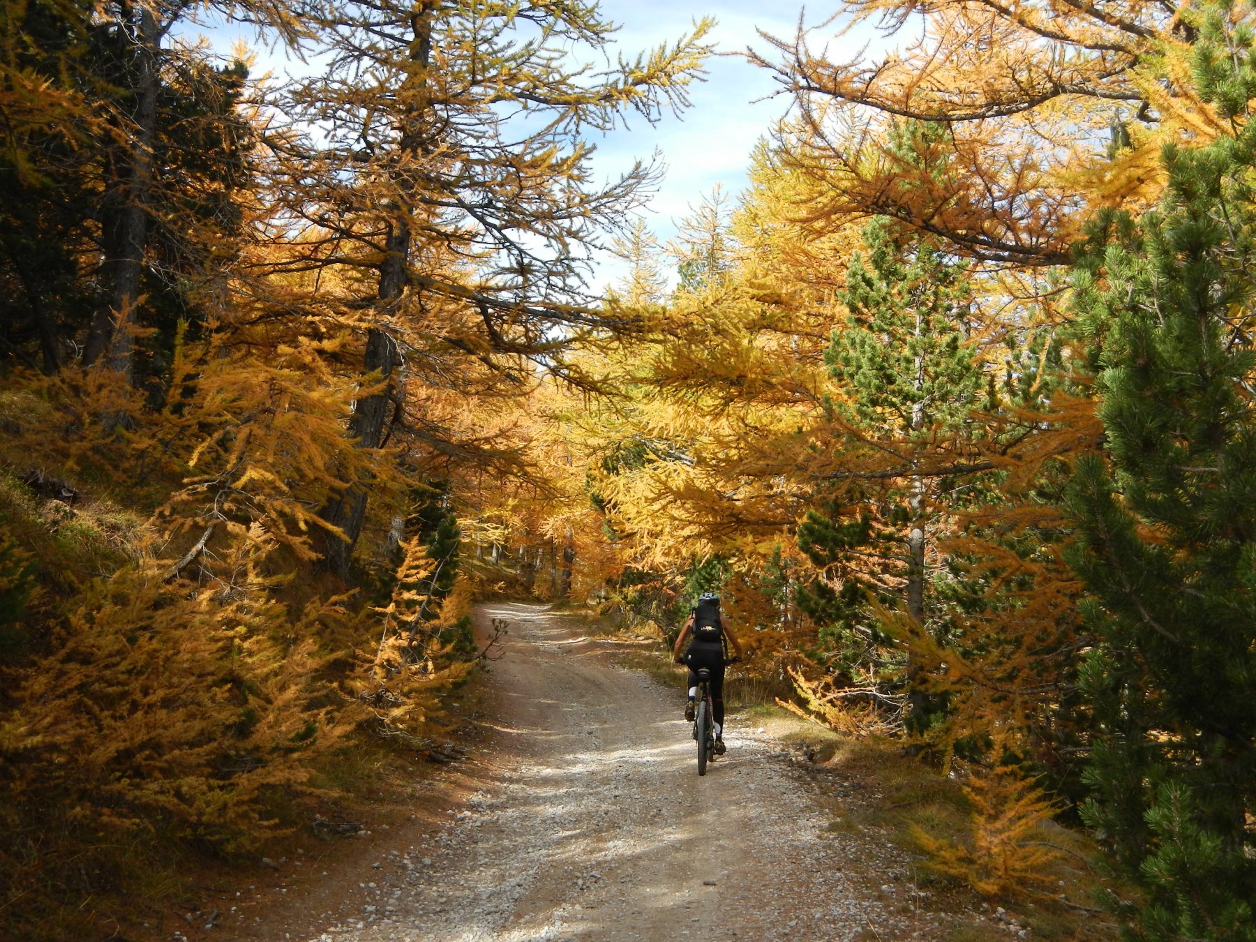
Questo single-track, che si snoda in bellissimi boschi di larici, ha solo un tratto impegnativo anche se purtroppo qualche albero abbattuto e un paio di guadi ci costringe a scendere di sella.
Imboccato il sentiero, si scende sino ad incontrare una traccia che si stacca sulla sn e che si ignora continuando a dx sino a giungere al Rio Perilleux m 1785, dove non scendiamo a sn verso Suppas, ma guadato il rio, arriviamo prima alla Cappella di Maria Ausiliatrice per poi ritrovare la strada che scende dai Bacini.
Si segue quest’ultima sino a Bardonecchia poi per la sp.335 fino a poco dopo il bivio per Royeres dove si prende a dx per una sterrata che ci porta a Beaulard.
Da Beaulard, nei pressi del passaggio a livello si continua sulla dx idr. della Dora prima attraversando la strada che conduce a Chateau poi costeggiando il campeggio dove ricomincia la sterrata.
Arrivati in vista di Signols si attraversa il ponte sulla Dora a sn, si passa sotto ferrovia e autostrada e girato a dx si arriva a Signols.
Di qui, per la statale si rientra a Salbertrand.
Si può evitare il single-track continuando dal Forte Foens la strada per i Bacini-Bardonecchia.
- Cartografia:
- IGC Valle di Susa Chisone e Germanasca, Fraternali 1:25.000 n. 1
Ultima revisione 16/08/2013
Nelle vicinanze Mappa
Itinerari
16/07/2020 TO, Salbertrand D+ 1700 m OC, TC Nord-Ovest
Basset (Col) da Salbertrand, giro
 0m
0m
25/06/2026 TO, Salbertrand D+ 1600 m BC, TC, S1 Nord-Ovest
Genevris (Monte) da Salbertrand
 0m
0m
06/07/2007 TO, Salbertrand D+ 450 m MC, OC Sud
Frenée (Case) da Salbertrand
0m
12/07/2026 TO, Salbertrand D+ 995 m MC, BC+, S2 Varie
Arlaud Daniele (Rifugio) e Montagne Seu da Salbertrand
 0m
0m
10/11/2025 TO, Salbertrand D+ 1200 m MC, OC, S2 Sud
Pramand (Forte) da Salbertrand, discesa su Beaume
 0m
0m
14/09/2011 TO, Salbertrand D+ 1600 m MC+, BC, S2 Nord
Gran Costa (Monte) da Salbertrand, giro per i Colli Blegier, Lauson discesa sentiero GTA
0m
09/10/2011 TO, Salbertrand D+ 1550 m BC, OC, S2 Nord
Assietta (Testa dell’) da Salbertrand
0m
16/07/2026 TO, Salbertrand D+ 1551 m BC, BC, S1 Nord-Ovest
Blegier (Monte) da Salbertrand, anello
 0m
0m
20/06/2026 TO, Salbertrand D+ 2000 m BC, BC+, S2 Sud-Est
Berrone Stefano (Bivacco) da Salbertrand per il Forte Pramand e la Galleria dei Saraceni
 50m
50m
01/11/2024 TO, Salbertrand D+ 1950 m BC, BC+, S2 Sud-Est
Jafferau (Monte) da Salbertrand per il Forte Pramand e la Galleria dei Saraceni, giro per il Forte Foens
 50m
50m
Servizi
0m
3.2Km
Arlaud Rifugio
Salbertrand
4.9Km
Levi Molinari Rifugio
Exilles
5.7Km
La Quadriglia Ristorante
Exilles
5.7Km
L’ultima stisa Ristorante
Exilles
5.8Km
orto del frate Ristorante
Sauze d'Oulx
5.8Km
paddy mc ginty Ristorante
Sauze d'Oulx
5.9Km
Touplan Ristorante
Exilles
6.1Km
L’Cantun B&B
Sauze D'oulx
6.5Km


