 8.7Km
8.7Km
Note
 300m
350m
350m
400m
400m
400m
600m
700m
1.8Km
1.8Km
300m
350m
350m
400m
400m
400m
600m
700m
1.8Km
1.8Km
8.7Km
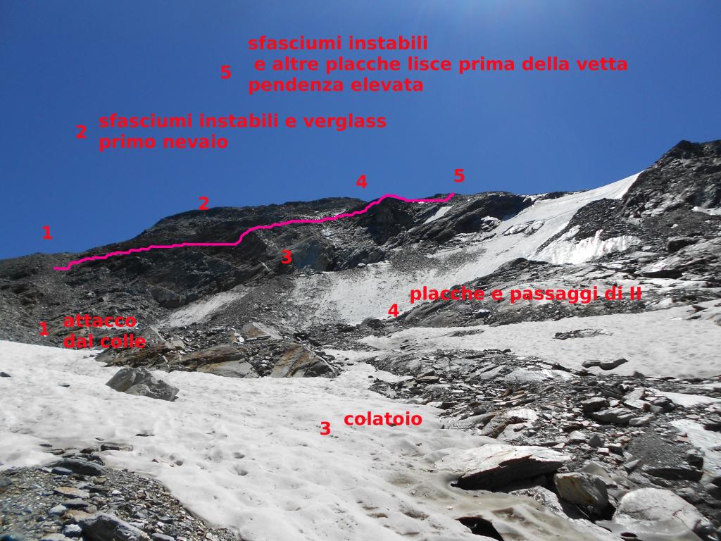
via che non presenta condizioni di innevamento, ed è quindi possibile percorrerla senza ramponi, prestando attenzione al verglass mattuttino e ai nevaietti rimasti(che sono aggirabili).
in condizioni di innevamento, visto la forte inclinazione, d'obbligo l'uso dei ramponi le difficoltà potrebbero aumentare nell'affrontare le parti più pendenti.
non presenta ad oggi difficoltà oggettive, a parte lo sfasciume veramente instabile che mette a dura prova soprattutto in discesa e le pendenze che non mollano mai. due placche lisce da affrontare, e anche qui occhio alla roccia marcia che si stacca.
sempre utile l'utilizzo delle mani nella prima parte, quasi d'obbligo negli ultimi metri prima della spianata della vetta.
consigliato caschetto perchè la montagna scarica davvero molto, e anche i compagni che camminano dietro in discesa!
Prima Salita agosto 2012 - Pera- Ronchietto- Gavardi
Descrizione
in condizioni di innevamento, visto la forte inclinazione, d'obbligo l'uso dei ramponi le difficoltà potrebbero aumentare nell'affrontare le parti più pendenti.
non presenta ad oggi difficoltà oggettive, a parte lo sfasciume veramente instabile che mette a dura prova soprattutto in discesa e le pendenze che non mollano mai. due placche lisce da affrontare, e anche qui occhio alla roccia marcia che si stacca.
sempre utile l'utilizzo delle mani nella prima parte, quasi d'obbligo negli ultimi metri prima della spianata della vetta.
consigliato caschetto perchè la montagna scarica davvero molto, e anche i compagni che camminano dietro in discesa!
Prima Salita agosto 2012 - Pera- Ronchietto- Gavardi
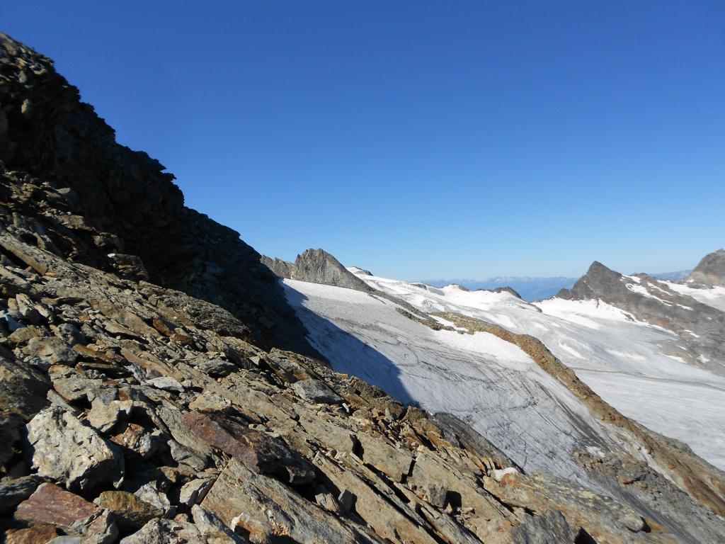
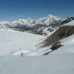
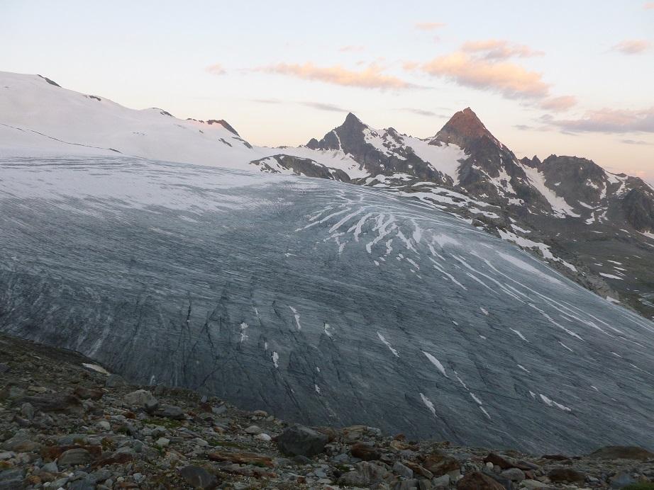
si sale fino a Passo Planaval seguento ometti e bollini gialli (occhio agli ultimi nevai presenti e all’assenza di sentiero negli ultimi cento metri). non si attacca la cresta del Flambeau, ma ci si tiene più bassi, svoltando a destra e puntando lo scivolo ghiacciato del ghiacciaio del Flambeau.
si cammina su sfasciumi grossi e instabili, prestando attenzione a dove si mette i piedi.si raggiunge il primo nevaio tenendosi bassi lo si attraversa, si giunge ad una specie di colatoio che visto da sotto fa veramente impressione, lo si attraversa prestando attenzione alle rocce o scivolose per l’acqua di fusione o per il verglass.
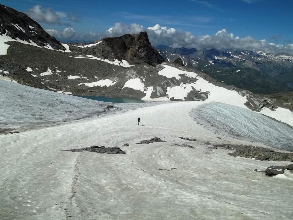
si continua a salire in diagonale e si punta ad una evidente placca liscia di circa 3 metri. non è consigliabile aggirarla per il terreno franoso a picco sullo scivolo ghiacciato. la si affronta con passi di semplice arrampicata, massimo secondo grado, controllando molto bene gli appigli visto il terreno esposto.
a questo punto il terreno spiana un pò, si costeggia il secondo e il terzo nevaio e si arriva sopra allo sbocco dello scivolo di ghiaccio. a questo punto la vetta è proprio sopra di noi. si attacca quindi il tratto più scosceso ed esposto, gli sfasciumi diventano sempre più piccoli e franosi, si affrontano altre placche lisce, più lunghe ed esposte, l’uso delle mani è indispensabile. si giunge quindi all’anticima, dove finalmente il terreno spiana e in poco tempo si raggiunge l’ometto di veta. spettacolo a 360° su tutte le principali cime valdostane. la discesa si effettua per lo stesso itinerario, disarrampicando e prestando davvero attenzione al terreno infido e scivoloso.
abbiamo sistemato ometti lungo la via, ma visto la natura del territorio, non dureranno molto!
- Cartografia:
- L'Escursionista Editore Carta dei sentieri 1:25000 n. 2 La Thuile
- Bibliografia:
- Guida C.A.I. - T.C.I. Alpi Graie Centrali
Nelle vicinanze Mappa
Itinerari
09/08/2011 AO, La Thuile D+ 1800 m PD- Nord-Ovest
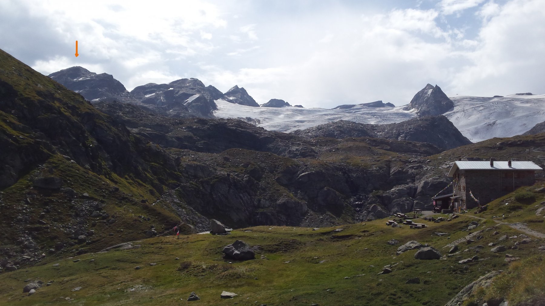
Flambeau per il versante Nord-Ovest
 300m
300m
24/09/2023 AO, La Thuile D+ 1650 m F Nord-Est
Chenal (Punta) da la Joux per il Rifugio Deffeyes
 350m
350m
21/08/2025 AO, La Thuile D+ 1750 m F Nord-Ovest
Paramont (Becca Bianca del) Via Normale da La Joux per il Rifugio Deffeyes
 350m
350m
21/07/2019 AO, La Thuile D+ 2000 m PD Varie
Doravidi (Monte, Punta Nord) e Flambeau traversata sud/nord
 400m
400m
14/08/2025 AO, La Thuile D+ 1580 m F Varie
Paramont (Testa del) da La Joux per il Rifugio Deffeyes
 400m
400m
17/08/2018 AO, La Thuile D+ 1900 m F+ Nord-Ovest
Doravidi (Monte, Punta Nord) da La Joux
 400m
400m
16/08/2024 AO, La Thuile D+ 1600 m F+ Varie
Loydon (Pointe) da La Joux per il Rifugio Deffeyes
 600m
600m
16/08/2023 AO, La Thuile D+ 1800 m F+ Varie
Paramont (Monte) Via Normale da la Joux
 700m
700m
28/07/2024 AO, La Thuile D+ 2000 m F Nord
Rutor (Testa del) Via Normale da La Joux per il Rifugio Deffejes
 1.8Km
1.8Km
06/08/2024 AO, La Thuile D+ 1700 m PD- Tutte
Grand Assaly Via Normale da La Joux
 1.8Km
1.8Km
Servizi
8.7Km