 3.1Km
3.1Km
Note
 4.8Km
21.9Km
4.8Km
21.9Km
3.1Km
3.1Km
3.1Km
3.2Km
3.4Km
3.9Km
7.7Km
7.7Km
7.7Km
7.7Km
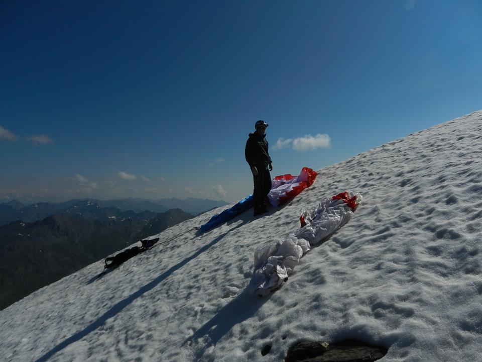
Decollo dalla vetta possibile in tutte le direzioni secondo la brezza dominante. Volo di montagna con brezze sostenute nella stagione estiva.
Molto tranquillo e panoramico in inverno.
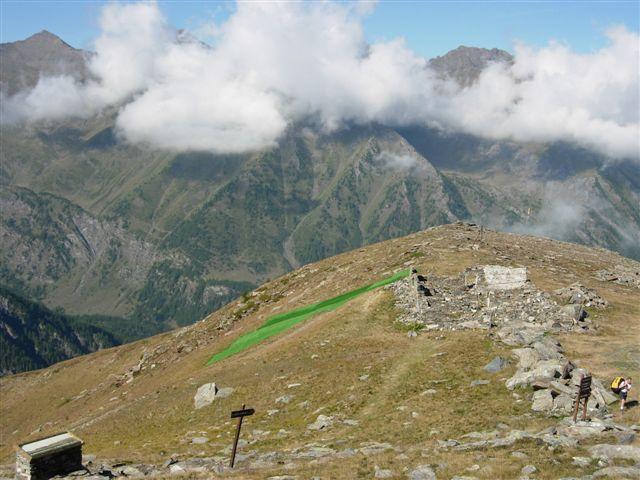
Atterraggio in valle argentiera in prossimità del maneggio per decollo in direzione nord ed est. Atterraggio negli ampi prati in prossimità di Thures per decollo in direzione sud e ovest.
E' possibile anche atterrare nell'ampio prato a monte dell'abitato di Bousson, tenere il campanile come riferimento, soprattutto d'estate è meno turbolento di quello vicino al maneggio all'imbocco della valle argentiera.
Per il volo in direzione Thures, in mancanza di ascendenze non attardarsi presso il decollo per non avere problemi a raggiungere Thures.
Avvicinamento
Molto tranquillo e panoramico in inverno.
Atterraggio in valle argentiera in prossimità del maneggio per decollo in direzione nord ed est. Atterraggio negli ampi prati in prossimità di Thures per decollo in direzione sud e ovest.
E' possibile anche atterrare nell'ampio prato a monte dell'abitato di Bousson, tenere il campanile come riferimento, soprattutto d'estate è meno turbolento di quello vicino al maneggio all'imbocco della valle argentiera.
Per il volo in direzione Thures, in mancanza di ascendenze non attardarsi presso il decollo per non avere problemi a raggiungere Thures.
In auto attraverso Cesana Bousson e arrivo a Thures dove si parcheggia l'auto prima del paese.
Ultima revisione 28/11/2022
Nelle vicinanze Mappa
Itinerari
21/07/2013 TO, Sauze di Cesana D+ 1400 m Nord-Ovest
Ramière (Punta) o Bric Froid da Argentera
 4.8Km
4.8Km
18/08/2014 Hautes-Alpes, Abriès-Ristolas D+ 1150 m Sud
Terra Nera (Monte) da Rhuilles per Cima Dormillouse e Monte Virandatour
7.4Km
11/03/2014 TO, Cesana torinese Sud-Est
Gallerie di Claviere
10.2Km
05/08/2015 TO, Cesana torinese D+ 1210 m Sud-Ovest
Petit Vallon – Batteria Alta
10.4Km
08/08/2014 TO, Cesana Torinese D+ 908 m Sud-Est
Cresta Nera Volo su Cesana
10.9Km
31/10/2016 Hautes-Alpes, Montgenèvre D+ 1786 m Sud-Est
Chaberton (Monte) Volo su Cesana Torinese
12.5Km
01/09/2007 TO, Prali D+ 1120 m Sud-Ovest
Envie (Cappello d’) Volo del Cappello d’Envie e Bric Rond
 21.9Km
14/08/2016 TO, Bardonecchia D+ 1200 m Ovest
Sommeiller (Punta)
22.8Km
27/12/2022 TO, Perrero D+ 1600 m Est
Midì o Muret (Punta) da Pomaretto
25.3Km
Servizi
3.1Km
3.1Km
La Tana degli Orsi B&B
Cesana Torinese
3.1Km
Misun La Font Ristorante
Sauze di Cesana
3.2Km
La Crota B&B
Cesana Torinese
3.4Km
La Fontana del Thures Rifugio
Cesana Torinese
3.9Km
Centro Ristorante
Cesana Torinese
7.7Km
L’Ibarus Rifugio
Cesana Torinese
7.7Km
Piergiorgio Frassati B&B
Cesana Torinese
7.7Km
Casa Cesana Bar
Cesana Torinese
7.7Km


