 4.9Km
4.9Km
Note
 17.2Km
4.9Km
4.9Km
4.9Km
4.9Km
5.2Km
7.5Km
7.9Km
8.6Km
8.7Km
8.9Km
Vedi Gulliver escursionismo "Chaberton (Monte) da Monginevro per il Colle dello Chaberton".
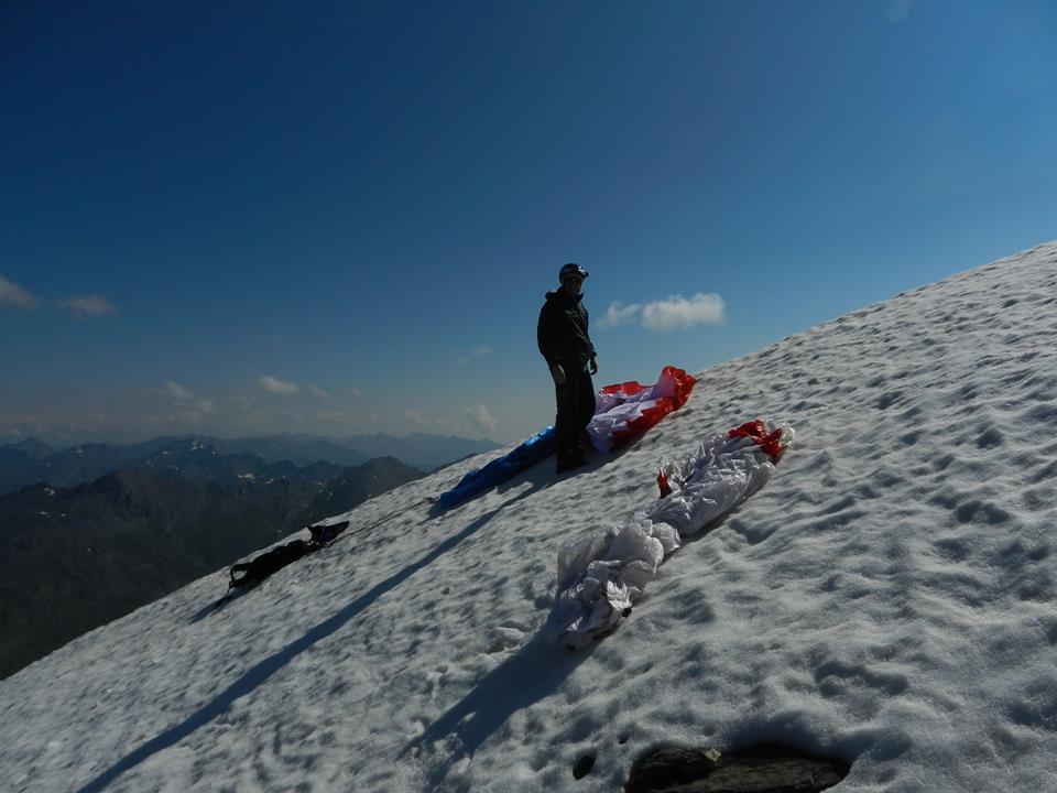
Partenza del trekking da Monginevro, decollo dalla cima. Allargare la vela sulla vetta piatta facendo attenzione ai numerosi fili spinati e residui metallici. Decollo in direzione sud puntando su Monginevro.
Se le condizioni non consentono il decollo dalla cima si può decollare dal colle dello Chaberton.
Avvicinamento
Partenza del trekking da Monginevro, decollo dalla cima. Allargare la vela sulla vetta piatta facendo attenzione ai numerosi fili spinati e residui metallici. Decollo in direzione sud puntando su Monginevro.
Se le condizioni non consentono il decollo dalla cima si può decollare dal colle dello Chaberton.
Cesana, Claviere, Monginevro.
Descrizione
Il vento dominante più comune è Ovest, meglio allontanarsi un poco dalla cima verso sud prima di dirigersi su Cesana che rimane un poco in sottovento.
Atterraggio a Cesana nel grande prato dietro alla caserma dei carabinieri in via Mario Ferragut.
Nelle vicinanze Mappa
Itinerari
08/08/2014 TO, Cesana Torinese D+ 908 m Sud-Est
Cresta Nera Volo su Cesana
2.2Km
05/08/2015 TO, Cesana torinese D+ 1210 m Sud-Ovest
Petit Vallon – Batteria Alta
2.6Km
11/03/2014 TO, Cesana torinese Sud-Est
Gallerie di Claviere
2.6Km
30/12/2016 TO, Cesana Torinese D+ 700 m Tutte
Bosco (Cima del) da Thures
12.5Km
18/08/2014 Hautes-Alpes, Abriès-Ristolas D+ 1150 m Sud
Terra Nera (Monte) da Rhuilles per Cima Dormillouse e Monte Virandatour
16.5Km
21/07/2013 TO, Sauze di Cesana D+ 1400 m Nord-Ovest
Ramière (Punta) o Bric Froid da Argentera
 17.2Km
14/08/2016 TO, Bardonecchia D+ 1200 m Ovest
Sommeiller (Punta)
21.4Km
Servizi
4.9Km
4.9Km
Casa Cesana Bar
Cesana Torinese
4.9Km
L’Ibarus Rifugio
Cesana Torinese
4.9Km
Piergiorgio Frassati B&B
Cesana Torinese
5.2Km
Baita Gimont Rifugio
Claviere
7.5Km
La vachette Bar
Montgenèvre
7.9Km
L’Eitabl Ristorante
Oulx
8.6Km
Centro Ristorante
Cesana Torinese
8.7Km
Guido Rey Rifugio
Oulx
8.9Km


