
Avvicinamento
 100m
4.3Km
4.5Km
4.5Km
4.5Km
4.6Km
4.6Km
4.7Km
100m
4.3Km
4.5Km
4.5Km
4.5Km
4.6Km
4.6Km
4.7Km
.
Descrizione
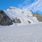
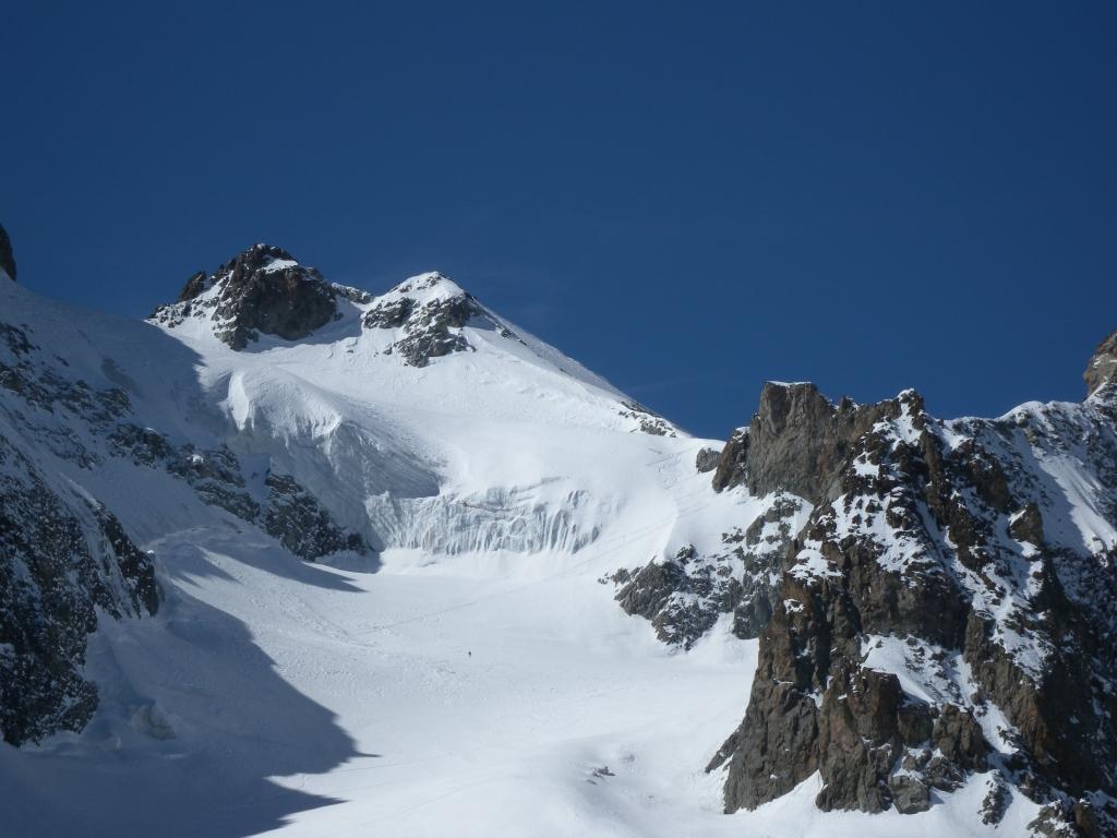
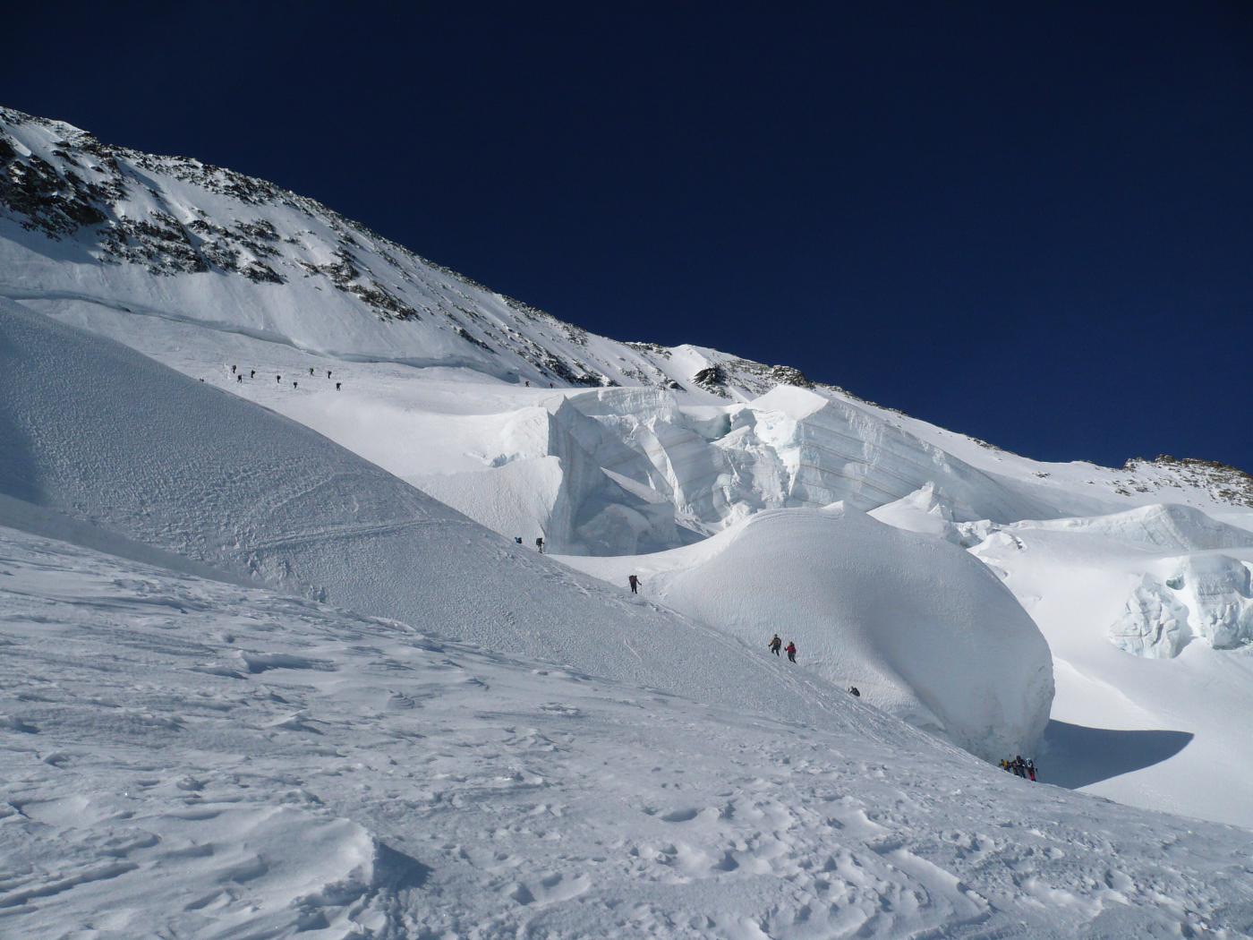
Seguire il sentiero estivo per il vallone di Selè fino a 200 mt circa dopo il carello indicatore (passerella sul torrente rimossa!). Attraversare il torrente e risalire il conoide a sinistra del sentiero estivo che passa nel ripido bosco. Si sbuca a Est della Bosse de Clapouse.
Seguire il vallone di Clapouse. A circa 2600, sotto il Colle di Rascrouset, risalire i pendii a dx, fino ai piedi della Pointe de Celse Niere e raggiungere il piccolo ghiacciaio di Clapouse.
Verso 3200 traversare a sx (SW) la cresta nevosa e portarsi quindi sul ghiacciaio di Rascrouset e al colle di Boeufs Rouges
- Cartografia:
- IGNtop25 3436 (Meije-Pelvoux)
- Bibliografia:
- Ski de randonnée - Hautes Alpes - Ed.Olizane
Ultima revisione 27/10/2022
Nelle vicinanze Mappa
Itinerari
16/06/2013 Hautes-Alpes, Vallouise-Pelvoux D+ 1780 m BS Est
Selè (Col du) da Ailefroide per il Glacier du Selè
100m
10/05/2024 Hautes-Alpes, Vallouise-Pelvoux D+ 1883 m BSA Nord-Est
Celse Niere (Pointe de), anticima sud da Ailefroide per il Vallon de Clapouse
 100m
100m
20/06/2026 Hautes-Alpes, Vallouise-Pelvoux D+ 2227 m BSA Nord
Ecrins (Barre des) Parete Nord
 4.3Km
4.3Km
24/04/2023 Hautes-Alpes, Villar-d'Arêne D+ 1509 m BS Sud
Arsine (Pic du Glacier d’) da Prè de Madame Carle
4.4Km
12/06/2022 Hautes-Alpes, Villar-d'Arêne D+ 1856 m BSA Sud-Est
Faurio (Roche) da Prè de Madame Carle
 4.5Km
4.5Km
25/04/2016 Hautes-Alpes, Villar-d'Arêne D+ 1211 m OSA Varie
Momie (Breche de la) da Prè de Madame Carle
 4.5Km
4.5Km
01/04/2012 Hautes-Alpes, Vallouise-Pelvoux D+ 1900 m OSA Sud-Est
Agneaux (Montagne des), cima NO da Prè de Madame Carle, traversata a Monetier les Bains per versante SO e col Casset
 4.5Km
4.5Km
15/06/2013 Hautes-Alpes, Vallouise-Pelvoux D+ 1506 m MSA Sud-Ovest
Faurio (Roche, Col de la) da Prè de Madame Carle
 4.6Km
4.6Km
07/06/2026 Hautes-Alpes, Vallouise-Pelvoux D+ 2140 m BSA Nord
Neige des Ecrins (Dome de) da Pre de Madame Carle
 4.6Km
4.6Km
28/10/2022 Hautes-Alpes, Vallouise-Pelvoux D+ 1318 m OS Nord-Est
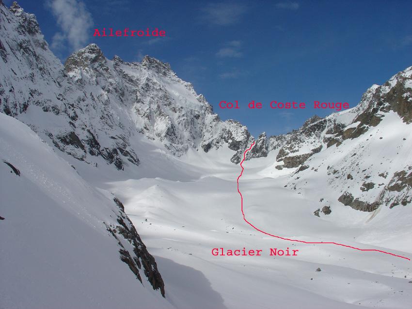
Coste Rouge (Col de) da Pré de Madame Carle per il Glacier Noir
 4.7Km
4.7Km