 2.8Km
2.8Km

Note
 100m
100m
100m
100m
150m
150m
150m
150m
150m
100m
100m
100m
100m
150m
150m
150m
150m
150m
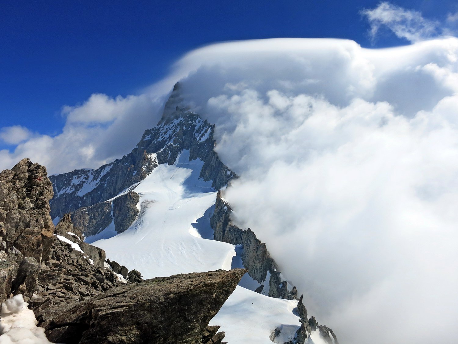
storico itinerario nel cuore del monte bianco, il più accessibile del trittico "sentinella - major - poire", ma assolutamente da non sottovalutare! pericoli oggettivi elevati, decisamente più impegnativo dello sperone della brenva.
raramente in condizioni.
Avvicinamento
raramente in condizioni.
.
Descrizione
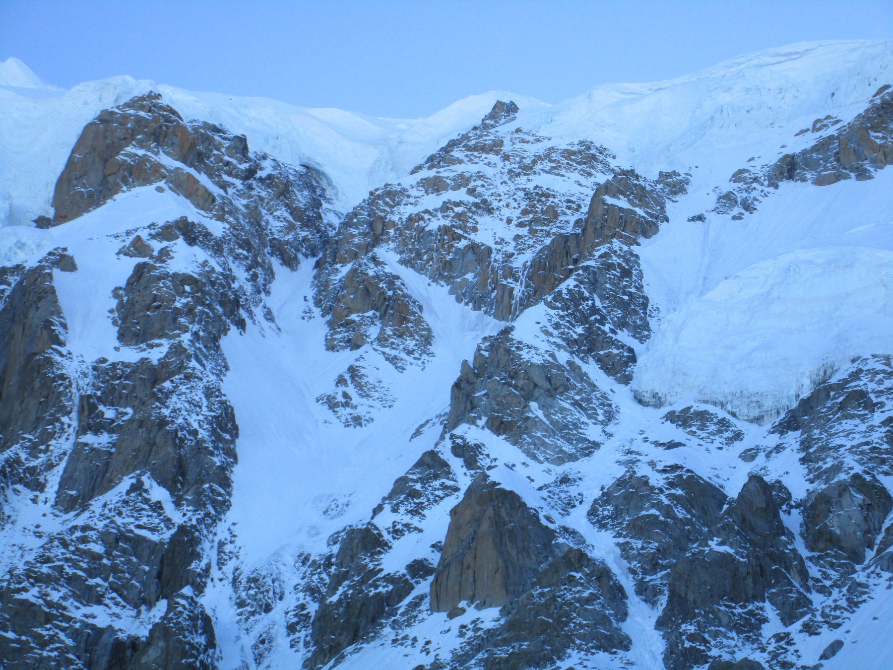
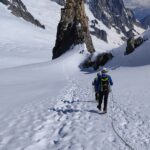
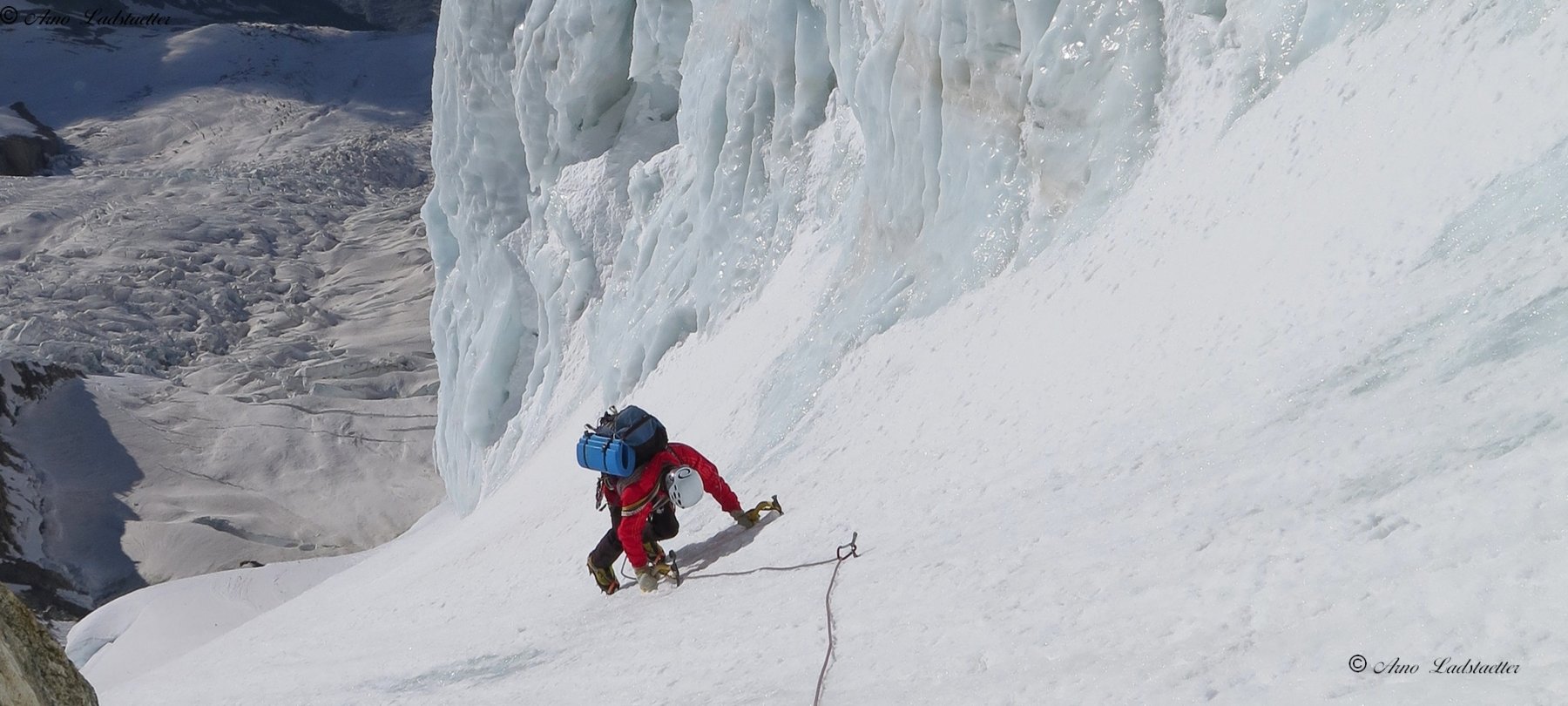
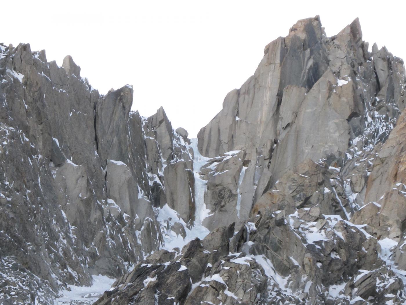
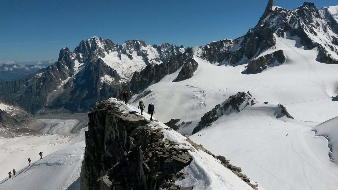
dal rifugio torino si raggiunge il bivacco della fourche 3737m (2 h), ci si cala in doppia sul bacino della brenva sotto il maudit (1 doppia da 60 o 2 da 30, roccia pessima) e si attraversa il ghiacciaio in piano fino al col moore (30 mt di seracco, buchi sul ghiacciaio!). da qui ci si abbassa 30 mt e si inizia un lunghissimo traverso verso la sentinella rossa (un sassone rosso e verticale ben visibile da qui) su terreno franoso e poco invitante. collegado al meglio lingue di neve e roccette si arriva sotto la sentinella, ottimo posto da bivacco, 2-3 h dalla fourche.
si contorna la sentinella sulla sx e si punta decisamente a sx seguendo l’evidente canalone, attenti però a non finire nel canale dei giapponesi!! si prosegue ad S andando a prendere un evidente e caratteristico lenzuolo di ghiaccio che termina su una crestina.
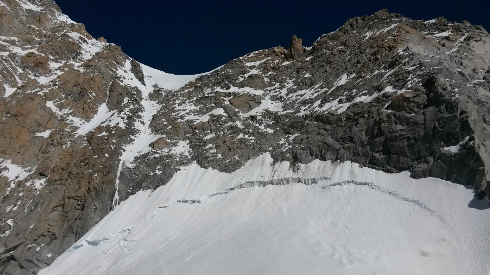
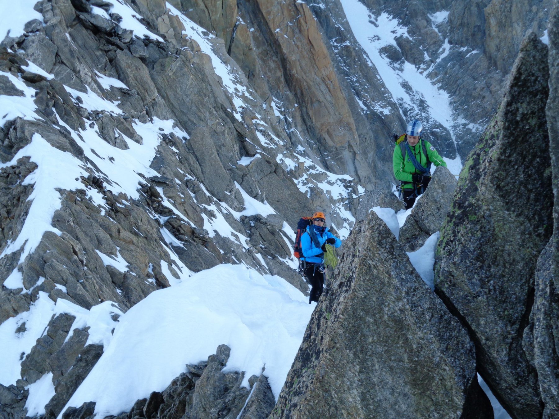
roccette facili portano su un lungo pendio sotto la fascia di seracchi. si punta in alto a dx fino ad uscire dal loro tiro, poi conviene puntare dritti alla cima del bianco o traversando tutto a dx raggiungere la normale verso il mur de la cote (crepacci), 4-6h.
- Bibliografia:
- neige glace et mixte - damilano
Nelle vicinanze Mappa
Itinerari
07/09/2025 AO, Courmayeur D+ 322 m PD+ Nord-Est
Marbrées (Aiguilles, Punta Nord) Cresta NE
 100m
100m
02/06/2023 AO, Courmayeur D+ 250 m PD+ Varie
Vierge (la) da Punta Helbronner
 100m
100m
10/04/2025 AO, Courmayeur D+ 200 m TD+ Nord
Grand Flambeau, settore Cuori di Ghiaccio – Koala Pirla
 100m
100m
25/06/2018 AO, Courmayeur D+ 1200 m D+ Sud-Est
Bianco (Monte) Sperone della Brenva – itinerario classico
 100m
100m
07/03/2025 AO, Courmayeur D+ 150 m D+ Est
Tacul (Mont Blanc du) Goulotte Silvia
100m
10/05/2015 AO, Courmayeur D+ 600 m ED- Nord-Est
Maudit (Mont) A l’est rien de nouveau
 150m
150m
13/09/2014 AO, Courmayeur D+ 1600 m D Varie
Bianco (Monte) Parete Nord dell’Aiguille Blanche e Cresta di Peuterey
 150m
150m
17/07/2024 AO, Courmayeur D+ 800 m F Varie
Vallèe Blanche traversata Punta Helbronner-Aiguille du Midi
 150m
150m
08/06/2025 Haute-Savoie, Chamonix-Mont-Blanc D+ 400 m PD- Ovest
Toules (Aiguilles des) Versante NW e cresta NW
 150m
150m
27/12/2015 AO, Courmayeur D+ 251 m AD Nord
Fourche (Colle della) da Punta Helbronner
 150m
150m