800m
800m


Note
 3.9Km
4.4Km
4.5Km
4.7Km
4.8Km
5Km
5Km
5.1Km
5.1Km
3.9Km
4.4Km
4.5Km
4.7Km
4.8Km
5Km
5Km
5.1Km
5.1Km
800m
800m
5Km
5Km
5.2Km
5.3Km
5.4Km
5.4Km
5.4Km
5.8Km
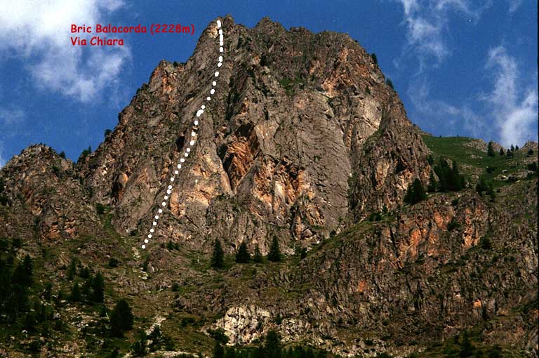
7 tiri sempre oltre i 40m,
Via interamente chiodata con fix da 10mm da S.Pettavino e G.Garro.
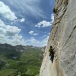
Qualche tratto di roccia friabile, molto panoramica e gradevole per l'ambiente, arrampicata divertente.
Avvicinamento
Via interamente chiodata con fix da 10mm da S.Pettavino e G.Garro.
Qualche tratto di roccia friabile, molto panoramica e gradevole per l'ambiente, arrampicata divertente.
.
Descrizione
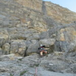
Attacco:
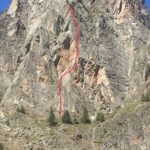
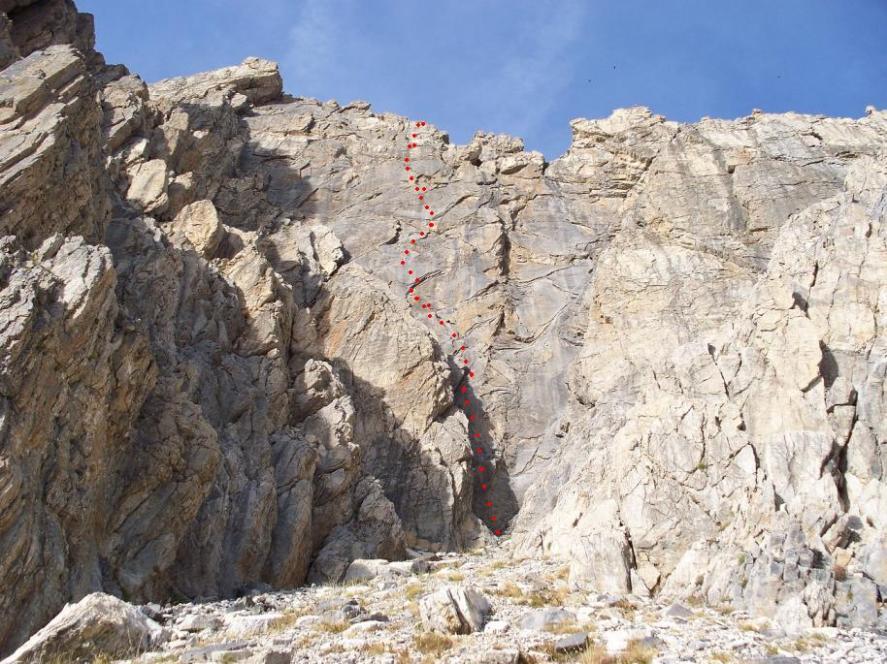
salire da Preit in direzione della parete rossastra che sovrasta l’abitato. Dirigersi all’imbocco del canale che porta verso l’evidente l’intaglio della cresta SE, alla base sulla dx lo sperone sul quale si sviluppa la via.
In partenza un chiodo con un cordino rosso.
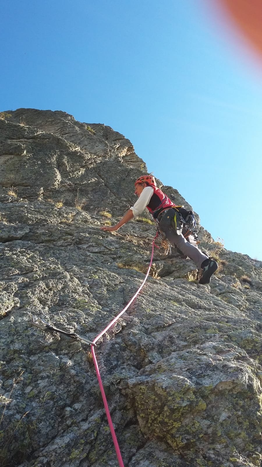
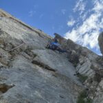
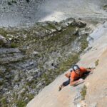
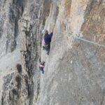
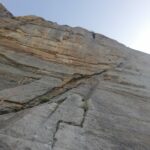
L1: 5b, arrampicata tecnica
L2: 5b, attenzione in questo tiro obliquare a sx per evitare roccia friabile fino a che si vede la linea degli spit proseguire.
L3: 5c, arrampicata elegante in diedro fessura
L4: 3, tiro di trasferimento
L5: 5a,
L6: 5c, facile ma omogeneo e singoli passi un po’ piu’ difficili
L7: 5a, tratto finale per raggiungere la cresta con roccia friabile ma comunque divertente.
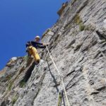
Calate:
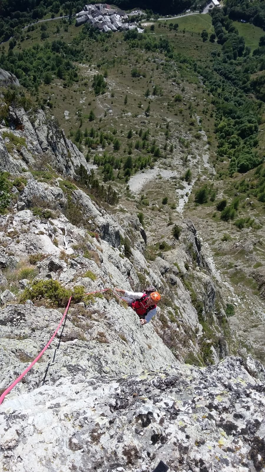
e’ possibile calarsi in doppia lungo la via. La via raggiunge la cresta SE poco sotto la cima che puo’ essere raggiunta aggirando vari gendarmi.
Scavalcando la cresta e’ possibile scendere per un canale erboso inizialmente ripido ma non esposto in direzione del sentiero verso le case Soleglio Bue e da qui prendere il comodo sentiero che scende a Preit.
ATTENZIONE: NON seguire la descrizione di Alpidoc n.58 pag.76 che dice di obliquare a dx anzichè a sx. Si va su terreno erba-ghiaia ripido e quasi improteggibile che può diventare molto pericoloso per chi fosse abituato solo a vie attrezzate !!!
- Cartografia:
- IGC n.111 Valle Maira Acceglio Brec de Chambeyron
Nelle vicinanze Mappa
Itinerari
08/10/2025 CN, Canosio 6c, 6a+ obbl. Sud-Est
Meja (Rocca la) – Attrazioni Gravitazionali
 3.9Km
3.9Km
18/09/2020 CN, Canosio 7b, 6c obbl., a1 Sud-Ovest
Meja (Rocca la) – Torrione Guanta Hardita
 4.4Km
4.4Km
24/05/2026 CN, Canosio 6c+, 6c obbl. Sud
Meja (Rocca la) – Primi Passi
 4.5Km
4.5Km
13/07/2024 CN, Canosio 7a+, 6b obbl. Sud
Meja (Rocca la) – Alchimeja
 4.7Km
4.7Km
01/09/2022 CN, Canosio 6b+, 6a obbl. Sud
Meja (Rocca la) – Un Tonfo per Lally
 4.8Km
4.8Km
15/09/2001 CN, Canosio 7a+, 6b obbl. Sud-Est
Meja (Rocca la) – Alkimeja
5Km
26/08/2025 CN, Canosio 7a, 6b obbl. Sud
Meja (Rocca la) – Abissi di Incoerenza
 5Km
5Km
28/07/2025 CN, Canosio 7a, 6b obbl. Sud-Ovest
Meja (Rocca la) – Full of Freedom
 5Km
5Km
13/09/2020 CN, Marmora 6a+, 6a+ obbl. Sud-Est
Balacorda (Bric) – Mastro Lindo…Ruffiano Protesico
 5.1Km
5.1Km
04/10/2008 CN, Canosio 6c, 6b obbl. Sud-Ovest
Meja (Rocca la) – Via dal Vento
 5.1Km
5.1Km
Servizi
800m
800m
Mascha Parpaja Rifugio
Canosio
5Km
Antica Osteria Albergo
Prazzo
5Km
Furnel e pirol Ristorante
Prazzo Superiore
5.2Km
Gardetta Rifugio
Canosio
5.3Km
Lou Pitavin Ristorante
Marmora
5.4Km
Croce bianca Ristorante
Marmora
5.4Km
Ceaglio Rifugio
Marmora
5.4Km
Posto tappa gta Ceaglio Rifugio
Marmora
5.8Km