200m
200m
Note
Storico
 50m
50m
50m
50m
1Km
2Km
2.5Km
2.9Km
50m
50m
50m
50m
1Km
2Km
2.5Km
2.9Km
200m
6.1Km
6.1Km
6.1Km
6.3Km
6.5Km
7.6Km
7.9Km
7.9Km
8.4Km
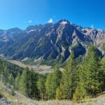
Questo itinerario, un “Sentiero Balcone”, assai panoramico, attraversa lungamente nella prima parte i boschi ed i pendii pascolativi in quota sulla destra orografica della valle. Scesi poi a fondovalle, ai ruderi degli alpeggi di Clotes e Argentera che dà il nome alla valle, si percorre, interminabile, un polveroso stradello sino al termine del piano, ritornando alla borgata di Bessen Haut dalla quale si era partiti.
Avvicinamento
Si parte dalla frazione di Bessen Haut.
Descrizione
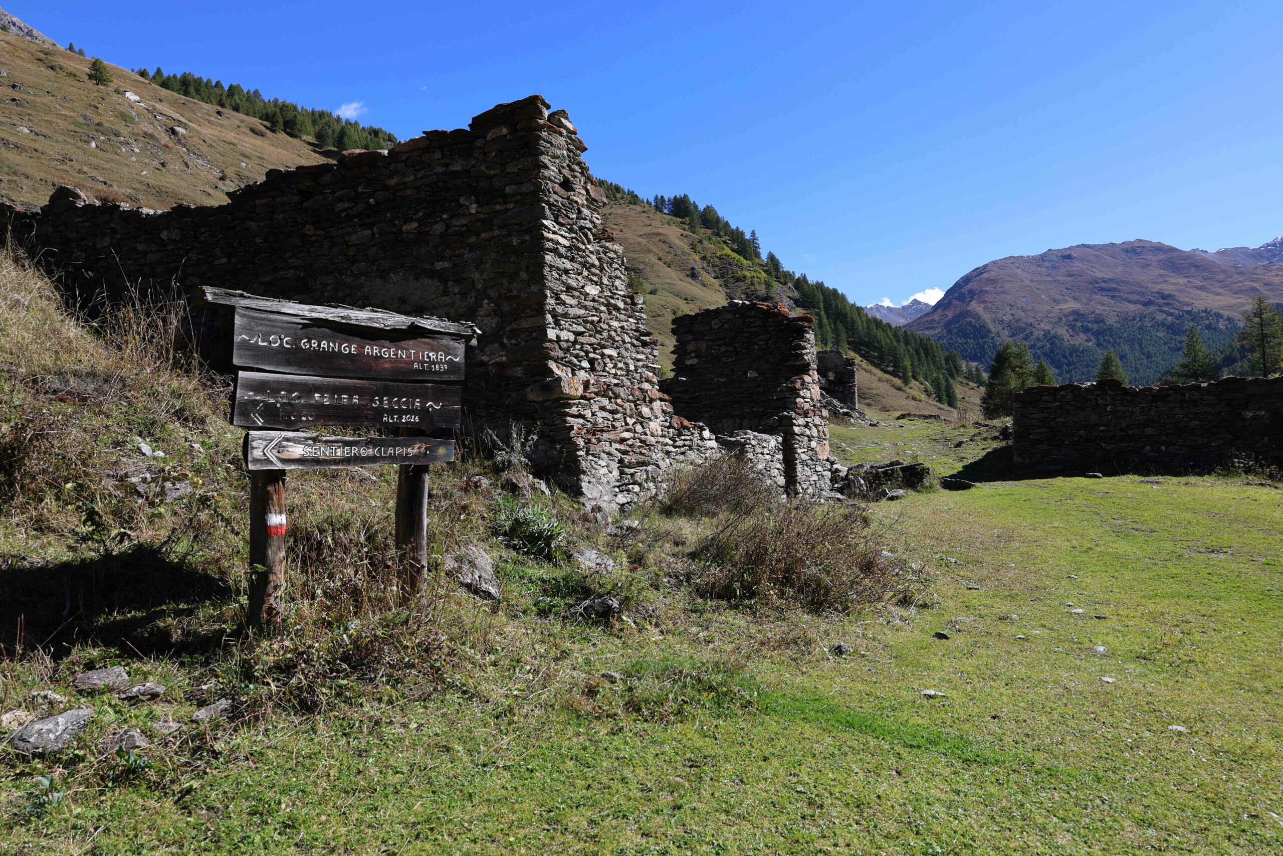
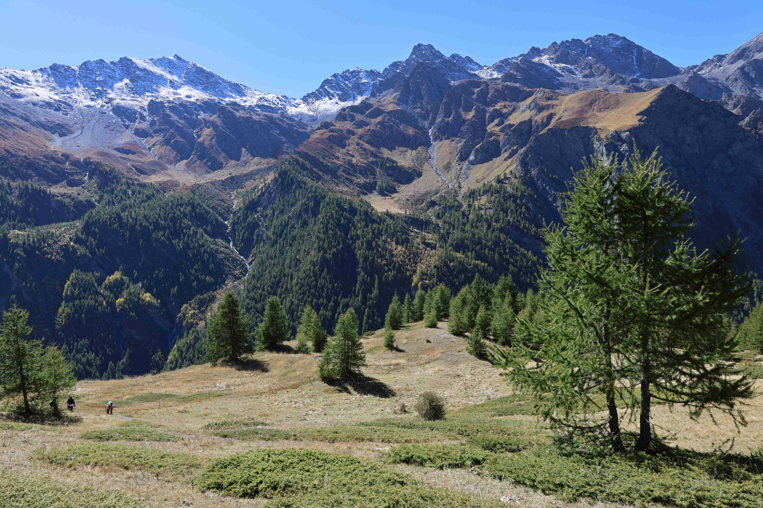
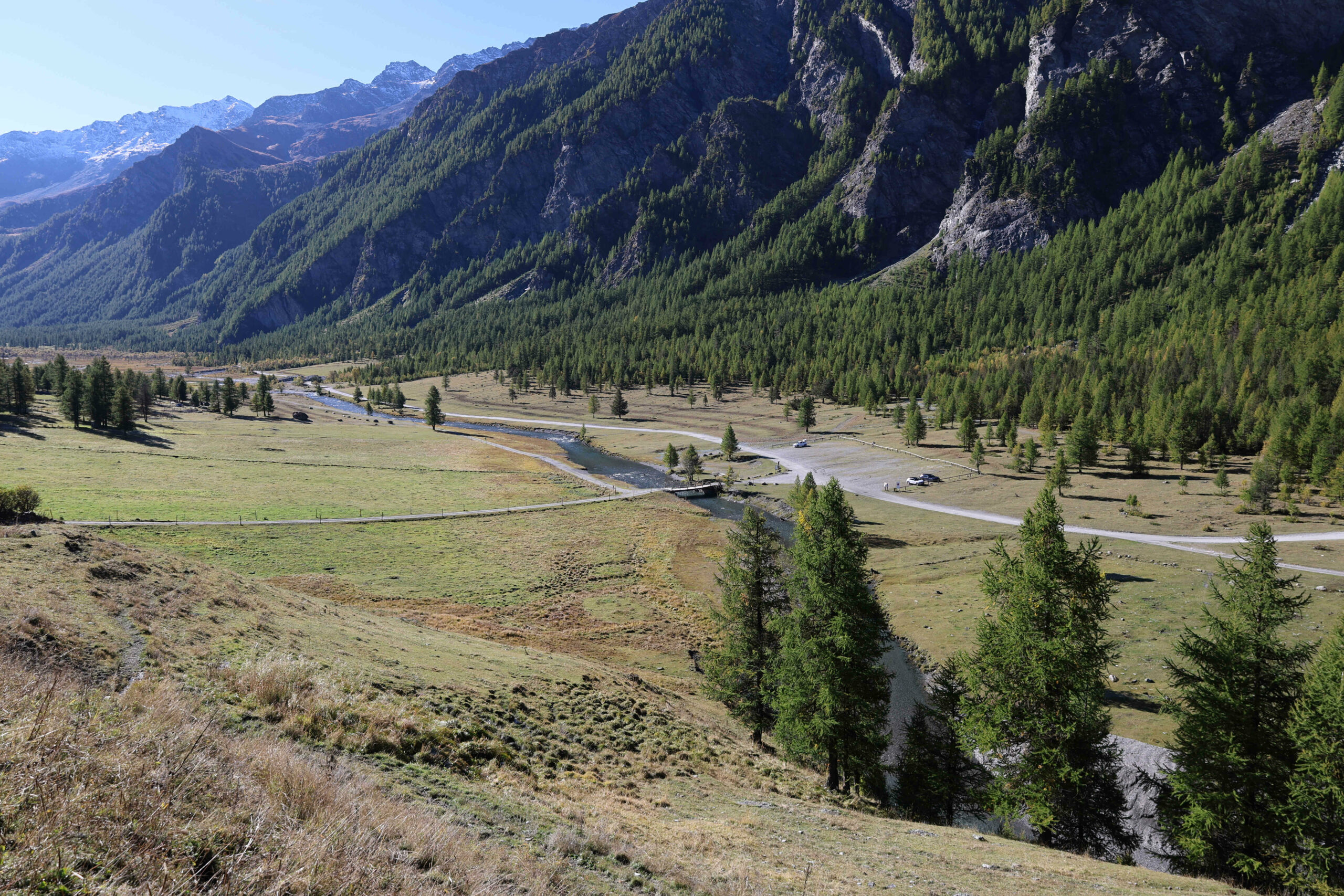
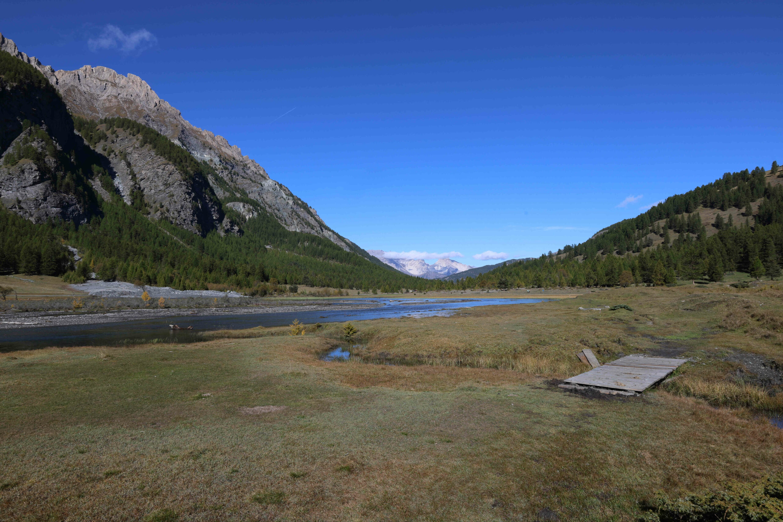
A monte delle case parte uno stradello sterrato, la strada della Lombarda, sul quale si rimarrà sino al termine in località “Sette Fontane”. Costeggiando inizialmente praterie e coltivi da tempo in abbandono, dopo un primo tratto in piano prende a salire raggiungendo alla sommità di una faticosa ascesa il punto in cui si trovano numerose indicazioni in località Serre Ciangrassa. Proseguendo, ora in piano, superata una rustica fontana e rasentata un’estesa radura pascolativa sotto le Rocce di S. Giacomo e la Punta Sotto Rognosa, il Piano del Bue per il quale si passerà ritornando, ancora si prosegue, sempre lungamente in piano, sino alla breve salita che porta alla presa dell’acquedotto in località “Sette Fontane” dominata dal grosso mammellone del monte Giornalet. Qui si trova il bivacco Ugo Ratazzo. Poco prima del bivacco, sulla destra, una palina con l’indicazione Argentera segna il punto in cui parte il “Sentiero Balcone”. Sempre ben evidente e segnato scende da subito al rio Colombiera, che si attraversa, risalendo l’opposto versante dove inizia il lungo, interminabile, piacevolissimo traverso pianeggiante che al termine condurrà a fondovalle alle dirute Grange Argentera. Assai panoramico sulla valle, sulla poderosa dorsale di monti di fronte che vanno dal monte Furgon alla Punta Ramiere, catena di vette separata dal colle del Pelvo, alternando lunghi tratti nel bosco ad altri nelle radure dove sono presenti macchie di ginepro strisciante, questo sentiero proseguendo si porta progressivamente verso i più avanzati e liberi pendii pascolativi che si raggiungono al termine di un breve tratto discendente. In località Peira Sechia la traccia scende a valle con un percorso non facilmente identificabile tra le alte erbe dei pascoli. Qui giunti conviene invece proseguire diritti e puntare a due rossastri dentini di roccia che spuntano isolati tra l’erba della prateria. Il sentiero sembra perdersi, ma lo si ritrova più in basso quando si attraversa una zona molle, ricca di sorgenti, superata la quale si prende a scendere, sempre traversando, per tracce per lo più dovute al passaggio del bestiame, trovando, di poco più sotto, il sentiero 609 che dal fondo sale al col Clapis sul quale ci si immette prendendolo verso valle. Segnato, ma poco evidente, lo si cerca e lo si percorre avendo già in vista, di sotto, le dirute Grange Clotes, che si raggiungono senza alcuna difficoltà. Un’inerbita strada scende da queste alle Grange Argentera, che danno il nome alla valle, dalle quali ci si porta alla strada di fondovalle dopo aver attraversato su di un ponte il torrente Ripa.
3 ore c.ca da Bessen Haut.
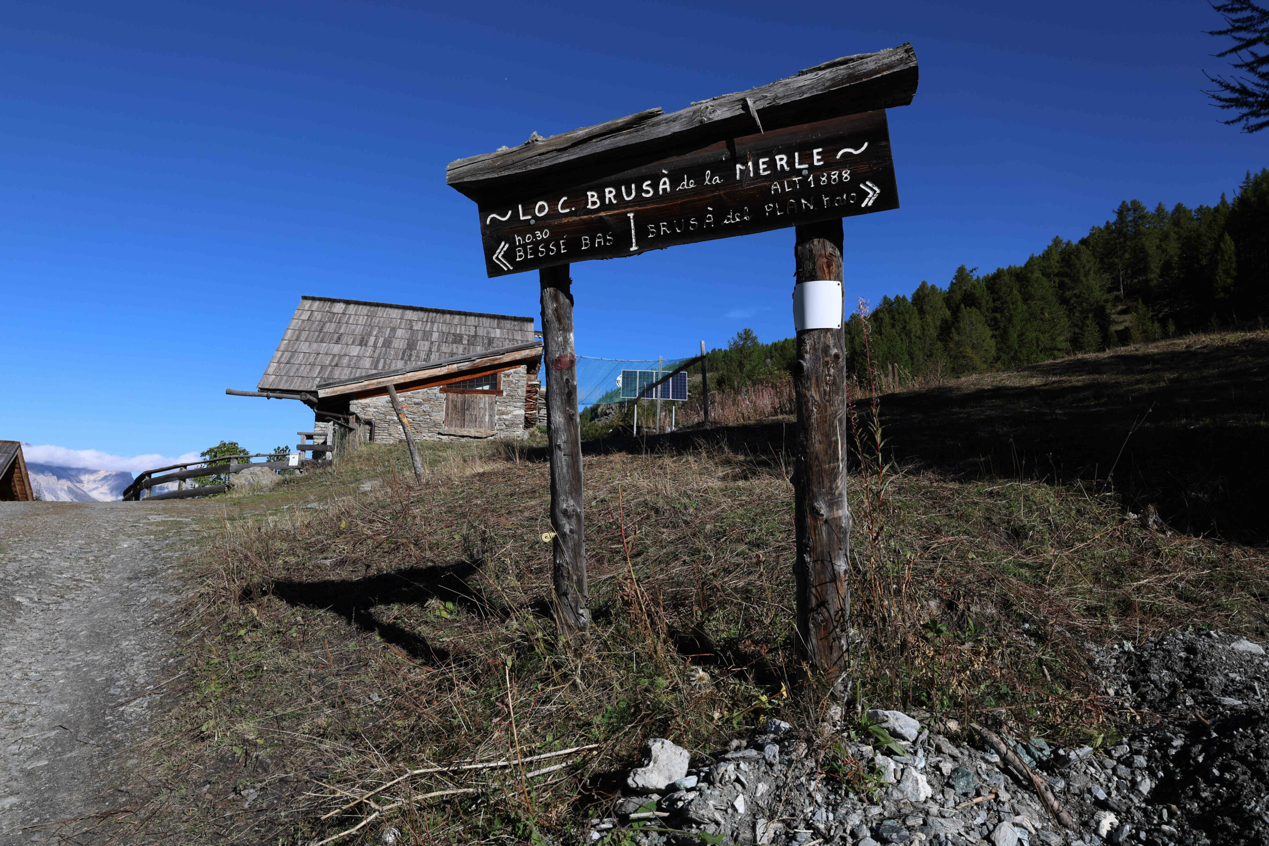
Si ritorna indietro verso Brusà del Plan dove il piano termina, percorrendo il bel sentiero sulla destra orografica della valle che da Grange Troncea porta fino a Brusà del Plan (presente un ponte per superare il torrente). Il sentiero permette di evitare la strada polverosa a causa del traffico veicolare. Si raggiunge l’alpeggio di Brusà del Plan, con la bella chiesetta e da questo alle poche case del successivo insediamento di Brusà de la Merle non prima di aver dato un’ultima occhiata, girandosi, a questa splendida valle.
Si prosegue infine scendendo a Bessen Bas dove un impervio sentiero sale a Bessen Haut e dove si chiude l’anello.
3 ore c.ca dalle Grange Argentera.
La valle Argentera, impropriamente chiamata così, è la valle dove nasce la Ripa che fondendosi a Oulx con la Dora di Bardonecchia forma la Dora Riparia.
Giunti al fondo della valle, uno dei più estesi pianori delle Alpi Occidentali, questa si divide in due: la valle Lunga che comunica con la valle di Massello per il colle di Rodoretto e la valle del Gran Miol, dominata dal Gran Queyron e dalla Punta Ramiere, dalla quale si scende a Prali per il passo della Longia o per il col Frappier.
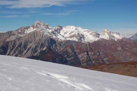
Chiusa sulla destra orografica dall’estesa catena montuosa che la separa dalla val Troncea, sulla sinistra dai poderosi contrafforti montuosi che vanno dalla Punta Furgon alla Punta Ramiere che la dividono dalla valle di Thuras, un polveroso stradello in discrete condizioni lungamente la percorre portandosi agli ultimi alpeggi.
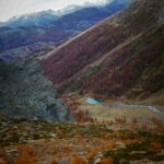
Piana, ricca di foreste, radure e pendii pascolativi, di sorgenti e cascate, la valle Argentera detta un tempo “La valle del silenzio” perché lontana da insediamenti abitativi, è oggi assai frequentata in tutte le stagioni per le escursioni e le traversate che si possono effettuare anche perché è permesso il campeggio libero.
Giunti al fondo della valle, uno dei più estesi pianori delle Alpi Occidentali, questa si divide in due: la valle Lunga che comunica con la valle di Massello per il colle di Rodoretto e la valle del Gran Miol, dominata dal Gran Queyron e dalla Punta Ramiere, dalla quale si scende a Prali per il passo della Longia o per il col Frappier.
Chiusa sulla destra orografica dall’estesa catena montuosa che la separa dalla val Troncea, sulla sinistra dai poderosi contrafforti montuosi che vanno dalla Punta Furgon alla Punta Ramiere che la dividono dalla valle di Thuras, un polveroso stradello in discrete condizioni lungamente la percorre portandosi agli ultimi alpeggi.
Piana, ricca di foreste, radure e pendii pascolativi, di sorgenti e cascate, la valle Argentera detta un tempo “La valle del silenzio” perché lontana da insediamenti abitativi, è oggi assai frequentata in tutte le stagioni per le escursioni e le traversate che si possono effettuare anche perché è permesso il campeggio libero.
Nelle vicinanze Mappa
Itinerari
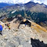
28/07/2025 TO, Sauze di Cesana D+ 1200 m EE Ovest
Fauri Sud (Punta) da Bessen Haut
50m
01/11/2023 TO, Sauze di Cesana D+ 380 m T Varie
Ratazzo Ugo (Bivacco) da Bessen Haut
 50m
50m
15/06/2025 TO, Sauze di Cesana D+ 1315 m EE Sud-Ovest
Rognosa del Sestriere (Punta) da Bessen Haut per il versante SO
 50m
50m
15/07/2024 TO, Sauze di Cesana D+ 1050 m EE Nord-Ovest
Fauri Nord (Punta) da Bessen Haut
 50m
50m
29/09/2024 TO, Sauze di Cesana D+ 1150 m EE Sud-Ovest
Giornalet (Monte) da Bessen Haut per il versante SO
 50m
50m
04/09/2022 TO, Sauze di Cesana D+ 1500 m EE/F Nord
Gran Roc (Monte) da Ponte Terribile
 1Km
1Km
24/06/2022 TO, Sauze di Cesana D+ 836 m E Nord
Bosco (Cima del) da Sauze di Cesana
 2Km
2Km
30/08/2025 TO, Sestriere D+ 1246 m EE Nord-Ovest
Rognosa del Sestriere (Punta) da Sestriere per il Passo di San Giacomo
 2.5Km
2.5Km
17/09/2025 TO, Sestriere D+ 692 m EE Ovest
Querellet (Monte) da Sestriere, anello per il Passo di San Giacomo e Monte Sises
 2.9Km
2.9Km
Servizi
200m
6.1Km
da Carlo Rifugio
Cesana Torinese
6.1Km
La Tana degli Orsi B&B
Cesana Torinese
6.1Km
La Crota B&B
Cesana Torinese
6.3Km
La Fontana del Thures Rifugio
Cesana Torinese
6.5Km
Centro Ristorante
Cesana Torinese
7.6Km
Mulino di Laval Rifugio
Pragelato
7.9Km
La capanna del sole Ristorante
Pragelato
7.9Km
Al Mulino Ristorante
Pragelato
8.4Km