 750m
750m

Note
Storico
 2Km
3.4Km
3.4Km
4Km
4.7Km
5Km
5.3Km
6.6Km
2Km
3.4Km
3.4Km
4Km
4.7Km
5Km
5.3Km
6.6Km
750m
750m
1.7Km
3.6Km
4.1Km
4.3Km
4.3Km
5.6Km
5.6Km
7.1Km
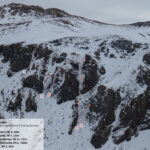
Difficoltà da dx a sx: da 3 a 4.
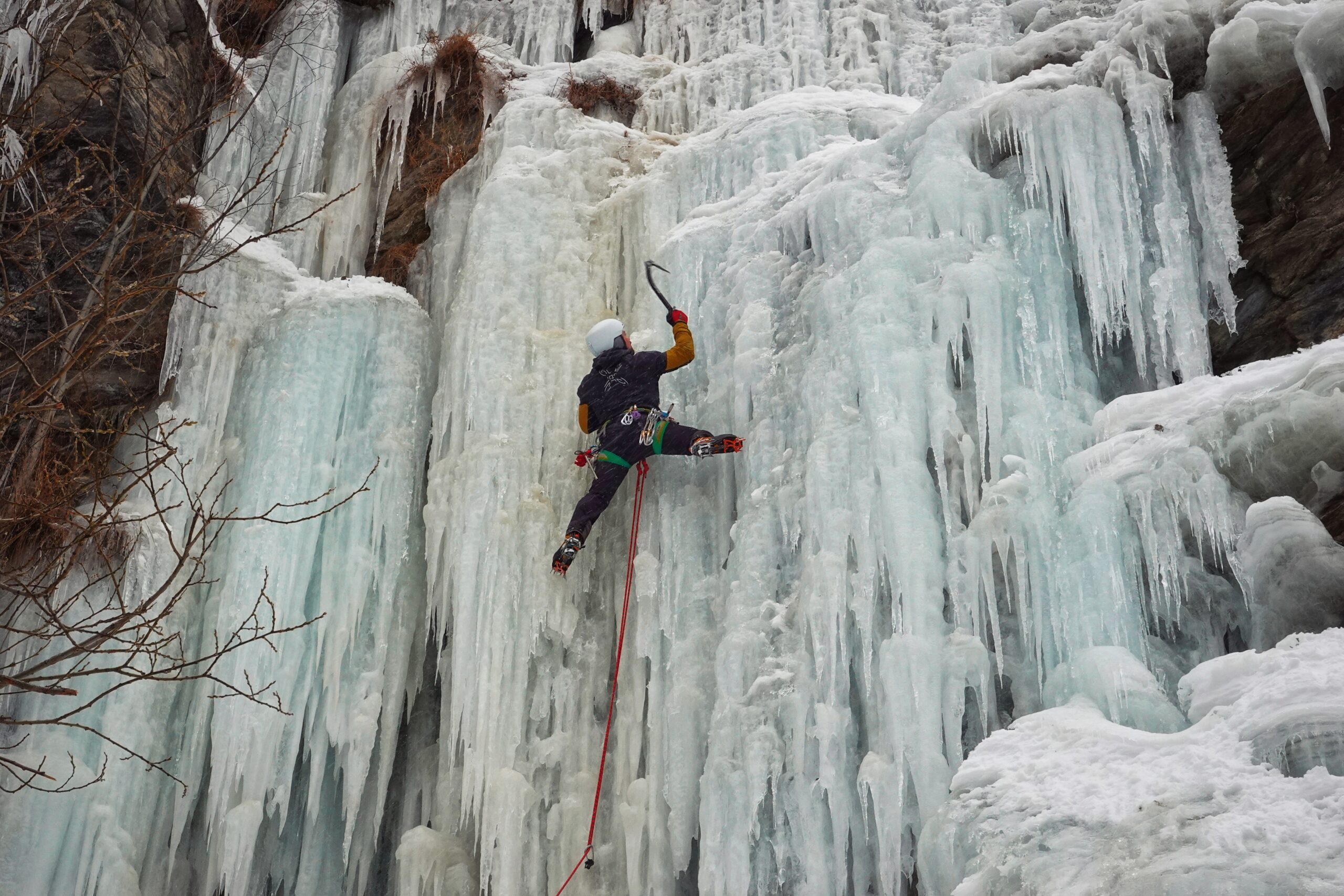
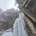
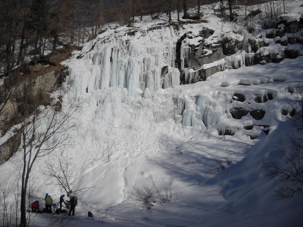
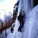
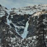
La cascata si forma grazie all'acqua che fuoriesce dal tubo sovrastante; se le condizioni lo permettono è possibile raddoppiare lo sviluppo, seppur con difficoltà decisamente ridotte. Il salto principale è costituito da un muro di ghiaccio di circa 15 metri a seconda dell'attacco e offre diverse opportunità di salita, con diverse difficoltà e tipologia di ghiaccio, compresi passaggi di misto sulla parte sinistra.
Prestare ATTENZIONE alle condizioni, perché a causa dell'esposizione, la parte alta è sensibile alla temperatura e soggetta a cadute di ghiaccio improvvise.
Avvicinamento
La cascata si forma grazie all'acqua che fuoriesce dal tubo sovrastante; se le condizioni lo permettono è possibile raddoppiare lo sviluppo, seppur con difficoltà decisamente ridotte. Il salto principale è costituito da un muro di ghiaccio di circa 15 metri a seconda dell'attacco e offre diverse opportunità di salita, con diverse difficoltà e tipologia di ghiaccio, compresi passaggi di misto sulla parte sinistra.
Prestare ATTENZIONE alle condizioni, perché a causa dell'esposizione, la parte alta è sensibile alla temperatura e soggetta a cadute di ghiaccio improvvise.
Torino - Pinerolo - Pragelato (In alterativa Torino - Cesana - Sestriere - Pragelato). Raggiungere la partenza della funivia di Pattemouche (frazione Plan). È possibile lasciare l'auto al parcheggio libero che si trova 200 metri prima del bivio per raggiungere la funivia (P2) lungo la strada che porta dritti nella Val Troncea.
Dal piazzale della funivia salire verso il ponte di legno (senza attraversarlo) e proseguire, oltrepassando la staccionata, sotto i cavi della funivia verso il boschetto, restando sulla sinistra orografica del fiume.
Salire per pochi metri verso sinistra fino ad intercettare un sentiero che si inoltra nel fosso (in caso la neve copra il percorso fare riferimento alla rete blu che per un tratto lo delimita). Proseguire fino ad incontrare la cascata sulla destra dopo poche decine di metri.
Descrizione
Dal piazzale della funivia salire verso il ponte di legno (senza attraversarlo) e proseguire, oltrepassando la staccionata, sotto i cavi della funivia verso il boschetto, restando sulla sinistra orografica del fiume.
Salire per pochi metri verso sinistra fino ad intercettare un sentiero che si inoltra nel fosso (in caso la neve copra il percorso fare riferimento alla rete blu che per un tratto lo delimita). Proseguire fino ad incontrare la cascata sulla destra dopo poche decine di metri.
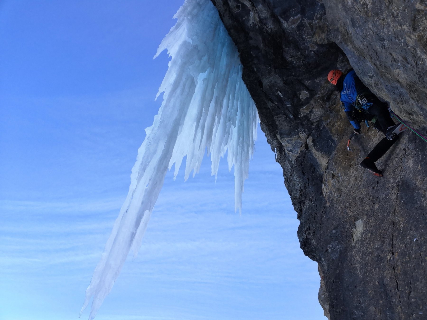
Il tiro principale risale il muro verticale sulla sinistra fino ad un evidente albero su cui si può fare sosta. In alternativa si possono salire diverse linee: più a sinistra si può partire in leggero strapiombo con ghiaccio a stalattiti o a destra dove la verticalità si ammorbidisce, ma il ghiaccio si presenta più a cavolfiori (ed è anche la parte che cede prima durante la stagione).
Discesa: In doppia o moulinette dall’albero.
E. Messina, anni '80 (non nominata)
Nelle vicinanze Mappa
Itinerari
17/01/2026 TO, Pragelato 25 m II, 3+ Nord
Pragelato – Anfiteatro del Vento (Cascata)
 2Km
2Km
31/12/2018 TO, Sestriere 65 m III, 5+, M8 Nord
Banchetta (Monte) – Alla Bellemmeglio (Cascata)
 3.4Km
3.4Km
21/02/1995 TO, Pragelato 120 m IV, 5 Nord-Est
Val Troncea – Pisse Neire (Cascata) VIETATA
 3.4Km
3.4Km
11/01/2022 TO, Pragelato 25 m I, 2+ Nord
Pragelato – Acquedotto (Cascata dell’)
3.9Km
11/01/2022 TO, Pragelato 20 m I, 4 Nord-Ovest
Pragelato – Anfiteatro del Ghiaccio (Cascate)
 4Km
4Km
16/12/2023 TO, Sestriere 180 m III, 2 Ovest
Chisonetto (Vallone del) – Principiante e dei Tre (Cascate)
 4.7Km
4.7Km
27/02/1994 TO, Pragelato 150 m III, 4+ Nord-Est
Val Troncea – Guglietta (Cascata della) VIETATA
 5Km
5Km
22/12/2025 TO, Sestriere 60 m III, 4 Ovest
Chisonetto (Vallone del) – Ghiacciolo Gigante e Cascata delle Goulottes (Cascate)
 5.3Km
5.3Km
04/01/2011 TO, Pragelato 100 m II, 5+ Est
Val Troncea – Dies Irae (Cascata)
6.3Km
10/01/2026 TO, Pragelato 130 m III, 4 Est
Val Troncea – Rouit (Cascatone del)
 6.6Km
6.6Km
Servizi
750m
750m
Al Mulino Ristorante
Pragelato
1.7Km
Mulino di Laval Rifugio
Pragelato
3.6Km
Refugium – ex. Rif. Belotte Rifugio
Pragelato
4.1Km
Casa degli Escartons Alex Berton B&B
Pragelato
4.3Km
Casa Alpina Rifugio
Pragelato
4.3Km
Passet Ristorante
Pragelato
5.6Km
Troncea Rifugio
Pragelato
5.6Km
L’itialette Ristorante
Pragelato
7.1Km


