3.4Km
3.4Km
Note
 350m
350m
350m
350m
350m
350m
350m
350m
350m
350m
350m
350m
350m
350m
350m
350m
350m
350m
350m
350m
3.4Km
4.7Km
6.7Km
6.7Km
6.7Km
6.7Km
7.3Km
9.5Km
9.9Km
Gita effettuabile tranquillamente con gli impianti aperti in quanto il percorso di salita tracciato dai francesi si mantiene totalmente separato dalle piste (un solo breve contatto di pochi metri a metà percorso e uno alla fine in quanto, ovviamente, al Colletto Verde arrivano gli impianti di Monginevro). Complimenti al gran lavoro fatto dai cugini d’oltralpe che hanno tracciato un magnifico itinerario di salita ottimamente segnalato sia alla partenza che lungo il percorso. Andrebbe preso ad esempio dalle nostre stazioni sciistiche.
Avvicinamento
Parcheggiare negli ampi parcheggi (gratuiti) che ci sono prima di Monginevro. Si incontrano sulla sinistra salendo dopo poche centinaia di metri dall’uscita della seconda galleria (quella che permette di evitare il paese di Claviere).
I parcheggi sono sotto l’impianto “misto” (seggiovia/ovetti) Serre Thibaud che sale alla sinistra orografica della valle.
Descrizione
I parcheggi sono sotto l’impianto “misto” (seggiovia/ovetti) Serre Thibaud che sale alla sinistra orografica della valle.
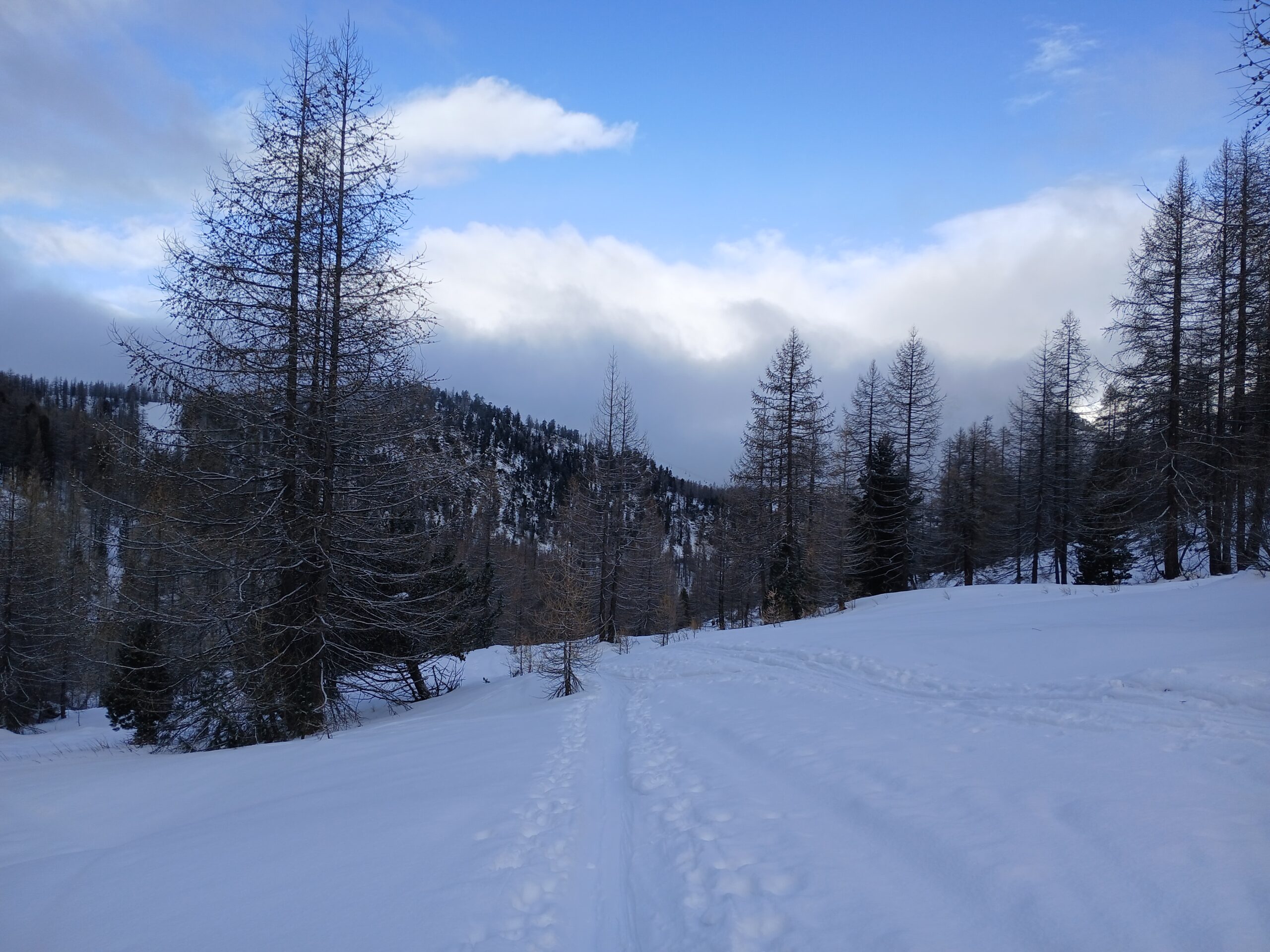
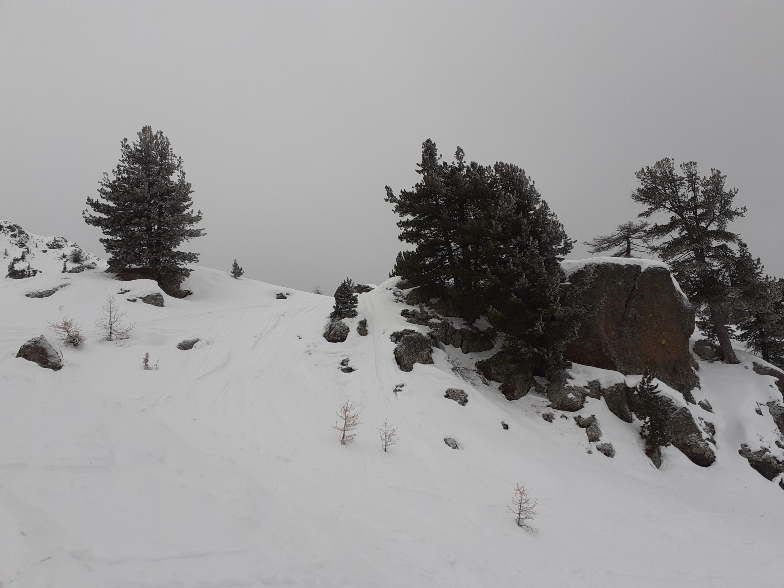
Dal parcheggio, utilizzando una delle numerose stradine esistenti, si scende nel fondovalle e si percorre sci ai piedi la pista per una cinquantina di metri fino alla zona dove sono collocate le partenza di due impianti. Salire lasciando il primo impianto (“Tremplin”) sulla sinistra e dirigersi verso il bosco a sinistra della pista che passa sotto un ponticello.
Alla partenza del percorso sono presenti evidenti cartelli che indicano la partenza del tracciato per “ski randonee”. Il tracciato si infila nel bosco abbandonando totalmente la zona degli impianti. Il percorso è segnalato con numerosi cartelli gialli posizionati sugli alberi. Si sale con alternanza di tratti in mezzo al bosco e di altri in zone più aperte. Il tracciato sbuca sulle piste poco dopo la stazione di partenza dell’ovovia “Rocher de l’Aigle” che porta gli sciatori al Colletto Verde (con meno fatica ma anche con molta meno soddisfazione …).
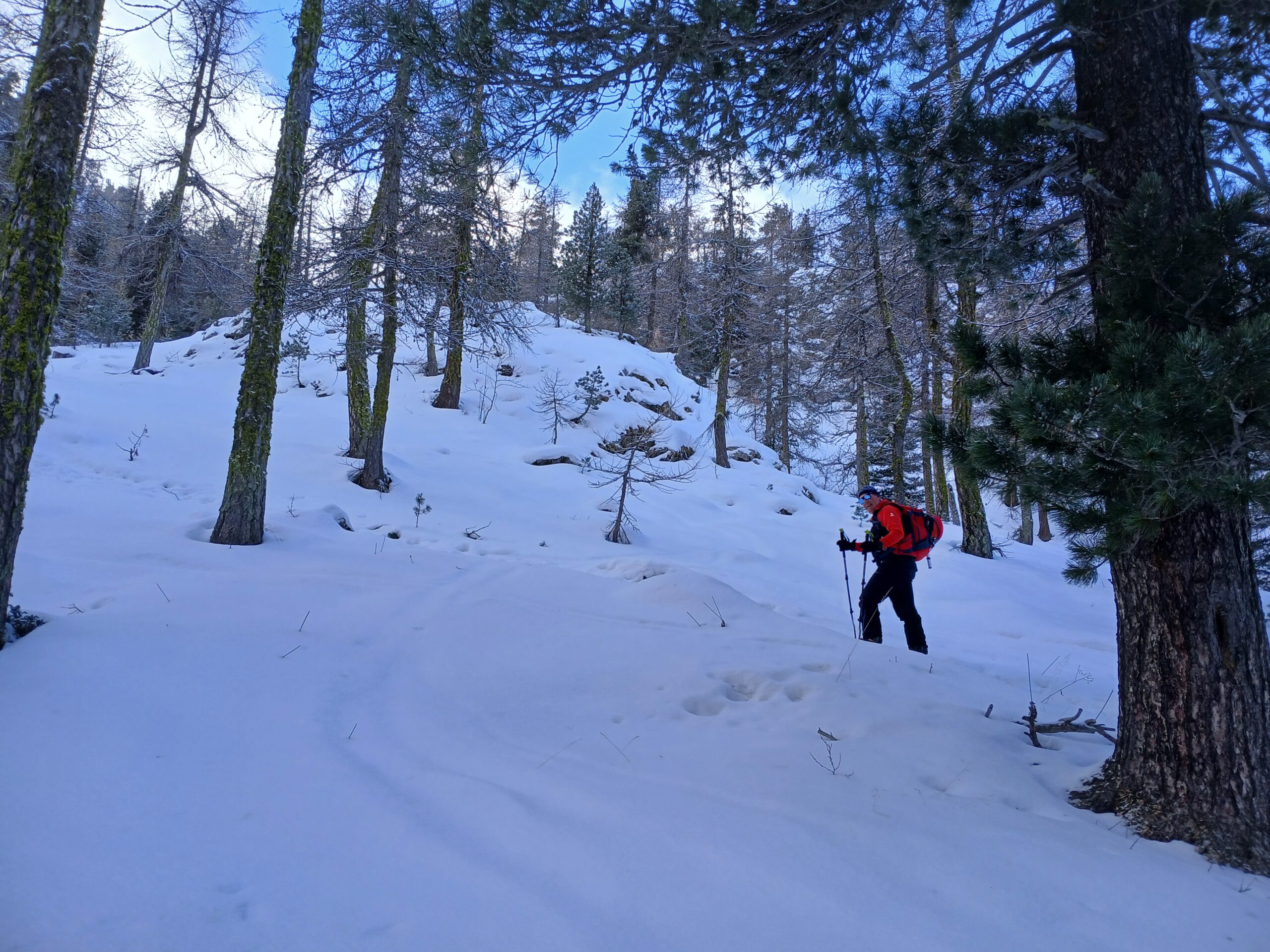
Dopo “l’affaccio” sulle piste, il percorso gira immediatamente a sinistra e si riallontana subito dagli impianti. Si sale inizialmente ancora su terreno boschivo abbastanza ripido che diventa poi più aperto raggiungendo un pianoro a poca distanza dalla pista. Da questo punto è importante considerare lo stato del manto nevoso. In presenza di pericolo valanghe conviene girare verso destra raggiungendo la pista e risalendola sui bordi (possibilmente all’esterno del tracciato delimitato dai pali) e facendo (ovviamente) attenzione agli sciatori in discesa.
Se invece siamo in presenza di basso pericolo valanghe si sale verso sinistra in direzione degli ovetti che si intravedono in alto allontanandosi decisamente dal tracciato della pista di discesa
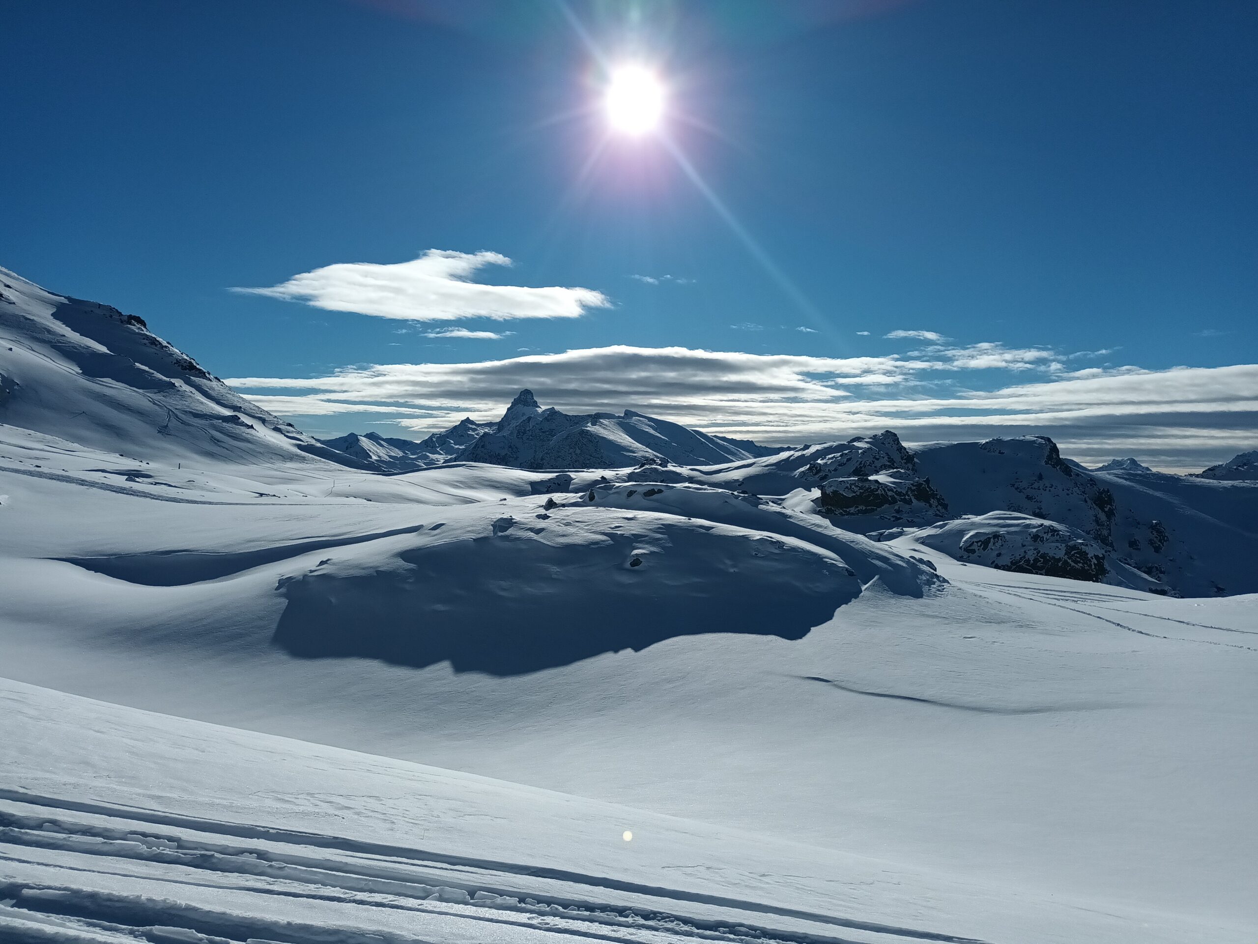
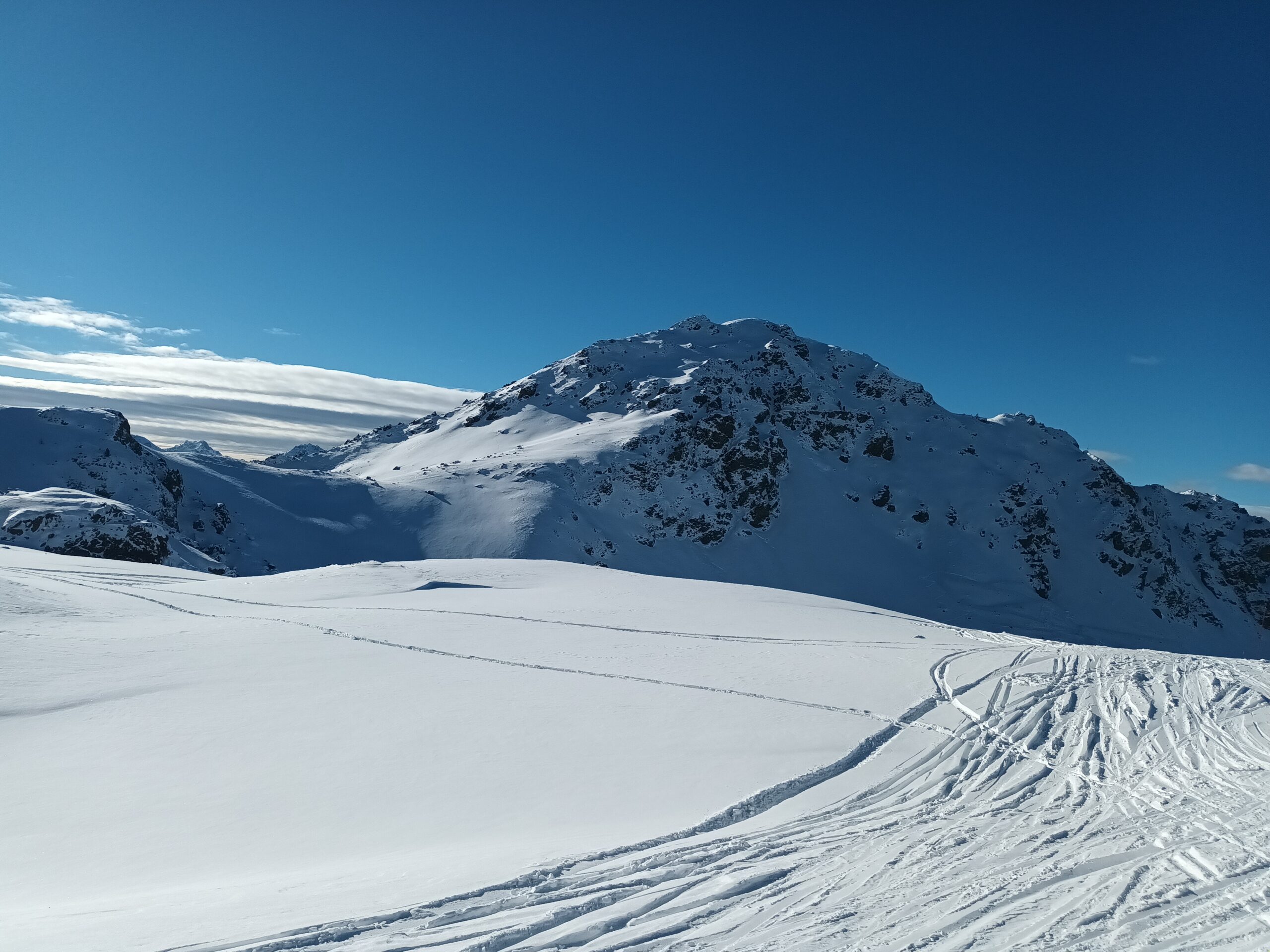
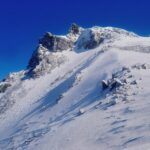
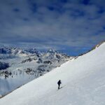
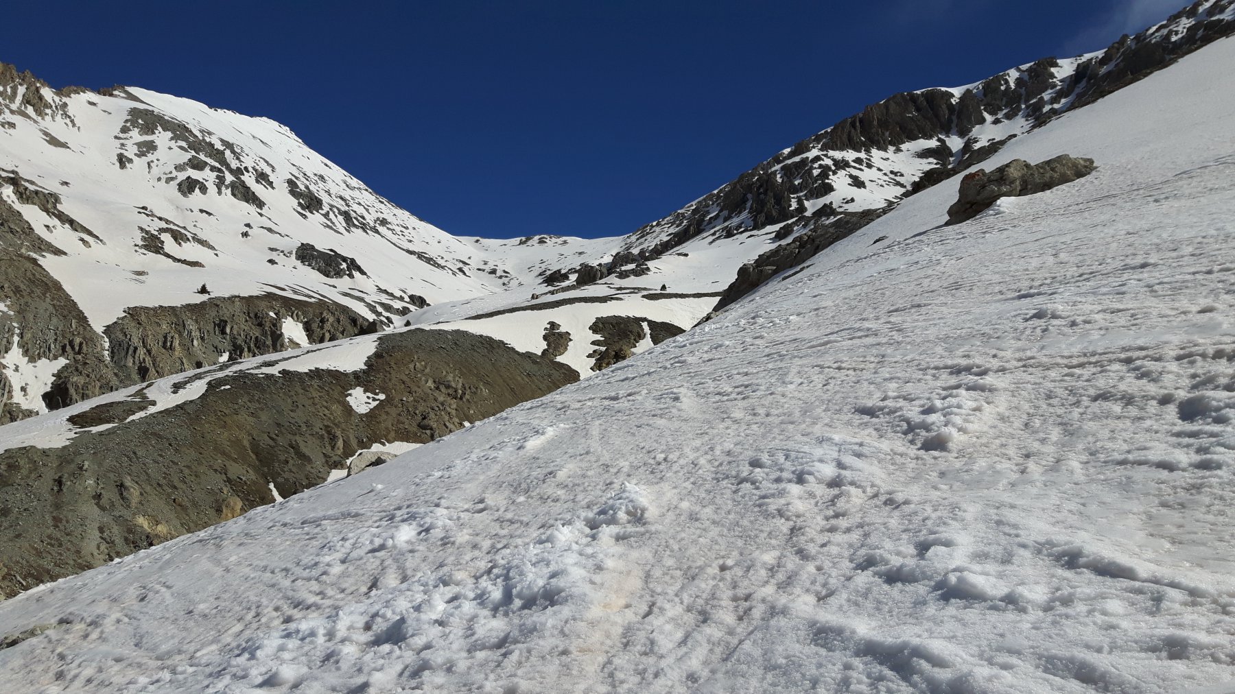
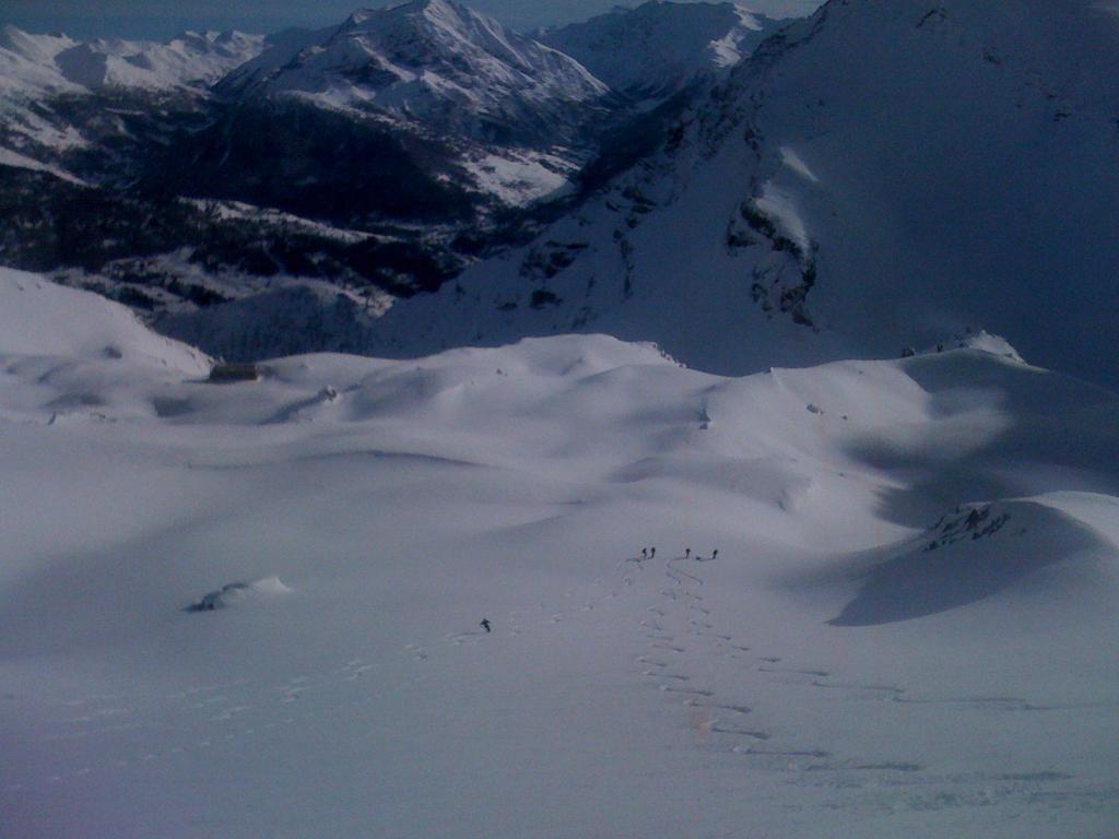
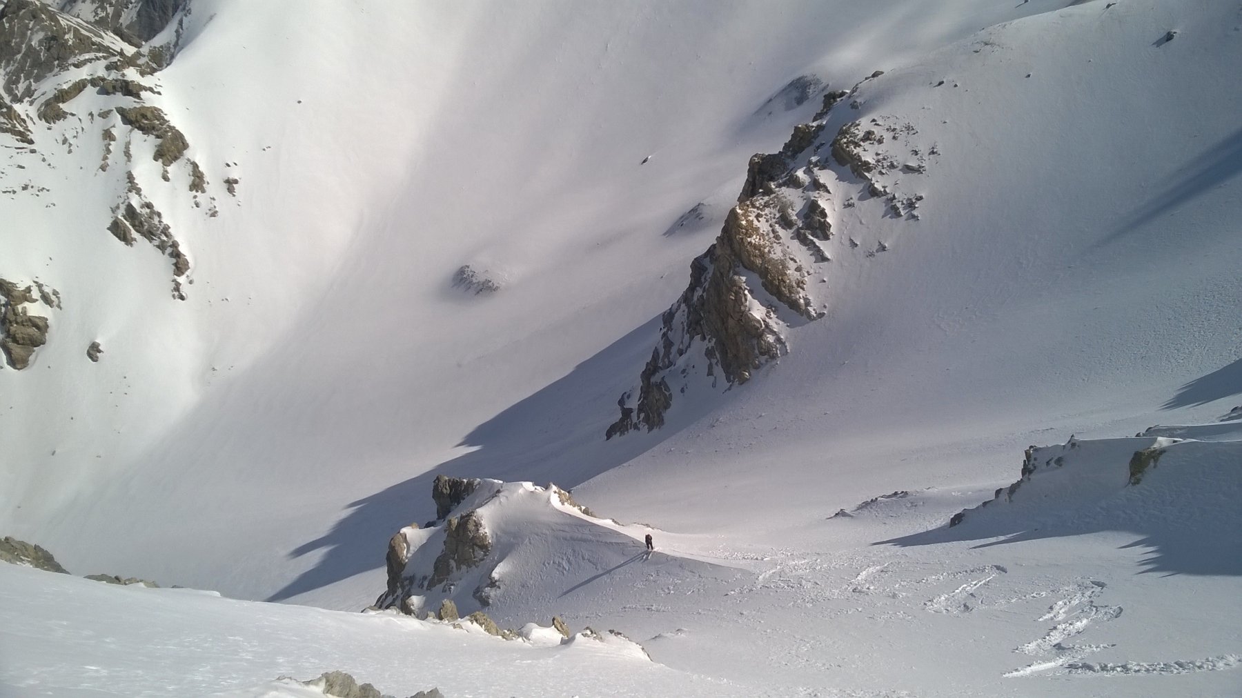
La salita diventa piuttosto ripida e in ambiente abbastanza severo. Si continua sempre verso la sinistra salendo fino a sbucare nella Valle dei Mandarini dove si può osservare il ripido pendio che chiude il vallone. Si sale faticosamente il vallone e nella parte finale ci si sposta verso destra dove la pendenza diminuisce e si sbuca nella stradina percorsa dalla pista che permette di scendere verso Claviere evitando il muro del Colletto Verde lato Claviere.
A questo punto il percorso coincide con la pista di discesa ma la “convivenza” si limita ad una cinquantina di metri i quali, tuttavia, vanno percorsi con molta attenzione per via degli sciatori che partono dal Colletto Verde e percorrono questo tratto di pista che si presenta piuttosto impegnativo (ripido e gobbuto).
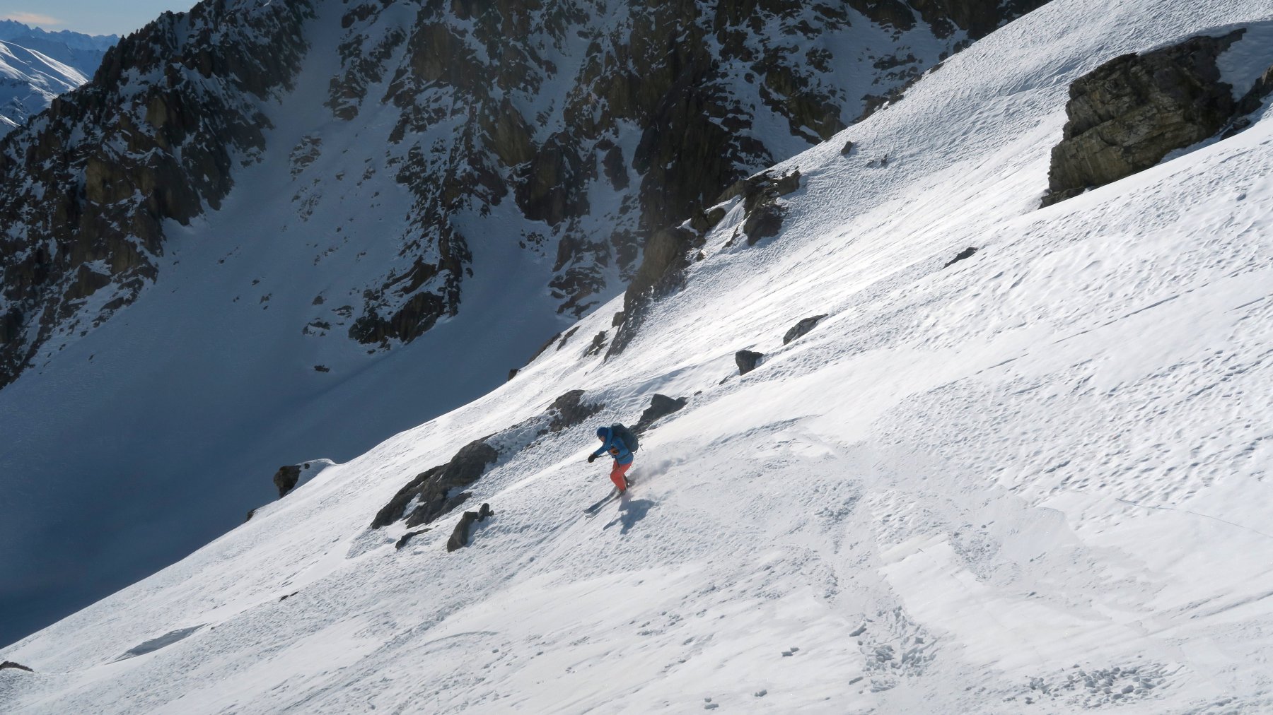
Per scendere sono presenti varie alternative. In caso di brutto tempo (o di brutta neve) si possono utilizzare le piste degli impianti che conducono fino alla partenza dell’itinerario. Tuttavia se le condizioni lo consentono è preferibile utilizzare in discesa uno dei “fuoripista” esistenti. Il più utilizzato è quello che percorre la Valle dei Mandarini il cui tratto finale è già stato usato in salita. La discesa per questo vallone è bellissima. Il vallone può essere affrontato o utilizzando il pendio finale (lo stesso usato in salita) che sbuca vicino alla pista di discesa (soluzione con minore pendenza), oppure è possibile percorrere un tratto della stradina che scende verso Claviere e, laddove si preferisce, abbandonarla per affrontare il vallone di discesa (soluzione con maggiore pendenza). In discesa mantenersi sulla destra orografica del vallone alternando traversi a discese verso il fondo del vallone. Si perviene, quindi, ad una largo pendio che scende verso sinistra. Al termine del pendio scendere il valloncello sulla destra mantenendosi un po’ in alto sul fianco destro. Dopo un breve tratto di bosco rado si attraversa un piccolo ponte in legno e si risale il piccolo pendio successivo sci ai piedi arrivando alla stazione di partenza della funivia Brousset. La discesa prosegue sulle piste fino al punto di partenza.
Nelle vicinanze Mappa
Itinerari
06/04/2026 Hautes-Alpes, Montgenèvre D+ 1227 m BS Sud-Ovest
Rochers Charniers (Pointe des) da Montgenèvre
 350m
350m
19/04/2026 Hautes-Alpes, Montgenèvre D+ 1500 m BSA Varie
Rochers Charniers (Pointe des) da Montgenevre, giro per Pian dei Morti e Colle dello Chaberton
 350m
350m
05/04/2026 Hautes-Alpes, Montgenèvre D+ 700 m MS Sud
Trois Freres Mineurs (Col des) da Montgenèvre
 350m
350m
30/01/2022 Hautes-Alpes, Montgenèvre D+ 1177 m OS Sud
Trois Scies (Pointe des) da Montgenèvre
 350m
350m
11/04/2026 Hautes-Alpes, Montgenèvre D+ 1290 m BS Varie
Chaberton (Monte) da Montgenèvre
 350m
350m
27/12/2010 Hautes-Alpes, Montgenèvre D+ 1307 m BS Sud
Rochers Charniers (Pointe des) da Montgenevre, traversata a Fenils
 350m
350m
15/02/2025 Hautes-Alpes, Montgenèvre D+ 1970 m BSA Sud-Est
Rochers Charniers (Pointe des) e Pointe de Chalanche Ronde da Montgenèvre, giro per il Colle dello Chaberton
 350m
350m
25/02/2024 Hautes-Alpes, Montgenèvre D+ 1350 m BSA Varie
Rochers Charniers (Pointe des) e Pointe de Chalanche Ronde da Montgenèvre, giro per il Passo dell’Asino
 350m
350m
07/01/2023 Hautes-Alpes, Montgenèvre D+ 1400 m BS Ovest
Chalanche Ronde (Pointe de) da Montgenèvre per il Passo dell’Asino
 350m
350m
27/12/2024 Hautes-Alpes, Montgenèvre D+ 651 m MS Sud
Alpet (Col del’) da Montgenèvre per il Vallon des Baisses
 350m
350m
Servizi
3.4Km
4.7Km
La vachette Bar
Montgenèvre
6.7Km
Casa Cesana Bar
Cesana Torinese
6.7Km
L’Ibarus Rifugio
Cesana Torinese
6.7Km
Piergiorgio Frassati B&B
Cesana Torinese
6.7Km
Ottima Scelta Ristorante
Cesana Torinese
7.3Km
Terre Rouge Rifugio
Cervières
9.5Km
Centro Ristorante
Cesana Torinese
9.9Km