5.7Km
5.7Km
Note
 50m
850m
2.8Km
2.8Km
2.8Km
2.8Km
50m
850m
2.8Km
2.8Km
2.8Km
2.8Km
Giro ad anello, con possibilità di effettuarlo più comodamente in 2 gg pernottando a La Thuile.
Nella salita al colle dell'Arp si incontra una fontana non sempre attiva. Nella discesa verso La Thuile ci sono dei punti acqua al Mayen de la Youla e appena più in basso. Prima di deviare per il vallone di Chavanne, conviene seguire ancora brevemente la statale per trovare un punto acqua ubicato nel parcheggio a valle del villaggio di Pont Serrand.
Avvicinamento
Nella salita al colle dell'Arp si incontra una fontana non sempre attiva. Nella discesa verso La Thuile ci sono dei punti acqua al Mayen de la Youla e appena più in basso. Prima di deviare per il vallone di Chavanne, conviene seguire ancora brevemente la statale per trovare un punto acqua ubicato nel parcheggio a valle del villaggio di Pont Serrand.
Da Aosta raggiungere in auto il paese di Pré Saint Didier. Appena oltre il paese lasciare la strada che sale a La Thuile e deviare a dx seguendo le indicazioni di Palleusieux. Si attraversa la Dora e in prossimità del primo tornante si abbandona la strada principale e ci si dirige a Planey. Parcheggiare appena dopo aver attraversato un piccolo ponticello in legno.
Descrizione
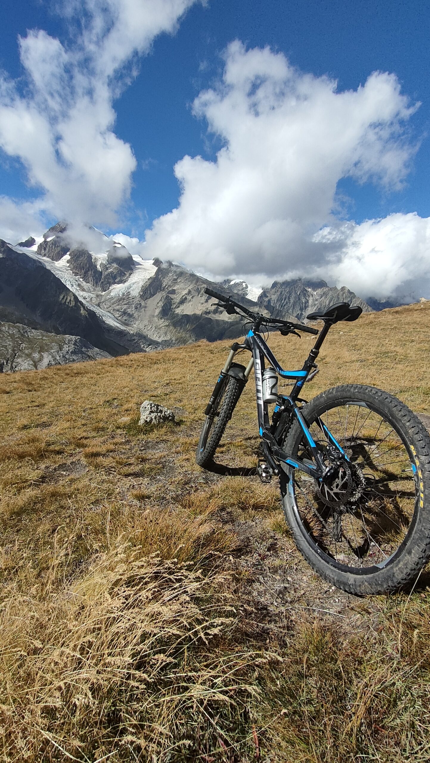
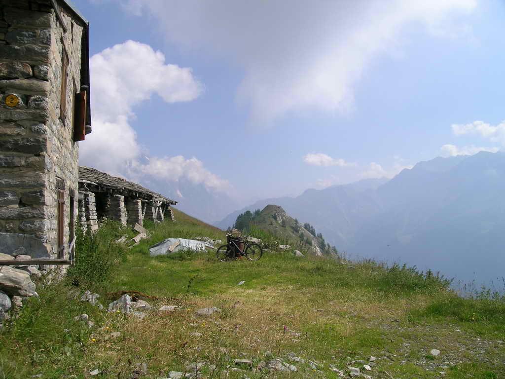
Lasciata l’auto, si segue la stradina consortile che sale nel Vallone dell’Arp. Inizialmente la strada è asfaltata per poi lasciare posto a una bella poderale. Nei pressi di Arp Damon (2.140 m) la strada termina e bisogna spingere la bici fino al colle dell’Arp.
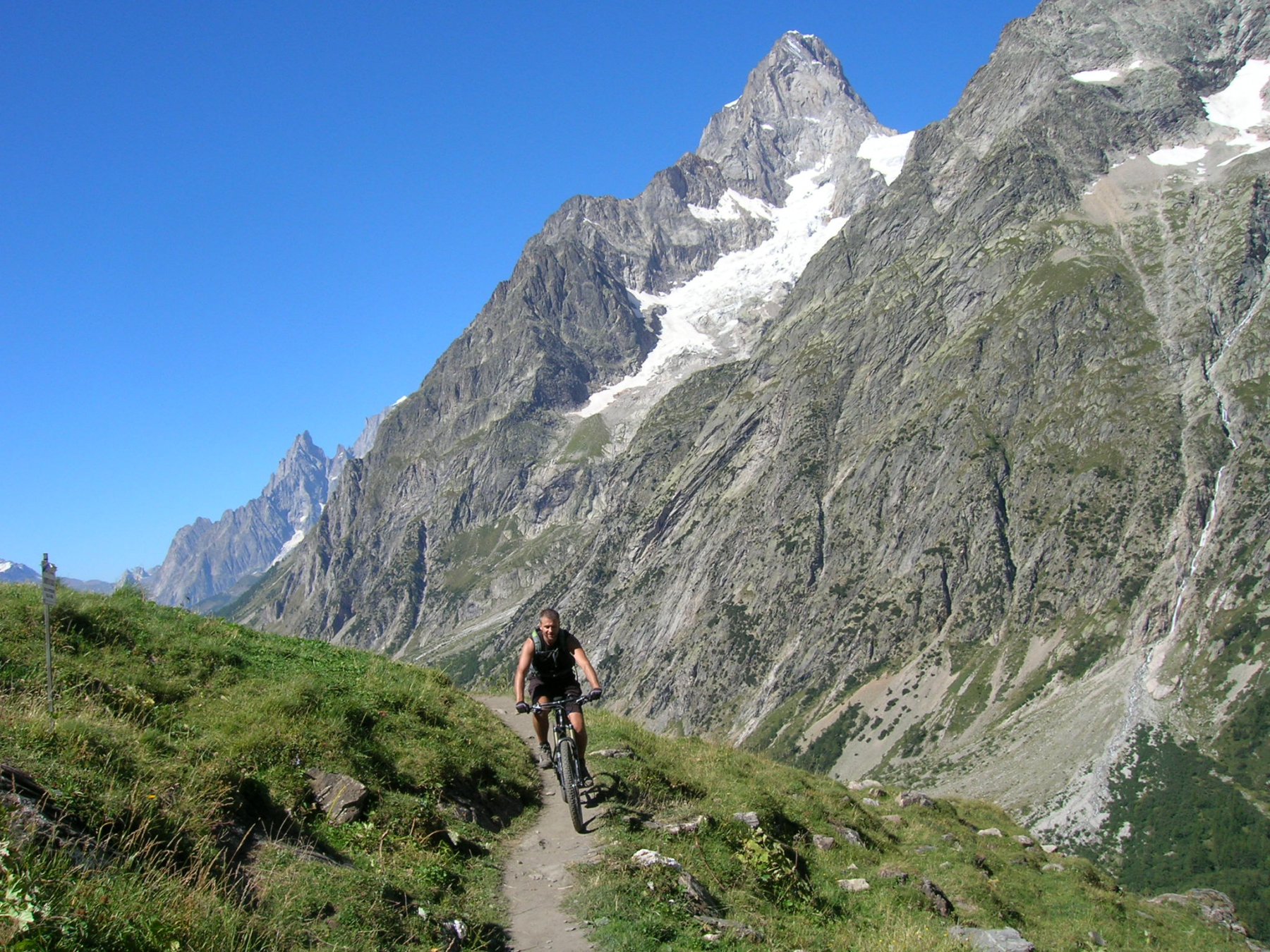
Dal colle ci si tuffa in discesa verso La Thuile inizialmente su sentiero ciclabile. Segue un lungo tratto su rettilinea poderale, per poi trovare asfalto al Mayen de la Youla (2.040 m). Giunti a quota 1.550 m in corrispondenza di un tornante, si lascia l’asfalto e si segue il sentiero che conduce al paese di La Thuile. Prima di giungere in paese, il sentiero attraversa 4 canaloni (un paio sono molto scomodi da passare con la bici tenuta al fianco).
Dal paese di La Thuile si segue la strada che conduce al colle del piccolo San Bernardo fino alla deviazione posta a valle della fraz di Pont Serrand.
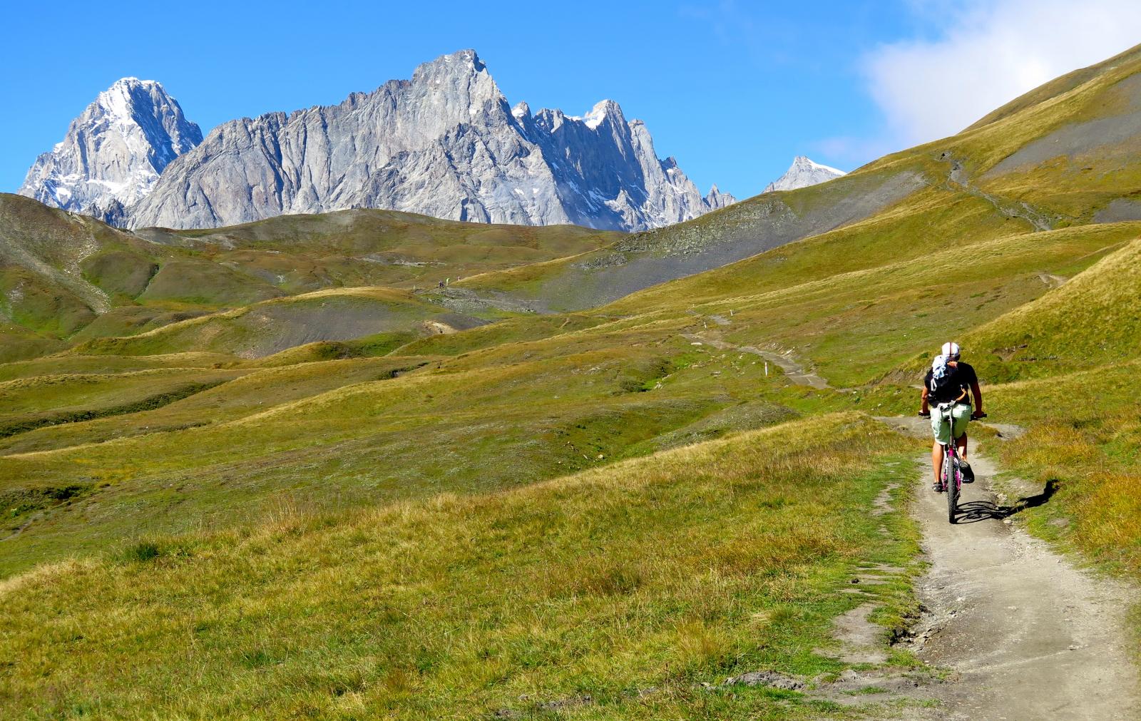
Si inizia a salire su asfalto per poi proseguire sulla poderale che si addentra nel vallone di Chavanne.
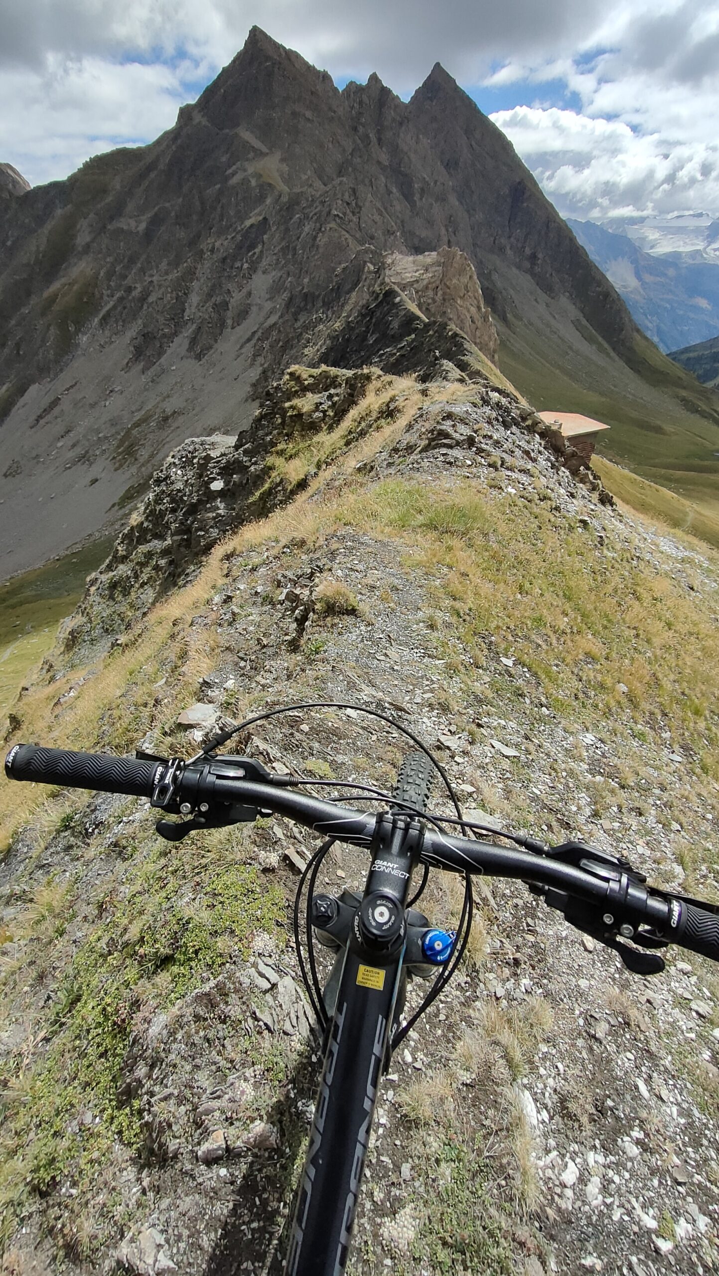
In fondo al vallone si incontrano un paio di tornanti con pendenza più accentuata e fondo più sconnesso. Gli ultimi metri prima di scollinare sono su single track con poca pendenza.
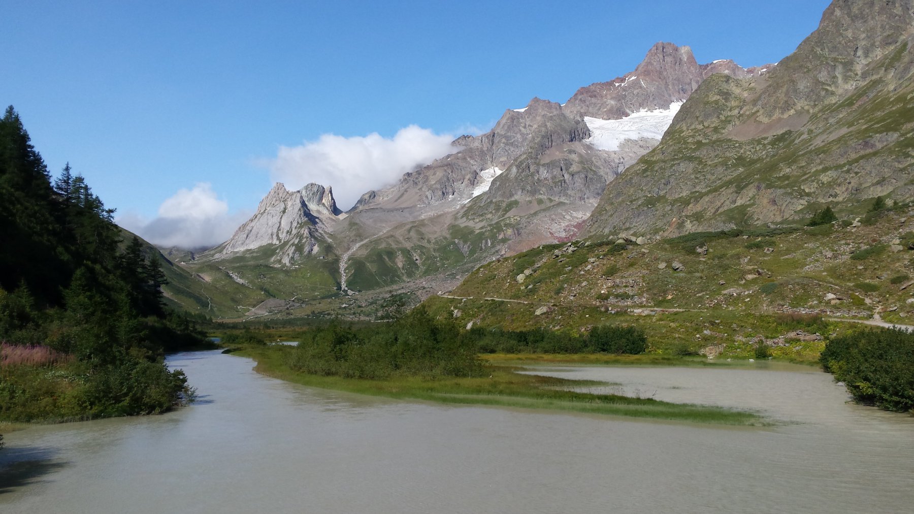
Dal colle il sentiero di discesa verso la Val Veny è molto esposto e sconnesso per almeno 200 m prima di diventare più mansueto. Un bellissimo single track permette poi di raggiungere la strada poderale del rifugio Elisabetta Soldini. La poderale è inizialmente piena di ciottoli per poi diventare più scorrevole una volta raggiunto il pianoro dei laghi Combal.
Si scende successivamente su asfalto tutta la Val Veny. Si passa davanti alla chiesa di Notre Dame de la Guerison e si scende speditamente fino al ponte. Una volta giunti al ponte, lasciare la strada principale e seguire il tracciato che porta a Entrelevie (rischio caduta massi, anche di enormi dimensioni).
Si transita davanti il palasport di Courmayeur e si sale brevemente la strada di Dolonne fino al suo termine. Qui, una poderale che transita sotto i piloni dell’autostrada permette di tornare all’auto.
Nelle vicinanze Mappa
Itinerari
01/08/2009 AO, Pré-Saint-Didier D+ 1100 m MC, MC, S0 Est
Arp (Alpe) da Pre Saint Didier
 50m
50m
03/08/2018 AO, Pré-Saint-Didier D+ 3500 m OC, BC+, S3 Varie
Bard, Citrin, Malatrà (Colli) da Prè Saint Didier, giro della Valdigne
850m
18/07/2025 AO, Pré-Saint-Didier D+ 1650 m BC, BC+, S1 Tutte
Chavannes (Col de) da Prè Saint Didier, discesa in Val Veny
850m
04/08/2018 AO, Pré-Saint-Didier D+ 2900 m MC, TC, S1 Tutte
Seigne (Col de la) da Pré Saint Didier, giro per Bourg Saint Maurice e Colle del Piccolo San Bernardo
 850m
850m
19/08/2018 AO, Pré-Saint-Didier D+ 2000 m OC, OC, S3 Tutte
Liconi (Testa di) da Prè Saint Didier, giro
850m
23/08/2004 AO, Courmayeur D+ 1600 m BC, BC, S1 Varie
Fortin (Mont) da Courmayeur, giro
2.8Km
25/08/2016 AO, Courmayeur D+ 1940 m BC, BC+, S2 Varie
Entre Deux Sauts (Tète) da Courmayeur, giro
 2.8Km
2.8Km
15/09/2019 AO, Courmayeur D+ 1040 m BC, BC, S2 Est
Seigne (Col de la) e Rifugio Elisabetta Soldini da Courmayeur per il lac Combal
 2.8Km
2.8Km
15/07/2015 AO, Courmayeur D+ 1700 m BC, BC, S0 Tutte
Tour del Monte Bianco (CCW) Tappa 1: Courmayeur – Champex
 2.8Km
2.8Km
08/09/2024 AO, Courmayeur D+ 10000 m OC+, OC+, S5 Tutte
Tor des Geants in MTB
 2.8Km
2.8Km