250m
250m

Note
 2Km
2.6Km
2.9Km
2.9Km
2.9Km
3.5Km
2Km
2.6Km
2.9Km
2.9Km
2.9Km
3.5Km
250m
1.3Km
2.9Km
3.8Km
4.4Km
6.2Km
6.4Km
6.7Km
6.8Km
6.9Km
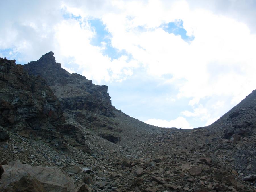
Il dislivello tiene conto di alcuni saliscendi. Lo sviluppo e’ tra i 18 e i 19 km. I sentieri sono per lo piu’ visibili, ma le indicazioni spesso non ci sono piu’, in modo particolare laddove si attraversano borgate e/o sono state tracciate nuove poderali non presenti in cartina. Molto interessante l’Arboretum Vescoz. Itinerario adatto anche ai mesi invernali data l’esposizione solatia.
Avvicinamento
Dalla To-Ao uscire a Chatillon e proseguire verso Aosta. Oltrepassare la rotonda della localita’ Champagne e svoltare a destra ad angolo retto alla stradina in salita successiva (in corrispondenza di un limitatore di velocita’ sulla sinistra – indicazioni per Champlong). Il parcheggio e’ lungo la strada ed e’ segnalato. In alternativa, dal parcheggio si puo’ continuare dritto superando l’incrocio di Oley ed entrare nel piccolo abitato lasciando l’auto in una piccola piazza sulla destra (qualche posto).
Descrizione
Dal parcheggio si continua dritto sulla strada asfaltata attraversando Cretaz. Usciti dal paese, si imbocca una sterrata (paline) all’apice di una curva a destra. Si costeggia il torrente fino al primo ponticello, dove si volge a sinistra per il sentiero n.3 (bollo giallo al di la’ del ponte). Tra stradina, mulattiera e sentiero si sale toccando diversi piccoli nuclei abitati, Here’ Dessous e Dessus (bella chiesetta), Vallet e infine Baravette (q. 968), dove ci si immette in una sterrata (palina). La si segue sino ad un bivio di poderali, dove si continua dritto fino alla strada asfaltata. Si svolta a destra e in breve si raggiungono le case di Moulin. Si sale a sinistra per la prima stradina che si incontra e si prosegue fino ad incrociare un’altra strada: qui si gira ancora a sinistra, in fondo e’ gia’ visibile l’ingresso ad arco dell’”Arboretum Vescoz”.
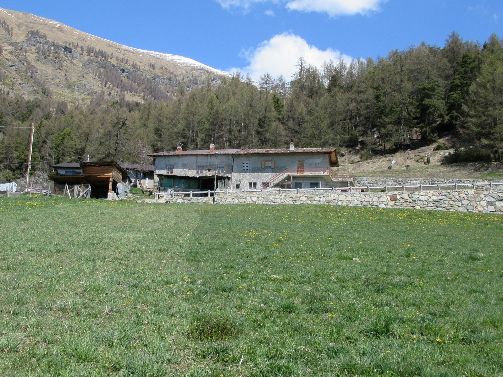
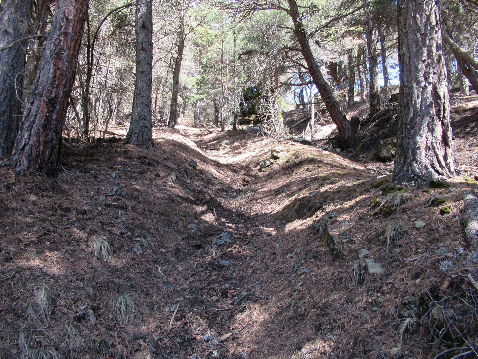
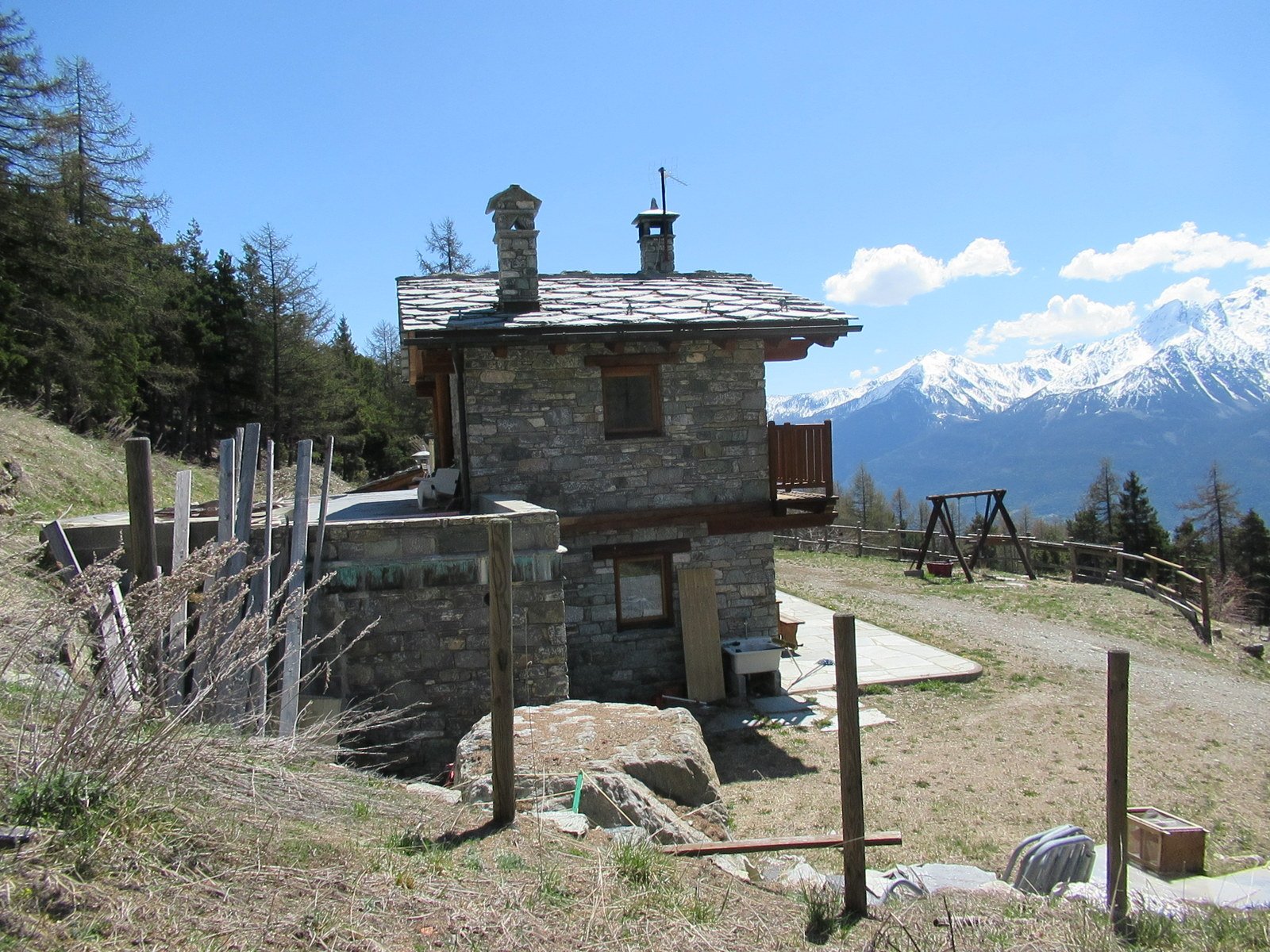
A questo punto vi sono due opzioni: continuare su uno dei sentieri indicati nella tabella illustrativa dell’Arboretum (se lo si vuole visitare) fino a confluire a q. 1200 circa nel sentiero 2 oppure imboccare subito il sentiero 2, che parte poco dopo l’entrata dell’Arboretum. Anche in questo secondo caso si ha comunque la possibilita’ di vedere alcuni esemplari di alberi presenti nel giardino botanico. Se si e’ scelto di salire sul 2, a q. 1140 circa, nei pressi di un pilone votivo, occorre trascurare una palina che indica di andare a destra per il Col des Bornes, rimanendo invece sul 2. Si arriva a Dorinaz, dove si oltrepassa la strada asfaltata proseguendo proprio di fronte e a q.1380, ormai in vista di Grand Villa, si sbuca in una stradina che va percorsa fino alla prima curva a sinistra, qui la si abbandona salendo per prati e puntando ad una evidente rampa di accesso al fondo. Si attraversa poi la carrozzabile per Champlong trovando un tratto di mulattiera. Poco oltre, dopo un nuovo attraversamento, si risale il pascolo in direzione di una baita isolata e diroccata (Semont) e superatala, si continua la salita verso le case di Fontane. In prossimita’ della piccola borgata, si volge a destra, poi a sinistra sulla stradina asfaltata. Fatti pochi metri, si ritrova il sentiero, molto incassato, che risale il bosco di conifere. In alcuni punti e’ ostruito da alberelli caduti e arbusti, che sono tuttavia aggirabili. Lo si segue abbastanza bene grazie anche ad alcuni ometti. Giunti alla nuova e bella baita di Ronc, si prosegue sul retro della casa (ometti). Si attraversa un paio di volte una sterrata sino ad immettersi nella stessa volgendo a sinistra. In breve si incontra il bivio con la poderale per il Col des Bornes (n.6 – paline) dove si volta a destra (q. 1815). Si sale ancora qualche metro per poi scendere gradualmente fino alla vasta area aperta del colle (m.1780).
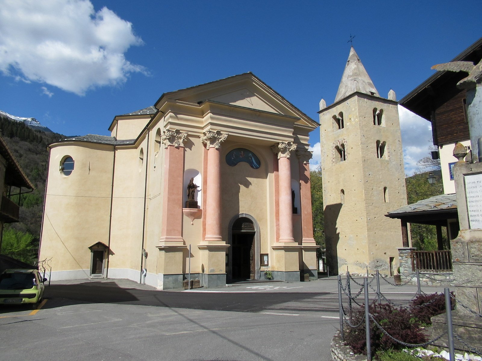
Si continua la discesa a destra sino all’area pic-nic di Champlong (sentiero 1) proseguendo poi per Clavon. In alternativa, prima dell’area pic-nic si puo’ lasciare la poderale svoltando a sinistra in corrispondenza di una palina che indica il Col des Bornes e reperire una traccia che con un mezzacosta a sinistra conduce a Clavon (piu’ breve). Si passa fra le case o a monte di esse (poderale) svoltando poi a destra e, per un bel tratto di mulattiera, si raggiunge Lozon. Si mantiene la direzione fino al termine del villaggio, dove si prosegue dritto trascurando le piste agricole a sinistra e a destra e le fuorvianti tacche gialle sul muretto in pietra di destra. Si rientra nel bosco e in breve si giunge al bivio con il sentiero 4 (paline), che si trascura. Per mulattiera e stradina si arriva a Tessella, dove si attraversa la carrozzabile verso sinistra. Si imbocca subito dopo una nuova sterrata sulla destra (qualche saliscendi) e si continua sino a reperire un sentierino sulla sinistra che riporta al bivio con il sentiero 2 nei pressi del pilone votivo. Si scende quindi per il tragitto dell’andata proseguendo poi fino alla chiesa di Verrayes e alla piazza antistante. Ci si dirige verso la fontana (bollo giallo n. 1 sulla vasca) e si imbocca un sentiero che nei pressi di una stalla sfocia in una pista agricola. Si continua dritto tralasciando la poderale di destra (n.3) e scendendo poi per prati, dopo un breve tratto il sentiero ritorna evidente. Raggiunte le case di Marseiller, si volta a sinistra entrando nell’abitato e, all’incrocio con la strada regionale per Verrayes, si scende a destra fino al primo tornante. Da qui per stradina e ripido sentiero si ritorna alla sterrata percorsa all’andata, poco piu’ a monte del ponticello dove la si era lasciata.
- Cartografia:
- Carta dei Sentieri n. 13 - Valle Centrale - L'ESCURSIONISTA Editore
Nelle vicinanze Mappa
Itinerari
24/11/2012 AO, Chambave D+ 1869 m E Sud
Aver (Becca d’) da Champagne per la diretta del versante sud
50m
12/06/2021 AO, Verrayes D+ 208 m T Sud
Cammino Balteo tappa n.9 da Verrayes a Nus
 2Km
2Km
14/05/2014 AO, Chambave D+ 700 m E Nord
Ponton (Bosco di) da Thuy
 2.6Km
2.6Km
05/04/2026 AO, Chambave D+ 1250 m E Varie
Saint Evence (Cappella di) da Chambave, anello per il Colle di San Pantaleone
 2.9Km
2.9Km
20/09/2015 AO, Fenis D+ 1620 m E Nord
Varotta (Col) da Arbussayes
 2.9Km
2.9Km
16/04/2026 AO, Fenis D+ 900 m E Nord
Tolomon (Bec) e Morgnettaz da Arbusseyes, anello per Cerise
 2.9Km
2.9Km
12/11/2013 AO, Fenis D+ 987 m E Nord
Ponton (Alpe) da Arbussayes per il vallone del Ponton
2.9Km
01/11/2020 AO, Fenis D+ 1960 m E Varie
Corquet (Monte) da Fenis, anello per vallone del Pieiller e Val Clavalitè
3.1Km
26/03/2022 AO, Fenis D+ 470 m E Sud
Cammino Balteo tappa n.20 da Fenis a Chatillon
3.1Km
11/04/2026 AO, Verrayes D+ 1057 m E Sud
Aver (Becca d’) e Cima Longhede da Grand Villa
 3.5Km
3.5Km
Servizi
250m
1.3Km
Maison Tersiva B&B
Nus
2.9Km
Mathamel Giorgio B&B
Verrayes
3.8Km
Chez Gaillard B&B
Fenis
4.4Km
Blanche Neige Bar
Verrayes
6.2Km
Maison Rosset Rifugio
Nus
6.4Km
Favre Ristorante
Nus
6.7Km
Saint Barthelemy Albergo
Verrayes
6.8Km
del Diavolo Ristorante
Saint-Marcel
6.9Km