 1.2Km
1.2Km


Note
 50m
50m
50m
50m
50m
50m
50m
50m
50m
750m
50m
50m
50m
50m
50m
50m
50m
50m
50m
750m
1.2Km
3.1Km
3.2Km
6.2Km
8.6Km
8.9Km
8.9Km
9.1Km
10Km
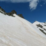
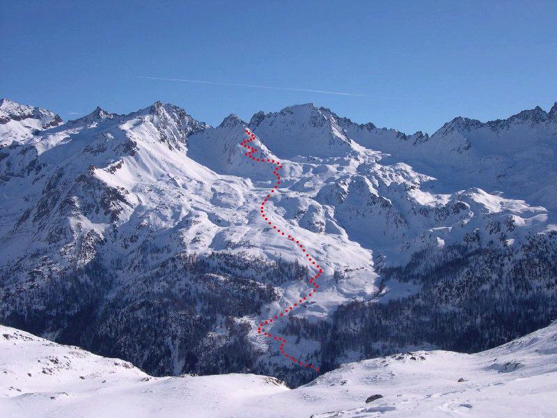
La punta 3214 m, senza nome ma quotata su cartografia IGM è una piccola punta lungo la cresta che scende a Sud dalla Testa del Rutor. Gita abbastanza lunga, con finale tecnico lungo il canale N-NE. Bella salita alternativa alle classiche della zona Arp Vieille e Forclaz du Bre. Il canale finale è piuttosto ripido e lungo, richiede neve sicura.
Zona poco frequentata ma sicuramente interessante.
Avvicinamento
Zona poco frequentata ma sicuramente interessante.
Raggiungere la frazione Bonne. La strada che costeggia il lago di Beauregard sulla sponda sinistra idrografica della valle è in genere chiusa nella stagione invernale poco dopo il paese.
Descrizione
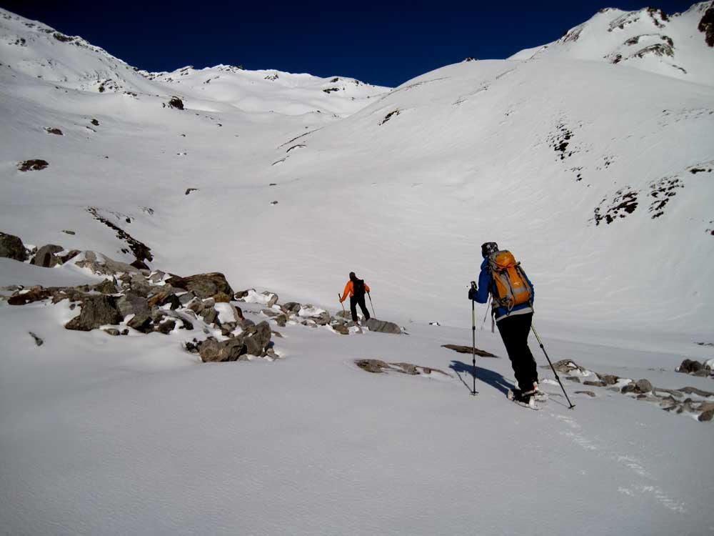
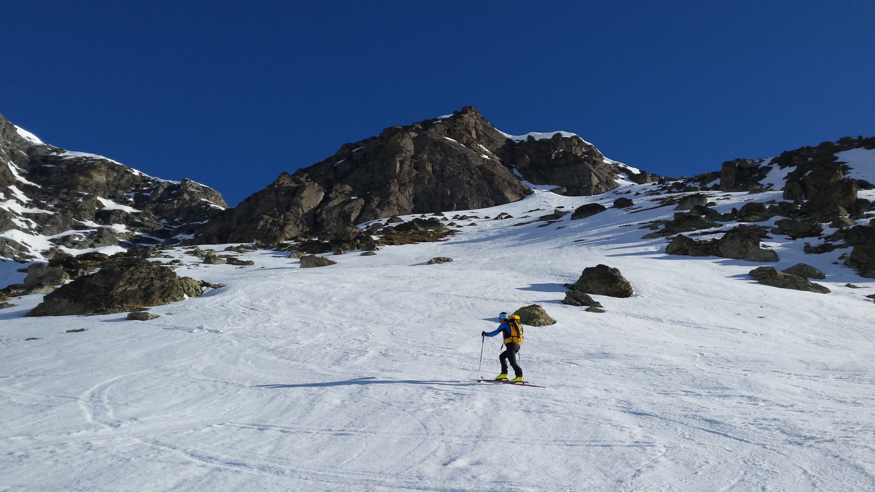
Prima di Menthieu si gira a destra (1848m, cartelli) per la sterrata (primo bivio a sinistra) che porta prima alla casa di Bochat poi, nel bosco e per pendii aperti, sale a Meillares (2161m).
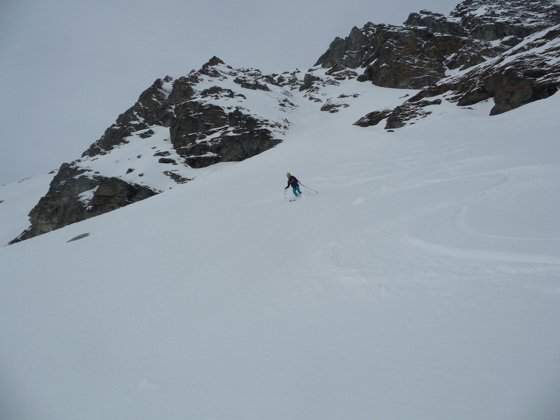
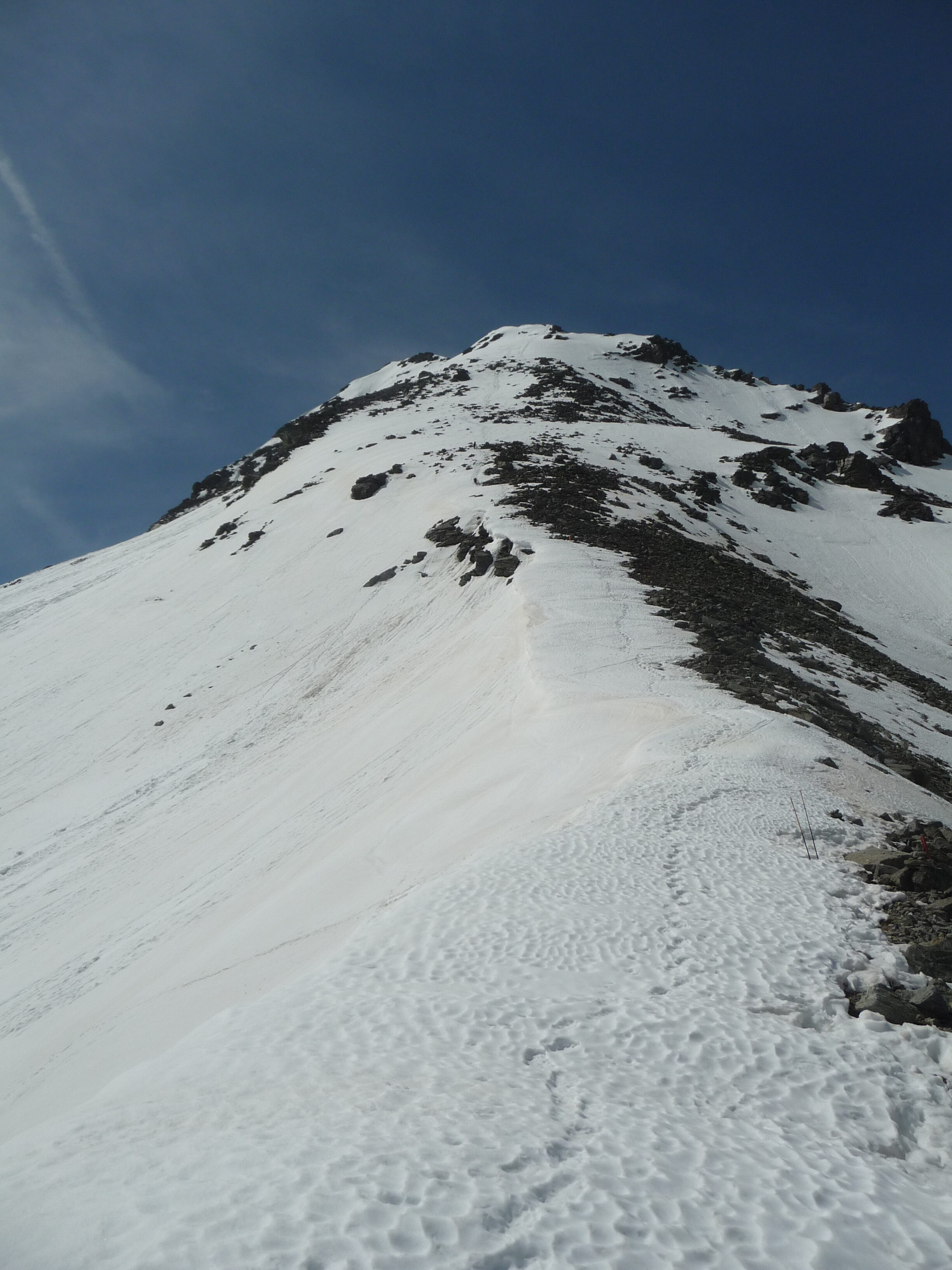
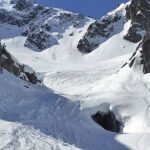
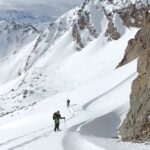
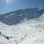
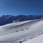
Si prosegue sul fondo del vallone, tra dossi e valloncelli, si lascia sulla sinistra il pendio che porta al ricovero Ricci e all’Arp Vielle, si supera il pianetto centrale e si giunge ai piedi del pendio che va alla Forclaz du Bre, da qui si gira a destra (direzione Nord) risalendo i ripidi pendii che portano ad un pianoro dal quale girando leggermente a sinistra è visibile il ripido canale che porta alla vetta. Il canale è sostenuto con pendenza intorno ai 35° ma comunque ampio e percorribile sci ai piedi (da valutare in caso di ghiaccio). Alla fine del canale (circa 400 m di dislivello) spostarsi a sinistra ed uscire in punta. Ampio e comodo pianoro con bellissima vista. Per la discesa seguire il percorso di salita.
- Cartografia:
- Tavoletta IGM 1:25.000 Valgrisanche
Nelle vicinanze Mappa
Itinerari
12/05/2023 AO, Valgrisenche D+ 769 m BS Sud
Brune (Roche) da Bonne
 50m
50m
17/06/2024 AO, Valgrisenche D+ 674 m MS Nord-Est
Pelà (Mont) da Bonne
 50m
50m
03/02/2024 AO, Valgrisenche D+ 2300 m BSA Tutte
Avernet, Montseti, Mont, Rutor (Colli) da Bonne, giro della Testa del Rutor
 50m
50m
15/05/2022 AO, Valgrisenche D+ 2240 m BS Tutte
Forclaz du Brè, Sachere, Montseti, du Mont (Colli) da Bonne, tour du Bec de l’Ane
 50m
50m
06/04/2025 AO, Valgrisenche D+ 1647 m BSA Varie
Rutor (Testa del) da Bonne, traversata a La Thuile
 50m
50m
02/05/2025 AO, Valgrisenche D+ 1102 m BS Sud-Est
Angeli (Rifugio degli) ex Scavarda da Bonne
 50m
50m
18/04/2026 AO, Valgrisenche D+ 1019 m BS Est
Forclaz du Brè da Bonne
 50m
50m
10/06/2026 AO, Valgrisenche D+ 1153 m MS Est
Arp Vieille (Mont) da Bonne
 50m
50m
23/05/2026 AO, Valgrisenche D+ 1676 m BSA Nord-Est
Rutor (Testa del) da Bonne
 50m
50m
20/01/2019 AO, Valgrisenche D+ 1305 m BS Ovest
Feluma (Costa) quota 2957 m da Valgrisenche
 750m
750m
Servizi
1.2Km
3.1Km
Chalet de L’Epée Rifugio
Valgrisenche
3.2Km
Degli Angeli Rifugio
Valgrisenche
6.2Km
Paramont Albergo
Arvier
8.6Km
Grande Rousse Albergo
Rhêmes-Notre-Dame
8.9Km
Tanini Ristorante
Rhemes-Notre-Dame
8.9Km
Lo Sabot Albergo
Rhemes-Notre-Dame
9.1Km
Galisia Albergo
Rhemes-Notre-Dame
10Km


