4.6Km
4.6Km

Note
Storico
 50m
1.4Km
8.6Km
8.7Km
8.9Km
9.8Km
10.8Km
11.4Km
50m
1.4Km
8.6Km
8.7Km
8.9Km
9.8Km
10.8Km
11.4Km
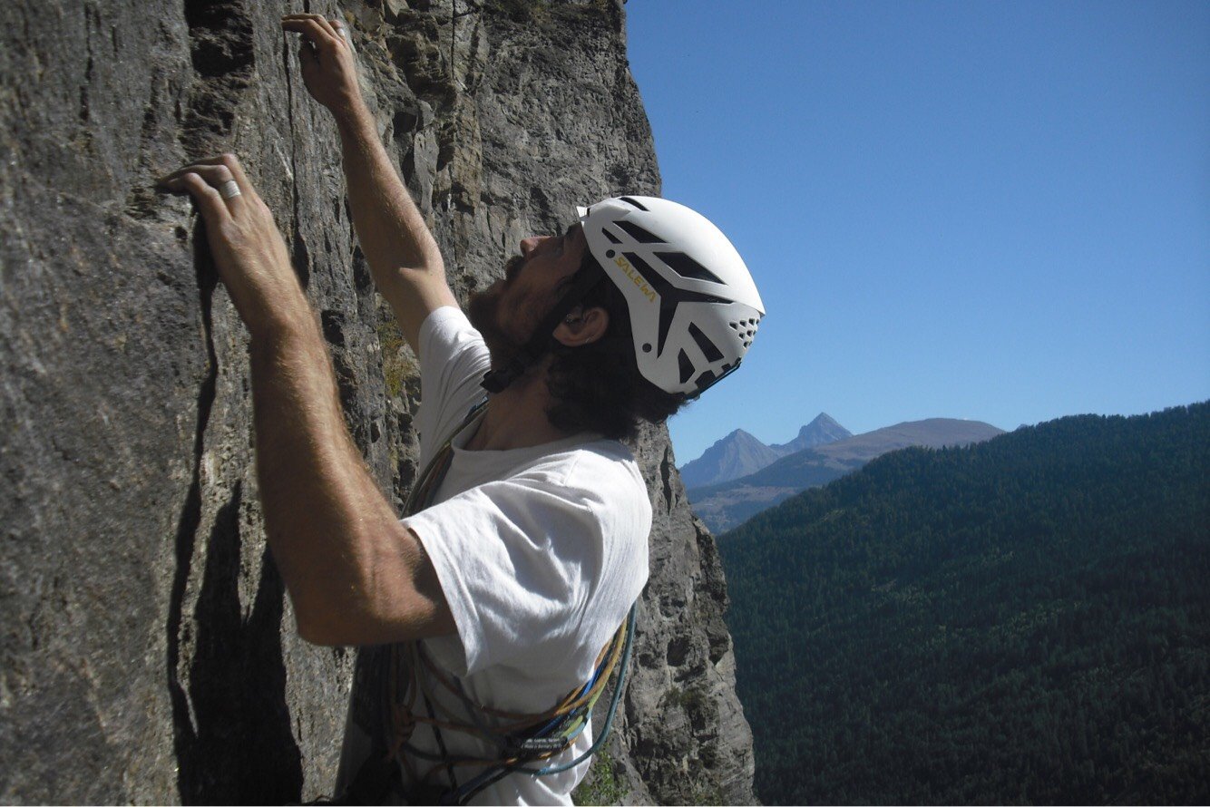
Casco
2 mezze corde da 60m
12 rinvii
Un paio di slunghi
Friends: sufficienti dal 0.3 al 1.0 della black diamond
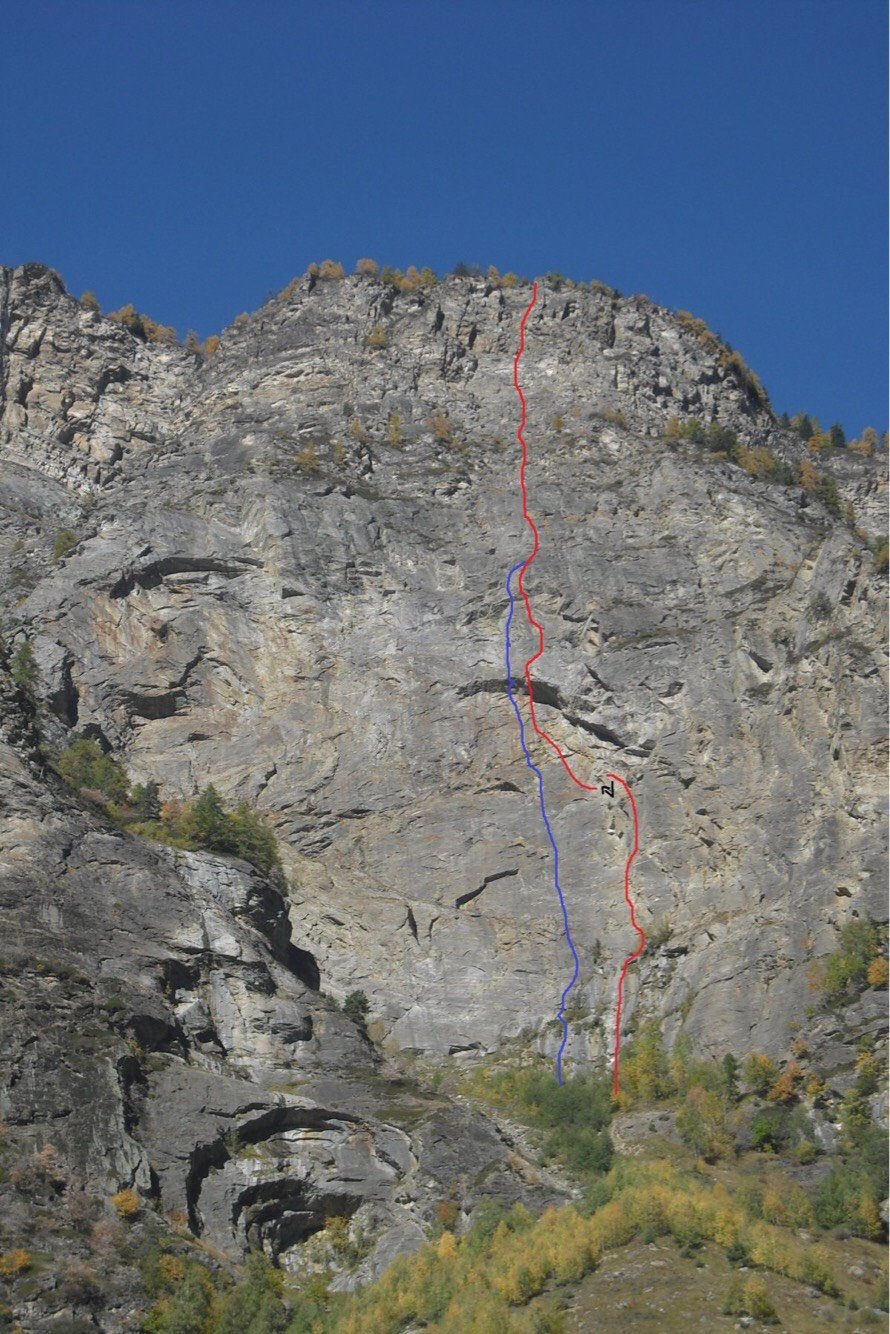
La via non ha bisogno di grandi spiegazioni perché basta seguire l’evidente linea di spit. È stata chiodata con spit kinobi 10x80. Le soste presentano 2 spit con anello di calata e sono collegate con un cordone verde. La via ad oggi NON è ancora completamente liberata quindi i gradi sono esclusivamente per dare un idea del livello necessario alla progressione.
Avvicinamento
2 mezze corde da 60m
12 rinvii
Un paio di slunghi
Friends: sufficienti dal 0.3 al 1.0 della black diamond
La via non ha bisogno di grandi spiegazioni perché basta seguire l’evidente linea di spit. È stata chiodata con spit kinobi 10x80. Le soste presentano 2 spit con anello di calata e sono collegate con un cordone verde. La via ad oggi NON è ancora completamente liberata quindi i gradi sono esclusivamente per dare un idea del livello necessario alla progressione.
Autostrada A5, uscita Aosta Ovest, direzione Courmayeur. Superato l'abitato di Villeneuve, svoltare verso la valle di Rhemes. Dopo l'abitato di Introd, in prossimità di una casetta dell'acquedotto, a circa 8km dalla statale, poco prima di giungere a Rhemes-Saint-George, percorrendo un rettilineo si noterà una strada che scende verso destra. Percorsi circa 200m in discesa parcheggiare in prossimità del ponte che attraversa la Dora di Rhemes.
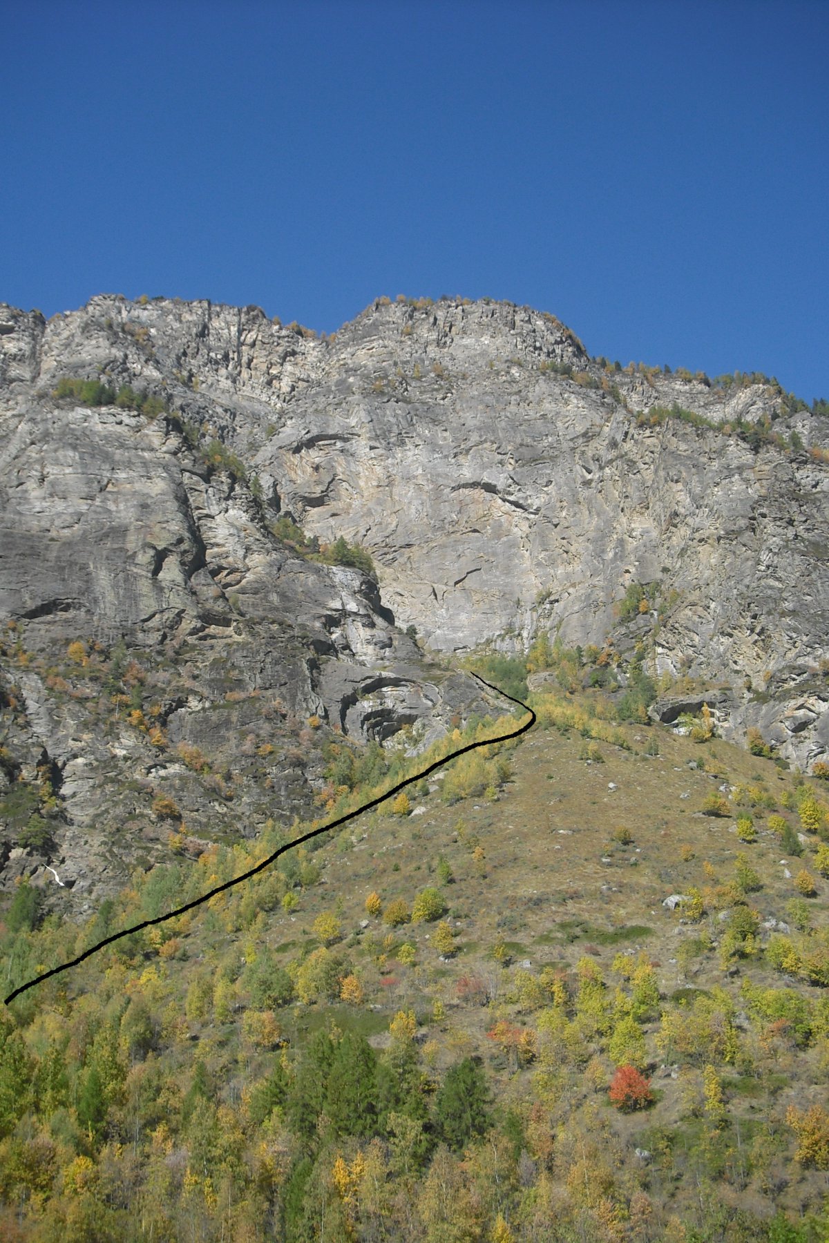
Superare il ponte e percorrere la strada sterrata per circa 100m fino a superare il primo tornante. Subito dopo, 50m circa, alla fine di muro di contenimento salire sul prativo e attraversarlo in diagonale fino ad entrare nel bosco ed incontrare l'impluvio (superato un tronco abbattuto si arriva ad un grosso masso grigio). Da qui imboccare il letto del torrente asciutto e risalirlo fino alla pietraia che adduce alla base della parete (mantenendosi sulla sinistra seguendo gli ometti segnavia). Giunti alla base del paretone l'attacco della via si trova all'estrema destra. 45m dalla macchina.
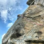
Descrizione
Superare il ponte e percorrere la strada sterrata per circa 100m fino a superare il primo tornante. Subito dopo, 50m circa, alla fine di muro di contenimento salire sul prativo e attraversarlo in diagonale fino ad entrare nel bosco ed incontrare l'impluvio (superato un tronco abbattuto si arriva ad un grosso masso grigio). Da qui imboccare il letto del torrente asciutto e risalirlo fino alla pietraia che adduce alla base della parete (mantenendosi sulla sinistra seguendo gli ometti segnavia). Giunti alla base del paretone l'attacco della via si trova all'estrema destra. 45m dalla macchina.
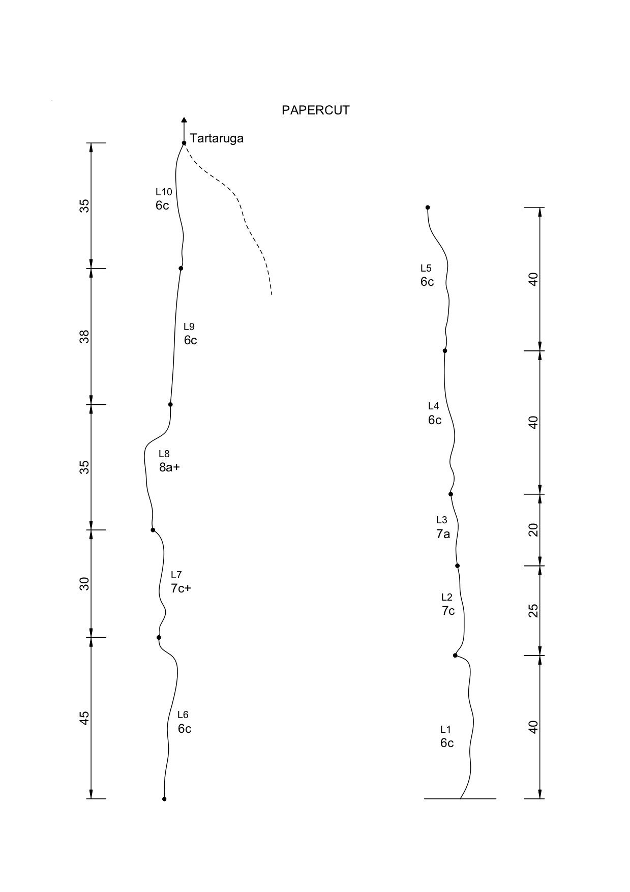
L1: 40m / 6c seguire la linea di spit che parte a sinistra di “tartaruga volante”. È possibile integrare le protezioni lungo la metà della tiro.
L2: 25m / 7c? su questa lunghezza la roccia non è sana. Non farsi scoraggiare da qui in avanti la situazione cambia decisamente in meglio!
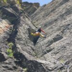
L3: 20m / 7a
L4: 40m / 6c
L5: 40m / 6c
L6: 45m / 6c lunghezza da integrare nella prima parte
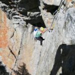
L7: 30m / 7c+?
L8: 35m / 8a+?
L9: 38m / 6c
L10: 35m / 6c sosta in comune con L11 di “tartaruga volante”. Da qui parte L12 (7a) e si può proseguire per “tartaruga”.
Discesa: in doppia lungo la via
2018 - Edoardo Saccaro
Nelle vicinanze Mappa
Itinerari
15/10/2017 AO, Introd 8a, 7a obbl. Sud-Est
Sarral (Pietra di) – Tartaruga Volante
 50m
50m
20/08/2020 AO, Introd 7c+, 7a obbl. Est
Val di Rhemes – Megabat
 1.4Km
1.4Km
22/06/2025 AO, Arvier 6b, 6a obbl. Nord
Planaval (Parete di) – A destra di la Fete du Village
8.6Km
06/09/2025 AO, Arvier 6a, 5c obbl. Sud
Planaval (Parete di) – La Fete du Village
 8.6Km
8.6Km
24/08/2024 AO, Arvier 6b+, 6a obbl. Varie
Planaval (Parete di) – Le Sanglier
 8.7Km
8.7Km
27/09/2025 AO, Arvier 5c, 5a obbl., a0 Est
Gnalle (Mont de) – Mario e Cecilia
 8.9Km
8.9Km
11/11/2024 AO, Valgrisenche 8a, 7a obbl. Ovest
Verconey (Becca di) – Monster
 9.8Km
9.8Km
06/06/2026 AO, Valgrisenche 6a, 5c obbl. Sud-Est
Nid des Hirondelles (Parete) – Calimero
 10.8Km
24/05/2022 AO, Valgrisenche 6b, 6a obbl. Sud-Est
Nid des Hirondelles (Parete) – Fragola
11.3Km
06/07/2026 AO, Valgrisenche 5c, 5b obbl. Sud
Nid des Hirondelles (Parete) – Barone Rosso
 11.4Km