3.1Km
3.1Km

Note
 3.1Km
3.7Km
3.7Km
4.9Km
6.7Km
7.1Km
7.1Km
3.1Km
3.7Km
3.7Km
4.9Km
6.7Km
7.1Km
7.1Km
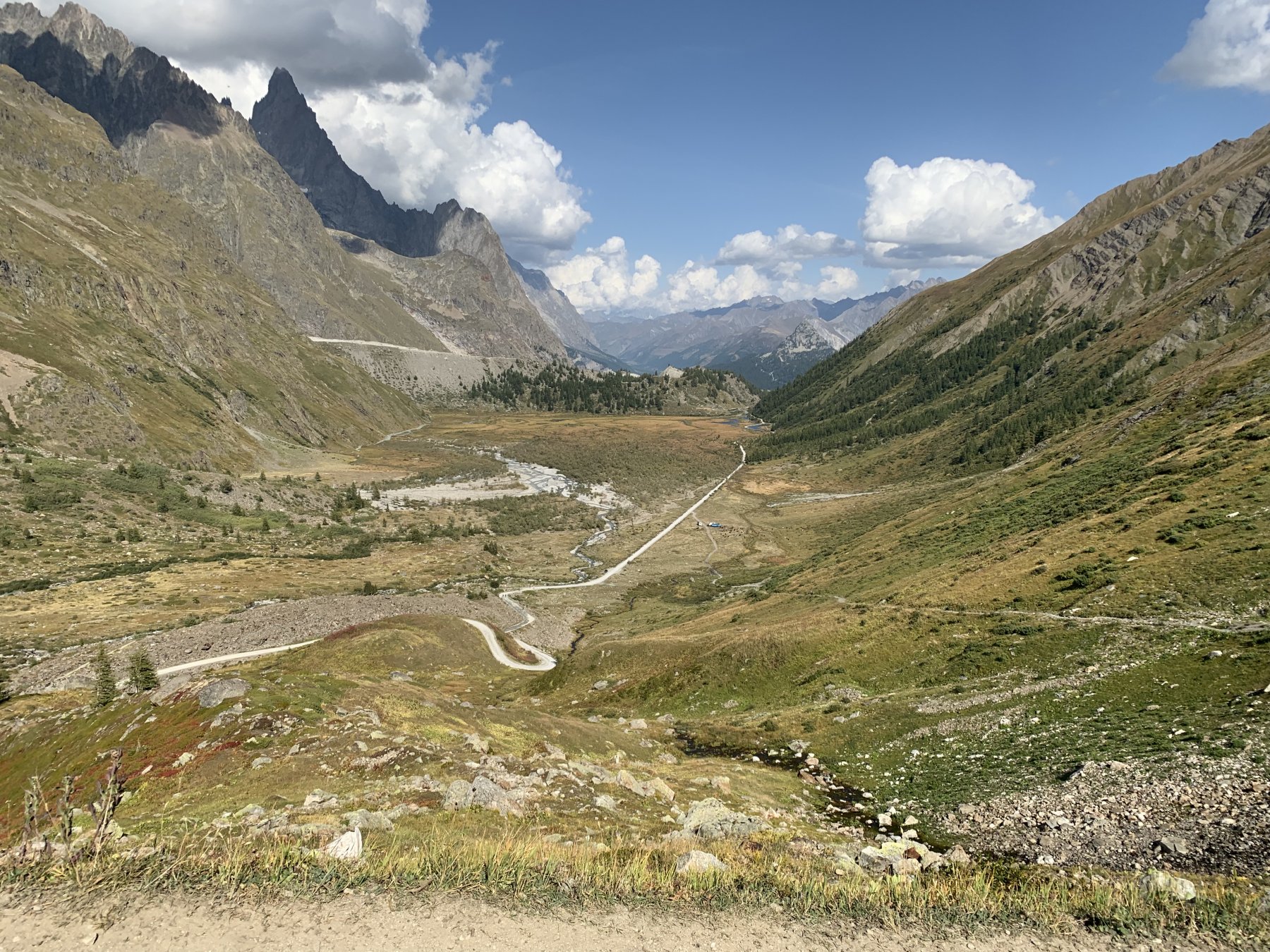
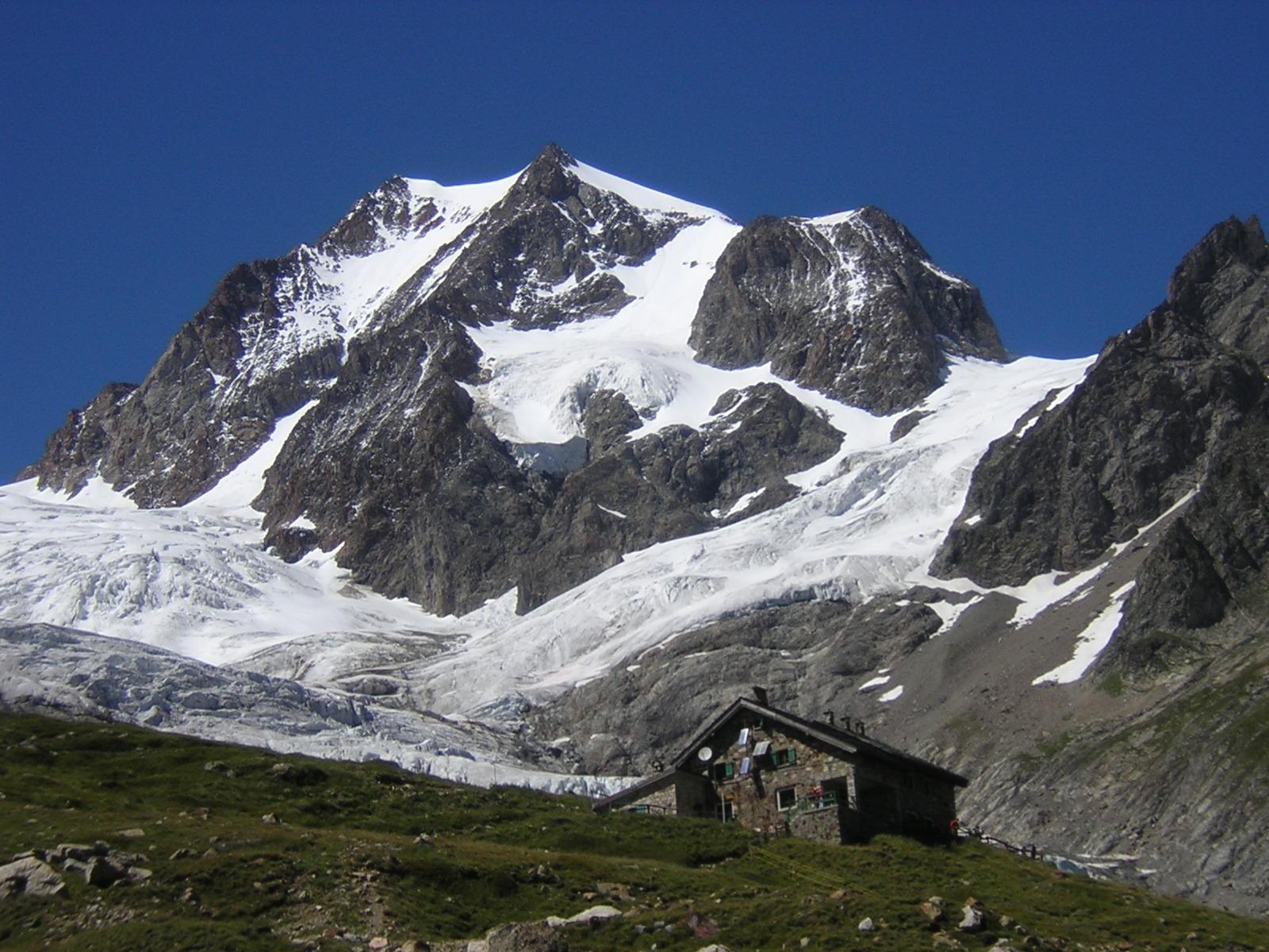
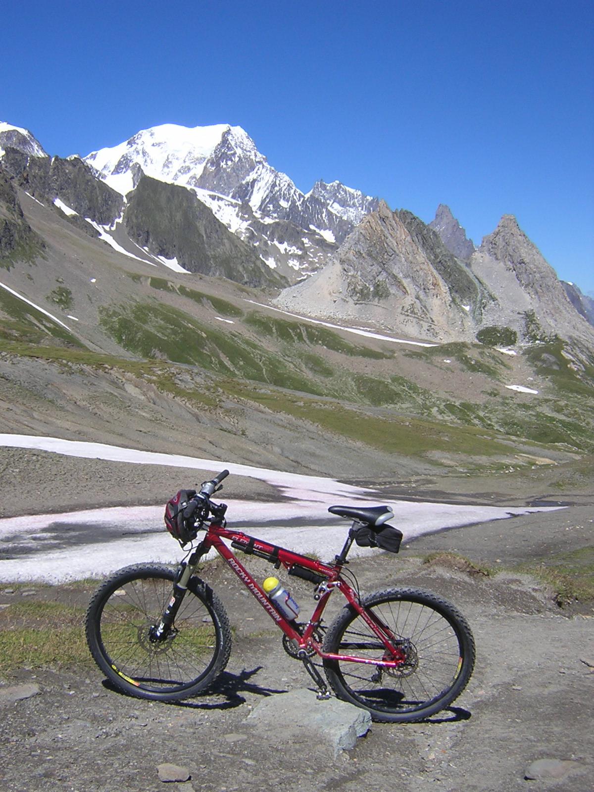
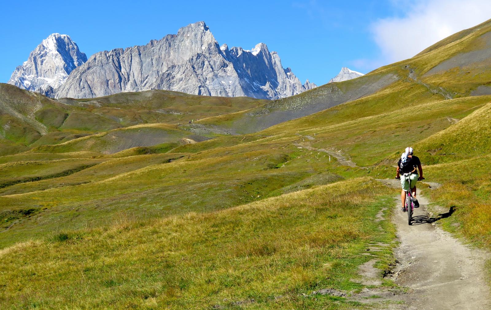
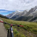
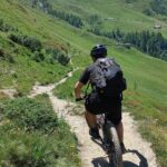
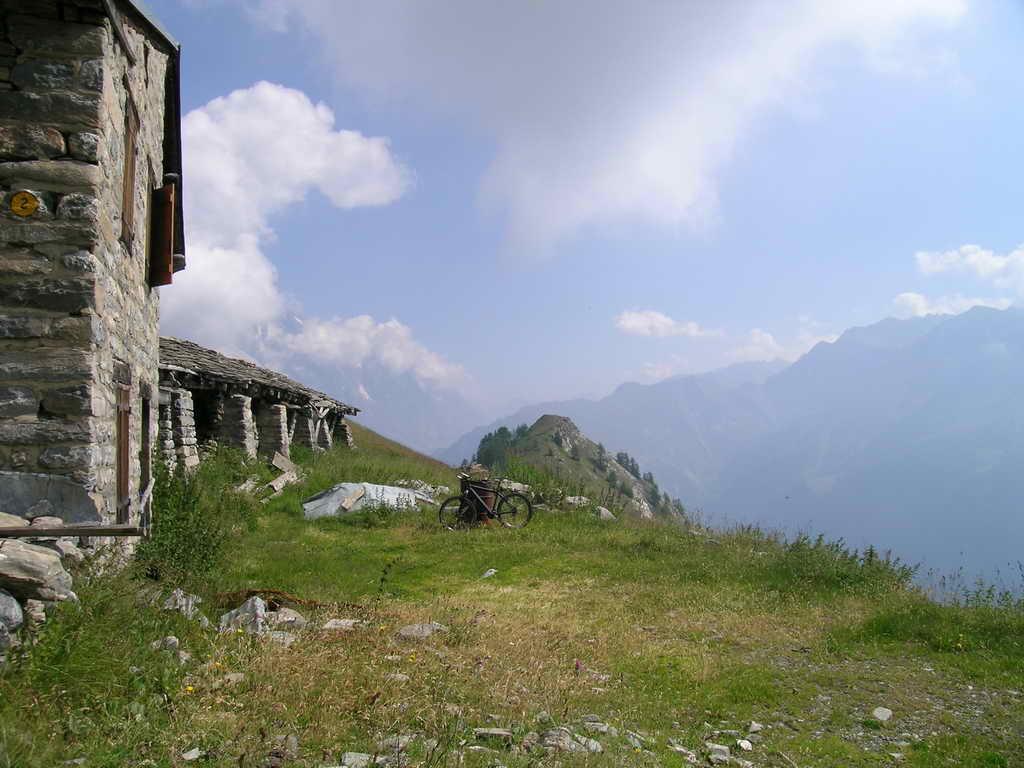
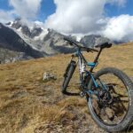
Bellissima salita andata e ritorno nella parte alta della Val Veny italiana, molto panoramica sul massiccio del Bianco; ambiente spettacolare e gran vista sull'integrale di Peuterey l'Aguille Noire e il bacino de la Lex Blanche. Belli i passaggi sotto le Pyramides Calcaires in contrasto col granito del Bianco
Avvicinamento
da Courmayeur risalire la Val Veny fino al bivio per Purtud e Casolari di Peuterey; parcheggiare lungo la sterrata o nei pressi del campeggio la Sorgente.
Descrizione
dai Casolari percorrere la piacevole sterrata e poi il sentiero alla sin orografica della Dora fino al ponte di Freney, poi rientrare sulla strada della Val Veny nei pressi dello Chalet del Miage e salire con alcuni tornanti fino alla zona del Combal costeggiando le morene del Gh. del Miage.
Dal Combal è consigliabile lasciare la bici e salire a piedi sulla morena per andare ad ammirare lo spettacolare lago glaciale del Miage.
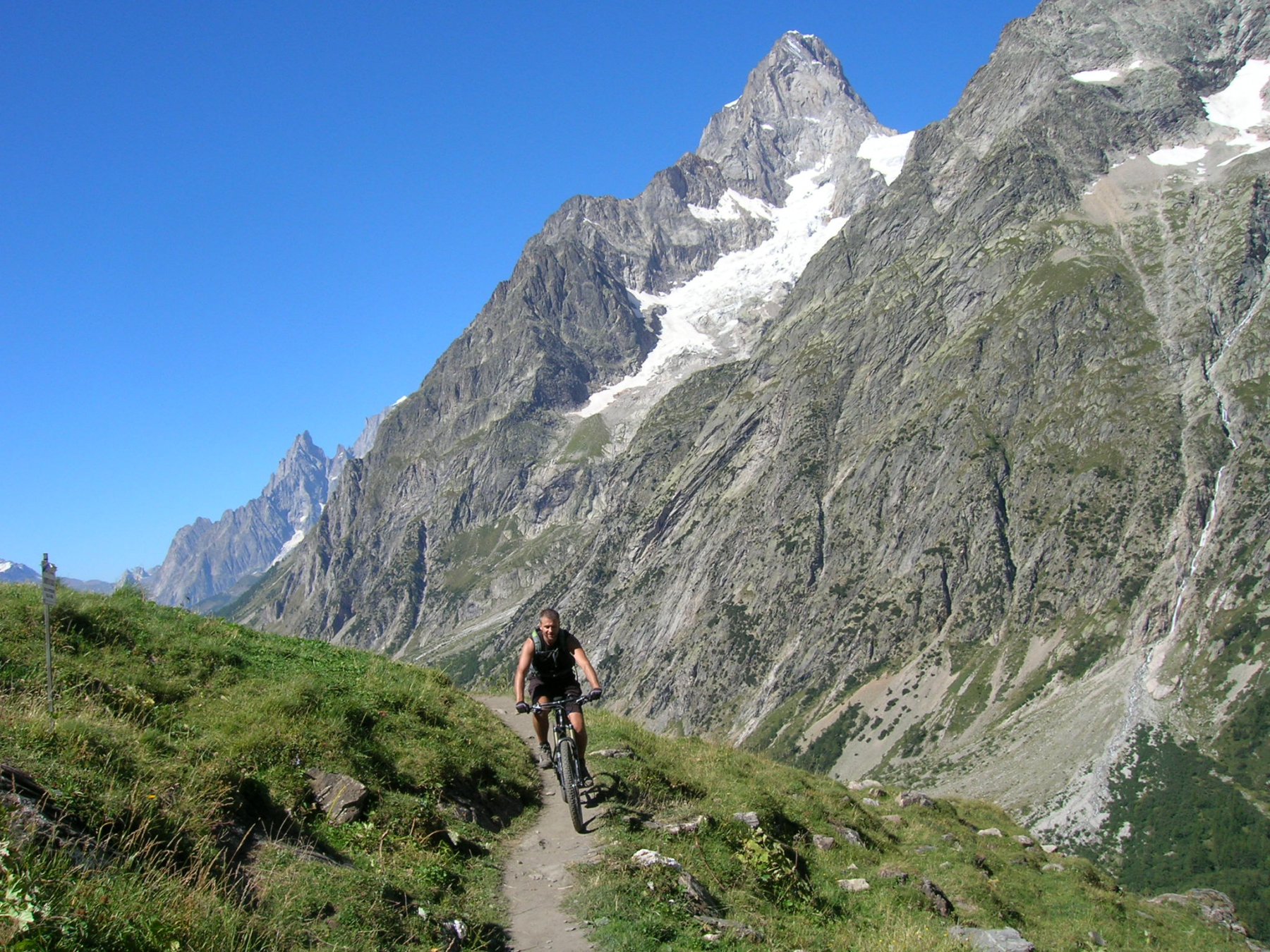
Riprendere la salita su sterrata che via via si fa più ripida e sconnessa fino ad arrivare al Rifugio (mt. 2200)
Da qui con terreno ondulato su una mulattiera giungere all’alpeggio superiore de la Lex Blanche (2282), costeggiando le Pyramides. Il sentiero continua a salire diventando ripido e molto impegnativo e costringendo a scendere dalla bici (mezz’oretta di spintage totale) fino ai 2500 metri del colle dove è posta una tavola di orientamento collocata per il bicentenario del Monte Bianco.
Il panorama è spettacolare e la discesa tutta in sella piacevole e godereccia con vista mozzafiato!
- Cartografia:
- IGC 1:25.000 Monte Bianco n.107
Nelle vicinanze Mappa
Itinerari
18/09/2022 AO, Courmayeur D+ 900 m BC Varie
Arp Vieille (Alpe) Balconata della Val Veny da La Visaille
 3.1Km
3.1Km
15/07/2015 AO, Courmayeur D+ 1700 m BC, BC, S0 Tutte
Tour del Monte Bianco (CCW) Tappa 1: Entreves – Champex
 3.7Km
3.7Km
19/07/2015 AO, Courmayeur D+ 1150 m BC, BC Tutte
Tour del Monte Bianco (CCW) Tappa 5: Les Chapieux – Entreves
3.7Km
25/08/2016 AO, Courmayeur D+ 1940 m BC, BC+, S2 Varie
Entre Deux Sauts (Tète) da Entreves, giro
 3.7Km
3.7Km
08/09/2024 AO, Courmayeur D+ 10000 m OC+, OC+, S5 Tutte
Tor des Geants in MTB
 4.9Km
4.9Km
23/08/2004 AO, Courmayeur D+ 1600 m BC, BC Varie
Fortin (Mont) giro della val Val Veny da La Visaille
4.9Km
24/06/2025 AO, Courmayeur D+ 1110 m MC+, BC, S2 Nord
Elena, Bonatti, Bertone (Rifugi) da Planpincieux, giro
 6.7Km
6.7Km
01/08/2009 AO, Pré-Saint-Didier D+ 1100 m MC, MC, S0 Est
Arp (Alpe) da Pre Saint Didier
 7.1Km
7.1Km
19/08/2023 AO, Pré-Saint-Didier D+ 2800 m BC, OC, S3 Tutte
Arp e Chavannes (Colli) da Pré Saint Didier, giro
 7.1Km
7.1Km
18/07/2025 AO, Pré-Saint-Didier D+ 1650 m BC, BC+, S1 Tutte
Chavannes (Col de) da Prè Saint Didier, discesa in Val Veny
8Km