400m
400m


Note
 3Km
3Km
3Km
3Km
3Km
3Km
6.2Km
6.2Km
6.8Km
7.3Km
3Km
3Km
3Km
3Km
3Km
3Km
6.2Km
6.2Km
6.8Km
7.3Km
400m
1.9Km
2.6Km
2.6Km
2.8Km
4.3Km
4.5Km
6.2Km
6.2Km
6.5Km
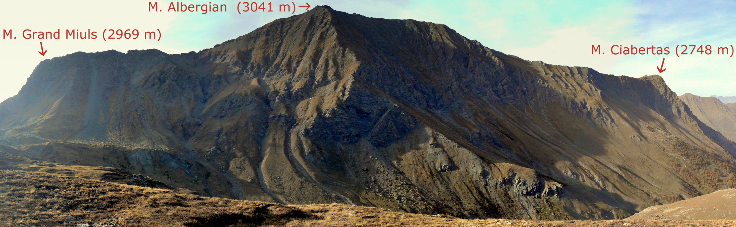
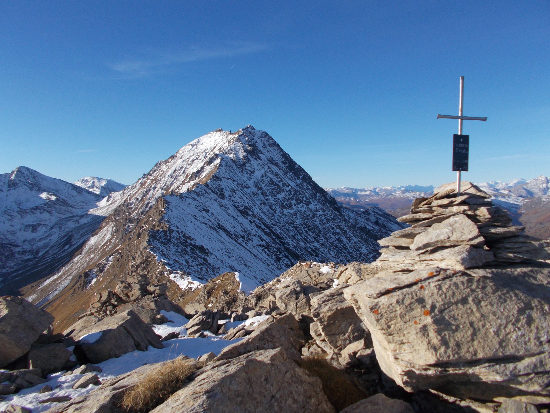
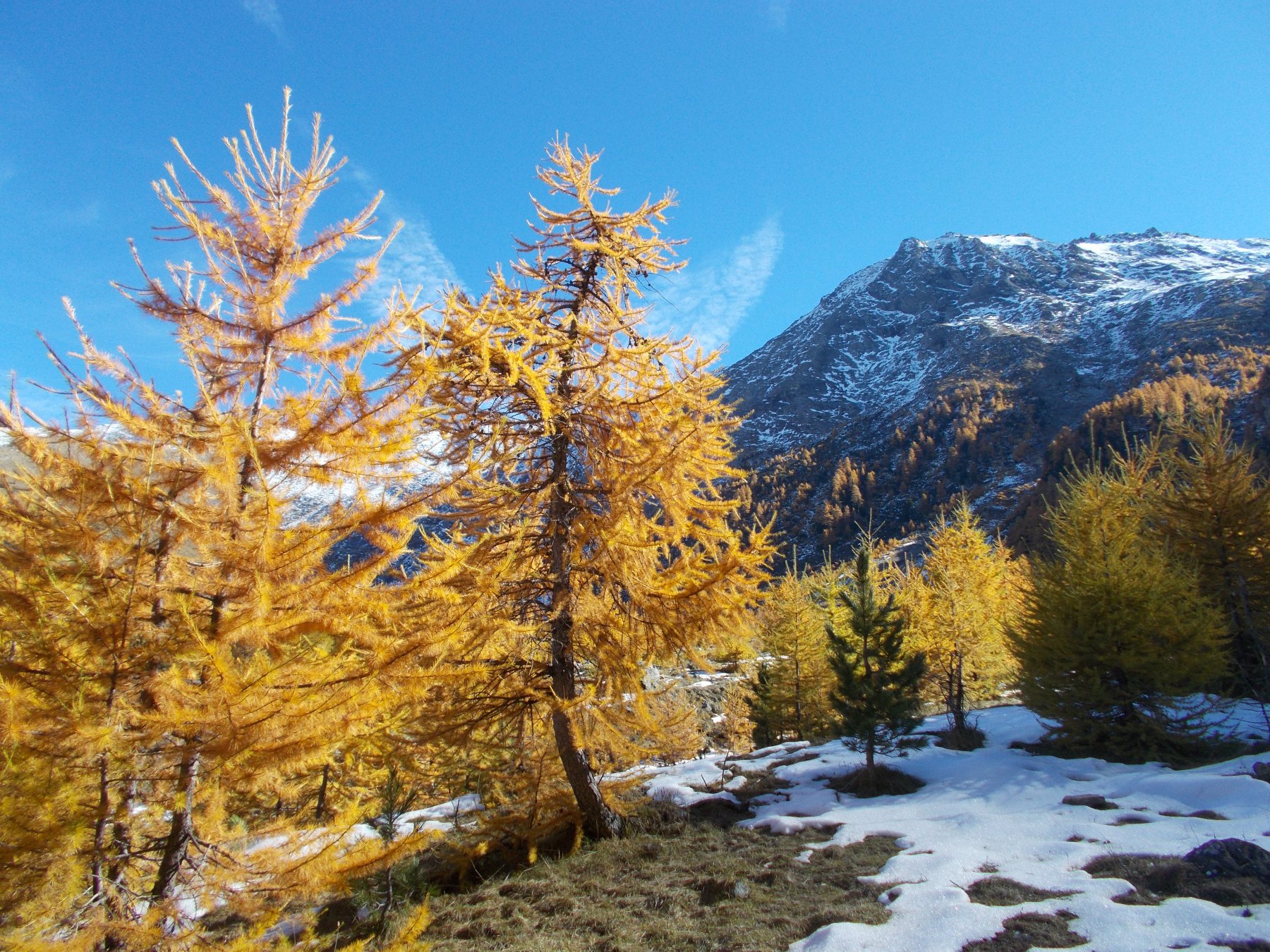
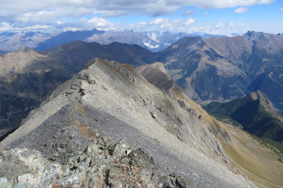
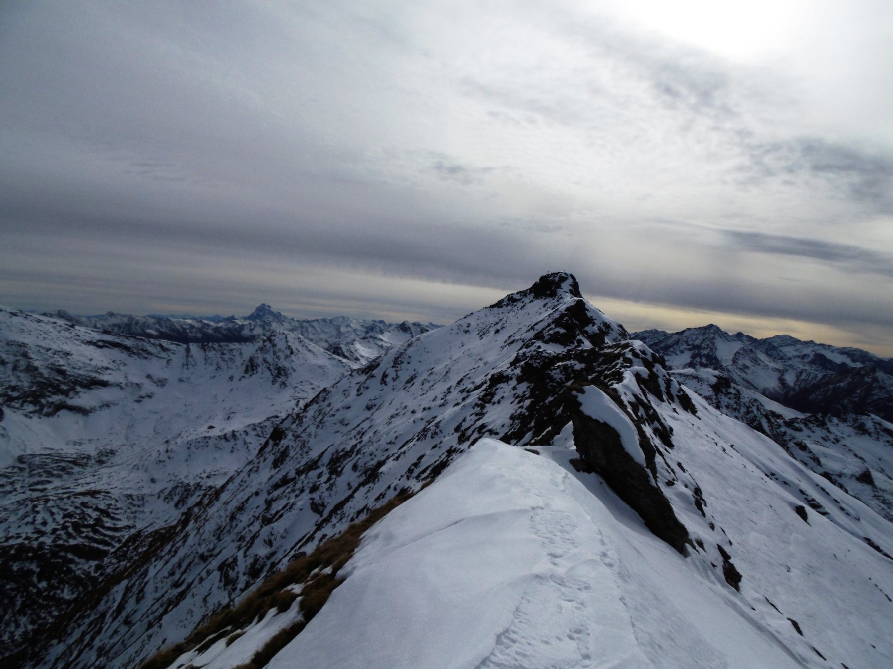
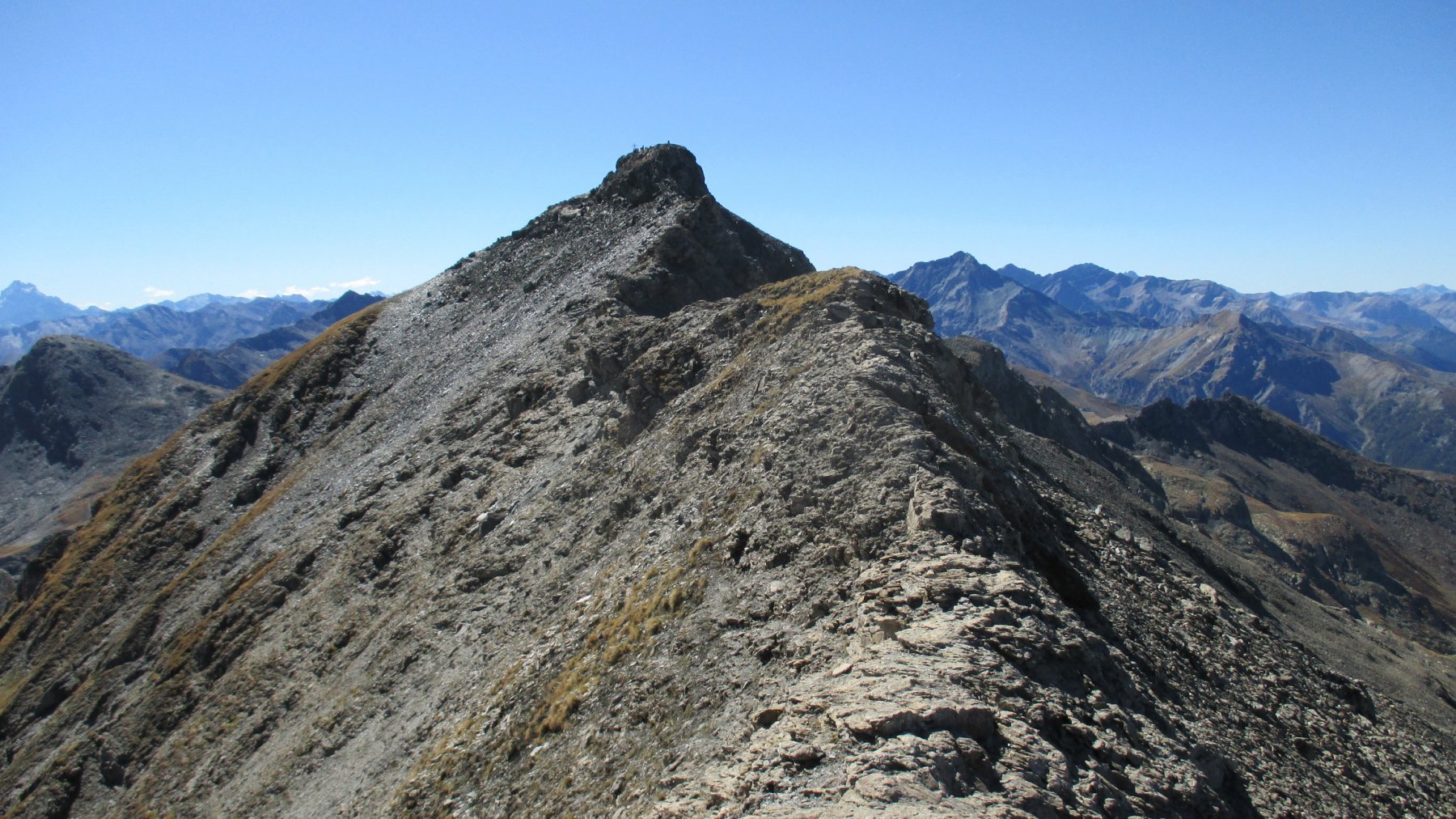
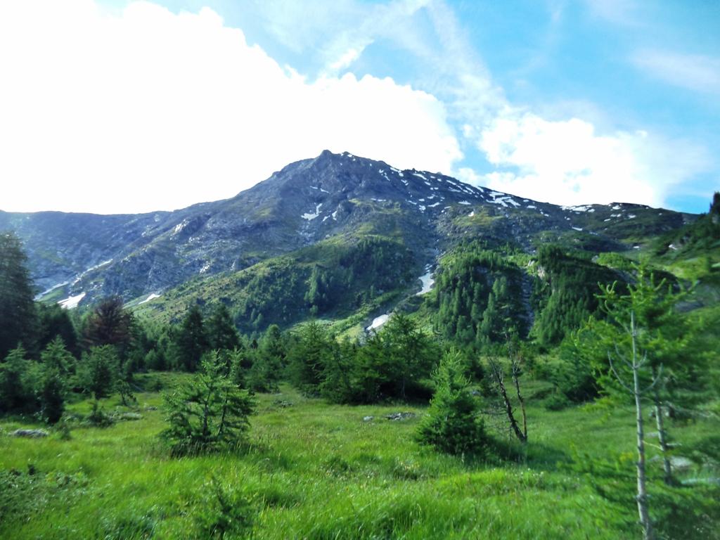
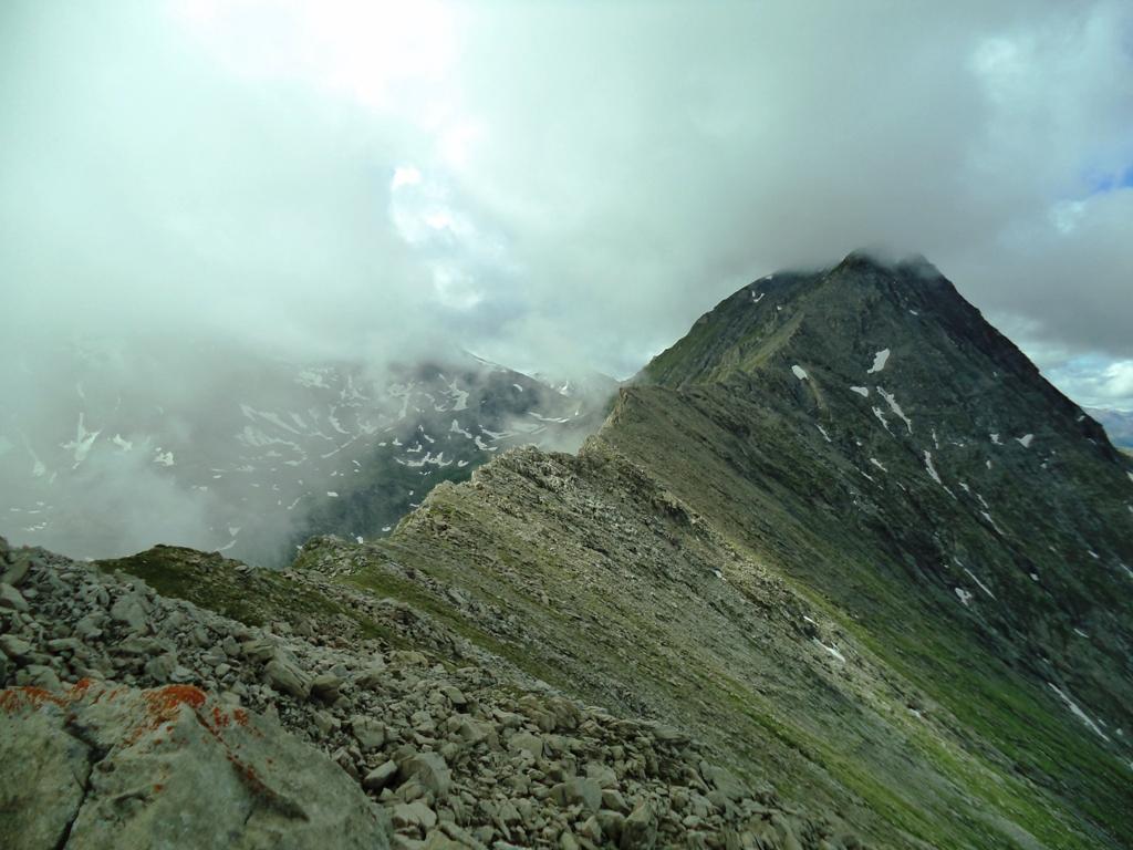
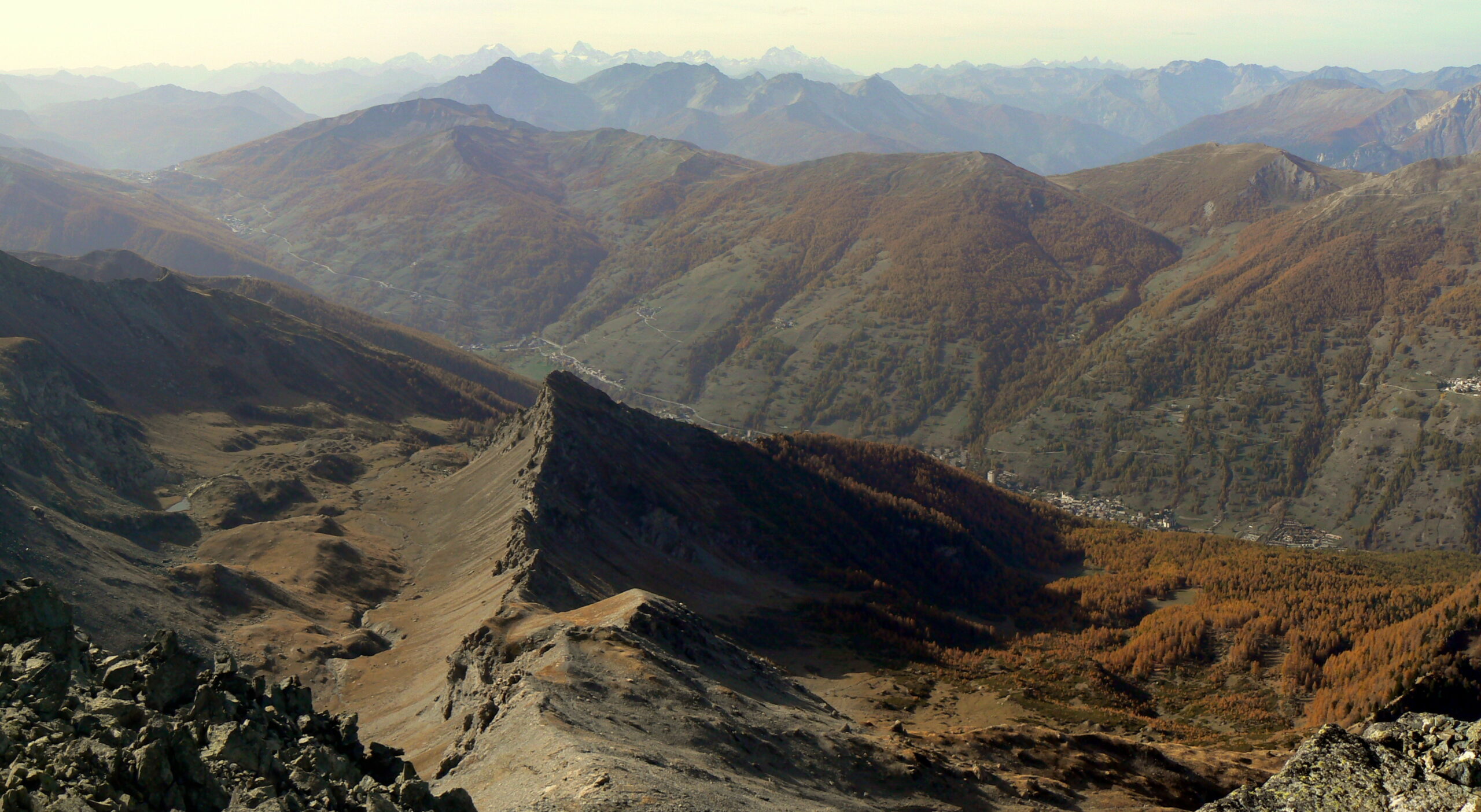
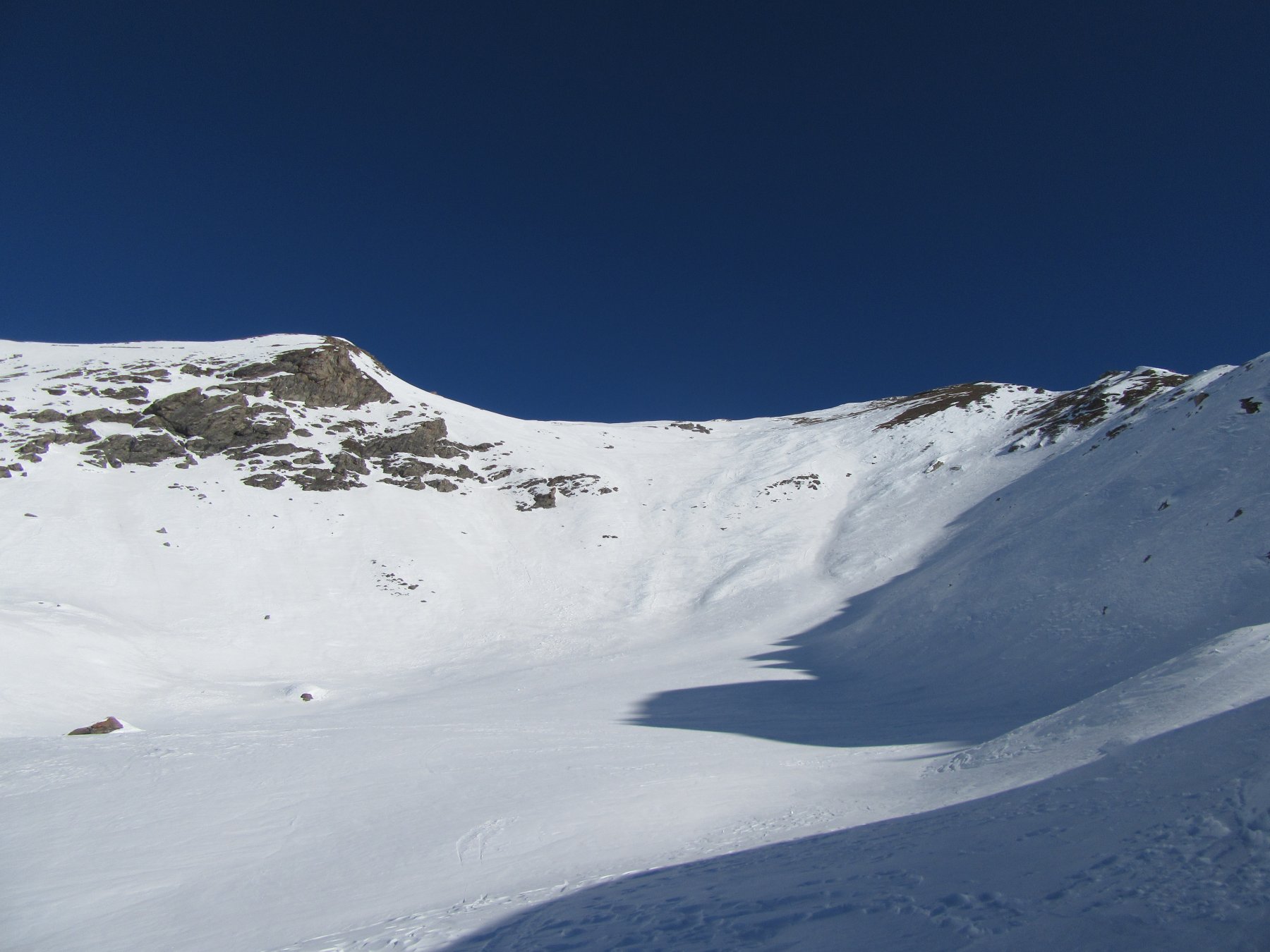
Salita grandiosa e faticosa, che percorre la cresta NE, ossia la via più difficile per l'Albergian. La cresta è rocciosa, a tratti stretta ma camminabile o quasi, fino alle vicinanze dell'anticima, dove si impenna. La salita dell'anticima dell'Albergian è tecnicamente facile, ma richiede comunque prudenza. Più facile è la cresta tra l'anticima e la cima. Questa salita richiede abitudine all'esposizione e passo sicuro. [da "da Pragelato... sentieri di Montagna", di F. Chianale]
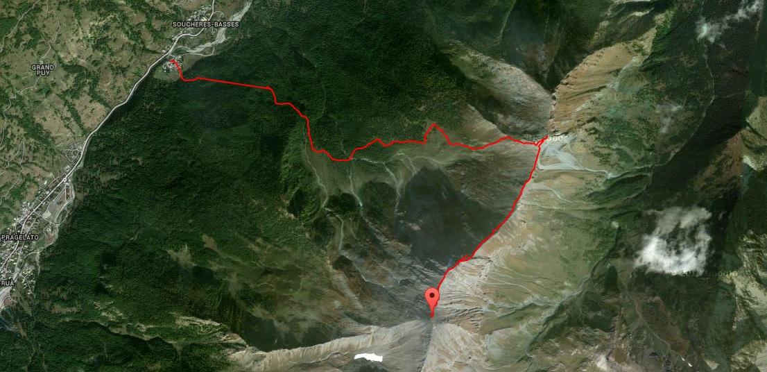
Avvicinamento
Risalire la val Chisone e una volta raggiunto Soucheres Basses, girare a sx e raggiungere la parte della vecchia della frazione aldilà del Chisone.
Descrizione
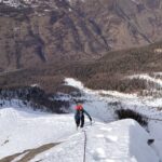
Dal centro del paese risalire verso l’inizio del sentiero della Larici-Cembreta. Seguire il sentiero che in modo diretto sale verso il vallone del rio Coimian. Continuare lungo il sentiero fino ad incrociare la sterrata che sale da Fraisse e di lì in breve alla capanna Ambrogio.
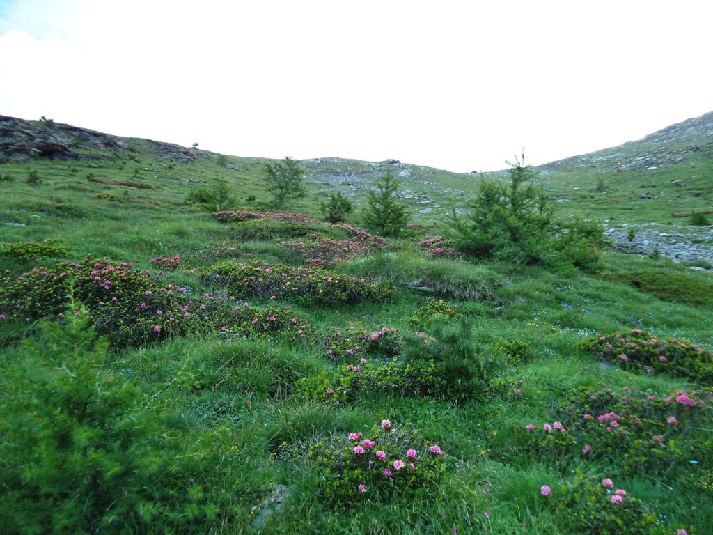
All’altezza della fontana Zalaveja parte una traccia che si inoltra in leggera salita verso il fondo del vallone.
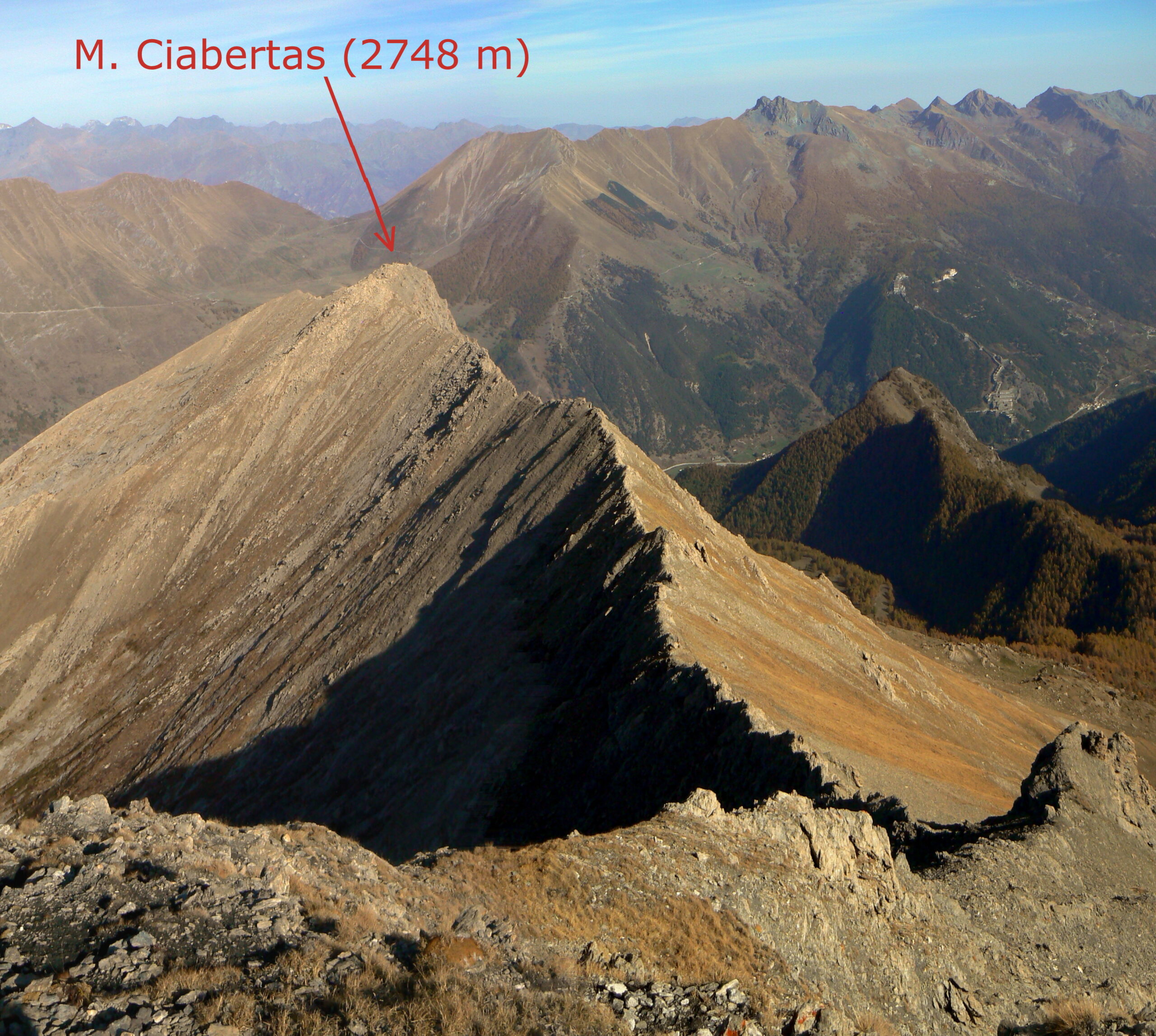
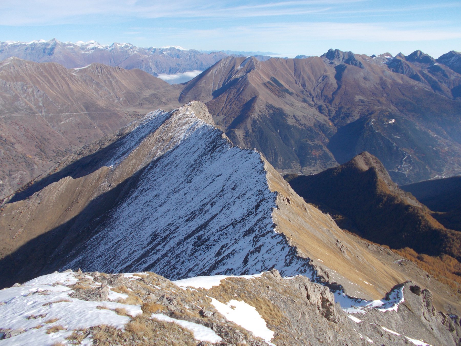
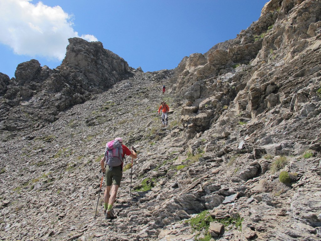
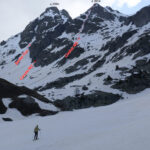
Seguirla per un centinaio di metri fin dove si perde un po’ e conviene salire i ripidi pratoni di sx che portano sulla cresta W del Ciabertas ad una quota di ca 2500m.
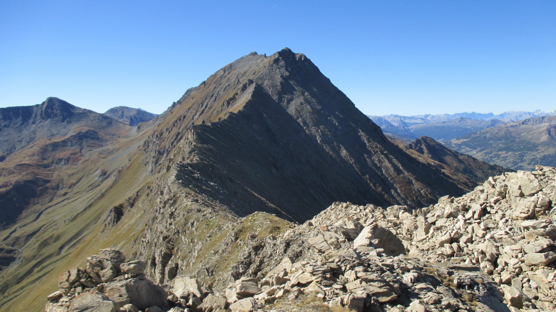
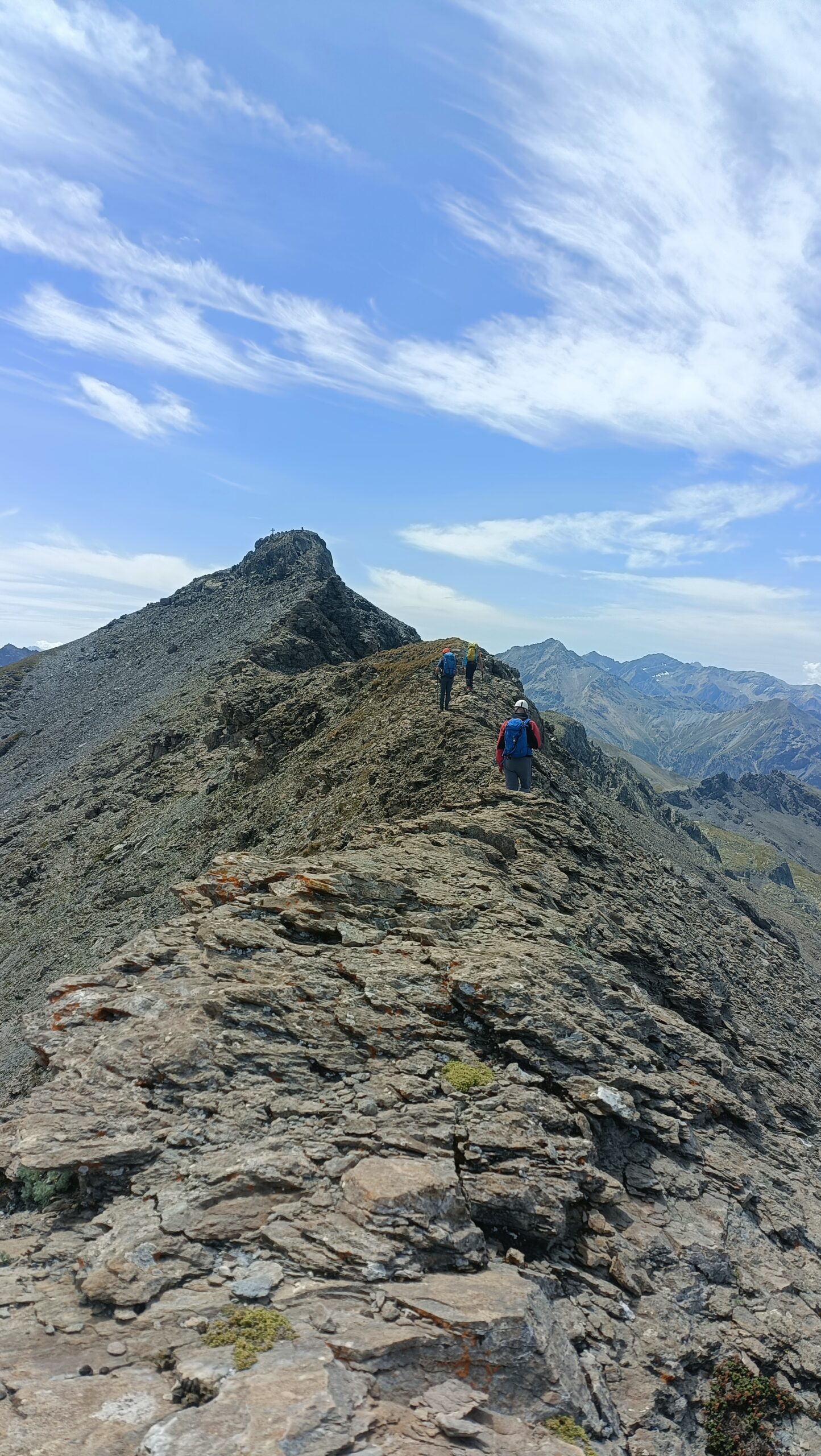
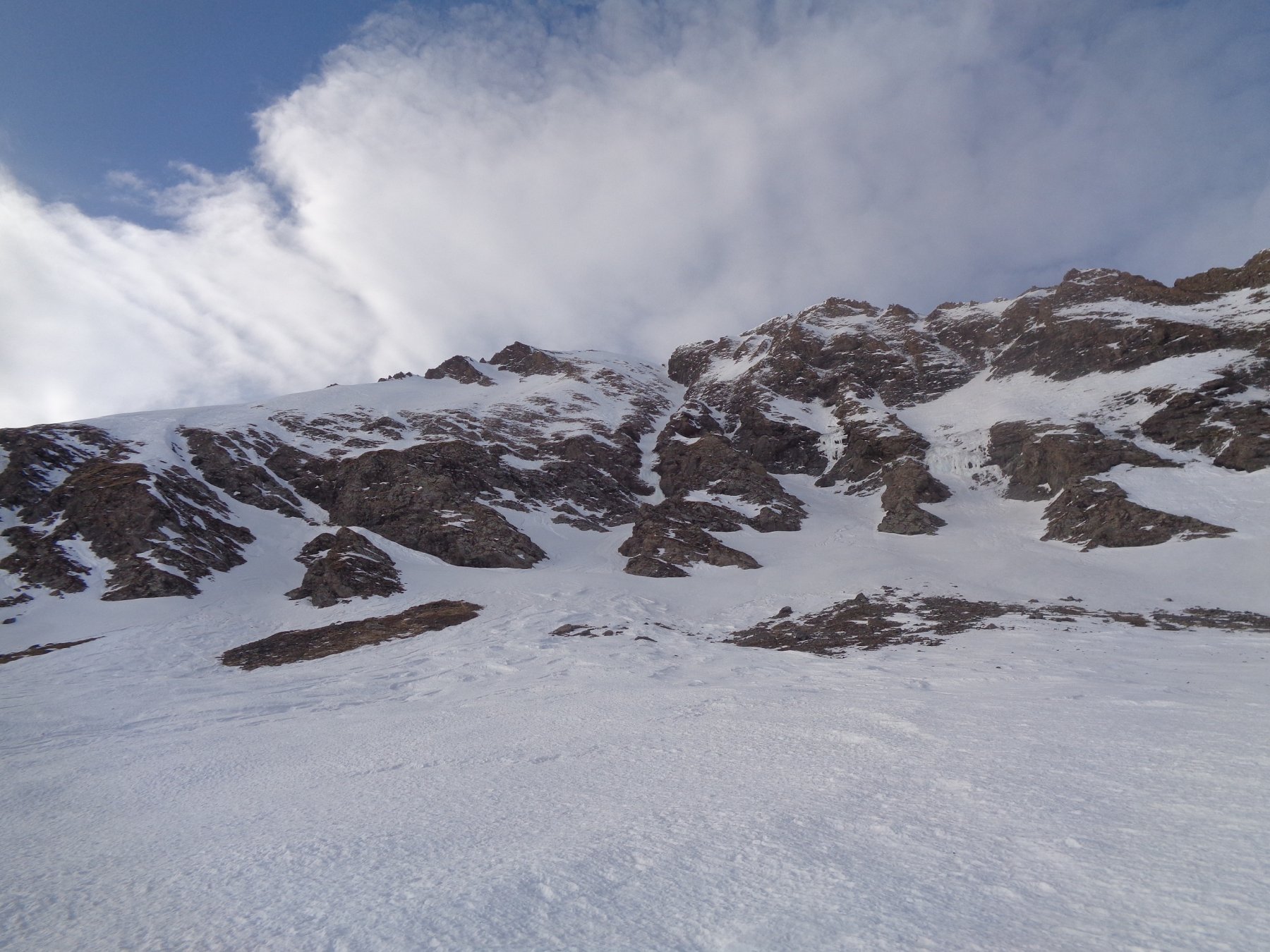
Seguire la dorsalina che per blocchi di roccia un po’ scomodi (ogni tanto qualche rado ometto indica l’itinerario migliore) porta in vetta al Ciabertas, 2742m. Ridiscendere dalla cima (in tutto si perderanno un 100m) e iniziare a percorrere la cresta NE dell’Albergian.
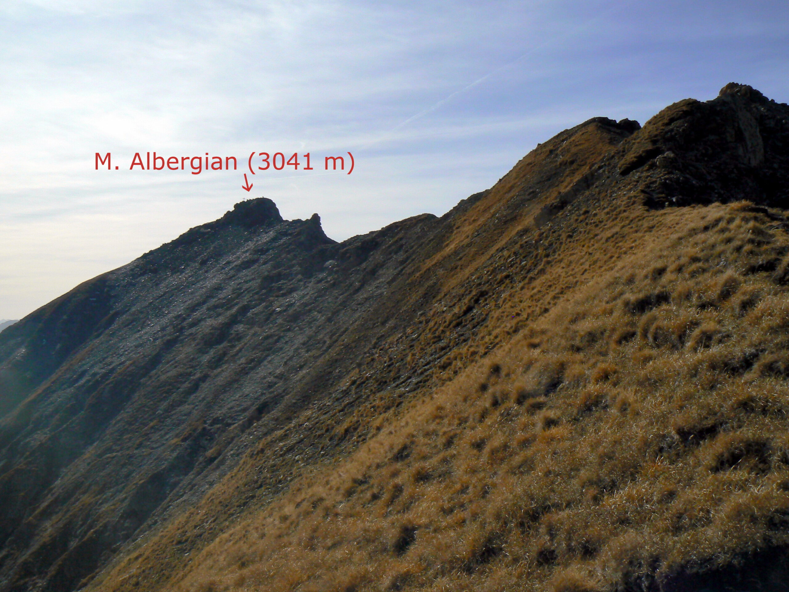
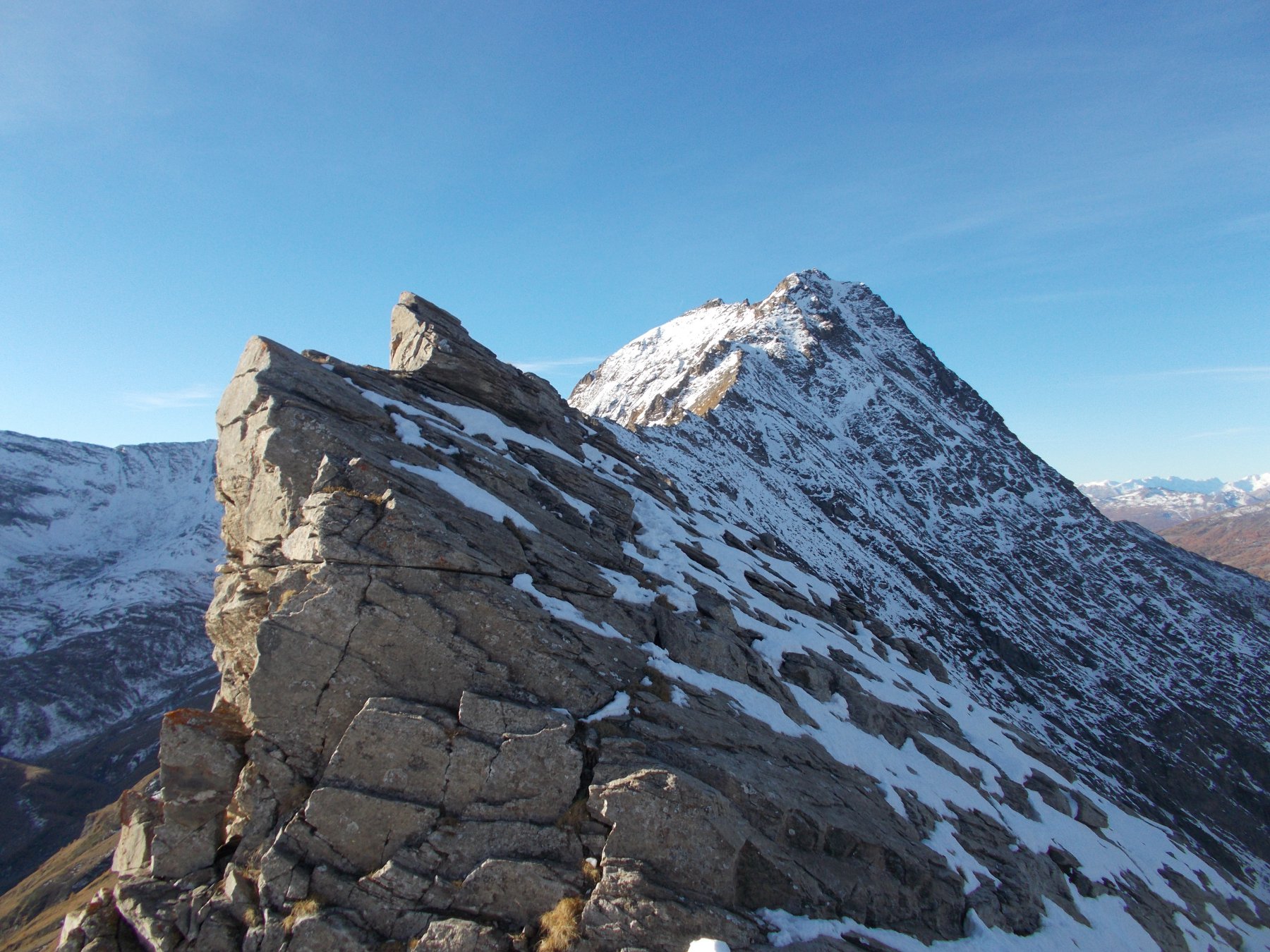
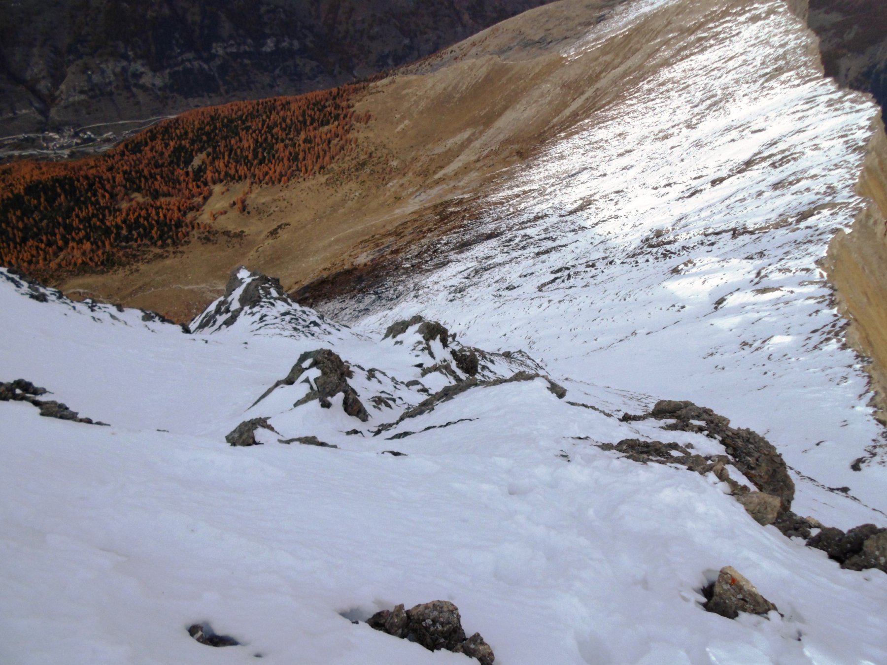
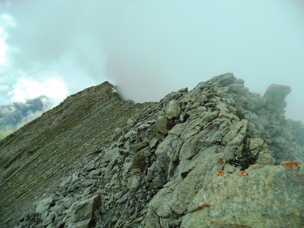
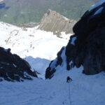
La cresta è in gran parte rocciosa ed è camminabile o quasi fin sotto l’anticima (qualche torrione o saltino si può decidere di salire o di evitare sulla dx nella prima parte della cresta e nella seconda parte sulla sx).
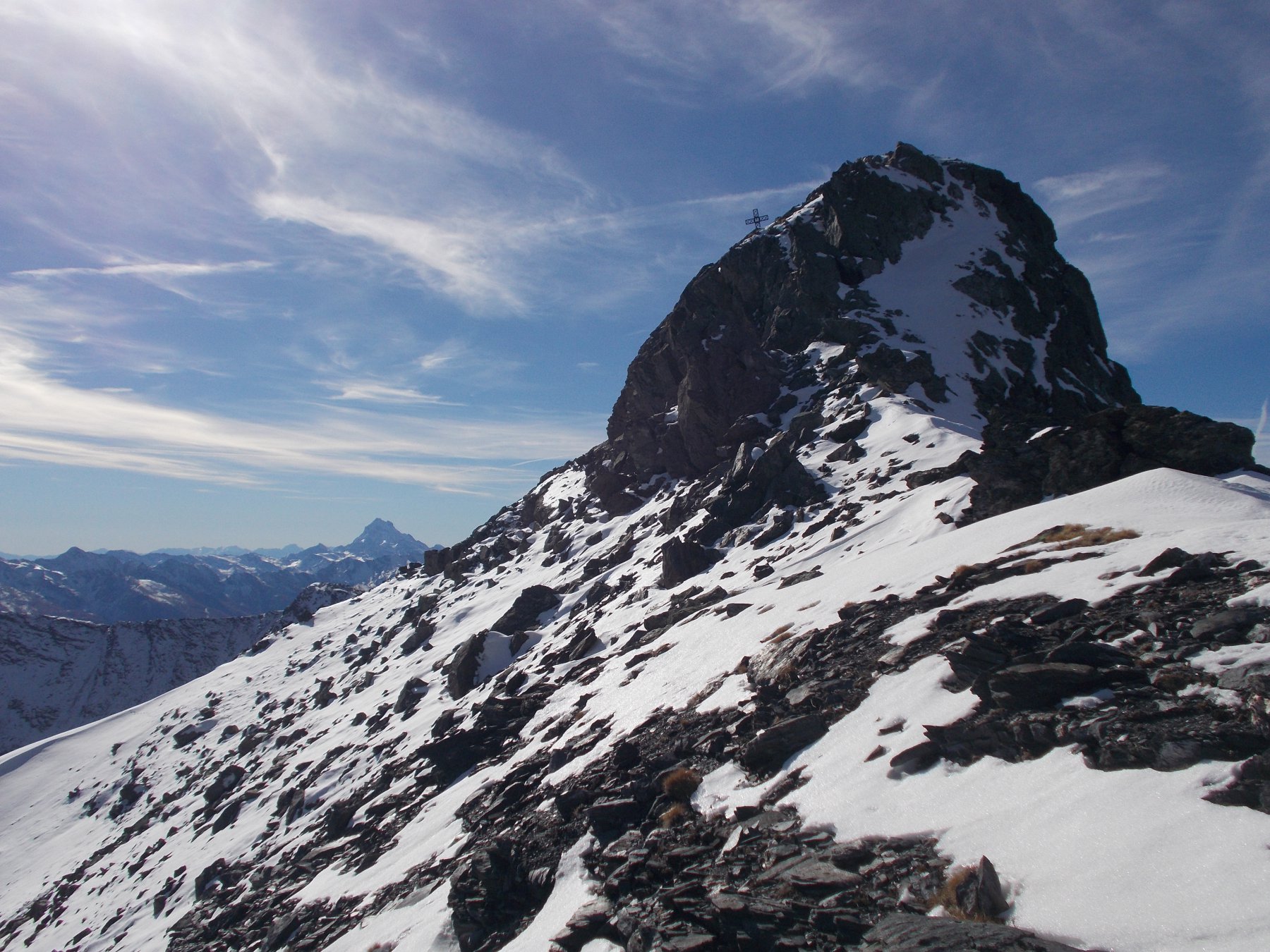
Da sotto l’anticima salire diritti lungo una serie di terrazzini fin sotto un torrione, che si passa comodamente sulla dx per una serie di caminetti. Dall’anticima la cresta prosegue affilata ma praticamente tutta camminabile fin sotto la vetta dell’Albergian, raggiungibile attraverso un brevissimo camino.
Discesa:
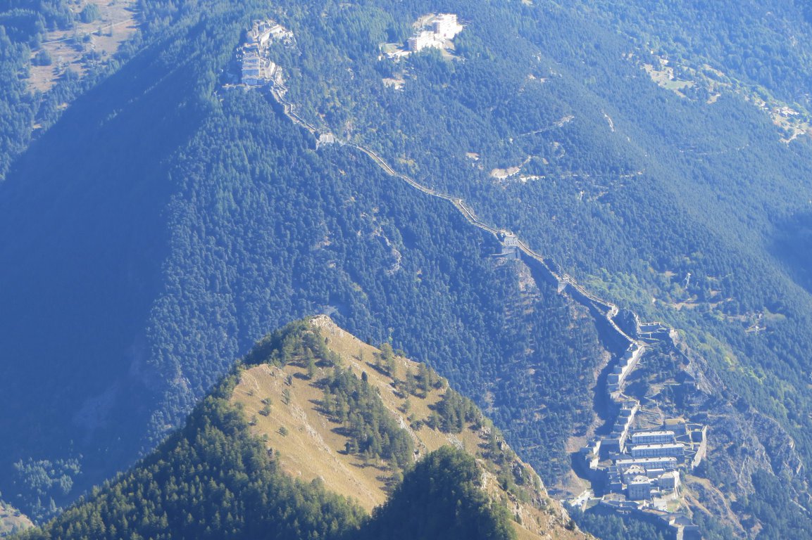
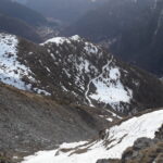
o per il vallone del Rio Coimian (normale da soucheres basses poco segnata nella parte alta, all’altezza del cote de la saume si gira a dx nel vallone) o per la normale di La Ruà (ben segnalata) fin al terzo tornante verso sx sotto alla fontana di pra da crò (quota 1737), dove un sentierino sulla dx riporta a soucheres basses al bivio da dove si è partiti.
- Cartografia:
- Fraternali 1:2500
- Bibliografia:
- Da Pragelato... sentieri di Montagna, di Ferruccio Chianale, Alzani editore
Nelle vicinanze Mappa
Itinerari
25/05/2025 TO, Pragelato D+ 1400 m AD Nord-Ovest
Gran Miuls (Monte) anticima NO 2940 m Couloir Magnaut
 3Km
3Km
06/06/2020 TO, Pragelato D+ 1434 m PD+ Nord-Ovest
Gran Miuls (Monte) Canalone NO
 3Km
3Km
01/06/2024 TO, Pragelato D+ 1400 m D Nord-Ovest
Gran Miuls (Monte) anticima NO 2940 m Couloir Barba-Truc
 3Km
3Km
25/05/2025 TO, Pragelato D+ 1330 m PD+ Nord-Ovest
Gran Miuls (Monte) quota 2865 m couloir Nord-Ovest
 3Km
3Km
10/02/2022 TO, Pragelato D+ 1055 m PD+ Ovest
Gran Muels (Monte) parete/canale Ovest
 3Km
3Km
02/07/2023 TO, Pragelato D+ 1450 m PD+ Varie
Gran Miuls (Monte) Cresta SE dal Colle dell’Albergian
 3Km
3Km
23/01/2022 TO, Usseaux D+ 1186 m PD Sud
Vallette (Cima delle) Canale/Parete S/SE
 6.2Km
6.2Km
17/03/2024 TO, Usseaux D+ 1292 m PD Sud-Est
Ciantiplagna (Cima) Versante S e Canale SE
 6.2Km
6.2Km
27/03/2022 TO, Pragelato D+ 1600 m D Nord-Est
Ruetas (Monte) Couloir NE
 6.8Km
6.8Km
08/01/2026 TO, Usseaux D+ 805 m AD+ Nord-Est
Laux (Rocca del) Goulotte del Lago del Laux
 7.3Km
7.3Km
Servizi
400m
1.9Km
L’itialette Ristorante
Pragelato
2.6Km
Casa Alpina Rifugio
Pragelato
2.6Km
Passet Ristorante
Pragelato
2.8Km
Casa degli Escartons Alex Berton B&B
Pragelato
4.3Km
Casa Assietta Rifugio
Pragelato
4.5Km
Refugium – ex. Rif. Belotte Rifugio
Pragelato
6.2Km
Al Mulino Ristorante
Pragelato
6.2Km
La capanna del sole Ristorante
Pragelato
6.5Km