2.8Km
2.8Km
Note
 0m
50m
50m
50m
50m
50m
50m
50m
50m
50m
0m
50m
50m
50m
50m
50m
50m
50m
50m
50m
Itinerario bello e relativamente breve, sicuramente fattibile in giornata. Montagna bella ed, in piccolo, molto caratteristica del Gruppo del Bianco. Cresta con notevole sviluppo panoramica e non difficile.
Questo via, descritta come normale nella GMI, evita il primissimo tratto più difficile della cresta (via descritta come in questo sito come "cresta E", che la percorre integralmente ed é gradata AD) e risulta più facile PD+.
Per la discesa, se le condizioni lo permettono, si consiglia il più facile e veloce canalone Freshfield (PD).
Avvicinamento
Questo via, descritta come normale nella GMI, evita il primissimo tratto più difficile della cresta (via descritta come in questo sito come "cresta E", che la percorre integralmente ed é gradata AD) e risulta più facile PD+.
Per la discesa, se le condizioni lo permettono, si consiglia il più facile e veloce canalone Freshfield (PD).
Con la Funivia la Palud al Rifugio Torino.
Descrizione
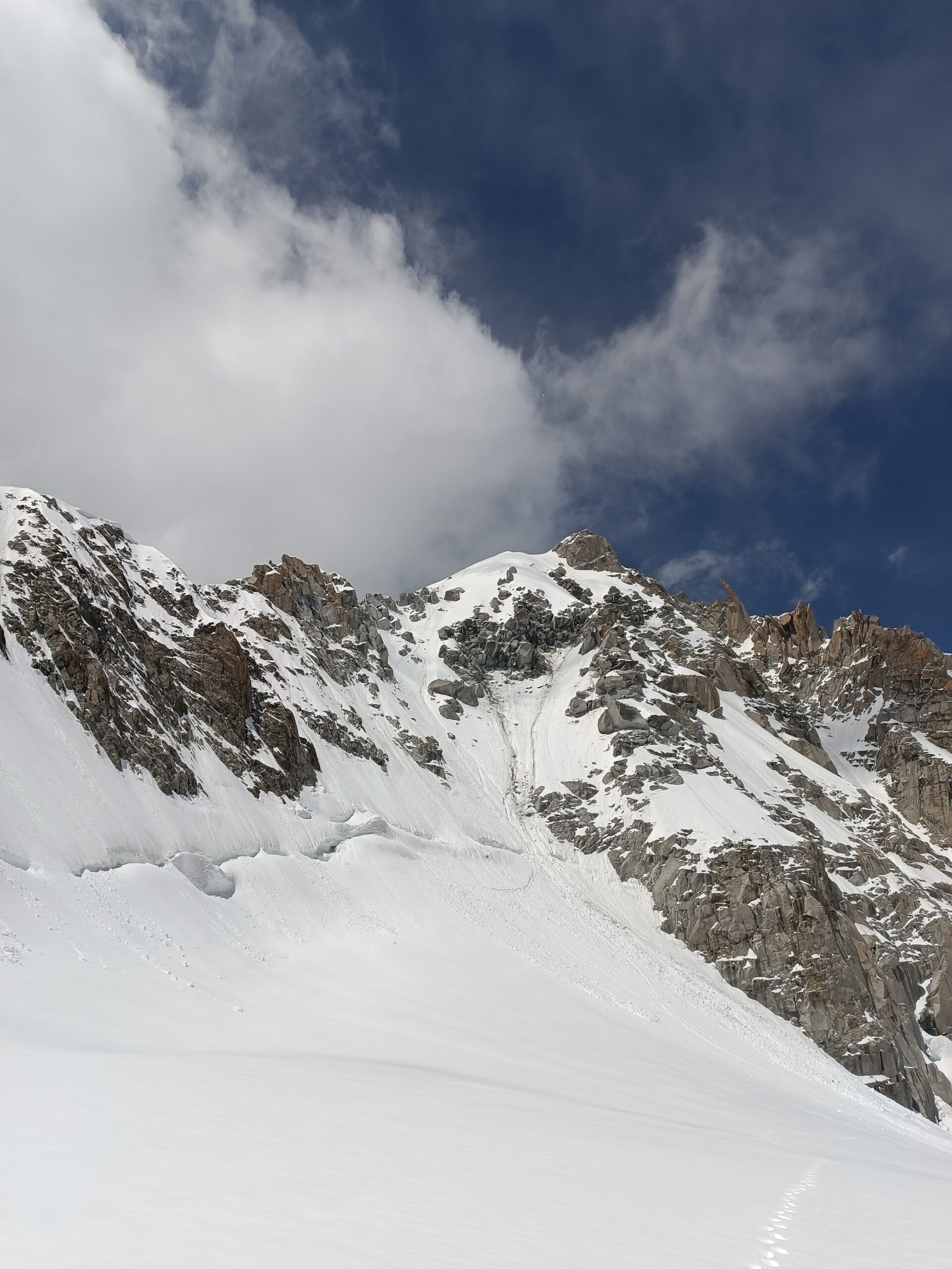
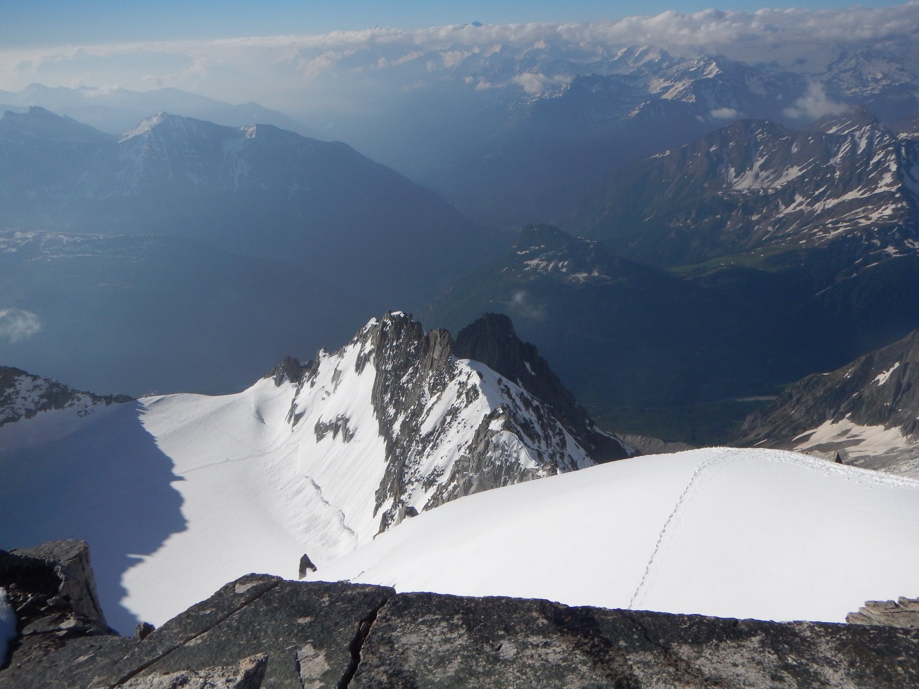
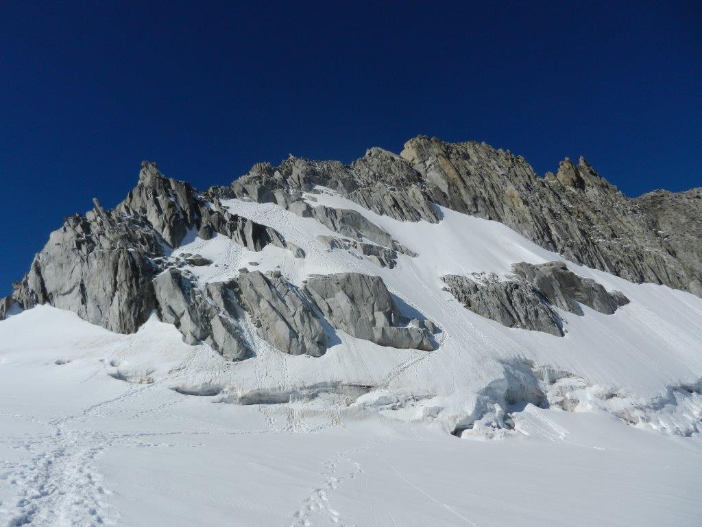
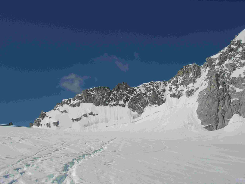
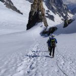
Dal rifugio Torino o da Punta Hellbronner si raggiunge il Col Flambeaux a 3407 m e si ridiscende poi a sinistra lambendo le pendici della parete nord dell’Aiguille De Toula abbassandosi fino a quota 3280. Si risale ora il ghiacciaio fin presso il Col d’ Entreves 3517 m. (1h 30).
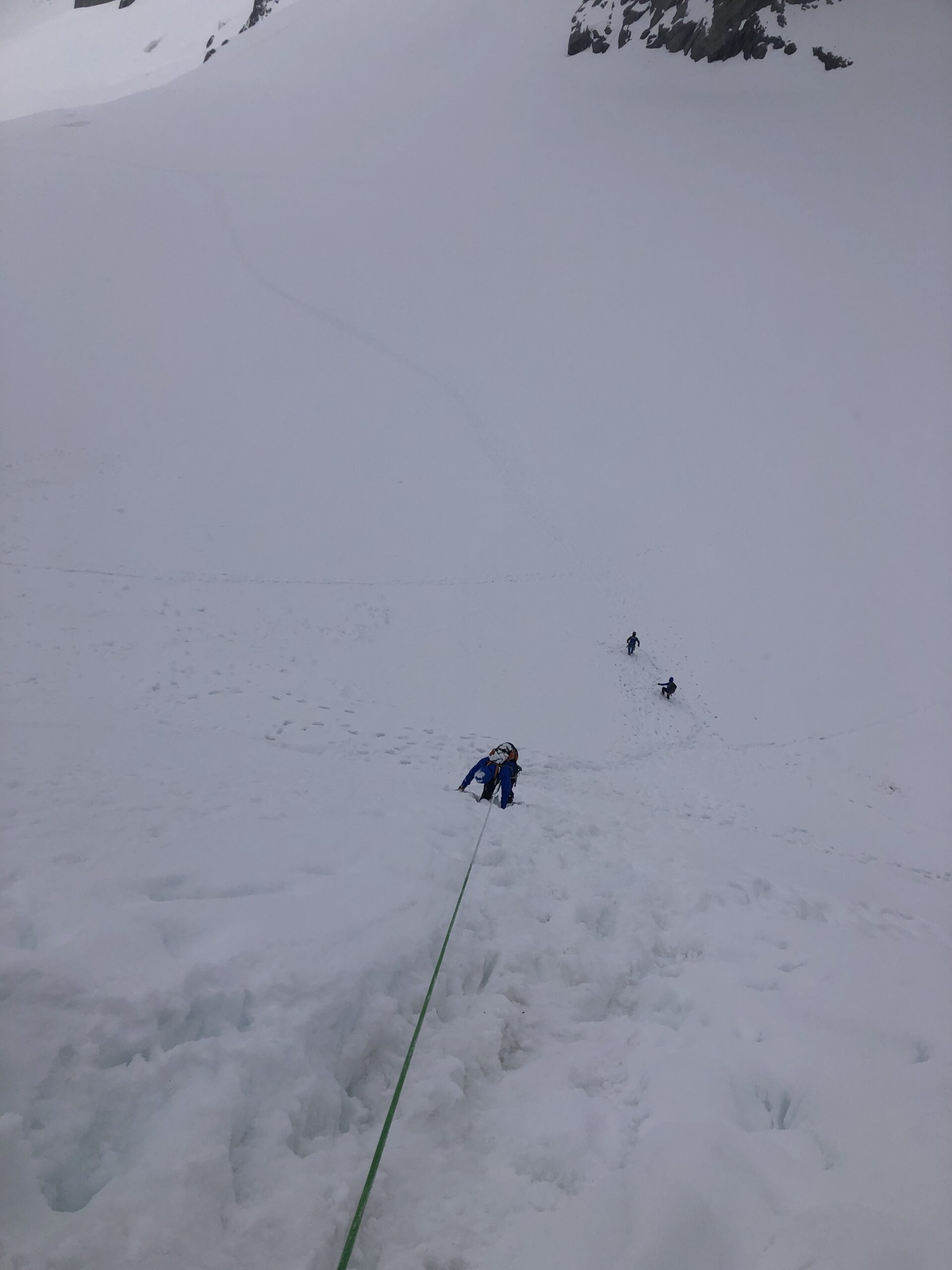
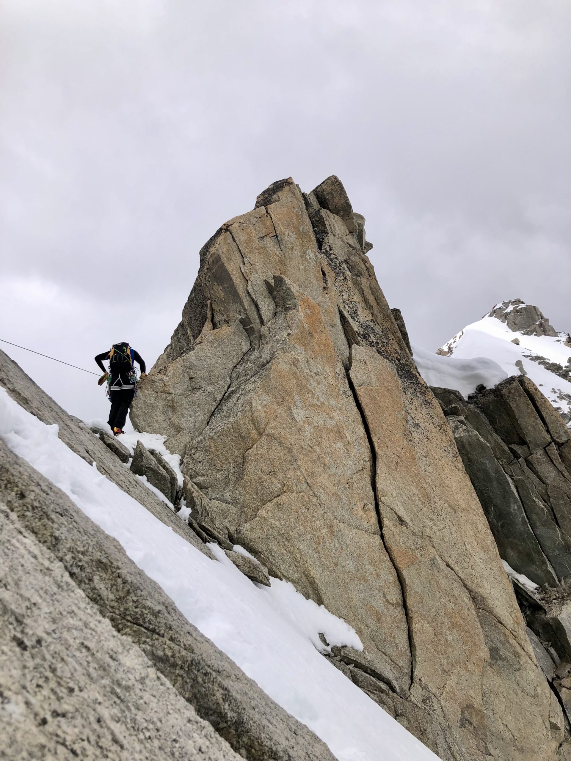
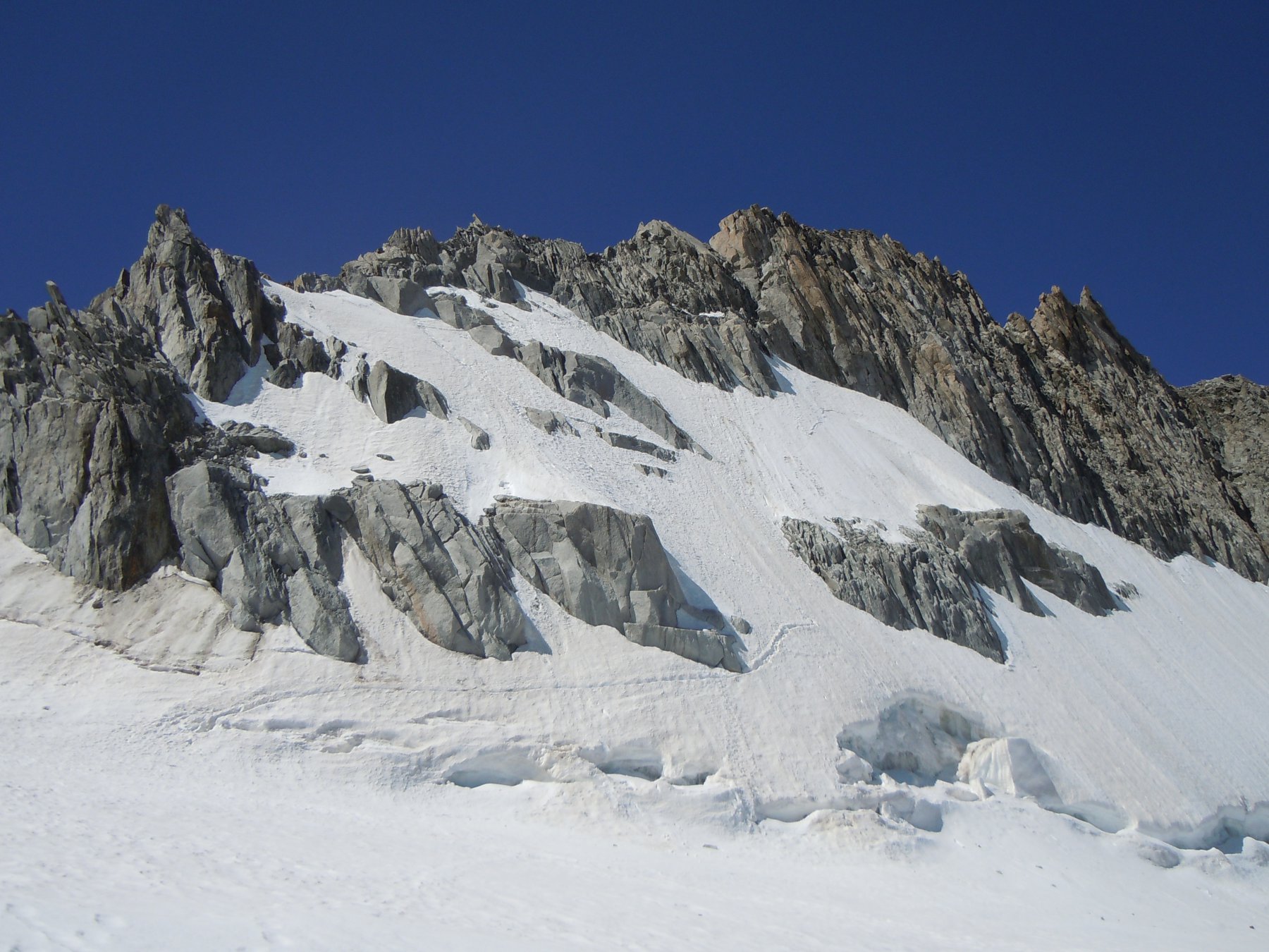
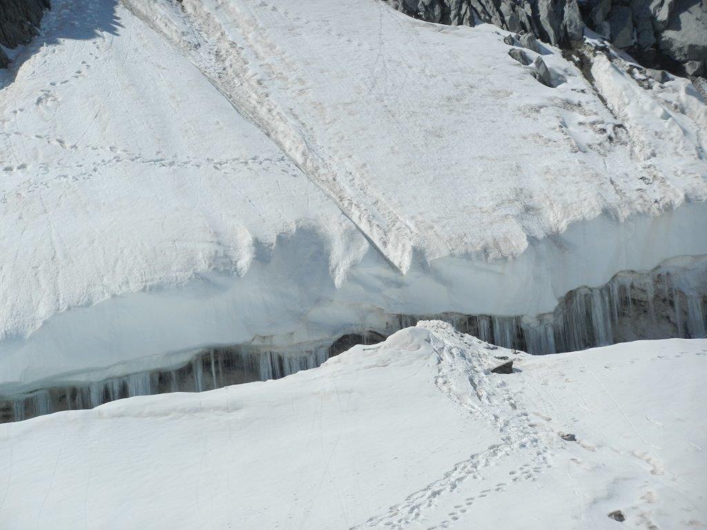
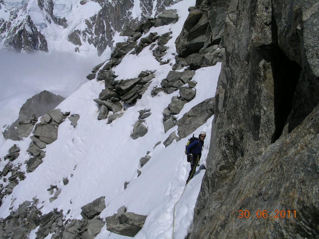
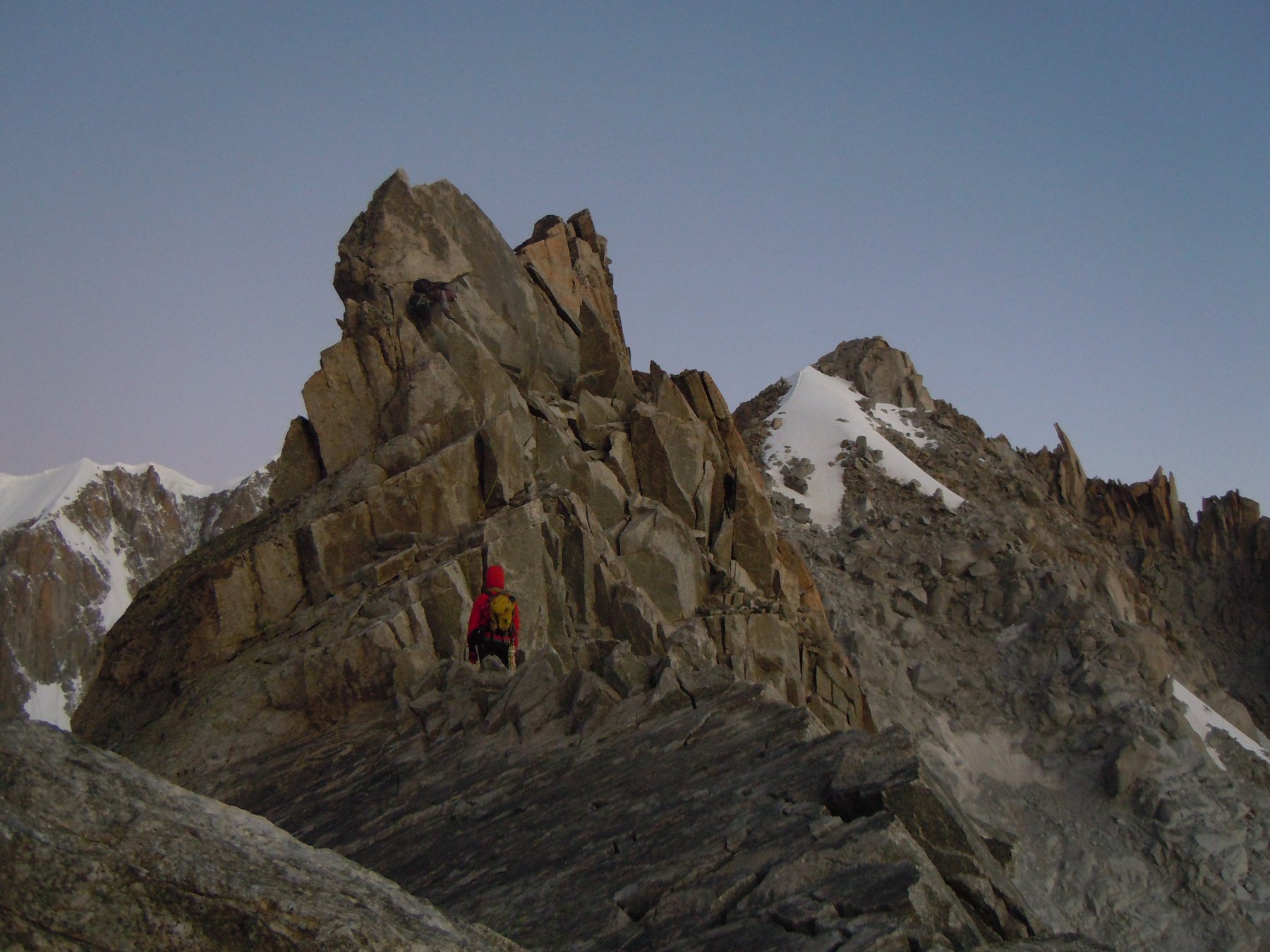
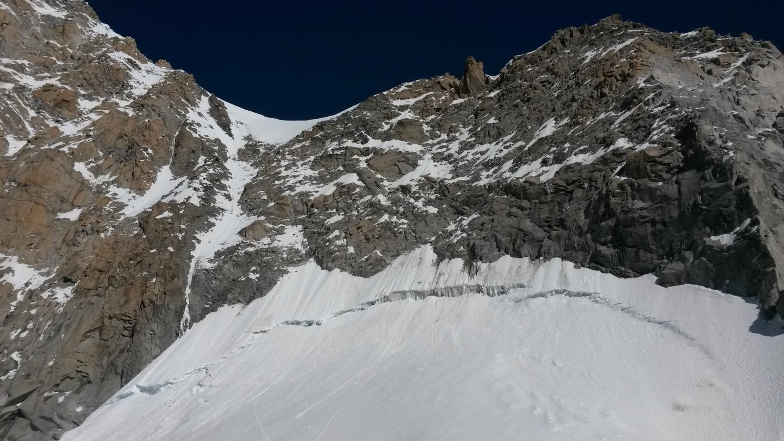
Si supera, in genere agevolmente, la terminale e si attacca, traccia, un breve ma ripido pendio di neve (45°) che conduce in cresta a quota 3570 m, aggirando le maggiori difficoltà poste nel primissimo tratto della cresta stessa.
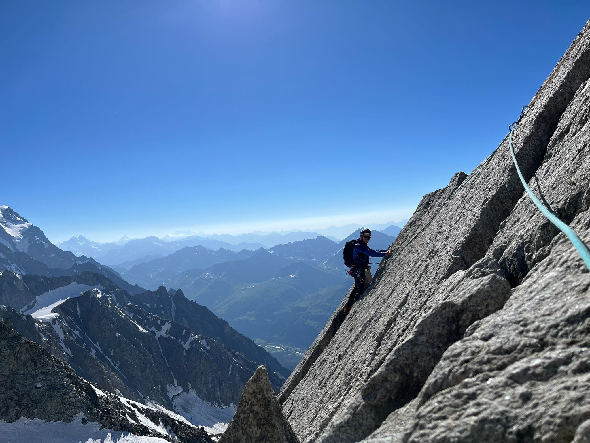
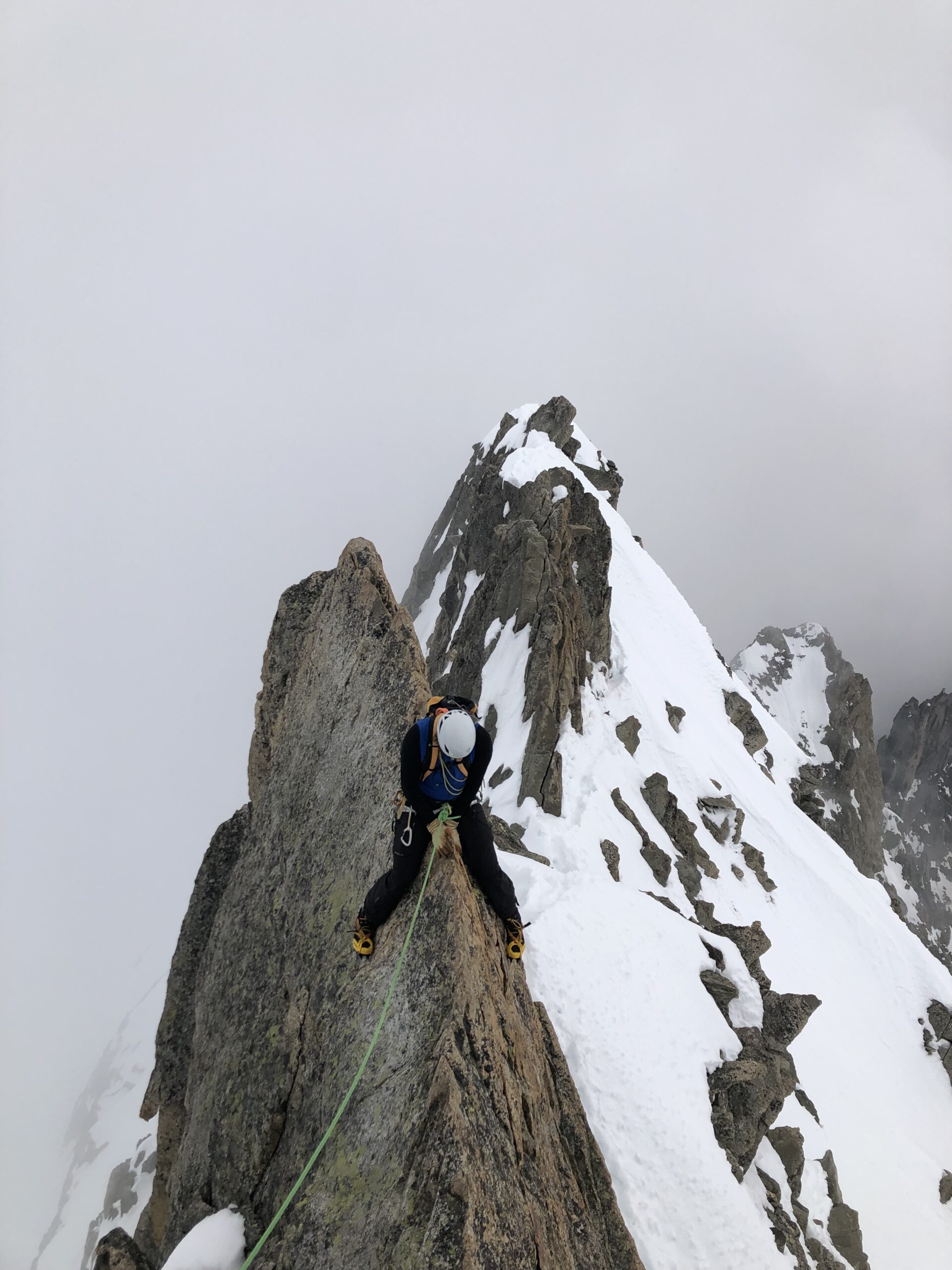
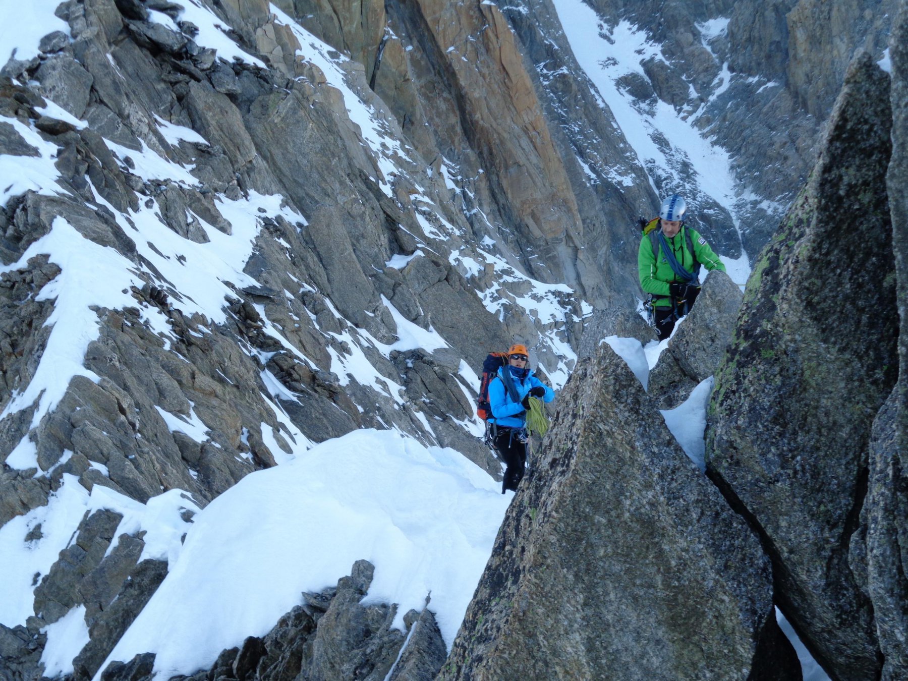
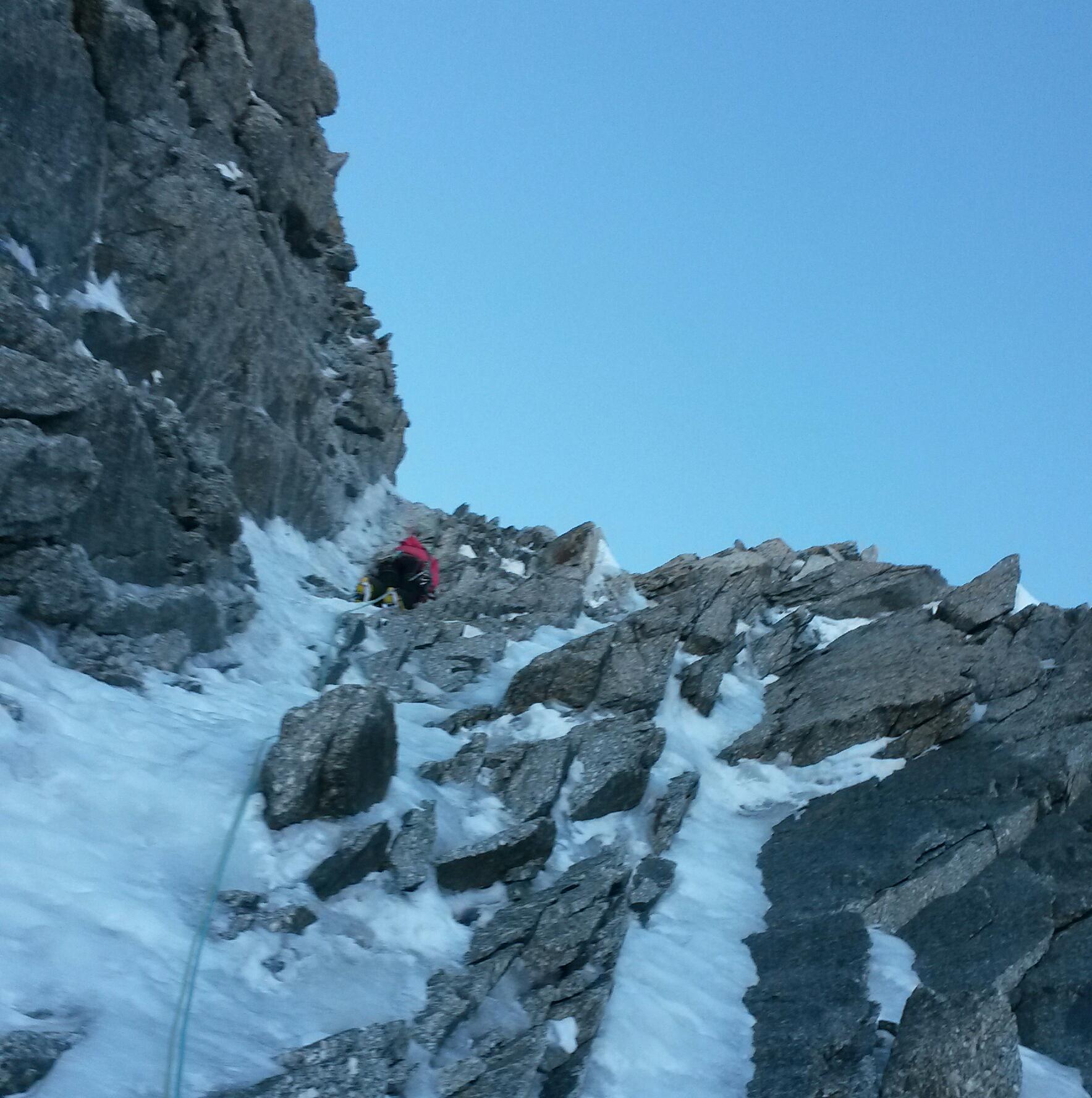
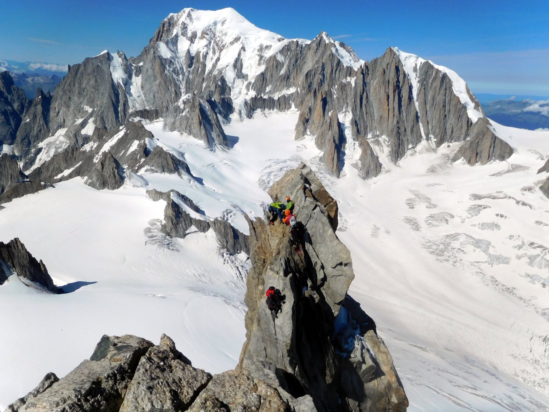
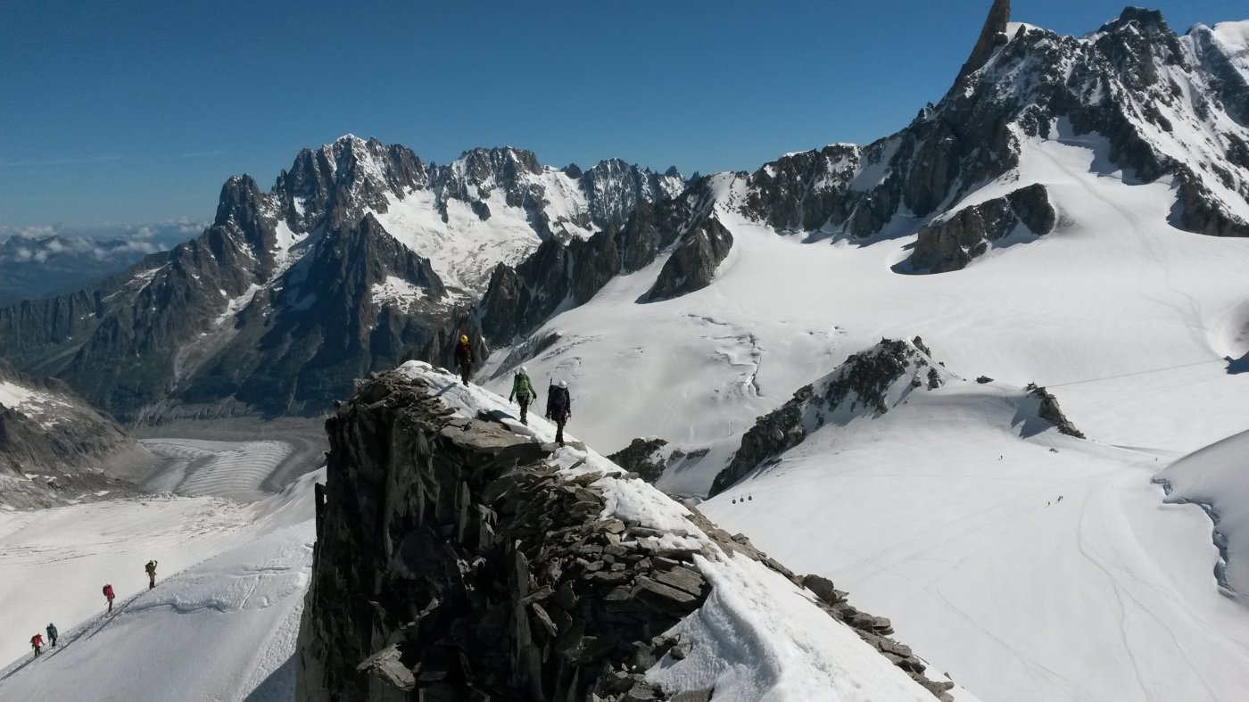
Si incontrano quindi le maggiori difficoltà di questo itinerario, due passi esposti non difficili e un passo leggermente più difficile (II/III) ma non esposto.
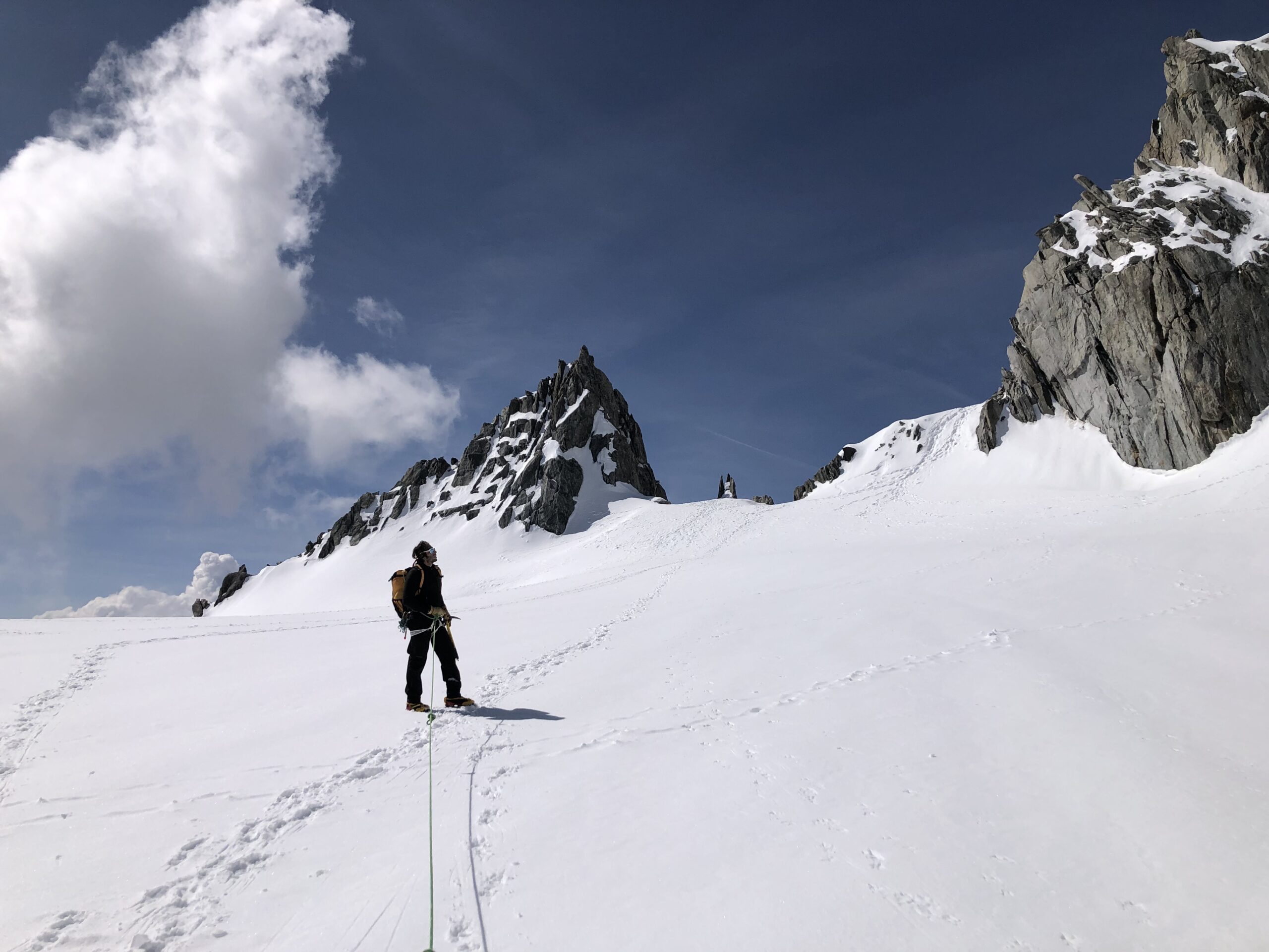
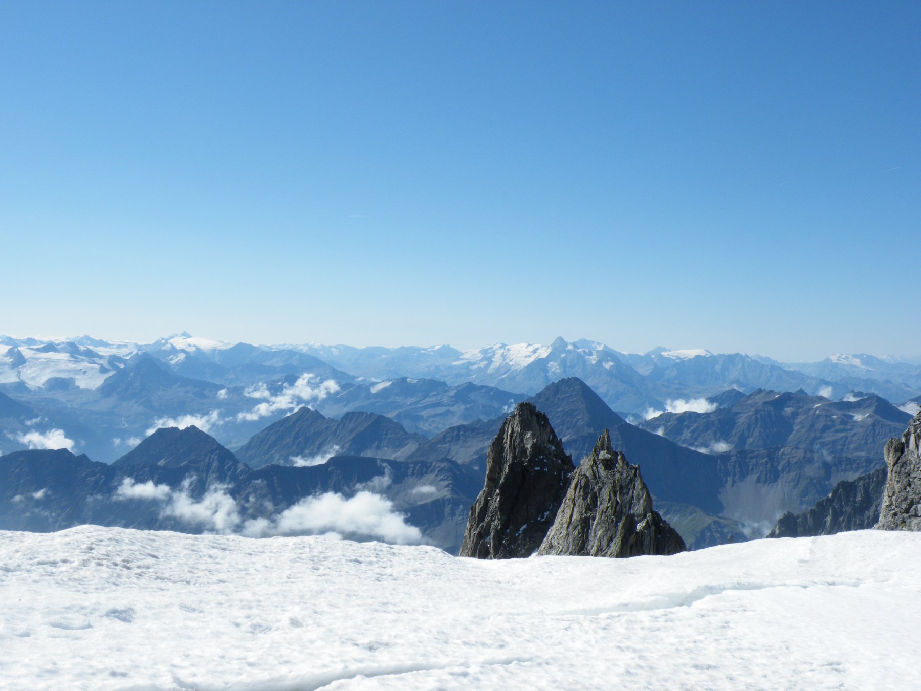
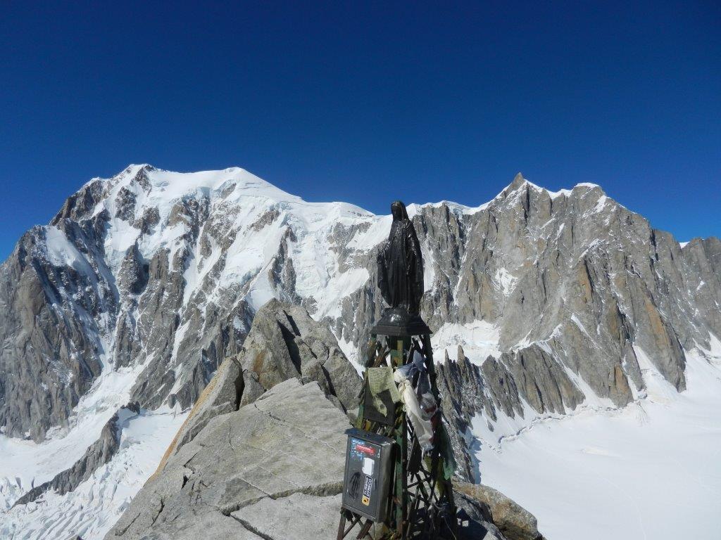
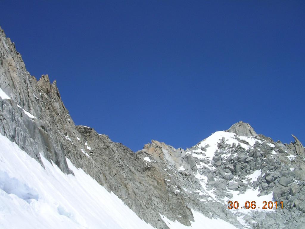
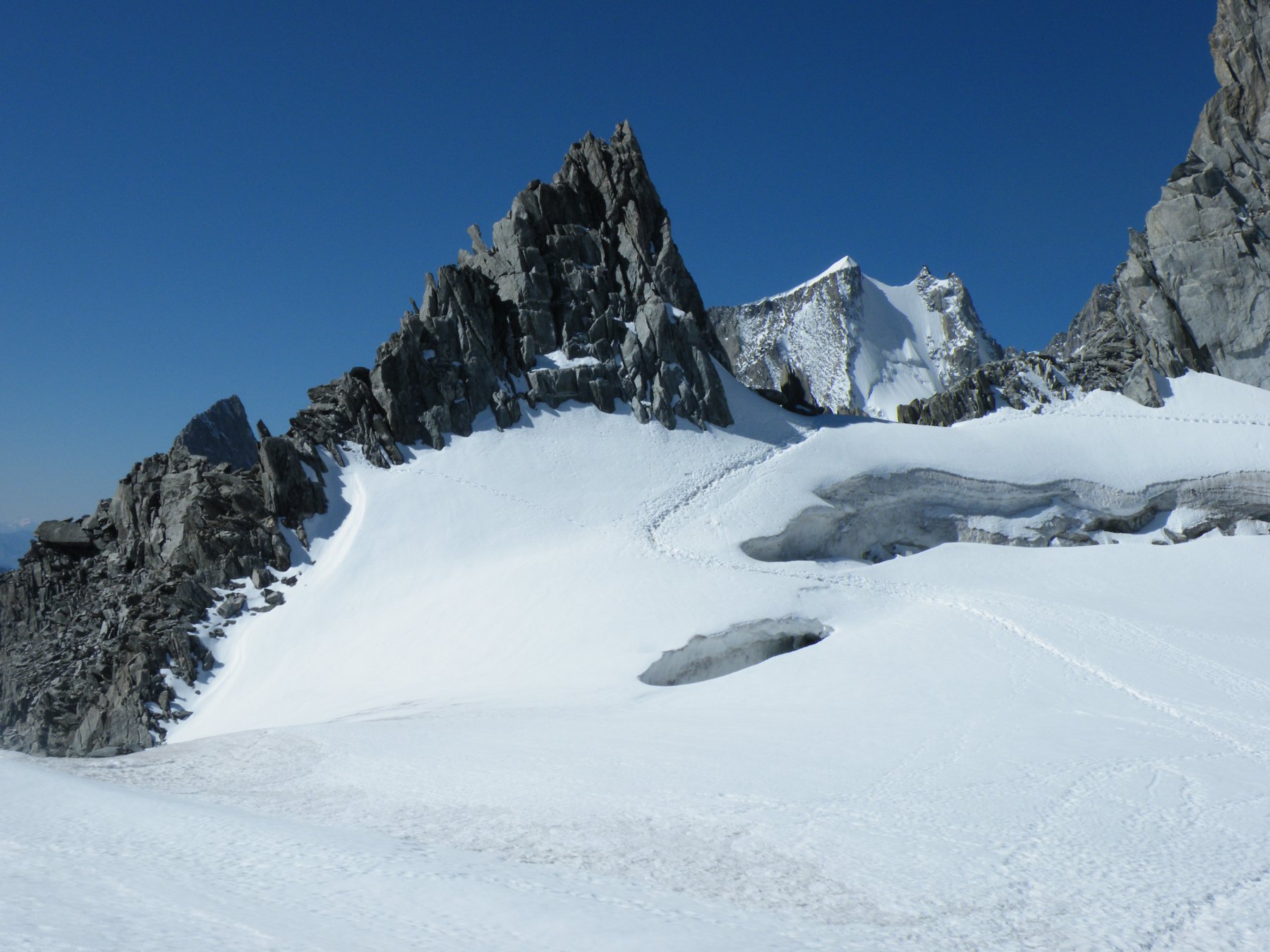
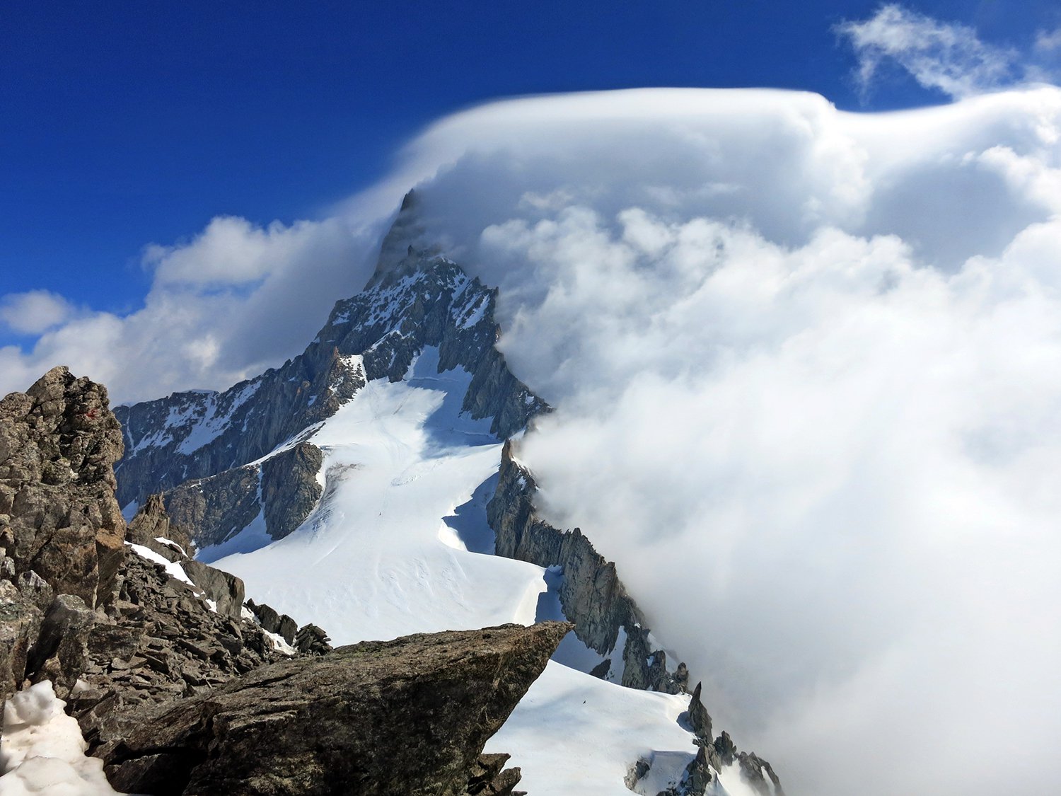
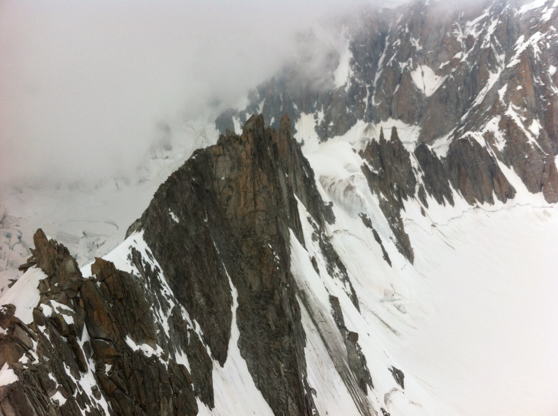
In seguito per aggirare i due torrioni ci si sposta sul versante sud (Brenva) e senza difficoltà si raggiunge il Col Freshfield (3640 m). Di qui proseguire sempre sul versante sud seguendo degli ometti e addirittura tracce di sentiero fino al facile pendio di neve finale e alle roccette della vetta. 1h 30-2h 30 dal col d’ Entreves, 3-4 ore dalla partenza.
Discesa lungo l’ itinerario di andata.
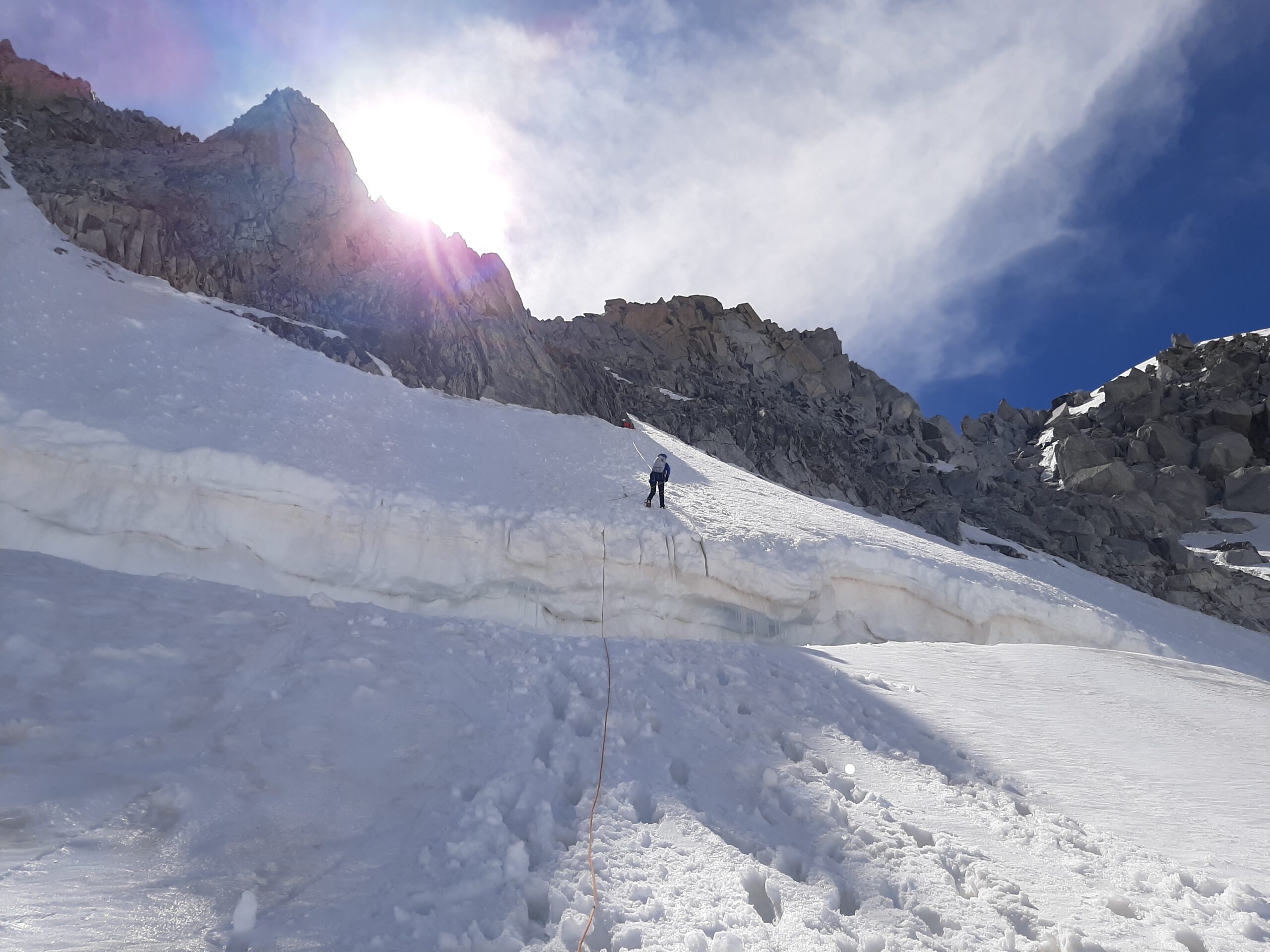
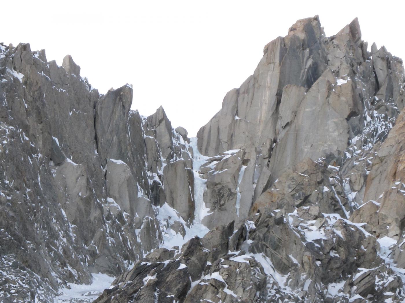
Più interessante, facile e veloce é il canalone Freshfield dall’ omonimo colle, inclinazione 45°. Questo itinerario è anch’ esso descritto giustamente come via normale in questo sito (PD/PD+).
Il canalone non è più sempre nevoso, ma lo è solo a inizio stagione. In ogni caso in assenza di neve si può scendere agevolmente sulle facili roccette del suo versante sud e toccar neve solo sul pendio. Il canalino è descritto sulla GMI come pericoloso in caso di ingenti nevicate recenti e di molto cordate presenti.
La terminale in genere è chiusa ma a stagione inoltrata occorre saltare o calarsi di un paio di metri (in questo caso molto più problematica la salita).
Ore 1-1h 30 per arrivare al ghiacciaio, 2h 30 per il Rifugio Torino.
- Cartografia:
- IGN 3630 OT Chamonix - Massif du Mont Blanc
- Bibliografia:
- GMI - Monte Bianco Vol 1
Nelle vicinanze Mappa
Itinerari
27/12/2015 AO, Courmayeur D+ 251 m AD Nord
Fourche (Col de la) da Punta Helbronner
 0m
0m
10/05/2015 AO, Courmayeur D+ 600 m ED- Nord-Est
Maudit (Mont) A l’est Rien de Nouveau
 50m
50m
13/09/2014 AO, Courmayeur D+ 1600 m D Varie
Bianco (Monte) Parete Nord dell’Aiguille Blanche e Cresta di Peuterey
 50m
50m
12/07/2026 AO, Courmayeur D+ 322 m PD+ Nord-Est
Marbrées (Aiguilles, Punta Nord) Cresta NE
 50m
50m
26/03/2022 AO, Courmayeur D+ 600 m TD Nord
Maudit (Mont) diretta Roger-Baxter-Jones
 50m
50m
23/06/2026 AO, Courmayeur D+ 638 m AD Sud-Ovest
Dente del Gigante Via Normale
 50m
50m
02/06/2023 AO, Courmayeur D+ 250 m PD+ Varie
Vierge (la) da Punta Helbronner
 50m
50m
08/06/2025 AO, Courmayeur D+ 400 m PD- Ovest
Toules (Aiguilles des) Versante NO e cresta NO
 50m
50m
14/07/2024 AO, Courmayeur D+ 850 m F Varie
Lachenal (Pointe) Via Normale da Punta Helbronner
 50m
50m
11/07/2016 AO, Courmayeur D+ 900 m PD+ Sud-Ovest
Tour Ronde Cresta SO dal Col du Trident
 50m
50m