 3.2Km
3.2Km
Note
 1.6Km
1.7Km
1.7Km
3.2Km
6.4Km
6.5Km
6.7Km
1.6Km
1.7Km
1.7Km
3.2Km
6.4Km
6.5Km
6.7Km
3.2Km
3.2Km
3.2Km
3.2Km
3.7Km
5.2Km
5.8Km
5.8Km
6.8Km
6.8Km
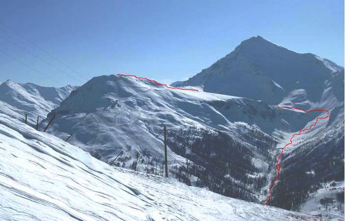
Fuoripista in pieno sud, bello ma piuttosto breve la parte interessante sciisticamente, poi lungo traverso, molto bello l' ambiente.
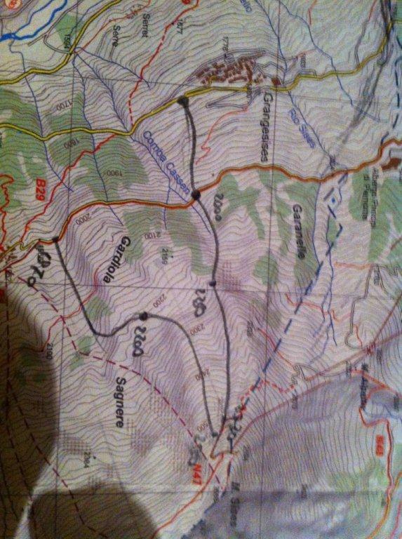
Descrizione
Dalla cima della seggiovia di Roccia Rotonda (meglio nota come Soleil Boeuf) risalire 10 m fino al colletto (2520 m) da cui si prende la pista che ridiscende verso Sestriere; oppure, meglio, raggiungere lo stesso posto sencedendo dal Fraiteve e traversando in corrispondenza della cappelletta.
Scendere i ripidi pendii iniziali in pieno sole (spesso poca neve e ventata; se molta, pericolo valanghe) fino a raggiungere la parte alta del Plateau (2400 m), dove in genere si trova bella neve. Tenersi poi a sinistra del solco del torrente appena entrati nel bosco (2280 m), neve in genere migliore, avendo poi cura di ritraversare e cominciare a spostarsi verso destra per raggiungere le Granges del Alpes Superiori (2120 m).
Qui si supera la strada per la galleria di Monte Rotta e si scende ancora per un bel plateau in lieve pendenza fino alla strada per le Chalmettes (2050 m); fine del tratto sciisticamente interessante. Si prosegue per la strada battuta, risalendo anche brevemente; dal punoto più alto della strada la si abbandona per concedersi ancora 4 curve in un pianoro, per riprenderla e raggiungere infine il Bar Chalemtes (2022 m).
Qui temina il fuoripista e si riprendeono le piste di Sansicario, che permettono di riportarsi alla partenza del Sellette (1720 m). Diversamente si può continuare in fuoriposta sul crinale fino al Forte (1900 m) e scendere per pista o boschi fino a Pariol (1560 m), cabinovia.
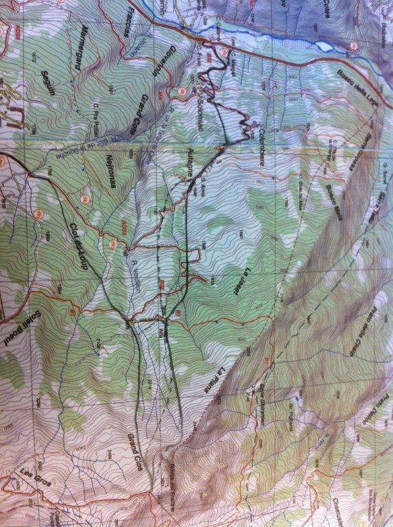
- Cartografia:
- Fraternali N°2, IGC N°1 -Valli di Susa, Chisone e Germanasca
Nelle vicinanze Mappa
Itinerari
17/02/2013 TO, Cesana Torinese D+ 920 m 3.1, E1 Ovest
Colombiere
450m
23/03/2012 TO, Cesana Torinese D+ 1000 m 3.1, E1 Ovest
San SicarioVari
 1.6Km
1.6Km
14/02/2018 TO, Cesana Torinese D+ 1363 m 3.1, E1 Ovest
Colombiere completa dal Colletto del Rio Nero
 1.7Km
1.7Km
17/03/2013 TO, Cesana Torinese D+ 609 m 2.3, E1 Ovest
Mollieres da Sansicario
 1.7Km
1.7Km
01/12/2012 TO, Sestriere D+ 540 m 1.1, E1 Sud
Chalmettes – Rollieres da San Sicario
2.6Km
30/12/2012 TO, Cesana Torinese D+ 800 m 1.1, E1 Nord-Est
Remolon (Rocca) fuoripista Colle Bercia
 3.2Km
3.2Km
08/12/2012 TO, Sauze di Cesana D+ 940 m 3.1, E1 Sud
Roccia Rotonda da Sansicario
5.3Km
22/12/2012 TO, Sauze D'oulx D+ 1110 m 3.2, E1 Nord-Ovest
Rio Nero
 6.4Km
6.4Km
15/12/2012 TO, Sauze D'oulx D+ 1029 m 3.2, E2 Nord
Barracano
 6.5Km
6.5Km
22/12/2012 TO, Sestriere D+ 580 m 3.2, E1 Sud-Ovest
Sises (Monte) discesa a Bessen Haut
 6.7Km
6.7Km
Servizi
3.2Km
3.2Km
L’Ibarus Rifugio
Cesana Torinese
3.2Km
Piergiorgio Frassati B&B
Cesana Torinese
3.2Km
Casa Cesana Bar
Cesana Torinese
3.7Km
Centro Ristorante
Cesana Torinese
5.2Km
La Fontana del Thures Rifugio
Cesana Torinese
5.8Km
La Chardouse Rifugio
Oulx
5.8Km
La Moretta Ristorante
Oulx
6.8Km
La Crota B&B
Cesana Torinese
6.8Km


