1.9Km
1.9Km
Note
 400m
600m
2Km
4.8Km
4.9Km
5Km
5.8Km
400m
600m
2Km
4.8Km
4.9Km
5Km
5.8Km
1.9Km
3Km
3.7Km
6.4Km
8Km
8.1Km
8.3Km
8.4Km
8.4Km
8.7Km
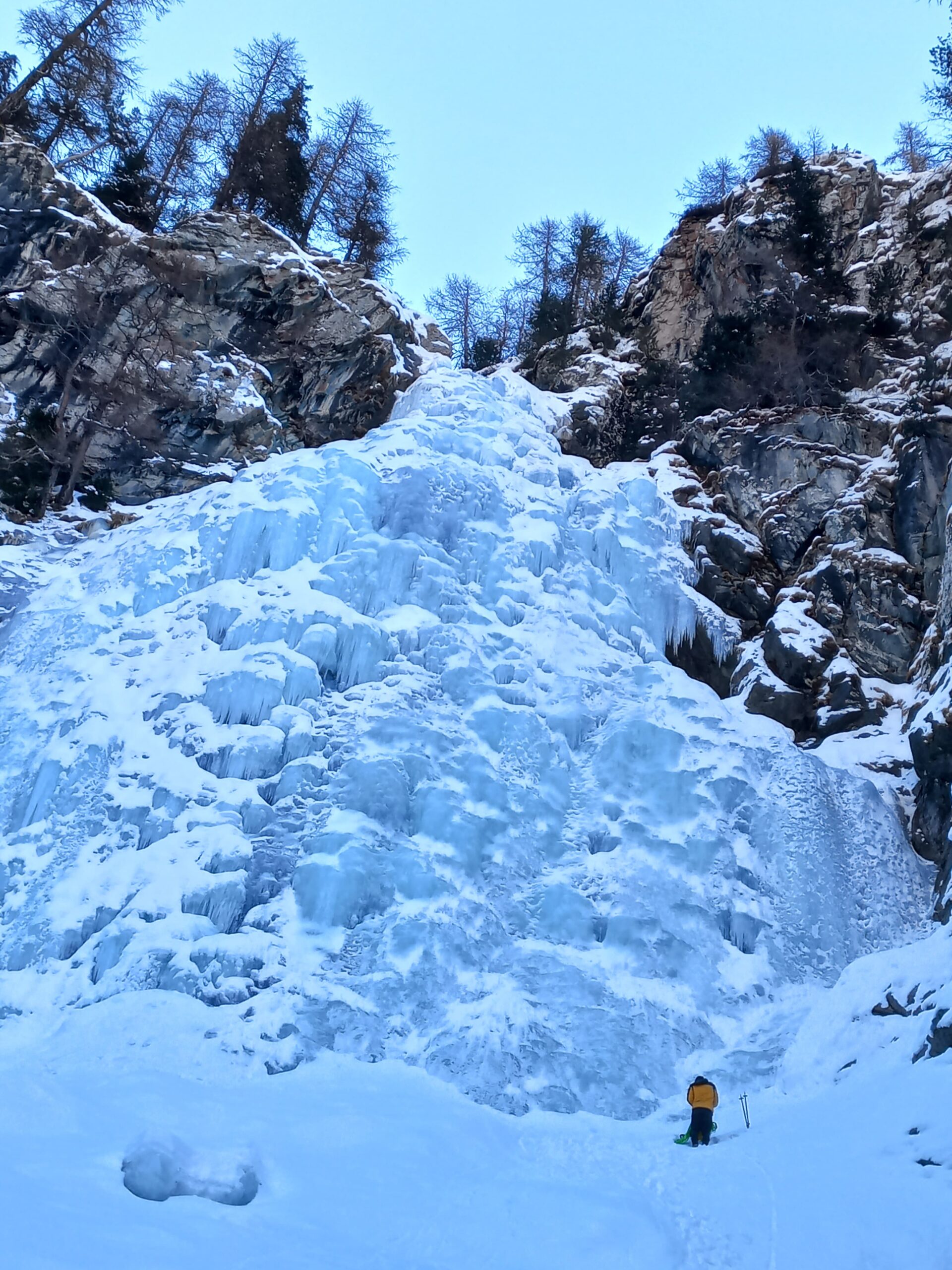
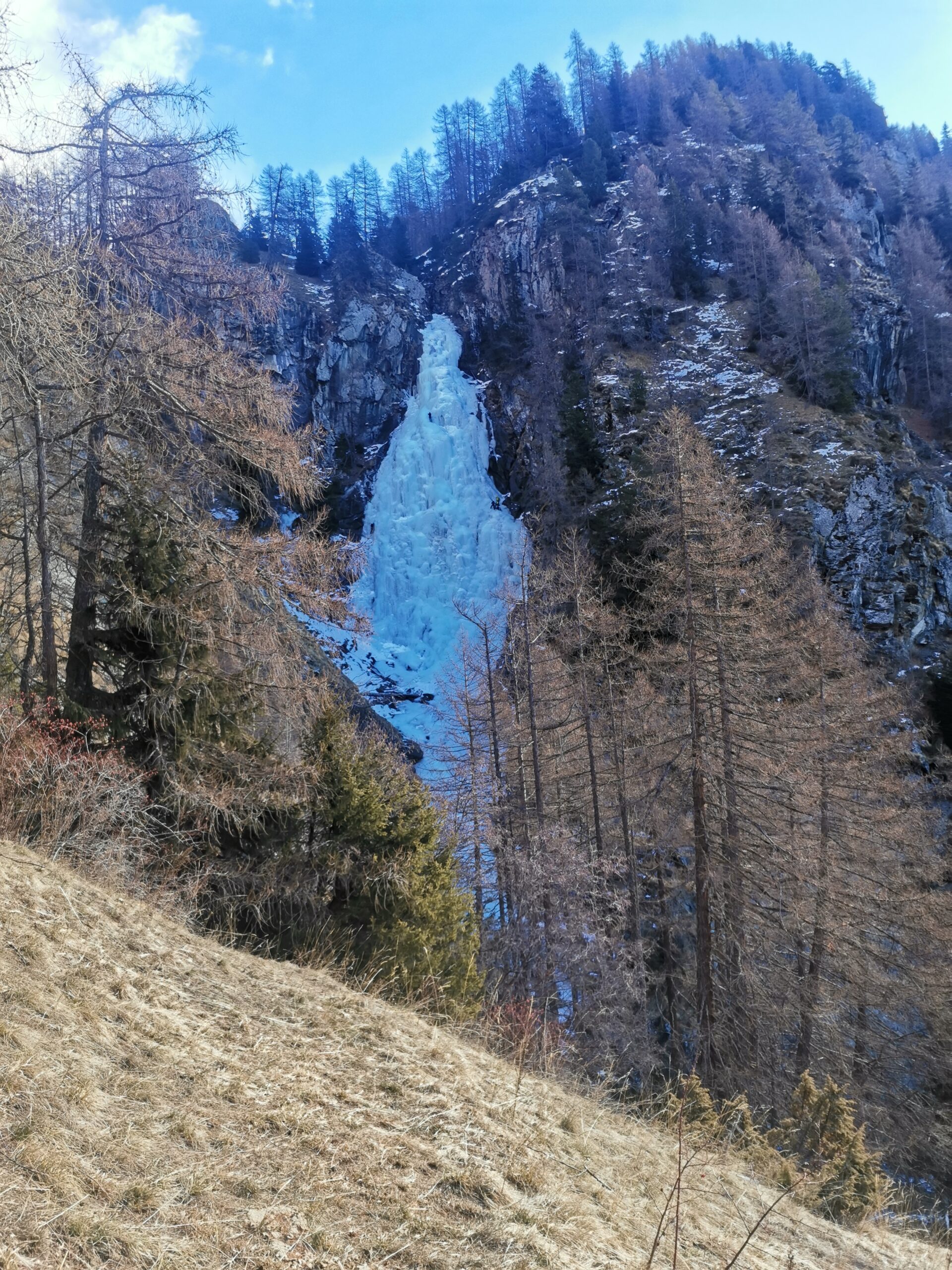
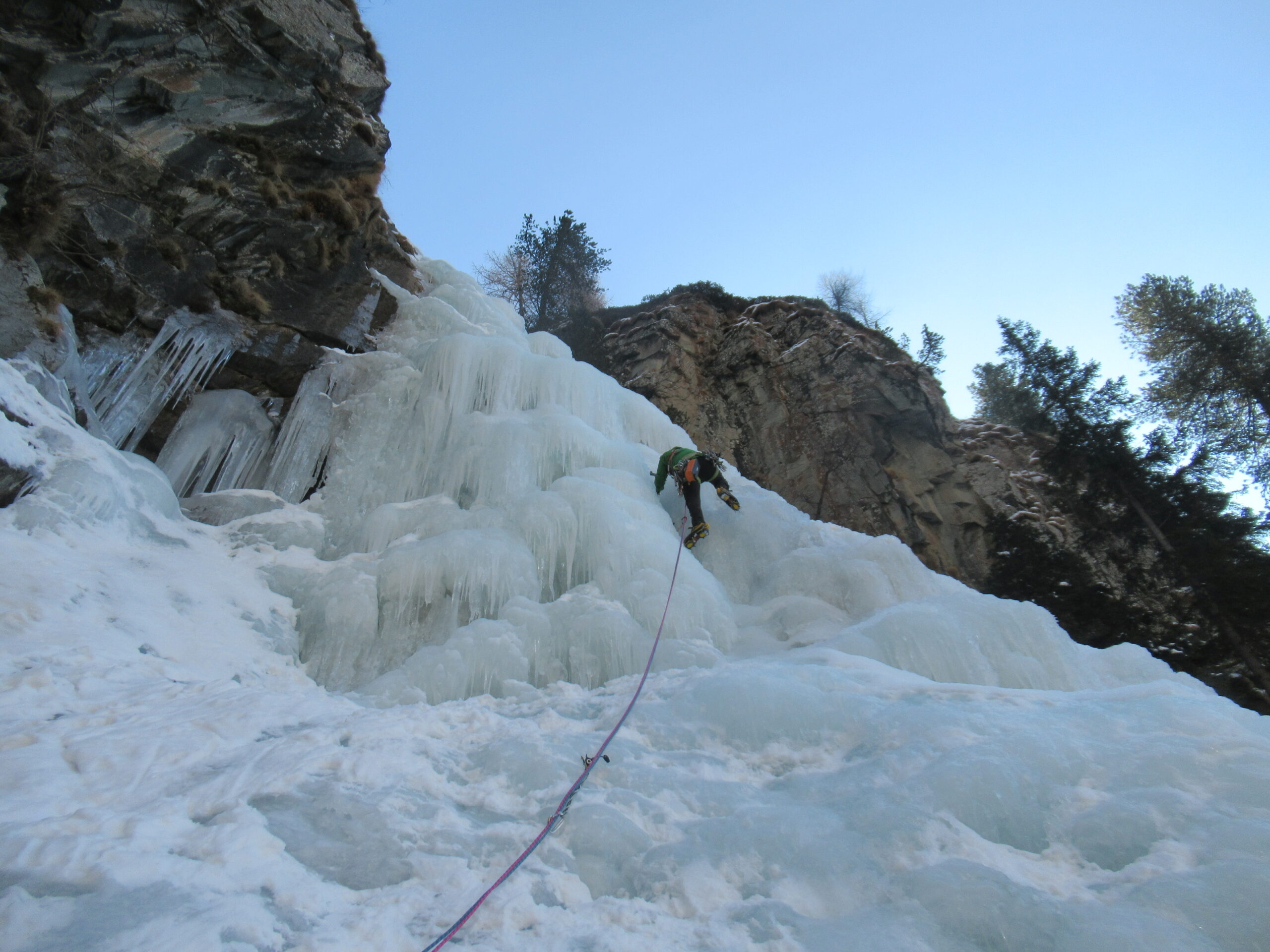
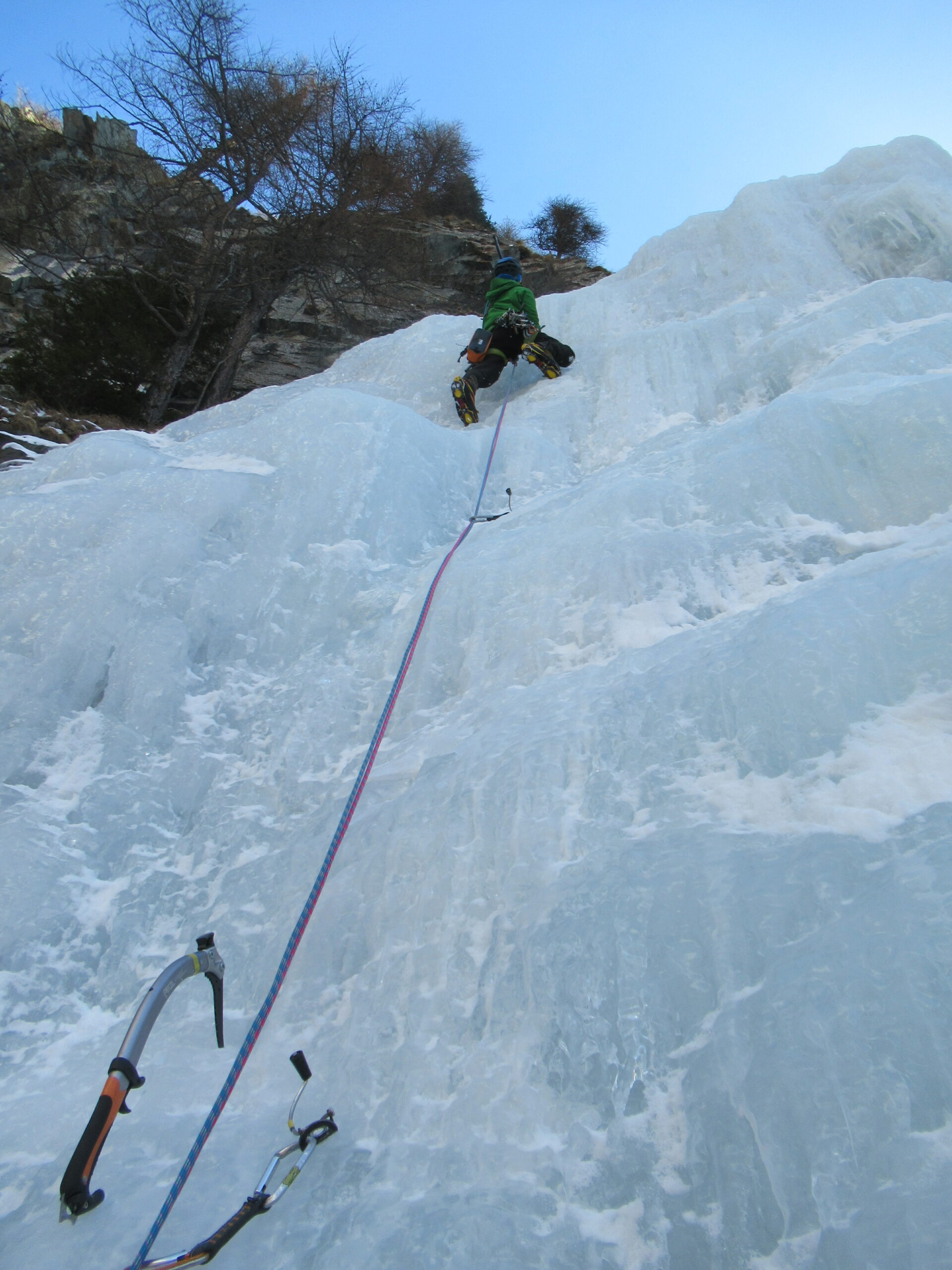
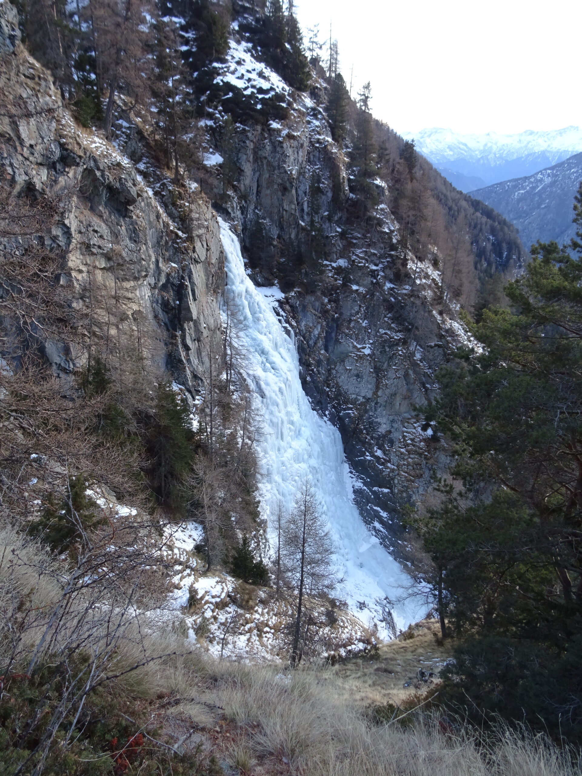
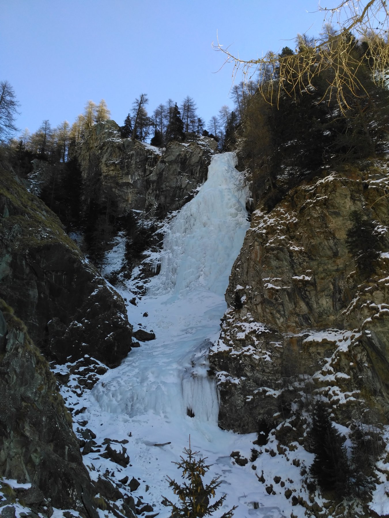
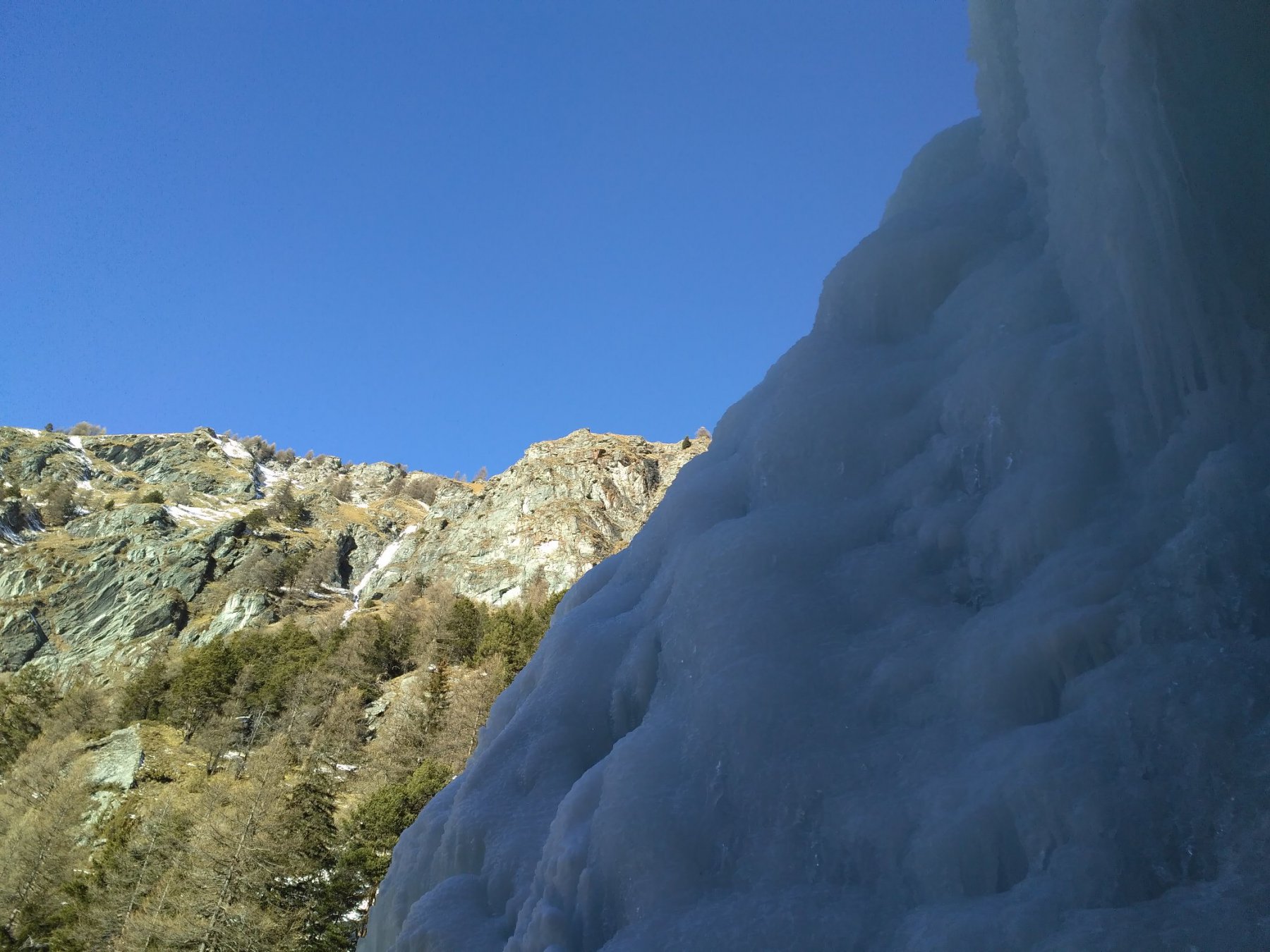
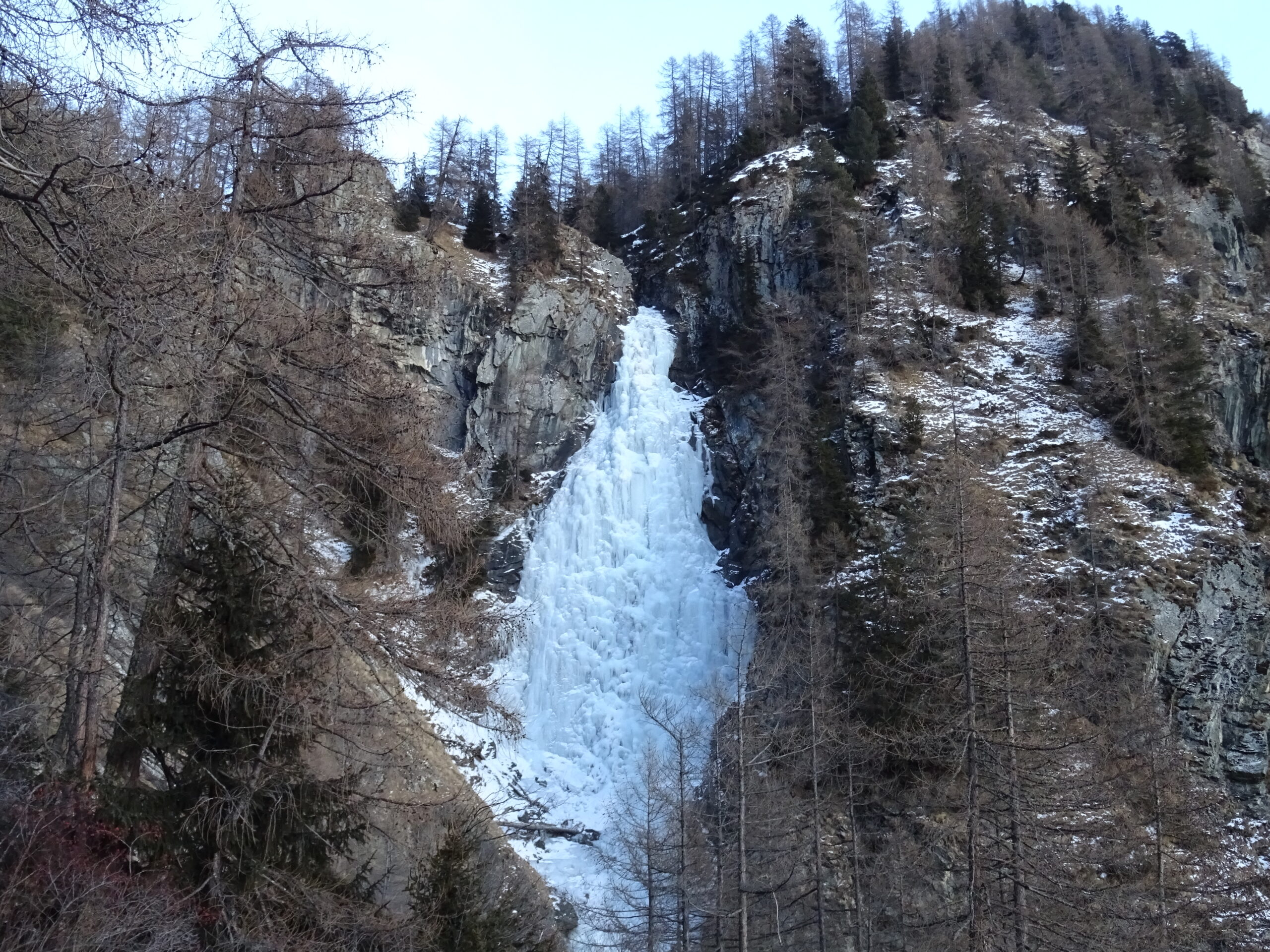
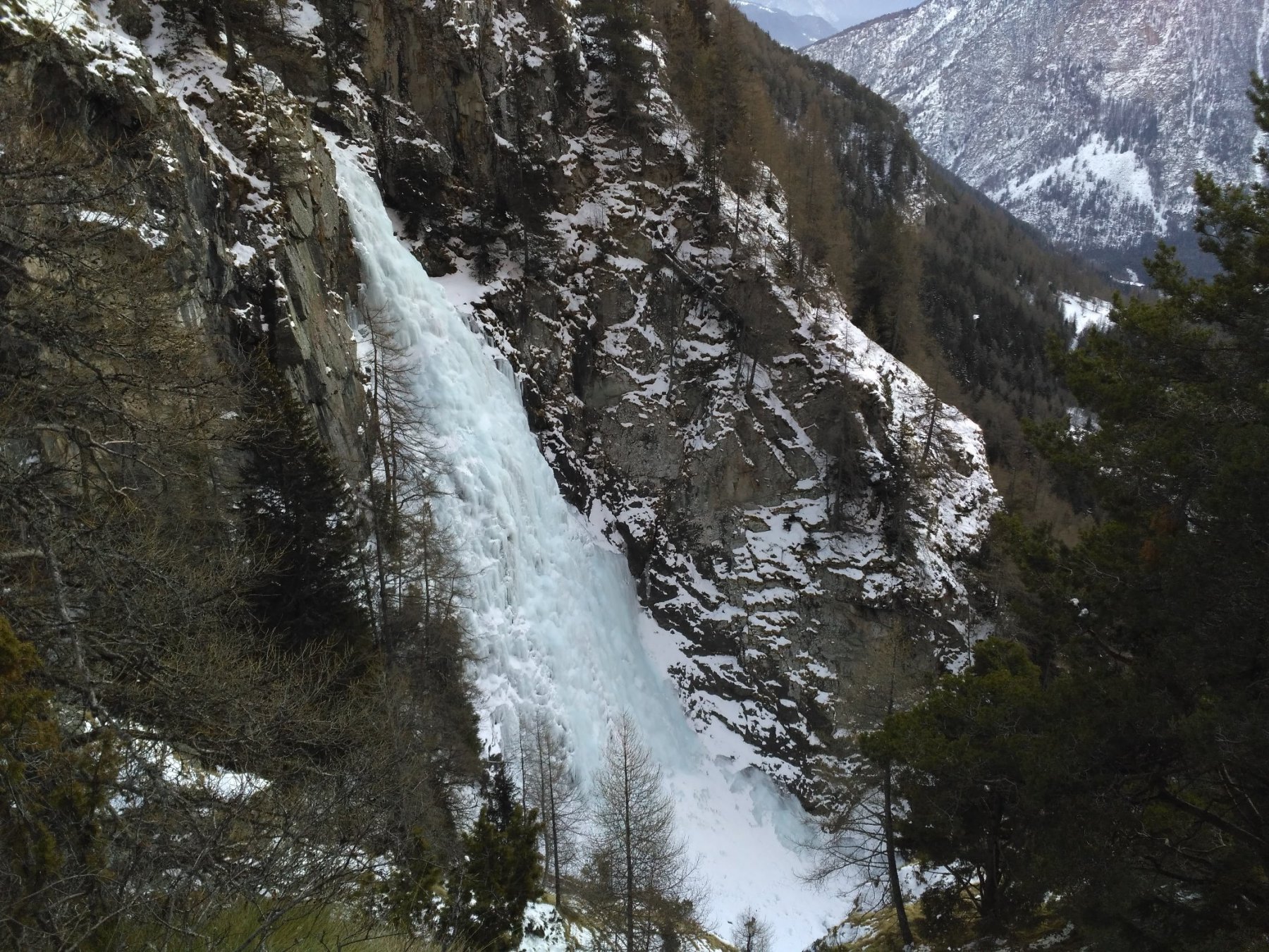
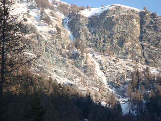
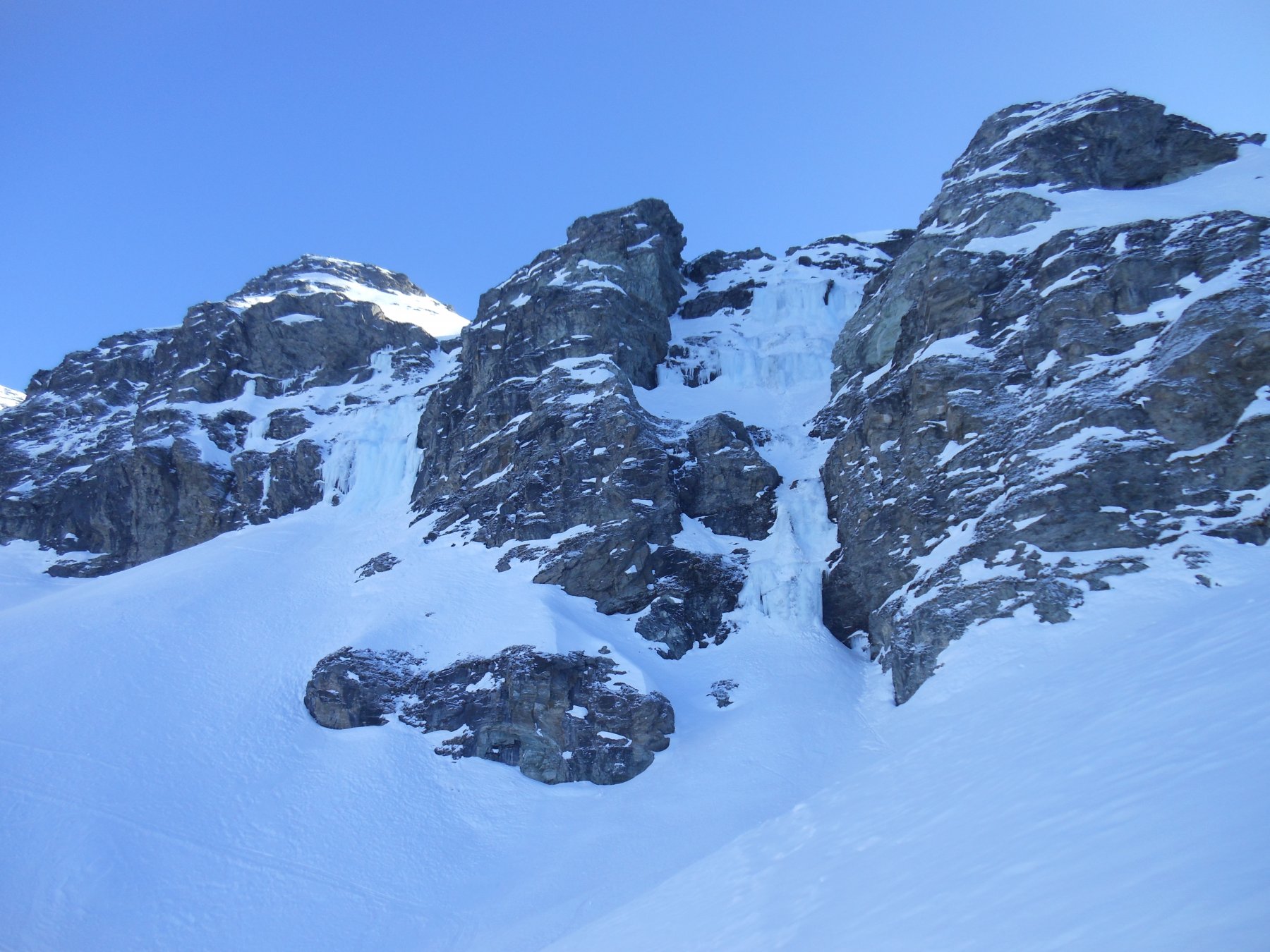
Bella cascata in ambiente isolato. Il ghiaccio spesso è stratificato e a cavolfiori.
Avvicinamento
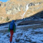
Lasciare l'auto al 6° tornante della strada per Estoul (piccolo parcheggio a 30m dal tornante). Seguire la strada sterrata prima in leggera salita e poi in discesa fino al torrente, in corrispondenza di una presa dell'acqua. Proseguire lungo la strada per 100m scarsi e poi prendere il sentiero sulla dx per Paccard (no indicazioni, solo una freccia su masso). Raggiunte le case (30min dal park), lasciare il sentiero e tagliare a dx per prati, quindi scendere fino a raggiungere il torrente ai piedi dell'imponente cascata.
Un breve e facile saltino conduce alla cascata vera e propria.
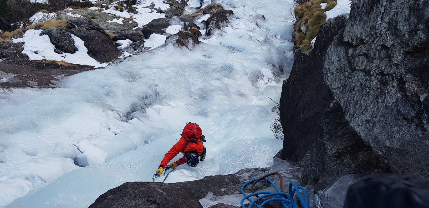
Descrizione
Un breve e facile saltino conduce alla cascata vera e propria.
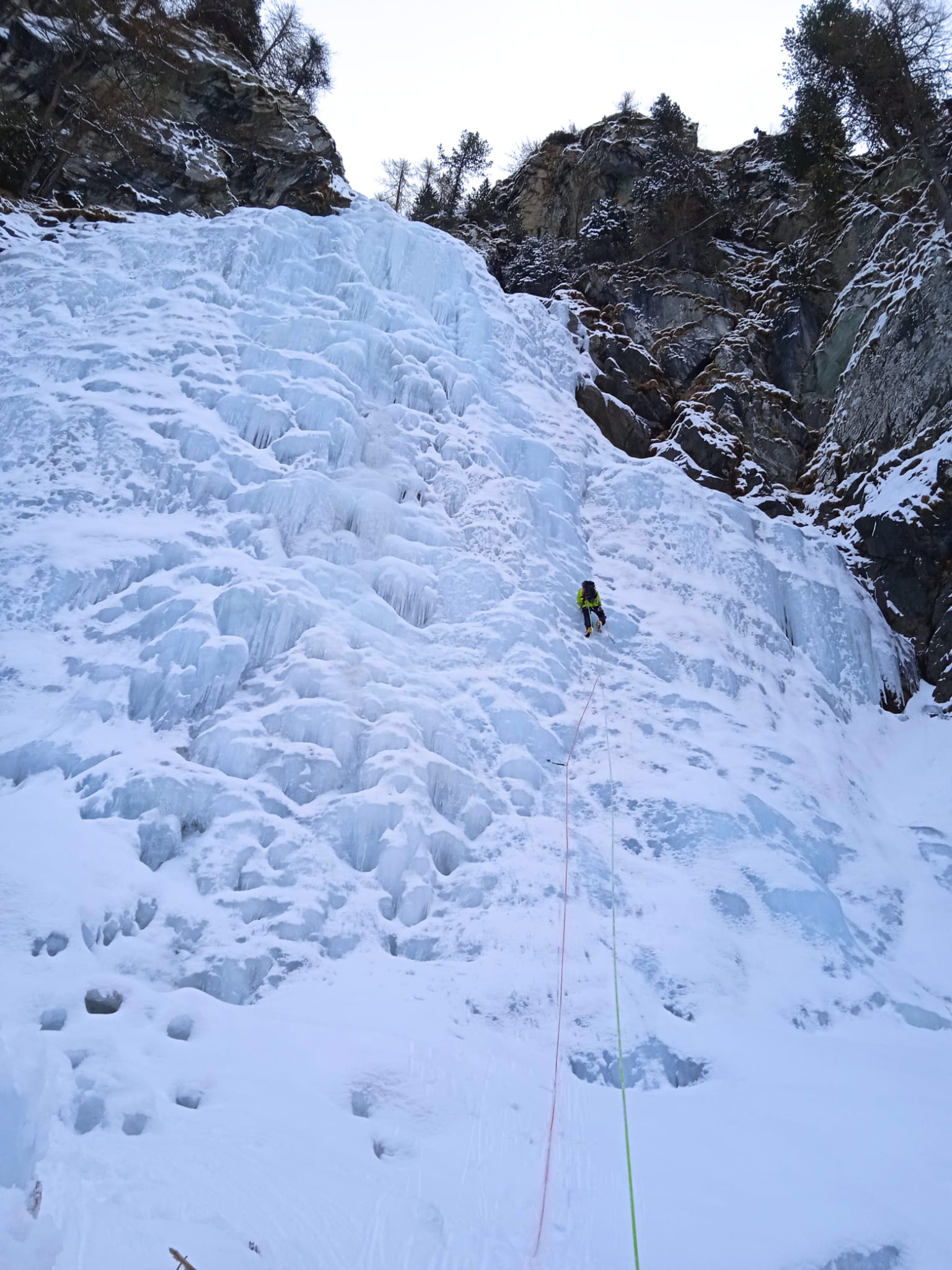
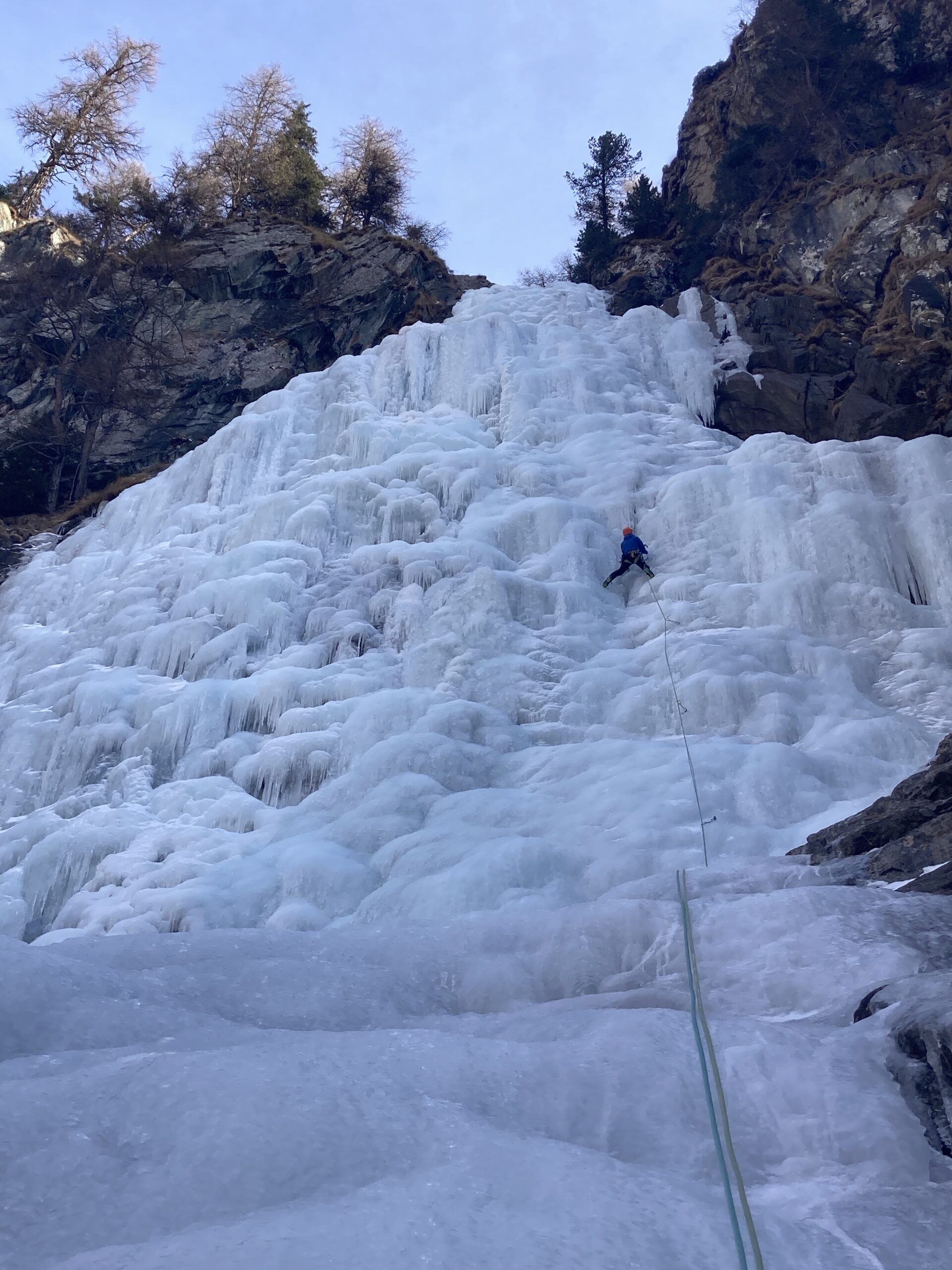
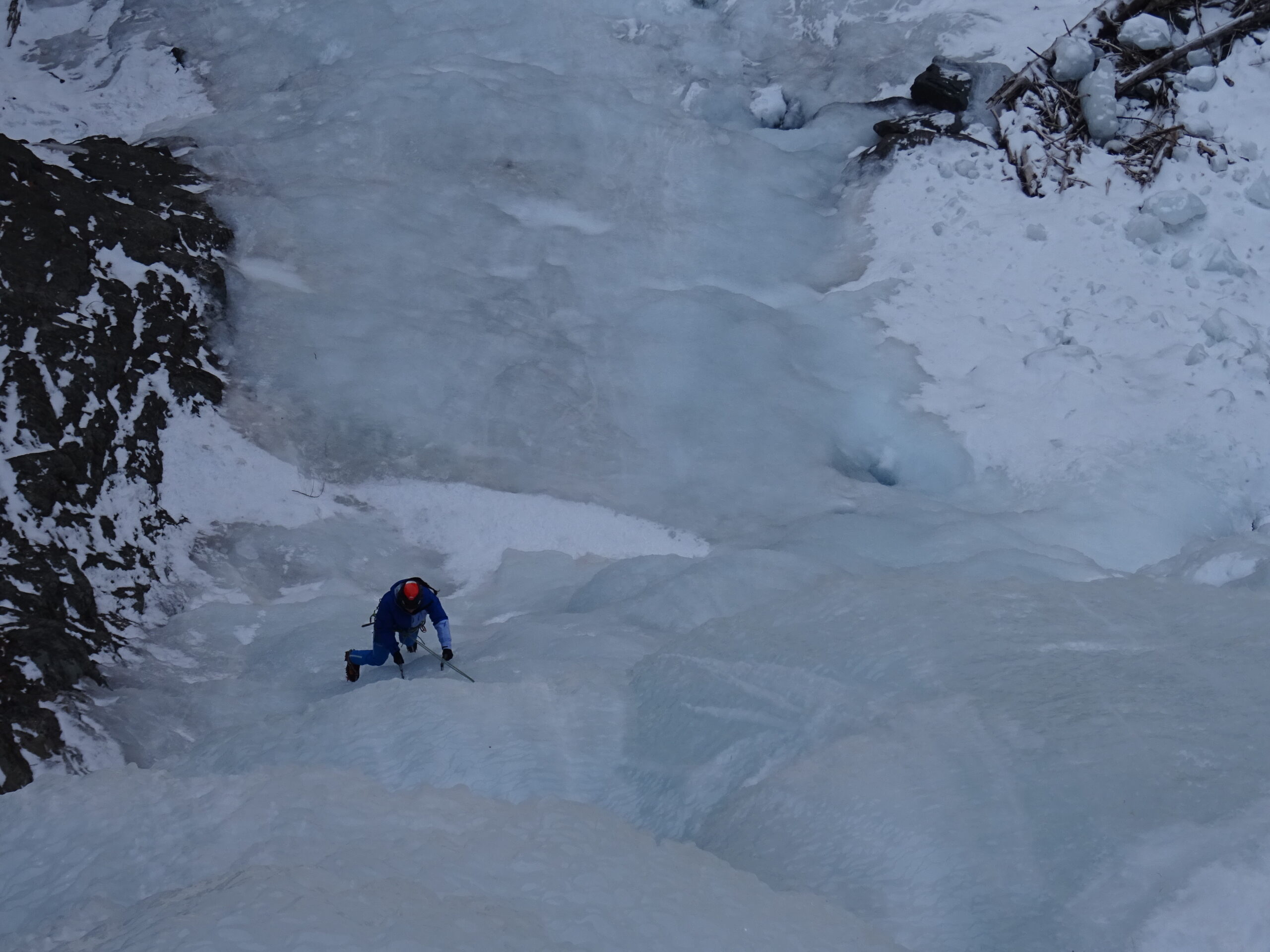
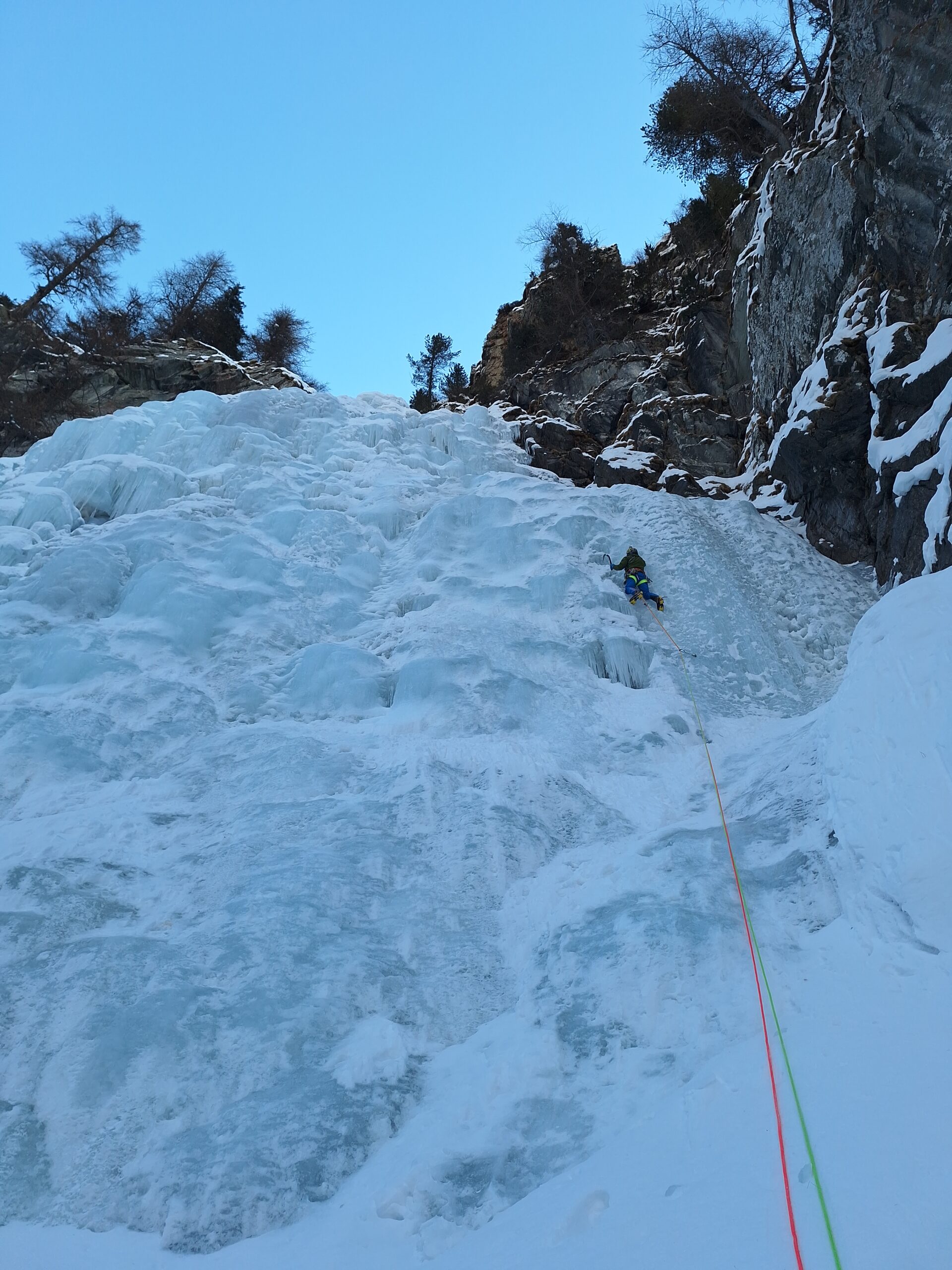
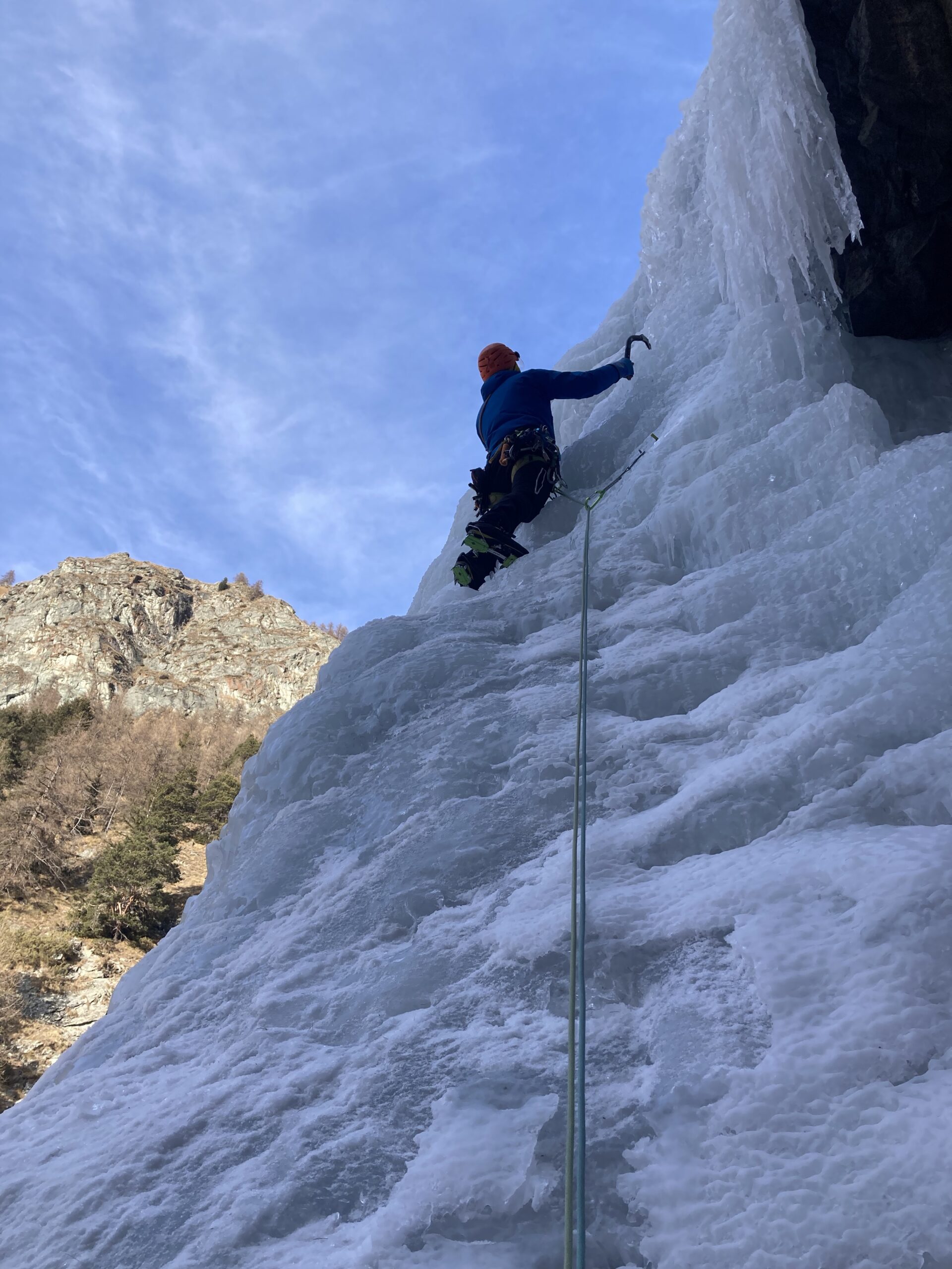
Un primo salto molto breve (5-6m) può essere affrontato al centro o a dx se con poco ghiaccio (da 70° a 85°). Quindi si prosegue per una 50ina di metri fino alla base del muro principale. Con forte innevamento questa parte può essere coperta.
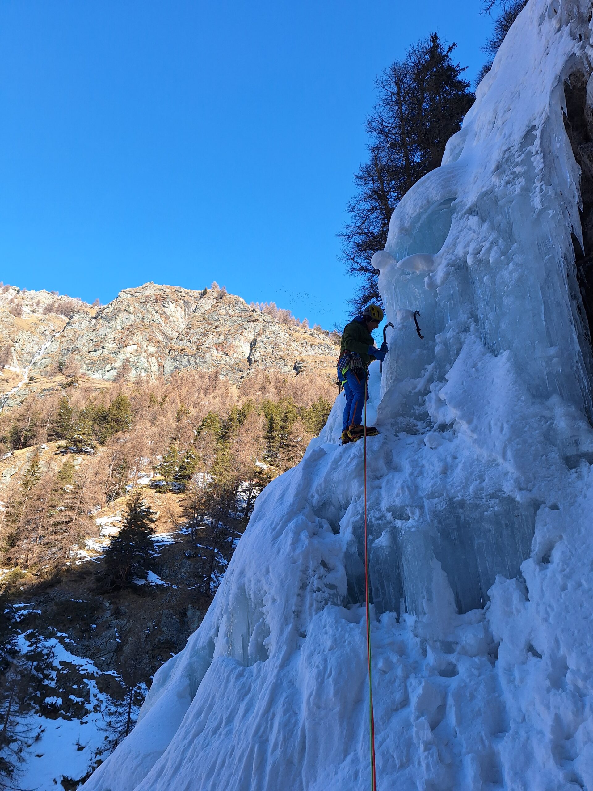
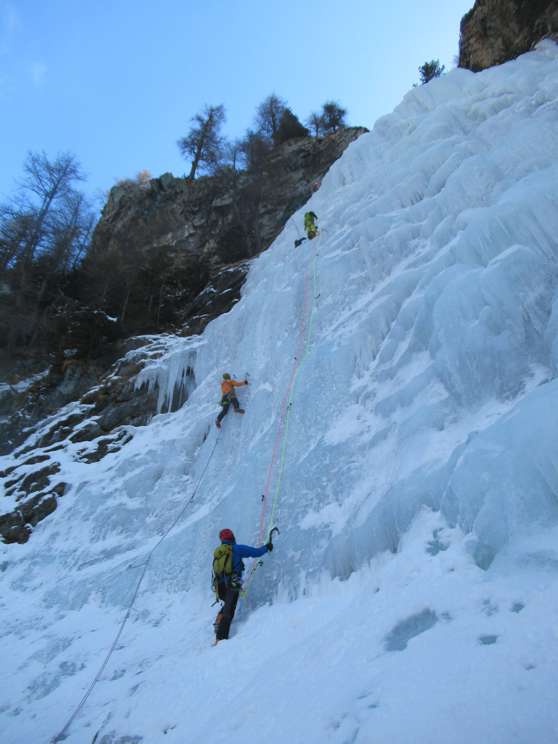
La cascata si sale generalmente nel centro-dx su pendenze costanti tra 70-80° e tratti a 90°, con 2/3 tiri. Sono presenti tre soste attrezzata e fix e cordoni sulla dx, le prime due in due grottini, e l’ultima poco oltre l’uscita, una decina di metri oltre la vecchia sosta cordoni su larice
Discesa:
– a piedi: proseguire sul fondo del torrente oltrepassando una prima vasca, alla seconda uscire a sx e risalire la sponda terrosa fino a raggiungere i prati e una radura con alpeggio, da lì per sentiero rapidamente si torna alle case di Paccard (ottimo colpo d’occhio sulla cascata)
– in doppia: la prima calata è più comoda fatta dalla vecchia sosta cordoni e maillon su larice sulla dx dove la cascata spiana.
- Bibliografia:
- Matteo Giglio - Effimeri Barbagli - 2014 Tipografia Valdostana
Nelle vicinanze Mappa
Itinerari
10/02/2012 AO, Brusson 220 m II, 2+ Sud-Est
Estoul – Blizzard (Cascata)
 400m
400m
06/02/2017 AO, Brusson 40 m II, 3+ Sud
Estoul – Martin Sec (Cascata)
550m
13/02/2012 AO, Brusson 70 m II, 5+ Sud
Estoul – L’Arpa Magica (Cascata)
 600m
600m
28/11/2025 AO, Brusson 180 m II, 3 Sud
Estoul – Palasina (Cascata di)
 2Km
2Km
26/01/2003 AO, Brusson 120 m III, 3+ Nord-Ovest
Comagna (Testa di) Goulotte di Comagna
2.9Km
05/02/2005 AO, Brusson 90 m II, 2+ Sud-Ovest
Brusson – Vollon (Cascata di)
4.3Km
20/12/2015 AO, Brusson 120 m III, 3+ Nord-Ovest
Graines – Camomilla Ice (Cascata)
 4.8Km
4.8Km
20/12/2015 AO, Brusson 100 m III, 3+ Nord-Ovest
Graines – Square House (Cascata)
 4.9Km
4.9Km
12/01/2019 AO, Brusson 120 m III, 3 Nord-Ovest
Graines – Hey Joe! (Cascata)
 5Km
5Km
12/03/2026 AO, Ayas 120 m III, 4 Ovest
Pinter (Monte) – Cascata di destra
 5.8Km
5.8Km
Servizi
1.9Km
3Km
Le Coin des Melezes B&B
Brusson
3.7Km
Laghetto Albergo
Brusson
6.4Km
La Grolla Campeggio
Challant
8Km
Le Petit Coq Ristorante
Ayas
8.1Km
Kleine bar Ristorante
Gressoney-Saint-Jean
8.3Km
Gran Baita Albergo
Gressoney-Saint-Jean
8.4Km
Le petit monde Ristorante
Ayas
8.4Km
Flying brasserie (Paul Verlaine) Ristorante
Gressoney-Saint-Jean
8.7Km