 600m
600m
Note
 150m
2Km
3.1Km
3.9Km
5.6Km
5.6Km
5.7Km
5.8Km
5.9Km
6.3Km
150m
2Km
3.1Km
3.9Km
5.6Km
5.6Km
5.7Km
5.8Km
5.9Km
6.3Km
600m
750m
750m
2.2Km
2.2Km
3.3Km
3.3Km
3.3Km
3.6Km
5.8Km
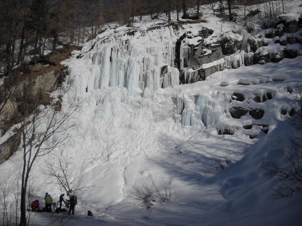
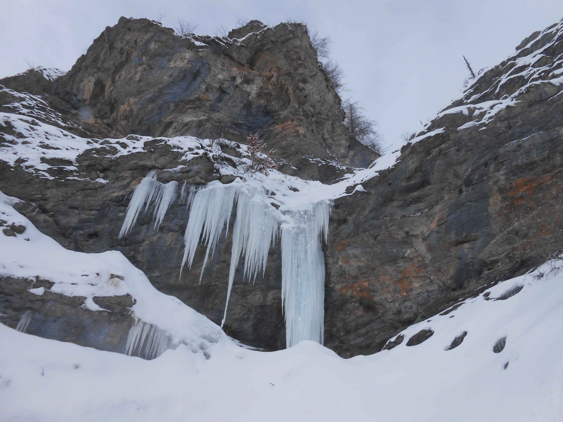
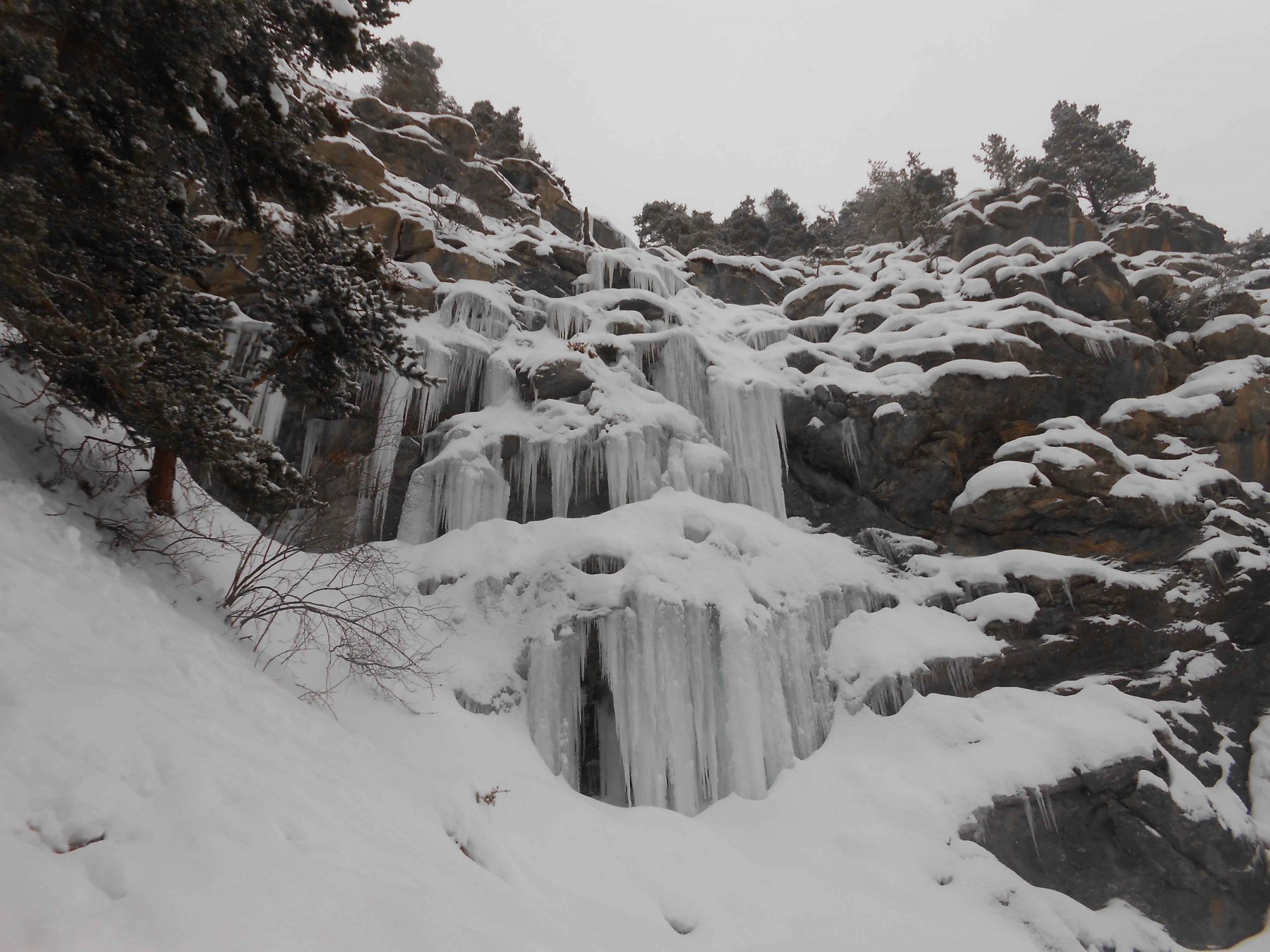
Entrambe le colate sono adatte a principianti e, volendo, assicurabili dall'alto (piante) passando per il bosco tra le 2 cascate.
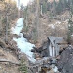
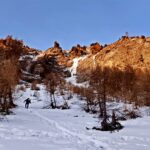
Avvicinamento
Dal piazzale prendere la strada che sale vs S ad E della sciovia e parallela alla stessa. Lasciare l'auto dove finisce la strada presso un ponte in legno.
Proseguire parallelamente alla sciovia e oltre la stessa inoltrandosi verso la presa dell'acqua.
Descrizione
Proseguire parallelamente alla sciovia e oltre la stessa inoltrandosi verso la presa dell'acqua.
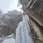
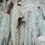
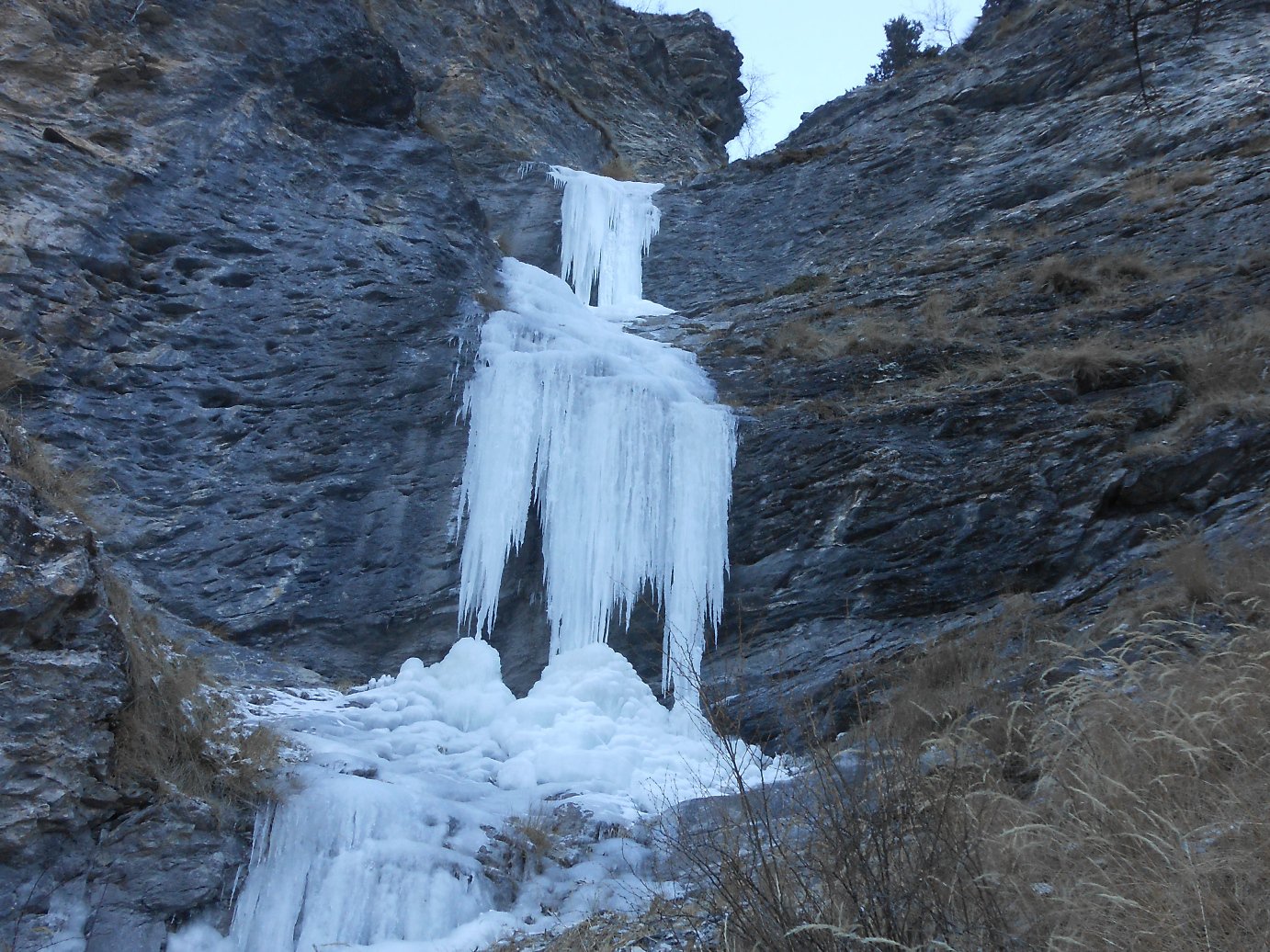
Si tratta di due colate: a dx si trova quella più interessante che si forma quasi sempre, l’altra a sx è più facile ma un po più lunga , ma necessita di condizioni più rare per la sua formazione.
Ultima revisione 31/12/2024
Nelle vicinanze Mappa
Itinerari
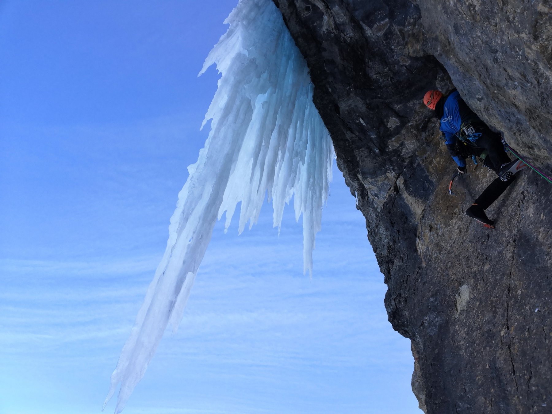
11/01/2022 TO, Pragelato 20 m I, 4 Nord-Ovest
Pragelato – Anfiteatro del Ghiaccio (Cascate)
 150m
150m
17/01/2026 TO, Pragelato 25 m II, 3+ Nord
Pragelato – Anfiteatro del Vento (Cascata)
 2Km
2Km
25/03/2022 TO, Pragelato 120 m II, 1+ Nord
Pragelato – Fraisse (Cascata di)
 3.1Km
3.1Km
18/01/2025 TO, Pragelato 15 m I, 3+ Est
Pragelato – Circus break (Cascata)
 3.9Km
3.9Km
15/01/2017 TO, Usseaux 60 m II, 3+, M4 Sud
Fraisse (Bastionata di) – Cristalli d’Annata
 5.6Km
5.6Km
21/02/1995 TO, Pragelato 120 m IV, 5 Nord-Est
Val Troncea – Pisse Neire (Cascata) VIETATA
 5.6Km
5.6Km
03/03/2018 TO, Usseaux 60 m II, 4 Sud
Fraisse (Bastionata di) – Suggestioni Cristalline
 5.7Km
5.7Km
18/01/2025 TO, Usseaux 60 m II, 4 Nord-Est
Gran Cerogne – Che Rogne! (Cascata)
 5.8Km
5.8Km
03/03/2018 TO, Usseaux 120 m II, 3 Sud
Fraisse (Bastionata di) – Effimere Circostanze (Cascata)
 5.9Km
5.9Km
31/12/2018 TO, Sestriere 65 m III, 5+, M8 Nord
Banchetta (Monte) – Alla Bellemmeglio (Cascata)
 6.3Km
6.3Km
Servizi
600m
750m
Casa Alpina Rifugio
Pragelato
750m
Passet Ristorante
Pragelato
2.2Km
L’itialette Ristorante
Pragelato
2.2Km
Refugium – ex. Rif. Belotte Rifugio
Pragelato
3.3Km
La capanna del sole Ristorante
Pragelato
3.3Km
Al Mulino Ristorante
Pragelato
3.3Km
1898 Ristorante
Soucheres-basses
3.6Km
Mulino di Laval Rifugio
Pragelato
5.8Km


