5.6Km
5.6Km
Note
Storico
 850m
1.1Km
1.1Km
1.2Km
1.2Km
1.3Km
1.3Km
1.3Km
850m
1.1Km
1.1Km
1.2Km
1.2Km
1.3Km
1.3Km
1.3Km
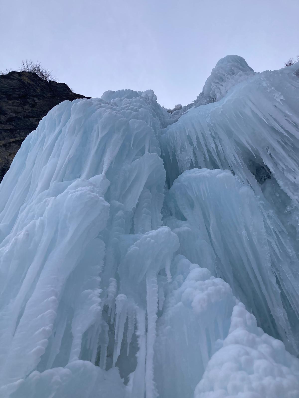
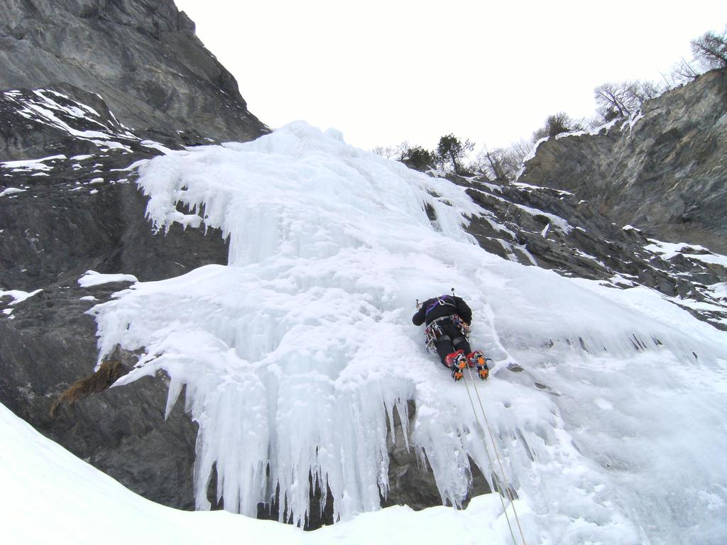
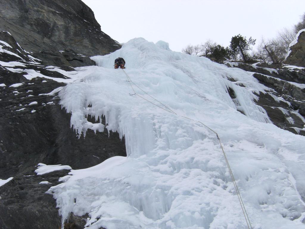
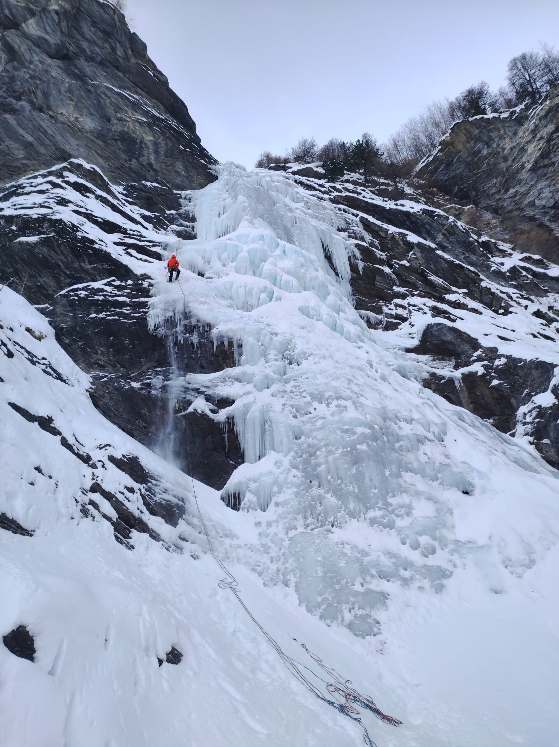
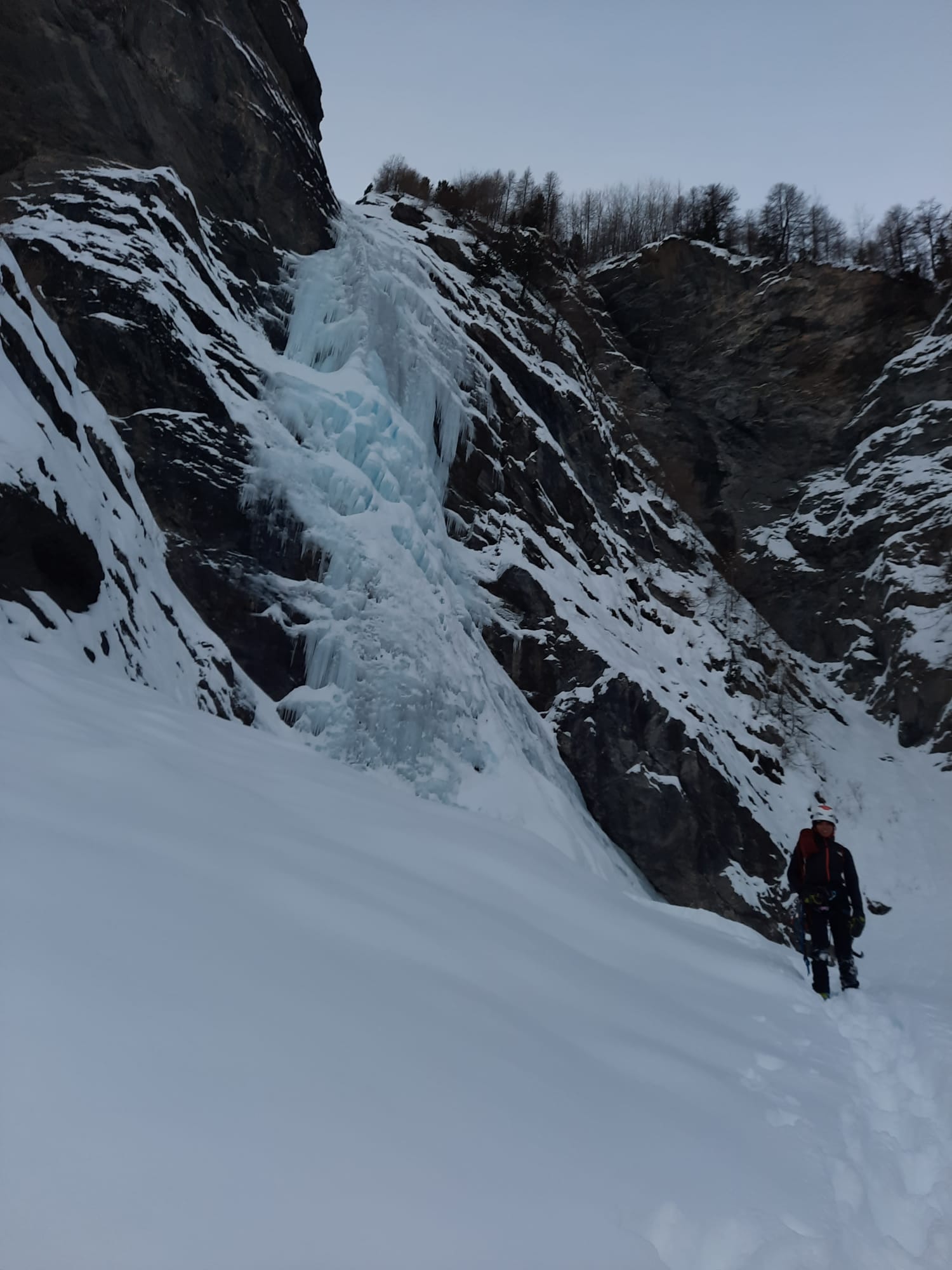
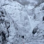
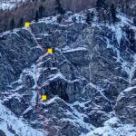
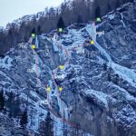
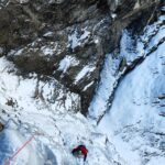
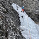
Cascata imponente ed estetica, non presenta rischi oggettivi in caso di neve.
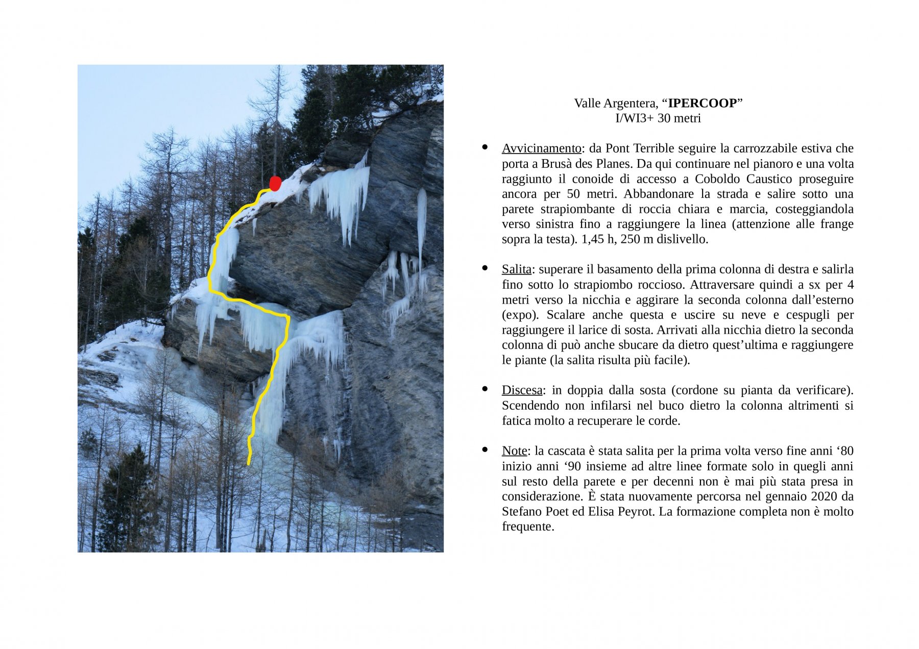
Avvicinamento
Seguendo la valle Argentera poco dopo i casolari di Troncea, prima di arrivare sotto la punta Ramiere, reperire un vallone ingombro da giganteschi massi circa un km dopo la cascata del Rio Gentira (ben evidente). 2h-2h 30 dal ponte.
Descrizione
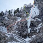
Sono presenti varie possibilità di salita, con diversi gradi. Tutti quanti arrivano su una sosta a spit con cordoni e maillon di calata, posta su un masso, sulla destra (faccia a monte).
- Sinistra: ghiaccio solitamente più precario. Primo tiro a 70-80° con risalti a 85-90°. Il secondo tiro presenta un muro verticale di 10-15 mt all’inizio del secondo tiro, poi ghiaccio precario ma appoggiato fino alla fine. 4/4+.
- Centrale: se si risale il pilastrino centrale, l’ascesa risulta più facile, con brevi risalti a 90. 3/3+
- Destra: rampa a 70-80°, poi muro verticale di 15-20 mt, o più a sinistra in un diedrino. 4/4+ o 5 a seconda dell’itinerario.
Discesa: una doppia da 60mt dalla sosta a spit fino in fondo (consigliata), oppure risalire a destra per una rampa su un costolone, traversare a sinistra per raggiungere i facili pendii che portano al sentiero estivo.
Presente una sosta un po’ marcia a metà cascata, sulla sinistra (faccia a monte), prima del muro verticale.
R. Luzi e G.C. Favro, inverno 1983
- Cartografia:
- IGC Piemonte n.1
- Bibliografia:
- Ghiaccio dell' Ovest
Nelle vicinanze Mappa
Itinerari
09/01/2023 TO, Sauze di Cesana 110 m III, 3+ Nord-Est
Valle Argentera – Anni di Ghiaccio (Cascata)
600m
06/02/2024 TO, Sauze di Cesana 140 m III, 3 Est
Valle Argentera – Candelino dell’Elefantasma (Cascata)
650m
21/12/2025 TO, Sauze di Cesana 110 m III, 3 Nord-Est
Valle Argentera – Rio Gentira (Cascata del)
 850m
850m
23/01/2024 TO, Sauze di Cesana 100 m II, 4+, M6 Nord
Valle Argentera – Pand’ice e Fuga dalla Panda (Cascate)
 1.1Km
1.1Km
11/01/2020 TO, Sauze di Cesana 30 m I, 3+ Nord-Est
Valle Argentera – Ipercoop (Cascata)
 1.1Km
1.1Km
17/01/2024 TO, Sauze di Cesana 100 m III, 5, M5 Nord
Valle Argentera – La chiave perduta (Cascata)
 1.2Km
1.2Km
17/01/2024 TO, Sauze di Cesana 100 m II, 5, M6 Nord
Valle Argentera – Ambarass a serne (Cascate)
 1.2Km
1.2Km
21/02/2025 TO, Sauze di Cesana 110 m III, 4+ Nord
Valle Argentera – Coboldo Caustico (Cascata)
 1.3Km
1.3Km
20/01/2024 TO, Sauze di Cesana 120 m III, 5+, M7 Nord
Valle Argentera – Ecofly (Cascata)
 1.3Km
1.3Km
18/02/2024 TO, Sauze di Cesana 120 m III, 5 Nord-Est
Valle Argentera – Frali Ice (Cascata)
 1.3Km
1.3Km