7.9Km
7.9Km
Note
 6.8Km
6.8Km
6.8Km
8.6Km
8.6Km
6.8Km
6.8Km
6.8Km
8.6Km
8.6Km
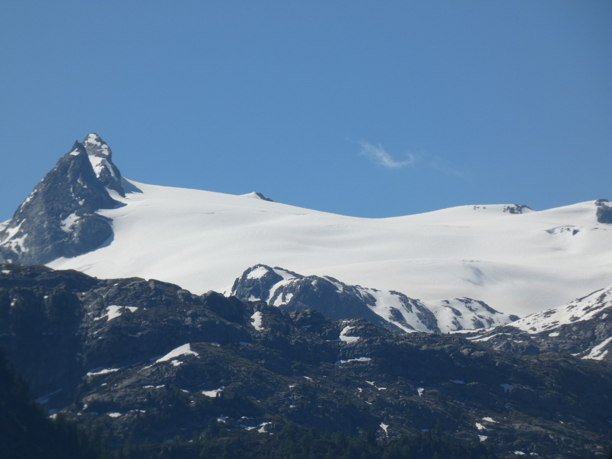
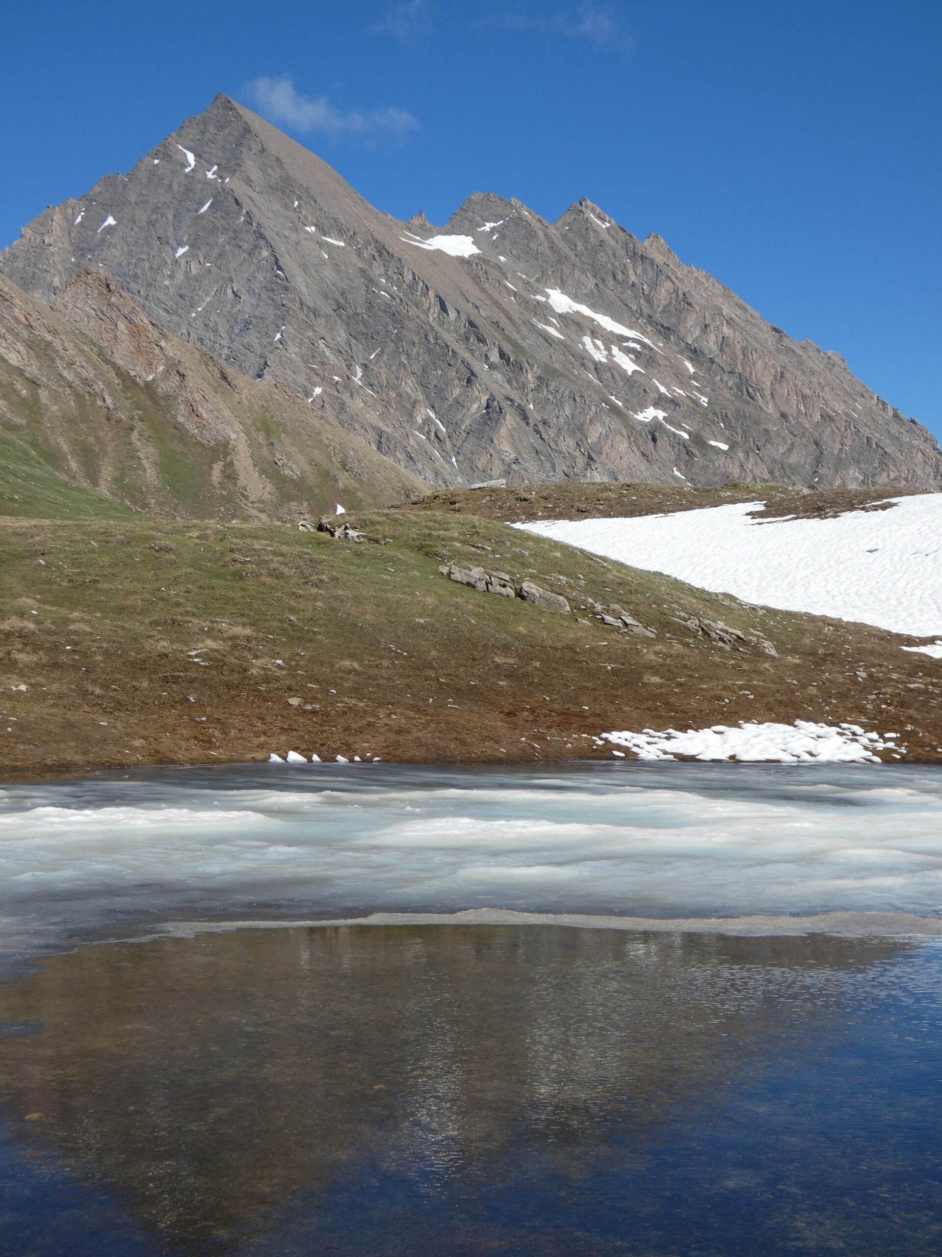
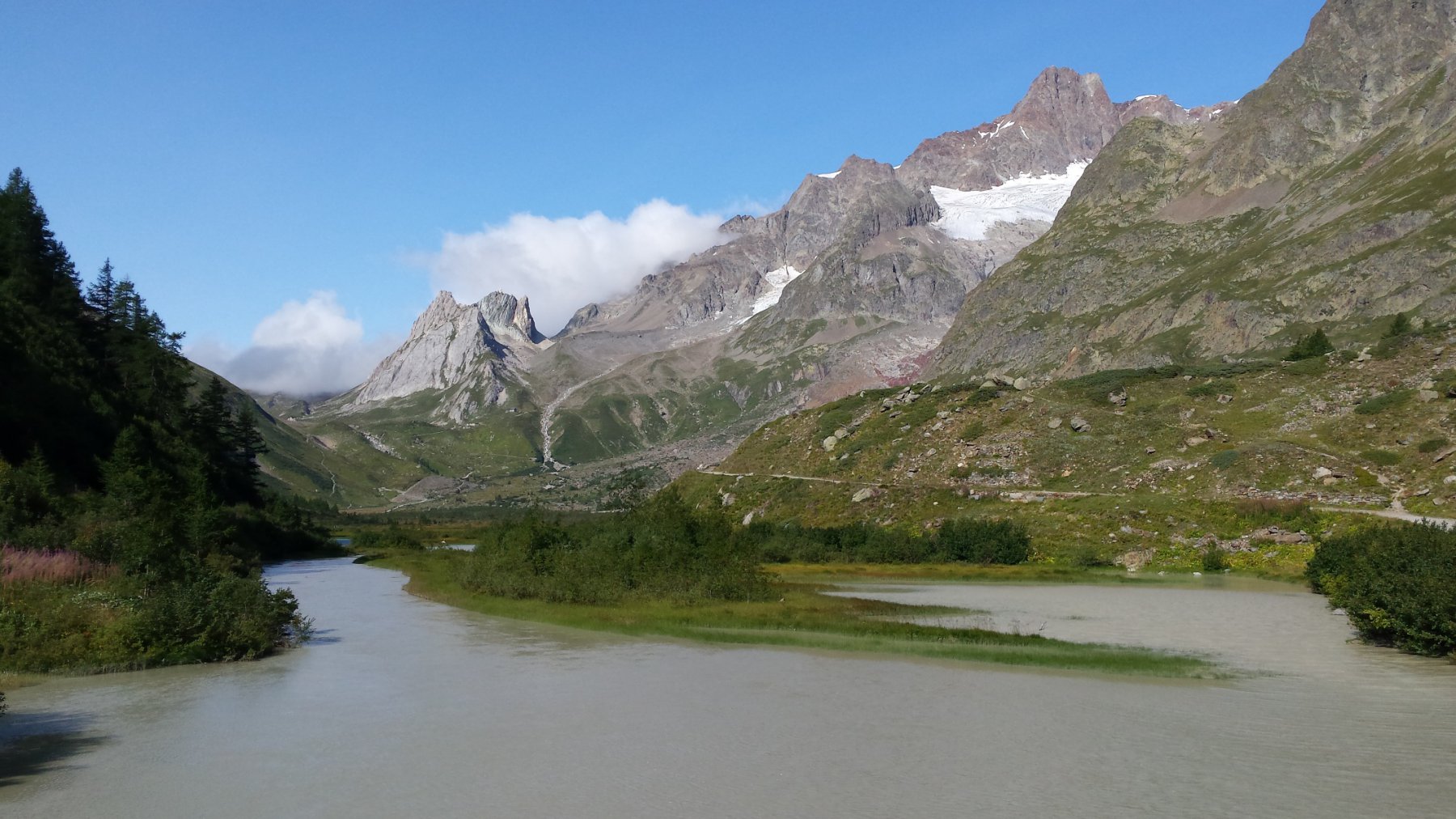
Sia il colle che a maggior ragione il mt Fortin sono un balcone da togliere il fiato sulla Val Veny e sul Bianco...non dimenticate la macchina foto!
Avvicinamento
.
Descrizione
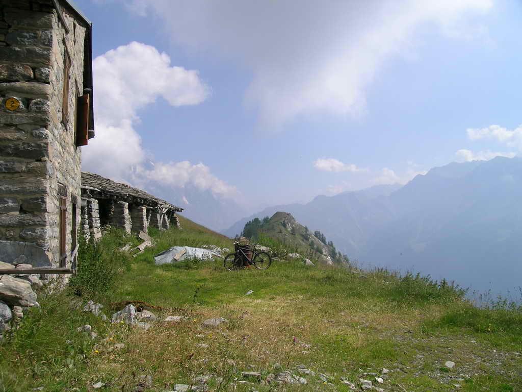
Da La Thuile si percorre la strada del Piccolo San Bernardo fino alla frazione di Pont Serrand dove in un picccolo piazzale sulla dx si può parcheggiare.
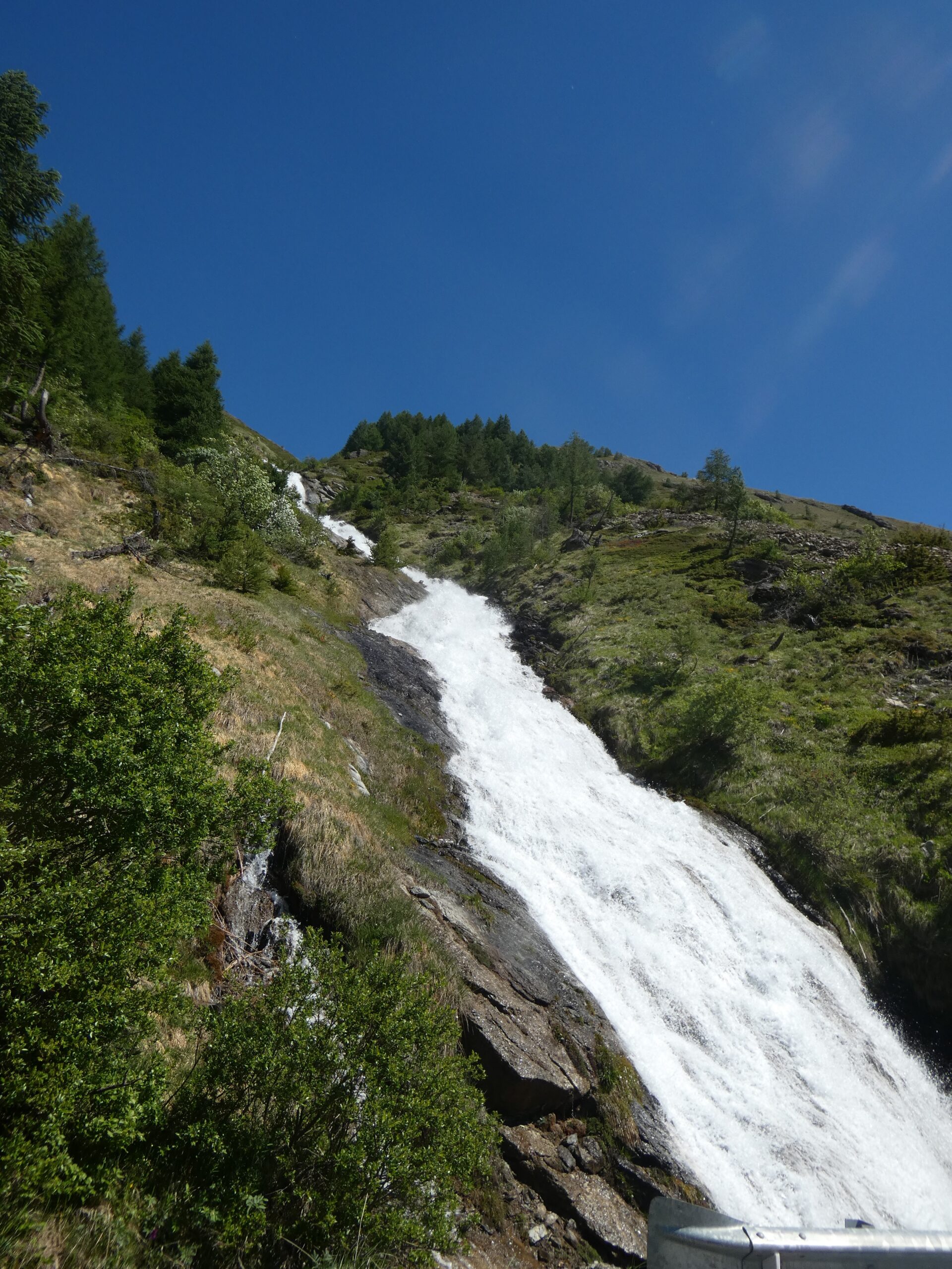
La salita decisamente ripida, su asfalto fino alle baite di Porassey 1900mt, si calma entrando nel vallone permettendoci di prendere un buon ritmo fino ai tornanti centrali.La parte terminale è quasi pianeggiante fino al colle.
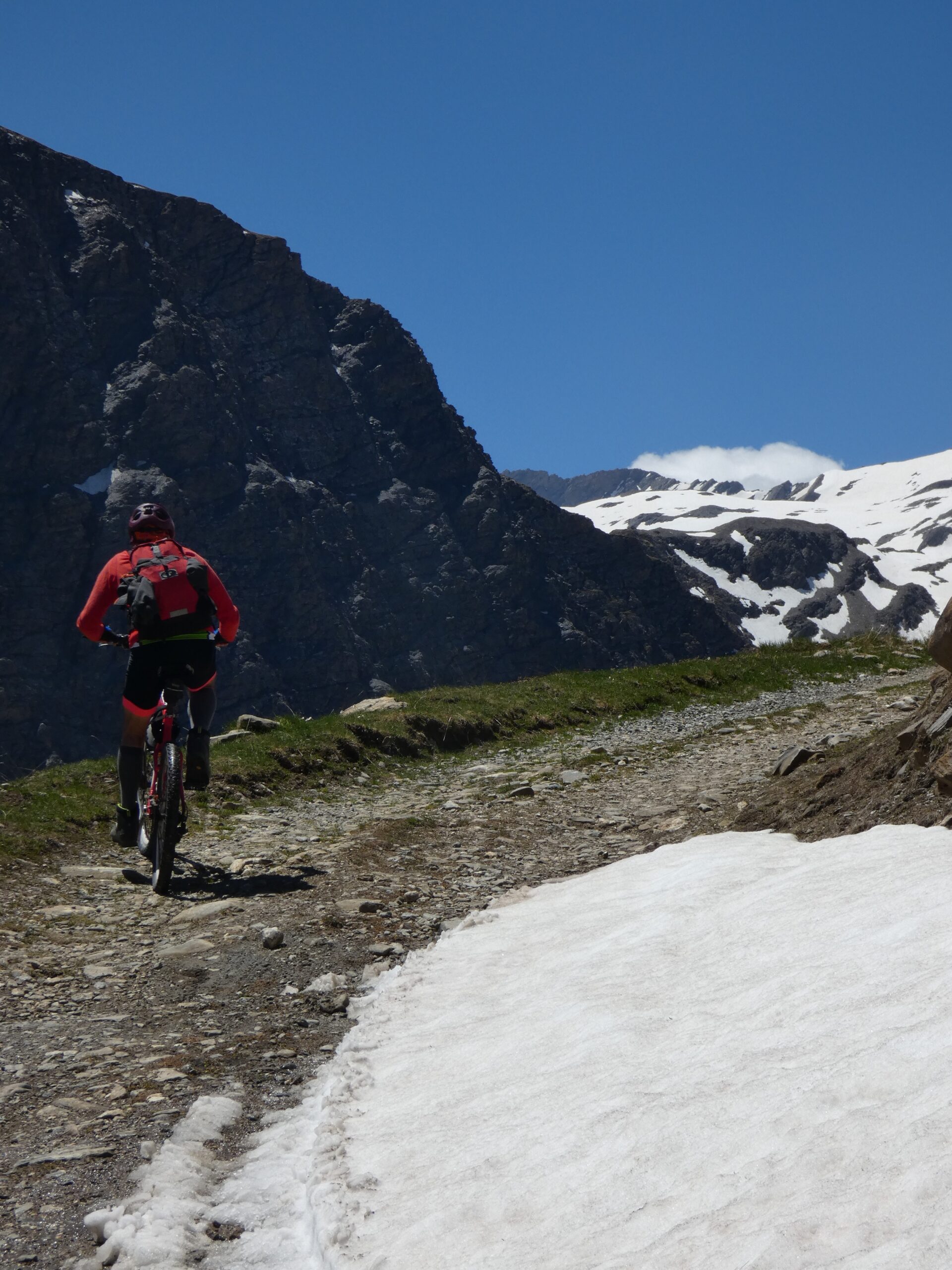
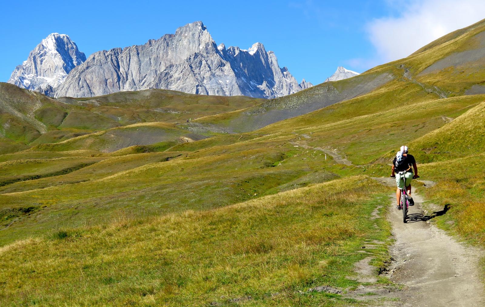
Ritornando sulle nostre tracce si abbandona la strada per un sentiero ciclabile al 70% che risale a sx toccando prima il lago del Mt Percè quindi quelli del Mt Fortin da cui bici a spalle si raggiunge la punta 2753mt.
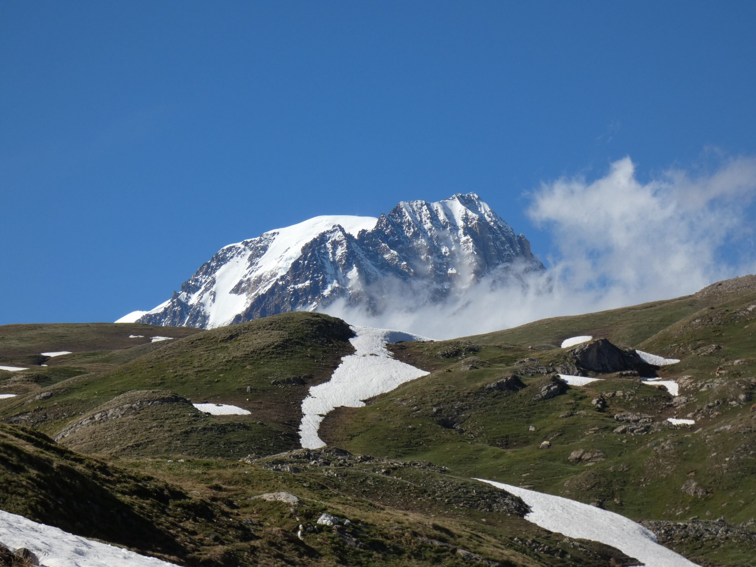
La discesa avviene per una divertente traccia che ci porta alle baite di Chavanne d’en Haut da cui riprendiamo la strada di salita.Questa variante poco evidente si dirama a sx al primo pianoro sotto la punta in vista di un laghetto.
- Cartografia:
- IGN AsF n°9
Nelle vicinanze Mappa
Itinerari
23/07/2023 AO, La Thuile D+ 1200 m MC, MC+, S0 Nord-Est
Belvedere (Colle) e Monte Chaz Duraz da La Thuile, giro per il Lago Longet
50m
27/08/2017 AO, La Thuile D+ 1200 m EC, BC+, S3 Varie
Colmet (Mont) dal Colle San Carlo
5.5Km
18/07/2025 AO, Pré-Saint-Didier D+ 1650 m BC, BC+, S1 Tutte
Chavannes (Col de) da Prè Saint Didier, discesa in Val Veny
6.8Km
04/08/2018 AO, Pré-Saint-Didier D+ 2900 m MC, TC, S1 Tutte
Seigne (Col de la) da Pré Saint Didier, giro per Bourg Saint Maurice e Colle del Piccolo San Bernardo
 6.8Km
6.8Km
03/08/2018 AO, Pré-Saint-Didier D+ 3500 m OC, BC+, S3 Varie
Bard, Citrin, Malatrà (Colli) da Prè Saint Didier, giro della Valdigne
6.8Km
19/08/2018 AO, Pré-Saint-Didier D+ 2000 m OC, OC, S3 Tutte
Liconi (Testa di) da Prè Saint Didier, giro
6.8Km
01/08/2009 AO, Pré-Saint-Didier D+ 1100 m MC, MC, S0 Est
Arp (Alpe) da Pre Saint Didier
 6.8Km
6.8Km
19/08/2023 AO, Pré-Saint-Didier D+ 2800 m BC, OC, S3 Tutte
Arp e Chavannes (Colli) da Pré Saint Didier, giro
 6.8Km
6.8Km
15/07/2015 AO, Courmayeur D+ 1700 m BC, BC, S0 Tutte
Tour del Monte Bianco (CCW) Tappa 1: Courmayeur – Champex
 8.6Km
8.6Km
15/09/2019 AO, Courmayeur D+ 1040 m BC, BC, S2 Est
Seigne (Col de la) e Rifugio Elisabetta Soldini da Courmayeur per il lac Combal
 8.6Km
8.6Km