1.6Km
1.6Km
Note
 50m
600m
600m
600m
1.6Km
1.6Km
1.6Km
1.8Km
1.8Km
1.8Km
50m
600m
600m
600m
1.6Km
1.6Km
1.6Km
1.8Km
1.8Km
1.8Km
1.6Km
1.7Km
1.7Km
1.7Km
1.8Km
1.8Km
3.2Km
3.9Km
4Km
4.5Km
Lasciate perdere l'itinerario descritto dallo Zavatta con partenza da Arnad, almeno finche' la pro-loco di Arnad o chi per essa si decidera' a segnare i sentieri; per ben due volte abbiam cercato di raggiungere Mgne Verdoyen da Champurmey ravanando ore senza riuscirci, stessa cosa cercare i sentieri che scendono da Fornelle a Collombar.
Avvicinamento
.
Descrizione
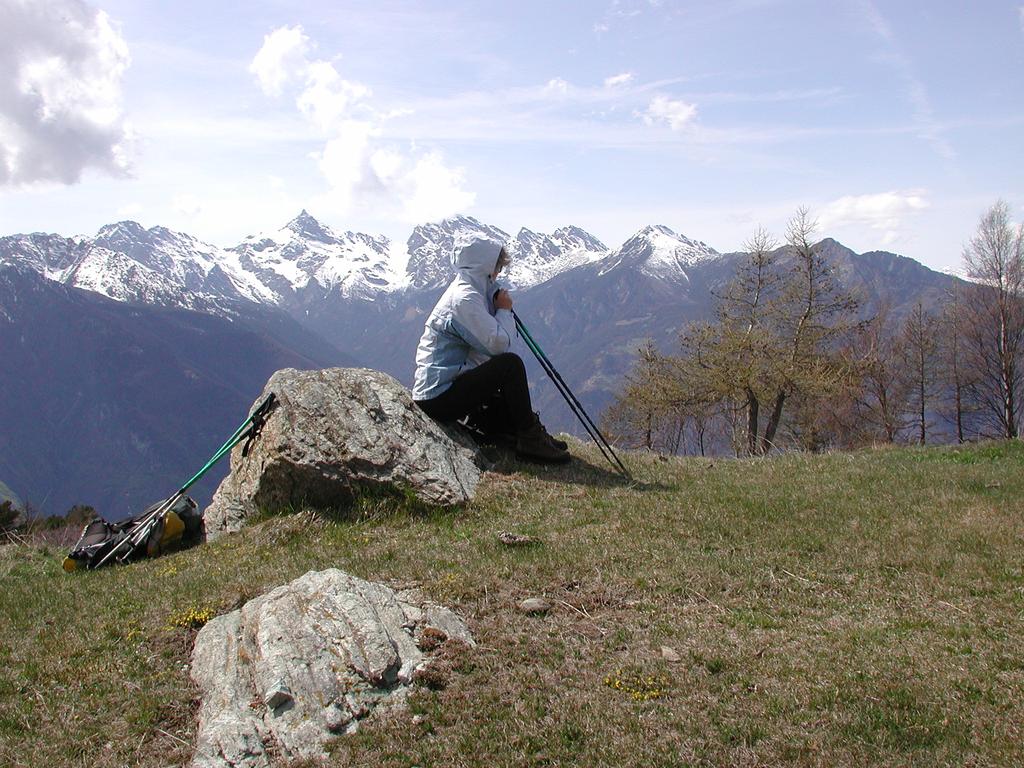
Salire in auto da Arnad alla frazione Pre’; le frazioni non hanno cartello, ma Pre’ e’ l’ultima raggiungibile in auto; da qui incomincia il divieto.
C’e’ un bel parcheggino per 5/6 auto. Proseguire a piedi lungo l’interpoderale; il villaggio successivo e’ Champurney (c’e una piccola vigna a sinistra, sulla strada…)
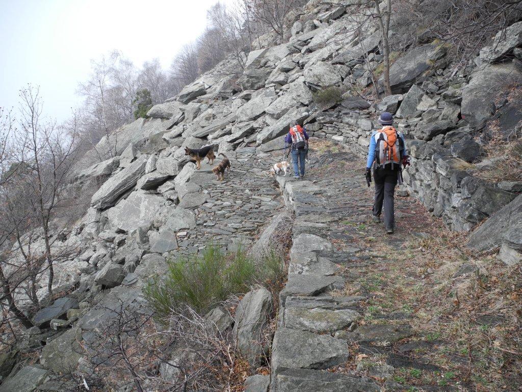
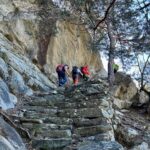
Proseguire sull’interpoderale per circa un km, fino ad un bivio: adesso la strada e’ sterrata, prendere quella che sale a destra; continuare per un altro km circa, finche’ a destra si notano due vecchie costruzioni: davanti alla seconda una losa (pietra che si usa per le coperture dei tetti) posta in piedi, con un segno rosso posto verticalmente segnala l’inizio della mulattiera, che sale nel prato subito dopo la costruzione.
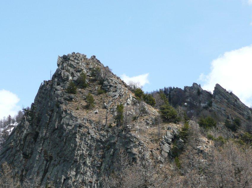
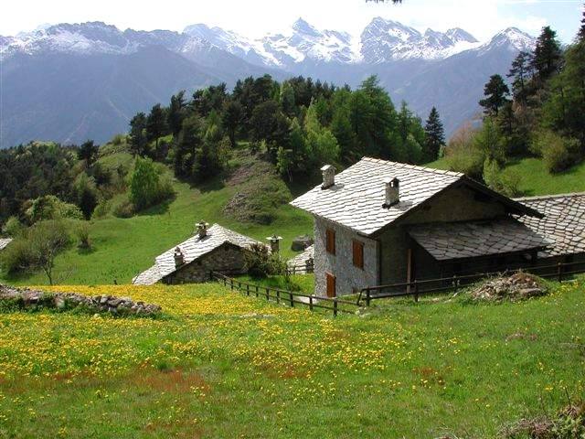
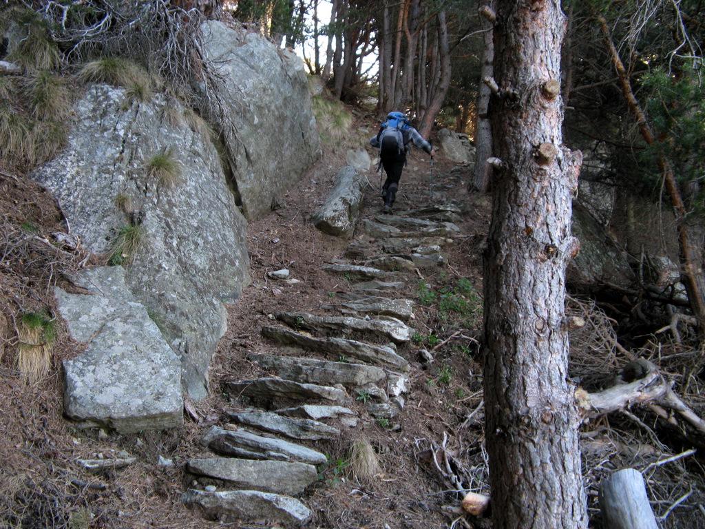
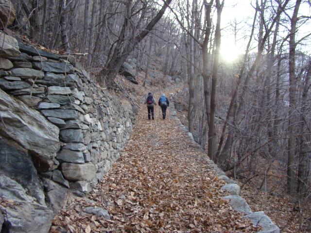
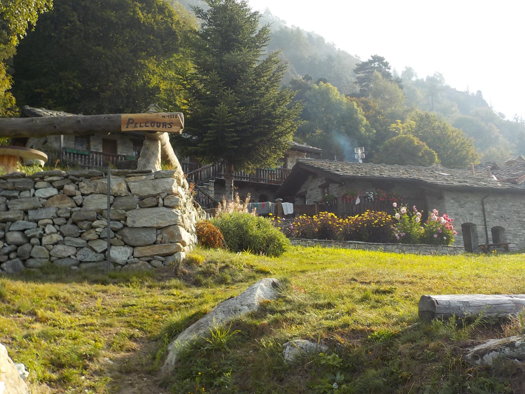
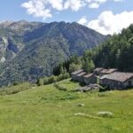
Questa mulattiera e’ molto bella, ai vari bivi proseguire sempre sul sentiero che sale. I segni sono molto scarsi. Si passano due baite con fontana, poi si sale zigzagando in un bel bosco, fino ad arrivare a Fornelle, circondata da prati di asfodeli; qui arriva l’interpoderale che sale al col Vert da Verres; seguirla fino al colle, un posto senza vista, continuare salendo fino allo stupendo villaggio di Pratsse, le cui case sono tutte ristrutturate; all’inizio di maggio i prati sono gialli di tarassaco.
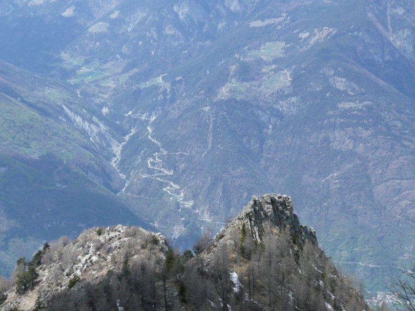
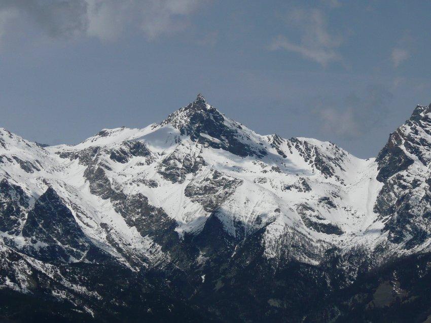
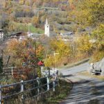
Al villaggio c’e una fonte la cui acqua arriva da un bacino all’interno di una miniera; dal villaggio si gode uno splendido panorama sul fondovalle, fino al forte di Bard, e sulle montagne di fronte, Avic, Revic, Cima Piana e tante altre.
Dal villaggio (m. 1460) tornare sui vostri passi e proseguire per l’interpoderale fino all’alpe Soura m. 1544.
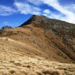
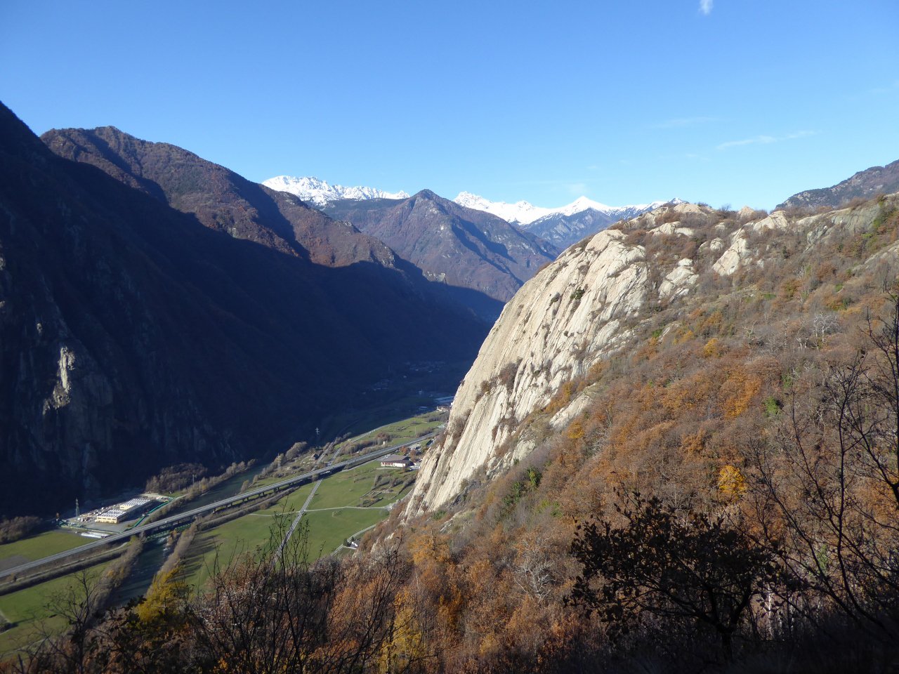
Qui il panorama e’ superbo, oltre alla valle centrale, si apre tutta la val d’Ayas, dalle dame di Challant, al castello di Graines, alle montagne sopra Estoul, Bieteron, Valfredda, Valnera ecc, Zerbion, Becca di Nana, e ancora piu’ lontano; discesa dall’alpe fino alla prima curva, dove si puo’ abbandonare lo sterrato e calare a Pratsse per un bel sentierino; di qui per lo stesso itinerario percorso in salita, almeno non rischiate di passare la notte lungo le traverse di Arnad…
- Cartografia:
- IGC 1:50000 Biella e Ivrea
- Bibliografia:
- Le valli del Monte Rosa-Luca Zavatta
Nelle vicinanze Mappa
Itinerari
09/11/2025 AO, Arnad D+ 1750 m EE Varie
Aquila (Monte) da Prè per Praz Ussel e il Col Chizzagne
 50m
50m
17/03/2012 AO, Arnad D+ 850 m E Sud
Echallogne (Tour di) da Chamgraffion
 600m
600m
28/04/2023 AO, Arnad D+ 1650 m EE Sud-Ovest
Chiva (Col de) da Vacheres
 600m
600m
17/09/2021 AO, Arnad D+ 1650 m E Sud
Pierres Blanches (Cime) o Pietre Bianche da Vacheres, anello per Echallogne e Arsinnes
 600m
600m
18/11/2023 AO, Arnad D+ 1144 m E Varie
Cammino Balteo tappa n.5 da Arnad a Challand Saint Victor
 1.6Km
1.6Km
10/04/2022 AO, Arnad D+ 184 m E Nord-Est
Machaby (Corma di) da Arnad
 1.6Km
1.6Km
18/04/2026 AO, Arnad D+ 1000 m E Sud-Ovest
Echallogne (Frazione) da Arnad, anello
 1.6Km
1.6Km
15/09/2019 AO, Arnad D+ 2450 m EE Tutte
Crabun (Monte) da Machaby, anello per Col de Fenetre
 1.8Km
1.8Km
19/04/2026 AO, Arnad D+ 810 m E Ovest
Cou (Tête de) da Machaby
 1.8Km
1.8Km
26/02/2023 AO, Arnad D+ 1372 m E Nord
Corma (Croix) da Machaby
 1.8Km
1.8Km
Servizi
1.6Km
1.7Km
Old Valley Pub Ristorante
Arnad
1.7Km
Des amies Ristorante
Arnad
1.7Km
Forte di Machaby Rifugio
Arnad
1.8Km
L’Arcaden Ristorante
Arnad
1.8Km
Lo dzerby Ristorante
Arnad
3.2Km
Dell’Isola Ristorante
Arnad
3.9Km
Saint Roch Ristorante
Hône
4Km
Antichi sapori Ristorante
Hone
4.5Km