300m
300m
Note
 50m
50m
50m
50m
6.7Km
6.7Km
7.3Km
7.7Km
7.7Km
7.7Km
50m
50m
50m
50m
6.7Km
6.7Km
7.3Km
7.7Km
7.7Km
7.7Km
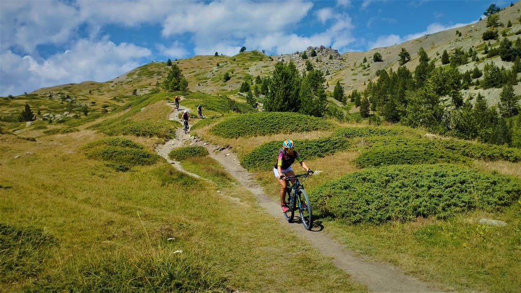
Itinerario non troppo impegnativo e ben segnalato. Portare acqua perchè lungo il percorso non si trovano fontane!!!
Avvicinamento
.
Descrizione
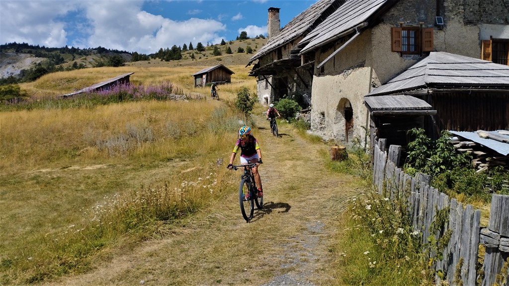
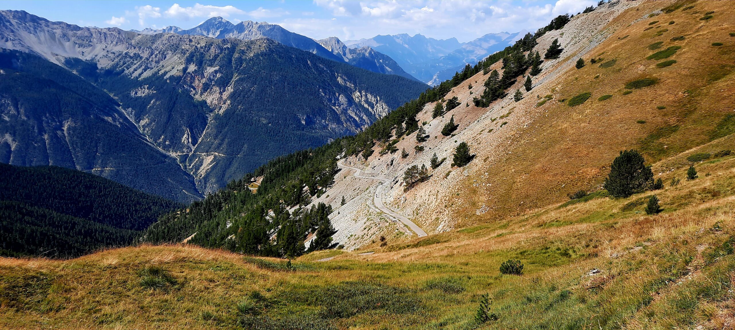
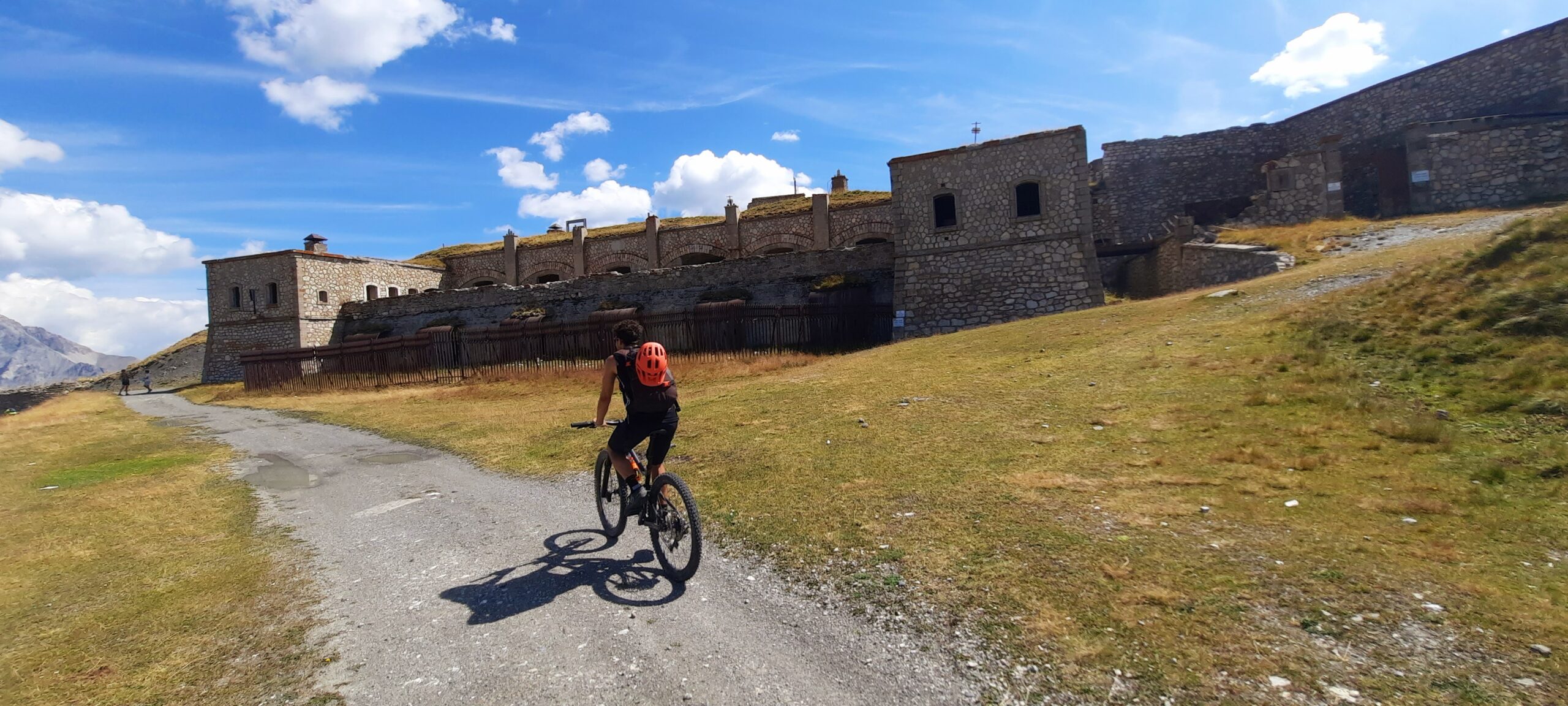
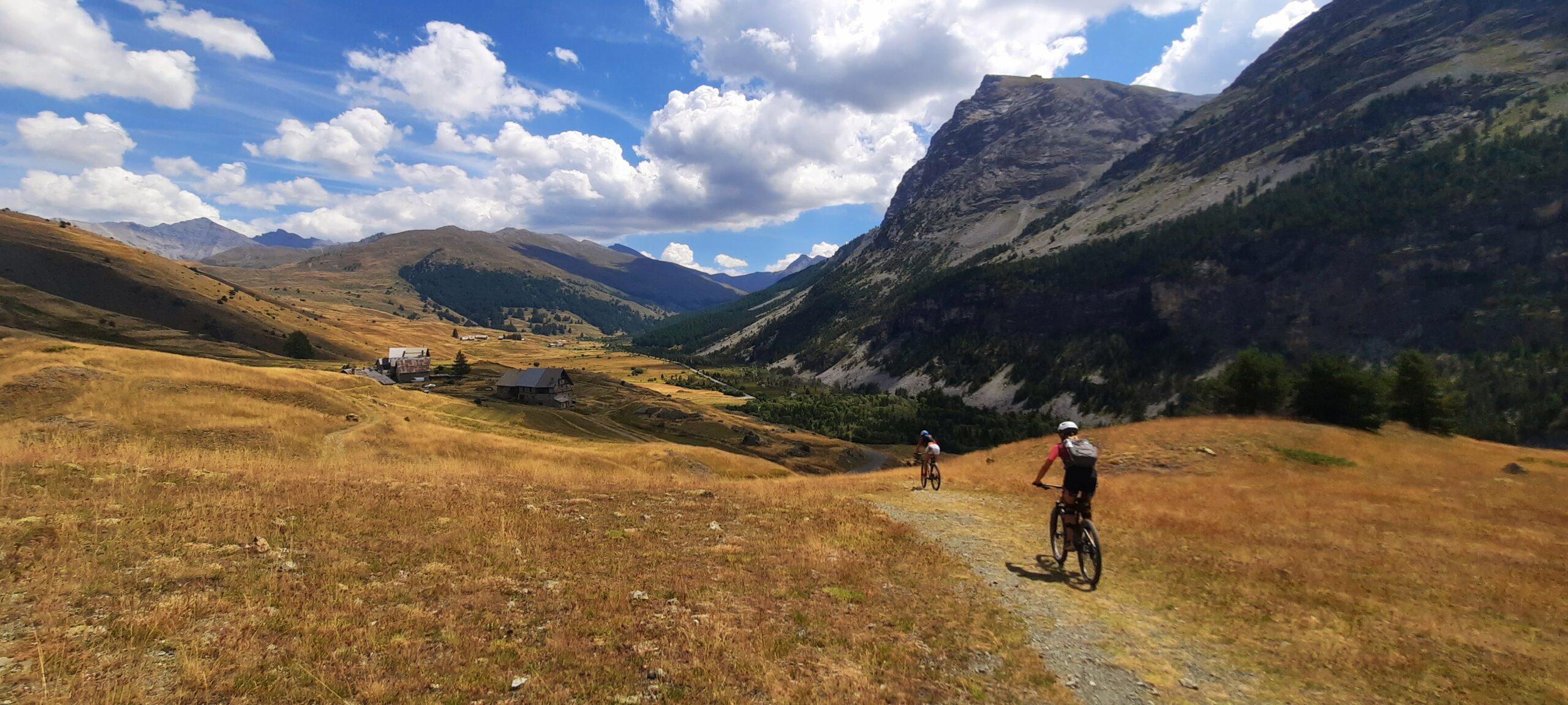
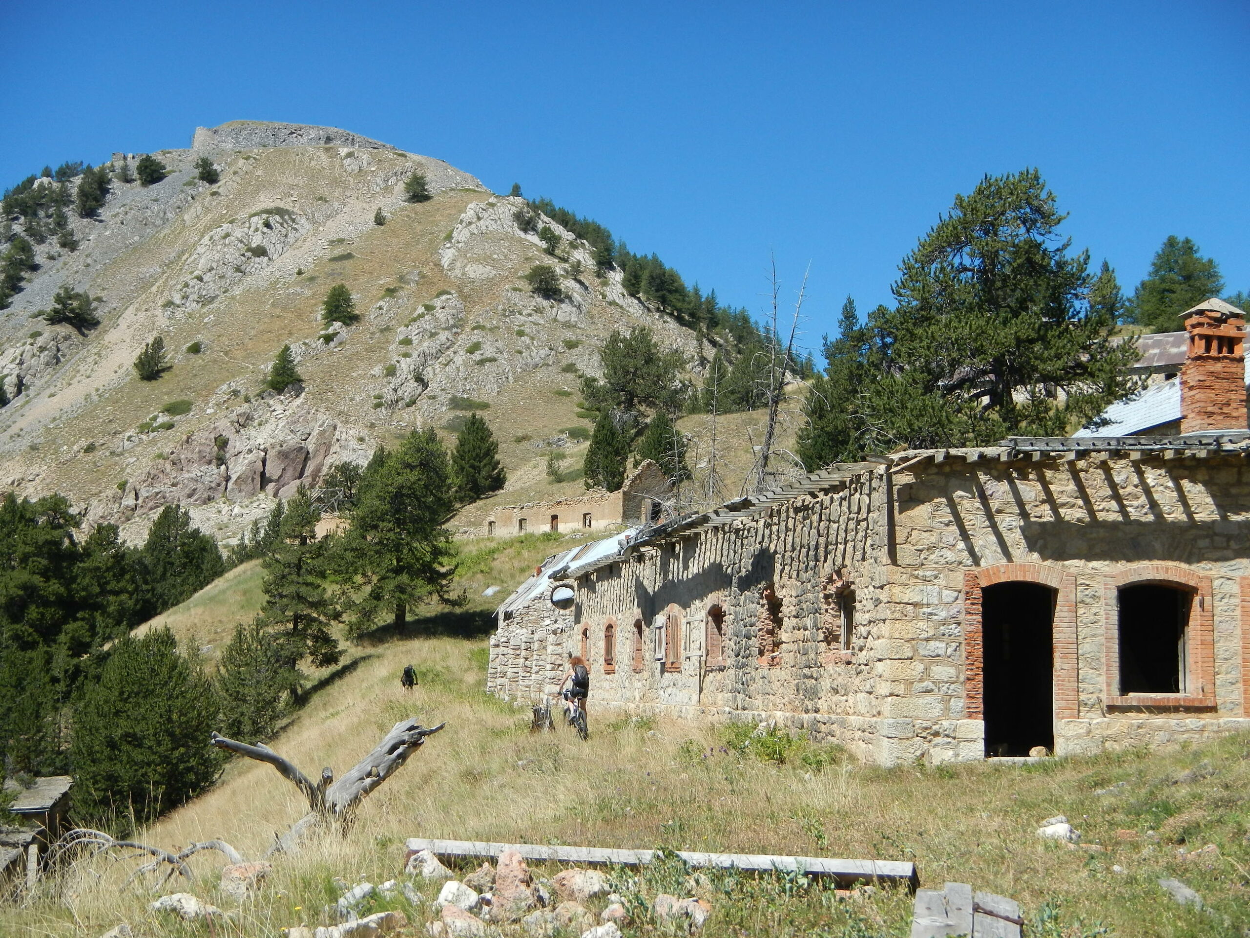
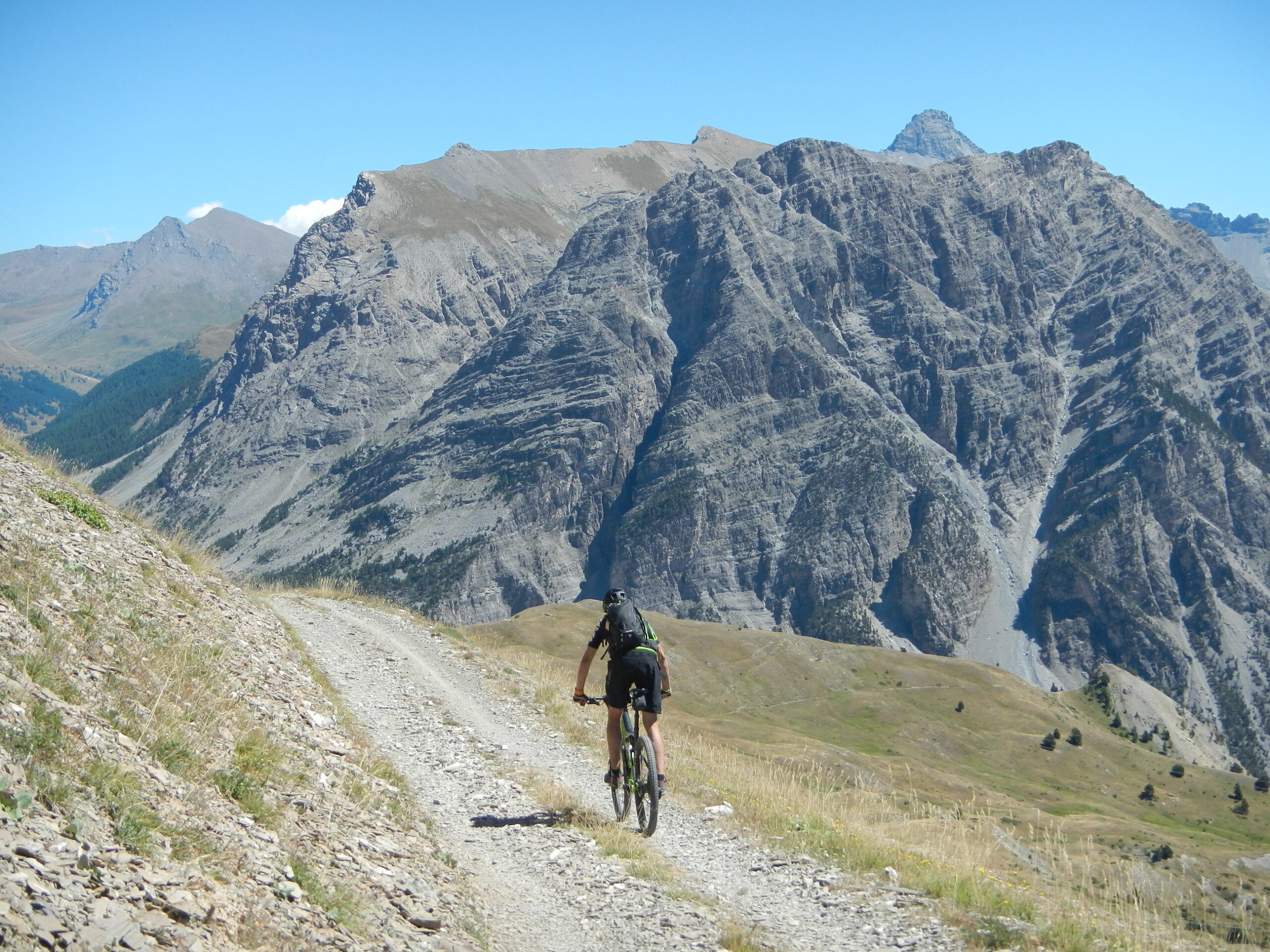
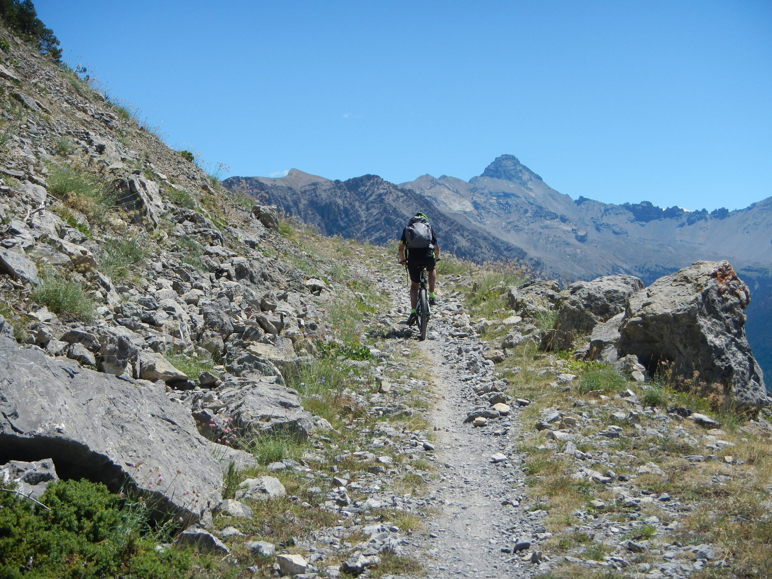
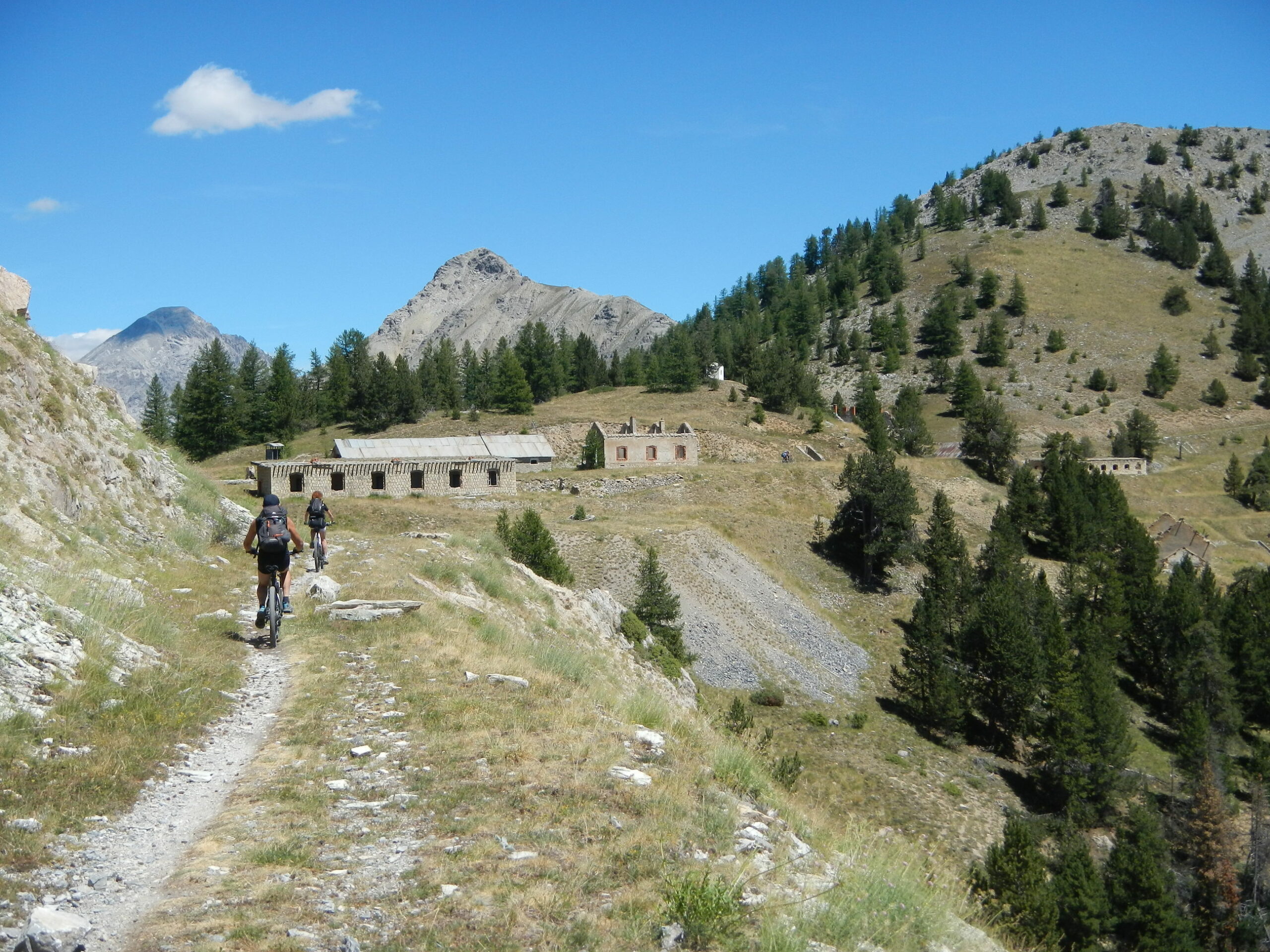
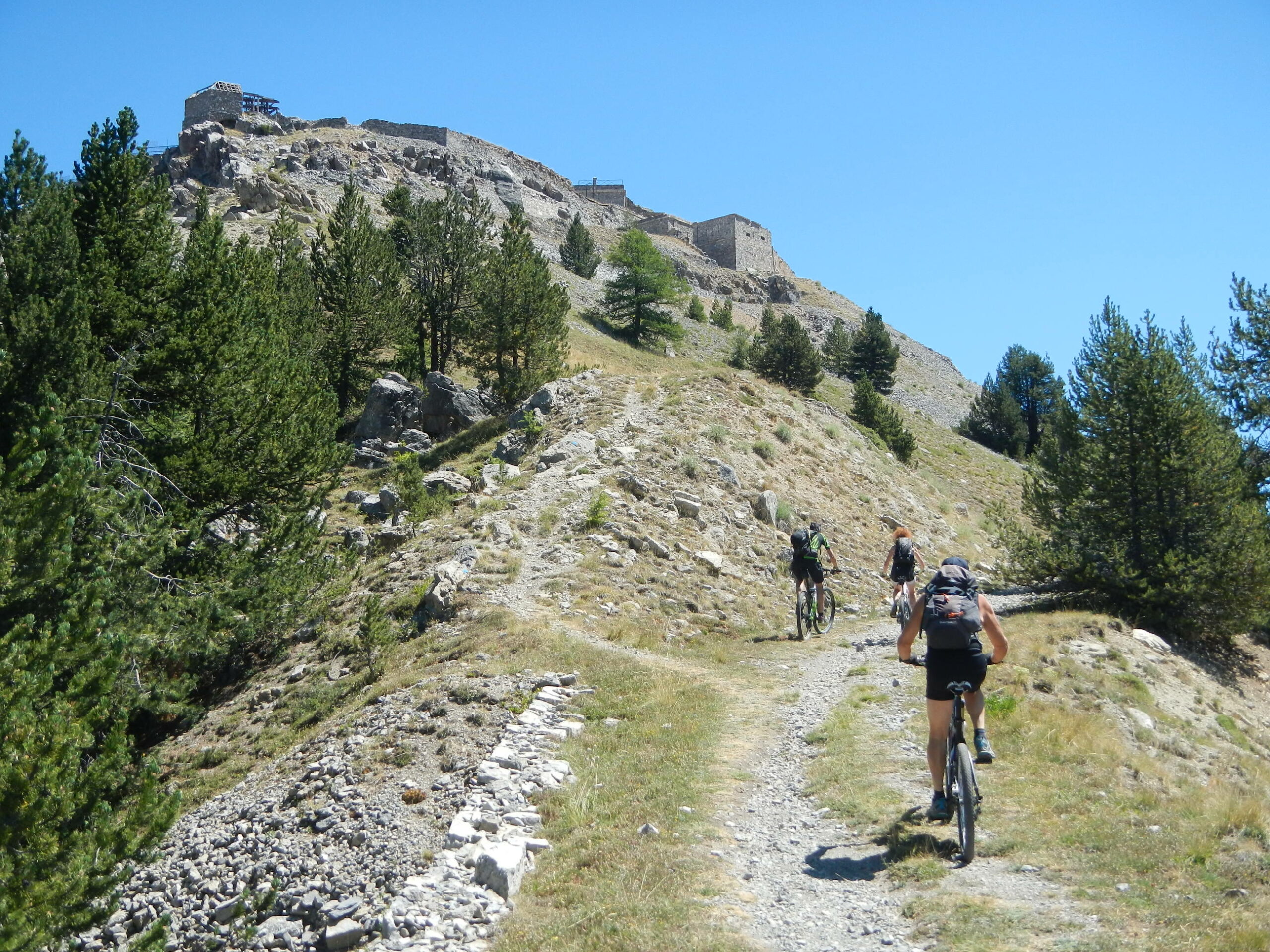
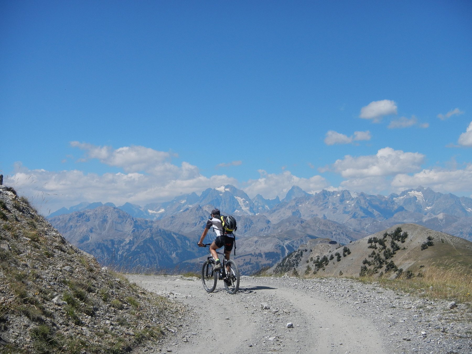
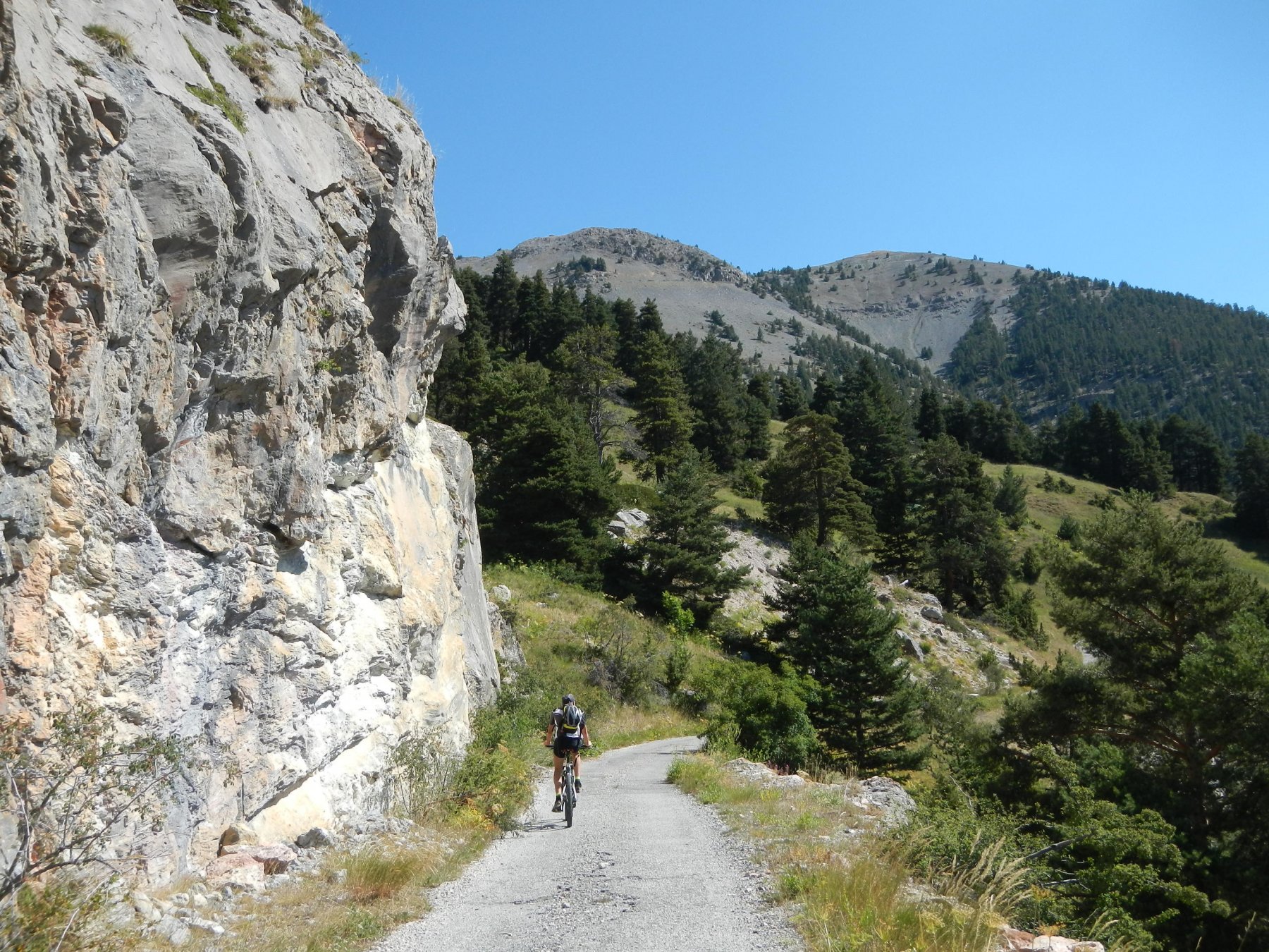
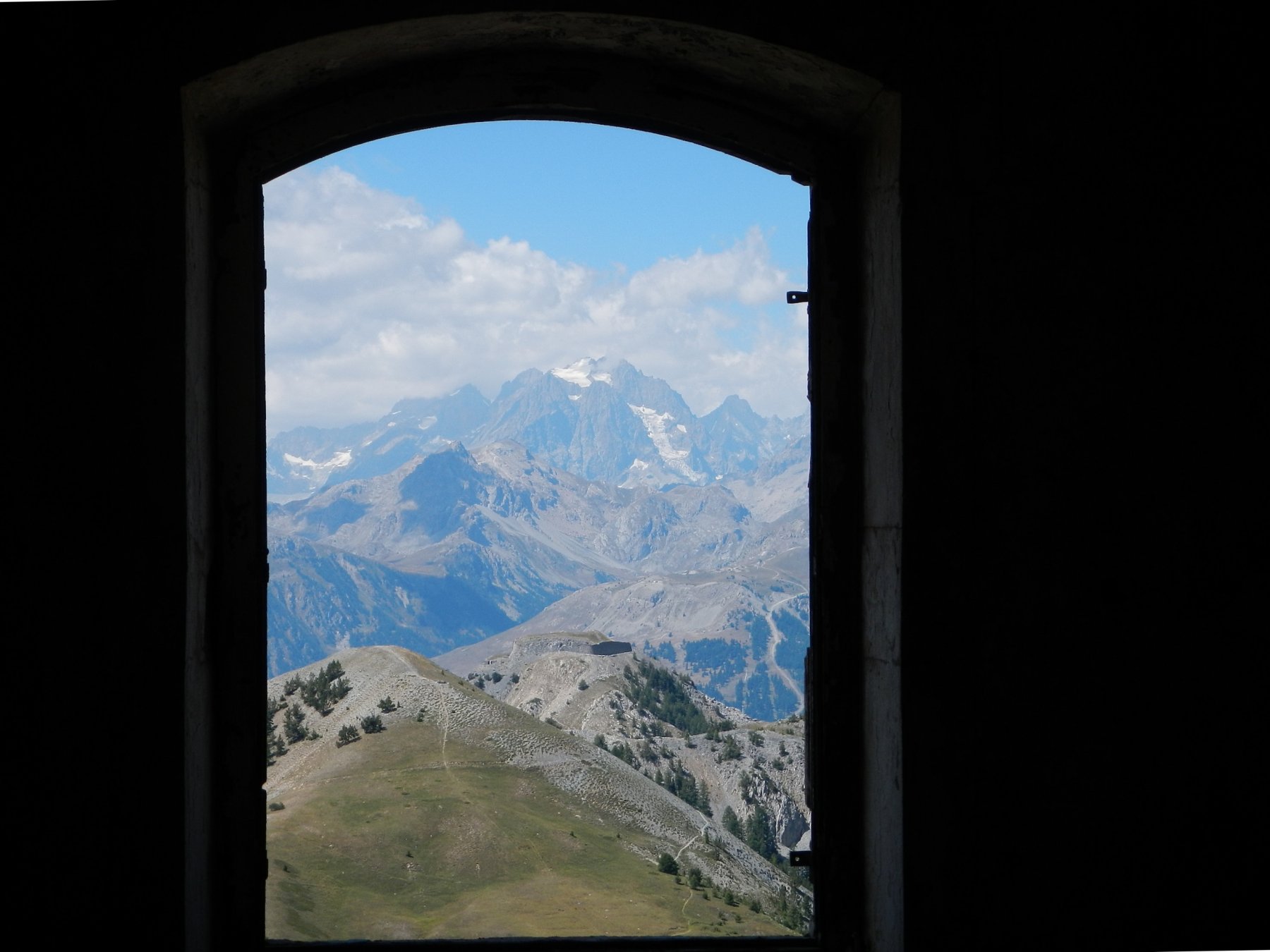
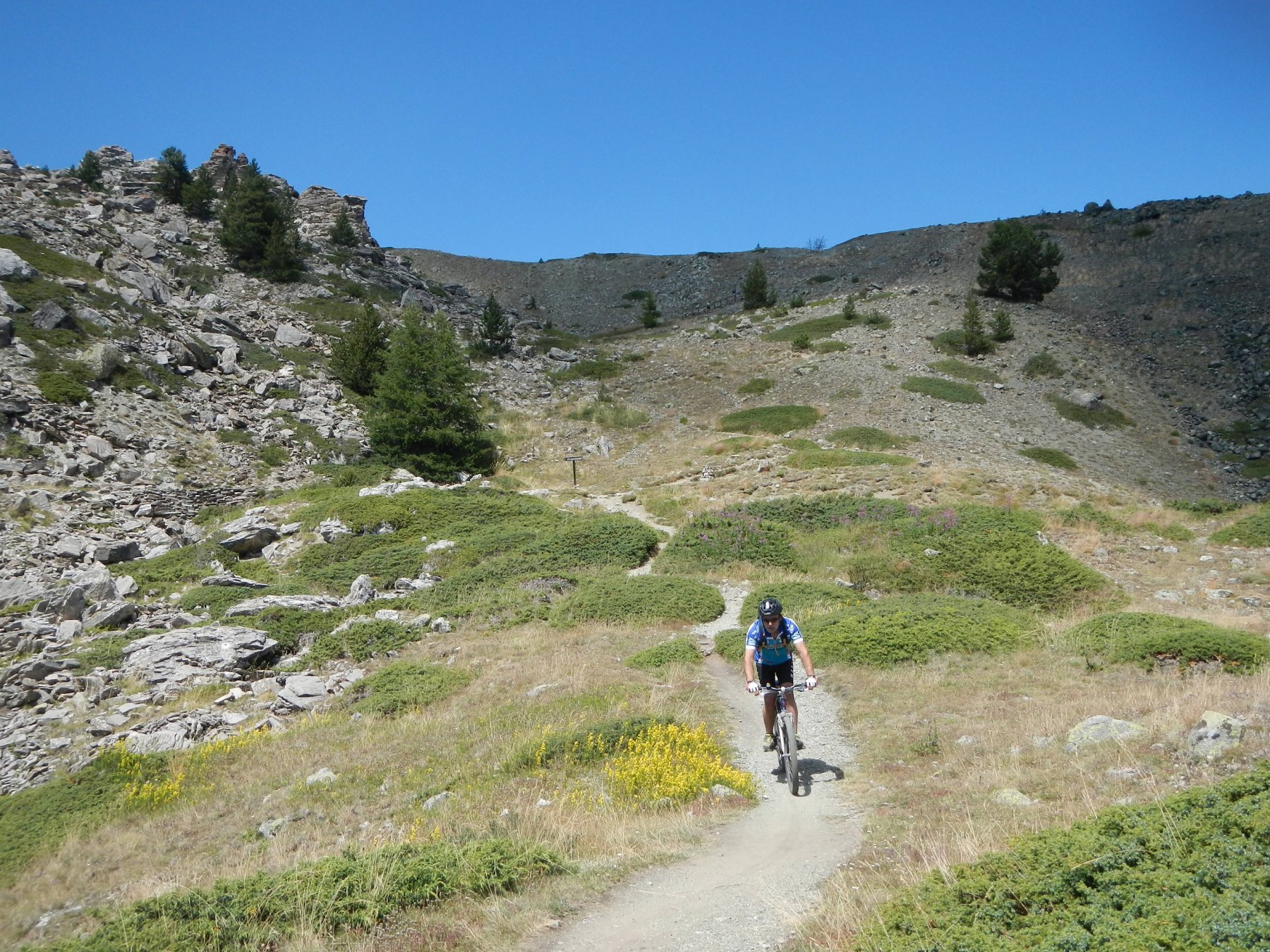
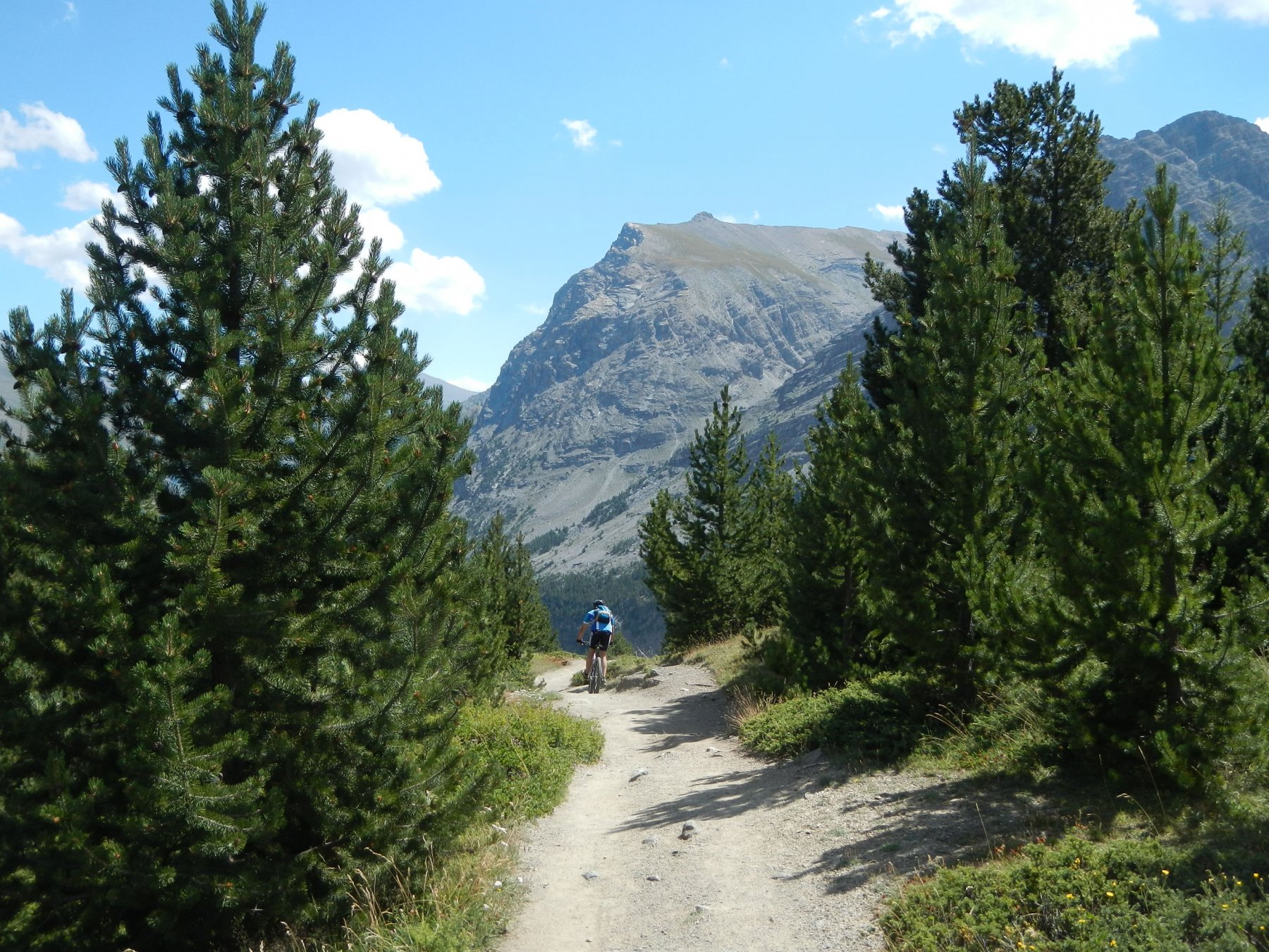
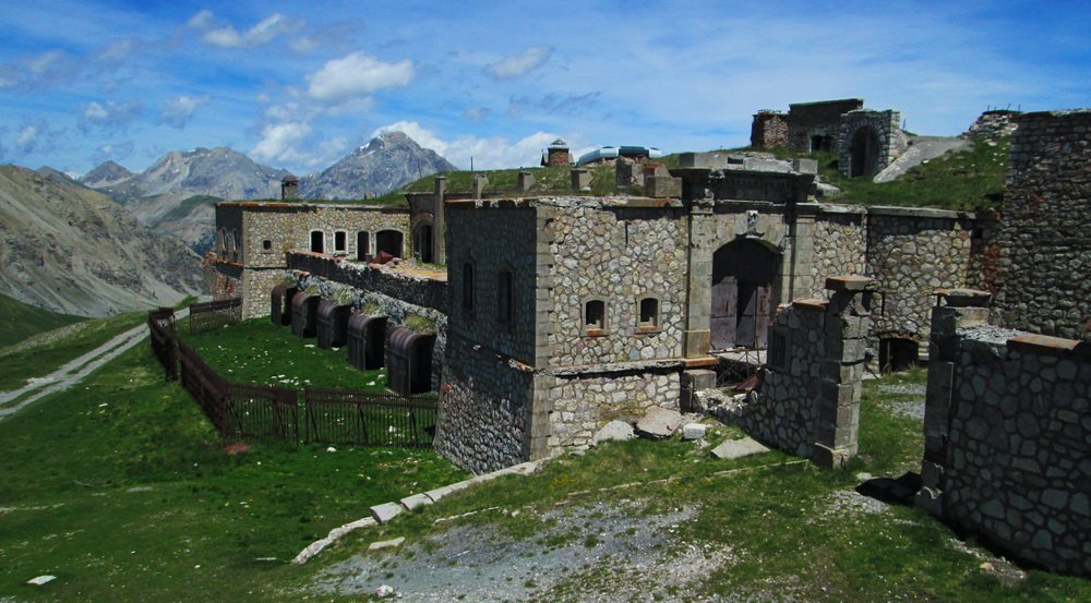
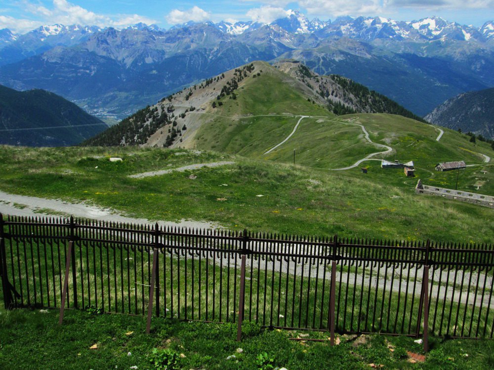
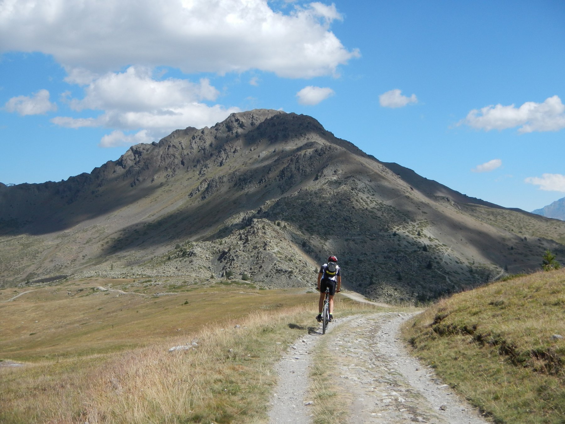
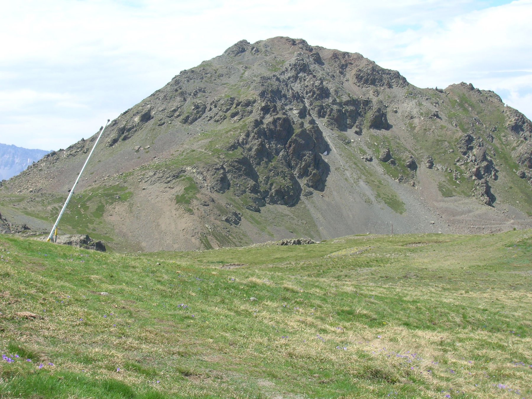
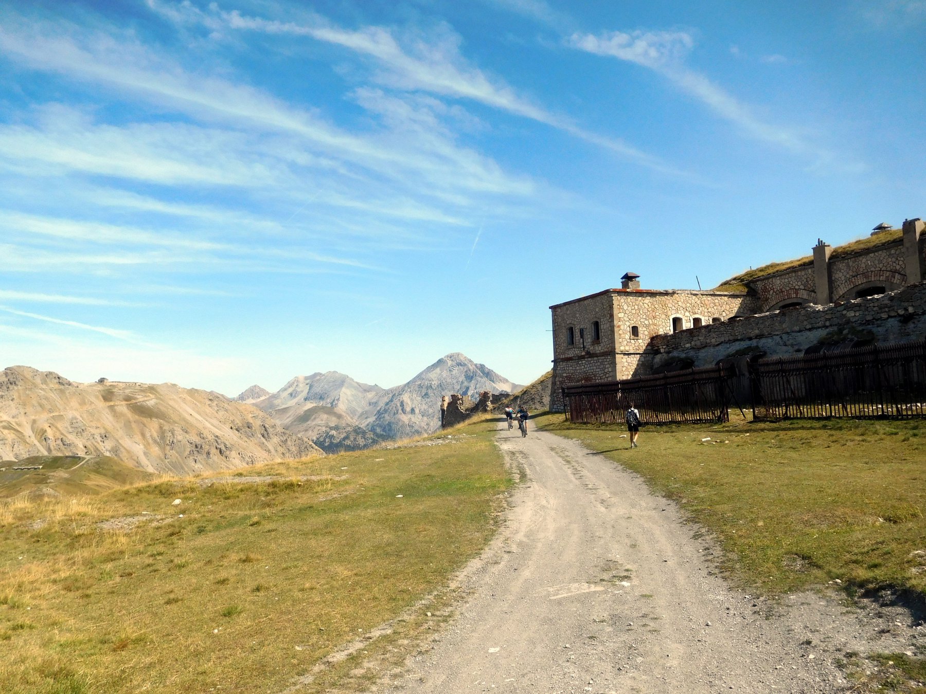
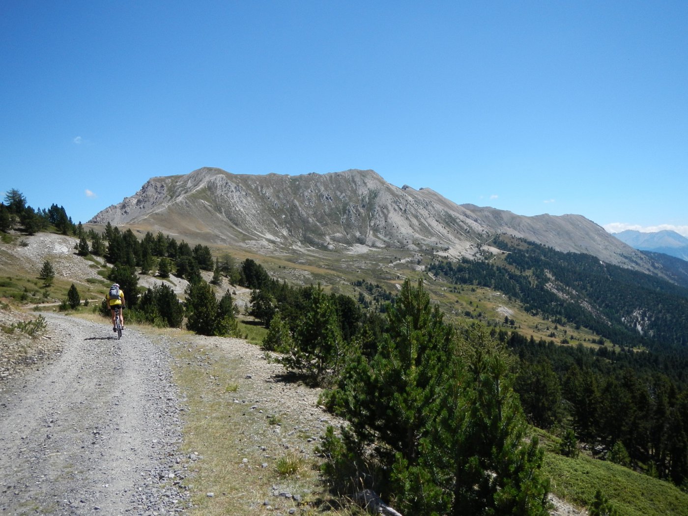
Da Cervieres scendere lungo la strada dell’Izoard in direzione Briancon. Dopo circa 5 Km, sulla destra parte una stradina asfaltata vietata al transito veicolare (quota 1.420 circa sulla carta IGN).Si imbocca questa stradina militare che presenta un fondo pressoché interamente asfaltato anche se a tratti un po’ sconnesso e che sale sempre con pendenze molto regolari (6-7%). Si supera il Fort D’Anjou e, senza possibilità di errore, con alcuni tornanti inframezzati da lunghi traversi, si raggiunge lo spartiacque con la Valle di Monginevro ad un colletto a quota 2331 m, proprio a Est dell’Ombilic. Da qui si svolta a destra e si prosegue su sterrato per circa 1 Km fino a raggiungere il Fort du Gondrand.
DISCESA
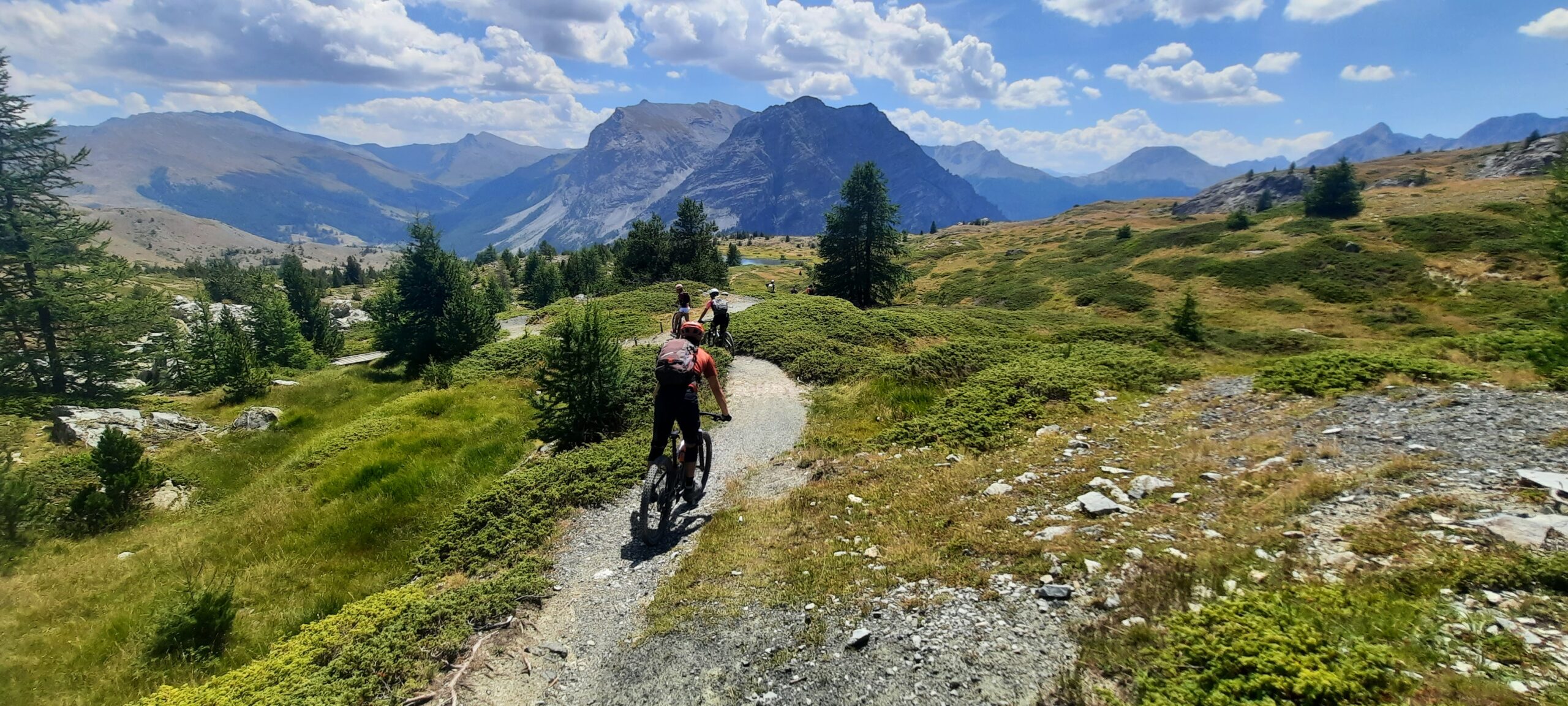
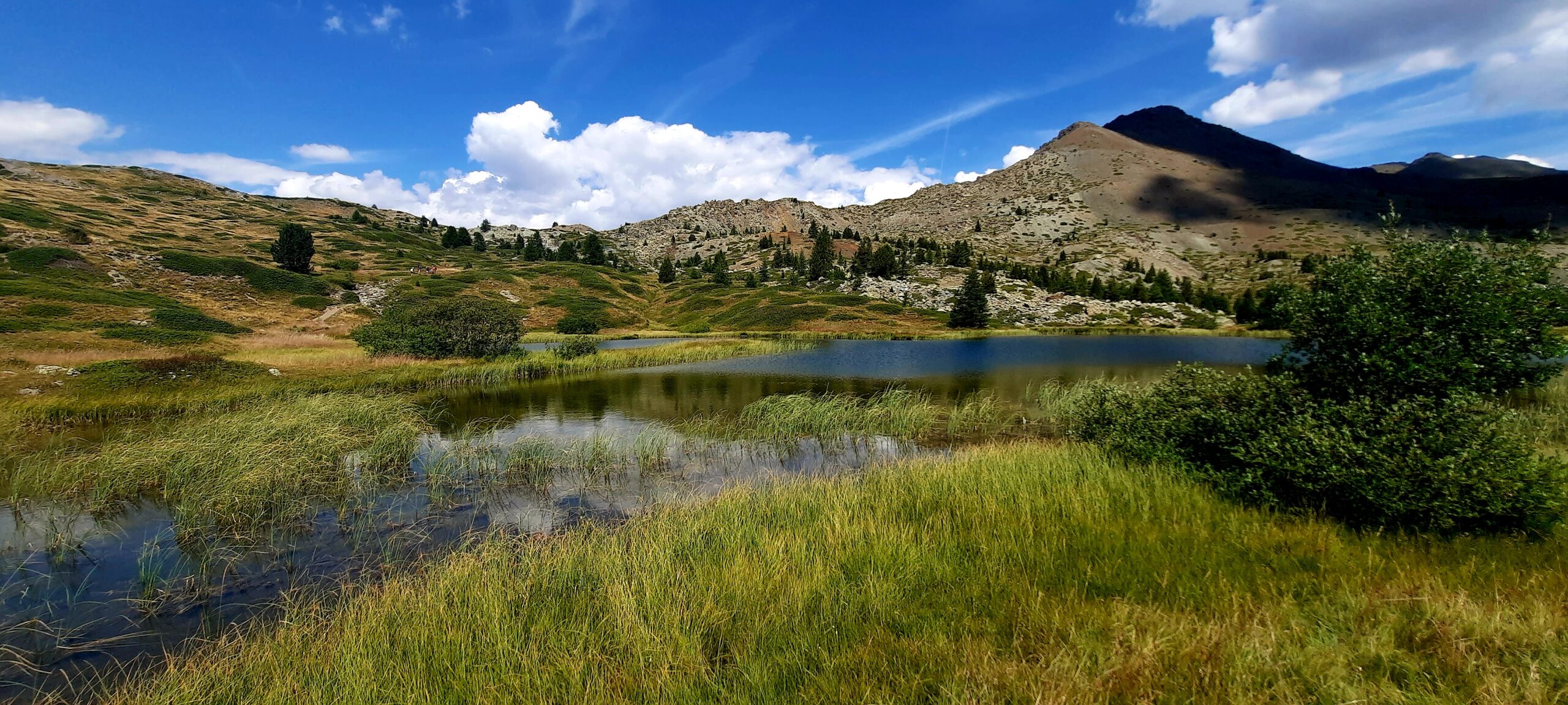
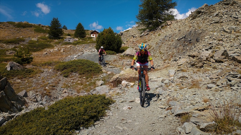
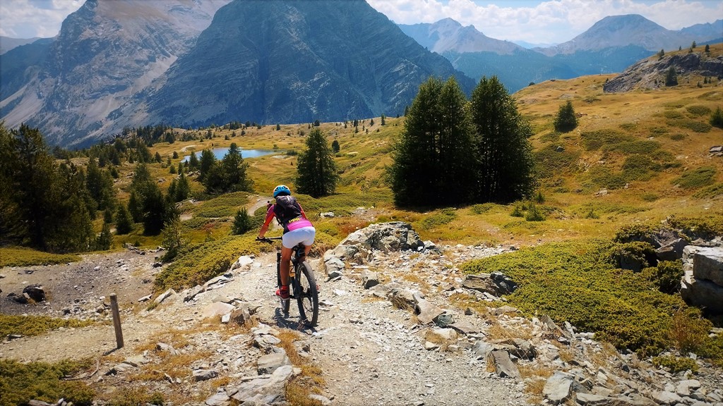
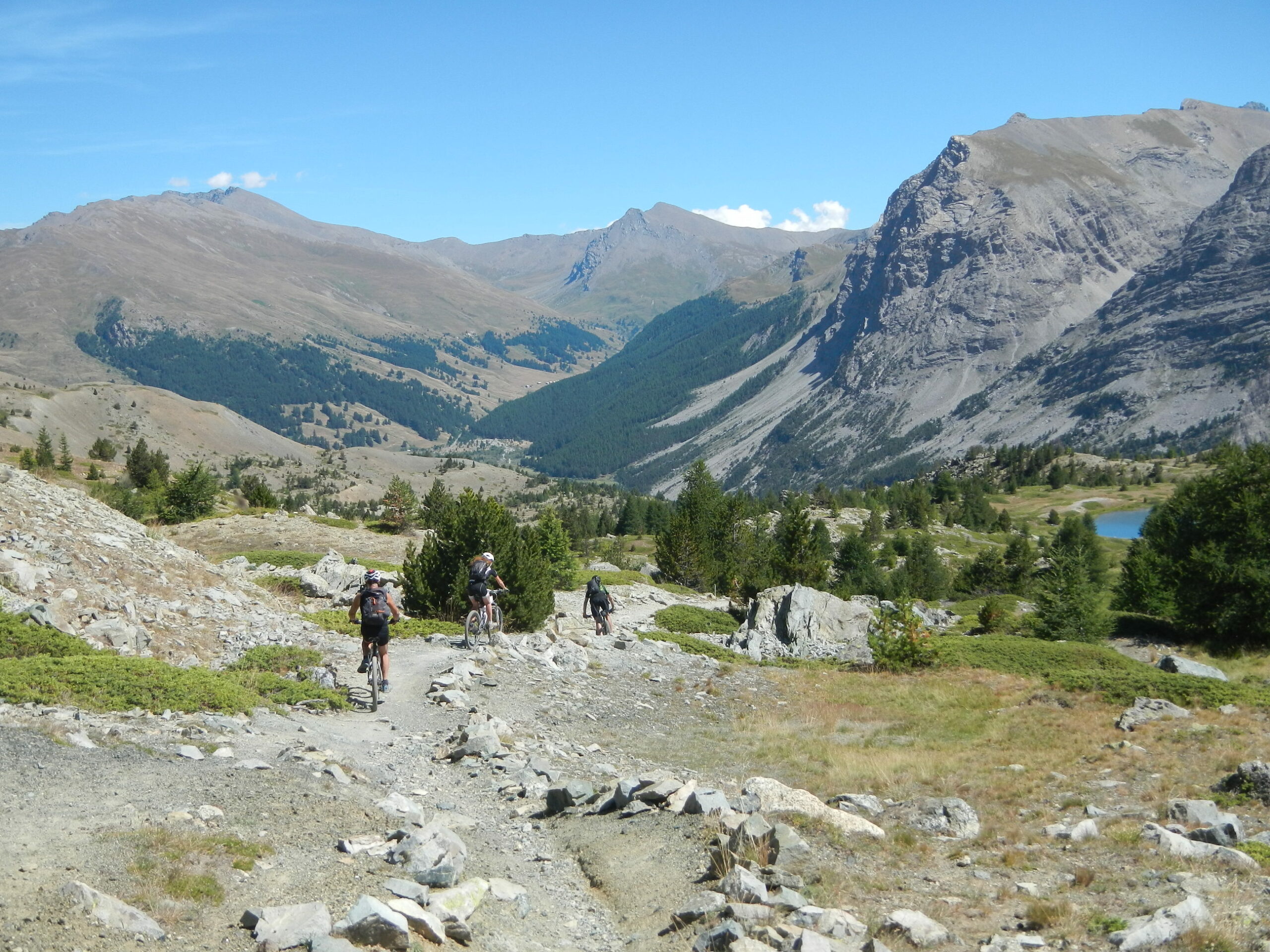
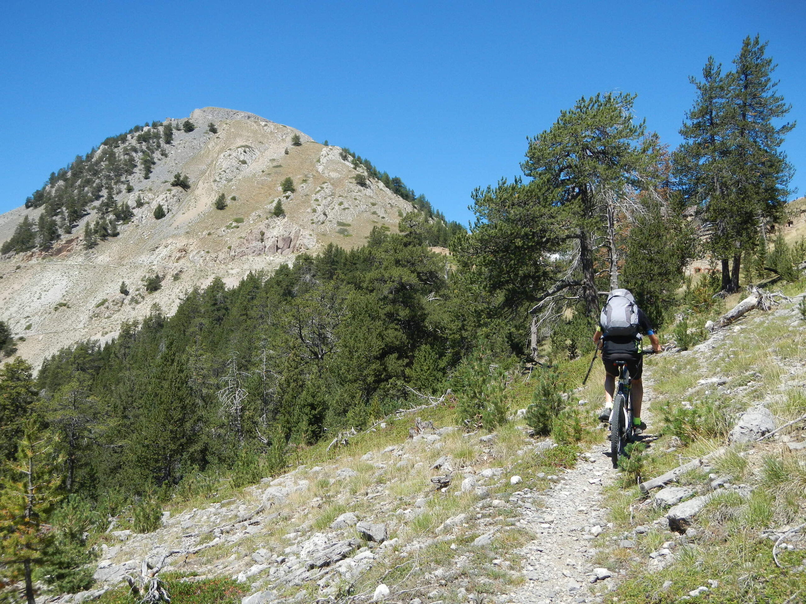
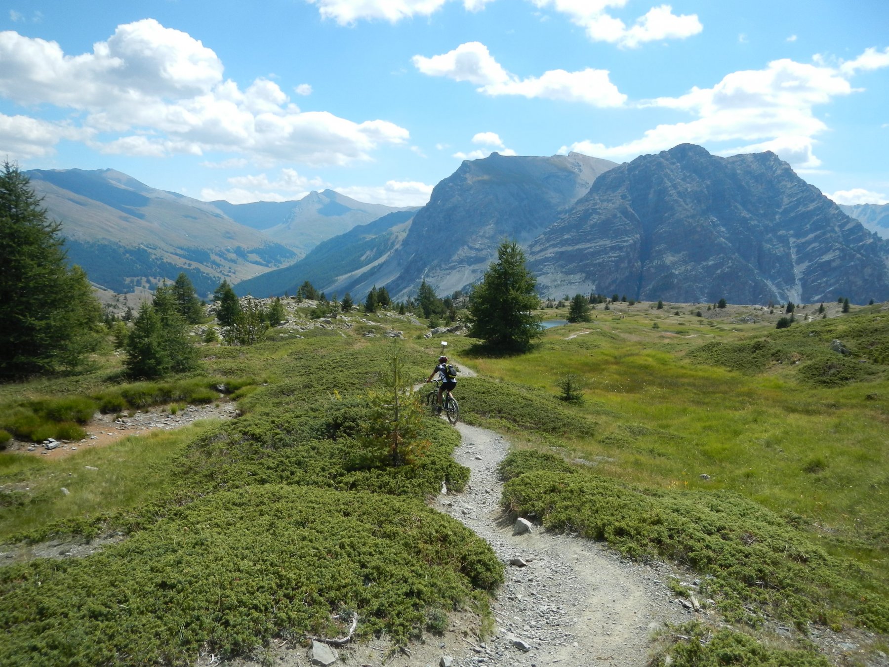
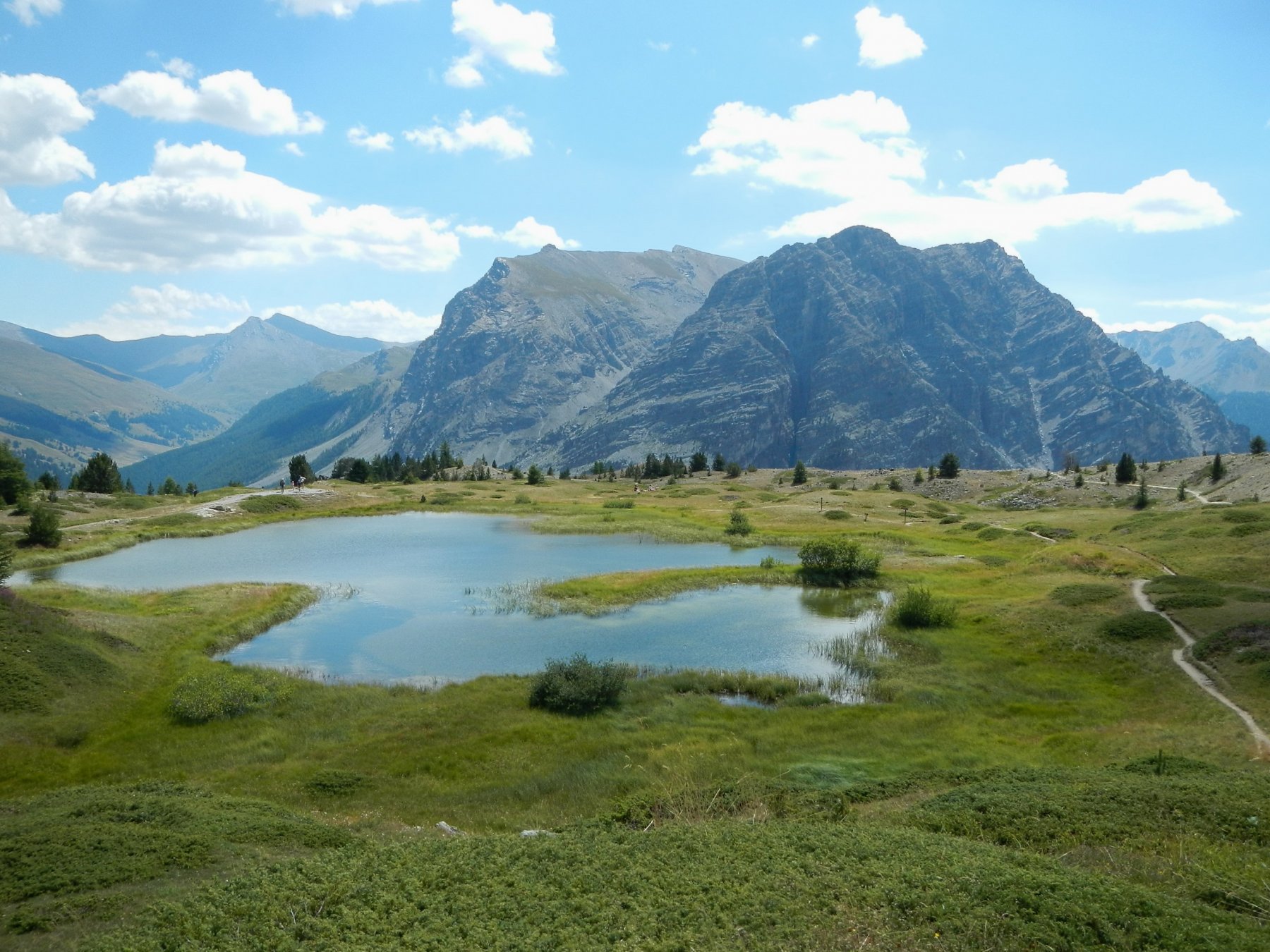
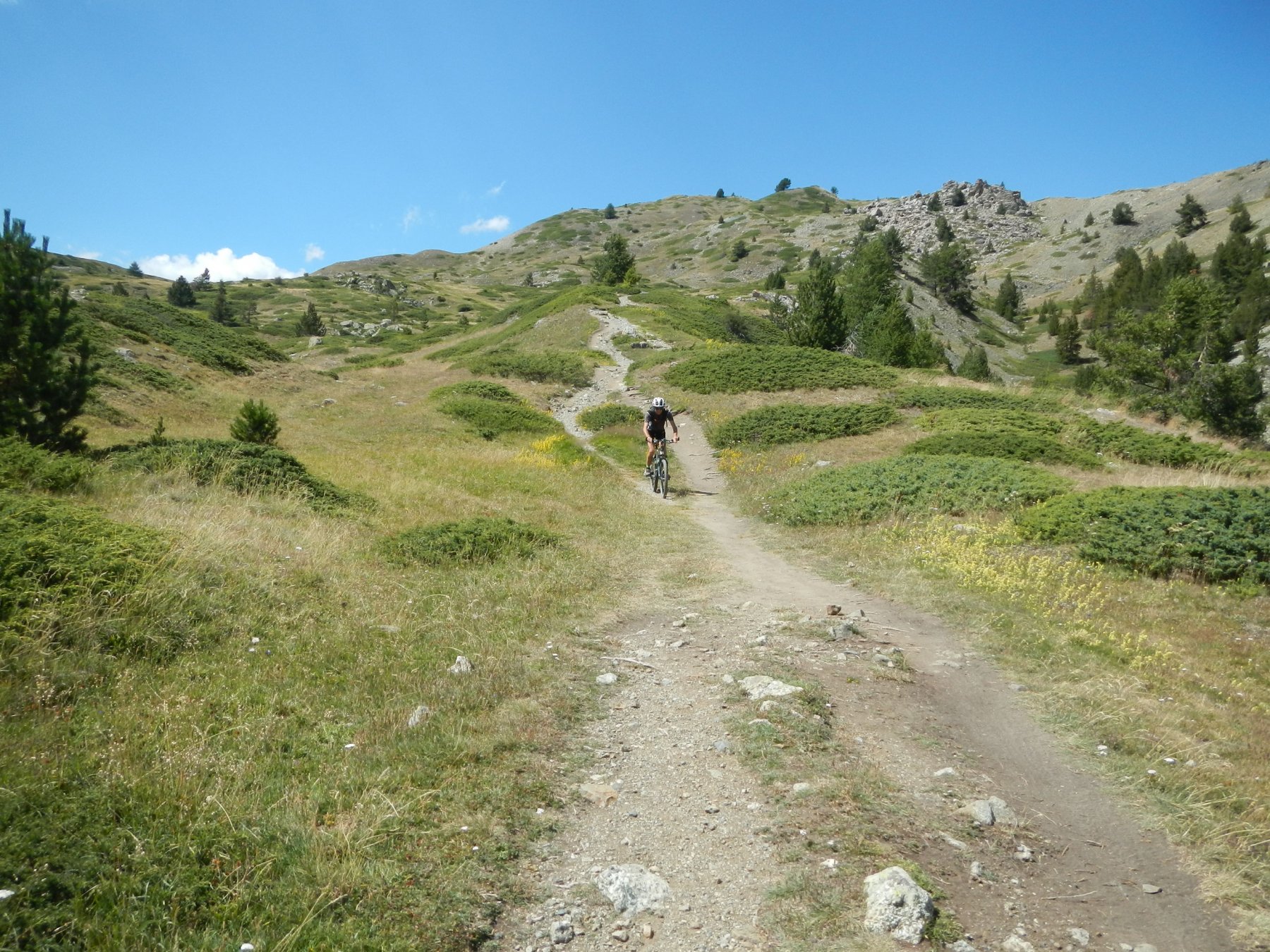
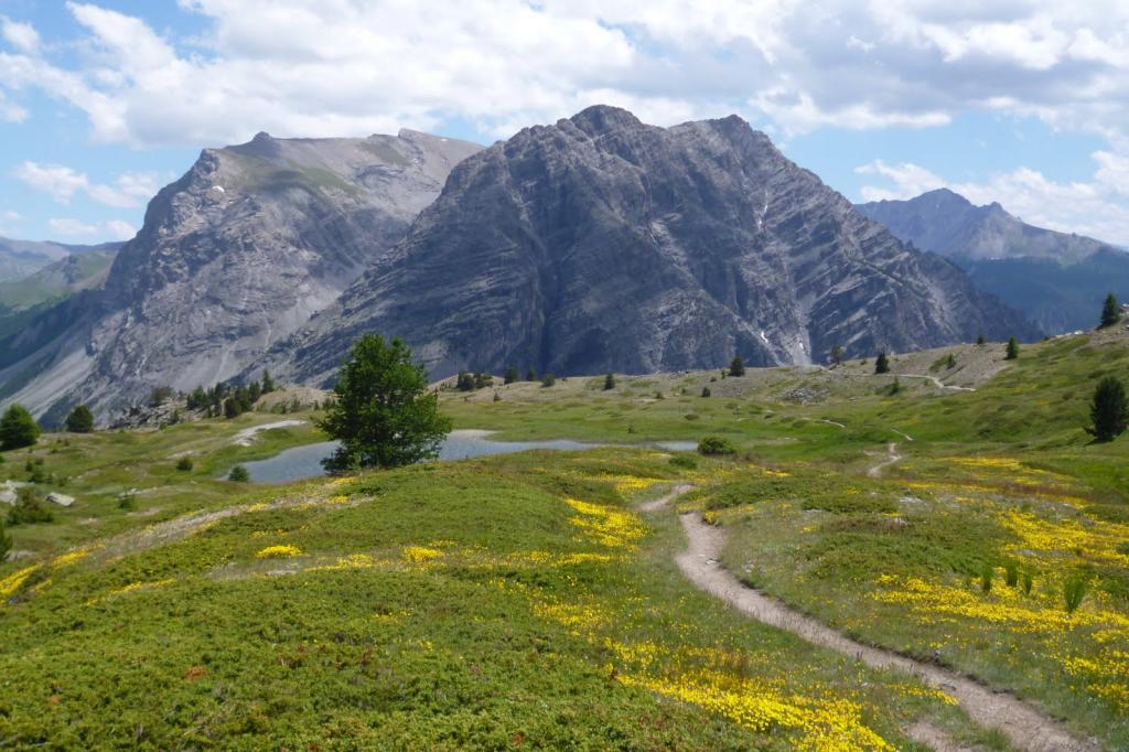
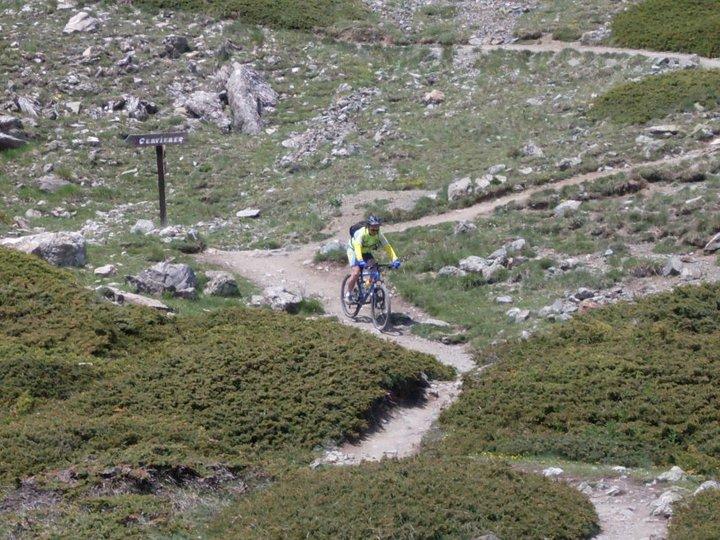
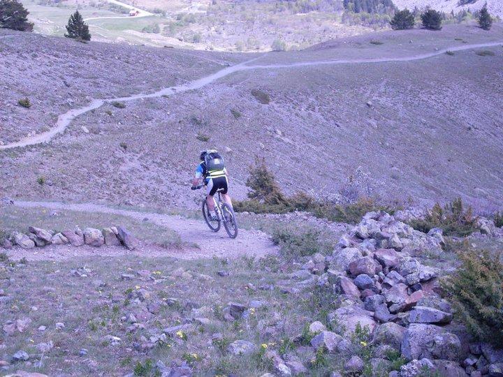
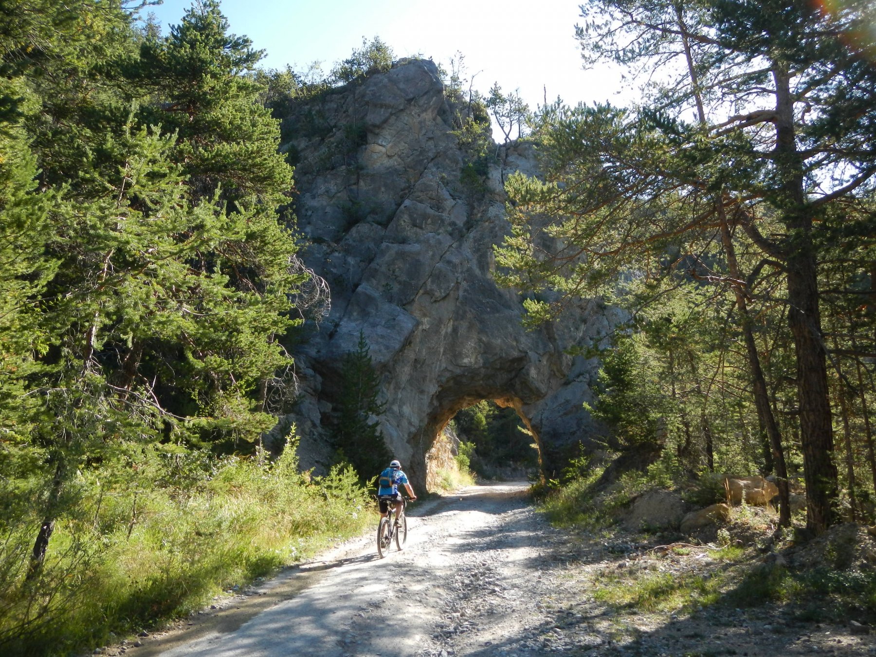
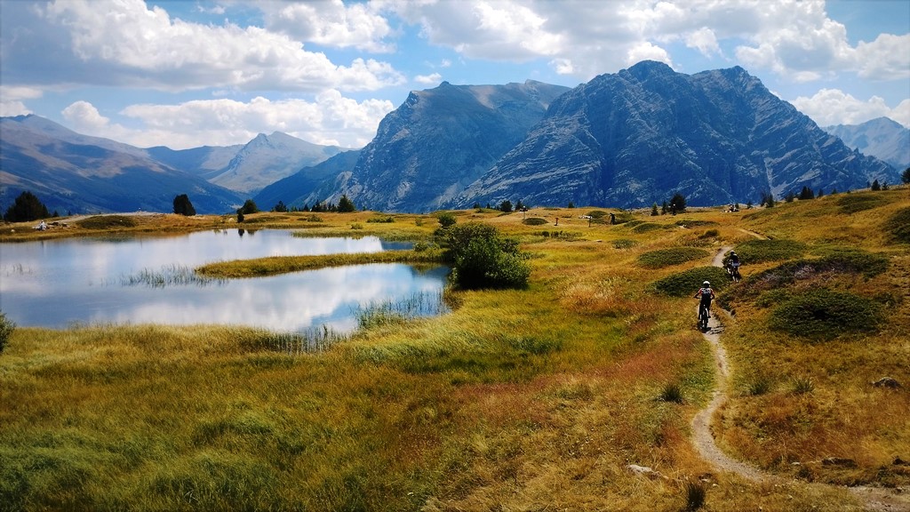
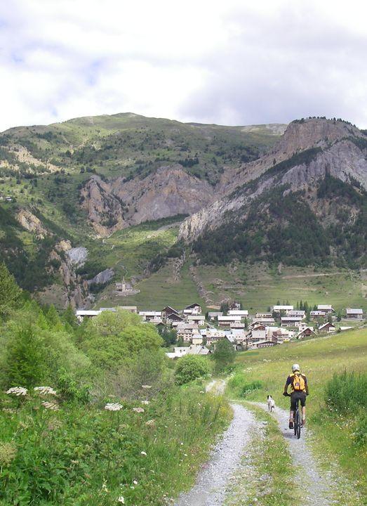
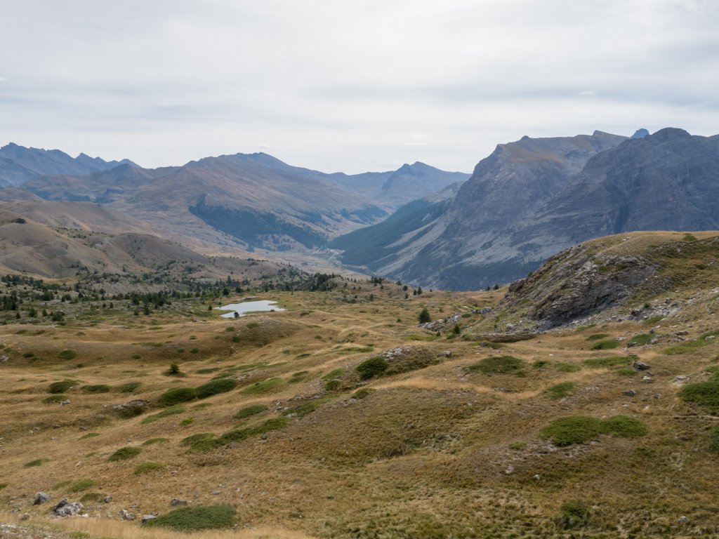
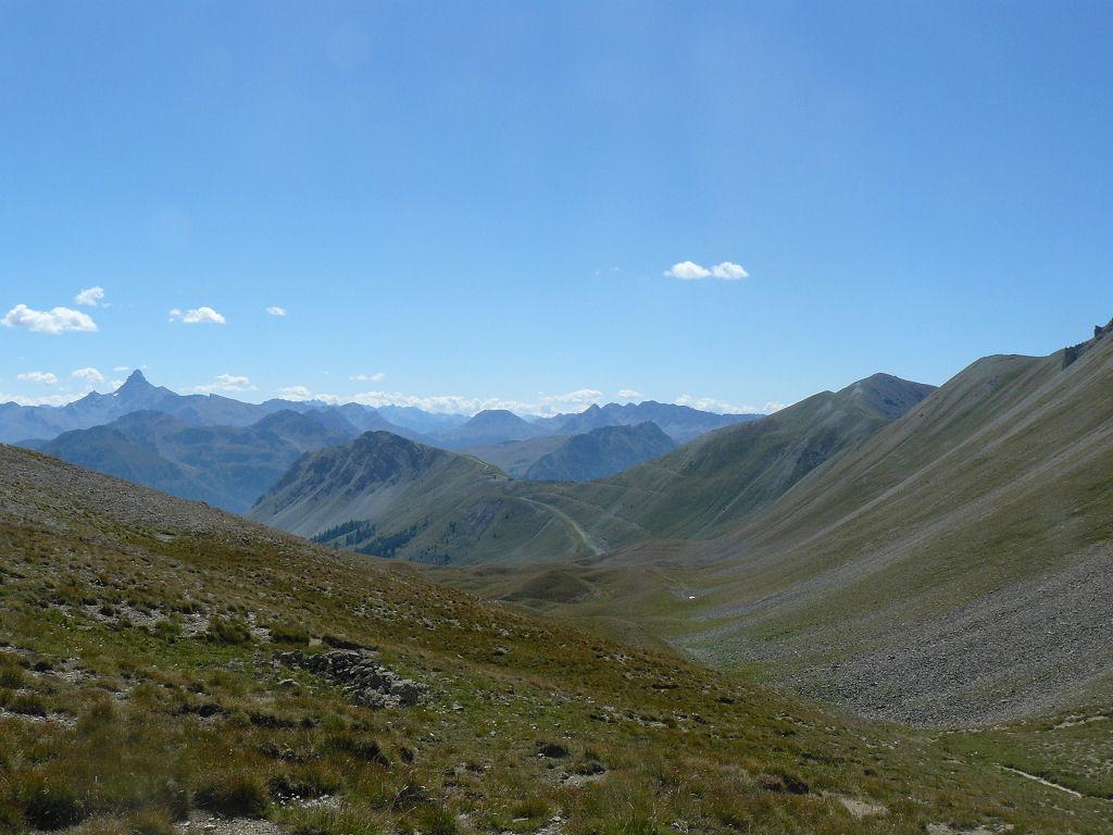
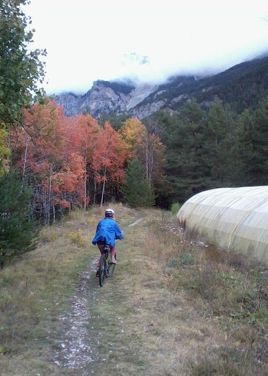
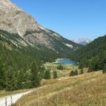
Dal piazzale del Fort du Gondrand si torna indietro per qualche centinaio di metri e si imbocca sulla sinistra uno sterrato in discesa che procede in direzione Est sullo spartiacque tra il versante di Cervieres e quello di Monginevro. Dopo un paio di Km si giunge al piccolo Lac de Sagne Enfonza (2315 m). Qui si imbocca sulla destra un bellissimo sentiero che scende tra i prati, costeggia sulla destra il bellissimo Lac des Sarailles e, dopo un breve tratto difficilmente ciclabile (100 m lineari circa), arriva ad un incrocio (quota 2200 m). Qui si prosegue dritto seguendo sempre le indicazioni per Cervieres. Il sentiero è sempre ampio e ben evidente e ciclabile praticamente al 100%, e termina a La Chau (1900 m circa), dove si raggiunge la strada che percorre il Vallone di Les Fonts. Si svolta a destra e in circa 5 Km di veloce discesa, in gran parte su sterrato, si ritorna a Cervieres.
- Cartografia:
- IGN 1:25.000 - 3536 OT - Briancon, Serre Chevalier, Montgenevre
Nelle vicinanze Mappa
Itinerari
23/07/2021 Hautes-Alpes, Cervières D+ 550 m MC, MC+, S1 Varie
Bletonnet (Vallon) da Cervieres
 50m
50m
06/09/2024 Hautes-Alpes, Cervières D+ 936 m BC+, BC, S2 Nord
Lausette (Fort de la) da Cervieres
 50m
50m
11/08/2023 Hautes-Alpes, Cervières D+ 1800 m BC+, OC, S2 Tutte
Péas (Col de) da Cervieres, giro del Pic de Rochebrune
 50m
50m
08/07/2016 Hautes-Alpes, Cervières D+ 1255 m BC+, OC, S2 Varie
Chenaillet (le) da Cervières, giro
 50m
50m
16/10/2025 Hautes-Alpes, Montgenèvre D+ 1030 m MC, BC, S1 Varie
Janus (Fort du) da Montgenevre, giro per Fort Gondran il Lago Gignoux o dei Sette Colori
 6.7Km
6.7Km
20/08/2017 Hautes-Alpes, Montgenèvre D+ 1025 m BC, BC, S2 Varie
Anges (Sommet des), Fort du Gondran da Montgenevre, giro per il Lago Gignoux, Colletto Verde e la valle dei Mandarini
 6.7Km
6.7Km
03/09/2010 Hautes-Alpes, Montgenèvre D+ 900 m BC+, OC, S2 Sud
Trois Freres Mineurs (Col des) da Montgenevre per il Vallone del Rio Secco
 7.3Km
7.3Km
05/07/2025 Hautes-Alpes, Val-des-Prés D+ 1300 m MC, BC+, S1 Est
Lenlon (Fort de) e Col du Granon da la Vachette, giro per il Fort de l’Olive e la Croix de Toulouse
 7.7Km
7.7Km
06/07/2020 Hautes-Alpes, Val-des-Prés D+ 250 m TC, MC, S0 Est
Clarée (Val de la) da la Vachette, piste ciclabili
 7.7Km
7.7Km
23/08/2024 Hautes-Alpes, Villar-Saint-Pancrace D+ 1780 m BC+, BC+, S3 Varie
Ayes, Néal, Lauzon (Colli) dal Lac de l’Orceyrette, giro per l’Echaillon e Chalets de Clapeyto
 7.7Km
7.7Km