2.6Km
2.6Km

Note
 50m
50m
50m
50m
50m
50m
50m
50m
50m
50m
50m
50m
50m
50m
50m
50m
50m
50m
2.6Km
2.7Km
3.2Km
3.5Km
3.9Km
4.8Km
5.9Km
6.1Km
6.4Km
6.4Km
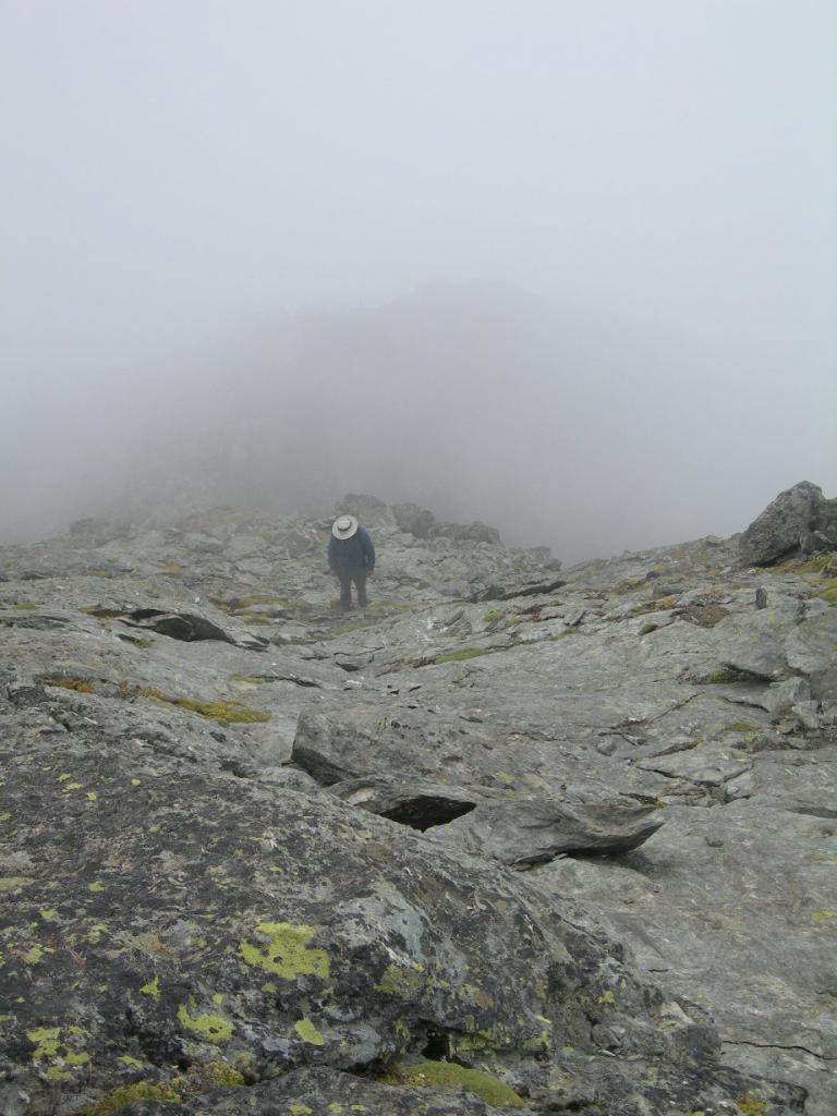
Itinerario selvaggio in una zona raramente visitata.
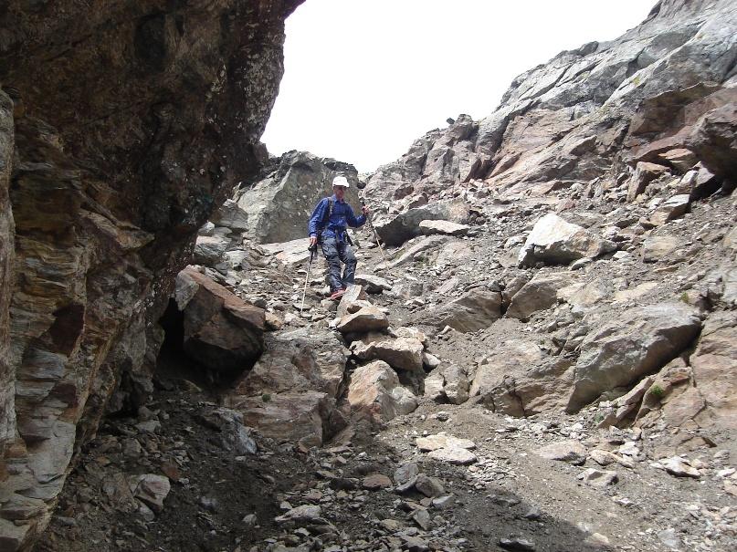
Pericolo caduta sassi nel canalino.
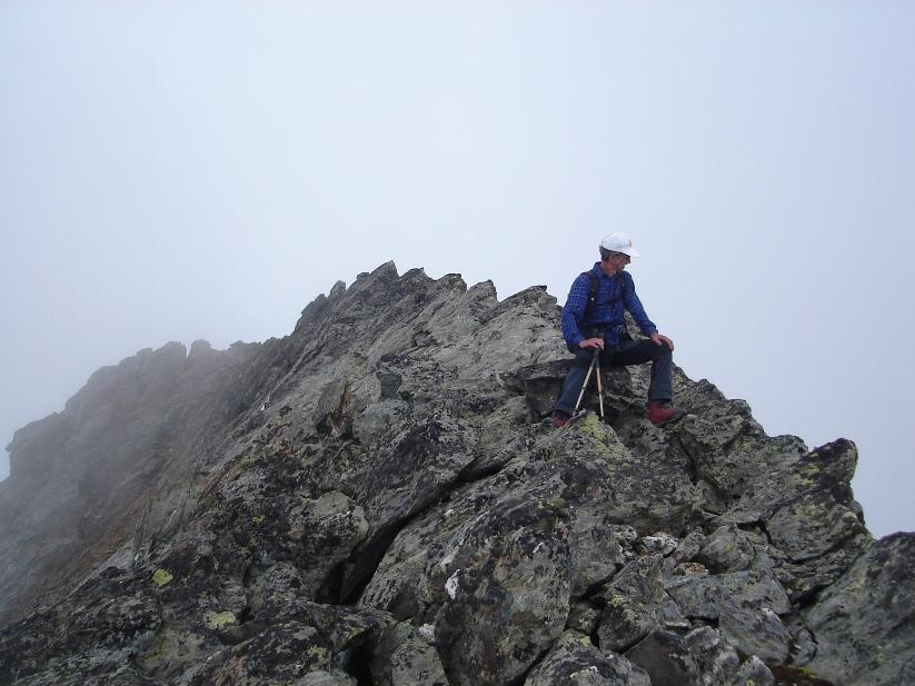
il salto terminale si supera con una facile arrampicata di una cinquantina di metri
La quota 3213m (quota CTR) secondo il Buscaini (alpi Pennine I, Guida dei Monti d’Italia) è errata.
Anche Osvaldo Cardellina quando descrive la traversata Crou de Bleintse – Salliousa, indica la quota 3258.
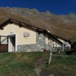
Sul sito del comune di Doues e del Rifugio Champillon il toponimo della località di partenza è Plan Detruit 2078m.
Avvicinamento
Pericolo caduta sassi nel canalino.
il salto terminale si supera con una facile arrampicata di una cinquantina di metri
La quota 3213m (quota CTR) secondo il Buscaini (alpi Pennine I, Guida dei Monti d’Italia) è errata.
Anche Osvaldo Cardellina quando descrive la traversata Crou de Bleintse – Salliousa, indica la quota 3258.
Sul sito del comune di Doues e del Rifugio Champillon il toponimo della località di partenza è Plan Detruit 2078m.
Da Plan Debat è raggiungibile in auto da Valpelline seguendo le indicazioni per Doues prima , quindi Chatelair, da quest'ultima proseguire su strada asfaltata fino ad una croce di pietra sulla dx.
Descrizione
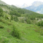
Da Plan Debat, m. 2076 si segue il sentiero per il rifugio Letey(Champillon), sino alla Tsa di Champillon, m. 2297, per abbandonarlo e seguire una strada di servizio verso destra sino quando la stessa non volta a sinistra per dirigersi verso alcuni impianti idraulici.
La si abbandona allora per raggiungere su tracce di bestiame il crestone che scende dal monte Chenaille e che divide la comba di Champillon dalla comba di Cretes.
A questo crestone si può arrivare anche dalla comba di Cretes, abbandonando l’interpoderale che porta alla Tsa d’Ansermin per raggiungere a sinistra la stalla a 2234 m. dalla quale un sentiero raggiunge il crestone.
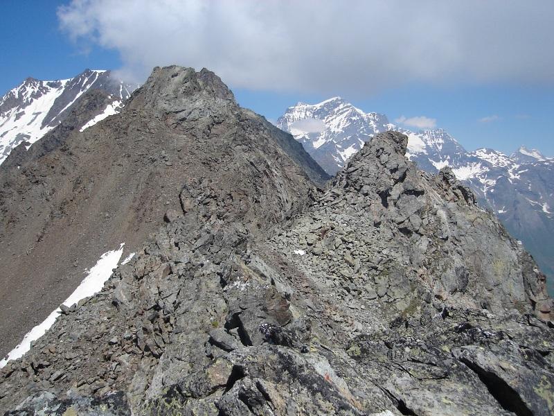
Si segue la cresta dapprima erbosa, poi detritica sino a sbucare nell’ampio terrazzo tra lo Chenaille e la Tete de Cretes.
Conviene allora attraversare a destra per poi salire faticosamente il pendio detritico in direzione del canale che si scorge dal basso.
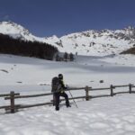
Si sale questo canale alto circa 90 metri con le dovute precauzioni (specie in discesa) per il terreno instabile e la conseguenza possibile caduta di sassi sulle persone sottostanti.
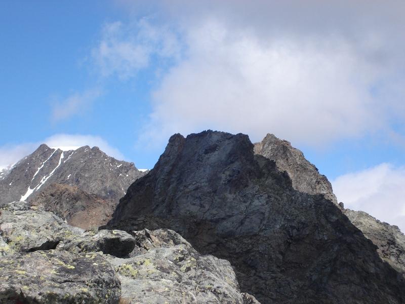
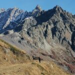
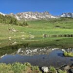
Si arriva così alla cresta tra Chenaille e Tete de Cretes, di fronte il Monte Bianco.
Occorre ora salire un salto di una cinquantina di metri abbastanza appoggiato.
Due passaggi richiedono l’uso delle mani, poi la pendenza diminuisce e più facilmente si perviene all’aerea vetta.
- Cartografia:
- l'Escursionista 1/25.000 n°5
- Bibliografia:
- Buscaini - Alpi Pennine I
Nelle vicinanze Mappa
Itinerari
10/11/2024 AO, doues D+ 423 m E Varie
Crźte (Combe de) da Plan Debat, anello
 50m
50m
23/06/2012 AO, Doues D+ 750 m EE Varie
Saron (Mont) dalla Comba di Champillon, traversata a Etroubles
50m
09/08/2025 AO, Doues D+ 746 m EE Est
Crou de Bleintse (Mont) da Plan Debat per il Colle Champillon
 50m
50m
10/08/2024 AO, Doues D+ 1068 m EE Sud-Est
Chenaille (Mont) da Plan Debat per il Col Champillon
 50m
50m
30/09/2025 AO, Doues D+ 750 m EE Varie
Crou de Bleintse (Mont) e Mont Saron da Plan Debat, anello per il Col Champillon
 50m
50m
01/07/2023 AO, Doues D+ 750 m EE Sud
Praz (Tète du) da Plan Debat
 50m
50m
30/05/2026 AO, Doues D+ 636 m E Varie
Rond (Mont) o Monte Rotondo da Plan Debat
 50m
50m
28/05/2026 AO, Doues D+ 633 m E Est
Champillon (Col) da Plan du Débat per il Rifugio Champillon-Letey
 50m
50m
14/04/2026 AO, Doues D+ 105 m E Sud-Est
Ru de By da Plan du Débat
 50m
50m
06/08/2013 AO, Doues D+ 750 m EE Sud-Est
Rosazza Maria Cristina (Bivacco) o Savoie da Plan Debat
 50m
50m
Servizi
2.6Km
2.7Km
Vecchia Miniera Rifugio
Ollomont
3.2Km
Rustic Chalet de Nos Ristorante
Glacier
3.5Km
Le Vieux Alpage Ristorante
Doues
3.9Km
Chiarella – Amiante Rifugio
Ollomont 4.8Km
4.8Km
Compagnie des Guides de la Valpelline et du Gran Saint Bernard Professionisti
Aosta
5.9Km
Lievre Amoureux Albergo
Valpelline 6.1Km
6.1Km
Flavio Mario Dalle Professionisti
Etroubles 6.4Km
6.4Km
Echevennoz Posto Tappa Rifugio
Etroubles 6.4Km
6.4Km