5.5Km
5.5Km


Note
Storico
 100m
2.3Km
5.4Km
5.4Km
6.4Km
6.7Km
6.7Km
7.7Km
8.6Km
9.7Km
100m
2.3Km
5.4Km
5.4Km
6.4Km
6.7Km
6.7Km
7.7Km
8.6Km
9.7Km
5.5Km
6.7Km
6.7Km
6.7Km
8.2Km
8.3Km
8.9Km
8.9Km
8.9Km
9.3Km
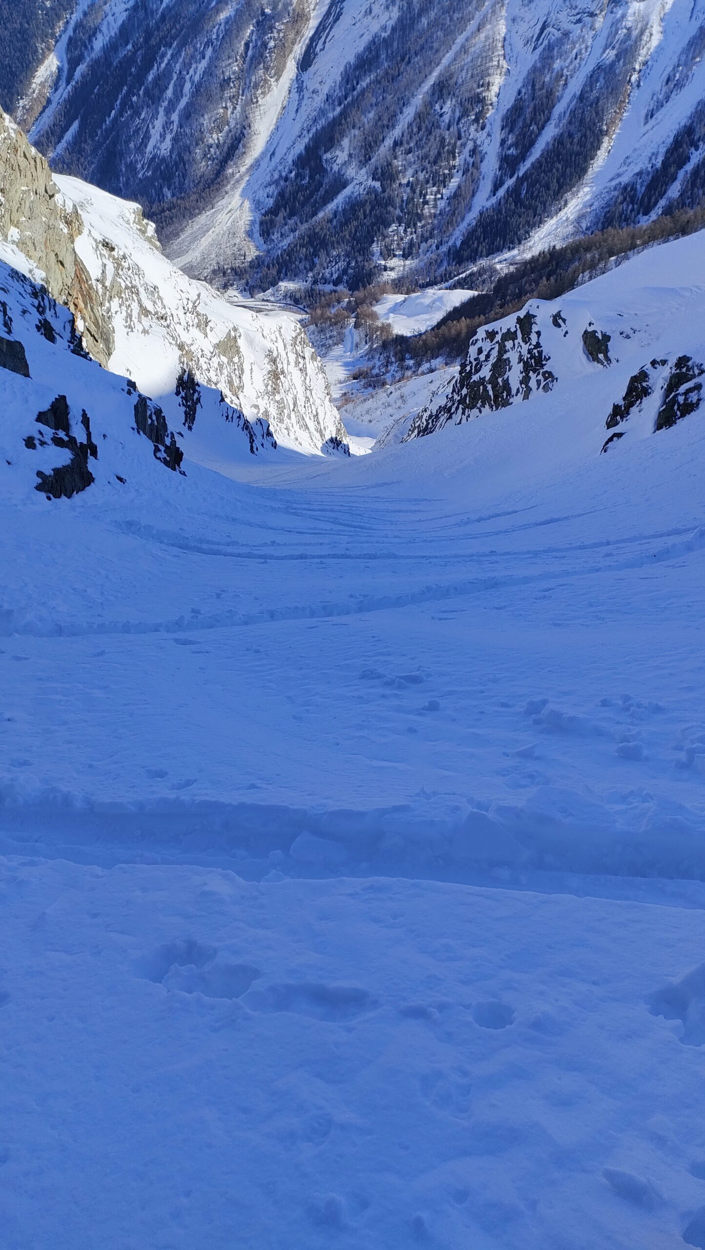
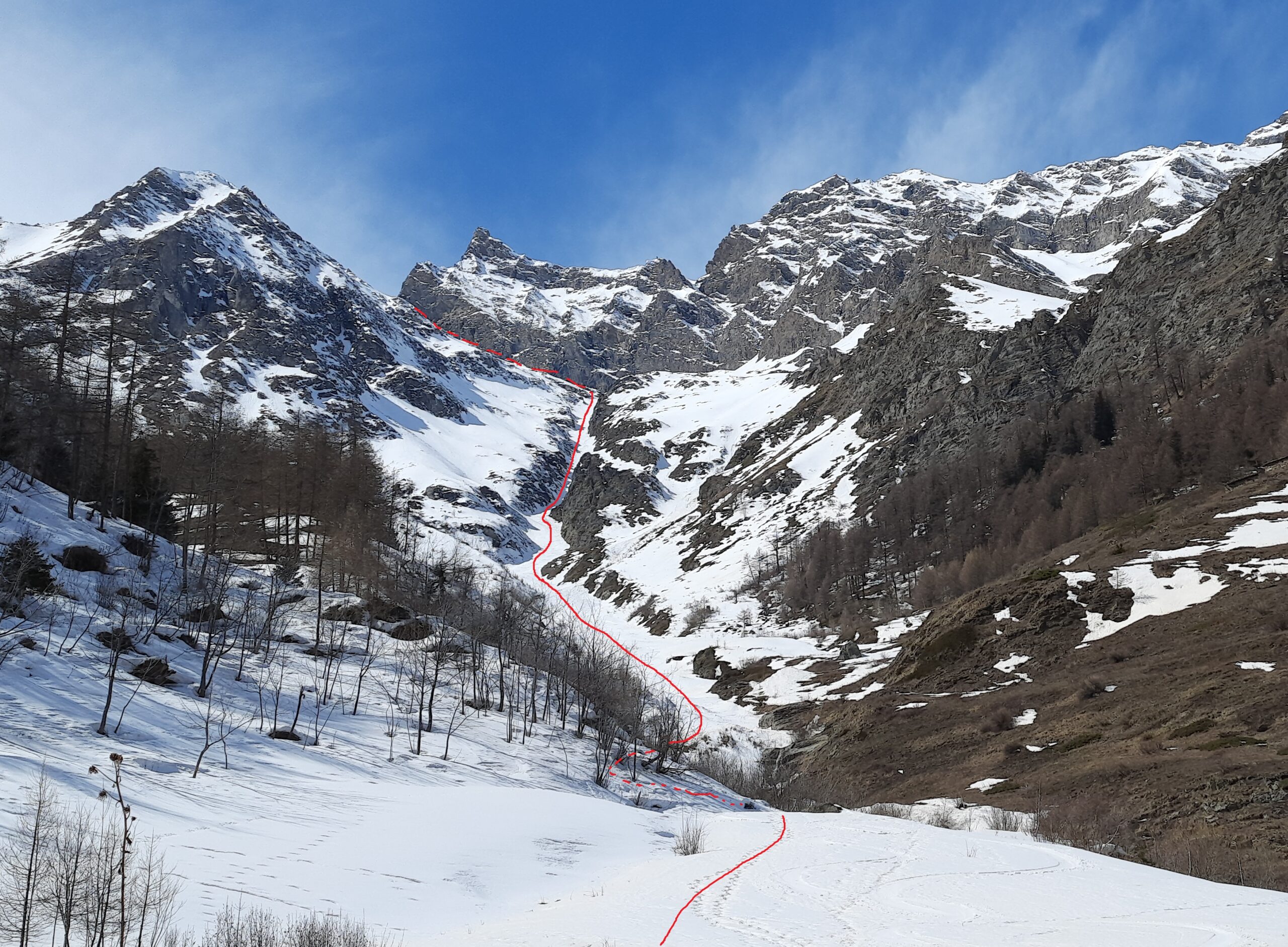
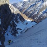
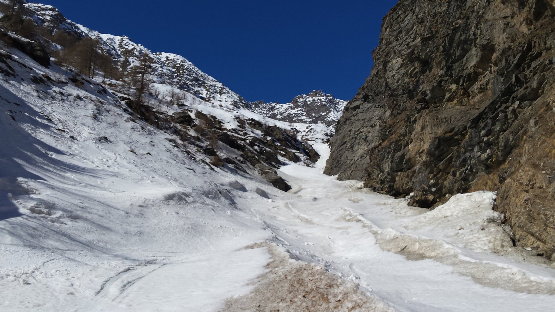
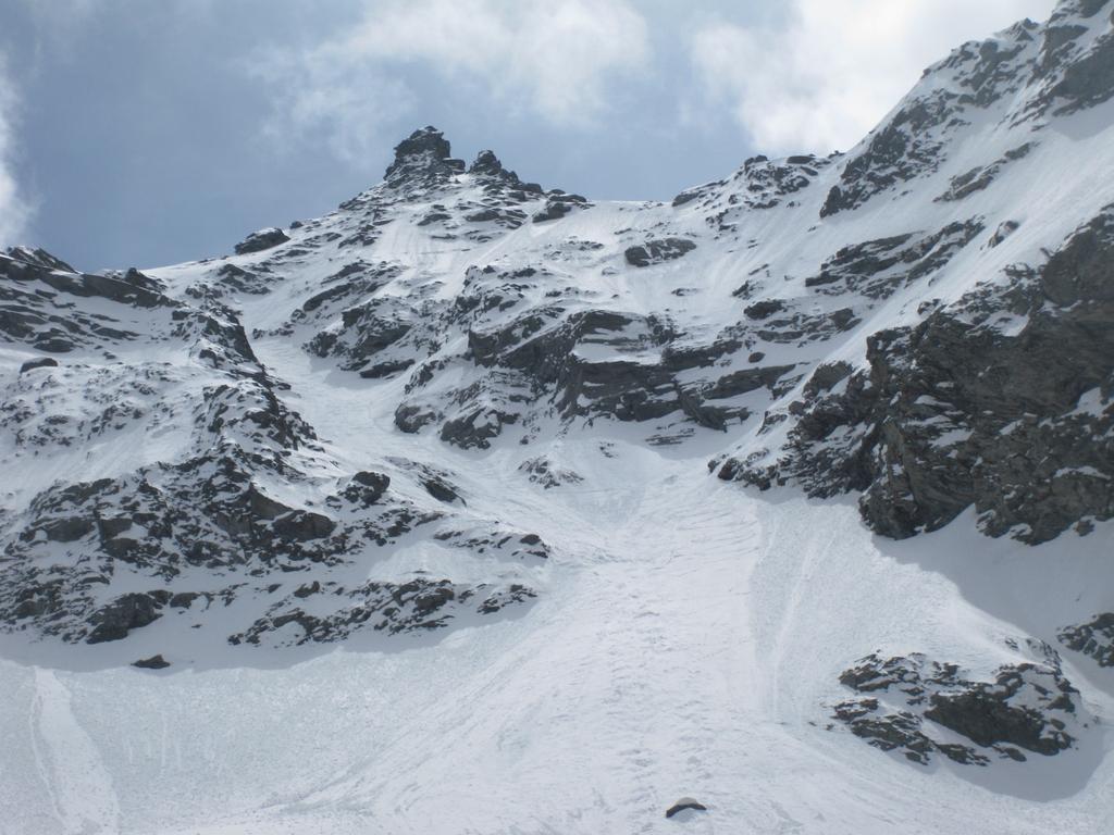
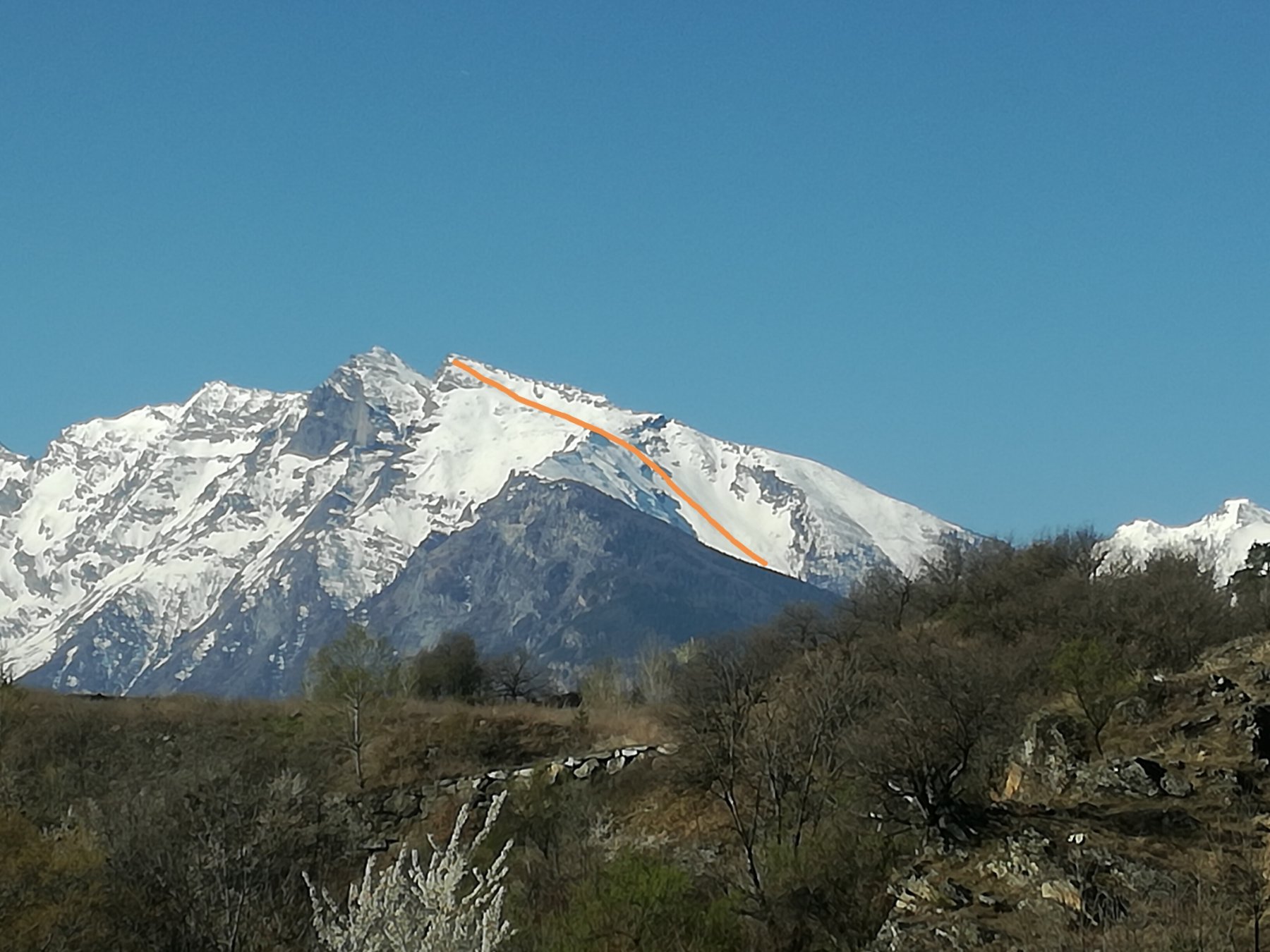
Bellissimo vallone caratterizzato da un lungo, rettilineo ed estetico canale, che si sviluppa per almeno 700 m di dislivello su circa 1250 di gita. Itinerario da non perdere per chi ama lo sci di canale senza volersi impegnare su difficoltà eccessive. Va comunque affrontato con condizioni di neve stabile, preferibilmente di tipo primaverile e possibilmente quando la strada sia percorribile fino nei pressi di Courthoud, altrimenti occorre preventivare dislivello supplementare.
Avvicinamento
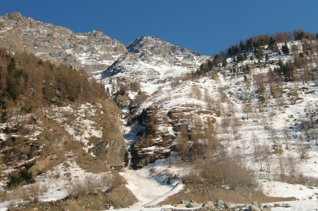
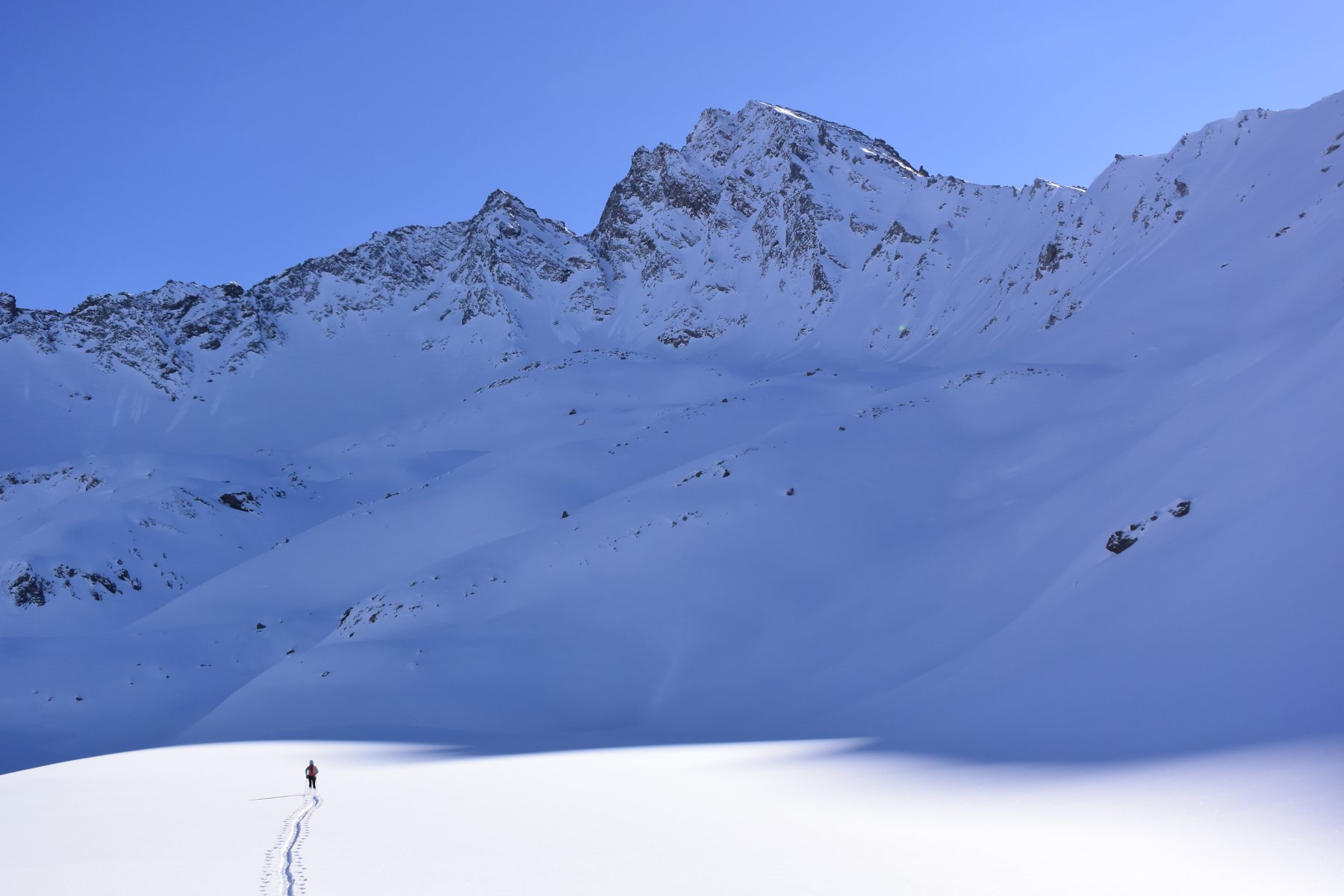
Pochi km dopo Rhêmes-Saint-Georges si incontra una galleria paravalanghe. Poco dopo di essa deviare a dx per Proussaz e proseguire verso Courthoud, fin dove la strada è percorribile, in base all'innevamento. Da Courthoud attraversare i prati a N del villaggio e imboccare il vallone del rio omonimo.
Descrizione
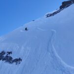
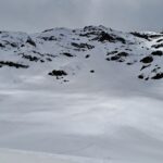
Seguire interamente il vallone, eventualmente evitando a sx i primi 100 m di dislivello, a seconda dell’innevamento, fino ai pendii più aperti a q. 2650. Circa 700 m di dislivello si percorrono all’interno di un canale rettilineo e uniforme con pendenze sempre moderate (max. 40°).
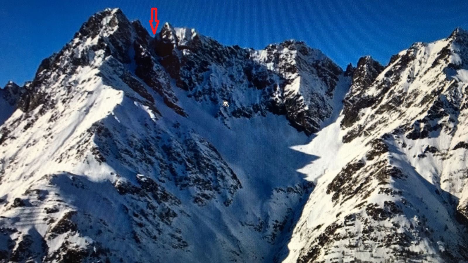
Da q. 2650 si può scegliere dove e come proseguire, ci sono almeno tre diverse possibilità lungo la cresta Est della P. di Tsaboc.
Discesa per lo stesso itinerario.
25/03/21 M. Ogliengo e R. Perrone. Non abbiamo notizie di discese precedenti, anche se parrebbe strano che non sia mai stato percorso.
- Cartografia:
- L'Escursionista - 03 - Valgrisenche, Val di Rhemes, Valsavarenche 1:25000
- Bibliografia:
-
Toponeige Val D'Aoste - Grand Paradis - J.B. Mang
A p. 108 è ben visibile, anche se non indicato, l'itinerario qui descritto. Vedere foto allegate.
Nelle vicinanze Mappa
Itinerari
27/01/2022 AO, Rhemes-Saint-Georges D+ 1330 m I, 4.2, E2 Nord-Est
Feluma (Col de) Couloir NE
 100m
100m
03/03/2012 AO, Rhemes-Saint-Georges D+ 1860 m III, 4.3, E3 Nord-Ovest
Blanc (Truc) Couloir NO
 2.3Km
2.3Km
03/02/2024 AO, Rhêmes-Notre-Dame D+ 1193 m I, 4.2, E1 Sud-Est
Cussunaz o Cussuna (Colle di) Canali SE
 5.4Km
5.4Km
25/02/2017 AO, Rhêmes-Notre-Dame D+ 1361 m I, 4.2, E1 Est
Tey (Becca) brèche 3053 m Couloir E
 5.4Km
5.4Km
26/01/2019 AO, Rhêmes-Notre-Dame D+ 1120 m II, 4.1, E1 Est
Fenetre de Torrent (Col) da Rhemes Notre Dame
 6.4Km
6.4Km
10/04/2023 AO, Rhêmes-Notre-Dame D+ 1350 m III, 4.2, E3 Nord-Ovest
Tsambeina (Becca) Canale Nord
 6.7Km
6.7Km
14/05/2019 AO, Introd D+ 1180 m I, 4.1, E1 Nord-Est
Merlo (Becca del) o di Chamin Pendio NE
 6.7Km
6.7Km
18/02/2023 AO, Arvier D+ 1600 m II, 4.2, E2 Nord-Est
Paramont (Becca Nera del) Couloir Emma
 7.7Km
7.7Km
03/02/2018 AO, Valgrisenche II, 4.2, E2 Nord-Ovest
Tey (Becca di) Canale NO
 8.6Km
8.6Km
21/04/2024 AO, Valsavarenche D+ 1784 m III, 4.2, E2 Est
Rolettaz (Monte) da Creton
 9.7Km
9.7Km
Servizi
5.5Km
6.7Km
Tanini Ristorante
Rhemes-Notre-Dame
6.7Km
Lo Sabot Albergo
Rhemes-Notre-Dame
6.7Km
Galisia Albergo
Rhemes-Notre-Dame
8.2Km
La Tana delle Volpi Ristorante
Valgrisenche
8.3Km
Paramont Albergo
Arvier
8.9Km
Chalet de L’Epée Rifugio
Valgrisenche
8.9Km
Lo Fourquin Bar
Valsavarenche
8.9Km
Abro de la Leunna Ristorante
Valsavarenche
9.3Km