1.8Km
1.8Km


Note
Storico
 100m
100m
100m
150m
200m
350m
350m
350m
350m
350m
100m
100m
100m
150m
200m
350m
350m
350m
350m
350m
1.8Km
1.8Km
1.9Km
2.4Km
2.4Km
 2.5Km
2.5Km
4.4Km
4.6Km
4.6Km
5.3Km
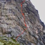
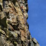
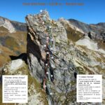
Tipo di roccia quarzite compattissima ( x ultimare il lavoro sono state usate 12 punte vidiam)
Fix inox diam 10, Soste catena inox diam 10
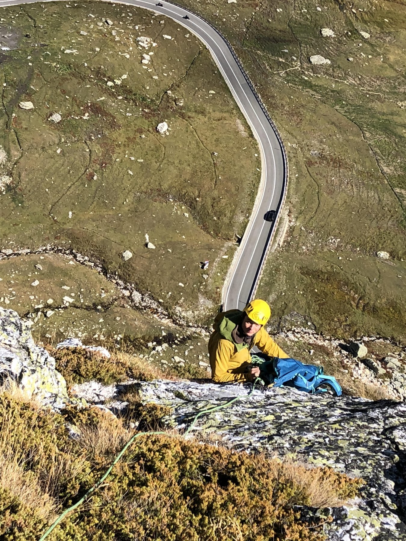
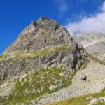
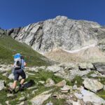
Avvicinamento
Fix inox diam 10, Soste catena inox diam 10
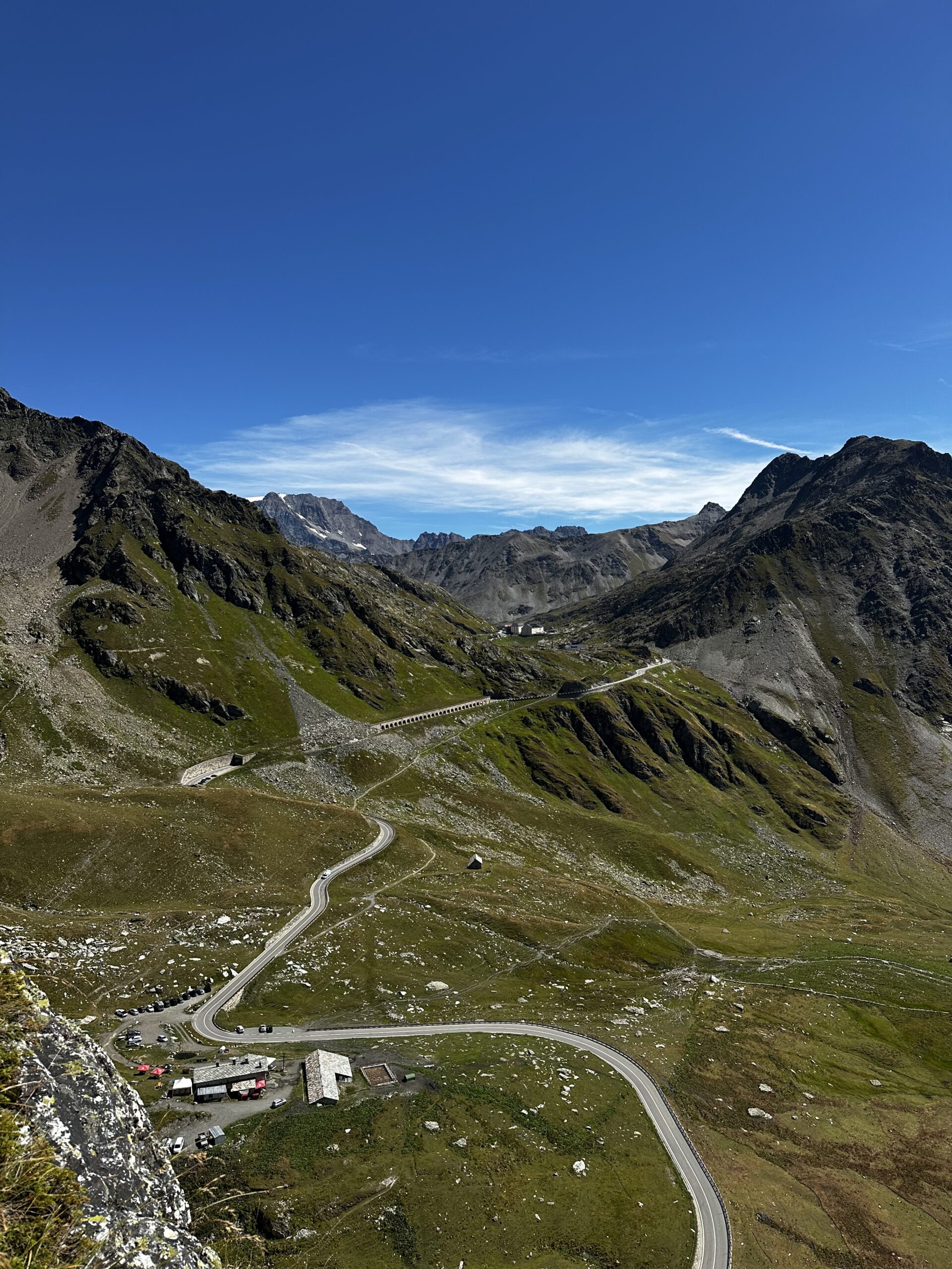
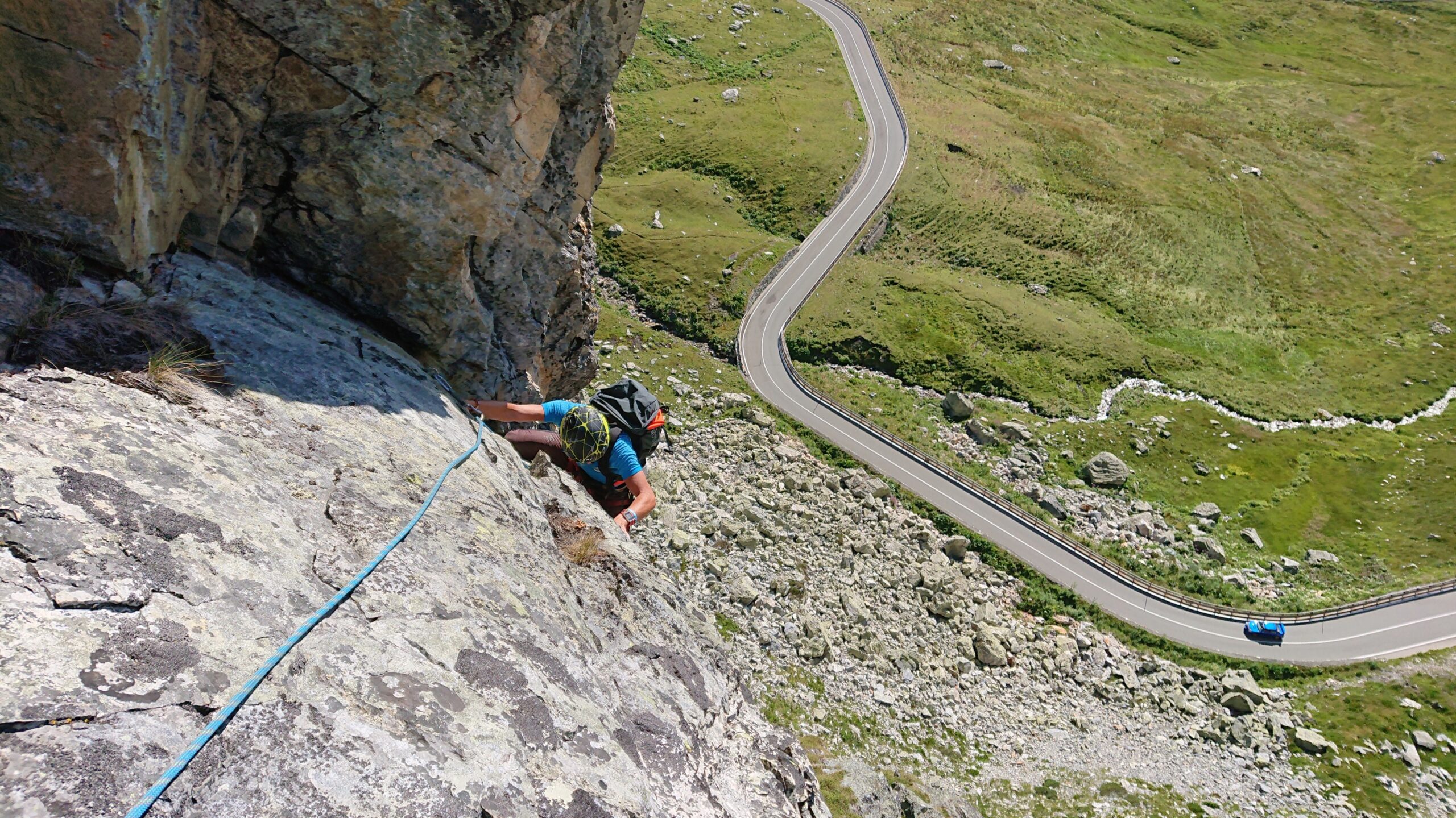
Parcheggiare presso il parcheggio dell alpeggio sottostante e tornare indietro sulla strada fino alla fine del muro in pietra di bordo strada da lì seguire gli ometti 5 min
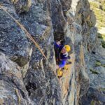
Descrizione
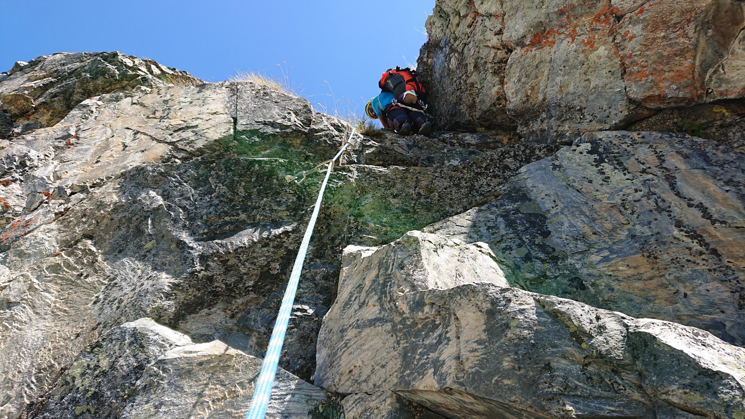
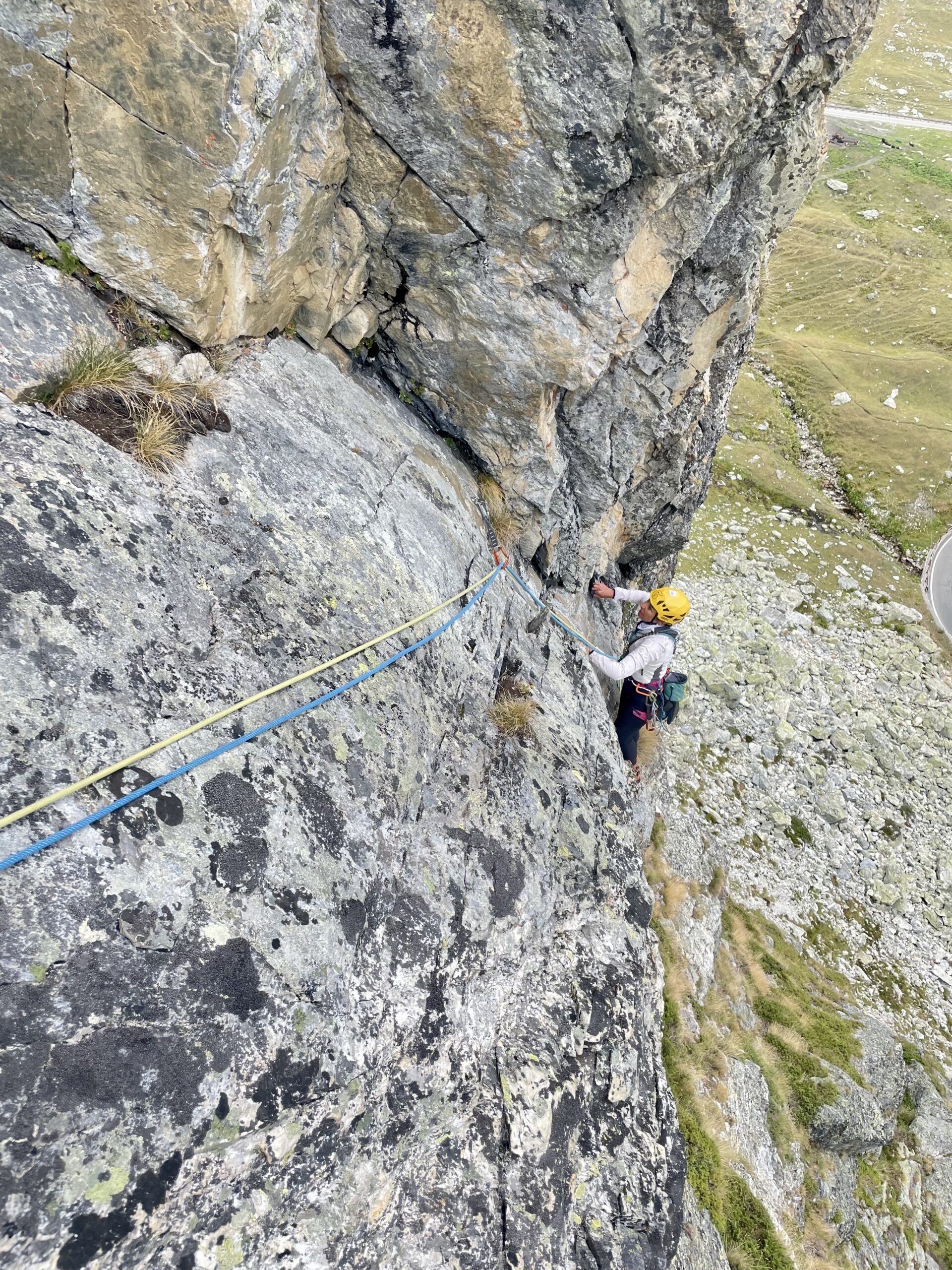
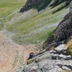
- L1 – placca 4+, 25m
- L2 – passo di forza 6a, poi un po di bosco e poi bel muretto 5a, 30m
- L3 – seguire cengia a sx x 10/15 metri, poi muretto ammanigliato (6a) e traverso a sinistra, 20m
- L4 – muro a blocchi 6b (chiodato vicino) e poi per belle prese, 20m
- L5 – verso sinistra con un po di vegetazione 4a, 30m
- L6 – placca facile 4a, 20m
- L7 – rocce a destra della sosta poi dritto e poi ancora traversando sotto rocce nere 4a, 30m3
- L8 – a sinistra su blocco staccato 5a, poi vegetazione, poi placca tecnica obbligatoria (okkio attriti), 5c 30m
- L9 – spigolo sulla placca 5c (ci sta un friend) poi per rocce più facili, 30m
- L10 – raggiungere la cresta 4a, poi verso sinistra camminando, 35m
- L11 – placca con quarzi 4c, 20m
Discesa: Calate 30 m sulla via
Chiodata il 29/09/2018 da Gilles Plat e Andrea Plat
Nelle vicinanze Mappa
Itinerari
28/06/2026 AO, Saint-Rhémy-en-Bosses 6b, 6a obbl. Sud-Ovest
Fous (Tour des ) – Grand Hotel Italia
 100m
100m
11/07/2026 AO, Saint-Rhemy-En-Bosses 7a+, 7a obbl. Ovest
Fous (Tour des) – DabadiDabada
 100m
100m
16/07/2026 AO, Saint-Rhemy-En-Bosses 7a+, 6c obbl. Ovest
Fous (Tour des) – Capitano Nemo
 100m
100m
13/07/2026 AO, Saint-Rhemy-en-Bosses 6c, 6a+ obbl. Sud-Ovest
Fous (Tour des) – Cumba Freida
 150m
150m
17/08/2025 AO, Saint-Rhemy-En-Bosses 6a, 5a obbl. Nord
Fous (Tour des), sperone nord – Tous Fous
 200m
200m
18/08/2025 AO, Saint-Rhemy-En-Bosses 6b+, 6a+ obbl. Nord-Est
Pain de Sucre, anticima 2796 m parete E/NE – Tranta Pürghi
 350m
350m
16/08/2025 AO, Saint-Rhémy-en-Bosses 7a+, 6c obbl. Nord-Est
Pain de Sucre, anticima 2796 m parere E/NE – Diamonds and Rust
 350m
350m
12/07/2025 AO, Saint-Rhemy-En-Bosses 6c, 6b+ obbl. Nord-Est
Pain de Sucre, anticima 2796 m Parete E/NE – Occhi Rossi a Colazione
 350m
350m
29/06/2026 AO, Saint-Rhemy-En-Bosses 6a+, 6a obbl. Nord-Est
Pain de Sucre, anticima 2750 m Parete E/NE – La Banda degli Onesti
 350m
350m
20/06/2025 AO, Saint-Rhemy-En-Bosses 6b+, 6a+ obbl. Nord-Est
Pain de Sucre, anticima 2750 m Parete E/NE – Free Free Palestine
 350m
350m
Servizi
1.8Km
 1.8Km
1.8Km
Albergo Italia Albergo
Saint-rhemy-en-bosses 1.9Km
1.9Km
Du Lac Ristorante
Saint-rhemy-en-bosses 2.4Km
2.4Km
Hospice du Grand-St-Bernard Albergo
Bourg-St-Pierre 2.4Km
2.4Km
Auberge de l’Hospice Ristorante
Bourg-Saint-Pierre
2.5Km
De l’Hospice Rifugio
Bourg-Saint-Pierre 4.4Km
4.4Km
Arp du Jeu Ristorante
Saint-rhemy-en-bosses 4.6Km
4.6Km
Grand Golliat B&B
Saint-rhemy-en-bosses 4.6Km
4.6Km
Grand Golliat Ristorante
Saint-Rhemy-En-Bosses 5.3Km
5.3Km