 5Km
5Km
Note
 3Km
3.2Km
3.2Km
3.2Km
3.2Km
3.2Km
3.4Km
3.4Km
3.4Km
3.4Km
3Km
3.2Km
3.2Km
3.2Km
3.2Km
3.2Km
3.4Km
3.4Km
3.4Km
3.4Km
5Km
5.6Km
5.7Km
7.9Km
7.9Km
8.3Km
8.3Km
8.6Km
9.3Km
10Km
Itinerario su strada sterrata o sentiero sul Ru di pompillard.
Attenzione a Roisan , galleria non illuminata da superare tranquillamente per fondo stradale buono.
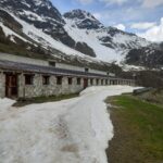
Avvicinamento
Attenzione a Roisan , galleria non illuminata da superare tranquillamente per fondo stradale buono.
Valpelline
Descrizione
Seguire le palline segnaletiche blu, evidenti fino alla fine del ru.
A pochi km da Valpelline le indicazioni mandano verso la strada asfaltata, portarsi sul lato sx dove si trovano le palline che offrono due opzioni:
- Seguire la strada asfaltata con palina con simbolo ciclabile che conduce al prossimo cartello blu dopo pochi metri dopo la galleria a dx per poi immettersi nuovamente sulla poderale che segue la sx del torrente buthier fino a conclusione a Valpelline del ru
- Seguire la palina con simbolo equestre e escursionismo che scende a sx, superare un ponticello e prosegue su poderale in salita che prende quota rapidamente con tre tornanti nel bosco per poi ritrovare le indicazioni in cima del fu pompillard che in discesa sempre su poderale riconduce sulla strada asfaltata per raggiungere la strada sterrata su medesimo itinerario ciclabile che porta conclusione del ru.
- Cartografia:
- L'escursionista editore.carta dei sentieri 5 Gran San Bernardo Ollomont
Nelle vicinanze Mappa
Itinerari
28/12/2019 AO, Quart D+ 1200 m E Varie
Trois Villes (Frazione) da Quart, anello per la Cappella del Beato Emerico
 3Km
3Km
17/07/2023 AO, Roisan D+ 1364 m EE Sud-Ovest
Mary (Mont) da Blavy per il Colle di Viou
 3.2Km
3.2Km
15/12/2024 AO, Roisan D+ 748 m EE Sud-Ovest
Tsa de Viou (Alpe) da Blavy
 3.2Km
3.2Km
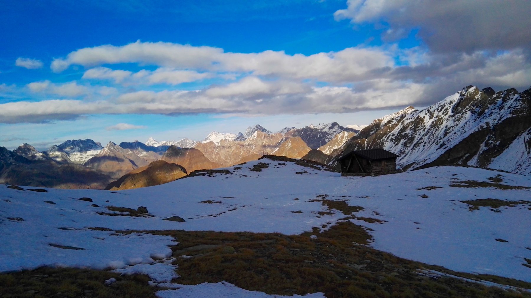
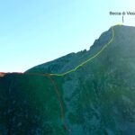
30/10/2025 AO, Roisan D+ 1400 m EE Sud-Est
Viou (Becca di) da Blavy
 3.2Km
3.2Km
16/06/2024 AO, Roisan D+ 1290 m EE Varie
Val Frèide (Tète du) da Blavy
 3.2Km
3.2Km
26/06/2021 AO, Roisan D+ 1095 m EE Ovest
Roisan (Becca di) da Blavy
 3.2Km
3.2Km
08/11/2022 AO, Quart D+ 1671 m EE/F Sud-Ovest
Tsaat a l’Etsena da Morgonaz per il Colle di Fana
 3.4Km
3.4Km
21/02/2020 AO, Quart D+ 668 m T Sud
Planes (Alpeggio le) da Morgonaz
 3.4Km
3.4Km
12/05/2024 AO, Quart D+ 935 m E Sud
Cénevé o Senevé (Alpe) da Morgonaz
 3.4Km
3.4Km
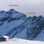
05/11/2020 AO, Quart D+ 1576 m EE/F Sud
Arpisson (Tete de) da Morgonaz
 3.4Km
3.4Km
Servizi
5Km
5.6Km
Papà Grand Rifugio
Gignod
5.7Km
Mamosipiegy B&B
Charvensod
7.9Km
Chez Edi Ristorante
Gignod
7.9Km
Chez Duclos Ristorante
Gignod
8.3Km
Vecchio Suisse Ristorante
Valpelline
8.3Km
Lievre Amoureux Albergo
Valpelline 8.6Km
8.6Km
Compagnie des Guides de la Valpelline et du Gran Saint Bernard Professionisti
Aosta
9.3Km
Le Vieux Alpage Ristorante
Doues
10Km